
August was another very dry month for much of the Panhandle. Drought busting rains did come finally at the end of September, but was not at all uniform across the region, and came too late in the year to boost crop yields. While the heavy rains fell at the very end of September, were great for water recharge, they came right at the very time most peanut farms were trying to harvest peanuts.
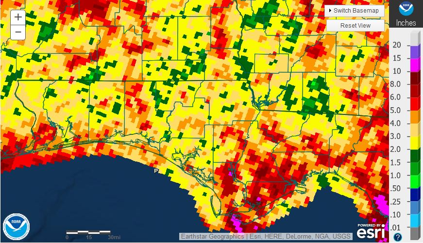
National Weather Service rainfall estimates for August 2015.
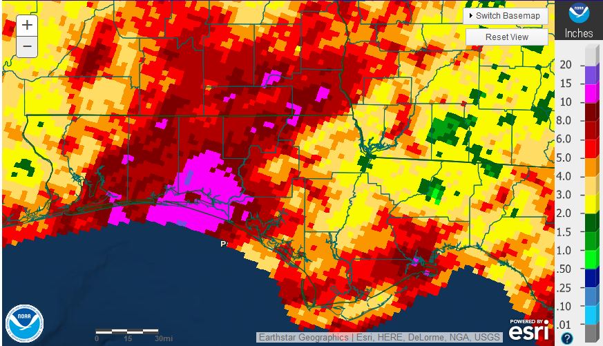
National Weather Service rainfall estimates for September 2015.
The graphic above shows that there were numerous pockets of the Panhandle that received less than two inches in August (green) while some ares along the coast had more than six inches (dark red). Rainfall totals for September were drastically different than August, with pockets that had over 10 inches (pink), with most of that rainfall coming at the end of the month over just a few days. The eastern Panhandle Counties were not as fortunate with less than three inches (yellow and green) of rain for the month of September.
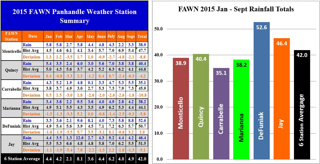 The University of Florida’s automated weather stations (FAWN) also showed the variation in rainfall over the past two months. Only the DeFuniak station has recorded above average rainfall for the year through September, with a total of 52.6 inches recorded. The Carrabelle station has been the driest location with only 35.1 inches for the year thus far, and 10.8″ below average.
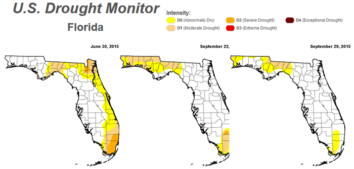 The drought monitor shows the transition of the Panhandle from July through the end of September. All of the rain at the end of September may have created major frustrations for peanut farmers, but they did improve drought conditions for the western counties.
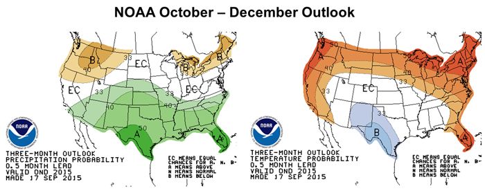 Looking ahead over the next three months, the effects of El Niño are expected to bring above average rainfall to most of the Southeast. Temperatures are expected to be above average for the eastern Panhandle and Peninsular Florida.
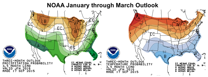
Current predictions are for one of the strongest El Niño winters in many years. Expectations for the late fall and winter are for above average rainfall, but cooler than normal temperatures over the first three months of 2016. Based on these long range forecasts you would expect it to be good year for winter pastures and small grains, as well as drought relief for the Southern US. As farmers well know, however, too much extra rainfall can also be a problem. How much rain and how cold are the difficult questions to answer. Will this additional moisture and colder temperatures affect vegetable and corn planting in the early part of the spring? Stay tuned, as we watch to see what affects this El Niño really brings to the region.
demayo@ufl.edu - 850-482-9620
Follow me on Twitter
@UFCowman