
Talk about a tale of two months. It seemed like we went from winter to spring in just one month. In the Panhandle, January 2018 was a pretty normal winter month, temperature wise, but was much drier than normal. February 2018 set records for the warmest February on record, with incredible rainfall totals over a 10-day span for part of the region.
Rainfall
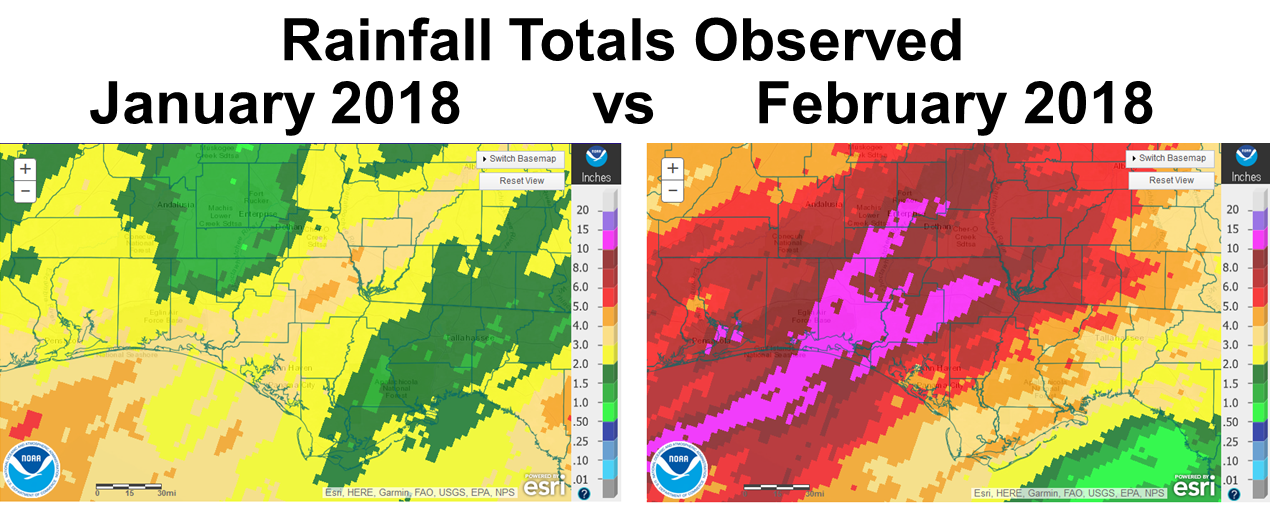 The two maps above show the national weather services estimates for rainfall in January and February 2018. In January, most of the region received fewer than 4″ (tan, yellow, green), yet in February the central portion of the Panhandle received more than 8″ (dark red and hot pink).
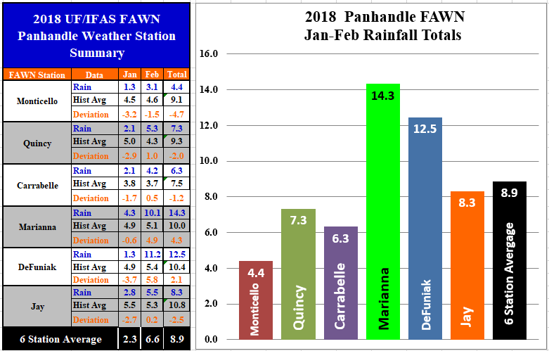 The FAWN Stations also showed the significant variation in rainfall totals for the first two months of 2018. In January all six stations received less rainfall than the historic average, with only 1.3″ recorded at the Monticello and DeFuniak stations. The six station average in January was 2.3″. The highest rainfall total was only 4.3″ at the Marianna location. February, however, was much wetter, with the highest total of 11.2″ in DeFuniak and 10.1″ in Marianna. The six station average was 6.6″ in February. For the two month period, only the Marianna and DeFuniak stations recorded above average rainfall. Clearly the rainfall has been quite varied between the six locations, as shown by the two month total of 14.3″ in Marianna compared to to only 4.4″ in Monticello.
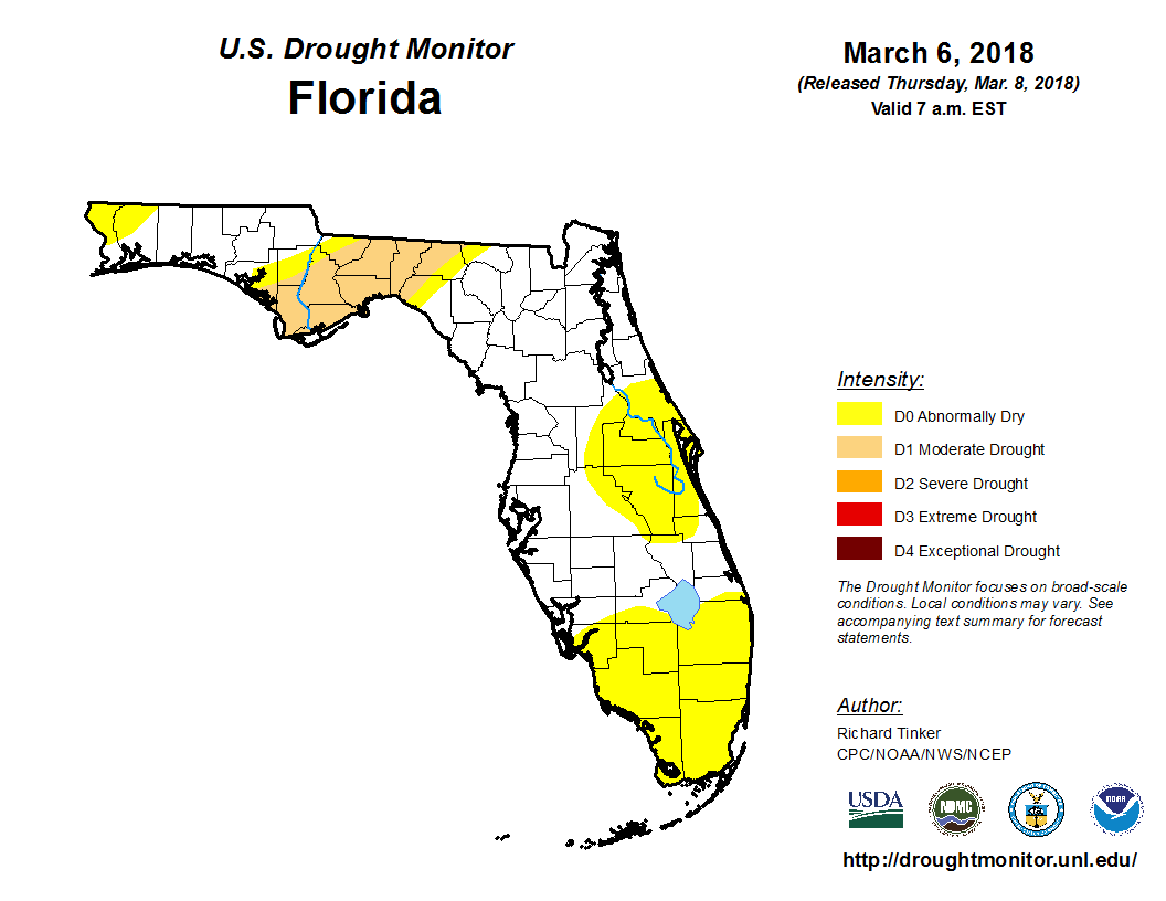 The Drought Monitor reflects the disparity in rainfall across Florida in recent months. Much of the eastern Panhandle remains in the moderate drought category.
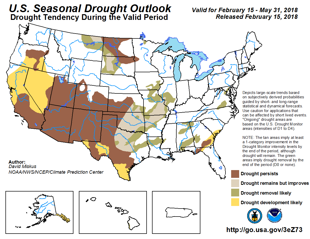 The seasonal drought outlook is predicting drought conditions in the eastern Panhandle and Big Bend to persist through the end of May.
Temperatures
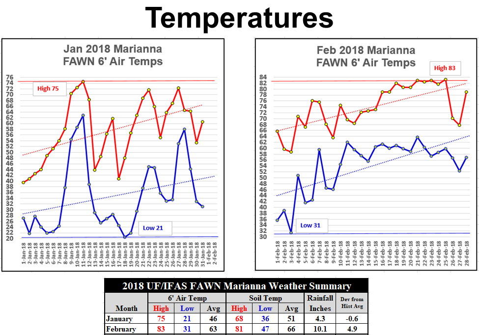 Temperatures were more normal in January with 16 of 31 nights below freezing, while there was only one night below freezing in February. The average air temperature rose 17° from 46° in January to 63° in February. There were eight days in February with high temperatures over 80°. February felt much more like April than a winter month in this region.
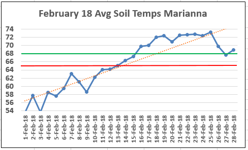 Average soil temperatures were actually warm enough in Marianna for planting peanuts and cotton from February 15-26, before cooling off again at months end, and through the first week of March. The green line in the chart is 68°, the optimal average soil temperature for peanut and cotton seed germination, and the red line is at 65°, the minimum recommended temperature for cotton and peanut planting.
Planting Season Forecast
La Niña Update
During February 2018, La Niña weakened, but was still reflected by below-average sea surface temperatures in the east-central equatorial Pacific Ocean. Most models predict La Niña will decay and return to ENSO-neutral during the spring 2018. The forecast consensus similarly favors a transition during the spring, with a continuation of ENSO-neutral conditions through the summer. In summary, a transition from La Niña to ENSO-neutral is most likely (~55% chance) during the March-May season, with neutral conditions likely to continue into the second half of the year. Climate Predication Center
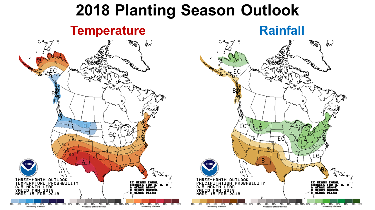 Based on their La Niña forecast, the Climate Predication Center (CPC) is predicting warmer and drier than normal conditions across Florida over the next three months. Based on this forecast, dryland farmers and ranchers will need to carefully time crop and pasture planting with expected rainfall. Hopefully, La Niña will continue to weaken to allow more normal conditions at this critical point of the farming season.
demayo@ufl.edu - 850-482-9620
Follow me on Twitter
@UFCowman