
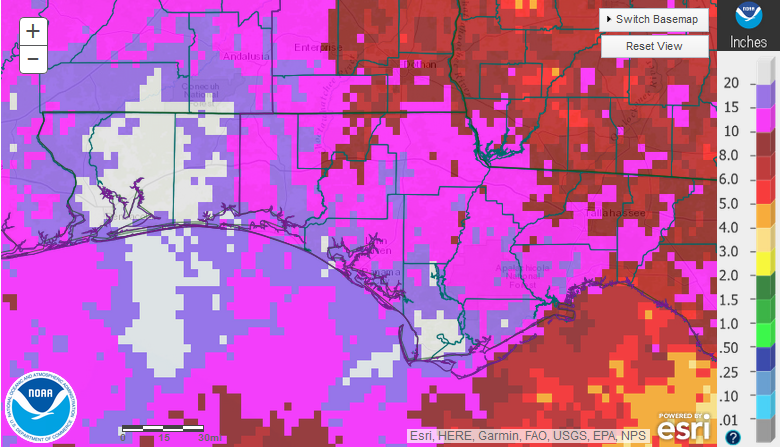
National Weather Service estimates for June 2107 rainfall across the Florida Panhandle
June was certainly a much wetter month than May. Escambia, Santa Rosa, Okaloosa, and Gulf Counties received 15″ of rainfall (dark purple) with large areas of more than 20″ (white). Tropical Storm Cindy brought much of the extra rainfall for the month. The eastern counties were less affected by this storm, but most of the Panhandle received more than 10″ (pink) in total for the month.
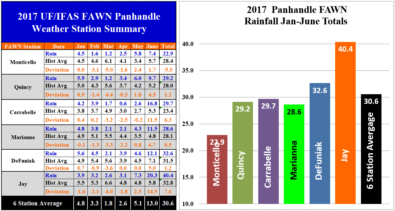 The University of Florida’s Florida Automated Weather Network (FAWN) weather stations provided more specific rainfall totals for the region in June. The highest total was recorded at the Jay station with 20.3″. This station recorded rainfall on 20 of the 30 days in June. The Carrabelle station recorded 16.8″. Only the Quincy and Monticello recorded less than 10″ in June. All six stations, however, recorded considerably more rain than the June historic average for each location. Through the first half of the year, only the Monticello location is direr than average. The Jay station has recorded 40.4″ so far in 2017 (half of total came in June). Monticello by contrast has only received 22.9″ thus far. The average rainfall for all six stations was 30.6″ from January through June.
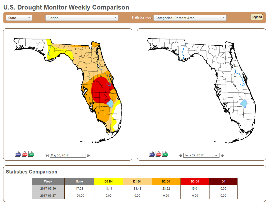 The good news is that all of the rain from Tropical Storm Cindy ended the drought in Florida. At the end of May, only 17% of Florida was not listed in one of the drought categories. Just one month later the entire state is considered drought free.
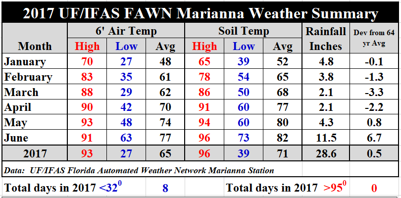 Temperatures were also affected by all the cloudy, rainy days as well. At the Marianna station, the average air temperature only increased three degrees from May to June. The average soil temperature rose only two degrees.
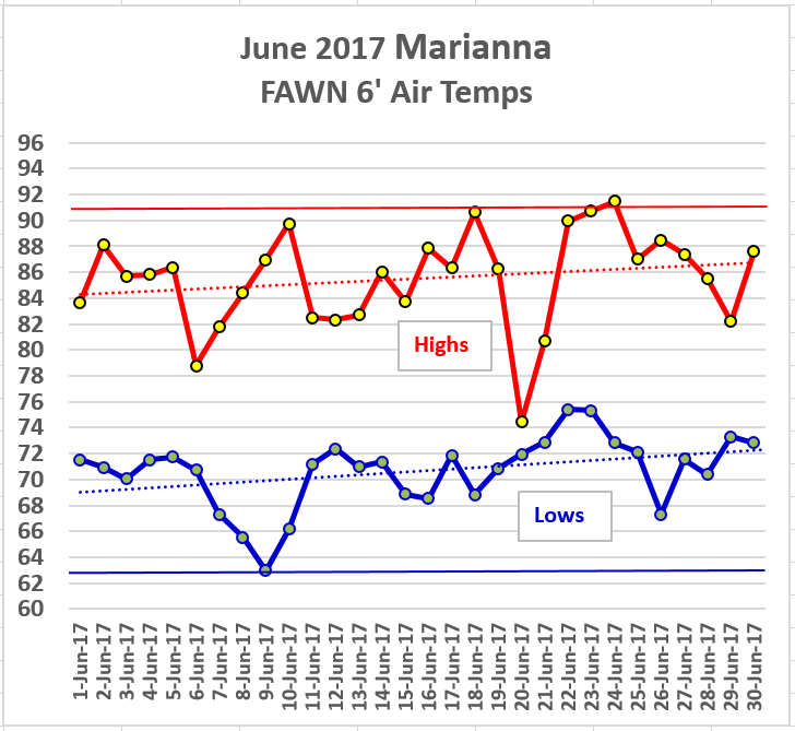 The high temperature for the month of June was 91° on 23 and 24, when the sun peeked out long enough to heat things up. The low temperature was 63° on June 9th. There was one strange occurrence on June 20th. It was a very cloudy, rainy day with only 2° difference between the high and the low temperature for the day (72°-74°).
Us the following link for a more detailed report of daily rainfall and temperatures recorded at the Marianna FAWN station: 17 Jan-June Jackson County Weather Summary
July Outlook
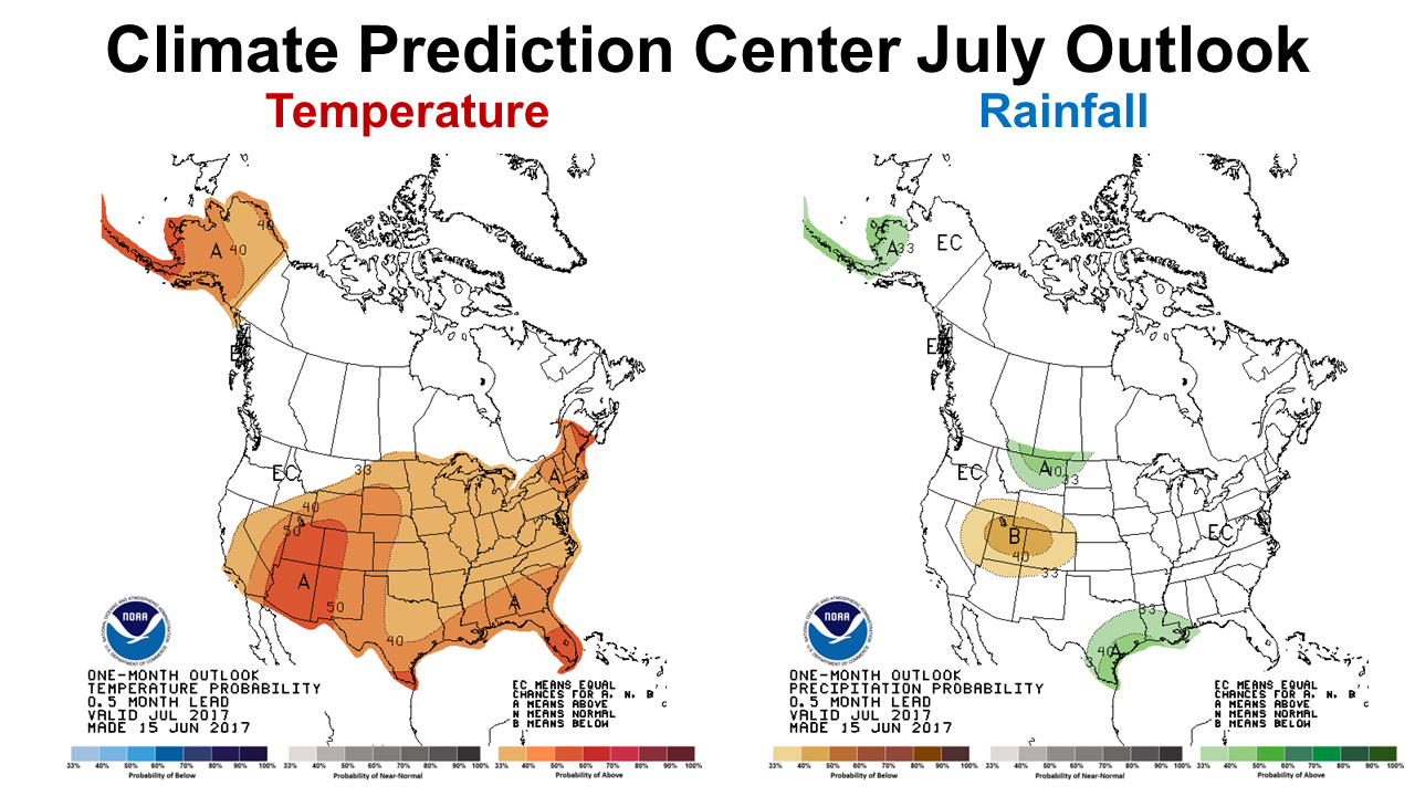 Looking ahead, the Climate Prediction Center (CPC) is expecting higher than normal temperatures for the month of July, with no clear expectation for rainfall for the month. Typically, July is the wettest month of the year in the Panhandle providing 6-7″ historically, so normal rainfall should be more than adequate to continue to support lush pasture and crop growth, with minimal irrigation. If you have been working outside this week, you know that it has already heated up considerably as compared to June.
El Niño Alert
ENSO Alert System Status: Not Active. ENSO-Neutral conditions are present. Equatorial sea surface temperatures (SSTs) are near-to-above average across most of the Pacific Ocean. ENSO-Neutral is favored (50 to ~55% chance) through the Northern Hemisphere fall 2017. Climate Prediction Center

demayo@ufl.edu - 850-482-9620
Follow me on Twitter
@UFCowman
- May 2025 Weather Summary and Summer Outlook - June 20, 2025
- Friday Feature:The History of Angus Cattle - June 20, 2025
- Friday Feature:High Quality Legume Hay Production – Virtual Tour of Conrad Farms - June 6, 2025