
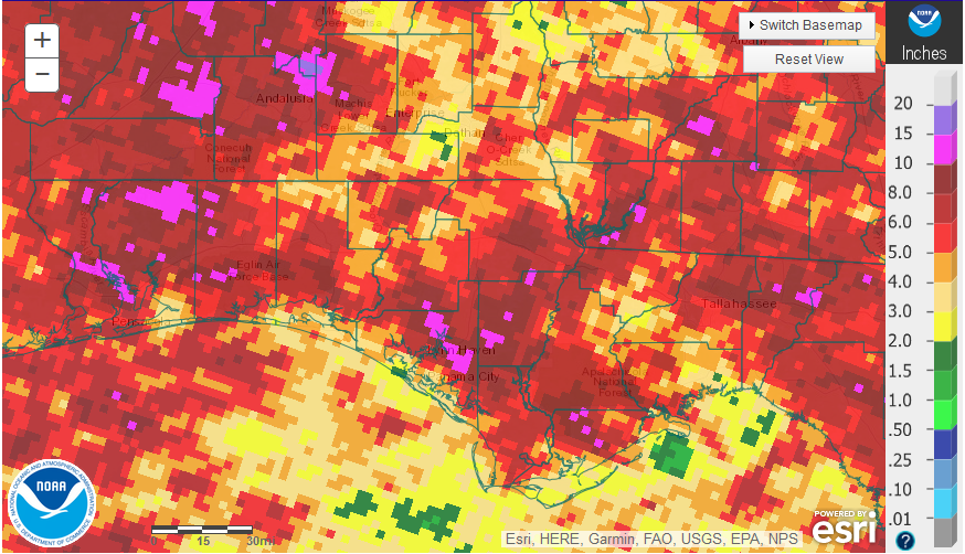
June 2018 rainfall estimates provided by the National Weather Service.
Rainfall
June was a wet month for much of the Panhandle, thanks in part to rain following Tropical Storm Alberto that came ashore at the end of May. But the rainfall was not at all uniform across the region. There were a few areas that received more than 10″ in June (hot pink), but there were other areas that had less than 4″ (tan and yellow).
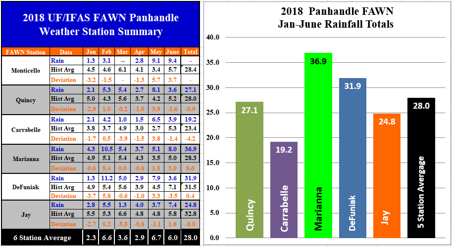 The six Florida Automated Weather Network (FAWN) stations in the Panhandle documented the variation in rainfall. Monticello had been one of the driest locations, but recorded 9.4″ in June, following a wet May. The driest locations were DeFuniak and Quincy with only 3.6″ for the month. The six station average for June was 6.0″. Through the first half of 2018, the Marianna station recorded the highest total of 36.9″. This was 8.6″ above historic average through the first half of the year. The lowest total for the first half of the year was in Carrabelle with only 19.2″, 4.2″ below historic average.
Temperature
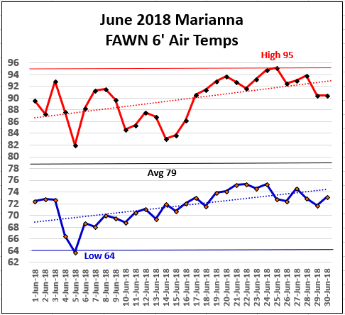 June started reasonably cooler than normal with so many cloudy and rainy days. Rainfall was recorded on 14 of the 30 days in June at the Marianna FAWN Station. The low in June was 64° on June 5. The high temperature that day was only 82°. As the month wore on, temperatures heated up to a high of 95° on June 24 and 25.
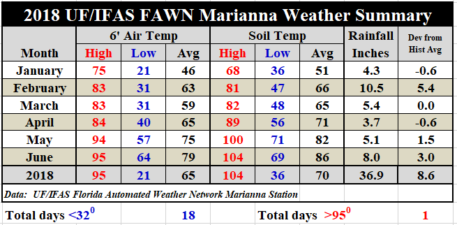 The average temperature in June was 79. This was 4° warmer than May. Soil temperatures really heated up to a high of 104° on June 21. The average soil temperature in June was 86°, which was also 4° warmer than May. If you would like to review the complete daily summary from the Marianna FAWN station, use the following link: 2018 Jan-June FAWN Weather Summary.
July Outlook
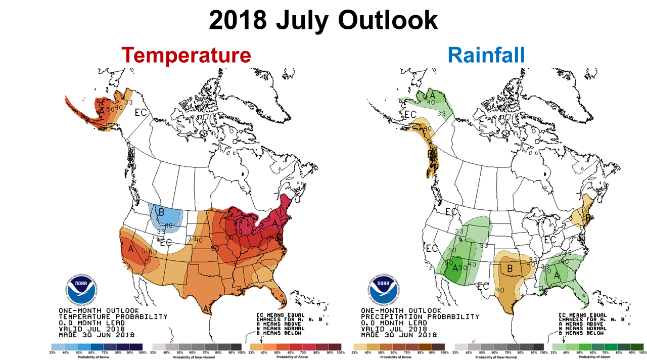 The Climate Prediction Center (CPC) is expecting a high probability of above average rainfall to continue in July. They are also forecasting above average temperatures across the Southeast.
EL Niño Watch
Although we are currently in the neutral ENSO phase, the CPC recently increased the probability for an El Niño at the end of the year. It seems the wet year will continue and perhaps intensify late this fall. The following statement was issued by the CPC this week:
ENSO-neutral is favored through Northern Hemisphere summer 2018, with the chance for El Niño increasing to about 65% during fall, and to about 70% during winter 2018-19.
This could mean that it will be a good year for winter forage crops, but may not be favorable for cool-season vegetables. In the Panhandle, El Niño years feature above average rainfall and slightly cooler winters. The CPC will be more certain of their El Niño forecast this fall. 2018 is certainly shaping up to be a wet year for many areas of the region.

demayo@ufl.edu - 850-482-9620
Follow me on Twitter
@UFCowman
- Making the Most of High Cattle Prices – Grow More of Your Own Feed - July 18, 2025
- Friday Feature:1960 Corn Farmer - July 18, 2025
- June 2025 Weather Summary and Three-Month Outlook - July 11, 2025