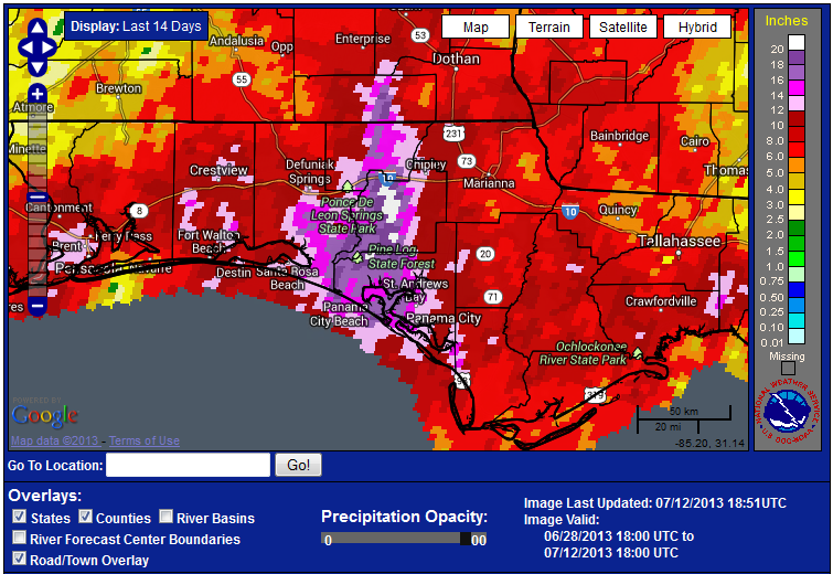
Libbie Johnson, Escambia County Ag Agent, found a really cool weather data website. The National Weather Service provides estimates of rainfall based on the combination of radar estimates and data collected by weather stations. This information is used to generate color coated images like the one above. Check out the site at: http://www.srh.noaa.gov/ridge2/RFC_Precip/ . What is also neat is that you can go back in the archives and look at rainfall estimate from previous years. This could prove to be very helpful for disaster claims at the end of the season. The address for the archive site is: http://water.weather.gov/precip/. This site provides either single day or monthly totals.
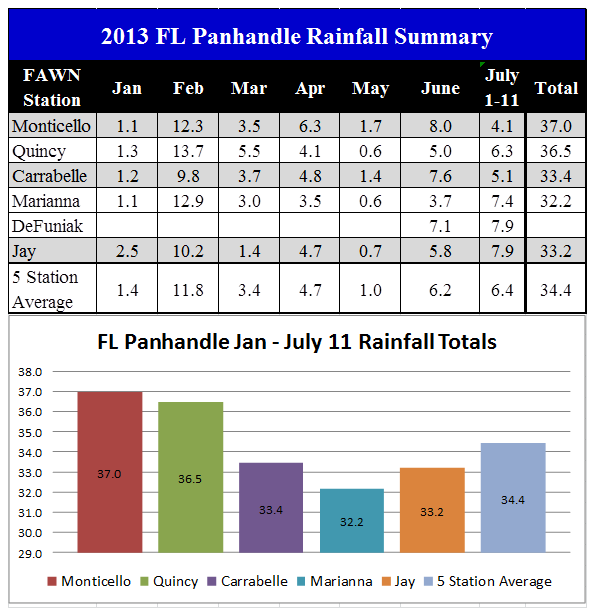
Notice from the graphic that rainfall in the Panhandle for the last two weeks ranged from over 20 inches in Washington County to as few as three inches in northern Escambia County. The chart below shows the variation in rainfall measured at the six Florida Automated Weather Network (FAWN) stations across the Panhandle. The rainfall measured in these six locations shows the wide variation in summer rainfall across the Panhandle.
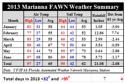
With all of the rain, one positive is that high temperatures have yet to reach triple digits this year. With the combination of long summer days, warm soil, and good soil moisture, crops will grow well as long as they don’t remain saturated for extended periods. These conditions, however, are also ideal for weeds, insects, and fungal diseases.
- Friday Feature:Prosperity on the Modern Farm in 1950 - January 30, 2026
- Ranch Record Keeping for Annual Analysis & Innovation - January 23, 2026
- Friday Feature: 2026 Farm Dog of the Year - January 23, 2026


