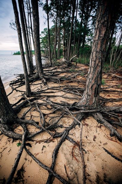
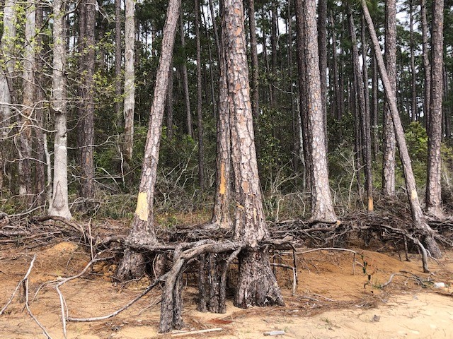
As the name implies, they are haunting—long stretches of standing, dead trees with exposed roots. These “ghost forests” are an unsettling scene in unsettling times for the environment. While coastal erosion is a fact of life—incoming waves, hurricanes, longshore drift of beach sand—the rate of its occurrence is startling lately.
Exposed roots of a ghost forest forming along the Escambia Bay. Photo credit: Deanie Sexton
Global rises in sea level due to increased atmospheric carbon levels mean more saltwater is moving into flat, coastal habitats that once served as a buffer from the open water. Salt is an exceedingly difficult compound for plants to handle, and only a few species have evolved mechanisms for tolerating it. Low-growing salt marshes and thick mangrove stands have always served as “first line of defense” buffers to take in wave action and absorb saltwater. If shorelines have too much wave action for marshes to form, wide stretches of sandy beach and dunes serve the same function, protecting the inland species of shrubs and trees. Many coastal areas are flat and stay at or just above sea level for thousands of yards, or even miles. This means that even a small increase in sea level can send saltwater deep into previously freshwater systems, drowning the marsh and flooding stands of oak and pine. The salt and sulfate in seawater will kill a tree quickly, although it may remain standing, dead, for months or years. Hurricanes and tropical storms exacerbate that damage, scouring out chunks of shoreline and knocking down already-unstable trees.
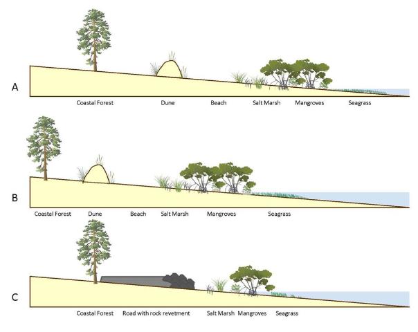
A slow increase in sea level could be tolerated and adapted to as salt marshes move inland and replace non-salt tolerant species. But this process of ecological succession can be interrupted if erosion and increased water levels occur too quickly. And if there is hard infrastructure inland of the marshes (like roads or buildings), the system experiences “coastal squeeze,” winnowing the marsh to a thin, eventually nonexistent ribbon, with no natural protection for that expensive infrastructure.
This diagram outlines the changes in coastal vegetation and shorelines as sea level rises. With “ghost forests,” the sea level moves into that coastal forest section. Figure credit: W. Gray, IAN Image Library
Ghost forests are popping up everywhere. Last year, Popular Mechanics magazine reported on a recently published study that used satellite imagery to document how 11% of a previously healthy forest was converted to standing dead trees along the coast of North Carolina. The trees died within a span of just 35 years (1984-2019). During that time frame, this stretch of coastline also experienced an extended drought and Category 3 Hurricane Irene. These impacts sped up the habitat loss, with over 19,000 hectares converted from forest to marsh and 1100 hectares of marsh vegetation gone, becoming open water.
A ghost forest forming along the shoreline of Blackwater Bay in Santa Rosa County. Photo credit: Carrie Stevenson, UF IFAS Extension
Due to increased coastal flooding and saltwater standing in forested areas, U.S. Fish and Wildlife Service employees are concerned that the historic Harriett Tubman Byway in Maryland—part of the famed underground railroad of the Civil War era—will soon be gone. Over 5,000 acres of tidal marsh have converted to open water in the area and large stands of trees have died. Even locally, trees along Escambia and Blackwater Bay are dying due to salt damage and heavy erosion. Hurricane Sally delivered a knockout punch to many remaining trees along the scenic bluffs of the bay.
Sea level has risen over 10” in the past 100 years in the Pensacola Bay area, and even mid-range Army Corps of Engineers estimates expect 0.6 to 1.4 feet of rise in the area by 2045. There are some actions we can take to mitigate future damage. Building a “living shoreline” of vegetation along a piece of waterfront property instead of using a seawall can help, especially if the vegetation growth outpaces sea level rise. You can also visit the City of Pensacola’s Climate Task Force report to learn more about climate action recommended (and being taken) locally, such as increasing the use of renewable energy and dedicating staff to sustainability measures.
Coastal plain honeycombhead blooms through the summer on local beaches. Photo credit, Bob Pitts, National Park Service
Over my years of leading people on interpretive trail hikes, I have learned it is particularly important to know the names of whatever happens to be in bloom. These flowers are eye-catching, and inevitably someone will ask what they are. In fact, one of my favorite wildflower identification books is categorized not by taxonomy, but by bloom color—with a rainbow of tabs down the edge of the book for easy identification.
Wildflower identification can be tough, but color-coded guidebooks are really helpful! Photo credit: Carrie Stevenson, UF IFAS Extension
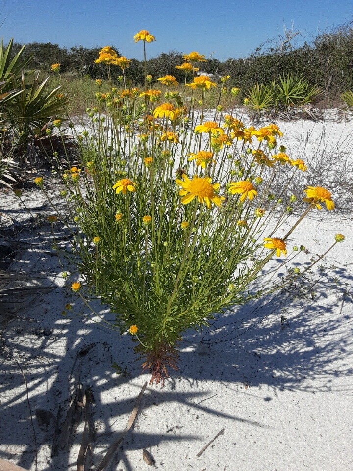
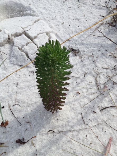
In our coastal dunes right now, several plants are showing off vibrant yellow blooms. Seaside goldenrod, coreopsis, and other asters are common. Rarer, and the subject of today’s post, is the Coastal Plain Honeycombhead (Balduina angustifolia). It has bright yellow flowers, but often gets more notice due to its unusual appearance when not in bloom. The basal leaves are bright green and similar in shape and arrangement to a pine cone or bottlebrush (albeit a tiny one), sticking straight up in the sand. The plants are typically found on the more protected back side of primary dunes or further into secondary dunes, a little more inland from the Gulf.
When not in bloom, the plant resembles a green pinecone planted in the sand. Photo credit: Carrie Stevenson, UF IFAS Extension
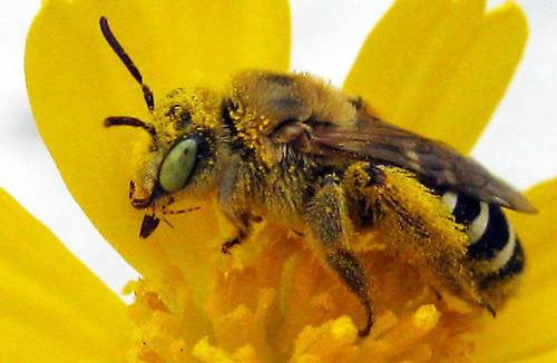
The plant plays a special role in beach ecology, as a host plant for Gulf fritillary butterflies and the Gulf Coast solitary bee (Hesperapis oraria). The bee is a ground-dwelling pollinator insect that forages only in the barrier islands of Mississippi, Alabama, and Florida. The species is currently the subject of a University of Florida study (they’re out at Ft. Pickens right now), as the endemic bee’s sole source of nectar and pollen is the honeycombhead flower. As of publication date, no bee nests have been discovered. Researchers are interested in learning more about the insect’s life cycle and nesting behaviors to better understand and protect its use of local habitats. Based on closely related species, it is believed the Gulf Coast solitary bee builds a multi-chambered nest under the soft sands of the dunes.
Adult female Hesperapis oraria foraging on coastal plain honeycombhead (Balduina angustifolia). Photograph by John Bente, Florida Department of Environmental Protection, Florida Park Service.
While the honeycombhead plant is found in peninsular Florida and coastal Georgia, the bee has been identified only in a 100 km² area between Horn Island, MS, and St. Andrews Bay, FL. Luckily for the bee, large swaths of this land are preserved as part of Gulf Islands National Seashore and several state parks. Nonetheless, these coastal dune habitats are threatened by hurricanes, sea level rise, and development (outside the park boundaries). Due to its rarity and limited habitat, a petition has been submitted to the Fish and Wildlife Service for protection under the Endangered Species Act. 0
Morrison Springs in Walton County is a natural spring ideal for paddling, snorkeling, and diving. Photo credit: Carrie Stevenson, UF IFAS Extensio
There is just SO much water in Florida. Besides the tremendous amount of rain and 1,350 miles of coastline and beachfront, there are endless bays, bayous, creeks, rivers, and streams. In this state, it is extraordinarily difficult to live more than a few miles from a body of water. Among the the coolest (literally) types of water bodies in Florida, though, are our springs. Like brilliant gemstones, the state’s 700+ springs dot the Florida landscape like a strand of sapphires.
While we have springs bubbling up all over northwest Florida in areas where the underground water table meets the surface, larger springs are more common as you move east and south. Some parts of north Florida and most of the peninsula are built on a limestone platform, known by the geological term “karst.” Limestone is composed of calcium carbonate, which has a porous and easily degradable chemical structure. When this barrier is breached, it allows the cold groundwater an opening directly to the surface water—hence a spring. (Fun fact—there are surface water streams that actually disappear into a spring—these are called swallets, operating as the reverse version of a spring!)
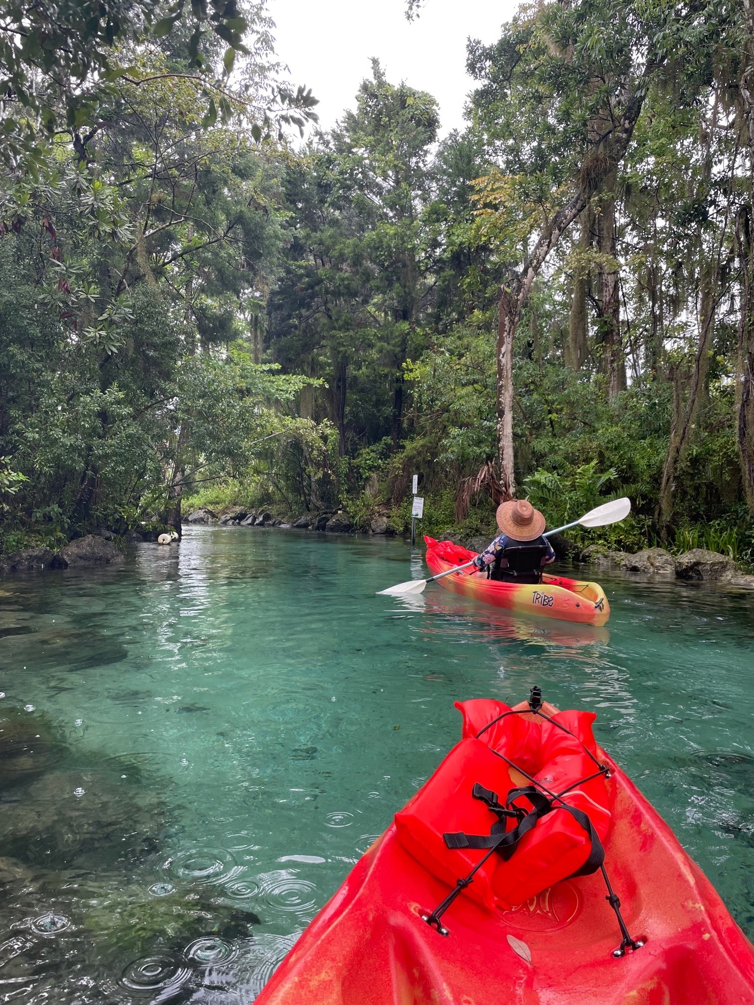
The striking blue-green water in Three Sisters Spring is only accessible by kayak or swimming. Photo credit: Carrie Stevenson, UF IFAS Extension
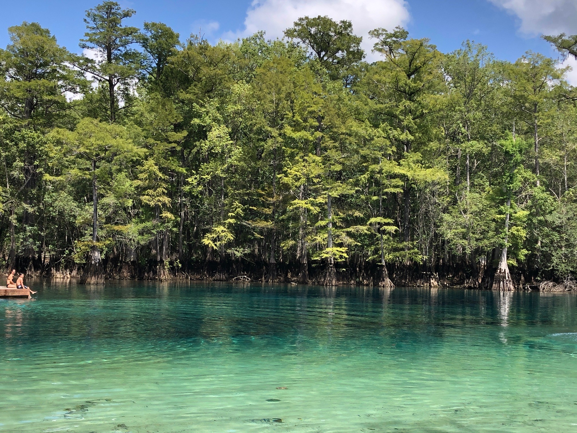
A few of the largest springs in northwest Florida are Vortex, Ponce de Leon, and Morrison Springs, found in Holmes and Walton County. Vortex is a privately operated water park and scuba diving/training facility. It is where the red and white “diver down” flag was invented and has a complex underwater cavern system. Ponce de Leon and Morrison Springs are state and county-run parks with a more natural feel, surrounded by woods and basic infrastructure for access. Morrison will especially wow visitors with its tremendous turquoise coloring.
Crystal clear water in Morrison Springs. Photo credit: Carrie Stevenson, UF IFAS Extension
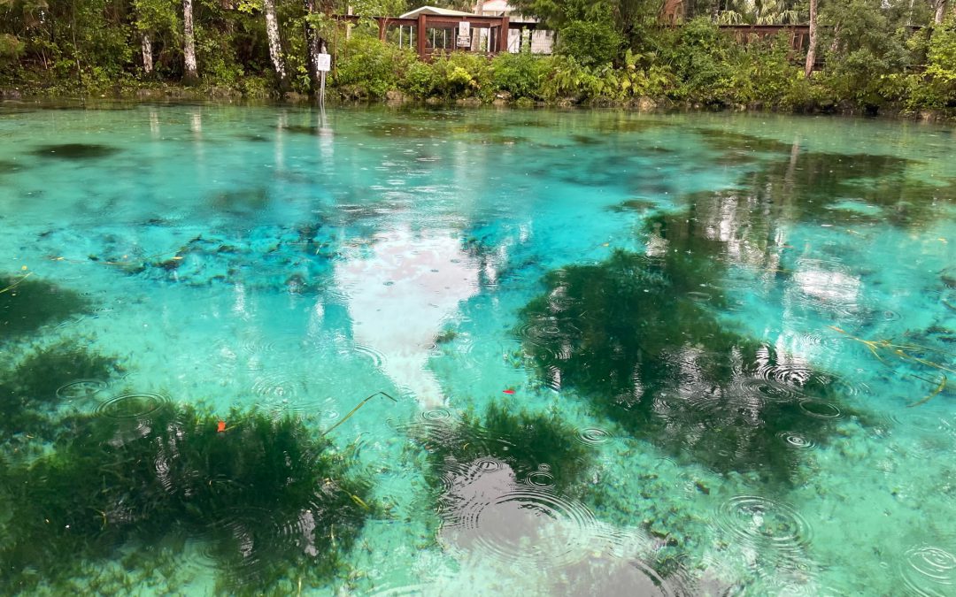
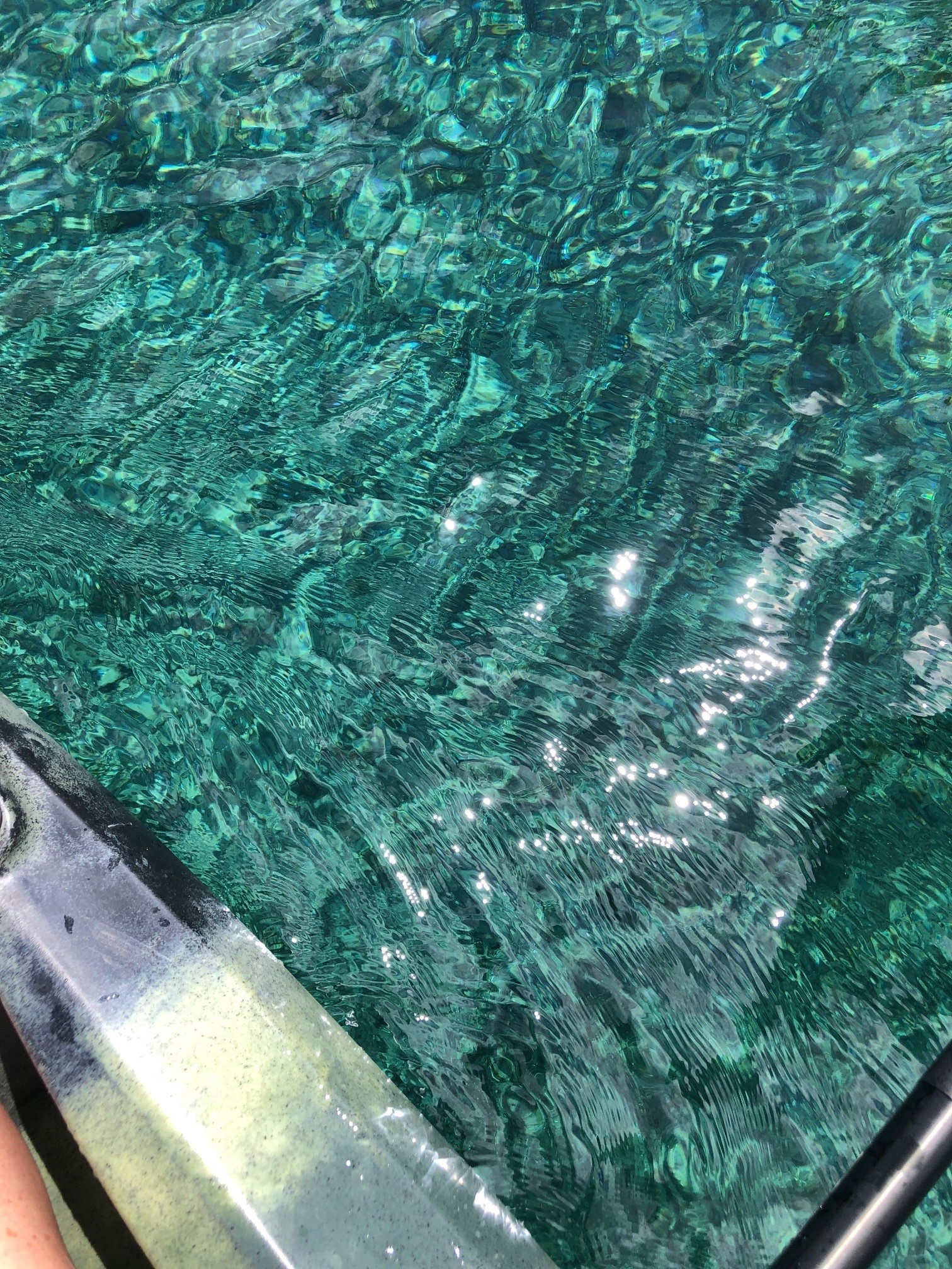
Before a meeting in Crystal River last week, I paddled and snorkeled through the famous Three Sisters Spring. As part of Crystal River National Wildlife Refuge, it is a popular but highly protected area. Three Sisters is well-known as a manatee gathering place, especially in winter, but during my visit was mostly unoccupied. The color was striking, though. Why do so many of these springs have such brilliant blue and turquoise coloring? The phenomenon is essentially the same as the blue-green Gulf waters in the Panhandle. The reflection of the sky on a sunny day with the backdrop of that pure white sand causes the water to reflect a color that inspired the nickname “The Emerald Coast.” In springs, the white calcium carbonate in limestone breaks down into tiny crystals, mixing with the water and reflecting the vivid shades of blue.
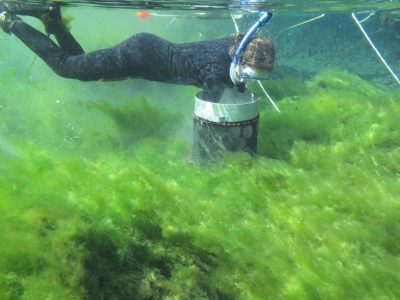
Alexander Springs Creek in Ocala National Forest is overrun with algae. Photo credit: Matt Cohen, UF IFAS
Besides their beauty, clarity, recreational, and wildlife value, springs pump 8 billion gallons of fresh water a day of into Florida ecosystems. Seagrass meadows in many of these springs are lush. Because they are literal windows into the underground aquifer, they are extremely vulnerable to pollution. While many springs have been protected for decades, others were seen as places to dump trash and make it “disappear.” Many have been affected by urban stormwater and agricultural pollution, losing their clarity, reducing dissolved oxygen levels, and prompting massive cleanup and buffer protection zones.
On one of these hot summer days in Florida, take the time to visit our incredible springs. While it may not be the literal “Fountain of Youth,” swimming in a spring is a unique and invigorating experience, and a beautiful way to get off the beaten path. A comprehensive guide to Florida springs, research, and statewide protection initiatives can be found at the Florida Department of Environmental Protection’s springs website.
The local Community Collaborative Rain, Hail, and Snow network is seeking interested citizen scientists to participate in the collecting weather data. See the notice below from local coordinator, Larry McDonald, for more information:
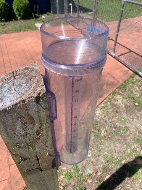
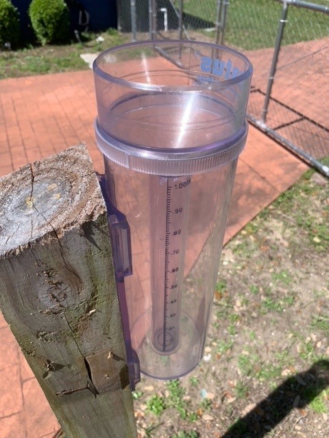
Citizen scientists interested in collecting rain data utilized by organizations all over the country use this type of rain gauge. Photo credit: Larry McDonald, CoCoRAHS
Weather forecasting depends on taking readings and measurements from the atmosphere. And it’s not just professionals, like meteorologists, who measure rainfall, temperatures, and humidity levels. You can, too! The Community Collaborative Rain, Hail, and Snow network (CoCoRaHS) allows everyday citizens to participate in weather data collection by measuring daily precipitation/rainfall totals at their own homes or workplaces. Using a special rain gauge that provides great detail in detecting rain amounts, CoCoRaHS observers submit rain observations online to a national network… along with over 20,000 participants in the U.S., Canada, and the Bahamas. Precipitation amounts are then evaluated for many needs by national, regional, and local weather forecasters, researchers, drought and flood monitoring, and agricultural interests. Rainfall data submitted can also be used in forecasting to predict the possibility of flash flooding for local flood prone areas.
A CoCoRaHS observer simply needs to purchase the approved rain gauge (costing from $30 to $40), mount the gauge in an open area away from roofs, fences, and vegetation, and simply collect rain that falls directly from the sky over a 24-hour period. Once each day, between 5:30 AM and 9:00 AM, the gauge is checked for rain with the amount recorded and submitted to the CoCoRaHS website. Missing a day or more is okay, but the more you report, the better the overall data becomes for your area. New and active CoCoRaHS observers are needed throughout Escambia and Santa Rosa Counties.
Those interested in possibly joining CoCoRaHS as an observer can obtain more information by visiting https://cocorahs.org/. You can also contact the CoCoRaHS local volunteer coordinator for Escambia and Santa Rosa Counties by emailing escambia_fl_cocorahs@icloud.com
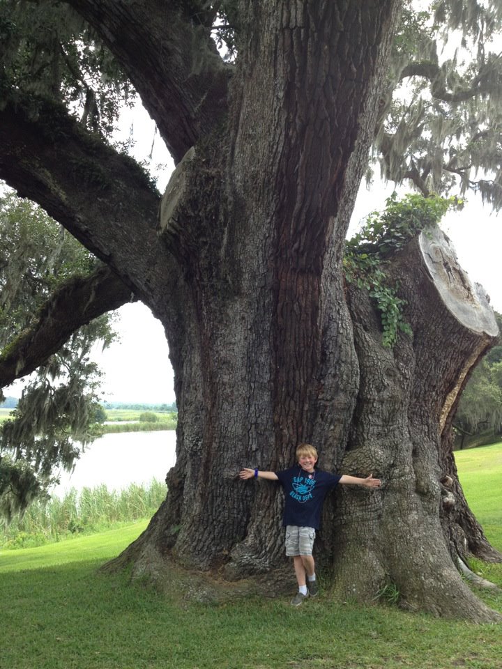
This giant heritage live oak tree has been providing oxygen, habitat, and shelter for 900 years! Photo credit: Carrie Stevenson, UF IFAS Extension
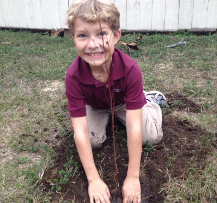
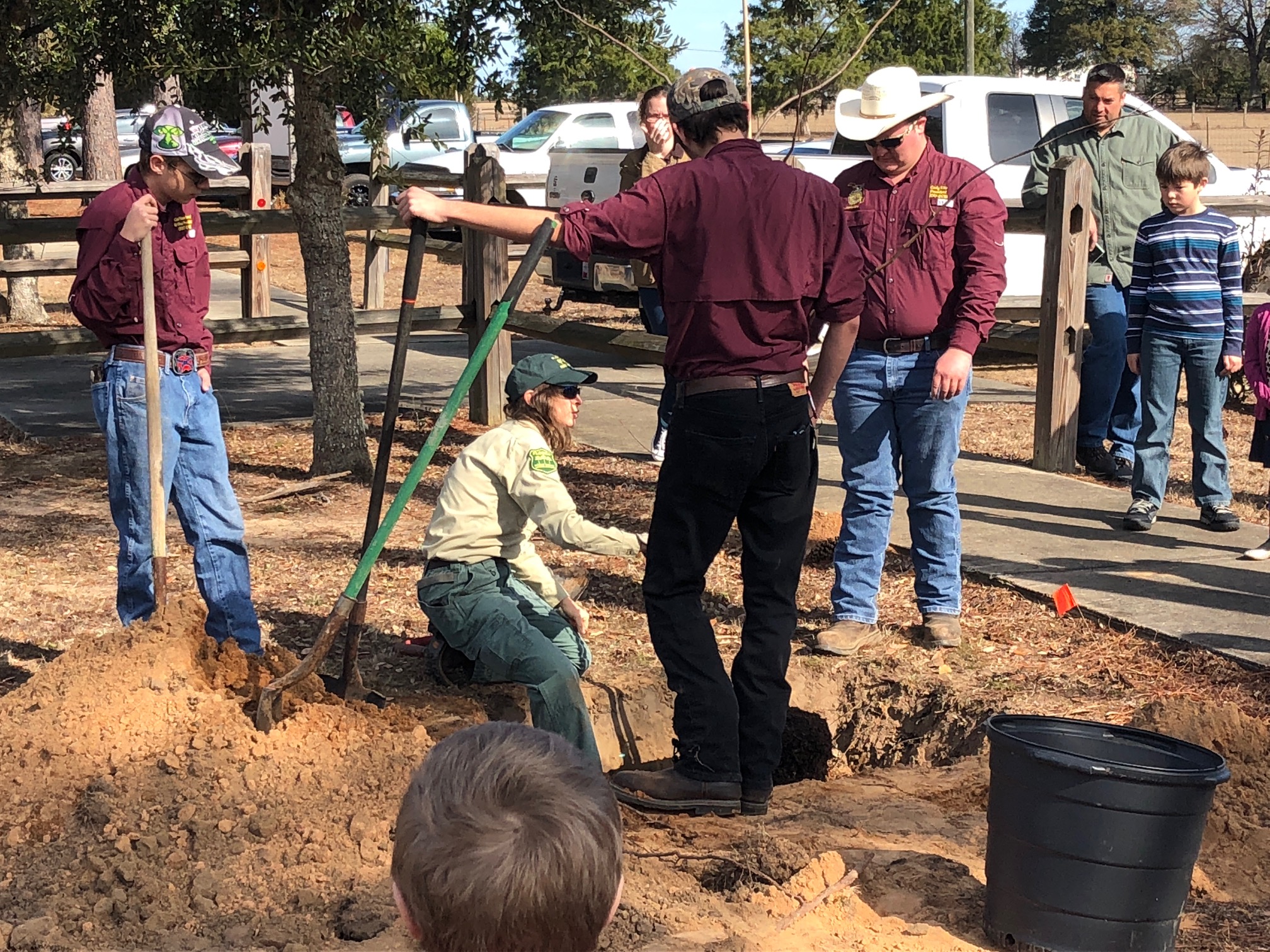
While many people think of planting trees in the spring, autumn and winter are ideal for these activities in Florida. The cooler weather means most trees are no longer actively growing and producing new leaves and fruit, so there are fewer demands on a newly planted tree to start “working” right away. The dormant winter season allows the trees to acclimate to their new environment and begin developing sturdy root systems.
However, a newly planted tree is only as valuable as the care it’s given when planted. To ensure a successful tree, important steps to follow include proper placement, planting depth, mulching, and watering.
Proper tree planting practices can ensure a long-lived, healthy tree in the environment. Photo credit: Carrie Stevenson, UF IFAS Extension
Before digging, look up and around to make sure there are no overhead or underground obstacles within the reaches of the tree’s mature height or root system. When digging the planting hole, make sure the hole is 2-3 times as wide as the root ball. When planted, the topmost root flare (where the roots join the trunk) should be just above the surface of the adjacent landscape. It is not necessary to fertilize a newly planted tree. Use mulch to retain moisture in the soil, but do not place it against the tree’s trunk. Finally, water the tree daily, saturating the root ball, for 1-2 weeks then weekly for a year.
For more information on planting trees and good varieties of trees for Florida, visit this excellent resource from UF. As always, one should strive to plant the right tree in the right place. For those who live in suburban or urban areas, considerations like tree size, leaf shed, and water requirements are big concerns. For more information on size evaluation and plant selection, please visit this link from the UF Horticulture department.


 0
0