by Carrie Stevenson | Mar 24, 2022
The local Community Collaborative Rain, Hail, and Snow network is seeking interested citizen scientists to participate in the collecting weather data. See the notice below from local coordinator, Larry McDonald, for more information:

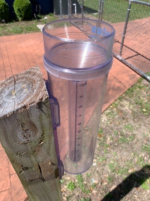
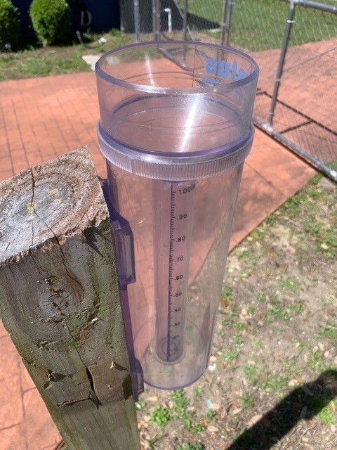
Citizen scientists interested in collecting rain data utilized by organizations all over the country use this type of rain gauge. Photo credit: Larry McDonald, CoCoRAHS
Weather forecasting depends on taking readings and measurements from the atmosphere. And it’s not just professionals, like meteorologists, who measure rainfall, temperatures, and humidity levels. You can, too! The Community Collaborative Rain, Hail, and Snow network (CoCoRaHS) allows everyday citizens to participate in weather data collection by measuring daily precipitation/rainfall totals at their own homes or workplaces. Using a special rain gauge that provides great detail in detecting rain amounts, CoCoRaHS observers submit rain observations online to a national network… along with over 20,000 participants in the U.S., Canada, and the Bahamas. Precipitation amounts are then evaluated for many needs by national, regional, and local weather forecasters, researchers, drought and flood monitoring, and agricultural interests. Rainfall data submitted can also be used in forecasting to predict the possibility of flash flooding for local flood prone areas.
A CoCoRaHS observer simply needs to purchase the approved rain gauge (costing from $30 to $40), mount the gauge in an open area away from roofs, fences, and vegetation, and simply collect rain that falls directly from the sky over a 24-hour period. Once each day, between 5:30 AM and 9:00 AM, the gauge is checked for rain with the amount recorded and submitted to the CoCoRaHS website. Missing a day or more is okay, but the more you report, the better the overall data becomes for your area. New and active CoCoRaHS observers are needed throughout Escambia and Santa Rosa Counties.
Those interested in possibly joining CoCoRaHS as an observer can obtain more information by visiting https://cocorahs.org/. You can also contact the CoCoRaHS local volunteer coordinator for Escambia and Santa Rosa Counties by emailing escambia_fl_cocorahs@icloud.com
by Rick O'Connor | Dec 22, 2021
2021 Panhandle Terrapin Project Survey Report
Rick O’Connor, Florida Sea Grant, University of Florida / IFAS Extension, Escambia County
SITUATION
The diamondback terrapin (Malaclemys terrapin) is the only resident brackish water turtle in the United States. Ranging from Cape Cod Massachusetts to Brownsville Texas, this turtle is most often found in the salt marsh and mangrove habitats within this range.
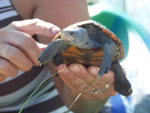
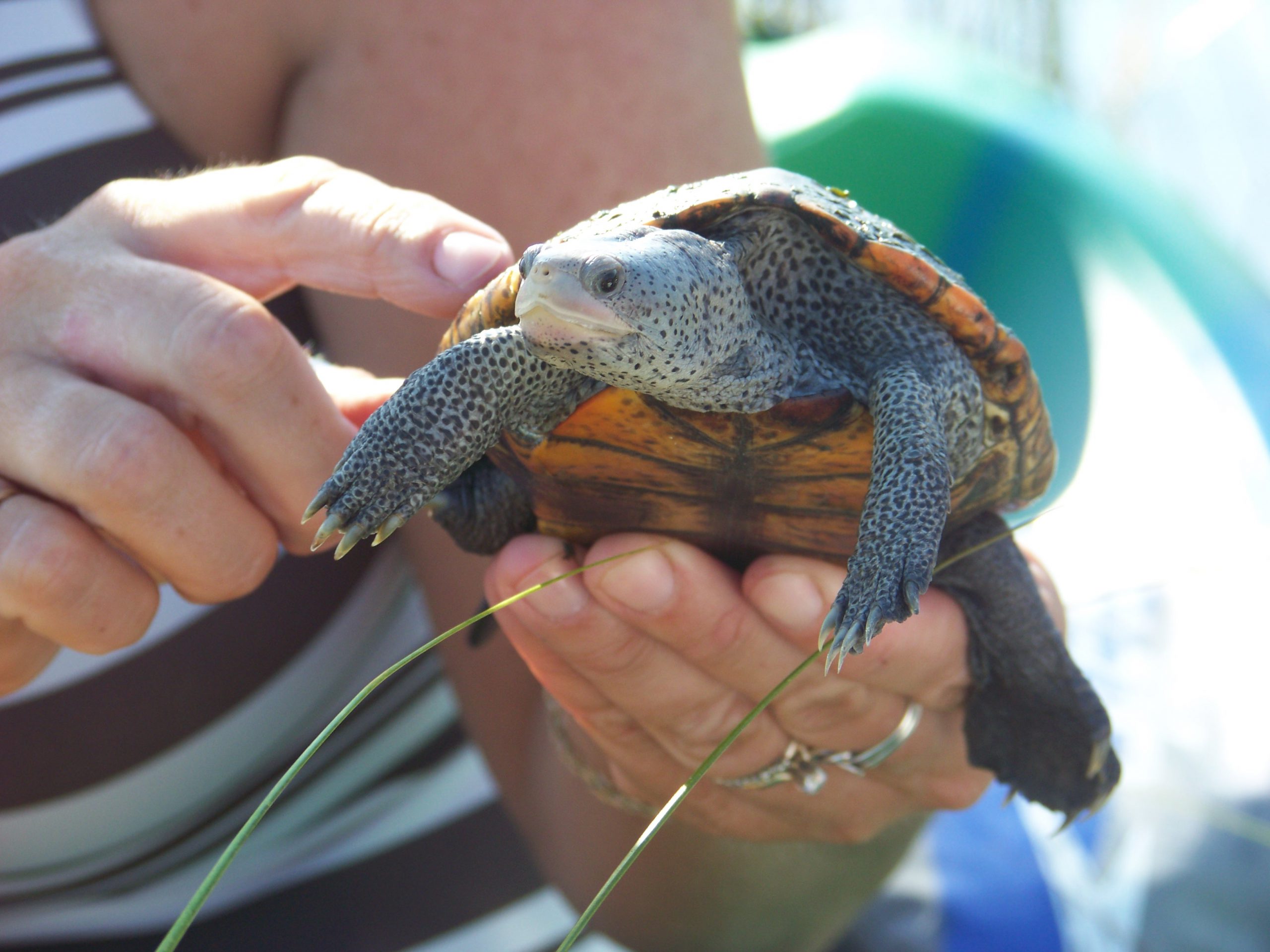
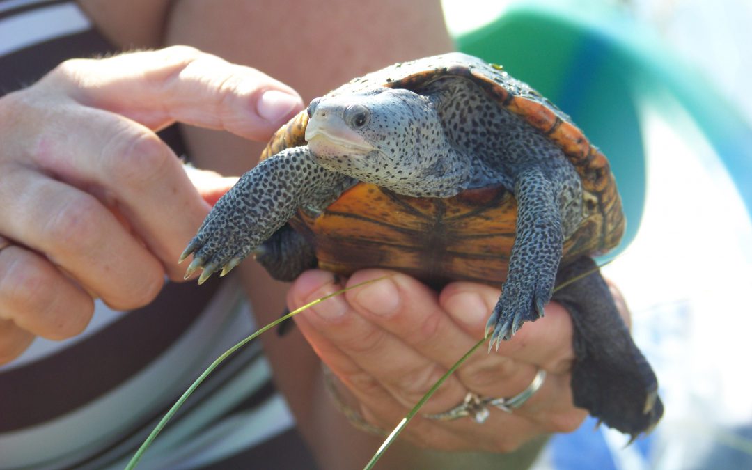
The light colored skin and dark markings are pretty unique to the terrapin.
Photo: Molly O’Connor
Terrapins are medium sized members of the Emydidae family, which includes the cooters, sliders, and box turtles. The carapace length of the larger females is about 10 inches, and she will weigh on average about 20 ounces. Males are smaller, 5-6 inches carapace and about 10 ounces. They are beautifully marked turtles having lighter skin with darker spots or bars. The carapace can have beautiful markings of spots and swirls, many times a brilliant orange in color. Because of this they are popular in the pet trade and illegal pouching is a problem across their range.
There are seven subspecies within this range.
- The northern terrapin ( t. terrapin) can be found from Massachusetts to the Chesapeake Bay area.
- The Carolina terrapin ( t. centrata) is found from the Chesapeake Bay area to the Daytona Beach area of Florida.
- The Florida east coast terrapin ( t. tequesta) is found from the Daytona Beach area to Miami-Dade County.
- The mangrove terrapin ( t. rhizophorarum) is found in the Florida Keys and along the Gulf coast to the Ten Thousand Islands area.
- The ornate terrapin ( t. macrospilota) can be found from the Ten Thousand Island area to Choctawhatchee Bay in the Florida panhandle.
- The Mississippi terrapin ( t. pileata) is found from Choctawhatchee Bay to the Louisiana/Texas state line.
- The Texas terrapin ( t. littoralis) is found along the coast of Texas.
The animal is quite well known in the Chesapeake Bay area where it was harvested in the 19th century as a food source. The popularity of “turtle soup” increased when President Lincoln included it as a local course for state dinners at the White House. The popularity increased the harvest to a point where terrapin farms began to supply the demand, many of these farms were in the south. Eventually the price became too high, and the popularity of the dish waned. At that point research into the animal began in earnest to assess how the commercial harvest had impacted the population. Much of this work was conducted in the early part of the 20th century. By the mid-20th century, a wired crab pot was developed for the harvest of blue crab, a popular fishery in the Chesapeake. Terrapins have a habitat of entering these crab pots and drowning. So, a new threat had emerged. About the same time the automobile was becoming more popular, bridges were being built to connect to barrier islands, and other locations, humans had not visited much before. This activity increased the number of nest predators for terrapins, raccoons being one of the larger problems.
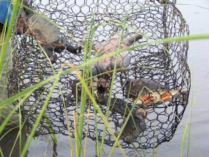
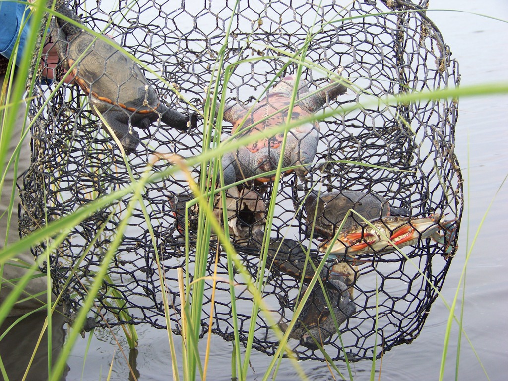
Terrapins in a derelict crab trap (photo: Molly O’Connor)
All of these issues led to more research on terrapin biology and ecology. However, there was one region within their range that very little was known – the Florida panhandle. There were no scientific studies conducted in this part of their range and even their existence there was questioned.
REPSONSE
In response to the question of existence in the Florida panhandle, the Florida Turtle Conservation Trust and the Florida Diamondback Terrapin Working Group, reached out to the Institute of Coastal and Marine Studies (a high school marine science program in Escambia County, Florida). The objective was to have them conduct surveys in suitable terrapin habitat indicating presence/absence of terrapins between Escambia and Franklin Counties. Those surveys began in 2005 and by 2010 had been conducted in all six counties with at least one verified record in each of the six counties (Escambia, Santa Rosa, Okaloosa, Walton, Bay, and Gulf). Terrapins did exist there.
Beginning in 2008 the team began to assess population status. Funding for mark/recapture was not available but a method of assessing relative abundance was being used in Mississippi and was chosen for the Florida panhandle. The method had made several assumptions –
- Each mature female nests every nesting season
- Each nesting female will lay more than one clutch each season but would not lay more than one within a 16-day period.
- The team had identified all terrapin nesting beaches in the region.
Based on this method, surveys were broken into 16-day intervals beginning April 1 and ending on July 1 (peak nesting period). Each track, or depredated nest, was counted and all sign of the track or nest removed so that it would not be recounted within that 16-day period. Each track would then represent a different female and over time the number of nesting females could be determined. Going on the argument that the sex ratio was 1:1 a relative abundance of adult terrapins could be determined. A study conducted in the Big Bend area of Florida by Suarez (Suarez, 2015) suggested the sex ratio was 1:3 in favor of males. A more recent study from the eastern panhandle conducted by Catizone (unpublished) suggests a 1:5 ratio in favor of males. Based on this we could develop a range of relative abundance from 1:1 to 1:5.
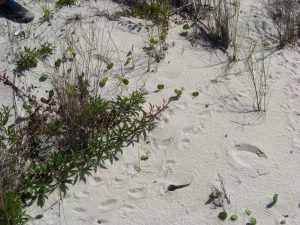
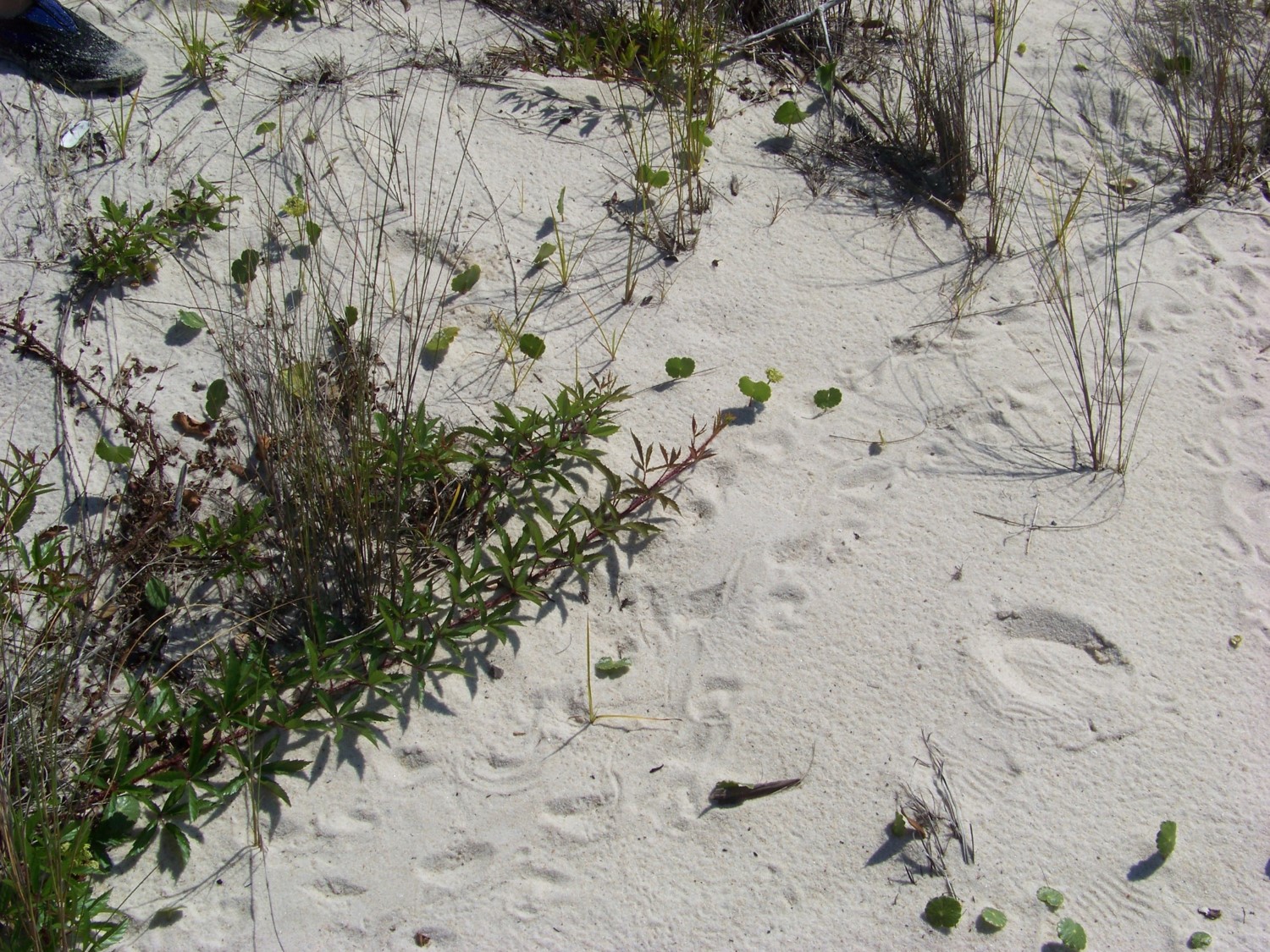
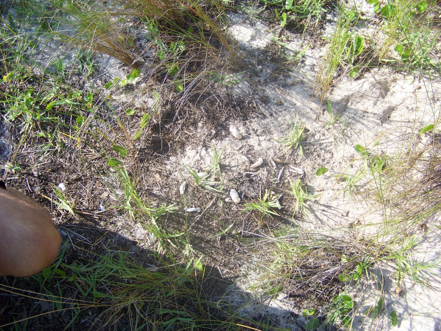
Note the track on this beach.
Photo: Rick O’Connor
Egg shells indicate a depredated nest.
Photo: Rick O’Connor
Another metric used to measure relative abundance was a 30-minute head count. The team would sit in kayaks within the ponds where adults resided and count the number of heads in that time period. Again, this does not indicate a population but a relative abundance within that location.
Finally, in 2008 the team began to deploy modified crab traps to capture terrapins for a potential mark/recapture study, marking using a scute notching method. The traps were modified so that a captured terrapin would be able to surface and breath. These traps were set in potential adult residing locations for a five-day period beginning on a Monday and ending on a Friday.
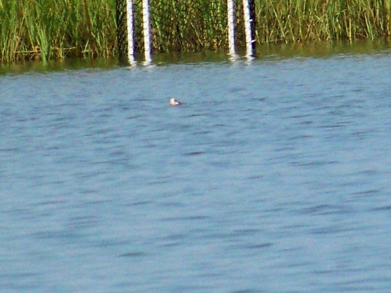
A terrapin swimming near but not entering a modified crab trap.
Photo: Molly O’Connor
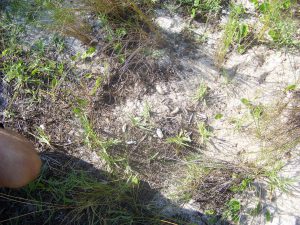
The focus of the relative abundance and trapping portions of the project were Escambia and Santa Rosa Counties due to the fact the team resided there.
In 2012, the author left the marine academy and joined Florida Sea Grant. This project was not a high priority in the job description and effort on this waned until no surveys were conducted in 2014. However, in 2015 the author established a citizen science program to continue these surveys and they have done so since. The focus of those surveys has been frequency of occurrence (FOO – the number of surveys where either terrapins, or terrapin sign have occurred) and continuing the relative abundance data collection.

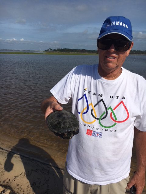
Citizen scientists have been crucial for the success of this project.
Photo: Rick O’Connor
In 2018 the U.S. Geological Survey joined the team. One member of USGS began coordinating citizen science work in the eastern panhandle (Bay, Gulf, and Franklin Counties as well as conducting research in the Gulf County area), and the author began coordinating citizen science work in the western panhandle (Escambia, Santa Rosa, Okaloosa, and Walton Counties). With USGS help some tagging has begun with both PIT and satellite tags.
RESULTS
The 2021 results are from the western panhandle portion of the project.
In the western panhandle during 2021, 263 surveys were conducted by 41 trained volunteers who logged 1832 hours. These surveys occurred in Escambia, Santa Rosa, and Okaloosa Counties. Surveys were conducted at known nesting areas with some occurring at potential new nesting sites. The number of surveys where either terrapins, or terrapin sign, were encountered was 52. This is a frequency of occurrence (FOO) of 20% of the surveys an encounter occurred. The breakdown by county is below.
2021 Data from the Western Panhandle
| County |
# of sites surveyed |
# of surveys |
FOO |
# of heads seen |
Nesting detected |
Relative abundance |
| Escambia |
8 |
86 |
.02 |
1 |
Yes |
8-24 terrapins |
| Santa Rosa |
2 |
79 |
.11 |
0 |
Yes |
4-12 terrapins
2-6 terrapins |
| Okaloosa |
5 |
98 |
.42 |
357 |
Yes |
20-70 terrapins
4-10 terrapins |
| TOTAL |
15 |
263 |
.20 |
358 |
|
|
Three of the eight sites surveyed in Escambia County were known nesting beaches, but evidence of nesting was only found at one. The other five locations were potential nesting sites, but no evidence of nesting was found. Based on these surveys, nesting activity declined in 2021.
Both sites surveyed in Santa Rosa County were known nesting beaches and nesting was detected at both. One site has long term data that, based on this year’s surveys, suggest a decline in relative abundance.
One of the five sites in Okaloosa was a known nesting site. However, evidence of nesting at a additional site was found. An encounter of some kind was logged at four of the five sites surveyed. All of these are relatively new survey sites to the project and relative abundance data is minimal. However, based on these data, the relative abundance is quite high.
Data from 2007 – 2021 for all sites
| County |
# of sites surveyed |
# of surveys |
FOO |
# of nesting beaches found |
| Escambia |
22 |
291 |
.11 |
4 |
| Santa Rosa |
13 |
441 |
.32 |
2 |
| Okaloosa |
12 |
123 |
.36 |
2 |
| Walton |
3 |
4 |
.25 |
0 |
| TOTAL |
50 |
859 |
.25 |
8 |
Since the beginning of the project 859 surveys have been conducted in the four counties of the western panhandle and terrapins have been encountered 25% of the time. Of the 50 sites surveyed, 8 (16%) of those have found nesting activity.
Objective 1 has been completed. There are terrapins in the Florida panhandle.
Objective 2 – the relative abundance – is still not completely understood. There was a significant decrease in encounters when the citizen science project began in 2015.
The citizen science effort the FOO was much higher and increased annually. The citizen science effort began in 2015 and the FOO was much lower but increased annually as well. It is believed that the cause of this decline is ability for volunteers to find terrapins, terrapin heads, or evidence of nesting. It is believed the volunteers are getting better and that the data will eventually provide better information on terrapin abundance.
DISCUSSION
Objective 1 has been answered. There are terrapins in the Florida panhandle.
Objective 2 is still not understood. It is believed the higher FOO between 2007 and 2011 was probably due to the ability of the volunteers to detect terrapin or terrapin sign. So, it is not known at this time whether the relative abundance of these animals have declined in the western panhandle or not. As the volunteers get better, we will see over time how the numbers change.
The effort of mark/recapture using modified crab traps has not been very effective. Traps have been deployed with much effort at four sites with very little success. That portion of the project has been suspended while searching for a better method of capture.
At two of the long-term monitoring sites, the relative abundance data suggests a decline in terrapins at those locations. However, as mentioned, confidence in the relative abundance data needs to increase before any strong conclusions can be drawn. These data do suggest small populations at all locations, between 20-50 animals. The citizen science effort will continue, and we hope a more robust population study will follow.
ACKNOWLEDGEMENTS
The author would like to thank the students from the Institute of Coastal and Marine Studies at B.T. Washington High School for assistance developing and conducting the early portion of this project.
Tom Mann from the Mississippi Department of Wildlife for the protocol on relative abundance based on nesting activity.
George Heinrich (Florida Turtle Conservation Trust, Florida Diamondback Terrapin Working Group)
Dr. Joe Butler (University of North Florida, Florida Diamondback Terrapin Working Group)
Dr. Andy Coleman (Birmingham Audubon Society, Gulf Coast Diamondback Terrapin Working Group)
Dr. Thane Wibbels (University of Alabama Birmingham, Gulf Coast Diamondback Terrapin Working Group)
Dr. Ken Marion (University of Alabama Birmingham, Gulf Coast Diamondback Terrapin Working Group) for their assistance, guidance and advice on this project.
Dan Catizone (U.S. Geological Survey, University of Florida)
Dr. Margaret Lamont (U.S. Geological Survey)
for their assistance, guidance, advice, and supply support.
Bob Pitts (Gulf Islands National Seashore)
Bob Blais (Navarre Beach Sea Turtle Conservation Center)
Jeanna Kilpatrick (Choctawhatchee Basin Alliance)
for taking the lead as county volunteer coordinators as well as surveyors.
And the 40 plus volunteers who have logged thousands of hours surveying sites in the western panhandle. We could not have done this without you.
Submitted:
December 22, 2021.
by Laura Tiu | Mar 6, 2019
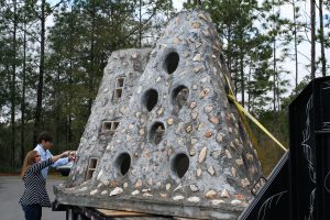
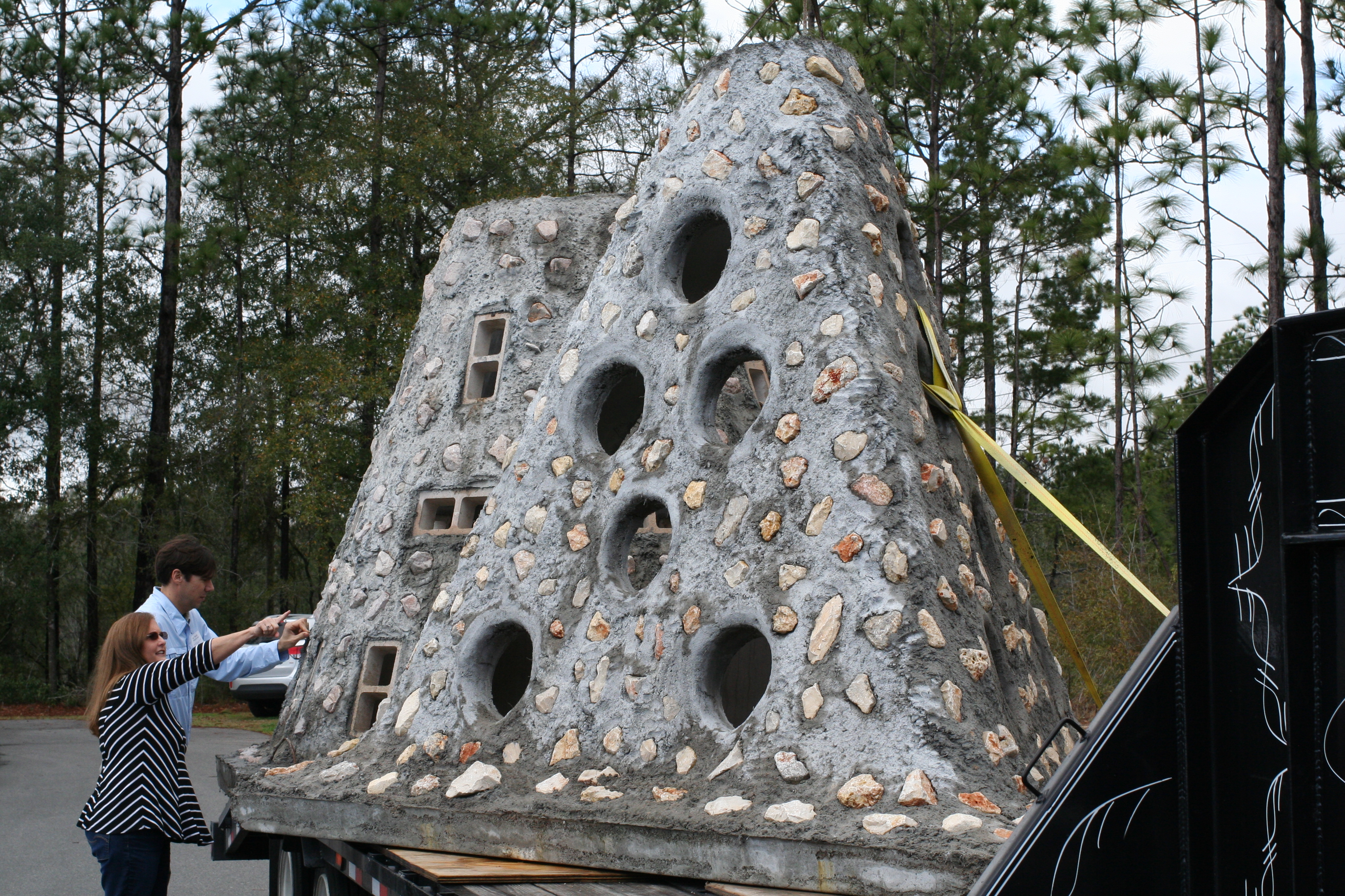
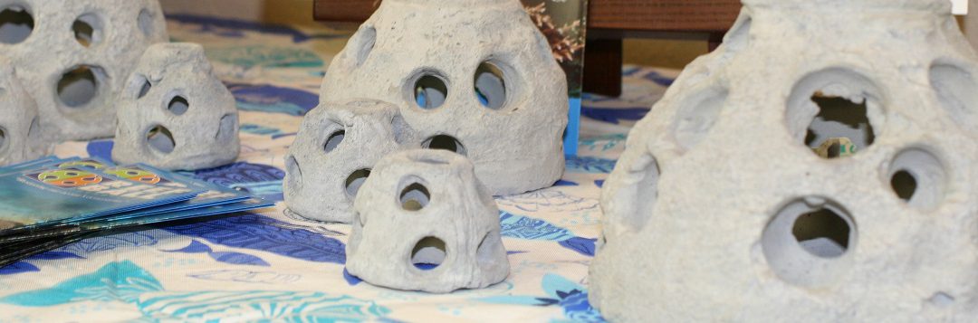
Artificial Reef Pyramid (Photo: L. Tiu)
The Northwest Florida Regional Artificial Reef Workshop was held February 20 at the Emerald Coast Convention Center in Fort Walton Beach Florida. It followed the Northwest Florida Regional Lionfish Workshop held the day before as many in the audience have interest in both lionfish and artificial reefs. Okaloosa County Commissioner, Captain Kelly Windes, gave the welcome, sharing his experiences as a lifelong local and a 3rd generation charter boat captain operating for over 30 years.
Keith Mille, Director of the Florida Fish and Wildlife Commission Artificial Reef Program gave the state updates. In the state of Florida, a total of 3,534 patch reefs have been deployed. In 2018, 187 new patch reefs were added to the mix. These reefs are made from concrete, formed modules, vessels, barges, metal and rock. The Atlantic side received 33 new patch reefs, while the Gulf side deployed 154. Many of the Gulf reefs are funded using Natural Resource Damage Assessment (NRDA) monies intended to compensate anglers and divers for loss of use during the 2010 Deepwater Horizon Oil Spill. According to a recent economic evaluation of artificial reefs by the University of West Florida’s Dr. Bill Huth, fishing and diving on Escambia County’s artificial reefs support 2,348 jobs and account for more than $150 million in economic activity each year.
County updates for Escambia, Santa Rosa, Okaloosa, Walton, Bay, City of Mexico Beach, Franklin, and Wakulla followed with Victor Blanco, Florida Sea Grant Agent from Taylor County, sharing his process for developing and training a volunteer research dive team to monitor the reefs.
University of Florida researchers provided a reef fish communities update highlighting the response of gray trigger fish and red snapper populations near the reefs, as well as the impact of lionfish on these communities. They also provided answers to the question of how artificial reefs function ecologically versus as fishing habitat. This research hopes to enhance future assessments concerning siting and function of artificial reefs. An anthropologist from Florida State University described his role in conducting cultural resource surveys for artificial reefs. The day ended with a report on the assessment of artificial reefs impacted by Hurricane Michael and a demonstration of updated software used to create side scan mosaics for monitoring.
Presentations were recorded and are available on the Florida Artificial Reefs Facebook page. A statewide Artificial Reef Summit is being organized for February 2020 and will be a great opportunity to learn more about Florida reefs.
“An Equal Opportunity Institution”
by Scott Jackson | Feb 16, 2017
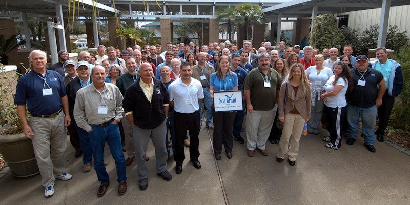
Northwest Florida Workshop Attendees from 2013 in Niceville, FL. This year’s workshop will be held at the UF/IFAS Extension Okaloosa County Office in Crestview, February 22, 2017. Direction and Contact Information can be found at this link http://directory.ifas.ufl.edu/Dir/searchdir?pageID=2&uid=A56
Researchers from University of West Florida recently estimated the value of Artificial Reefs to Florida’s coastal economy. Bay County artificial reefs provide 49.02 million dollars annually in personal income to local residents. Bay County ranks 8th in the state of Florida with 1,936 fishing and diving jobs. This important economic study gives updated guidance and insight for industry and government leaders. This same level of detailed insight is available for other Northwest Florida counties and counties throughout the state.
The UWF research team is one of several contributors scheduled to present at the Northwest Florida Artificial Reef Manager’s Workshop February 22. Florida Fish and Wildlife Commission and Florida Sea Grant are hosting the workshop. This meeting will bring together about fifty artificial reef managers, scientists, fishing and diving charter businesses, and others interested in artificial reefs to discuss new research, statewide initiatives and regional updates for Florida’s Northwest region. The meeting will be held at the UF/IFAS Extension Okaloosa County Office in Crestview, FL.
Cost is $15.00 and includes conference handouts, light continental breakfast with coffee, lunch, and afternoon refreshments. Register now by visiting Eventbrite or short link url https://goo.gl/VOLYkJ.
A limited number of exhibit tables/spaces will be available. For more information, please contact Laura Tiu, lgtiu@ufl.edu or 850-612-6197.
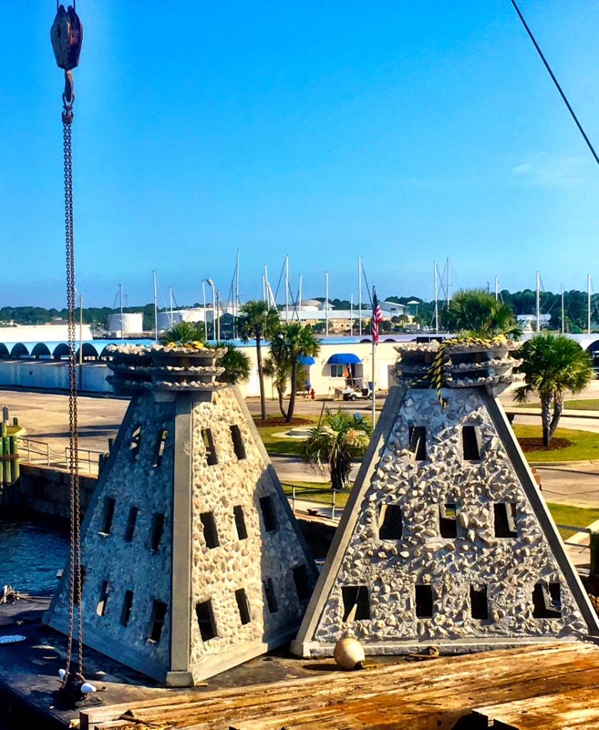
Super Reefs staged at the Panama City Marina, which were deployed in SAARS D, located 3 nautical miles south of Pier Park. Learn more about this reef project and others at the Northwest Florida Artificial Reef Manager’s Workshop in Crestview, February 22, 2017. (Photo by Scott Jackson).
Northwest Florida Artificial Reef Workshop Tentative Agenda
Date: February 22, 2017
Where: UF/IFAS Extension Okaloosa County Office, 3098 Airport Road Crestview, FL 32539
8:15 Meet and Greet
9:00 Welcome and Introductions – Laura Tiu UF/IFAS Okaloosa Co and Keith Mille, FWC
9:25 Regional and National Artificial Reef Updates – Keith Mille
9:50 Invasive Lionfish Trends, Impacts, and Potential Mitigation on Panhandle Artificial Reefs – Kristen Dahl, University of Florida
10:20 Valuing Artificial Reefs in Northwest Florida – Bill Huth, University of West Florida
11:00 County Updates – Representatives will provide a brief overview of recent activities 12:00 LUNCH (included with registration)
12:00 LUNCH
1:00 NRDA NW Florida Artificial Reef Creation and Restoration Project Update – Alex Fogg, FWC
1:15 Goliath Grouper Preferences for Artificial Reefs: An Opportunity for Citizen Science – Angela Collins, FL, Sea Grant
1:45 Current Research and Perspectives on Artificial Reefs and Fisheries – Will Patterson, University of Florida
3:00 BREAK
3:30 Association between Habitat Quantity and Quality and Exploited Reef Fishes: Implications for Retrospective Analyses and Future Survey Improvements – Sean Keenan, FWRI
3:50 Innovations in Artificial Reef Design and Use – Robert Turpin, facilitator
4:10 Using Websites and Social Media to Promote Artificial Reef Program Engagement – Bob Cox, Mexico Beach Artificial Reef Association & Scott Jackson, UF/IFAS Bay Co
4:40 Wrap Up and Next Steps – Keith Mille and Scott Jackson
5:00 Adjourn and Networking
Register now by visiting Eventbrite or short link url https://goo.gl/VOLYkJ. Live Broadcast, workshop videos, and other information will be available on Facebook at https://www.facebook.com/floridaartificialreefs/ (Florida Artificial Reefs) .
An Equal Opportunity Institution. University of Florida, Institute of Food and Agricultural Sciences (UF/IFAS) Extension, Nick T. Place, Dean.
by Will Sheftall | Jul 22, 2016
Birds, migration, and climate change. Mix them all together and intuitively, we can imagine an ecological train wreck in the making. Many migratory bird species have seen their numbers plummet over the past half-century – due not to climate change, but to habitat loss in the places they frequent as part of their jet-setting life history.
Migrating songbirds forage for insects in coastal scrub-shrub habitat. Photo credit: Erik Lovestrand, UF IFAS Extension
Now come climate simulation models forecasting more change to come. It will impact the strands of places migrants use as critical habitat. Critical because severe alteration of even one place in a strand can doom a migratory species to failure at completing its life cycle. So what aspect of climate change is now threatening these places, on top of habitat alteration by humans?
It’s the change in weather patterns and sea level that we’re already beginning to see, as the impacts of global warming on Earth’s ocean-atmosphere linkage shift our planetary climate system into higher gear.
For migratory birds, the journey itself is the most perilous link in the life history chain. A migratory songbird is up to 15 times more likely to die in migration than on its wintering or breeding grounds. Headwinds and storms can deplete its energy reserves. Stopover sites for resting and feeding are critical. And here’s where the Big Bend region of Florida figures prominently in the life history of many migratory birds.
According to a study published in March of this year (Lester et al., 2016), field research on St. George Island documented 57 transient species foraging there as they were migrating through in the spring. That number compares favorably with the number of species known to use similar habitat at stopover sites in Mississippi (East Ship Island, Horn Island) as well as other central and western Gulf Coast sites in Alabama, Louisiana, and Texas.
We now can point to published empirical evidence that the eastern Gulf Coast migratory route is used by as many species as other Gulf routes to our west. This confirmation makes conservation of our Big Bend stopover habitat all the more relevant.
The authors of the study observed 711 birds using high-canopy forest and scrub/shrub habitat on St. George Island. Birds were seeking energy replenishment from protein-rich insects, which were reported to be more abundant in those habitats than on primary dunes, or in freshwater marshes and meadows.
So now we know that specific places on our barrier islands that still harbor forests and scrub/shrub habitat are crucial. On privately-owned island property, prime foraging habitat may have been reduced to low-elevation mixed forest that is often too low and wet to be turned into dense clusters of beach houses.
Coastal slash pine forest is vulnerable to sea level rise. Photo credit: Erik Lovestrand, UF IFAS Extension
Think tall slash pines and mid-story oaks slightly ‘upslope’ of marsh and transitional meadow, but ‘downslope’ of the dune scrub that is often cleared for development.
“OK, I get it,” you say. “It’s as if restaurant seating has been reduced and the kitchen staff laid off. Somebody’s not going to get served.” Destruction of forested habitat on our Gulf Coast islands has significantly reduced the amount of critical stopover habitat for birds weary from flying up to 620 miles across the Gulf of Mexico since their last bite to eat.
But why the concern with climate change on top of this familiar story of coastal habitat lost to development? After all, we have conservation lands with natural habitat on St. Vincent, Little St. George, the east end of St. George, and parts of Dog Island and Alligator Point. Shouldn’t these islands be able to withstand the impacts of stronger and/or more frequent coastal storms, and higher seas – and their forested habitat still serve the stopover needs of migratory birds?
Let’s revisit the “low and wet” part of the equation. Coastal forested habitat that’s low and wet – either protected by conservation or too wet to be developed – is in the bull’s eye of sea level rise (SLR), and sooner rather than later.
Using what Lester et al. chose as a reasonably probable scenario within the range of SLR projections for this century – 32 inches, these low-elevation forests and associated freshwater marshes would shrink in extent by 45% before 2100. It could be less; it could be more. Conditions projected for a future date are usually expressed as probable ranges. Experience has proven them too conservative in some cases.
The year 2100 seems far away…but that’s when our kids or grandkids can hope to be enjoying retirement at the beach house we left them. Hmm.
Scientists CAN project with certainty that by the time SLR reaches two meters (six and a half feet) – in whatever future year that occurs, 98% of “low and wet” forested habitat will have transitioned to marsh, and then eroded to tidal flat.
But before we spool out the coming years to a future reality of SLR that has radically changed the coastline we knew, let’s consider where the crucial forested habitat might remain on the barrier islands of the next generation’s retirement years:
It could remain in the higher-elevation yard of your beach house, perhaps, if you saved what remnant of native habitat you could when building it. Or if you landscaped with native trees and shrubs, to restore a patch of natural habitat in your beach house yard.
Migratory songbird stopover habitat saved during beach house construction. Photo credit: Erik Lovestrand, UF IFAS Extension
We’ve all thought that doing these things must be important, but only now is it becoming clear just how important. Who would have thought, “My beach house yard: the island’s last foraging refuge for migratory songbirds!” even in our most apocalyptic imagination?
But what about coastal mainland habitat?
The authors of the March 2016 St. George Island study conclude that, “…adjacent inland forested habitats must be protected from development to increase the probability that forested stopover habitat will be available for migrants despite SLR.” Jim Cox with Tall Timbers Research Station says that, “birds stop at the first point of land they find under unfavorable weather conditions, but also continue to migrate inland when conditions are favorable.”
Migratory birds are fortunate that the St. Marks Refuge protects inland forested habitat just beyond coastal marshland. A longer flight will take them to the leading edge of salty tidal reach. There the beautifully sinuous forest edge lies up against the marsh. This edge – this trailing edge of inland forest – will succumb to tomorrow’s rising seas, however.
Sea level rise will convert coastal slash pine forest to salt marsh. Photo credit: Erik Lovestrand, UF IFAS Extension
As the salt boundary moves relentlessly inland, it will run through the Refuge’s coastal buffer of public lands, and eventually knock on the surveyor’s boundary with private lands. All the while adding flight miles to the migration journey.
In today’s climate, migrants exhausted from bucking adverse weather conditions over the Gulf may not have enough energy to fly farther inland in search of forested foraging habitat. Will tomorrow’s climate make adverse Gulf weather more prevalent, and migration more arduous?
Spring migration weather over the Gulf can be expected to change as ocean waters warm and more water vapor is held in a warmer atmosphere. But HOW it will change is difficult to model. Any specific, predictable change to the variability of weather patterns during spring migration is therefore much less certain than SLR.
What will await exhausted and hungry migrants in future decades? Our community decisions about land use should consider this question. Likewise, our personal decisions about private land management – including beach house landscaping. And it’s not too early to begin.
Erik Lovestrand, Sea Grant Agent and County Extension Director in Franklin County, co-authored this article.
by Laura Tiu | Jul 22, 2016
Dr. Monica Wilson, University of Florida Sea Grant, shares an update on the research that has occurred in the past five years since the Deepwater Horizon oil spill. Presented in the Rodeo Room at the Destin History and Fishing Museum. Photo credit: Laura Tiu
The Deepwater Horizon (DWH) oil spill occurred about 50 miles offshore of Louisiana in April 2010. Approximately 172 million gallons of oil entered the Gulf of Mexico. Five years after the incident, locals and tourists still have questions. The Okaloosa County UF/IFAS Extension Office invited a Gulf of Mexico Oil Spill Scientist, Dr. Monica Wilson, to help answer the five most common questions about the oil spill and to increase the use of oil spill science by people whose livelihoods depend on a healthy Gulf.
The event was held at the Destin History and Fishing Museum on Monday evening, July 11, 2016. Executive Director, Kathy Marler Blue partnered with the University of Florida to host the event. “The Destin History and Fishing Museum has a vision that includes expanding its programs to include a lecture series,” said Blue. Over 20 interested individuals attended the lecture and the question and answer session was lively. This was the first in what hopes to be an ongoing lecture series, bringing more scientific information to our county.
Dr. Wilson is based in St. Petersburg, Florida with the Florida Sea Grant College Program. Monica uses her physical oceanography background to model circulation and flushing of coastal systems in the region and the impacts of tropical storms on these systems. She focuses on the distribution, dispersion and dilution of petroleum under the action of physical ocean processes and storms. For this lecture, she covered topics such as: the safety of eating Gulf seafood, impacts to wildlife, what cleanup techniques were used, how they were implemented, where the oil went, where is it now, and do dispersants make it unsafe to swim in the water?
The oil spill science outreach program also allows Sea Grant specialists to find out what types of information target audiences want and develop tailor-made products for those audiences. The outreach specialists produce a variety of materials, such as fact sheets and bulletins, focused on meeting stakeholder information needs. The specialists also gather input from target audiences through workshops and work with researchers to share oil spill research results at science seminars that are facilitated by the specialists.
The Destin History and Fishing Museum is a nonprofit organization whose members are dedicated to preserving, documenting, and sharing the complete history of Destin. Please subscribe to their Facebook page for information on upcoming events. The UF IFAS Extension Okaloosa County office also hosts a Facebook page with announcement of upcoming programs.
For additional information and publications related to the oil spill please visit: https://gulfseagrant.wordpress.com/oilspilloutreach/