Morrison Springs in Walton County is a natural spring ideal for paddling, snorkeling, and diving. Photo credit: Carrie Stevenson, UF IFAS Extensio
There is just SO much water in Florida. Besides the tremendous amount of rain and 1,350 miles of coastline and beachfront, there are endless bays, bayous, creeks, rivers, and streams. In this state, it is extraordinarily difficult to live more than a few miles from a body of water. Among the the coolest (literally) types of water bodies in Florida, though, are our springs. Like brilliant gemstones, the state’s 700+ springs dot the Florida landscape like a strand of sapphires.
While we have springs bubbling up all over northwest Florida in areas where the underground water table meets the surface, larger springs are more common as you move east and south. Some parts of north Florida and most of the peninsula are built on a limestone platform, known by the geological term “karst.” Limestone is composed of calcium carbonate, which has a porous and easily degradable chemical structure. When this barrier is breached, it allows the cold groundwater an opening directly to the surface water—hence a spring. (Fun fact—there are surface water streams that actually disappear into a spring—these are called swallets, operating as the reverse version of a spring!)
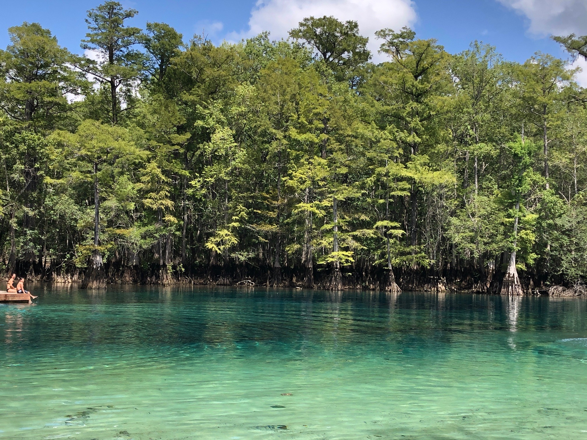
The striking blue-green water in Three Sisters Spring is only accessible by kayak or swimming. Photo credit: Carrie Stevenson, UF IFAS Extension
A few of the largest springs in northwest Florida are Vortex, Ponce de Leon, and Morrison Springs, found in Holmes and Walton County. Vortex is a privately operated water park and scuba diving/training facility. It is where the red and white “diver down” flag was invented and has a complex underwater cavern system. Ponce de Leon and Morrison Springs are state and county-run parks with a more natural feel, surrounded by woods and basic infrastructure for access. Morrison will especially wow visitors with its tremendous turquoise coloring.
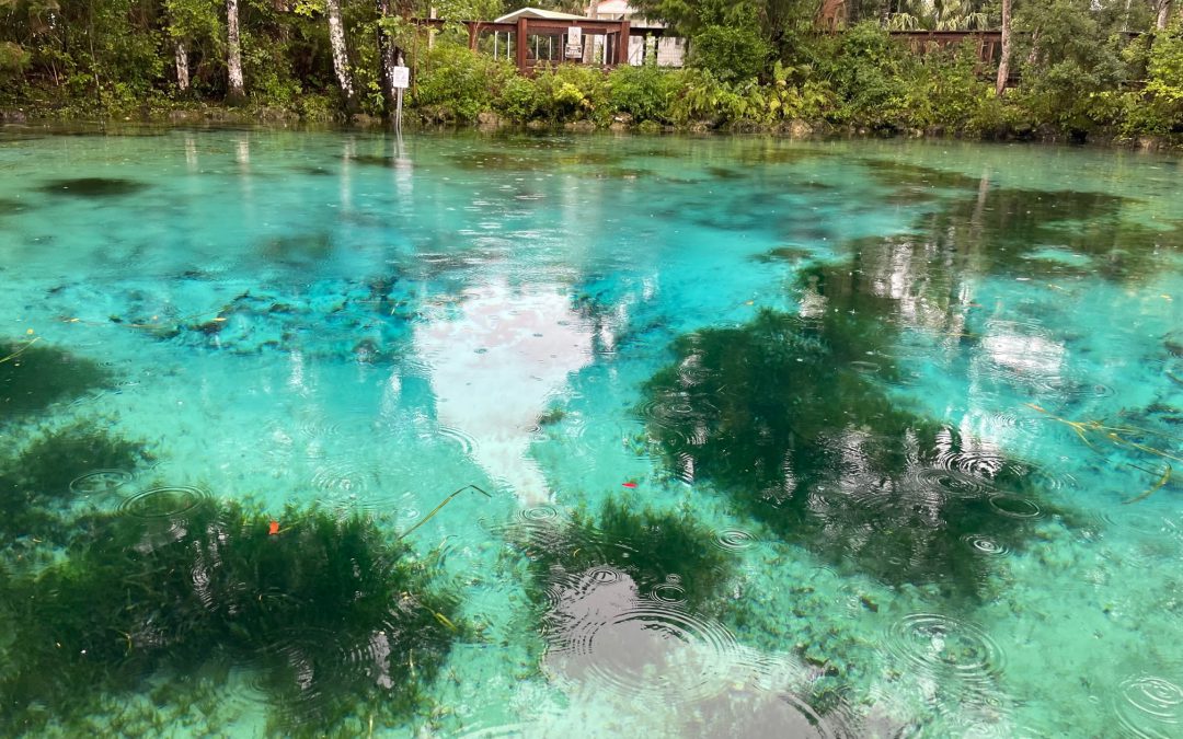
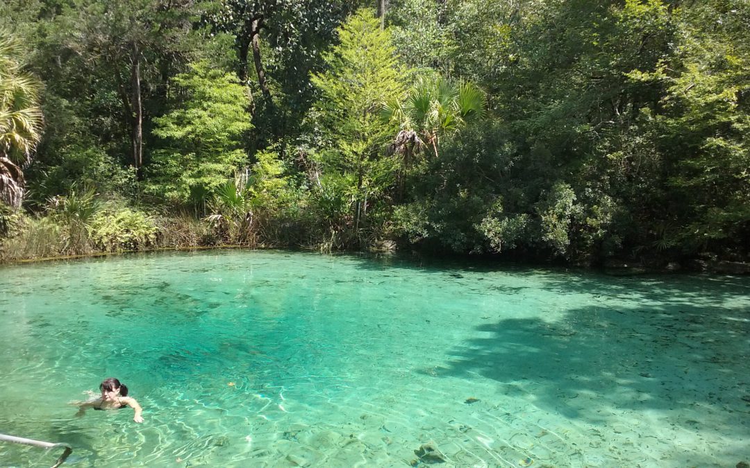
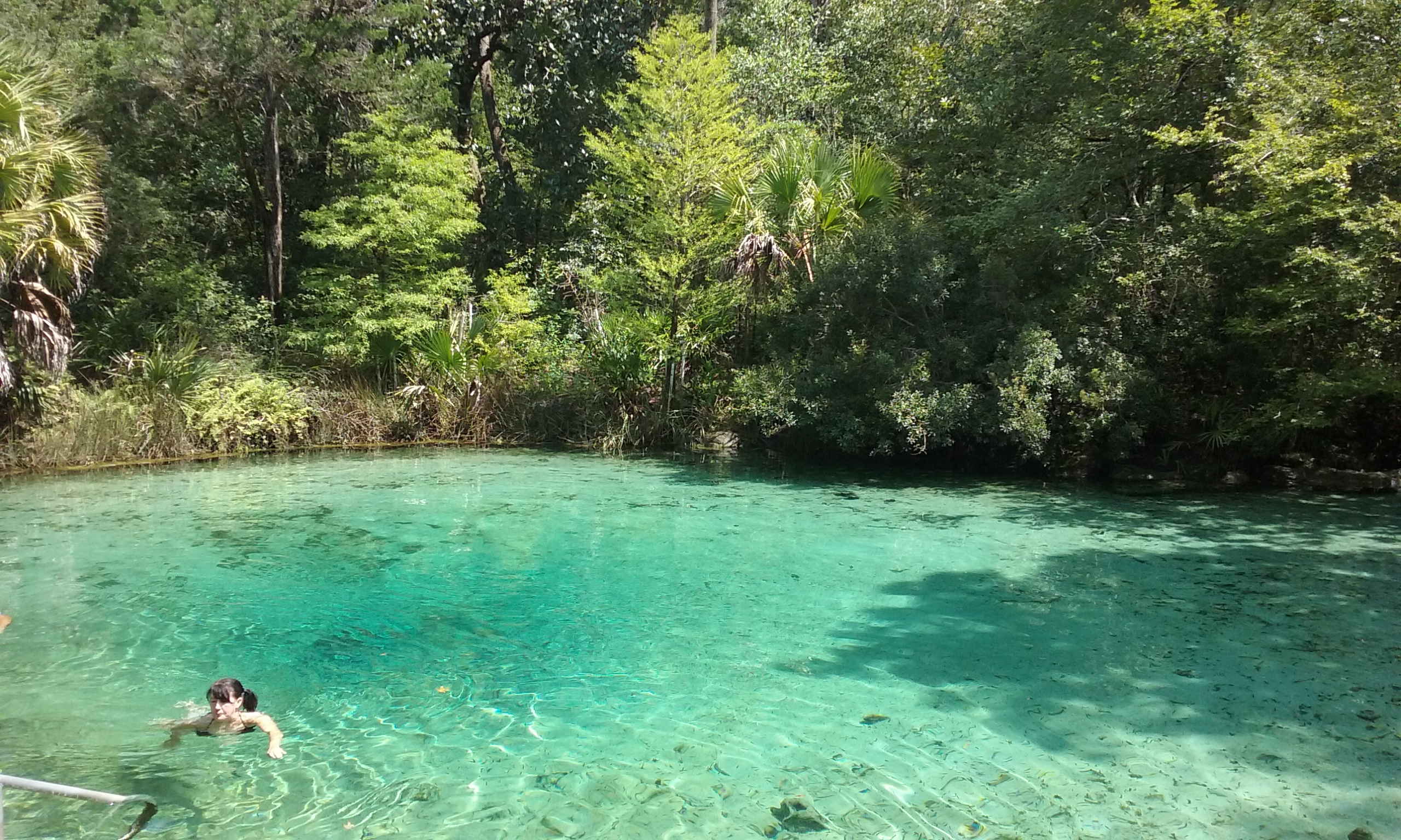
Crystal clear water in Morrison Springs. Photo credit: Carrie Stevenson, UF IFAS Extension
Before a meeting in Crystal River last week, I paddled and snorkeled through the famous Three Sisters Spring. As part of Crystal River National Wildlife Refuge, it is a popular but highly protected area. Three Sisters is well-known as a manatee gathering place, especially in winter, but during my visit was mostly unoccupied. The color was striking, though. Why do so many of these springs have such brilliant blue and turquoise coloring? The phenomenon is essentially the same as the blue-green Gulf waters in the Panhandle. The reflection of the sky on a sunny day with the backdrop of that pure white sand causes the water to reflect a color that inspired the nickname “The Emerald Coast.” In springs, the white calcium carbonate in limestone breaks down into tiny crystals, mixing with the water and reflecting the vivid shades of blue.
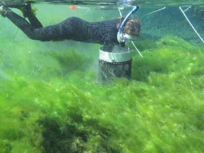
Alexander Springs Creek in Ocala National Forest is overrun with algae. Photo credit: Matt Cohen, UF IFAS
Besides their beauty, clarity, recreational, and wildlife value, springs pump 8 billion gallons of fresh water a day of into Florida ecosystems. Seagrass meadows in many of these springs are lush. Because they are literal windows into the underground aquifer, they are extremely vulnerable to pollution. While many springs have been protected for decades, others were seen as places to dump trash and make it “disappear.” Many have been affected by urban stormwater and agricultural pollution, losing their clarity, reducing dissolved oxygen levels, and prompting massive cleanup and buffer protection zones.
On one of these hot summer days in Florida, take the time to visit our incredible springs. While it may not be the literal “Fountain of Youth,” swimming in a spring is a unique and invigorating experience, and a beautiful way to get off the beaten path. A comprehensive guide to Florida springs, research, and statewide protection initiatives can be found at the Florida Department of Environmental Protection’s springs website.
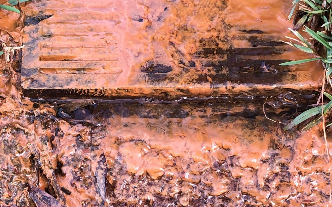
“Someone dumped oil in the creek behind my house!” I had dozens of people call with that exclamation when I was a field inspector for the Florida Department of Environmental Protection’s (FDEP) wetlands compliance program. A significant portion of the job entailed responding to concerns and complaints from citizens regarding damage to wetland areas. In the field, I would come across an oily film along creeks in rural, near-pristine conditions in northern Holmes County and in heavily populated neighborhoods in the tourist hot spots of Destin and Panama City. The first time I saw it, I was taken aback. A shiny, rainbow sheen is something you might expect in an oil-soaked parking lot, not a relatively untouched body of water.
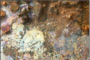
The reaction between iron, native bacteria, and oxygen can produce this orange sheen and filamentous material in streams and groundwater (as it exits the soil). Photo credit: Carrie Stevenson, UF IFAS Extension
Thankfully, an experienced colleague explained the workings of iron-oxidizing bacteria to me, and I was able to allay the fears of all those frantic homeowners. All the places I’ve ever seen evidence of iron bacteria on the water were adjacent to wetlands with some level of iron in the soil. The bacteria essentially “eat” ferrous iron, which is common and able to react with other elements in oxygen-free (anaerobic) environments. Wetlands are classic examples of anaerobic soils, and the mucky conditions of a stream floodplain are ideal for iron bacteria. These are naturally occurring, harmless bacteria that gain energy by breaking down iron available in the soil. In addition to the oily film, side effects of iron-oxidizing bacteria can include a swampy odor, a reddish filament, or red chunks of iron. In large amounts, these byproducts can clog wells if present in pipes. This can be problematic and prevent water flow, but the iron and bacteria are not threats to human health
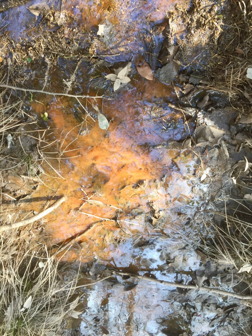
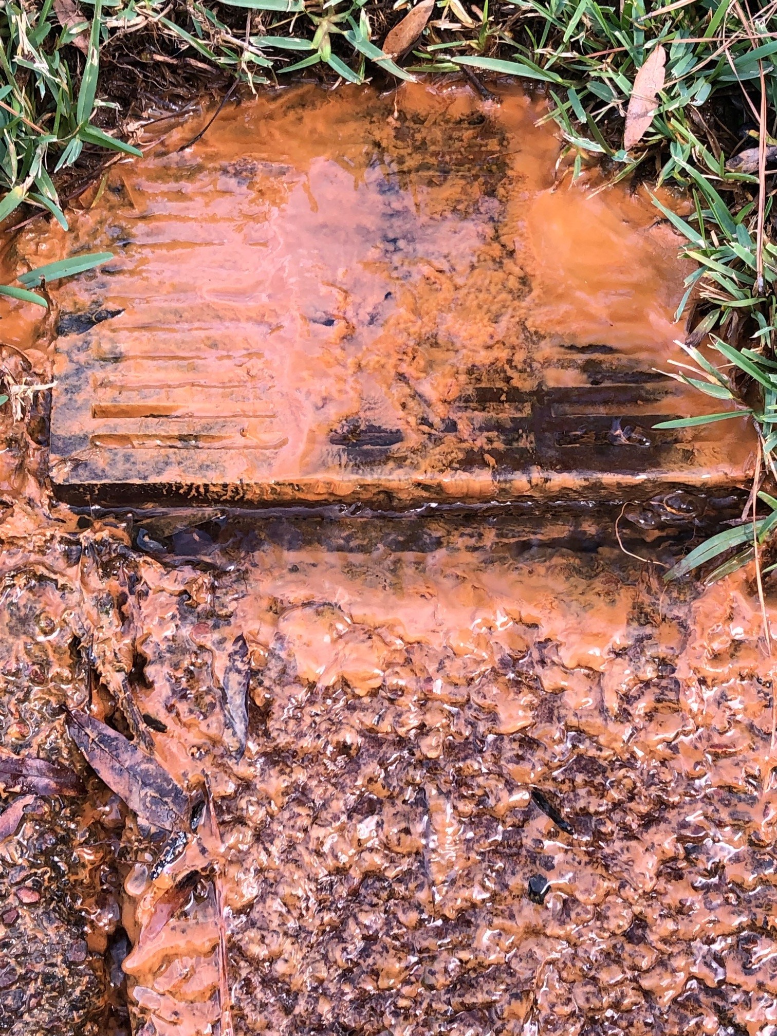
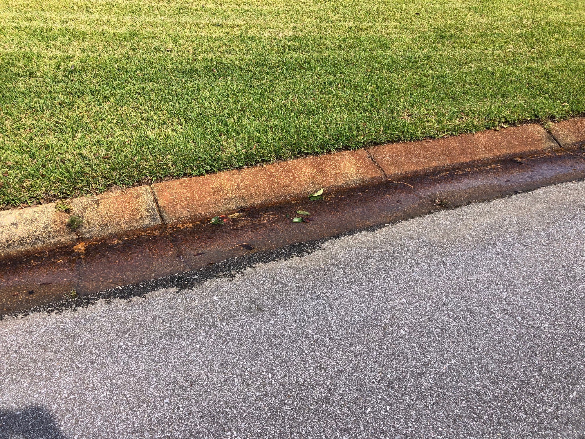
A colleague with Escambia County recently responded to a homeowner call about bright orange water flowing out of their front yard. While not the typical creek location, environmental conditions were absolutely suited for this phenomenon. Their neighborhood is situated adjacent to a large wetland area, and several of the homes have French drains in the backyards that drain out to the street. During heavier rainfalls, excess groundwater enters those pipes, picks up iron bacteria in the soil, and exits to the surface along the road. The red-stained curbs are evidence that iron is common in the local soil.
When touched, the sheen produced by iron bacteria will fracture. This is an easy way to differentiate it from actual oil. Photo credit: City of Kirkland, Washington
While it’s possible someone could dump oil in a backwoods area (and if you do ever see that, report it to FDEP), it is much more likely that you are seeing the natural aftereffects of iron-oxidizing bacteria. To determine the difference between iron bacteria and actual oil, one simple test is to touch the water and its oily film with a stick. If the sheen fractures into small pieces, it’s iron bacteria. If it oozes back to an intact slick (and smells like petroleum), it could very well be oil.
Well-maintained stormwater ponds can become attractive amenities that also improve water quality. Photo credit: Carrie Stevenson, UF IFAS Extension
Prior to joining UF IFAS Extension, I spent three years as a compliance and enforcement field inspector with the local Florida Department of Environmental Protection (FDEP) office. It was a crash course in drinking water regulation, wetlands ecology, stormwater engineering, and human psychology. For about half of that time, I worked in the stormwater section with an engineer, certifying the proper construction and specifications of stormwater treatment ponds built for residential and commercial developments. During a construction boom in 2000-2003, my coworkers and I traversed back roads from Perdido Key to Freeport, trying to catch every new project and make sure it was done right. If they weren’t, it also fell to the 3 of us to make sure mistakes were corrected.
Since 1982, Florida Statutes have required that rainfall landing on newly constructed impervious surfaces (rooftops, streets, parking lots, etc.) must be treated before turning into runoff that leaves the property and ends up in local water bodies. The pollutants in stormwater runoff—heavy metals, fertilizer, pesticides, trash, bacteria, and sediment—are the biggest sources of water quality problems for the state, more so even than industrial and agricultural sources.
The most common stormwater ponds have sandy bottoms, grassed berms, and piped inlets with riprap to slow the influx of water. Photo credit, Michelle Diller
Therefore, new developments are required to treat that runoff. This may be accomplished by several means, including regional stormwater ponds. However, the most common are still curbs and gutters, which drain to an often-rectangular hole in the ground with a chain-link fence around it. Ideally, water pools into these dry ponds while raining, reducing flood risk and holding water long enough to allow it to soak into the soil. Most of the ponds in northwest Florida have sandy bottoms that percolate easily. Maintenance is required, however, and when heavier soils, trash, or muck accumulate they must be cleaned out to function properly. Depending on the geology of any given location, the ponds may need sand filters or “chimneys” added to allow water to soak into the native soil.
Admiral Mason Park, adjacent to the Veterans’ Memorial Park along Pensacola Bay, is an example of a regional City stormwater treatment facility that also serves as a park. Photo credit: Visit Pensacola
If an area is naturally low-lying, close to the water table, or has highly organic, water-holding soils, it may be necessary to construct a “wet” stormwater pond. In these, water stands to a level below an overflow device, and can become a water feature for the development. Many residential developers will sell lots around a stormwater pond as “waterfront property” and a well-maintained one really can be a nice amenity. However, at their core, these are stormwater treatment mechanisms. A wet pond functions differently than a dry one and is dependent on healthy stands of shoreline vegetation to take up extra nutrients, metabolize them, and render them into harmless compounds. Many of these ponds have fountains to aerate the water and keep them from becoming stagnant. The City of Pensacola and Escambia County have several great examples of these types of ponds that serve as regional stormwater detention and community amenities. These were constructed in lower-lying areas to handle chronic problems with stormwater in areas that were built up and paved many decades before stormwater rules came into effect. Many other innovative and newer stormwater treatments exist as well, including bioretention, rainwater harvesting, green roofs, and pervious pavement.
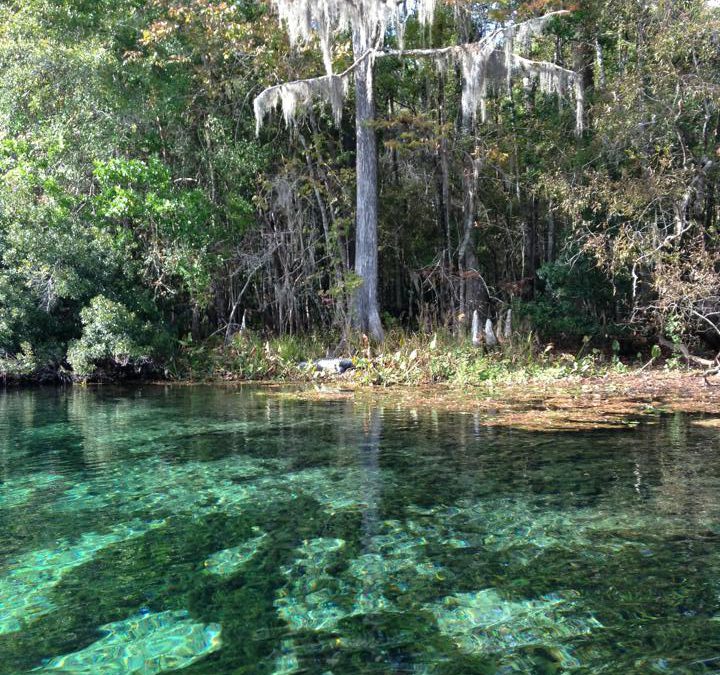
Pitt Spring in the Florida Panhandle is one of more than 1,000 freshwater springs in the state. Springs serve as ‘windows’ to groundwater quality, since the water that flows from them comes largely from the Upper Floridan Aquifer. Photo: A. Albertin
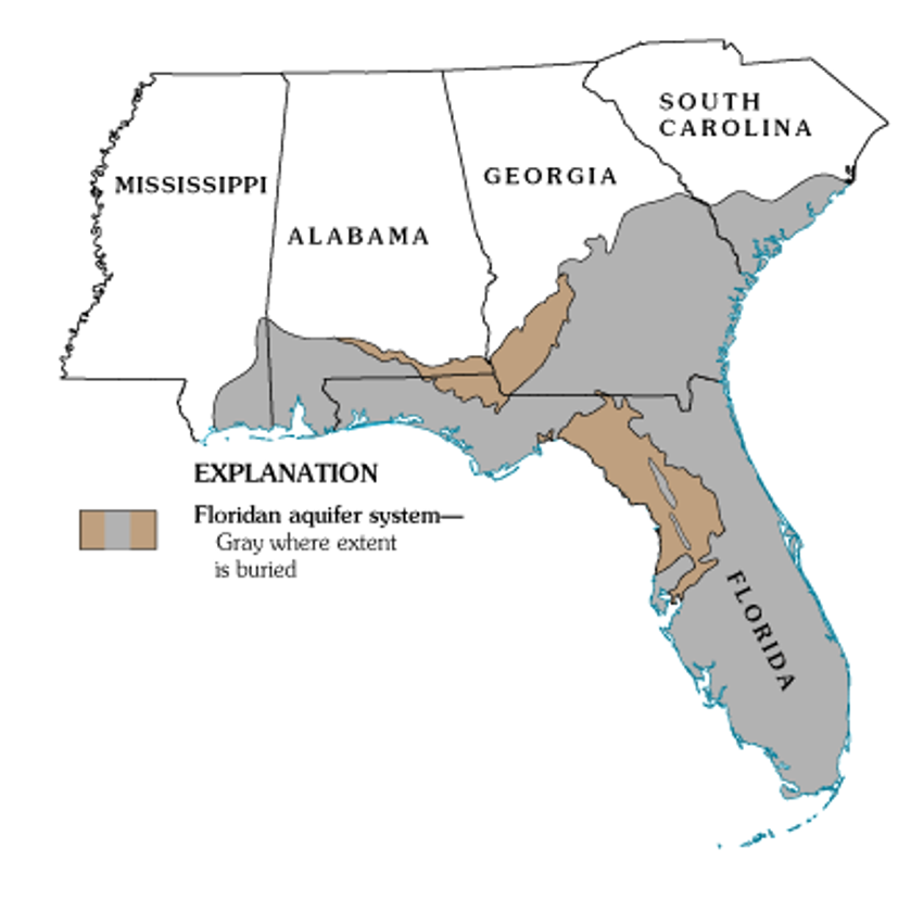
As Florida residents, we are so fortunate to have the Floridan Aquifer lying below us, one of the most productive aquifer systems in the world. The aquifer underlies an area of about 100,000 square miles that includes all of Florida and extends into parts of Alabama, Georgia and South Carolina, as well as parts of the Atlantic Ocean and the Gulf of Mexico (Figure 1). The Floridan Aquifer consists of the Upper and Lower Floridan Aquifer.
Figure 1. Map of the extent of the Floridan Aquifer. Areas in gray show where the aquifer is buried deep below the land surface, while areas in light brown indicate where the aquifer is at land surface. Many springs in Florida are found in these light brown areas. Source: USGS Publication HA 730-G.
Aquifers are immense underground zones of permeable rocks, rock fractures and unconsolidated (or loose) material, like sand, silt and clay that hold water and allow water to move through them. Both fresh and saltwater fill the pores, fissures and conduits of the Floridan Aquifer. Saltwater, which is more dense than freshwater, is found in all areas of the deeper aquifer below the freshwater.
The thickness of the Floridan Aquifer varies widely. It ranges from 250 ft. thick in parts of Georgia, to about 3,000 ft. thick in South Florida. Water from the Upper Floridan Aquifer is potable in most parts of the state and is a major source of groundwater for more than 11 million residents. However, in areas such as the far western panhandle and South Florida, where the Floridan Aquifer is very deep, the water is too salty to be potable. Instead, water from aquifers that lie above the Floridan is used for water supply.
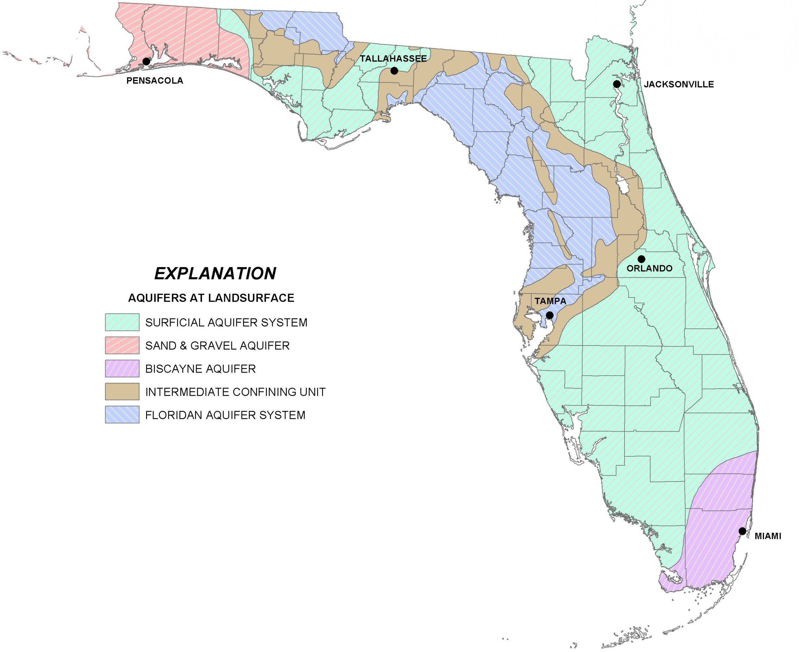
There are actually several major aquifer systems in Florida that lie on top of the Floridan Aquifer and are important sources of groundwater to local areas (Figure 2):
The Sand and Gravel Aquifer in the far western panhandle is the main source of water for Santa Rosa and Escambia Counties. It is made up of of sand and gravel interbedded with layers of silt and clay.
The Biscayne Aquifer supplies water to Dade and Broward Counties and southern Palm Beach County. A pipeline also transports water from this aquifer to the Florida Keys. The aquifer is made of permeable limestone and less permeable sand and sandstone.
The Surficial Aquifer System (marked in green in the map in Figure 2) is the major source of drinking water in St. Johns, Flagler and Indian River counties, as well as Titusville and Palm Bay. It is typically shallow (less than 50 ft. thick) and is often referred to as a ‘water table’ aquifer, but in Indian River and St. Lucie Counties, it can be up to 400 ft. thick.
Not included in Figure 2 is a fourth aquifer, the Intermediate Aquifer System in southwest Florida. It lies at a depth between the Surficial Aquifer System and the Floridan Aquifer. It is found south and east of Tampa, in Hillsborough and Polk counties and extends south through Collier County. It is the main source of water supply for Sarasota, Charlotte and Lee counties, where the underlying Floridan Aquifer is too salty to be potable.
Figure 2. A map of four major aquifer systems in the state of Florida at land surface. The Floridan Aquifer (in blue) underlies the entire state, but in areas north and east of Tampa it is found at the surface. The Surficial (green), Sand and Gravel (red), and Biscayne Aquifer (purple/pink) lie on top of the Floridan Aquifer. A confining unit (area in brown) consists of impermeable materials like thick layers of fine clay that prevent water from easily moving through it. Source: FDEP.
All of the aquifer systems in Florida are recharged by rainfall. In general, freshwater from deeper portions of the aquifer tends to have better water quality than surficial systems, since it is less susceptible to pollution from land surfaces. But, in areas where groundwater is excessively pumped or wells are drilled too deeply, saltwater intrusion occurs. This is where the underlying, denser saltwater replaces the pumped freshwater. Florida’s highly populated coastal areas are particularly susceptible to saltwater intrusion, and this is one of the main reasons that water conservation is a major priority in Florida.
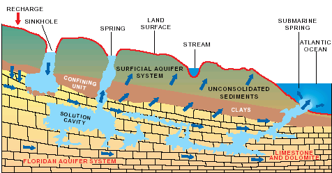
Hydrologic cycle and geologic cross-section image courtesy of Florida Geological Survey Bulletin 31, updated 1984.
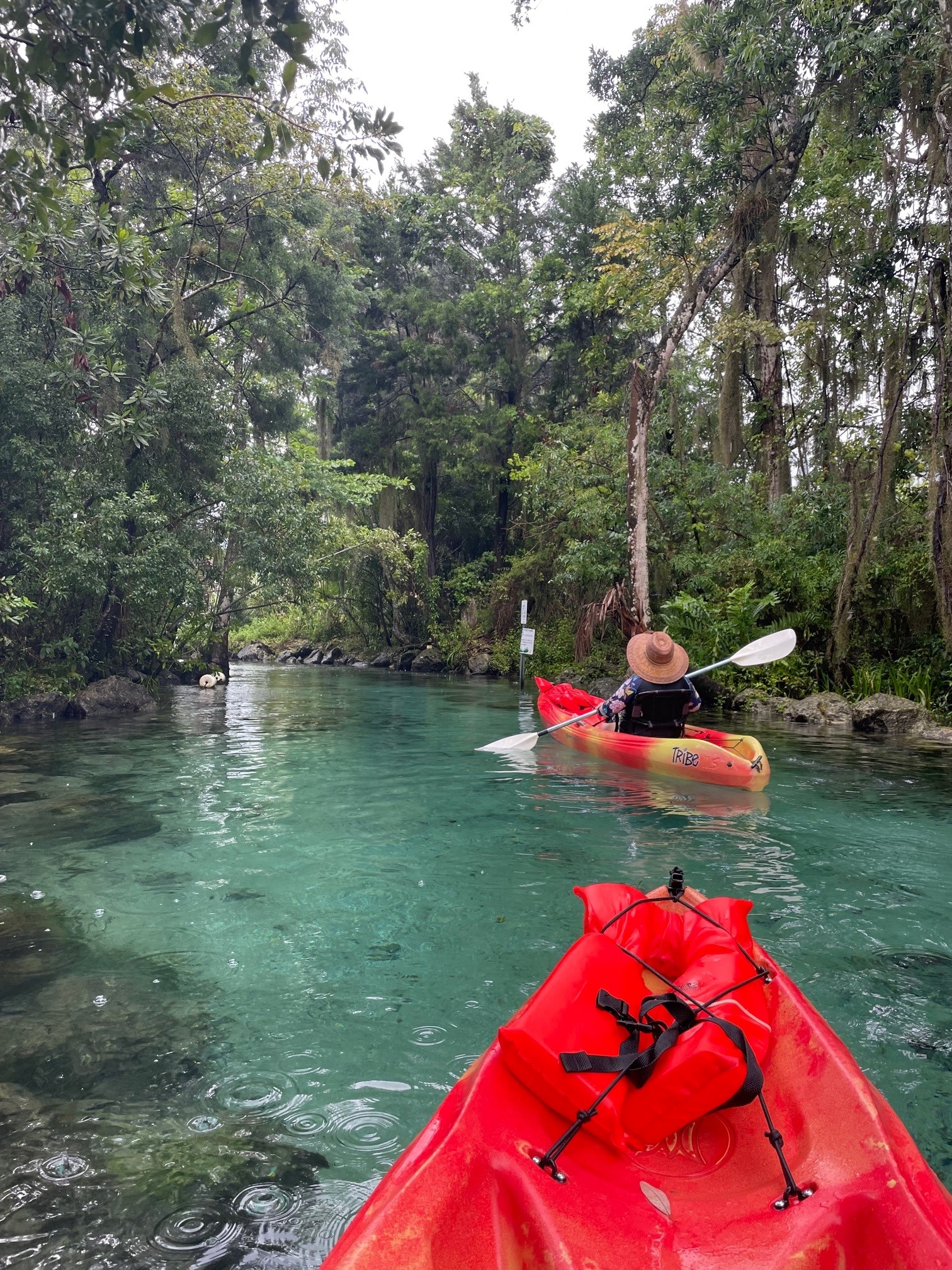
With more than 250 crystal clear springs in Northwest Florida it is just a short road trip to a pristine swimming hole! Springs and their associated flowing water bodies provide important habitat for wildlife and plants. Just as importantly, springs provide people with recreational activities and the opportunity to connect with the natural environment. While paddling your kayak, floating in your tube, or just wading in the cool water, think about the majesty of the springs. They are the visible part of the Florida Aquifer, the below ground source of most Florida’s drinking water.
A spring is a natural opening in the Earth where water emerges from the aquifer to the soil surface. The groundwater is under pressure and flows upward to an opening referred to as a spring vent. Once on the surface, the water contributes to the flow of rivers or other waterbodies. Springs range in size from small seeps to massive pools. Each can be measured by their daily gallon output which is classified as a magnitude. First magnitude springs discharge more than 64.6 million gallons of water each day. Florida has over 30 first magnitude springs. Four of them can be found in the Panhandle – Wakulla Springs and the Gainer Springs Group of 3.
Wakulla Springs is located within Edward Ball Wakulla Springs State Park. The spring vent is located beneath a limestone ledge nearly 180 feet below the land surface. Archaeological evidence suggests that humans have utilized the area for nearly 15,000 years. Native Americans referred to the area as “wakulla” meaning “river of the crying bird”. Wakulla was the home of the Limpkin, a rare wading bird with an odd call.
Over 1,000 years ago, Native Americans used another first magnitude spring, the Gainer Springs group that flow into the Econfina River. “Econfina”, or “natural bridge” in the local native language, got its name from a limestone arch that crossed the creek at the mouth of the spring. General Andrew Jackson and his Army reportedly used the natural bridge on their way west exploring North America. In 1821, one of Jackson’s surveyors, William Gainer, returned to the area and established a homestead. Hence, the naming of the waters as Gainer Springs.
Three major springs flow at 124.6 million gallons of water per day from Gainer Springs Group, some of which is bottled by Culligan Water today. Most of the springs along the Econfina maintain a temperature of 70-71°F year-round. If you are in search of something cooler, you may want to try Ponce de Leon Springs or Morrison Springs which flows between 6.46 and 64.6 million gallons a day. They both stay around 67.8°F. Springs are very cool, clear water with such an importance to all living thing; needing appreciation and protection.
What do the Ochlockonee and Aucilla rivers have in common? Not much, it would seem, beyond the fact that both have headwaters in Georgia and flow through Florida to the Gulf of Mexico. These two rivers do share the distinction of being unusual, although they’re unusual in very different ways.
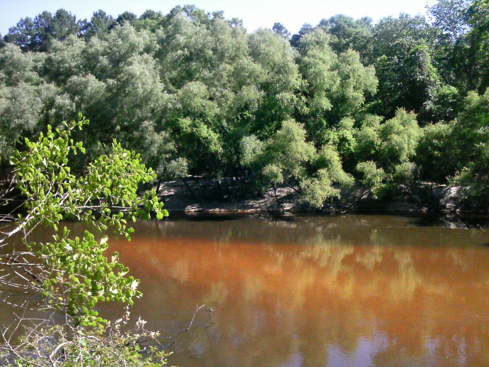
The Ochlockonee runs yellow-brown between Leon and Gadsden counties. Photo: Rosalyn Kilcollins
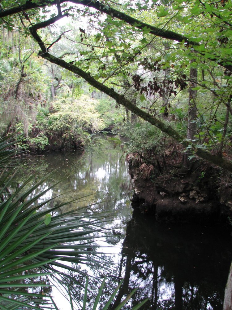
The Aucilla is a blackwater stream that goes underground and rises again before reaching the Gulf – a disappearing act that has fascinated early settlers, paddlers and naturalists alike. The Aucilla drains a smaller watershed, has lower flows, and features stream channel sediments that are predominantly sands and decaying organic material – the sediment signature of coastal plain streams with water stained dark brown, the color of tea.
In fact, blackwater rivers like the Aucilla get their color by steeping fallen and decaying tree leaves and twigs in slow-moving water, just as we steep shredded tea leaves or ground up coffee beans to dissolve their tannic acids into beverages. Blackwater steeping occurs in swamp forests up river tributaries, and in oxbow sloughs and other quiescent side channels of the downstream reaches. These form as a river “in flood” meanders and changes course within its floodplain.
The Ochlockonee is unusual among rivers originating in the Coastal Plain: in its upper reaches it has alluvial characteristics common to streams flowing from the Piedmont. The Ochlockonee drains soils rich in silt and clay that give it a yellowish brown color when those extremely fine sediments are suspended in the water. Land use activities such as paving roads and tilling farm fields elevate the fine sediment load when it rains by setting up larger volumes of fast-moving runoff. Higher rain runoff volume and velocity conspire to erode bare fields, construction sites and river banks, accentuating this river’s color.
But in spite of these differences, the Aucilla and Ochlockonee were once branches of the same river drainage system – the Paleo-Ochlockonee River. How could that possibly be? Well, sea level rise has drowned the lower reaches of this once mightier river, leaving its upper branches to empty into the Gulf separately, as smaller streams.
Sea level along Florida’s Big Bend coastline has been rising since the end of Earth’s last Ice Age – roughly 18,000 years ago. Our shallow, gently sloping underwater continental shelf was exposed during that last period of glaciation. As higher temperatures began melting ice sheets, not only did sea level rise, but more water evaporated and fell as rain. Southeastern rivers began carrying greater volumes of water.
Before annual rainfall reached today’s level during this prehistoric period of climate change, it is likely that the Aucilla from headwaters to Gulf was even more discontinuous than it is today. A current hypothesis is that the Aucilla was more like a string of sinkholes than a river, resembling its lower reaches today in a section known as the “Aucilla Sinks.”
The Aucilla is a tannic river. Thus not as yellow-brown but rather more “blackwater”. Photo: Jed Dillard
But the nature of the Paleo-Aucilla is just one part of this intriguing story. Using sophisticated technology, scientists have discovered clues about the ancient route of the entire Paleo-Ochlockonee as it meandered across that more expansive, exposed Continental shelf to the Gulf.
In their 2008 publication Aucilla River, Tall Timbers Research Station & Land Conservancy reports that, “Ten thousand years ago, the Florida coastline was located 90 miles away from its present position. Scientists have discovered a buried river drainage system indicating that approximately 15 to 20 miles offshore from today’s coast — and now underwater — the Aucilla River combined with the Ochlockonee, St. Marks, Pinhook, and Econfina rivers to create what archeologists call the Paleo-Ochlockonee, which flowed another 70 miles before reaching the Gulf.”
“Well, I’ll be!” you say, “That’s all pretty cool to think about.” That was my reaction, too, until I remembered that this process of sea level rise continues still, albeit at an accelerating rate thanks to global warming. Which means our rivers that join forces today before emptying into the Gulf will one day be separated. Sea level rise eventually will dismember the Wakulla from the St. Marks, and the Sopchoppy from the Ochlockonee – but thankfully not in our lifetime.
True, that’s happened before, but long before humans were on the scene. Today and for many tomorrows to come, I am grateful that we and our children and grandchildren have a wonderful watery world patiently awaiting our exploration, not far beyond the urban bustle of Tallahassee.
We’re far removed in time from the first humans beckoned by these rivers. A pause in the rate of sea level rise 7,000 years ago enabled development of coastal marsh ecosystems and more successful human habitation – supported in part by the bounty of fish and shellfish that depend on salt marshes. Farther upstream and still inland today, the sinks and lower reaches of the Aucilla hold archaeological sites about twice that old, that are integral to our evolving understanding of very early prehistoric human habitation on the Gulf Coastal Plain.
If you’re intrigued by the myriad of fascinating rivers and wetlands of the Big Bend region – this globally significant biodiversity hotspot we live in, and want to experience some of them first-hand, you’re in luck. Several Panhandle counties offer Florida Master Naturalist courses on Freshwater Systems (and also courses on Upland Habitats and Coastal Systems). You can check the current course offerings at: http://conference.ifas.ufl.edu/fmnp/
You can also explore on your own. There are many public lands in our region (and across the Panhandle) that provide good access.
Go see the Aucilla’s remaining string of sinks by hiking a short segment of the Florida Trail through the Aucilla Wildlife Management Area in Taylor County. And the Ochlockonee’s floodplain of sloughs and swamps, bluffs and terraces by taking trails that follow old two-track roads “down to the river” through the Lake Talquin State Forest in Leon County.
Get some maps of your public lands, get some tips on trails, get outside, and go exploring!