by Rick O'Connor | Sep 17, 2021
In Part 1 we looked at the history, and the science, behind the climate change issue. That post discussed everything said during the early periods up to about 2010. In this post, we will look at what has happened since 2010 and will look at how the early prediction models are working. We will begin with how CO2 levels have changed over the last decade.
CO2 concentrations since 2007
It was mentioned in Part 1 that at the beginning of the industrial revolution the CO2 concentration in the atmosphere was at 280 ppm and had reached 384 ppm by 2007. It was also mentioned that many considered the “tipping point” for CO2 concentration was at 450 ppm11. What has happened since 2007? NOAA reports that the CO2 levels have reached 409.8 ppm (±1.0 ppm) in 2019. This is the highest recorded CO2 value in the last 800,000 years4. This suggests that greenhouse admissions do continue to climb at a rate of about 2 ppm/year. At this rate, we will pass the potential “tipping point” of 450 ppm by 2050. For obvious reasons, this is concerning.
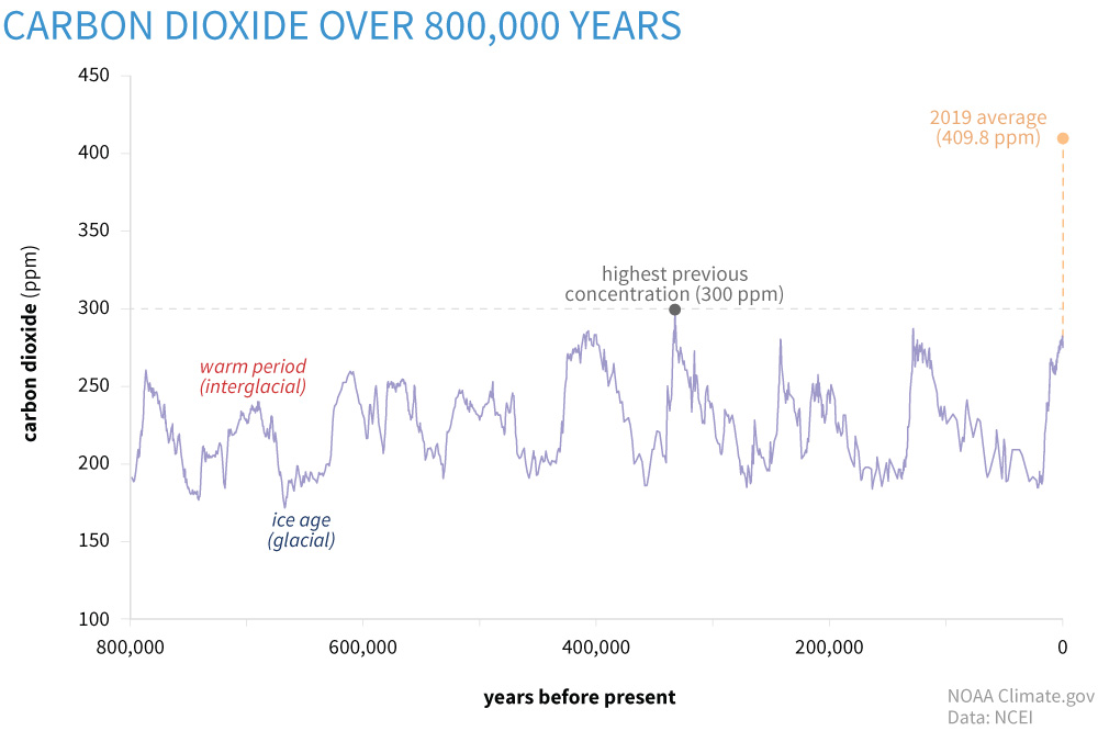
Changes in carbon dioxide levels up to 2019.
Image: NOAA
What about extreme weather conditions?
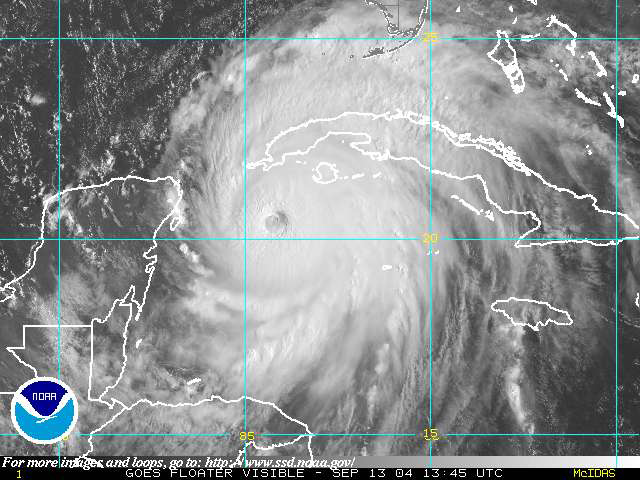
Everyone has noticed the extreme weather conditions posted on the evening news each day. Fires out west, droughts in the southwest, floods in the Mississippi Valley, hurricanes along the Gulf coast, and blizzards/floods/and even tornados in the northeast. There have been catastrophic floods in Europe, and extreme droughts in equatorial Africa. These things have always happened, but they now seem to be more frequent, and more concerning to residents in these areas where they continually occur. They certainly match the pattern predicted by the climate models of the early 1980s and it is hard to argue when in 2020 the named tropical storms went through the entire alphabet and into the Greek alphabet before the storm season was over. Are these becoming more common? Or do they appear to be more common?
A 2021 NOAA publication on sea level rise suggest it is likely that tropical storm frequencies will increase. They work from what is called the power dissipation index (PDI). This index measures storm activity, frequency, duration, and intensity. Correlating the annual index against the annual sea surface temperatures (SSTs) of the Atlantic suggest, at medium to high confidence, the intensity of future tropical storms will increase. But they point out the frequency of storms prior to 1965 was based on ship observations at sea. Numerous storms form over the Atlantic Ocean but only last for a few days and may not make landfall. They argue that some of these could have been missed using the ship observation methods of the early 20th century. One study made a correction for this in their calculations which suggested that the frequency of todays storms may not be that significantly different from those of the earlier 20th century and that the increase could be due to better monitoring today6,7. Either way, it has become custom along the northern Gulf of Mexico to prepare for hurricanes each season, and possibly more than one. As I am writing this, it is early September, and we are currently on storm “N” – Nicholas – the 14th named storm of the season. This is certainly something that warrants continued monitoring.
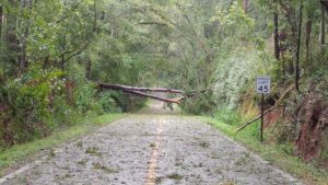
Hurricanes seem to becoming more frequent bringing more frequent damage.
Photo: Dr. Pete Vergot
Record temperatures
At one point during the summer of 2021 there were triple digit air temperatures all over the country. For Arizona, Texas, and Florida it is not unusual to see these high temperatures. But Oregon, North Dakota, and New England it was unusual. It seems we are breaking records on high temperatures each year, and sometimes multiple times a year for some locations. Does the science support what appears to be happening?
Yes…
The data shows the most intense period of warming has occurred in the last 40 years and the seven most recent years are the warmest on record. This publication from NASA also states that 2016 and 2020 tied for the highest record warm days since they began collecting this data, and not only are the records highs increasing – the low temperatures reported from around the country having been increasing since 1950. It is getting warmer3.
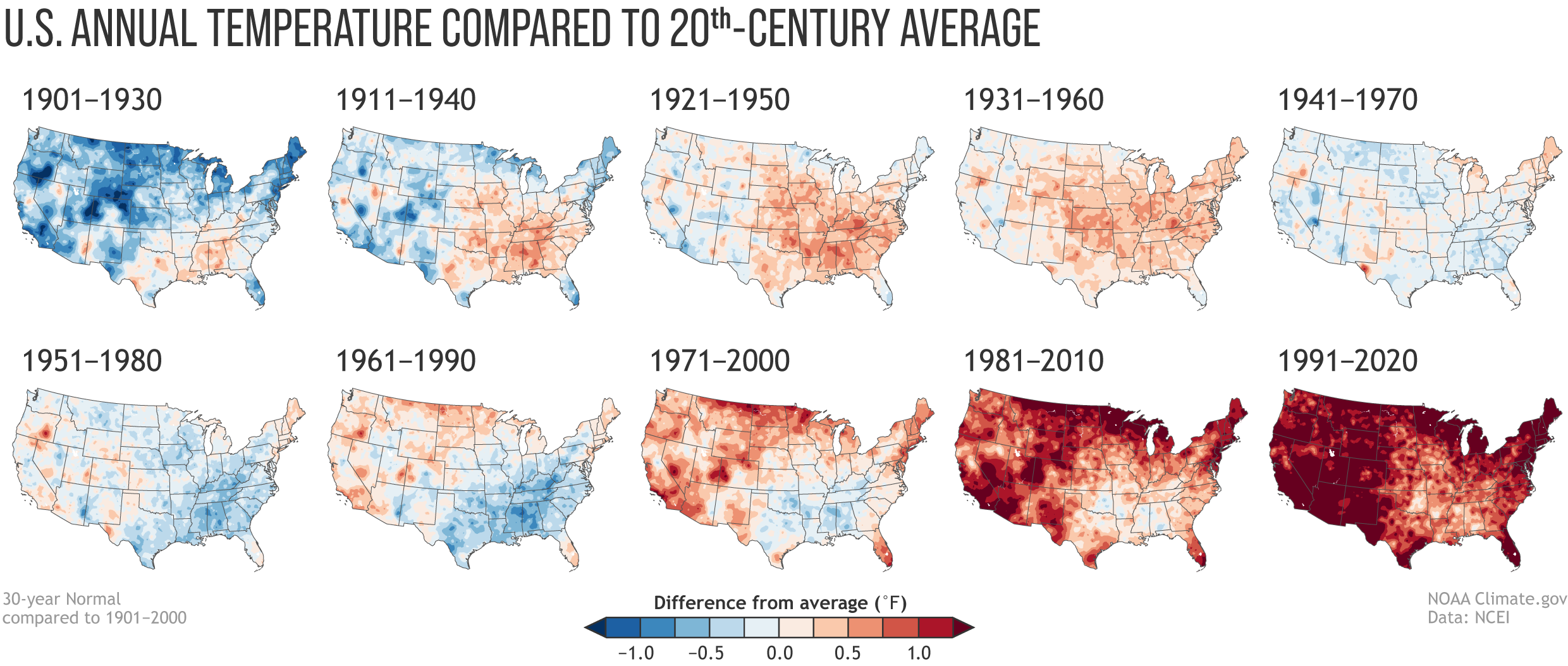
Image: NOAA
The models developed in the 1980s suggested the wet areas of the country will become wetter, and the dry areas will become drier… is this happening?
It appears so…
In the image below published by NOAA you see a series of national maps divided by 30-year periods. The colors indicate wet and dry periods as compared to 20th century averages for those areas. The reds and browns indicate below average rainfall, the greens and blue-greens above average rainfall. You can see at the beginning of the century most of the country was near the century mean. Over the first 50 years there was dry period, which included the famous “dust bowl”. The southwest United States experienced a very dry period in the middle of the century. Beginning in the 1970s it became wetter, with the midwest and northeast become very wet since that time, and the southwest is returning to the dry periods they saw earlier in the century.
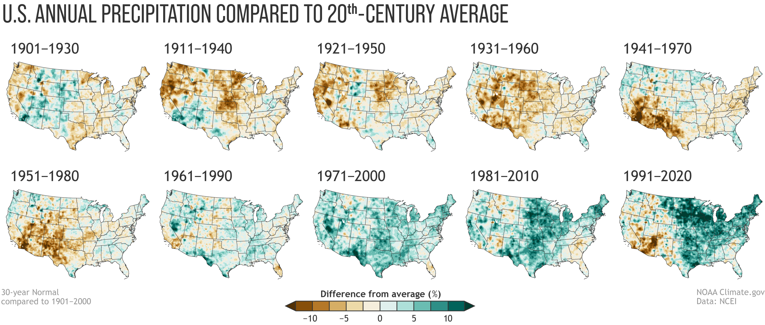
Image: NOAA
At least some of the wetness relative to the 20th century averages is linked to the warming of the atmosphere. Rising temperatures have enhanced evaporation since the 1970s and increased atmospheric moisture and humidity across the middle and eastern portion of the country8.
In a 2021 publication looking at changes in hurricanes and tropical storms, NOAA discusses what are termed “normals”. These are 30-year averages of key atmospheric and climate observations from weather stations across the country. They can be used by climatologists to assess how both the weather and climate compare to “normal” over time.
Tropicalization
This is an interesting phenomena that is occurring, and one we are watching along the northern Gulf of Mexico. The idea is basically tropical climate of the lower latitudes is moving northward across the northern hemisphere, and southward in the southern. It suggests that a warming plant is making temperate areas of the earth more tropical.
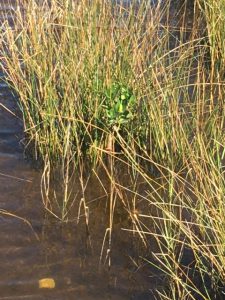
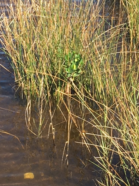
A young red mangrove growing near Pensacola FL.
Photo: Carrie Stevenson
Locally in the Pensacola area, there have been reports of mangroves growing in some estuaries. Mangroves are coastal salt tolerant trees that do not do well in colder temperatures. Historically, these plants dominated the estuarine coastlines of south Florida and Keys reaching as far north as Tampa Bay area along the Gulf coast, and Indian River area on the east. Over the last few decades there has been a migration of mangroves northward. They are now established in Cedar Key on the Gulf coast and reaching the Jacksonville area along the Atlantic. But even more interesting are the reports of small groups, or individuals of mangroves even further north into Georgia, and along the northern Gulf coast including Pensacola. Working with the Pensacola-Perdido Estuary Program, Sea Grant from Mississippi-Alabama and Florida, and NOAAs National Estuarine Research Reserves along the northern Gulf, we have been conducting annual surveys for these trees since 2019. Individual plants have been reported from the barrier islands of Mississippi, coastal inlets in Pensacola and Panama City, and numerous plants in the St. Joe Bay area. Black mangroves (Avicennia germinans) are more tolerant of cold than the other species of mangroves, and they have been found across the northern Gulf. What is interesting is that the red mangrove (Rhizophora mangle) has also been found. During the mangrove surveys we have conducted here in Pensacola Bay, the nine records we have were all red mangroves. These have not become established here, as a matter of fact all nine plants died during a hard freeze in 2018, but the fact that all reached a height of about 20 inches suggested that winter seasons are warm enough, for long enough, to allow them to grow for a period of time. One red mangrove growing within Big Sabine survived for almost 10 years, reaching a height of about a meter and developing prop roots, before the hard freeze of 2018 killed it. In addition to this survey project, others have reported the expansion of these plants into the northern Gulf2, 9.

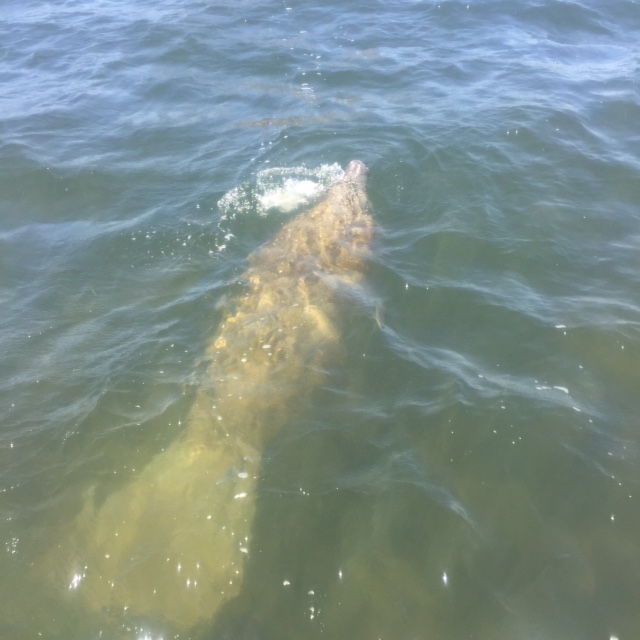
Manatee swimming in Big Lagoon near Pensacola.
Photo: Marsha Stanton
But mangroves are only one tropical species suggesting a climate shift. Manatees are animals that have historically migrated into the northern Gulf region over the years. Having lived in Pensacola all of my life, it was not unusual to hear about 1-2 sightings each year. Most were in the summer months but some were during the winter. They were often seen near the jetties at Ft. Pickens, near Palafox Pier downtown, and in Bayou Texar. However, in recent years the number of sightings seemed to be increasing. Some of citizen science volunteers were reporting them in Big Lagoon, and many times multiple individuals at one time, one report had nine individuals at the end of a private dock – which was unusual. In 2019 Sea Grant, working with Dauphin Island Sea Lab, decided to begin a tracking/reporting project to determine how frequent these encounters were. Dauphin Island Sea Lab had been conducting a “manatee watch” for almost 10 years at that time due to an increase in encounters in the Mobile Bay area. In 2019 we logged 66 records in the Pensacola Bay area. Based on time of day and location, we could determine that at least five of these were the same individuals reported by different people. Records came from the shoreline of the Gulf of Mexico, Santa Rosa Sound, Big Lagoon, NAS Pensacola, Tarkiln Bayou, Bayou Chico, Bayou Texar, and even up in Blackwater Bay near Bagdad. There were numerous manatees exploring all over the bay. This was different. The Manatee Watch program continues with a new reporting location on the Pensacola-Perdido Bay Estuary Program’s website – www.panhandlemanatee.org – and we continue to track this.

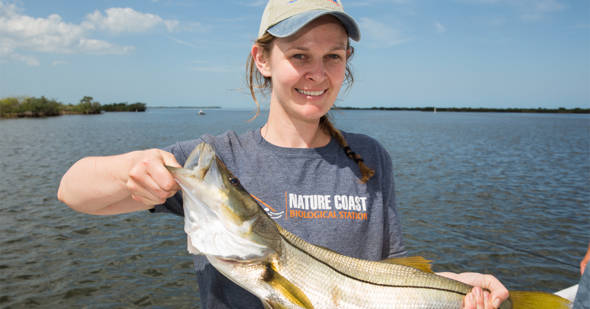
This snook was captured near Cedar Key. These tropical fish are becoming more common in the northern Gulf of Mexico.
Photo: UF IFAS
Now there are reports of snook (Centropomus undecimalis) and tarpon (Megalops atlanticus) roaming the northern Gulf. These are popular game fish found in south Florida associated with mangrove swamps and are a big draw for tourism in that part of the state. There have been reports of tarpon in the Pensacola Bay area for a number of years, but they seem to pass through seasonally and anglers reported that they would not strike any type of bait (live, dead, or artificial) thrown at them. However, in recent years there have been reports of anglers catching them.
Snook are more tropical and reports of them dispersing north are more recent. They are now reported in the Cedar Key area and enough to consider including them as a charter fishing target. Other reports from the Apalachicola area and even in Pensacola – Mobile Bay areas, suggest they are visiting us – albeit in small numbers.
But researchers have been following the “tropicalization” trend not only in the Gulf of Mexico but across the planet. Much of this is due to a reduction of the number of below freezing days during the winter period. One study showed that San Francisco CA has seen a reduction of sub-freezing days. Prior to 1980 most winters had sub-freezing days. In 1949 they had a total of 17 days below freezing. However, between 1981-2020 there were only 14 days below freezing, they have only had one since 1999, and have not had any since 20089. This same report looked at Tucson AZ, New Orleans LA, and Tampa FL. Tucson has experienced a slow warming over the century. New Orleans had relatively few sub-freezing days between 1940-1950, with an increase in freezing days between 1960-1980, and over the past 30 years a reduction in those freezing days. Between 1961-1990 there were 480 days below freezing. Since 1991 there have only been 165 days below freezing. The data from Tampa FL mimics what occurred in New Orleans9.
Along with the northern expansion of tropical species there has been a shift in the traditional “planting zones” used by agriculture and horticulturists. These are zones developed to let people know which plants will do best in your climate, and when to plant them. All of these zones are shifting north8.
And then there are coral reefs…
Long associated with the tropics, many species are now being found in the northern Gulf of Mexico and one scientific team predicts that as reefs continue to struggle with increasing water temperatures and ocean acidification, they will expand northward into the Big Bend region of Florida1.
Invasive Species
Everyone has heard of invasive species and are aware of the potential problems they can cause. With all of the media about Burmese Pythons, Brazilian Pepper, and Green Iguanas, it seems south Florida is under constant attack by these creatures. It’s understandable that Miami would be ground zero for such invasions. With the heavy international traffic and warm tropical climate creatures that are either intentionally, or accidentally, brought there and escape do well.

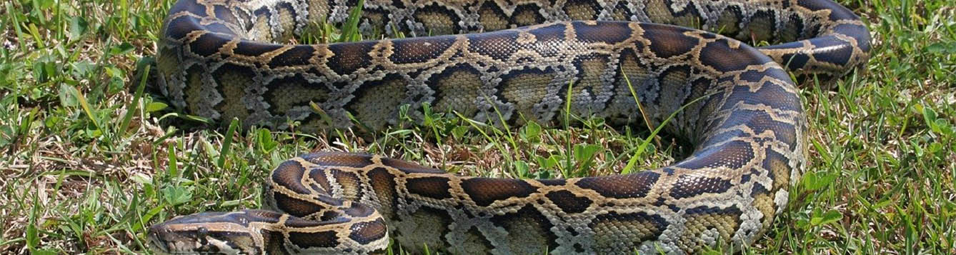
The Burmese python.
Photo: University of Florida
But most are not fond of the colder winters found in the northern Gulf of Mexico. Temperatures reaching, and sometimes exceeding, the freezing point are not unheard of. This has actually helped impede the dispersal of these tropical invasive species into the Florida panhandle.
That could be changing.
With over all milder winters we are seeing not only the tropicalization of the northern Gulf by native flora and fauna, but by non-native as well. Brazilian Pepper (Schinus terebinthifolius) has been reported on St. George Island near Apalachicola. The national database EDDMapS12 reports 18 records of the Cuban Treefrog (Osteopilus septentrionalis) in the Florida panhandle and there is reason to believe one population near Panama City may be breeding. There are 10 records of the Argentine Black and White Tegu (Salvator meriana) in the Florida panhandle and another 11 further north in the state of Georgia12.
A recent study looking at the cold tolerance of the Burmese Python (Python molurus) may be greater than we thought, that specific cold tolerant genes are becoming more common in the population, and the winters are getting milder9. All of this spells problems as these once south Florida issues begin to disperse northward.
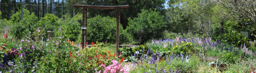
The types of plants and planting zones are moving northward.
Photo: UF IFAS
Growth Zones
Also, along the lines of tropicalization, is the northward movement of growth zones. These zones are commonly used by horticulturalists when recommending plants for certain geographic areas. For example, much of our area of the northern Gulf is in zone 8. Zone 9 (warmer climate) can be found in other portions of the northern Gulf and in peninsula Florida. There is evidence to suggest that these growth zones are migrating northward with latitude and altitude with the changing climate8. This will be important for those in the nursery and gardening industry as they select species for markets in different parts of the country. These changes will also impact what time of year people choose to plant.
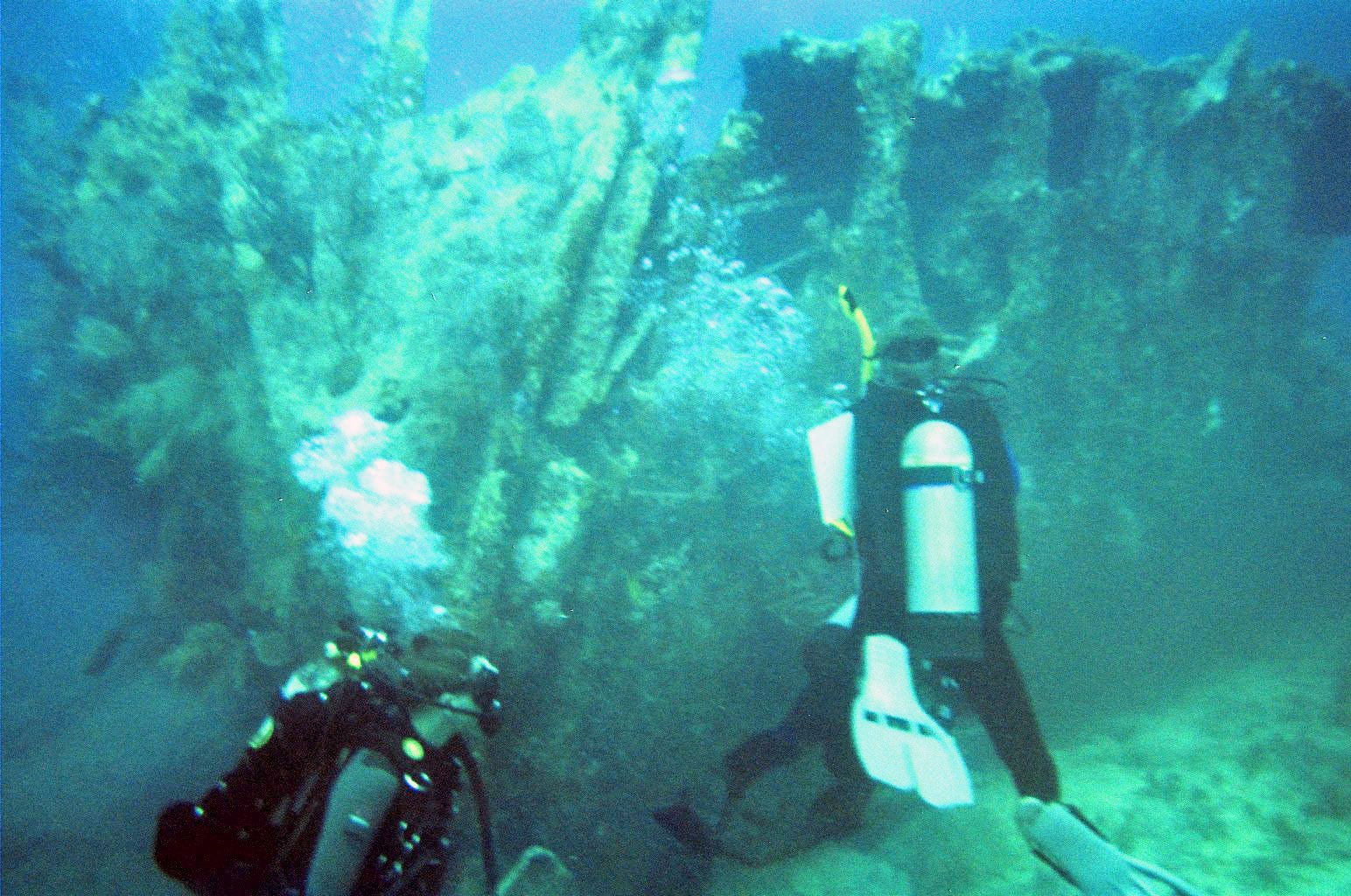
Coral reefs are struggling along the Florida Reef Track.
Photo: Indiana University
Corals, the Oceans, and Acidification – how have the oceans held up over the last decade?
For corals and ocean acidification, the answer is not so good.
NOAA reports that the oceans have absorbed enough CO2 to lower the pH by 0.1 – a 30% increase in acidity4. Mollusk shells, coral skeletons, etc. are made of calcium carbonate (CaCO3) which dissolves in acid. Obviously having a shell made of limestone (CaCO3) is not a good idea in an ocean that is becoming more acidic. The coral reef track has been dealing with life threatening diseases for many decades now. The increase ocean temperatures stress them, and the symbiotic microscopic plants known as zooxanthalle they rely on. This increase stress has made it easier for pathogens to attack them. There is currently a serious stony coral tissue disease spreading through the Florida reef tract that is also life threatening. The last decade has not been good for corals.
Sea Level Rise
Miami’s famous king tides…
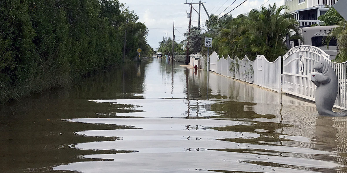
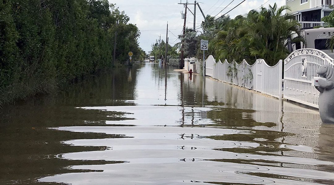
Sea level is rising everywhere but some locations seem to be having larger issues than others. One such location is Miami FL. High tide occurs there twice a day. Twice each month, when the moon-earth-sun are all aligned during the full and new moons, the tides are larger than normal – spring tides. During certain times of the year these tides are stronger still – king tides. King tides are now covering portions of A1A in downtown Miami. These are not storm events causing flooding, they are natural high tides, just reaching higher levels because sea level is higher.
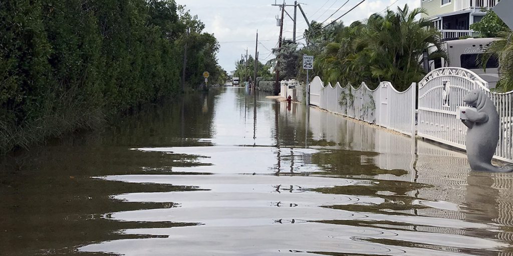
Flooding like you see along this street in Key Largo is becoming more frequent.
Photo: Florida Sea Grant
NASA reports that sea levels have risen eight inches over the past century and that the rate of that increase has doubled3. NOAA reports similar numbers and connects this rise to melting glaciers and expanding ocean volume due to warming. NOAA also connects the melting glaciers and expanding oceans to human activities since 19715, 7. In addition to Miami FL, there have been stories on impacts to London and Venice. Many coastal areas are beginning to see increased flooding due to both rising seas, sinking land, and increased rain events.
Data provided over the last decade do not suggest that the impacts of a changing climate have varied much from what the earlier climate models suggested. Some changes have occurred by impacts have not been noticed yet. More manatees and snook in the northern Gulf, growing/planting seasons shifting, mangroves moving north. Others have been impactful. Movement of invasive species, increased flooding, and the continued decline of our coral reefs. And we circle back to the original comment… “everyone is talking about the climate – but is anyone doing anything about it?”
In Part 3 we will review the recent report from the International Panel on Climate Change (IPCC) – Assessment Report #6 (AP6). What are the climate scientists saying about the current state of things and what are the models suggesting for the next decade.
References
1 Furman, B.T., B.J. Peterson, K.L. Heck Jr. 2020. Will the Florida Big Bend Area Become the Next Gulf of Mexico Reef Tract? Opinion Article. Frontiers in Marine Science. https://doi.org/10.3389/fmars.2020.00334.
2 Macy, A., S. Sharma, E. L. Sparks, J. Goff, K.L. Heck, M.W. Johnson, P. Harper, J. Cebrian. 2019. Tropicalization of the barrier islands of the northern Gulf of Mexico: A Comparison of herbivory and decomposition rates between smooth cordgrass (Spartina alternifloria) and black mangrove (Avicennia germinans). PLOS One. 14(1): e0210144. https://journals.plos.org/plosone/article?id=10.1371/journal.pone.0210144.
3 NASA. 2021. Global Climate Change: Vital Signs of the Planet. https://climate.nasa.gov/vital-signs/carbon-dioxide/.
4 NOAA. 2021. Climate.gov. Science and Information for a Climate Smart Nation. Climate Change and the 1991-2020 U.S. Climate Normals. https://www.climate.gov/news-features/understanding-climate/climate-change-and-1991-2020-us-climate-normals.
5 NOAA. 2021. Climate.gov. Science and Information for a Climate-Smart Nation. Carbon Emissions. https://www.climate.gov/news-features/understanding-climate/climate-change-atmospheric-carbon-dioxide.
6 NOAA. 2021. Climate.gov. Science and Information for a Climate Smart Nation. Sea Level Rise. https://www.climate.gov/news-features/understanding-climate/climate-change-global-sea-level.
7 NOAA. 2021. Geophysical Fluid Dynamics Laboratory. Global Warming and Hurricanes. https://www.gfdl.noaa.gov/global-warming-and-hurricanes/
8 NOAA. 2021. Geophysical Fluid Dynamics Laboratory. Historic Changes in Atlantic Hurricanes and Tropical Storms. https://www.gfdl.noaa.gov/historical-atlantic-hurricane-and-tropical-storm-records/
9 Osland, M.J., P.W. Stevens, M.M. Lamont, R.C. Brusca, K.M. Hart, J.H. Waddle, C.A. Langtimm, C.M. Williams, B.D. Keim, A.J. Terando, E. A. Reyier, K.E. Marshall, M.E. Loik, R.E. Boucek, A.B. Lewis, J.A. Seminoff. 2021. Tropicalization of Temperate Ecosystems in North America: The Northward Range Expansion of Tropical Organisms in Response to Warming Winter Temperatures. Global Change Biology. Wiley. DOI: 10.1111/gcb.1556.
10 Verges, A., C. Doropoulos, H.A. Malcom, M. Skye, M. Garcia-Piza. 2016. Long-Term Empirical Evidence of Ocean Warming Leading to Tropicalization of Fish Communities, Increased Herbivory, and Loss of Kelp. Proceedings of the National Academy of Sciences of the United States of Amercia. 113 (48) 13791-13796. https://doi.org/10.1073/pnas.1610725113.
11 Miller, G.T., S.E. Spoolman. 2011. Living in the Environment: Concepts, Connections, and Solutions. Brooks and Cole Publishing, Belmont CA. pp. 659.
12 Early Detection Distribution Mapping System (EDDMapS). 2021. https://www.eddmaps.org/.
by Rick O'Connor | Sep 15, 2021
Six Rivers “Dirty Dozen” Invasive Species
Red Lionfish (Pterois volitans)
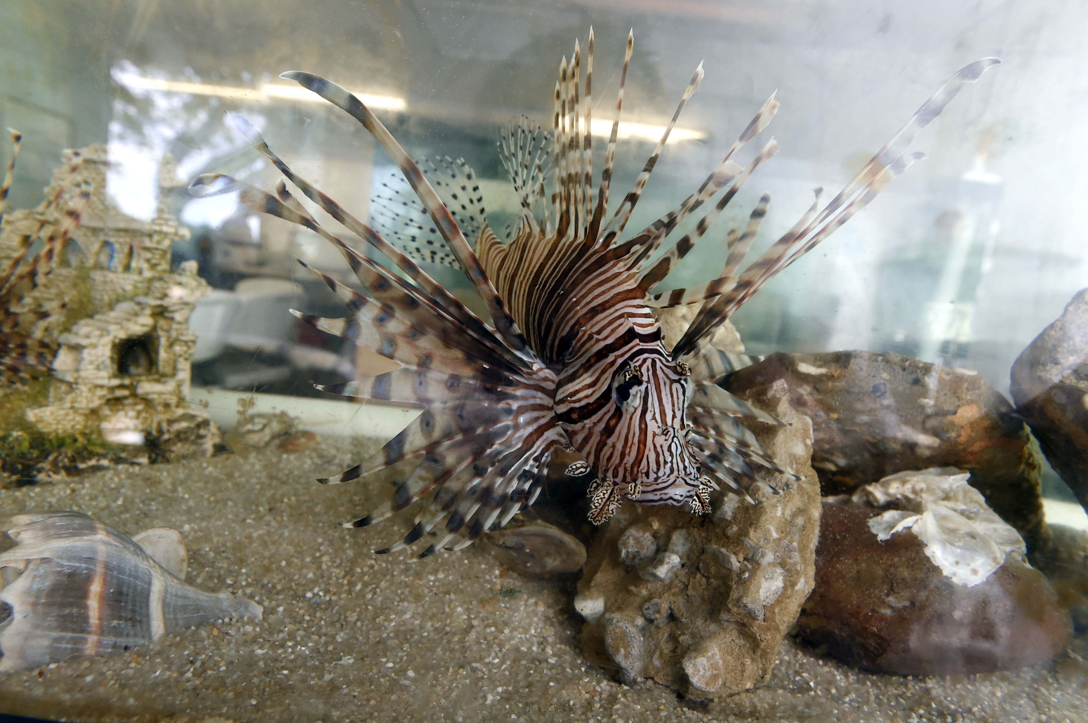
Lionfish in tank. Photo credit: Laura Tiu
Define Invasive Species: must have all of the following –
- Is non-native to the area, in our case northwest Florida
- Introduced by humans, whether intentional or accidental
- Causing either an environmental or economic problem, possibly both
Define “Dirty Dozen” Species:
These are species that are well established within the CISMA and are considered, by members of the CISMA, to be one of the top 12 worst problems in our area.
Native Range:
The Indo-Pacific and Red Sea.
Introduction:
The first record of lionfish in U.S. waters was in the late 1980s off the coast of Davie, Florida. It is believed the release was connected to the aquarium trade but whether it was accidental or intentional is unknown.
EDDMapS currently list 3,029 records of lionfish in the U.S. This is certainly under reported. Few invasive marine fish are reported to EDDMapS. Most are reported to a NOAA website which reports area of lionfish rather than individual records. It is known that the lionfish is well established all along the eastern seaboard of the United States, Bermuda, the Caribbean, and the entire Gulf of Mexico – including the coastal areas of Six Rivers CISMA. In 2014, it was reported that the densities of lionfish off the Six Rivers CISMA were some of the highest in the entire south Atlantic Region1. At a regional workshop in 2018, it was reported these densities had declined in waters less than 200 feet2.
Description:
Lionfish are deep bodied fish with large dorsal and pectoral fins and a truncate caudal fin. It is a slow swimmer. The body has a white/maroon vertically striped pattern that includes the head. The dorsal spines extend above tissue of the dorsal fin and possess a neurotoxin that is quite painful. The enlarged pectoral fins resemble wings and are used by the fish to corral prey into corners. There are no venomous spines on the pectoral fins but there are on the pelvic and anal ones. Lionfish have a large gaping mouth that can swallow a variety of prey using an engulfing/vacuum method.
Issues and Impacts:
These are voracious predators and have been known to consume over 70 different species of small demersal reef fishes. These small fish play an important ecological role on the reefs they inhabit, such as prey for larger commercially sought-after fish species as well as those that graze algae and keep the corals from being smothered by such. The decline of these populations can have both ecological and economic impacts. Studies have found that the popular red snapper will stay further away from reefs inhabited by lionfish, and they are also known to inhabit lobster traps in the Florida Keys, impeding the entry of the much sought-after spiny lobster.
Management:
The high reproductive rate has made lionfish management difficult. Adult females are known to produce an average of 30,000 fertilized every four days. The fertilized eggs are encased in a gelatinous sac that drifts with the currents and disperses the young to new territories. There are toxins associated with this sac and consumption of larvae is not currently known. In addition to high reproductive rates, the currents disperse the developing young great distances and lionfish are known to tolerate salinities found in estuaries.
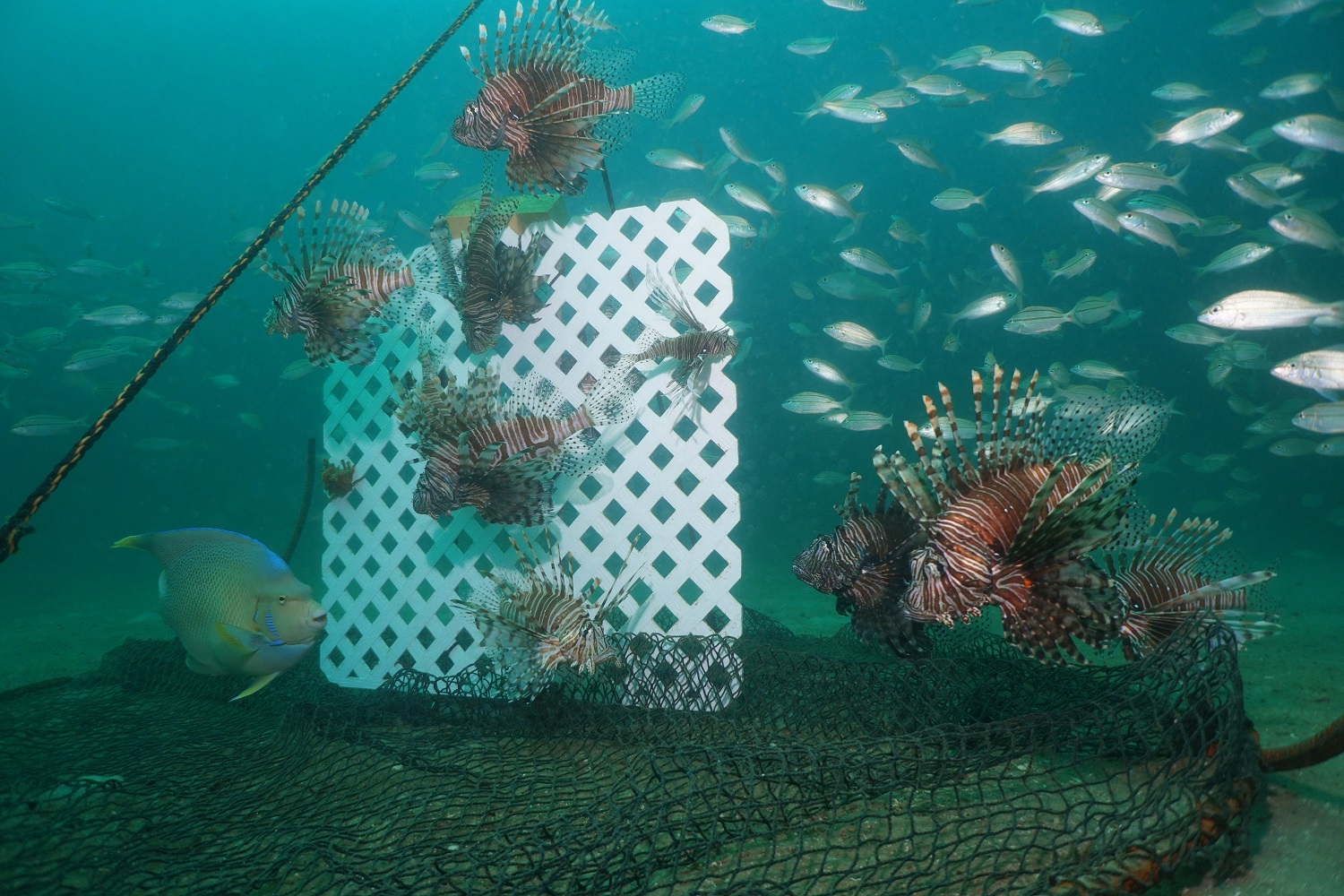
They rarely bite hook and line making the most effective of removal being the diver with a pole spear. There are very good lionfish hunters, and prize-winning tournaments are well attended, but studies have shown that removals using spear must be repeated about once a month to be effective. Effective here meaning keeping the population stable, lionfish is a “Dirty Dozen” species, it will not be eradicated.
Test using traps are currently being conducted and these may prove to be more effective than removing by spear alone. There are a few native species that have been known to consume lionfish, but not at a rate to impact their invasion. Since 2018 lionfish in the south Atlantic region have been reported with skin lesions. It is not known at this time how this will impact their numbers, but early studies suggest it is.
For more information on this Dirty Dozen species, contact your local extension office.
References
Early Detection and Distribution Mapping System (EDDMapS)
https://www.eddmaps.org/
Six Rivers CISMA
https://www.floridainvasives.org/sixrivers/
by Rick O'Connor | Sep 2, 2021
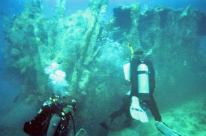
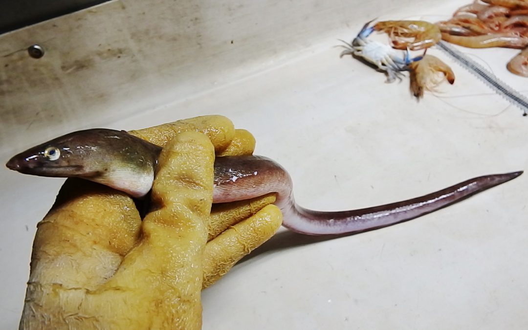
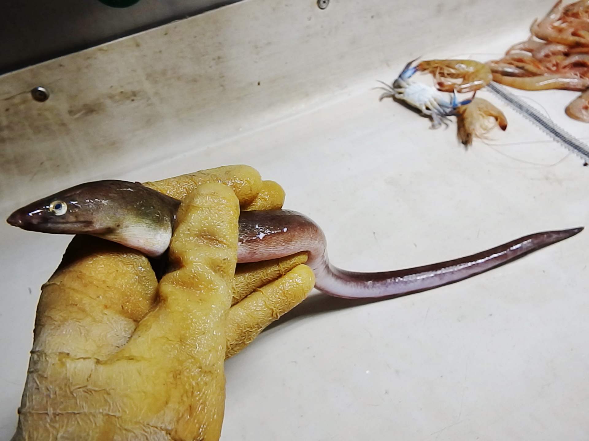
Eels… when that name comes up most think of either the vicious moray eels or the famous electric eel. Moray eels do exist in the Florida panhandle, and we will talk about them. Electric eels do not, they are found in the Amazon River system. That said, we do have eels here – quite a few. There are at least 18 species found in six different families. Most are 2-3 feet in length, though the Banded Shrimp Eel (Ophichthus) can reach six feet. About half of them are found offshore on the middle and outer shelves, the other half can be found in the inner shelf and estuaries, a few species swim into freshwater. Shrimpers often catch them when trawling and occasionally anglers will catch them with rod and reel.
Eels superficially resemble snakes and sometimes are confused with them. I have been told more than once that we do have sea snakes here. We do not. What people are finding are one of the 18 species of eels in the area. We do have snakes swimming across our estuaries, but we do not have sea snakes.
Eels differ from snakes primarily in that they, being fish, possess gills – not lungs. Most eels do have sharp teeth, the morays are famous for theirs, but no eels are venomous – so no worries there. Most of our eels have very small scales or are completely scaleless and are often very slimy and difficult to handle. They have been used as bait and one species, the American eel (Anguilla rostrata), has been used for food.
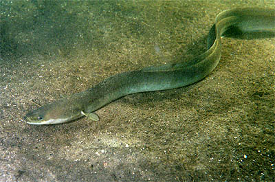
The Anguilla eel, also known as the “American” and “European” eel.
Photo: Wikipedia.
The American eel has an interesting life history. They spawn in the Sargasso Sea, an area in the middle of the Atlantic Ocean. Their developing leptocephalus larva are thin, flat, and transparent in the water. They drift with the ocean currents into the Gulf of Mexico and eventually into our estuaries. I have found them along the shores of Project Greenshores (in Pensacola Bay) during certain parts of the year. From here they work their ways into our local rivers where people encounter the large adults. I have found them living in submerged caves near Marianna and many locals have found them at the bottom of our rivers. When time to breed, the adults will leave and head back to the open Atlantic to begin the cycle again. An amazing trip.
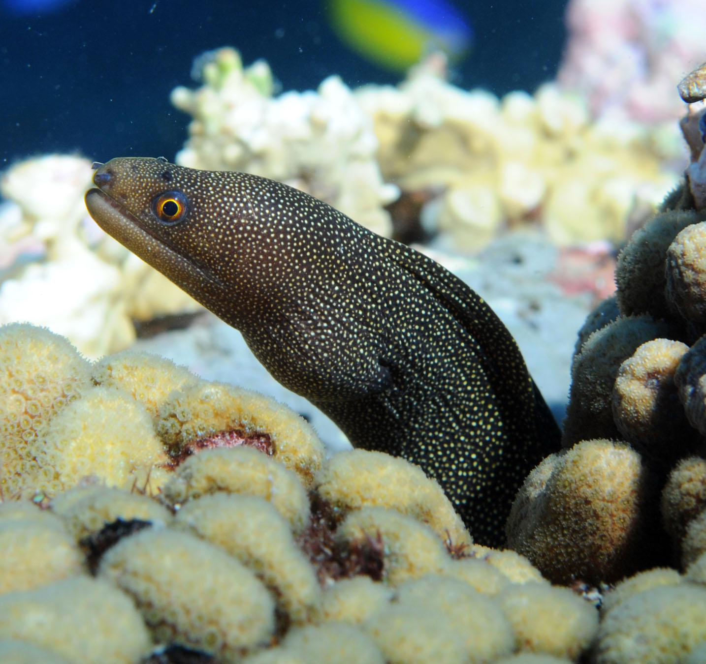
Moray eel.
Photo: NOAA
Moray eels are famous for the nasty attitudes and vicious bites. They are more tropical and associated with offshore reefs, though the ocellated moray (Gymnothorax ocellatus) is often caught in shrimp trawls. They live in the crevices of the reef ambushing prey. Some, like the green moray, can get quite large – over six feet. Like all eels, they have very powerful muscles and sharp teeth.
The shrimp eel is common on our inner and middle continental shelf.
Photo: NOAA
Conger eels are very common despite few people ever seeing them. There are six species and they frequent the middle continental shelf, so are rare in estuaries.
There are eight species of snake, or worm, eels. These are more common on the inner shelf and the coastal estuaries. Many prefer muddy bottoms where they bury tail first to ambush prey swimming by.
The majority of these marine eels have a large geographic distribution. Their larva can be carried great distances in the currents and their need for sandy or muddy bottoms can be met just about anywhere. They appear to have few barriers keeping them from colonizing much of the Gulf and surrounding waters. Most fall into the category we call “Carolina Fish”. Meaning their distribution occurs from the Carolinas, throughout the Gulf of Mexico, south to Brazil. There are a few species that can tolerate the lower salinities of the estuaries and one, the Anguilla eel, that can even venture into freshwater.
There are few species restricted to the tropical reefs, such as the morays. But morays are found on our smaller middle shelf and artificial reefs in the northern Gulf. Though found in parts of the Atlantic Ocean, Hoese and Moore1 reported one species of conger eel, Uroconger syringus, as only occurring near south Texas in the Gulf of Mexico. What barriers keep it from colonizing other Gulf habitats is unknown.
Eels are true fish that we rarely encounter. Encounters are usually startling but exciting at the same time. They are pretty amazing fish.
Reference
Hoese, H.D., R.H. Moore. 1977. Fishes of the Gulf of Mexico; Texas, Louisiana, and Adjacent Waters. Texas A&M University Press, College Station TX. Pp. 327.
by Rick O'Connor | Sep 1, 2021
EDRR Invasive Species
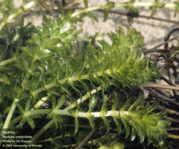
Hydrilla (Hydrilla verticillata)
Hydrilla Photo Credit: Vic Ramey, UF/IFAS Center for Aquatic and Invasive Plants
Define Invasive Species: must have ALL of the following –
- Is non-native to the area, in our case northwest Florida
- Introduced by humans, whether intentional or accidental
- Causing either an environmental or economic problem, possibly both
Define EDRR Species: Early Detection Rapid Response. These are species that are either –
- Not currently in the area, in our case the Six Rivers CISMA, but a potential threat
- In the area but in small numbers and could be eradicated
Native Range:
India.
Introduction:
Intentionally introduced in 1950-51 as a plant for aquariums.
EDDMapS currently list 3,592 records of this plant in the U.S. and Canada. Most are east of the Mississippi River. There are 370 records in Florida (certainly underreported) and 91% of those are in central and south Florida. There are only 33 records in the Florida panhandle but none of those are within the Six Rivers CISMA (Escambia, Santa Rosa, Okaloosa, Walton, Holmes, and Washington counites. There are four records from the Mobile delta, which lies in Baldwin County Alabama and is part of Six Rivers.
Description:
This is a submerged aquatic plant that will grow up to and across the surface of freshwater habitats. It can grow to lengths of 20 feet. Small whorled, saw-toothed, and pointed green leaves grow from the stem. Small solitary white flowers grow from extended threadlike stalks coming from the stems and resting on the surface. Can form dense mats at the surface.
Issues and Impacts:
The fast growing dense mats of Hydrilla block out sunlight needed by native submerged plants and cause their decline. These thick mats can reduce the natural flow of rivers and springs it invades altering the hydrology and ecology of the system, often reducing the dissolved oxygen levels. It has been known to clog irrigation and flood control canals as well as actually impede boating on some waterways.
The plant is extremely hardy being found in canals and ditches as shallow as a few feet to rivers, lakes and springs up to depths of 20 feet.
It is listed as a Florida Noxious weed and is prohibited from being sold.
Management:
Small infestations can be removed by hand or pulling out using a rake. The plant should be placed in a location where it can completely dry out and die. Those who can manage the levels of their lakes and ponds and draw down the water and kill the plant that way.
For larger infestations of lakes and springs, mechanical “mowers” can be used to cut and remove large areas of the plant. The removed pieces are then deposited into trucks on shore for further desiccation and disposal. Large mats not removed can increase hypoxia in the waterway. One issue with this method is fragments that are missed can generate into new plants.
There are six insects and one fish (Chinese Grass Carp) that have been used to biologically control the plant. However, establishment of these insects have been problematic. The Chinese Grass Carp do well on hydrilla but will feed on other aquatic plants and breeding populations could be a problem for the native ecology. Thus, only sterile triploid carp are allowed to be used and only with an FWC permit. Read more about these biological control agents at the reference below2.
There are several chemical herbicides that have had some success. For more information on using those, contact your local county extension office.
If you are in the Florida panhandle area and believe you may have hydrilla, please contact your county extension office to let them know and report the siting to www.EDDMapS.org. If you have questions on how to do this, your county extension office can help.
For more information on this EDRR species, contact your local extension office.
References
1 University of Florida IFAS Center for Aquatic and Invasive Plants. Hyrdilla. https://plants.ifas.ufl.edu/plant-directory/hydrilla-verticillata/.
2 Biological Controls. Plant Management in Florida Waters: An Integrated Approach. 2021. Center for Aquatic and Invasive Plants. University of Florida IFAS. https://plants-archive.ifas.ufl.edu/manage/control-methods/biological-control/.
Early Detection and Distribution Mapping System (EDDMapS)
https://www.eddmaps.org/
Six Rivers CISMA
https://www.floridainvasives.org/sixrivers/
by Rick O'Connor | Aug 30, 2021
Mark Twain once said – “Everyone talks about the weather, but no one does anything about it”. I guess you could say the same for climate.
The topic has been around for a while. As an undergrad science major in the late 1970s, we discussed what was then called “global warming”. It was explained to us that there were gases in our atmosphere that can cause what was called “the greenhouse effect”. Like the windows of a greenhouse, these gases allowed solar radiation to pass through to the surface of the planet but would not allow heated air to leave. Within the greenhouse it would get warmer.
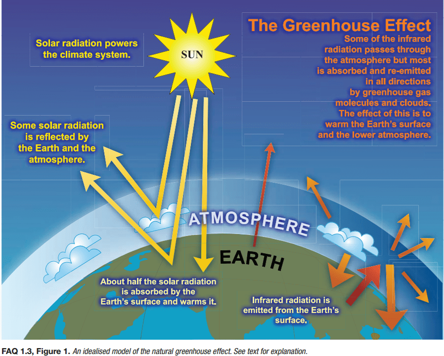
The greenhouse effect.
Image: NOAA
It was also explained to us that this was a natural part of the planet’s cycle. That without the “greenhouse effect” life on our planet could not exist. But it was also explained that the cycle worked like the thermostat in your home. Conditions on the planet increased the amount of greenhouse gas, which would in turn, increase the temperature of the planet. These warming conditions would enhance specific forms of life and their populations increased as well, land and sea. But like a thermostat at home, when the temperature reaches a certain point, the HAVC system shuts off and a cooling period happens within the house. The same happens on earth. Trees, and other forms of life, would increase in number during the warming periods but consume CO2 for photosynthesis and reduce the greenhouse effect leading to a cooling period. Other methods of greenhouse gas sequestration would occur as well. We know that the cooling periods could be quite significant – leading to ice ages. The species that sequestered the greenhouse gases would decline with the cooling periods allowing for an increase in those gases, and the cycle would begin again. And so it goes.
But was there any scientific evidence that such cycles actually exist?
Yes…
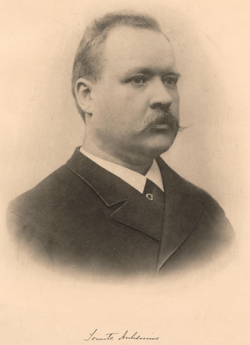
It is simple to construct an experiment within a closed system in a lab where you increase selected greenhouse gases to determine whether they actually increase temperatures within the systems. This has been numerous times by numerous scientific teams and the answer is yes… this happens. Science has been following this since 18961.
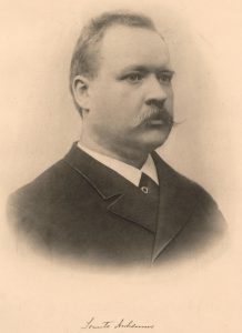
Svante Arrhenius, the Swedish chemist who first proposed how the greenhouse effect works in 1896.
Image: Science History Institute.
But is there evidence this occurs in the natural world, where there are more complex factors involved?
Yes…
Probably one of the more notable ones were gases trapped in ice cores removed from Arctic and Antarctic ice. Geology has understood for decades that material on our planet, rock and ice, are laid down over time. You can travel anywhere out west and see these layers of different rock layered over time. The idea is that the older material is laid down first and the newer material is near the top. But we also have evidence that the world is not a stagnant place. The earth’s surface shifts and changes constantly under the stresses of plate tectonics (another topic for another day). This shifting can cause older material on the bottom to shift in an upward position, placing it at – or above – newer material. So, geologists understand that it is not as simple as “older is on bottom” and great scrutiny and study must go into “reading” the rock layers. But reading those rock layers correctly can tell you a lot about how the earth has changed over time.

You can see the different layers of rocks as they have laid out over the history of the earth.
Photo: Rick O’Connor
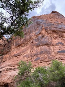
Notice the different layers within the rock face in Utah.
Photo: Rick O’Connor

This slab of rock shows the impression of a dinosaur foot. Notice how the slab has slid down the rock face into its current position.
Photo: Rick O’Connor
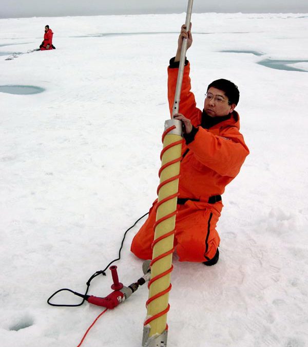
We know that when ice forms gas bubbles are trapped inside. You can take any ice cube today and see this. Using the same concept as “rock reading”, you can read layers of ice that are cored from the great ice sheets at the poles. Analyzing these gases, you can get an idea of the concentration of the greenhouse gases present at the time the ice formed. You can compare this to the fossilized plants and animals (even fossilized pollen) of those same periods and put together a map of the concentration of greenhouse gases, what the expected temperatures would have been based on those concentrations and compare this to the plants and animals that existed during that same time (were they warm or cold seasoned creatures). With this you could develop a map of the changing climate over time.
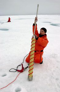
An ice core is being removed by a NOAA scientist.
Photo: NOAA
There is data going back over the last 900,000 years and yes… there are cool and warm periods found. One graph published by Miller and Spoolman (2011)1 shows average surface temperatures ranging from 9°C to 16°C (48°F to 61°F) over the last 900,000 years. The graph shows a basic “sine wave” of steady cooling and warming – a steady pattern – a cycle. Miller and Spoolman referred to these cycles as glacial and interglacial periods (freezing and thawing).
So, the lab and field evidence suggest we do live on a planet with ever changing climate. We are currently in a “thawing” period, and all is right with the world. But the data shows something else. Something that has climate scientists a bit concerned. Over the last 1000 years there has been a steady increase in surface temperatures, which was expected, but over the last 100 years there has been an unusual spike in increasing temperatures, something that have not seen in all of the data studied before. A rapid increase in surface temperature. What could be causing this unusual steep increase, and can the natural sequestering processes mitigate this rapid change?
This graph shows the changes in mean CO2 levels over the last 800,000 years. Notice the sharp increase in recent years.
Image: NOAA
If you examine a graph of temperature change over the last 1000 years you will notice the unusual spike beginning about the year 1900, 120 years ago. What could have happened to generate this spike?
Did the concentrations of greenhouse gases increase at the same rate during this time period?
Yes… they did.
What could have happened to cause this unusual increase in greenhouse gases and surface temperatures? And why has the natural sequestering process to cool the planets “thermostat” not kept up?
Back to the lab and to the field.
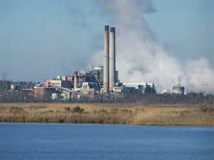
One event stands out… the industrialization of the planet. The industrial revolution began almost 300 years ago. We moved from burning wood as a source of energy to coal, and eventually oil. The burning of these fossil fuels significantly increases the same types of gases as the planet’s greenhouse gases (carbon dioxide CO2, methane CH4 and others). By the turn of the century (1900) the fossil fuel boom was in full swing. Industry and transportation were burning more and more of these fuels emitting more and more of the greenhouse gases that we know warm the planet up.

Power plant on one of the panhandle estuaries.
Photo: Flickr
But what about the sequestering processes of the forest and the oceans?
We began removing the forest. As the human population grows there is a need for more land for agriculture and homes/cities to live in. All across the planet deforestation was also in full swing, and agriculture/cities used fossil fuels as well. The change was on. Science has been able to determine that the carbon dioxide concentration has risen from 280 ppm at the beginning of the industrial revolution to 384 ppm in 20071. A study conducted by Field and Marland (2007) suggested that if the rate of CO2 increase at that time (3.3% annually) continued, it would reach 560 ppm by 2050 and 1390 ppm by 2100. This would have a significant impact on the climate which would in turn have a significant impact on the ecology and economics of our planet.
There was deep concern over this in the scientific community. They began developing computer models that could predict the changes in temperature with increased rates of greenhouse gases and how those could impact glacial melt, sea level rise, and atmospheric conditions that stimulate our weather. It is understood that models are only as good as the data you provide. We have learned this with hurricane models. There are numerous computer models that predict the landfall of hurricanes. The climatologist inputs what data they can get, and the model predicts where the storm will probably go – and at what intensity it will probably hit land with. These are the classic “spaghetti” models we are all familiar with on the evening weather. With hurricanes it is pretty easy to test your model. You input the data – predict landfall and intensity – and see what happens. You will get results very soon. You will notice on the evening weather that not all models make landfall at the same location. Some models are better than others. For those that were wrong, you go back and determine what information was not inputted, or inputted incorrectly, and “fix the model”. Because of this we feel very good about our hurricane models.

Hurricane forecasting has improved tremendously over the last decades.
Image: NOAA
But with climate, the results of the “landfall” will not happen in hours or days – it will be years or decades. So, as the models were developed in the early 1980s, no one knew for certain whether they were accurate or not.
But that did not stop climate scientists from developing them. There was much concern in what they thought might happen. Some studies suggested that the “tipping point” (the point of no return) for CO2 admissions was 450 ppm1. Their concern was CO2 at, or above, this value could have consequences that could be irreversible for long periods of time – for some, they may never recover. This means even if we brought CO2 emissions down to almost zero, we would still feel the effects for years – a lag effect, and some impacts may not be corrected. And CO2 is only one of the greenhouse gases – there were several others that needed to be watched and analyzed as well. This concerned many scientists as well. Was anyone paying attention?
Enter the IPCC…
In 1988 the United Nations and the World Meteorological Organization established the International Panel on Climate Change (IPCC). This panel consists of over 2500 climatologists from over 130 countries. Their 2007 report was based on more than 29,000 sets of data collected over that last decade. It was stated in this report that there was high probability (90-99%) that the lower atmosphere of the planet is warming and that human activities were responsible for most of this. They cited multiple layers of evidence to support this statement.
This report stated that a rise of 2°C (3.6°F) over 2005 temperatures is unavoidable, and an increase of 3°C (5.4°F) is likely during the next century. Their models suggested the possible outcomes of such climate change.
At a 2°C increase1
- Forest fires worsen
- Prolonged droughts become more intense
- Major heat waves become more common
- Conflicts over water supplies will increase
- Modest crop production increases in temperate regions
- Crop yields fall in tropical Africa
- Coral reefs will be impacted by bleaching
- Glaciers melt faster and impact water supplies for some
- Sea levels will rise and initiate coastal flooding issues
- Malaria will increase
- Arctic species will experience an increase in extinction
At a 3°C increase1
- Forest fires get worse
- Prolonged droughts get worse
- Deserts spread more
- Major heat waves will increase, and associated deaths with them
- Irrigation and hydroelectric power declines
- Water shortages for billions of people
- Water wars and terrorism increase
- Malaria and tropical disease will spread
- Crop pests will multiple
- Coral reefs severely threatened
- Arctic tundra will melt
- 20-30% of the species will face extinction
We discussed how many climate models need time to be tested. It was 30 years between the time I first heard about “global warming” and the publication of the 2007 IPPC report, and another 10 years since that report came out. Do any of the predictions in the list above look familiar? Could these models be on the right course, as we learned with hurricane models – could these be correct?
If so, “no one is doing anything about the weather” – but are we doing anything about the climate?
In the next edition – The Changing Climate: Part 2 – we will look what has happened since 2007. How have things changed in the last decade? Are things getting better?
Reference
1 Miller, G.T., S.E. Spoolman. 2011. Living in the Environment: Concepts, Connections, and Solutions. Brooks and Cole Publishing, Belmont CA. pp. 659.