by Rick O'Connor | Dec 16, 2016
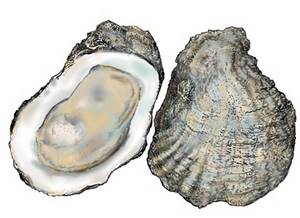
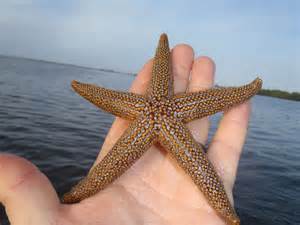
The Florida Orange Sea Star.
Photo: Florida Sea Grant
One of the more popular traditions this time of year is placing the star on top of the Christmas Tree. The star represents the Christmas Star which led the wise men to the manager. The stars that have been placed on Christmas Trees over the decades have come in all shapes and forms but gulf coast residents will use a starfish to both represent the Nativity and their connection to the sea.
Starfish, more correctly called sea stars, are one of the most recognized marine creatures in the world. Many have used it as a logo or their symbol of the sea. But what is a sea star actually? We know they live on the bottom and look like stars but what do they do? How do they function?
Sea stars are invertebrates in the Phylum Echinodermata. Echinoderms have radial symmetry; meaning they have a distinct top and bottom but no head or tail. You certainly know if it is upside down but you are not sure if it is facing you. They are the only invertebrates to have an internal skeleton; called a test. It is this skeleton we find in the curio shops and stores – and what we place on our tree. This skeleton produces tubercules or spines which extend into (and above) the skin – giving them the “spiny skin” for which they get their name – “echino” “derm”. Echinoderms have a series of tube like sacs underneath their bodies which they fill with water and use like suction cups to move and feed. Most have male and females and all produce planktonic larva.
Sea stars in particular are found worldwide and are more common in coastal waters. They come in a variety of colors and most have five arms – though one species has 40! Their mouth is on the underside of the body and lacks teeth. They have a pigment spot at the end of each arm that can detect light. Some sea stars are attracted to light, while others are repelled by it. Most sea stars are carnivorous, feeding on a variety of invertebrates including other echinoderms, and some are scavengers. Mollusk are a common prey, and – to the dismay of oyster farmers – oysters are an easy prey. The sea stars approach the bivalve, use their tube feet to open the two shells slightly, and insert their digestive tract inside the oyster. They attack the abductor muscle first, release the tension on the two shells, and then consume the rest of the animal. Sea stars like seawater, so oysters growing in the upper estuaries have fewer problems with these predators. Our local sea stars are good at detecting buried prey in our quartz sand and then digging them out. These animals are famous for their ability to regenerate their body parts. Oyster farmers trying to reduce this threat have been known to cut them and toss them back, only to have more sea stars later. However sexual reproduction is also very common. Most sea stars have 2 gonads per arm and can fertilize up to 2 million eggs in a spawning event. Spawning is usually in the spring and is triggered by chemicals in the water.
Though they are a classic icon for the ocean, and holiday decoration along the coast, these are fascinating animals in their own right. I wish all of you Happy Holidays and a joyous new year.
by Rick O'Connor | Nov 18, 2016
I was trying to think of a topic that could connect Thanksgiving and our marine environment. Like many others, when I think of Thanksgiving images of Pilgrims and native Americans come to mind. There is the turkey – and I wrote about “turkey fish” (another name for lionfish) last year. So I continued to think. One thing I do know about the native Americans who lived in this area, they liked oysters. We find middens (piles of oyster shell) in many places around the Gulf coast. These were discard piles from their consumption of the animal. Lots of these indicate, at least to me, that they enjoyed them… and we do also. Oysters are a part of Gulf coast culture and many have them with their Thanksgiving meal.

Oysters are one of the more popular shellfish along the panhandle.
Photo: FreshFromFlorida
Oysters are animals – meaning they lack cell walls and must consume their energy. The food of choice is plankton, sounds good doesn’t it! They possess two tubes called siphons which basically filter seawater. One brings water in, the other expels it. As the water enters their body they filter it for food and oxygen. As it leaves they expel waste and carbon dioxide. At times sand is sucked in and becomes lodged – they cannot expel. This “irritant” is covered by a material called nacre and becomes a pearl. Most are not round nor pretty but occasionally there are nice ones… Pacific oysters make better pearls. Amazingly a single oyster can filter up to 20 gallons of water in a day during the warmer months.
They are invertebrates and belong to the phylum Mollusca – meaning they have a soft body. Many invertebrates have a soft body, but what makes mollusks different is that they have bilateral symmetry (a head and tail end), a coleomic cavity (which allows organ development and increased size), and unique to them is a tissue called a mantle (which can secrete a calcium carbonate shell – and most mollusks do this).
Oysters are in the class Bivalvia – meaning they have two shells connected by a hinge at a point called the umbo. Other bivalves include the clams, scallops, and mussels. All of these are popular seafood products. Oysters differ from other bivalves in that they are cemented to a structure and cannot move around (sessile). Many mussels are sessile also but oysters differ in that they use calcium carbonate to literally cement themselves to the substrate, where mussels use a series of threads to do this. Cementing to the substrate means that they are picky about their habitat – it needs to have a hard substrate, sand will not do. We all know this. Place a piling, clay pot, board, or boat in the water… and oysters find it. Typically, they will attach to each other and form small clumps of oysters. These clumps form larger structures we call oyster reefs (or oyster bars) and this is what the commercial oysterman is looking for – and the recreational boater is trying to avoid!
So how do these oysters, who are sessile, find these habitats? Well, when it is time to reproduce oysters (which are hermaphroditic) release their gametes into the water. The sperm and egg that find each other form a planktonic larva called veliger. To increase the chance of finding each other the oysters release their gametes at the same time – a mass spawn. There are a variety of factors that trigger this but water temperature seems to be an important one. The veliger drift in the currents, developing into juveniles, and then settling out as small oysters called spat. If the currents have brought them to a good location, the spat settle on a hard substrate and the next generation begins. If not, they die. So literally millions of fertilized veliger are produced from individual adults. In many cases the suitable substrate are other oysters.
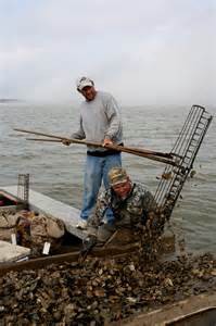
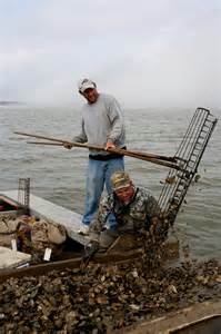
An oysterman uses his 11 foot long tongs to collect oysters from the bottom of Apalachicola Bay
Photo: Sea Grant
Today oysters seem to be in trouble. Large bars have disappeared due to dredging and over harvesting. Hurricanes certainly do damage to some and poor water quality alters their growth and development. Recently problems in Apalachicola include the lack of river water reaching the Gulf. The higher salinities created by the reduction of river flow have increased the number of oyster predators (starfish and snails) as well as diseases. All of that said, they are still a popular seafood item and enjoyed by many during the holidays. The cooler months mean less bacteria in the water and fewer problems consuming them raw. Cooked oysters have few problems… period.
I hope all have a Happy Thanksgiving and if you have not tried oyster dressing, maybe this year could be the year.
Happy Holidays.
by Rick O'Connor | Nov 4, 2016
October 31st not only reminds all that the ghost and goblins are out and about, but that the sea turtle nesting season is complete for another year. These federally protected animals typically begin nesting in late April and continue into the month of October – but there is almost always someone late to the party…
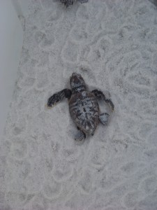
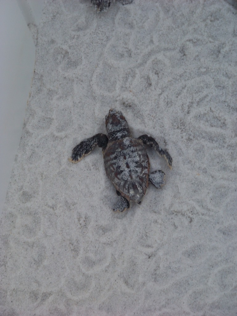
Young loggerhead sea turtle heading for the Gulf of Mexico. Photo: Molly O’Connor
What is neat about sea turtles is that their nesting beaches are usually always in the same general vicinity – meaning Pensacola Beach turtles are Pensacola Beach turtles… each year – and it is always great to see them come back. And this year, come back they did…
I have data collected by Gulf Islands National Seashore going back to 1996. The number of hatching nests on Escambia County beaches has ranged from a low of 8 (2005) to 52 in (2011); it has averaged around 25 hatching nests each year. This year was different…
This year, within the National Seashore, we had a total of 68 nests in Escambia County, 56 of which were on Santa Rosa Island. This is great news!
59 of the 68 nests hatched (87%) – which is also great news – typically only 10-20% of diamond back terrapin nests avoid predators. Most of the sea turtle nests lost this year were due to flooding from tropical storms in the Gulf. There was one nest between Pensacola Beach and Navarre Beach that was raided by a coyote and I am sure there were depredated nests all along the panhandle. But again, between 75-90% of terrapin nests are lost to raccoons, so the sea turtles had a good year. A recent report from southwest Florida states the same – a record nesting season for the Gulf coast.
However, there is still one problem lurking out there… disorientation…
Disorientation occurs when these successful hatchlings emerge from the sand and head the wrong way – typically towards artificial lights. Sea turtles are attracted to shortwave light (blues, greens, and white). Much of our artificial lighting falls into those wavelengths – and attract hatchlings. Since 1996 between 30 – 89% of Escambia County nests have shown signs of disorientation; the average is 49%. This year 63% of the Escambia County nests showed disorientation behavior. We are lucky that we have dedicated turtle watch volunteers to step in and correct these – but they cannot be there for all hatchings – we really need to alter our lighting. Longer wavelengths (yellow and red) do not attract most hatchlings, and therefore – are considered “turtle friendly”. Switching our outdoor lighting to these colors, reducing the illumination, lowering the elevation of the lighting, and shielding the light to direct it towards the ground all help reduce the disorientation problem.
Most panhandle counties have some form of coastal lighting ordinance to address this problem and problems with other wildlife. Ordinances vary some from county to county but the basics are the same; keep it long, keep it low, keep it shielded. Keep it long refers to the wavelength – usually less than 560nm (in the yellow/red portion of the spectrum). Keep low refers the height of the light fixture. If it can be placed at a lower height this is preferred, if not shielding the light source to direct down is required. We must also remember indoor lighting. This can be reduced by simply closing the curtains, moving lamps away from windows, or using tinted windows (if you are replacing yours). Who has to be wildlife friendly varies from county to county, so property owners should contact their Sea Grant Extension Agents if they have questions. There are funds available to help some complete this process and this to varies from county to county.
It’s been a great nesting season, let’s make it even better by reducing the amount of disoriented hatchlings.
by Rick O'Connor | Oct 14, 2016
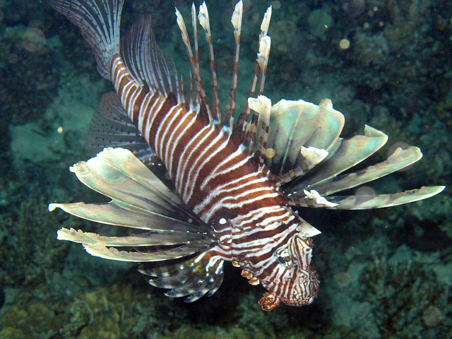
Most coastal residents along the panhandle are aware of the invasive lionfish and the potential impacts they could have on local fisheries and ecosystems. Since they were first detected in this area in 2010, there have been tournaments, workshops, and presentations, to help locals both learn about the animal and ways to control them. Existing non-profits have joined the fight and new non-profits have formed. In 2015 FWC and local organizations began hosting the Lionfish Removal and Awareness Day (LRAD) events. These are held the weekend after Mother’s Day. During the 2016 event in Pensacola, 8,089 lionfish were removed. In 2016 FWC introduced the Lionfish Challenge. This program began at the conclusion of the LRAD event and ran through September 30. Lionfish, or lionfish tails for those who wanted to keep the animal, could be turned into local collection sights and submitted for state awards and recognition – a Hall of Fame was created and King Lionfish. Over 16,000 lionfish were logged during this event. But has any of this helped? Are we getting control of this invasive species?

The Invasive Lionfish
Maybe… having conversations with local divers who work with researchers and remove for profit, it appears that the 2016 Pensacola LRAD may have made an impact. If you review the literature it states that to control an invasive species a minimum of 25% of the population should be removed annually. Others say you need to remove 75% and others still say it should be 25% each month. The problem here is that we do not know how many lionfish are actually out there. We know how many we are bringing in but is it enough?
One report, submitted by the non-profit REEF (from Key Largo) a few years ago, indicated they had removed about 70% of the lionfish in their area during one tournament. Based on this, the argument that tournaments are effective was supported. The recent Pensacola LRAD suggest the same. Local divers who remove lionfish with researchers, tourists, and as a commercial venture for themselves told us that their “sweet spots” – where high numbers of lionfish can be found – are not so sweet anymore. They are finding lionfish, but prior to LRAD it was not uncommon for some locations to have 50-100 lionfish around them. These same locations may yield 10-20 now. Though this information is anecdotal; it does suggest that these intensive tournaments may be having an effect on managing them. Of course a quantitative study is needed to confirm these observations, but it is encouraging none the less.
It is believed the tournaments alone will not solve the problem. With their high reproductive rates, continuous removals are needed. To encourage this divers can obtain a Saltwater Products License from FWC and sell what they catch. Some dive charters are now making it a tourism trip – “lionfish hunting”. As long as it marketed properly (as in they are not going to find tons of them – but will enjoy shooting a few) customers seem to be happy and are enjoying it. Of course they are still working on an effective trap so that non-divers can participate in control programs. It is also important to note that you should not get into a commercial venture on lionfish as your main source of income. To do so would lead to the argument “we do not want to get rid of lionfish because they are my livelihood”. The objective is to make them uncommon and reduce their impact on our marine resources.
Of course it will take time to know for sure just how effective the tournaments have been. Several will be meeting this week in Ocala to discuss the 2017 tournament season. I have written a longer update on the lionfish, which can be found at the Escambia County Extension Marine Science page.

by Rick O'Connor | Oct 7, 2016
It’s October and it feels great outside. Time to fire up the grill and enjoy football with your favorite local seafood. So what’s in peak season this month?
Clams – cultured Cedar Key clams are always in season and can be purchased at some local markets.
Oysters – they like the cooler months, there are a lot of ways to prepare them but we recommend cooking them
White Shrimp – other varieties of shrimp are not in peak season at this time but still available
Spiny Lobster – the Florida (Spiny) lobster is still in peak season but more available in south Florida
Stone Crab – we are JUST entering peak season for these guys, but like lobster – they are more common in south Florida.
Flounder – a local favorite this time of year – we are in peak of peak season – enjoy.
Mullet – This is a local favorite with those along the Florida panhandle.
Snapper – these are in peak season year round, but harvesting regulations reduce their abundance at the markets – so you will need to check.
Yellowfin Tuna – these have been in peak season for most of the summer; we are on the down side of it.
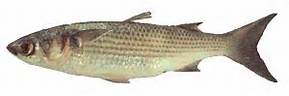
The Striped Mullet.
Image: LSU Extension
SPECIES OF THE MONTH…. MULLET
This is one of those – “either you love them or you hate them” fish. It is not news that these are not a popular food fish in much of the Gulf region. In some locations that have an oily/muddy taste that does not appeal to many. In those areas the fish is still abundant but is used as bait. They are an oily fish and are preferred fried or smoked when fresh. Mullet that sit too long develop a strong fishy taste. Mullet roe has its fans… and its enemies. Andrew Zimmern (Bizarre Foods) – did not care for them. They were very popular in the Orient for a period of time, and the local mullet population suffered for it, but that fad has waned.
We actually have 3 species found in the northern Gulf. There are two that frequent the estuaries – the white and the striped mullet. As the name implies, striped mullet does have body stripes as adults. They grow a little larger than the whites and are the one of choice for eating. At times though, the stripes on the striped mullet are hard to see. What then?… well – the white mullet has 9 soft rays on their anal fin, the striped have 8… have fun counting those. Another way is to look at the operculum (the bony plate covering the gills). On FRESH mullet, the white will have a gold spot here that is missing on the striped. The iris of the white mullet has a gold stripe that runs vertically… on the striped mullet the entire iris is gold.
Both species are what we call euryhaline – meaning that can tolerate a wide range of salinities. Striped mullet have been found several hundred miles inland and in Baffin Bay TX (where the salinities can reach 70 ppt). The white mullet prefer saltier habitats and do not frequent the upper estuaries and rivers. White mullet gather and spawn in the spring, striped mullet spawn in the fall – both spawn offshore on the continental shelf.
If you have not tried fried mullet, or smoked mullet dip, give a chance and see what you think. As always – enjoy our local seafood.