by Will Sheftall | Feb 4, 2017
I know you’ve seen the rear window decals that announce in stick figures just who could be riding in that SUV – mom, dad, kids of various sizes, and sometimes pets. A clever Florida variation uses big and little flip-flops and paw prints to paint the same picture.

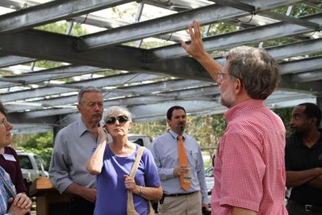
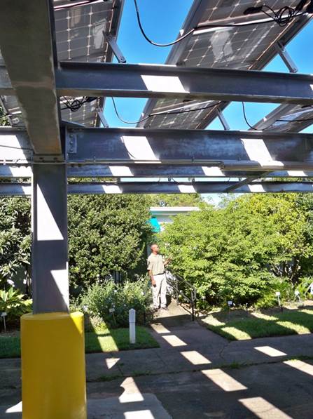
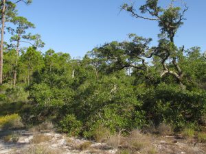
Shade pattern under Leon Extension Solar PV array
Photo: Will Sheftall
Flip-flops on the beach = footprints in the sand = carbon footprints on the Earth – at least, that’s how my mind processes this voluntary family accounting, posted for all to see. I wonder if I’m the only driver out there who studies a family’s flip-flop line-up at the stop light, and ponders our human family’s footprint on Earth’s climate and other natural resources.
My mind can imagine the line-up of flop-flops as belonging just to me. The two big pairs (representing mom and dad on the rear glass) evoke the four big lifestyle footprints I leave on this Earth. My lifestyle footprints are made by what I eat and how it was produced, the way I commute and travel, the buildings in which I live and work, and by what I wear and how it was made. Lifestyle footprints left on Earth’s resources are the water and energy I consume directly and indirectly, plus greenhouse gas emissions and wastes with my name on them.
Wouldn’t it be great if we could shrink the size and impact of one of those pairs of big flip-flops with an integrated solution, a twofer – reducing two of our lifestyle footprints by linking them together? There is an opportunity to do just that by combining solar PV (solar photovoltaics, better known as solar panels) with EVs (electric vehicles), to achieve an integrated reduction in the energy and carbon footprints of the two together. This opportunity is available to families for home application, and to agencies/ businesses for work application. It’s particularly exciting to envision the prospect of reducing commercial/ institutional CO2 footprints by combining net-metered solar PV on zero-net office buildings and warehouses, with EV’s for business errands and local deliveries.
Here’s some insight into how this might work. The office building in which I work is an award-winning, energy-exporting “Sustainable Demonstration Center” for Leon County government. It’s the UF IFAS Extension Center in Leon County, on Paul Russell Road. Constructed in 1961 and retrofitted with solar PV and geothermal HVAC in 2012, it was certified in 2014 by the New Buildings Institute as the third commercial/ institutional “zero-net energy” building in Florida. It has a grid-tied, net-metered system.
In the 4¾ years since our facility’s solar PV and geothermal energy systems went on-line in March 2012, thermostats in this County government building have been managed to obtain even greater energy conservation than was envisioned when planning the retrofit. As a result, our facility has exported a continually growing net surplus of energy to the City of Tallahassee Utilities grid – over and above covering its own energy needs. The amount of surplus energy donated since just August 2014 stands at 24,400 kWh.
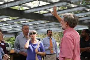
Visitors learn about the solar PV system from Extension Agent Will Sheftall.
Photo: Kendra Zamojski
To put this amount of energy into context, let’s consider what mechanical work 24,400 kWh of electrical energy can do. Here’s where the other half of the twofer opportunity comes in. On an accessible battery charge of 10.5 kWh, an extended range electric vehicle (EV) such as the Chevrolet Volt goes a summer/ winter average of 40 miles on stored battery power alone. 24,400 kWh would provide the equivalent of 2324 EV charges at 10.5 kWh per charge. That’s enough stored battery power for 92,960 electric miles!
Forget about this surplus from the past for a moment. Let’s compute the repeating annual surplus of clean solar energy produced by our PV array, and apply that to the opportunity for integrating building and travel footprints at Leon Extension. If we compute that our solar PV system has produced – over the past 2.3 years – an annual energy surplus equivalent to 997 EV charges per year, and if we project that Extension Agents could utilize County vehicles to travel 40 miles every work day for 245 work days/year, then we find there would be enough surplus energy produced every year to fully charge a fleet of four EVs at 10.5 kWh per charge/day, for use on the job every single work day.
This is exciting stuff! With more auto manufacturers offering new EV models with longer ranges and lower prices – and with extension through 2019 of the 30% federal tax credit for residential solar and the 30% federal Business Energy Investment Tax Credit (ITC) for business solar, the future of PV + EV looks bright. Perhaps this rosy outlook will encourage government offices and businesses around town to shrink those two big flip-flops down in size with a twofer, and ‘Leave a Lower Carbon Footprint Trace’ on the Earth.
by Will Sheftall | Oct 22, 2016
What do the Ochlockonee and Aucilla rivers have in common? Not much, it would seem, beyond the fact that both have headwaters in Georgia and flow through Florida to the Gulf of Mexico. These two rivers do share the distinction of being unusual, although they’re unusual in very different ways.

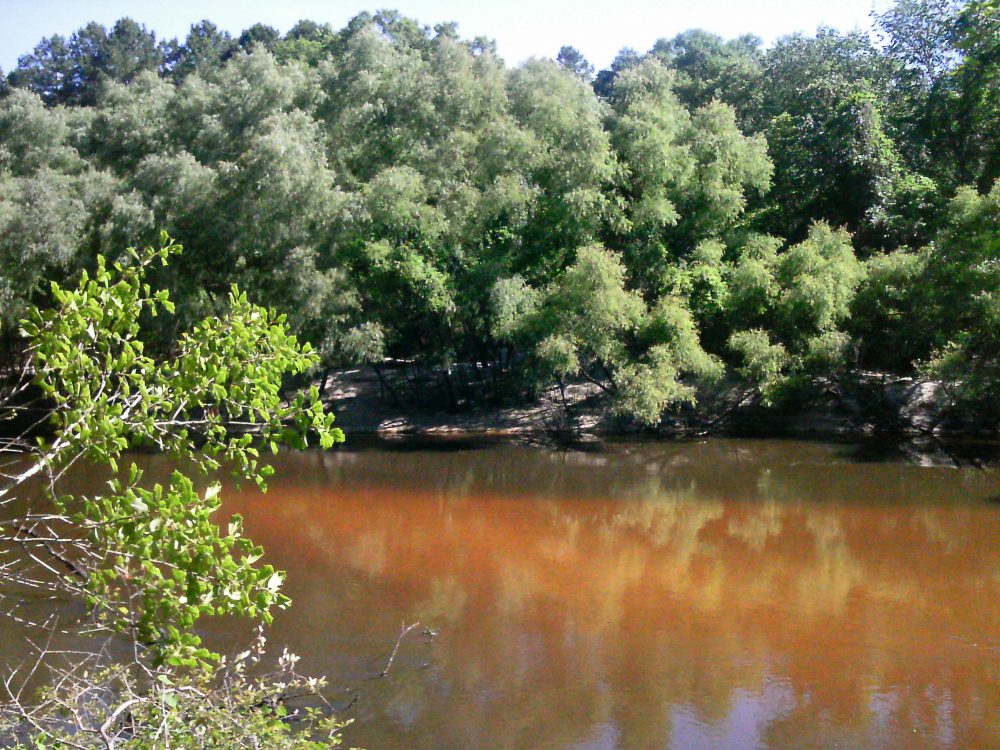
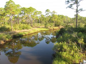
The Ochlockonee runs yellow-brown between Leon and Gadsden counties.
Photo: Rosalyn Kilcollins
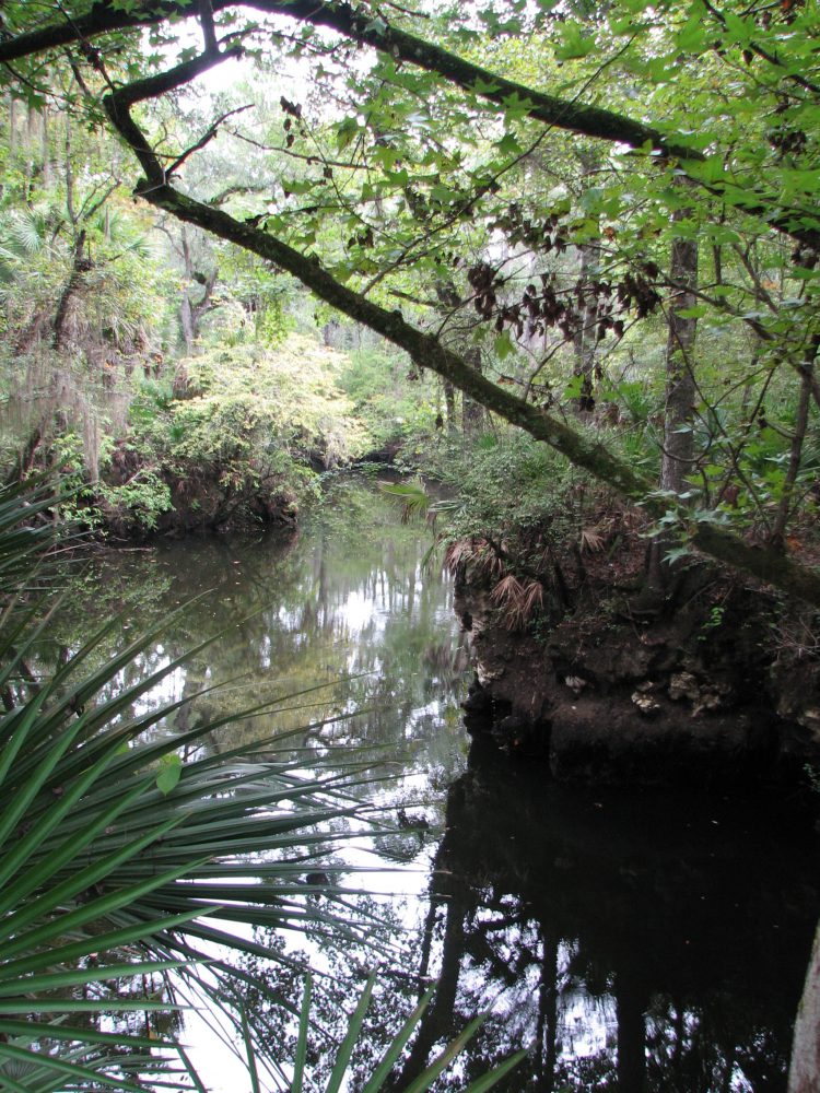
The Aucilla is a blackwater stream that goes underground and rises again before reaching the Gulf – a disappearing act that has fascinated early settlers, paddlers and naturalists alike. The Aucilla drains a smaller watershed, has lower flows, and features stream channel sediments that are predominantly sands and decaying organic material – the sediment signature of coastal plain streams with water stained dark brown, the color of tea.
In fact, blackwater rivers like the Aucilla get their color by steeping fallen and decaying tree leaves and twigs in slow-moving water, just as we steep shredded tea leaves or ground up coffee beans to dissolve their tannic acids into beverages. Blackwater steeping occurs in swamp forests up river tributaries, and in oxbow sloughs and other quiescent side channels of the downstream reaches. These form as a river “in flood” meanders and changes course within its floodplain.
The Ochlockonee is unusual among rivers originating in the Coastal Plain: in its upper reaches it has alluvial characteristics common to streams flowing from the Piedmont. The Ochlockonee drains soils rich in silt and clay that give it a yellowish brown color when those extremely fine sediments are suspended in the water. Land use activities such as paving roads and tilling farm fields elevate the fine sediment load when it rains by setting up larger volumes of fast-moving runoff. Higher rain runoff volume and velocity conspire to erode bare fields, construction sites and river banks, accentuating this river’s color.
But in spite of these differences, the Aucilla and Ochlockonee were once branches of the same river drainage system – the Paleo-Ochlockonee River. How could that possibly be? Well, sea level rise has drowned the lower reaches of this once mightier river, leaving its upper branches to empty into the Gulf separately, as smaller streams.
Sea level along Florida’s Big Bend coastline has been rising since the end of Earth’s last Ice Age – roughly 18,000 years ago. Our shallow, gently sloping underwater continental shelf was exposed during that last period of glaciation. As higher temperatures began melting ice sheets, not only did sea level rise, but more water evaporated and fell as rain. Southeastern rivers began carrying greater volumes of water.
Before annual rainfall reached today’s level during this prehistoric period of climate change, it is likely that the Aucilla from headwaters to Gulf was even more discontinuous than it is today. A current hypothesis is that the Aucilla was more like a string of sinkholes than a river, resembling its lower reaches today in a section known as the “Aucilla Sinks.”
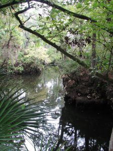
The Aucilla is a tannic river. Thus not as yellow-brown but rather more “blackwater”.
Photo: Jed Dillard
But the nature of the Paleo-Aucilla is just one part of this intriguing story. Using sophisticated technology, scientists have discovered clues about the ancient route of the entire Paleo-Ochlockonee as it meandered across that more expansive, exposed Continental shelf to the Gulf.
In their 2008 publication Aucilla River, Tall Timbers Research Station & Land Conservancy reports that, “Ten thousand years ago, the Florida coastline was located 90 miles away from its present position. Scientists have discovered a buried river drainage system indicating that approximately 15 to 20 miles offshore from today’s coast — and now underwater — the Aucilla River combined with the Ochlockonee, St. Marks, Pinhook, and Econfina rivers to create what archeologists call the Paleo-Ochlockonee, which flowed another 70 miles before reaching the Gulf.”
“Well, I’ll be!” you say, “That’s all pretty cool to think about.” That was my reaction, too, until I remembered that this process of sea level rise continues still, albeit at an accelerating rate thanks to global warming. Which means our rivers that join forces today before emptying into the Gulf will one day be separated. Sea level rise eventually will dismember the Wakulla from the St. Marks, and the Sopchoppy from the Ochlockonee – but thankfully not in our lifetime.
True, that’s happened before, but long before humans were on the scene. Today and for many tomorrows to come, I am grateful that we and our children and grandchildren have a wonderful watery world patiently awaiting our exploration, not far beyond the urban bustle of Tallahassee.
We’re far removed in time from the first humans beckoned by these rivers. A pause in the rate of sea level rise 7,000 years ago enabled development of coastal marsh ecosystems and more successful human habitation – supported in part by the bounty of fish and shellfish that depend on salt marshes. Farther upstream and still inland today, the sinks and lower reaches of the Aucilla hold archaeological sites about twice that old, that are integral to our evolving understanding of very early prehistoric human habitation on the Gulf Coastal Plain.
If you’re intrigued by the myriad of fascinating rivers and wetlands of the Big Bend region – this globally significant biodiversity hotspot we live in, and want to experience some of them first-hand, you’re in luck. Several Panhandle counties offer Florida Master Naturalist courses on Freshwater Systems (and also courses on Upland Habitats and Coastal Systems). You can check the current course offerings at: http://conference.ifas.ufl.edu/fmnp/
You can also explore on your own. There are many public lands in our region (and across the Panhandle) that provide good access.
Go see the Aucilla’s remaining string of sinks by hiking a short segment of the Florida Trail through the Aucilla Wildlife Management Area in Taylor County. And the Ochlockonee’s floodplain of sloughs and swamps, bluffs and terraces by taking trails that follow old two-track roads “down to the river” through the Lake Talquin State Forest in Leon County.
Get some maps of your public lands, get some tips on trails, get outside, and go exploring!
by Will Sheftall | Jul 22, 2016
Birds, migration, and climate change. Mix them all together and intuitively, we can imagine an ecological train wreck in the making. Many migratory bird species have seen their numbers plummet over the past half-century – due not to climate change, but to habitat loss in the places they frequent as part of their jet-setting life history.
Migrating songbirds forage for insects in coastal scrub-shrub habitat. Photo credit: Erik Lovestrand, UF IFAS Extension
Now come climate simulation models forecasting more change to come. It will impact the strands of places migrants use as critical habitat. Critical because severe alteration of even one place in a strand can doom a migratory species to failure at completing its life cycle. So what aspect of climate change is now threatening these places, on top of habitat alteration by humans?
It’s the change in weather patterns and sea level that we’re already beginning to see, as the impacts of global warming on Earth’s ocean-atmosphere linkage shift our planetary climate system into higher gear.
For migratory birds, the journey itself is the most perilous link in the life history chain. A migratory songbird is up to 15 times more likely to die in migration than on its wintering or breeding grounds. Headwinds and storms can deplete its energy reserves. Stopover sites for resting and feeding are critical. And here’s where the Big Bend region of Florida figures prominently in the life history of many migratory birds.
According to a study published in March of this year (Lester et al., 2016), field research on St. George Island documented 57 transient species foraging there as they were migrating through in the spring. That number compares favorably with the number of species known to use similar habitat at stopover sites in Mississippi (East Ship Island, Horn Island) as well as other central and western Gulf Coast sites in Alabama, Louisiana, and Texas.
We now can point to published empirical evidence that the eastern Gulf Coast migratory route is used by as many species as other Gulf routes to our west. This confirmation makes conservation of our Big Bend stopover habitat all the more relevant.
The authors of the study observed 711 birds using high-canopy forest and scrub/shrub habitat on St. George Island. Birds were seeking energy replenishment from protein-rich insects, which were reported to be more abundant in those habitats than on primary dunes, or in freshwater marshes and meadows.
So now we know that specific places on our barrier islands that still harbor forests and scrub/shrub habitat are crucial. On privately-owned island property, prime foraging habitat may have been reduced to low-elevation mixed forest that is often too low and wet to be turned into dense clusters of beach houses.
Coastal slash pine forest is vulnerable to sea level rise. Photo credit: Erik Lovestrand, UF IFAS Extension
Think tall slash pines and mid-story oaks slightly ‘upslope’ of marsh and transitional meadow, but ‘downslope’ of the dune scrub that is often cleared for development.
“OK, I get it,” you say. “It’s as if restaurant seating has been reduced and the kitchen staff laid off. Somebody’s not going to get served.” Destruction of forested habitat on our Gulf Coast islands has significantly reduced the amount of critical stopover habitat for birds weary from flying up to 620 miles across the Gulf of Mexico since their last bite to eat.
But why the concern with climate change on top of this familiar story of coastal habitat lost to development? After all, we have conservation lands with natural habitat on St. Vincent, Little St. George, the east end of St. George, and parts of Dog Island and Alligator Point. Shouldn’t these islands be able to withstand the impacts of stronger and/or more frequent coastal storms, and higher seas – and their forested habitat still serve the stopover needs of migratory birds?
Let’s revisit the “low and wet” part of the equation. Coastal forested habitat that’s low and wet – either protected by conservation or too wet to be developed – is in the bull’s eye of sea level rise (SLR), and sooner rather than later.
Using what Lester et al. chose as a reasonably probable scenario within the range of SLR projections for this century – 32 inches, these low-elevation forests and associated freshwater marshes would shrink in extent by 45% before 2100. It could be less; it could be more. Conditions projected for a future date are usually expressed as probable ranges. Experience has proven them too conservative in some cases.
The year 2100 seems far away…but that’s when our kids or grandkids can hope to be enjoying retirement at the beach house we left them. Hmm.
Scientists CAN project with certainty that by the time SLR reaches two meters (six and a half feet) – in whatever future year that occurs, 98% of “low and wet” forested habitat will have transitioned to marsh, and then eroded to tidal flat.
But before we spool out the coming years to a future reality of SLR that has radically changed the coastline we knew, let’s consider where the crucial forested habitat might remain on the barrier islands of the next generation’s retirement years:
It could remain in the higher-elevation yard of your beach house, perhaps, if you saved what remnant of native habitat you could when building it. Or if you landscaped with native trees and shrubs, to restore a patch of natural habitat in your beach house yard.
Migratory songbird stopover habitat saved during beach house construction. Photo credit: Erik Lovestrand, UF IFAS Extension
We’ve all thought that doing these things must be important, but only now is it becoming clear just how important. Who would have thought, “My beach house yard: the island’s last foraging refuge for migratory songbirds!” even in our most apocalyptic imagination?
But what about coastal mainland habitat?
The authors of the March 2016 St. George Island study conclude that, “…adjacent inland forested habitats must be protected from development to increase the probability that forested stopover habitat will be available for migrants despite SLR.” Jim Cox with Tall Timbers Research Station says that, “birds stop at the first point of land they find under unfavorable weather conditions, but also continue to migrate inland when conditions are favorable.”
Migratory birds are fortunate that the St. Marks Refuge protects inland forested habitat just beyond coastal marshland. A longer flight will take them to the leading edge of salty tidal reach. There the beautifully sinuous forest edge lies up against the marsh. This edge – this trailing edge of inland forest – will succumb to tomorrow’s rising seas, however.
Sea level rise will convert coastal slash pine forest to salt marsh. Photo credit: Erik Lovestrand, UF IFAS Extension
As the salt boundary moves relentlessly inland, it will run through the Refuge’s coastal buffer of public lands, and eventually knock on the surveyor’s boundary with private lands. All the while adding flight miles to the migration journey.
In today’s climate, migrants exhausted from bucking adverse weather conditions over the Gulf may not have enough energy to fly farther inland in search of forested foraging habitat. Will tomorrow’s climate make adverse Gulf weather more prevalent, and migration more arduous?
Spring migration weather over the Gulf can be expected to change as ocean waters warm and more water vapor is held in a warmer atmosphere. But HOW it will change is difficult to model. Any specific, predictable change to the variability of weather patterns during spring migration is therefore much less certain than SLR.
What will await exhausted and hungry migrants in future decades? Our community decisions about land use should consider this question. Likewise, our personal decisions about private land management – including beach house landscaping. And it’s not too early to begin.
Erik Lovestrand, Sea Grant Agent and County Extension Director in Franklin County, co-authored this article.
by Will Sheftall | Jan 19, 2016
The Florida Legislature has just convened for the 2016 session, and news from the capitol is already announcing a sweeping water bill on the fast-track to passage. Supporters are quoted as saying it would provide increased protection for certain key water resources in the State such as springs and the Everglades; opponents are quoted as saying that while it doesn’t undo current protections, neither does it go far enough to assure sustainable protection of water resources for Florida’s future.
Thus it seems our legislators and lobbyists are celebrating something that’s a little better than what we’ve got now, but isn’t good enough to get the job done. That doesn’t sound very reassuring. We need a realistic blueprint for how Florida’s ever-expanding population and robust agricultural industry that produces our food can continue to use Florida’s water resources without using them up. The only way that’s going to happen is for citizens concerned about their grandchildren’s future in Florida to become the voices that legislators ignore at the peril of their political future.
So how do you know what to think, and what to say, about the state of water resources where you live – in the Panhandle? Do you understand their current status and vulnerabilities? Threats to their near-term viability? Prospects for their long-term sustainability, complicated as they are by projections of amplified climate variability?
“Panhandle Outdoors LIVE!” is stepping it up a notch for 2016, to help you get a handle on these “need to know” issues that affect future sustainability. University of Florida Extension’s acclaimed “Panhandle Outdoors LIVE!” mode of exploring signature water resources with knowledgeable guides is not going away; it’s being expanded into “water school” events in 2016. We are adding expert presentations and discussion to the on-water, on-trail immersion learning adventures you’ve come to love.

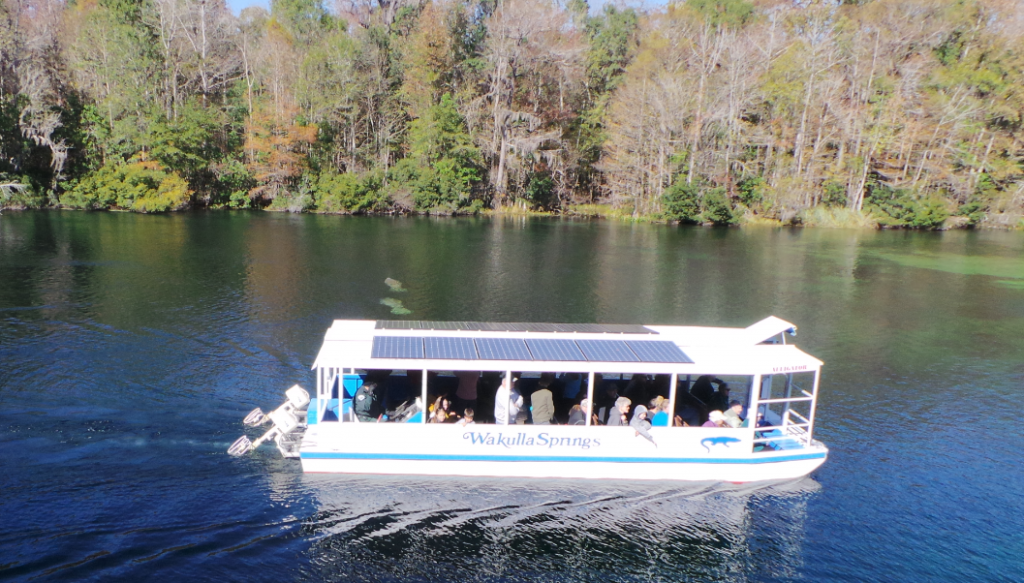
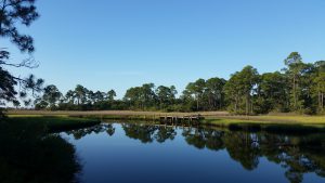
Daily river cruises on the Wakulla River are a great way to see manatees and other unique wildlife.
Photo: L. Scott Jackson
This year we’ll study four Panhandle water resources of regional significance – the Wakulla Springshed, St. Joe Bay, the Econfina Watershed, and Weeks Bay. Two are freshwater streams and their watersheds; two are bays. Two are in the eastern Panhandle; two are in the west (one even in Alabama). Two are being offered in the spring, the other two in the fall.
First up is the Panhandle Outdoors LIVE! – Wakulla Springshed School on March 1-2. It will base out of the magnificent “Old Florida” Wakulla Springs Lodge south of Tallahassee, and feature field trips to Leon Sinks Geological Area, Cherokee Sink and the Wakulla River – concluding with an optional paddle downriver from Wakulla Springs through a transition of ecosystems to historic Fort San Marcos de Apalachee, where the Wakulla joins the St. Marks River.
Next up, on April 4-5, is Panhandle Outdoors LIVE! – Weeks Bay Watershed School that will base out of the Episcopal Beckwith Camp and Retreat Center on Weeks Bay in Fairhope (Baldwin County) Alabama. This second watershed school will focus on the Weeks Bay National Estuarine Research Reserve, and feature a demonstration of oyster farming and a kayak paddle trip.
For more detailed information, and to register, for the Wakulla Springshed School visit – http://pol-2016-wakulla-springshed.eventbrite.com
For more information on the April overnight school to Weeks Bay National Estuarine Research Reserve contact Rick O’Connor at roc1@ufl.edu
For more information on the August day school on the Ecofina River contact Laura Tiu at lgtiu@ufl.edu
For more information on the September overnight school to St. Joe Bay contact Erik Lovestrand at elovestrand@ufl.edu
by Will Sheftall | Oct 26, 2014
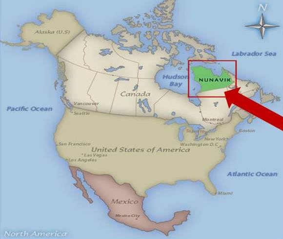
“Within the past five years, nine of the 14 villages in Nunavik in northernmost Quebec have had to install cooling systems at community ice hockey arenas to keep the rinks cold during winter.“
– The Arctic in the Anthropocene: Emerging Research Questions
Have you wondered how Florida’s wildlife conservation policy planners and habitat managers are responding to the new management challenge of predicted coastal habitat loss from sea level rise? And how that overlays on predicted habitat loss from a 50-year doubling of Florida’s human population? Are the model predictions for both trends reliable enough to give planners a platform for recommending actions to ensure a habitable Florida for wildlife and for our grandchildren?
It’s a daunting task. The latest reports released by the Intergovernmental Panel on Climate Change (IPCC) [ http://www.floridaclimateinstitute-uf.org/new-ipcc-report-climate-change-2014-impacts-adaptation-and-vulnerability/ ] serve to compress our “breathing room” of time to shift gears into planning for a “multiple-whammy” future – a future that just a decade ago, few natural resource managers knew they would soon need to anticipate. How do we juggle explosive population growth, accelerating freshwater depletion, and rapid climate change? What initiatives and efforts are underway?
To answer this question, let’s turn to Dr Thomas Eason, Director of the Division of Habitat and Species Conservation at the Florida Fish and Wildlife Conservation Commission (FWC). Dr Eason gave a talk on campus a year ago at the UF/IFAS conference, “Sustaining Economies and Natural Resources in a Changing World.” His 25-minute presentation, “Florida Fish and Wildlife – Adapting to a Changing World,” was recorded and posted at [ http://training.ifas.ufl.edu/FCI2013/Session4_Natural_Resources_Eason/main.htm ]
Eason noted that globally, climate change is predicted to result in the extinction of 10-40% of all wildlife species. FWC has generated vulnerability assessments for a first suite of rare and imperiled species, and some non-native invasive exotic species as well. Analysis has shown that for many non-native species in Florida, climate change will create new habitats, and they will expand their range, while imperiled species will more likely experience shrinkage of habitat that is already inadequate.
Eason noted that sea level rise will directly impact “tens of thousands” of acres of Florida habitat, and that consideration of secondary and tertiary impacts had yet to be addressed by habitat planners. Species adaptation planning has been undertaken in collaboration with GeoAdaptive (formerly MIT). Thus far, the initiative includes future habitat modeling for six South Florida species for which FWC has good data, under three different scenarios for sea level rise.
Eason concluded with the metaphor that society (and the natural resource conservation professions) are in a car he called “Business-as-Usual” (BAU) colliding in slow motion with a wall (future reality), and that even if we don’t know it yet, BAU is “already blowing up” because “humans have put things in motion that are not going to stop”(changes in technology, demographics, the economy and climate) that will make our world 50 years hence radically different from today’s world.