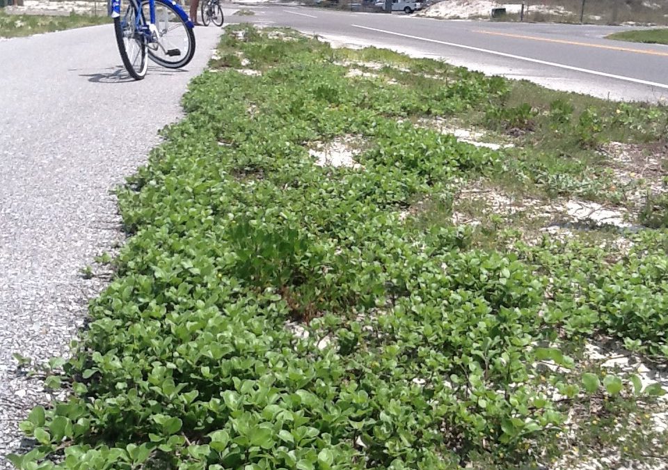
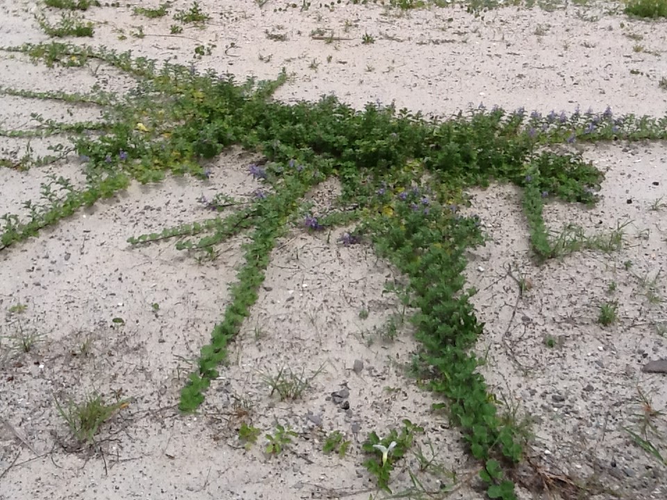
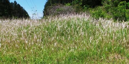
During the spring and early summer beach vitex is not in seed and this is a good time to remove this invasive plant from your property. This time of year, the leaves have their unique blueish-green coloration, allowing them to stand out from other plants on your lawn, and soon will also have their lavender flowers. It will appear as a series of vines running across the surface of the sand extending from a central taproot.
Beach vitex expands it’s woody rhizomes aggressively; it can actually grow over sidewalks.
Photo: Rick O’Connor
To remove it you begin at the end of the vine away from this central point and slowly, carefully pull it from the sand, cutting it into two-foot sections to make it easier to bag. The vine may have smaller secondary roots extending from it that you have to carefully remove as well. If you are lucky, and the plant is relatively small, you may be able to pull all of the vines and the taproot with no tools. But if the plant is more established, the texture of the vine may become more woody and you will need to use loppers (or clippers) to remove it. The same is the case with the taproot, you may have to use a shovel to get it completely out. If you cannot remove all of the taproot, you may have to spray the remaining section with an herbicide. All cuttings should be double bagged before disposing to reduce the chance of spreading by fragmentation.
Beach vitex (Vitex rotundifolia) was brought to the United States from Asia in the 1950s as an ornamental plant. In the 1980s the states of North and South Carolina used in dune restoration where it exposed its invasiveness. The plant quickly spread, killing off native vegetation, such as sea oats, and forming dense monocultures on the dune. As the plant matures it becomes more of a woody shrub and much more difficult to remove. The shrub blocks sunlight not allowing the germination of other plants and the vines can extended onto the beach impacting sea turtle nesting. We are not sure at this time how it may impact the beach mice found in Florida.
We are not sure when it was first introduced to Pensacola Beach, but it was first found in 2014. Since then, Florida Sea Grant has been able to identify 2 sites in Gulf Breeze, 1 at Ft. Pickens, 24 in Naval Live Oaks, and 57 sites on Pensacola Beach where the plant exists (or did exist). One Pensacola Beach, 54 of the 57 sites are east of Casino Beach. 22 of the 57 sites are on public lands, and with permission from the Santa Rosa Island Authority, Florida Sea Grant uses local volunteers to manage those. However, 35 are on private property and we hope those homeowners will take the initiative to remove the plant to help stop its spread.
If you have questions on identification or methods of management, contact Rick O’Connor at the Escambia County Extension Office – roc1@ufl.edu, (850-475-5230 ext.1111).
No one species has altered the land, sea, and sky – as well as decreased the overall biodiversity of the planet in such as short time as has Homo sapien. Since we have arrived on this planet we have slowly dispersed across all continents, oceans, and even the polar regions. In our wake we have changed the landscape. Altering forests and changing waterways. We have built communities and cities and, in recent years, increased the amount of waste we produce to impact the land, water, and even change the climate. Our planet has encountered major changes in climate and habitats before – but not at the rate it is currently happening, and many are not able to adapt fast enough. Wildlife over much of the planet has declined due to our activities – and barrier islands are not an exception.
Humans have found our barrier islands. Photo credit: Lydia Weaver
Humans first arrived in the Florida panhandle a little over 10,000 years ago. Most of them built communities along our riverways and deltas. As with much of coastal wildlife, barrier islands were difficult places to inhabit. There is little freshwater, selected game to hunt (though an abundance of seafood – which they did seek), intense heat in the summer and cold in the winter, and tropical storms – where there were few places to hide. It appears humans did visit the islands but did not settle there. The early European colonists tried, but unsuccessfully – they had to moved inland.
In the Pensacola Bay area, the first settlements that were successful were fortifications placed there by the U.S. Army to protect the communities where people lived. These were brick fortifications that held up well against the storms, all built with large cisterns to collect freshwater for the troops stationed there. Soldiers accessed them using ferries.
In the early 20th century locals from Pensacola built a casino at what is now Pensacola Beach. There were casinos, boxing, and food vendors for those who made the day trip by ferry to visit the location.
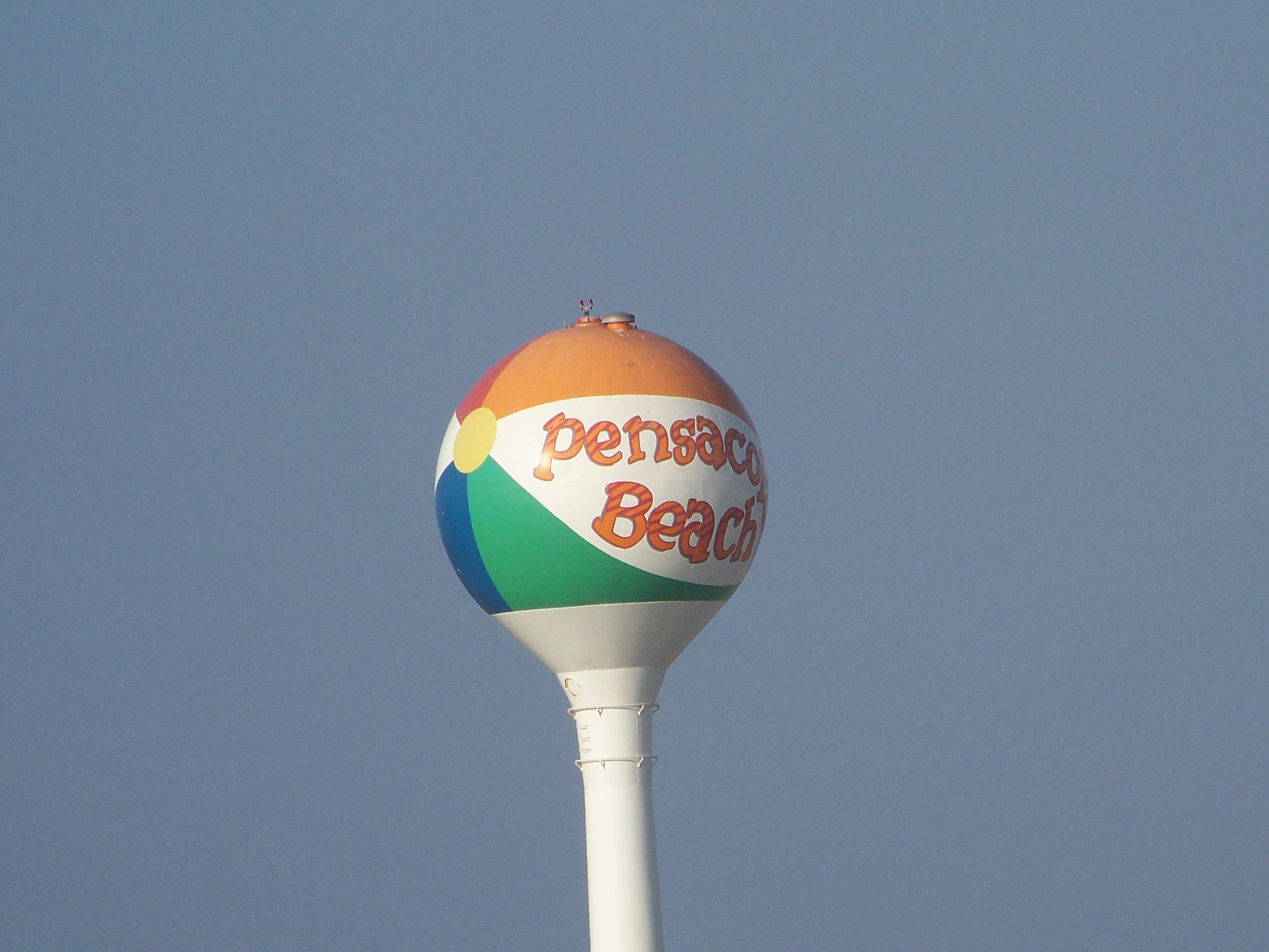
The famous “beach ball” of Pensacola Beach marks the spot where the old casino once stood.
Photo: Molly O’Connor
Much of this early human activity had little impact on the island wildlife. Humans were concentrated in specific locations and did not / could not venture very far from them. But when automobiles became more commonplace with people, bridges soon followed, and things did begin to change. More cars meant more people, and the need for roads. These roads bisected the dune system and altered how they naturally progressed with wind and waves. Not only did dune dynamics change but dunes began to disappear with the new homes and hotels that were built.
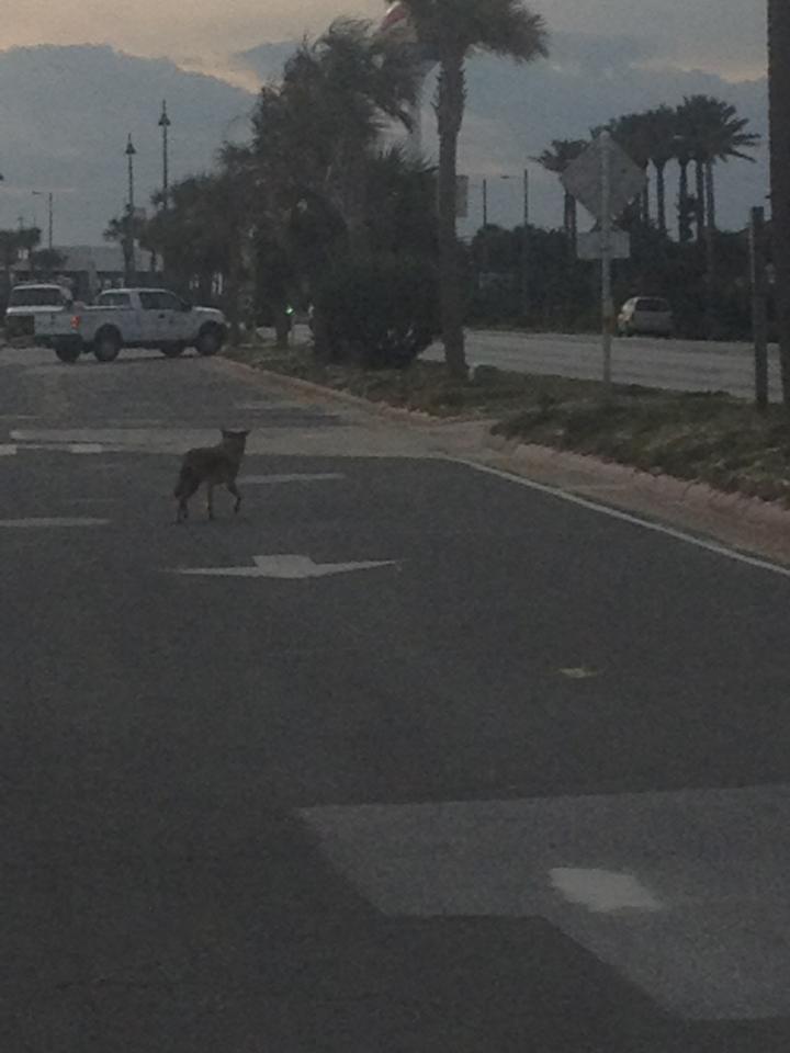
A coyote navigates the roads that are now on our islands.
Photo provided by Shelley Johnson.
Homes, cars, and roads made life for several island creatures tough. Most of the shorebirds using the islands as nesting areas lay their nests on the sand. The white/speckled eggs blend in well with the white sand and the warm sand helped incubate them. There were fewer predators on these beaches and so, protection of the chicks was achieved more by driving off any potential threat by “dive bombing” them. This did not work with humans, nor their cars. The roads became hazards for them, and small chicks were often hit by cars. Today some species are threatened and have been given federal protection.
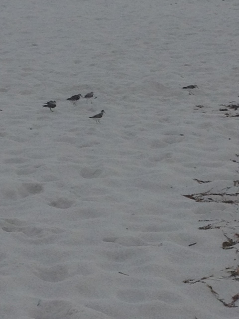
A variety of shorebirds utilize the sand as a nesting area.
Photo: Rick O’Connor
In recent years beaches houses have become true homes, with lawns and gardens. This alters the natural landscape even more. Along with the altering of the dune systems, this impacted many dune creatures like the beach mice. The species on Perdido Key is now considered endangered, and also has federal protection.
Additional housing, development, and roads led to additional needs in lighting in the evening. Many barrier island creatures need “dark skies,” but notably are the nesting sea turtles. In recent years 50-60% of sea turtle nests on our islands have had adults and hatchlings “disorient” towards the artificial lighting instead of the moon/star light that reflects off of the Gulf. This, along with other human related impacts like structures left in the sand at night, have caused a decline in these turtles and they too are now federal protected.
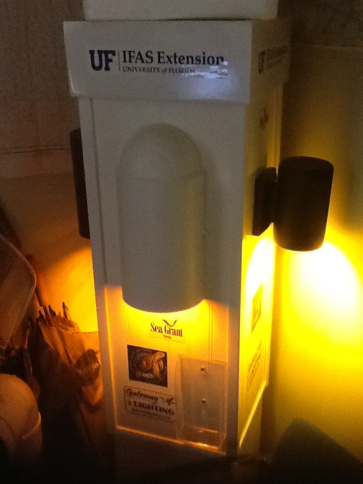
Turtle friendly lighting.
Photo: Rick O’Connor
You could not mention impacts by the human presence without mentioning solid waste – marine debris. Modern humans produce a wide variety of plastic products which we bring to the beach, and some of it ends up in the environment. Sea turtles, shore birds, and even manatees have been found either entangled in it or having ingested it. Much of this marine debris is problematic for the wildlife there.
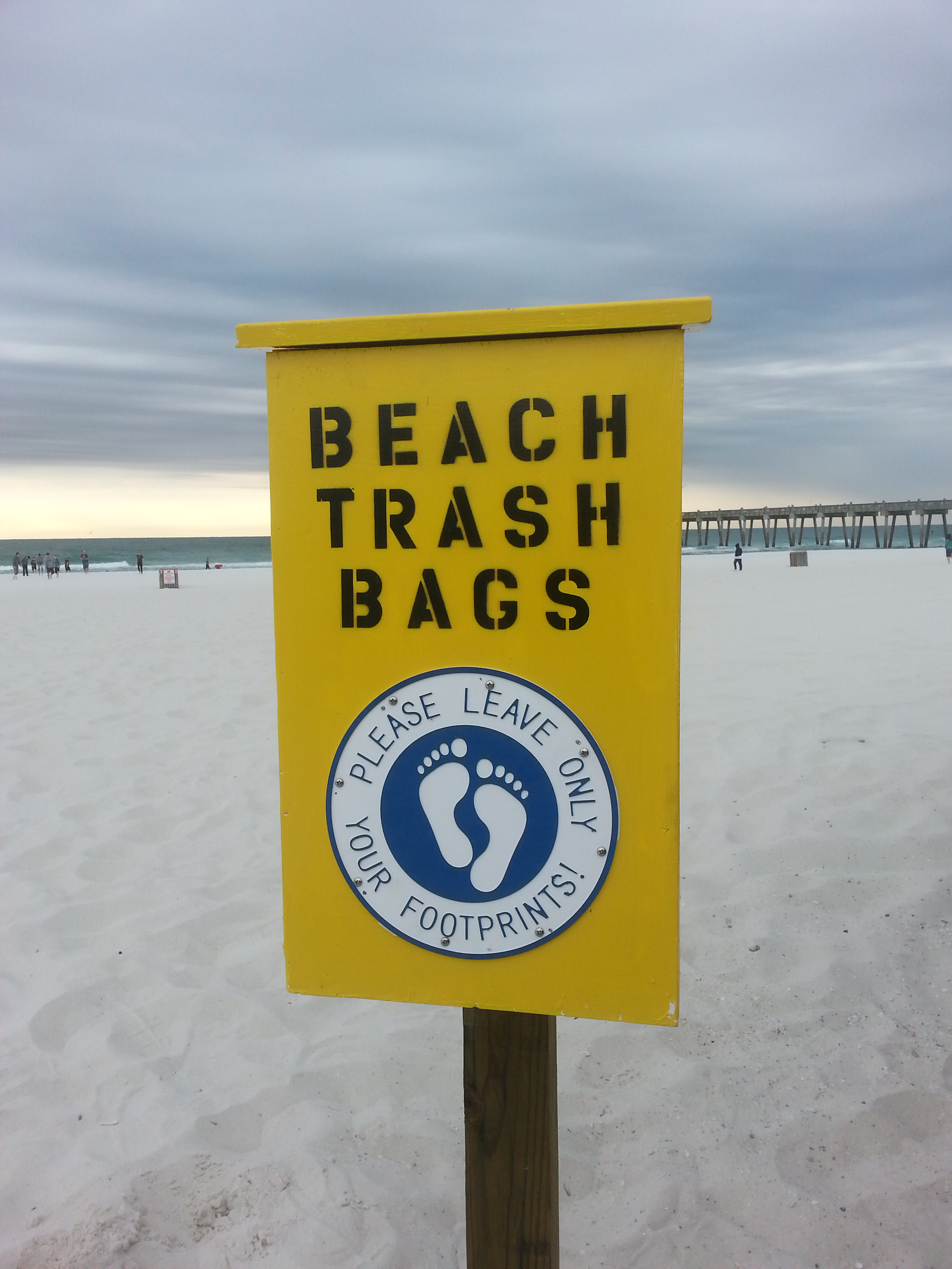
Boxes providing garbage bags and disposal.
Photo: Pensacola Beach Advocates
Recently there has been an increased issue of pet cats that are allowed to roam the island at night. These pets (some strays) are known for the impact they can have on small wildlife like birds.
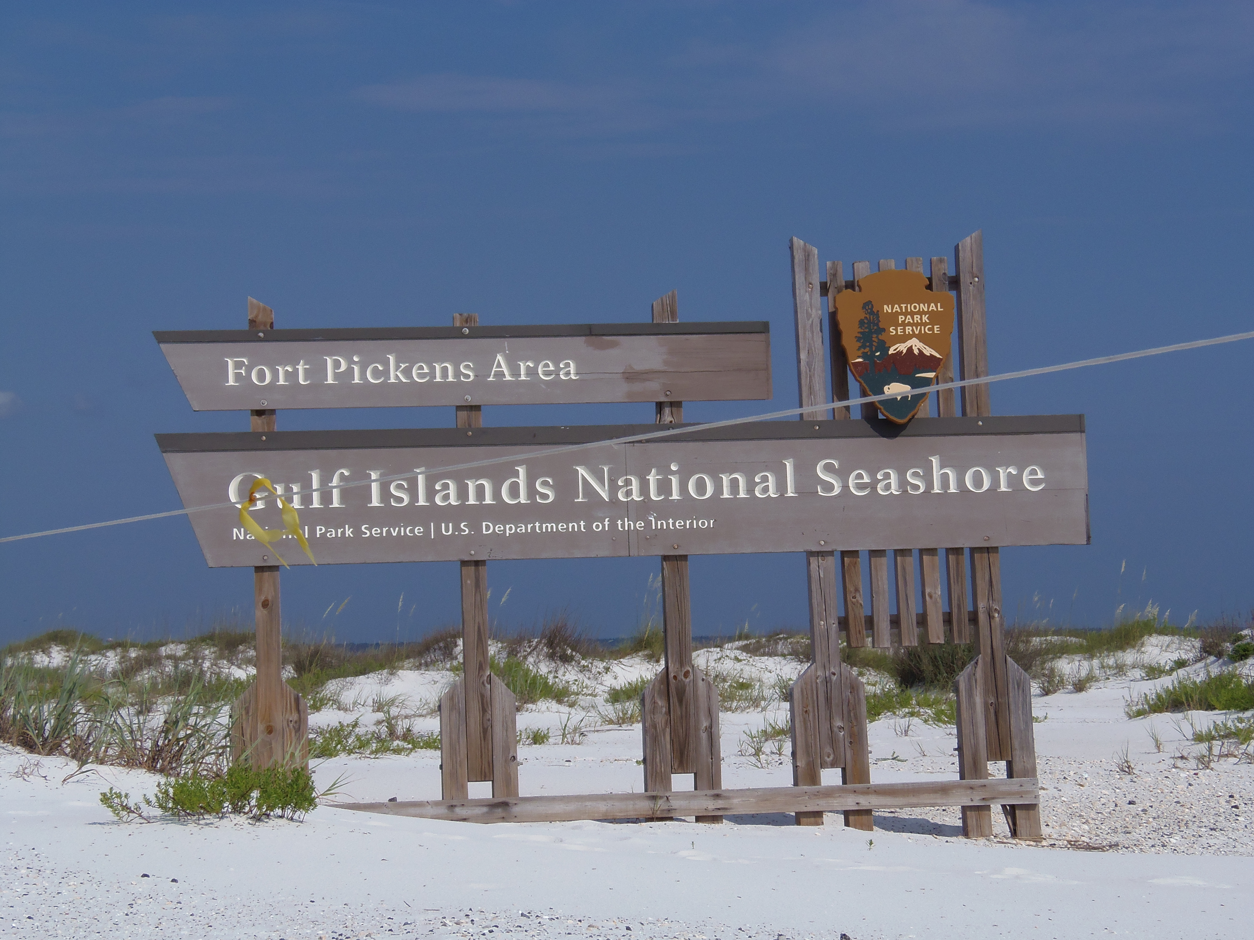
We were lucky in Escambia County during the 1970s to have the National Park purchase about 50% of the island as a National Seashore. This has provided a space for the island creatures and a great nature/cultural tourism destination.
Much of the west end of Santa Rosa Island has remained natural due to the presence of the Gulf Islands National Seashore.
Photo: Molly O’Connor
No one moves to the beach with the intent of harming wildlife, but our sense of changing things when we arrive – which we have been doing for some time – does impact them. The answer to this problem is to learn how to live, and develop, with the wildlife on the islands. The islands play a crucial role in protecting the mainland from storms and providing habitat for several unique species. Many of these species are beneficial to our lives by playing an ecological role in maintaining the island. It can be done.
I hope you have learned something new in this nine-part series on barrier island wildlife. If you have, please let me know by emailing roc1@ufl.edu. I hope you get a chance to explore our islands and maybe see some of these neat creatures.
The definition of an invasive species used by the University of Florida IFAS has three parts.
It is not native to the area.
Was brought to the area by humans; either intentionally or accidentally.
Is causing an environmental or economic problem, or somehow lower the community’s quality of life.
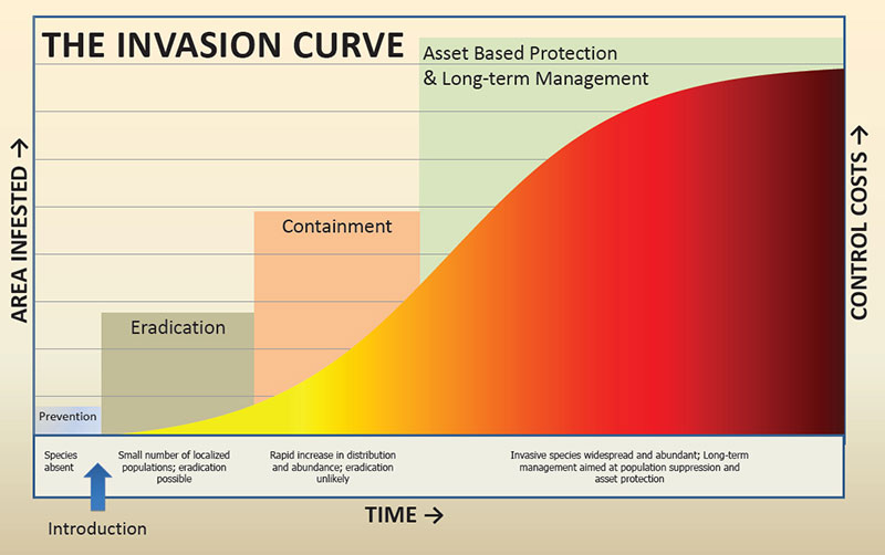
Florida is famous for its invasive species problems. Actually, every state in the country is battling this issue. In 2005 the estimated economic cost of invasive species in the United States was $137 billion annually. Looking at the Invasive Species Curve (below) you can see the most effective method of managing is to prevent them from coming in the first place. Easier said than done. International travel and commerce by plane and boat enters Florida every day, who knows what these are bringing with them. There is the legal trade, illegal trade, and the accidental hitchhiker. Though there are efforts in each state trying to prevent invasive species from entering, they do enter. Once they have arrived, resource managers move into what we call Early Detection Rapid Response (EDRR) in hopes of eradicating the species but at the very least containing them. It is a constant battle.
The Invasive Species Curve
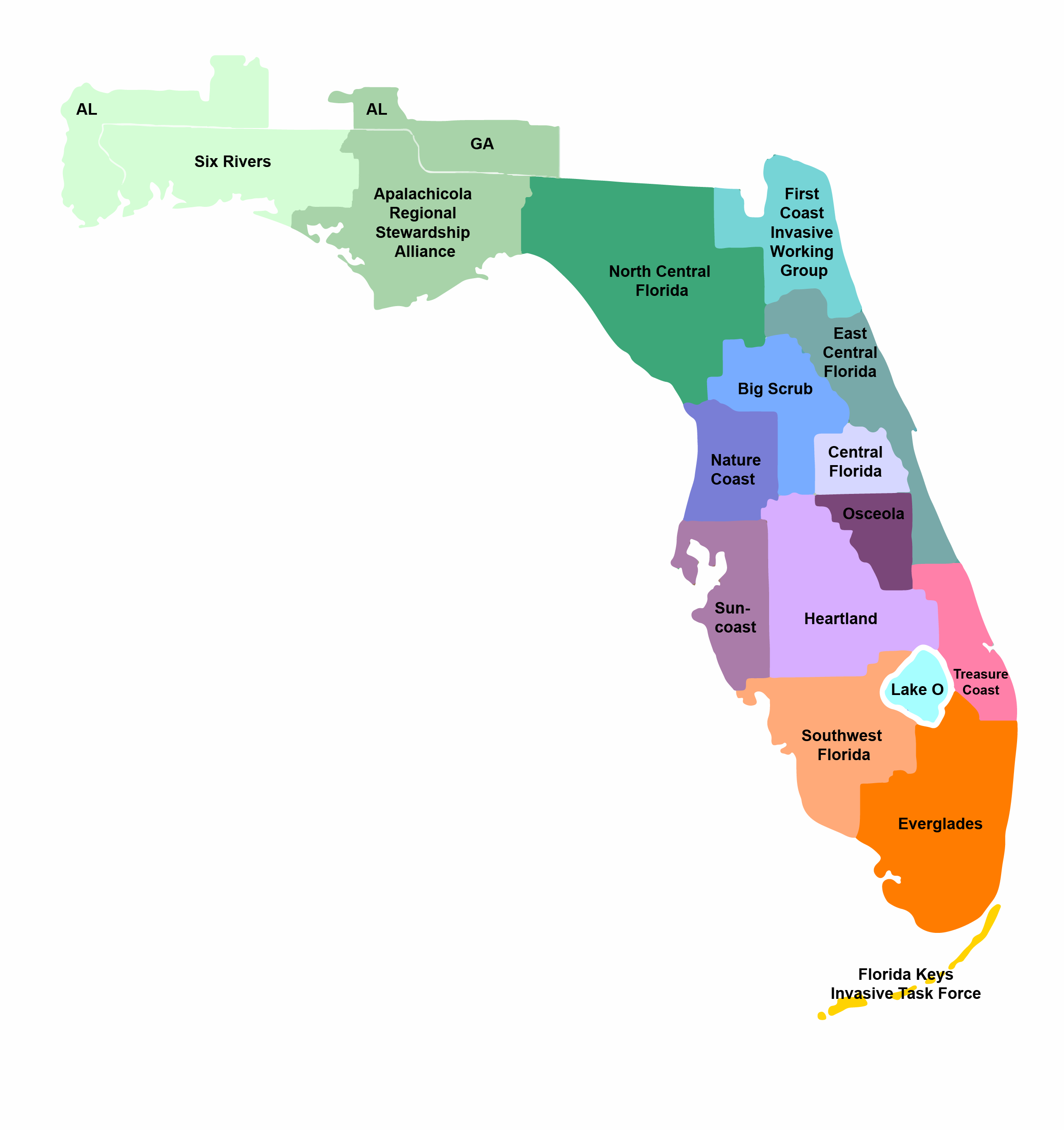
Though separated from the mainland, our barrier islands are not immune to this threat. Humans travel to and from our islands all year round; we live on many of them. With us comes non-native species we both intentionally and accidentally bring. Some of these become invasive and can threated the wildlife of our islands. The state is divided into 15 Cooperative Invasive Species Management Areas (CISMAs). The western panhandle is under the Six Rivers CISMA, the eastern panhandle is under the Apalachicola Regional Steward Alliance (ARSA). Both CISMAs have developed a EDRR list for their area. As a member of the Six Rivers CISMA, I helped developed ours and below are the species considered the biggest threats to our island wildlife.
Florida CISMAs
Beach vitex (Vitex rotundifolia)
Beach vitex is native to the Pacific coast of Asia and was intentionally brought to the United States as an ornamental/landscape plant. It does well in open sunny areas, dry soils, along the coast – perfect for barrier islands. In the 1980s it was used for dune restoration in the Carolinas and that is when its invasive nature was first seen. Like all invasive species, there are few predators and disease, and so reproductive success is high. The species multiples and spreads rapidly, basically uncontrolled. Beach vitex is allelopathic, meaning that it creates an environment that can kill nearby plants and thus take over that area; sea oats are one species this occurs with. Its impact on wildlife could include the loss of required habitat and food source. It appears to have already impacted sea turtle nesting in the Carolina’s, and that threat exist here as well. It could also impact the ecology of the listed beach mouse.
I was first made aware of the presence of this plant in the Pensacola area in 2013. It was discovered on the shoreline of a private property on the Gulf Breeze peninsula in Santa Rosa County. It was suspected to have come from nearby Santa Rosa Island. A survey of the Pensacola Beach area found 22 sites where the plant existed. One was quite large, covering about 70% of the property. The others were small individual plants. Some were part of a homeowner’s landscape; others were on public land. At the time, beach vitex was not listed as an invasive species in Florida. Today it is and has also been declared a state noxious weed. A database search indicates there are currently 118 records in the state of Florida found in six counties. Four of those counties are in the Florida panhandle and include Escambia, Santa Rosa, Okaloosa, and Franklin. More in-depth surveys of the coastal areas, and islands, of the remaining counties in the panhandle may find more records of the plant. There are active projects in the Escambia/Santa Rosa area to manage it.
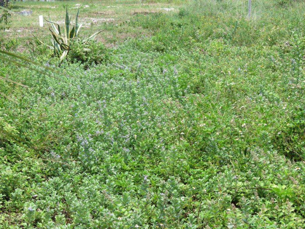
This yard on Pensacola Beach has become over run by vitex.
Cogongrass (Imperata cylindrica)
Cogongrass is native to Central and South America. It was brought to the United States accidentally through the Port of Mobile. It quickly spread across the landscape covering much of south Alabama, northwest Florida, and Mississippi. It now can be found in most of Alabama, a large portion of Mississippi, much of Louisiana and Georgia, some of the Carolina’s, Tennessee, and Virginia, and in every county of Florida. It is not only listed as an invasive species in these states, but also as one of the nation’s worst noxious weeds. It quickly covers pastureland. Being serrated and having silica with the grass blades it is not palatable to livestock, you can lose good pastureland when this invades. In natural areas and private timberland, it quickly covers the understory where it burns too hot during prescribed burning efforts and creates a situation where the valuable management method cannot be used. It is not a good plant to have on your land.
In 2020 we were made aware the plant was growing on Perdido Key in Escambia County. We are not sure how it got there but most likely from landscaping equipment that was not cleaned after working an inland area where the plant was present – this is a common method of dispersing the plant. Currently there are 456 records along the coast of the Florida panhandle. 404 of these are on coastal beaches and 52 are on our barrier islands. 44 of the island records are on Santa Rosa/Okaloosa Island, 4 at St. Andrew’s State Park, 1 on Cape Sand Blas, and 1 on St. Vincent Island.
What impact this plant will have on barrier island wildlife is not fully understood. But we know that it has not been beneficial within inland habitats and the potential of having a negative impact is there. Locally we will begin to survey for exact locations on the islands in Escambia County in 2023 and begin a management plan for those, as well as education outreach to reduce potential sources.
Cogongrass shown here with seedheads – more typically seen in the spring. If you suspect you have cogongrass in or around your food plots please consult your UF/IFAS Extension Agent how control options.
Photo credit: Mark Mauldin
Giant Salvinia (Salvinia molesta)
This is a new invasive species to our area and, until recently, was only found within our state in the panhandle. There are now 19 records found in 7 counties across the state; 10 of the 19 records are in Escambia County. This is a freshwater species that prefers quiet backwaters with high levels of nutrients. In our county the plant is concentrated in the upper arms of Bayou Chico. Though an estuary, Bayou Chico has relatively lower salinities than most of our other bayous – the plant is doing well there. The Florida Fish and Wildlife Conservation Commission (FWC) began management of this area a few years ago, but it is still there and seems to have spread to a nearby retention pond. The best guess as to method of dispersal were beavers seen moving back and forth between the water bodies. We plan to conduct surveys of other nearby retention ponds in 2023.
Though relatively new to Florida, it has had a large impact on the freshwater systems of Texas and Louisiana. I witnessed firsthand that impact at a lake near Shreveport LA where I was camping. This plant is a small one that floats on the surface of the water. It resembles duckweed but the leaves are larger. It had completely covered the surface of the lake and was kept out of the swimming area by using booms. There was no way to fish in the lake and moving through with a paddle craft would have been difficult. It is similar to water hyacinth covered waters. Though the swimming area was clear, the bottom had become “mucky”, and no one was swimming. All water recreation had stopped. The thick canopy covering the surface of the lake blocks sunlight so no submerged grasses can grow, the dead plant material decomposes and draws down the dissolved oxygen levels which could create fish kills.
Knowing this, FWC has a team focused on eradicating this plant from our state before such situations occur here. Though it will not reach our barrier islands by floating there (because of its dislike of salt water) if it DID reach any of the retention ponds near the homes, hotels, and condos, via landscaping equipment used on inland ponds, or some other method, it could be a real problem. And, as we have seen in Bayou Chico, wildlife could move it to the natural freshwater ponds on the island. We will begin surveys of all ponds on Perdido Key and Santa Rosa Island in 2023.
Giant Salvinia mats completely covering Bay County pond. This fast growing invasive can double in coverage every two weeks! Photo by L. Scott Jackson
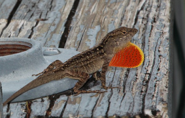
The Brown Anole (Anolis sageri)
This small lizard from Cuba (also known as the Cuban anole) has been in Florida for some time. It most likely reached our shores accidentally by hitchhiking on a boat. With south Florida’s tropical climate, the lizard did quite well and began to disperse north.
I first encountered the creature on campus in Gainesville. Along west side of Ben Hill Griffin Stadium (The Swamp) are trees that are enclosed in wooden boxes – a sort “raised bed” look. When I looked in one of them there were numerous brown lizards scattering everywhere. I checked the next tree and found the same. I found the same in each of the tree boxes along that road. I then began to see them at the rest stops on I-10 between Pensacola and Gainesville. You would step out of the car and as you walked you would see numerous small brown lizards scattering everywhere. The same ones as in Gainesville – the brown anole. I then received a call from a resident on Innerarity Point Road near Perdido Key. She wanted to know what type of lizard she was now seeing in her yard. They were small, brown, had white spots (diamond-like patterns) on their backs and were EVERYWHERE. I asked for a photo, and eventually made a site visit, they were the brown anole. I then began to receive calls from other residents near Perdido Key, then from Gulf Breeze, then from the East Hill area of Pensacola. All the same. The brown anole had made it to Pensacola. Interestingly, when I was speaking to a garden club about invasive species, and was discussing this one, residents from the north end of the county had no idea what I was talking about. They had never seen them. They apparently were invading near the coast. Between 2018-2021 I was conducting a cottonmouth survey on Perdido Key for a Homeowners Association who was encountering a lot of them. At first the brown anoles were not there. Then, during the second year of surveying, I began to see them. The brown anole had reached the barrier island.
It is believed that the mode of dispersal is the same as how they reached Florida in the first place – hitchhiking. Most likely on landscape plants that were grown in south Florida, transported up here, and delivered to you. It is not quite clear how they may impact barrier island wildlife. We know where they show up the native green anole (Anolis carolinensis) begins to decline. Some studies show that the green anoles move higher up in the trees and shrubs where needed resources are limited, and the population will most likely not survive. I have watched green and brown anoles battle it out on my front porch (yes – I have brown anoles in my yard also). I have seen green anoles win these battles – but they seem to have lost the war. I seldom find them anymore. What changes may happen to wildlife on the barrier islands we will learn with time. Though I have not personally seen one on Santa Rosa Island, I am sure they are there – and probably on your barrier island also.
Cuban Anole. Photo credit: Dr. Steve A. Johnson, University of Florida
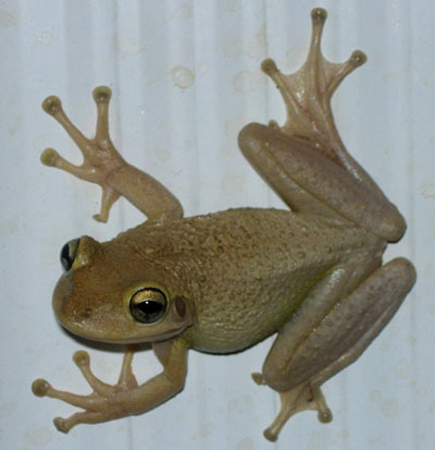
Cuban Treefrog (Osteopilus septentrionalis)
As with the brown anole, it is believed the Cuban treefrog reached our state hitchhiking on a boat. They too have been in the state for quite some time. But records in the Florida panhandle were non-existent. It was believed that the winters here too cold for them. But that appears to be changing.
I have had occasional calls about this frog over the last few years. In each case it was a single individual, hanging on their windows and glass doors, shortly after the homeowner had purchased new plants for landscaping. As with the brown anole, we believe this is a common method for spreading them. But as we mentioned, there was not much concern because our cold winters would keep this invasion at bay. Then there was a report of several Cuban treefrogs at a location on Tyndall AFB in Panama City. They appeared to be breeding and also appeared that they had overwintered. Dr. Steve Johnson (of the University of Florida) later confirmed this to be the first recorded breeding group in the panhandle. And the “love had begun to spread”. More accounts were being reported in the western panhandle. One community in Santa Rosa County found over 100 over the course of a year. Again, we think they are spreading with landscaping plants, or hitchhiking by other methods.
The issue with the animal is similar to that of the brown anole. It is much larger than our native treefrogs and likes to devour them. They are large enough to eat small native lizards and snakes as well. They produce a mild toxin in their skin that can irritate your eyes, nose, and even trigger asthmatic attacks. They have been found in toilets and are known to even plug the plumbing. They have also been found in electrical power boxes and have caused power outages. Overall, they are pain to deal with.
There are currently 28 records in the Florida panhandle. Though some have been found along the coast of our estuaries, there have been no reports on our barrier islands. Maybe we can educate the public on the hitchhiking issue and possibly keep them off the islands. We will be initiating a citizen science effort to monitor their locations on Pensacola Beach and Perdido Key beginning in 2023.
Cuban Treefrog.
Photo by: Dr. Steve Johnson
Invasive species, by definition, are a problem for barrier island wildlife. But another problem they are facing is the increase in humans. That will be the topic in part 9.
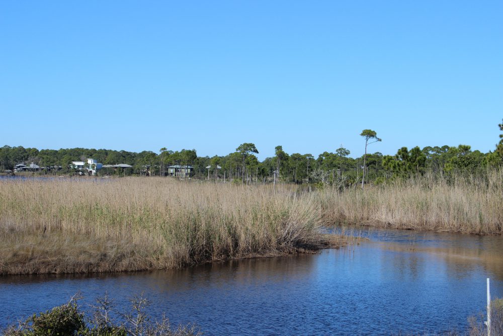
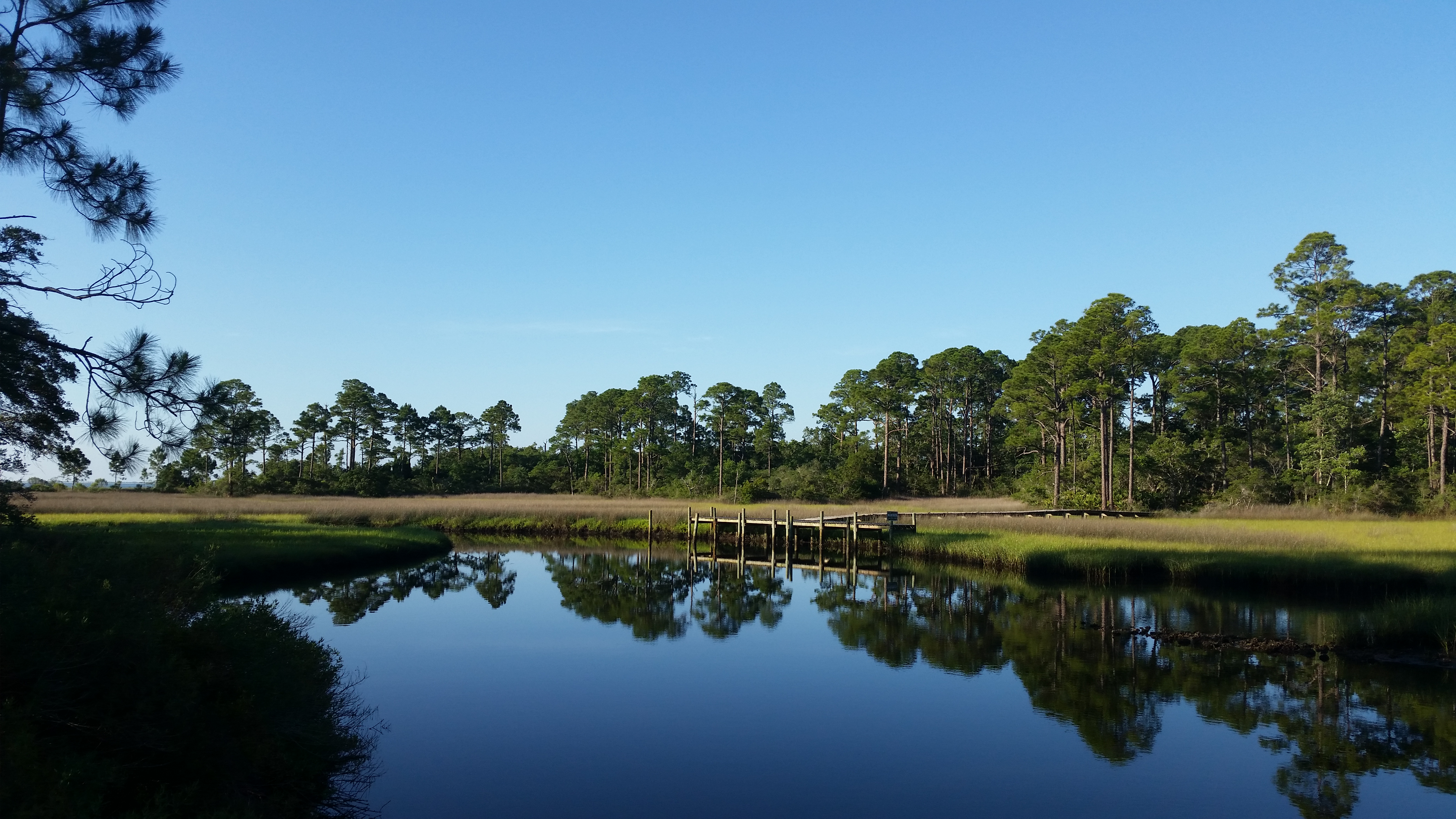
The land of the wet and muddy – that’s what lot of folks call the salt marsh. If you have ever experienced walking through one you know why they call it that. Salt marshes are wetlands that are dominated by grasses and are partially flooded with salt water during high tide; some portions of the marsh are still flooded at low tide. The grasses that grow there are halophytes (salt tolerant). Their diversity is low, but abundance is high.
Salt marshes are wetlands dominated by grass.
Photo: Molly O’Connor
Salt marshes grow on the protected side of the island – the bay side – and even there they do better in protective coves and inlets off of the main shoreline. They are not big fans of high wave energy. The grasses that live there are spaced in zones. Smooth cordgrass (Spartina) is more water and salt tolerant than black needlerush (Juncus) and is found along the marsh edge close to the shore of the bay itself. Black needlerush dominates the upper marsh closer to the maritime forest and tertiary dunes.
If you approach the marsh from the dune/forest side, you will encounter a dense field of needlerush. As you step into it you will experience soupy layers of black mud and detritus. Your feet sink and, if you do not have on secured shoes, you will lose them. You will get the odor of rotten eggs as you walk. This is hydrogen sulfide released by bacteria who are decomposing the leaf litter, and other organic matter, that is trapped and collected with the rising and falling tide. There is not a lot of wildlife in this area. The mud is deep, and the food sources are few. You will notice small white snails on the needlerush blades. These are marsh periwinkles. During high tide they move up the grass blades to avoid predators, at low tide they come down to feed on the organic material on the exposed mud.
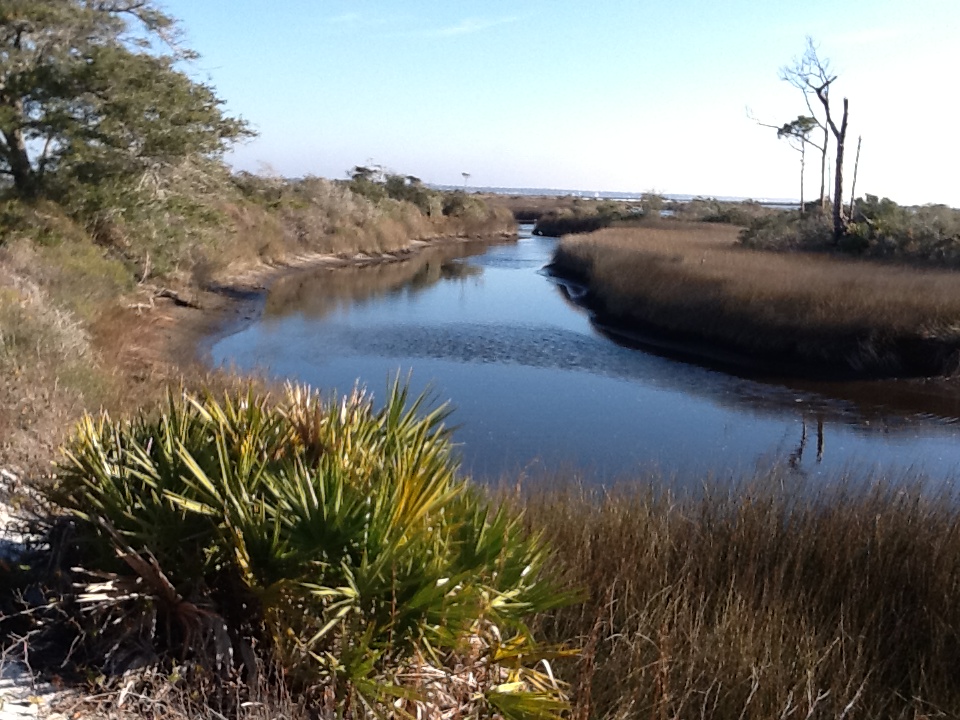
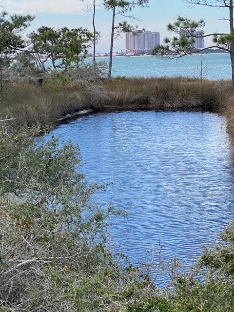
Eventually you find small creeks heading towards the bay. Here the water is murky and the bottom still very muddy. Scattered amongst the needlerush are mounds of high dry ground covered in salt bush (Baccharis) where some animals can move around much better. Raccoons frequently these small “islands” seeking the numerous fish and shellfish that can be found in the creeks. Ribbed mussels can be found attached the base of the needlerush and are a particular favorite of the raccoons. Juvenile blue crabs can be found scavenging food sources in the creeks, juvenile mullet is common, as are small killifish and mollies. These can provide food for wading birds like the great blue heron who has widespread feet that resist sinking in the mud and allow them to hunt. Sometimes oysters and crown conchs are found in the creeks. Oysters do not move and cement to each other forming clumps. They filter feed in the water column collecting organic material and improving the water clarity – unless you walk through and sir up the mud and silt.
A creek within a salt marsh on Santa Rosa Island. The water here is saline, particularly during high tide. Photo: Rick O’Connor
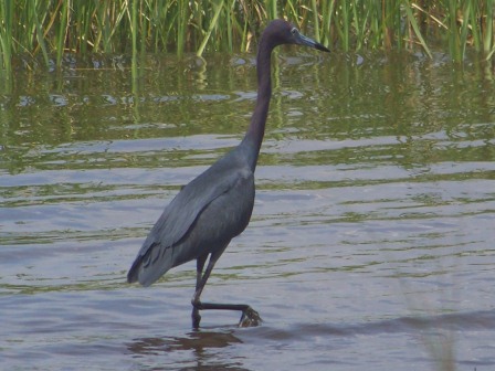
These small creeks become wider and deeper as you approach the bay. In places the bottom becomes sandier, and all of this allows other species to forage. The above mentioned are still present. Oyster clumps become more numerous because they are not covered by the silt of the upper marsh. In the sandier areas flounder can be found feeding on the small fish and shrimp that reside here. This part of the marsh can be an important nursery for many open estuarine species. A variety of shrimp are found here, crabs, and juvenile fish as well. With more sand it is easier for herons to walk and hunt.
This little blue heron is stalking prey in a Gulf coast salt marsh.
Photo: Molly O’Connor
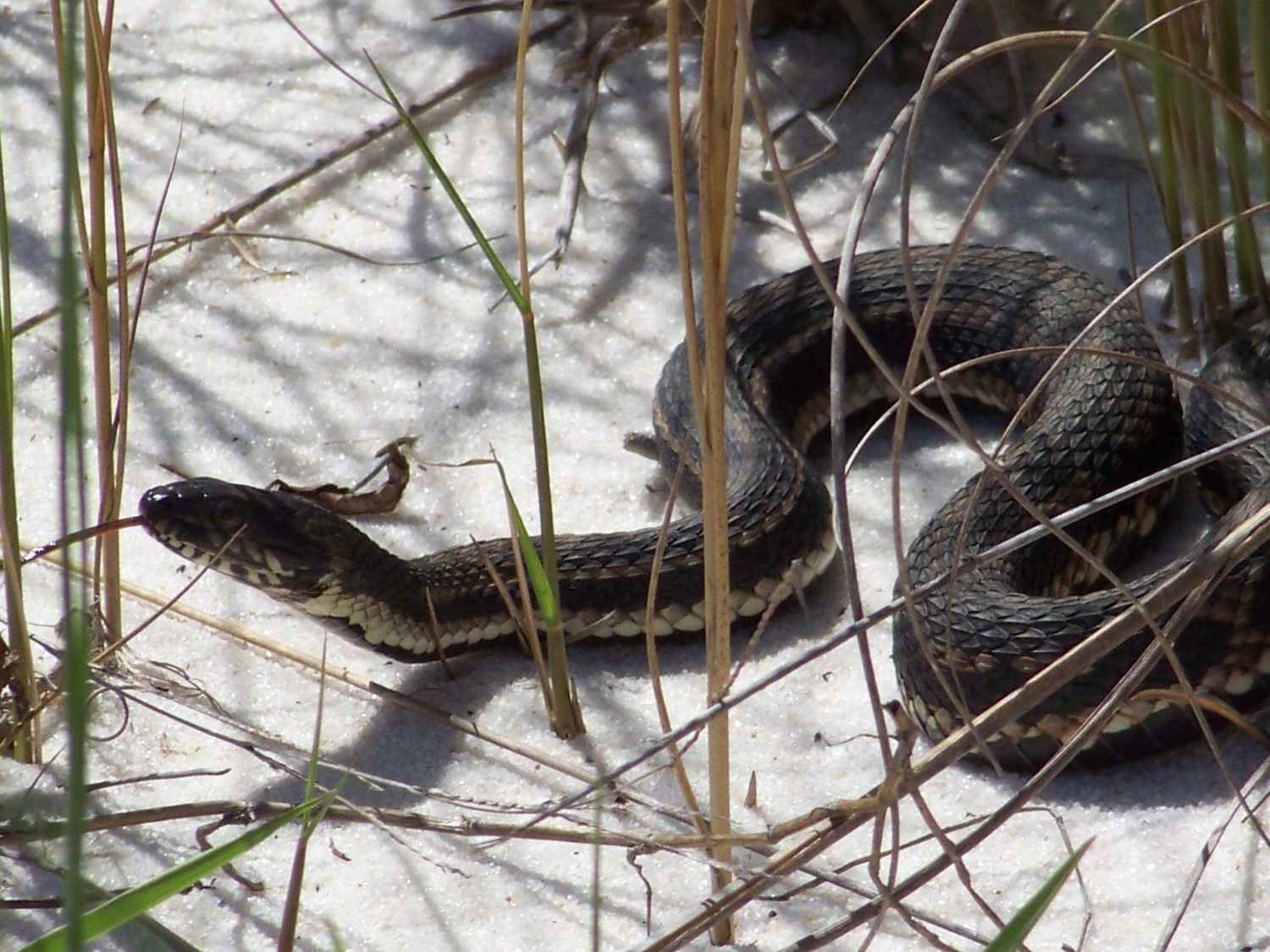
There are also a few reptiles found here. The American alligator can be found at times, but are more common in the open lagoons. The Gulf salt marsh snake (Nerodia) resides here. They are nocturnal and rarely seen. But in the spring when breeding is going on, they can be encountered during daylight hours. These are none venomous snakes.
The nonvenomous Gulf Salt marsh Snake.
Photo: Molly O’Connor
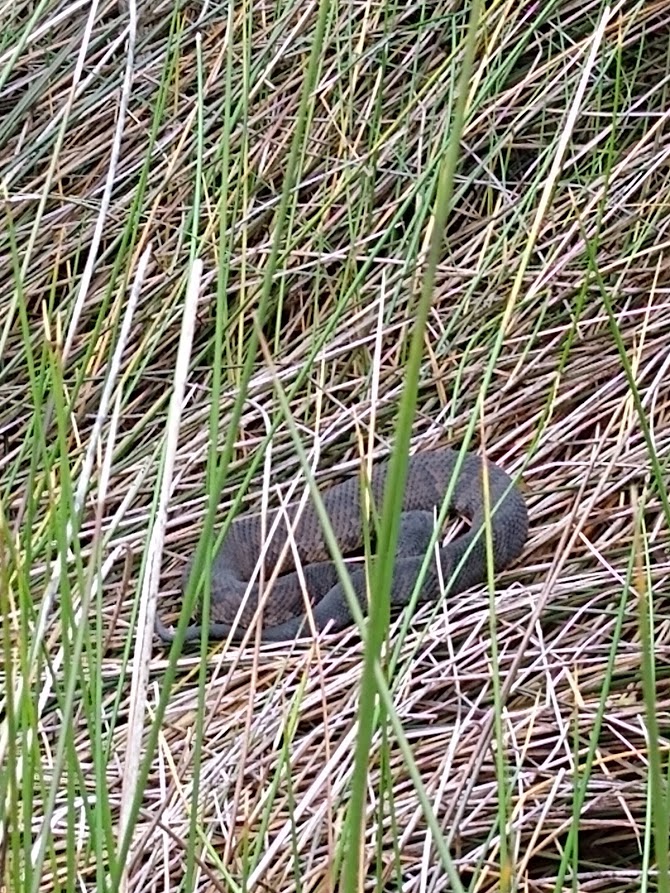
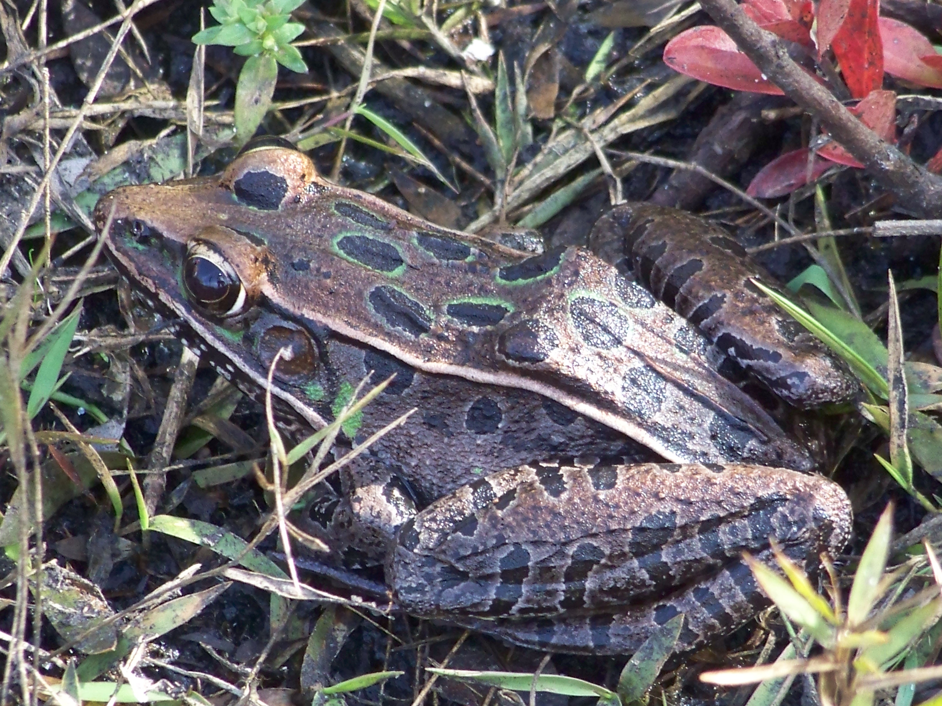
Interestingly the venomous cottonmouth can be found here. This is an interesting story. The cottonmouth is associated with freshwater. It is not surprising, or uncommon, to find them near the freshwater ponds we have discussed already. By they do not have the lachrymal glands found in sea turtles and terrapins that allow them to swallow seawater, excrete the salt through glands in their eyes, and use this as a freshwater source. It appears that the cottonmouth needs freshwater for drinking. Despite this they are being encountered more often in more saline areas. One barrier island near Cedar Key, Seahorse Key, supports a large population of cottonmouths. It has been stated there may be more per square meter there than anywhere in Florida – and there is no source of freshwater. Researchers from the University of Florida have found they drink from pools of freshwater that form after heavy rains and are very opportunistic when it comes to selecting prey – including other cottonmouths. The species found on Seahorse Key is Agkistrodon conanti (Florida Cottonmouth). The eastern cottonmouth (A. piscivorous) is the one most common in and around our freshwater systems. It would be interesting to determine which species is living on our barrier islands, and how they use the landscape. Though I have never seen them swimming in the larger creeks of the marsh, I have seen them basking along its edges many times. I am sure they use this saline environment.
This cottonmouth is basking in a salt marsh on Perdido Key.
Photo: Jen Aicher
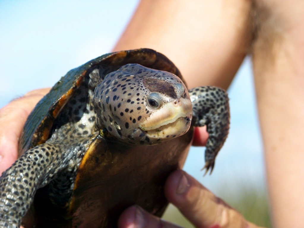
Another unique marsh reptile is the turtle known as the diamondback terrapin. This is the only resident estuarine turtle in the United States. They are related to the freshwater pond turtles people frequently see but prefer the more saline marshes of these islands. They feed primarily on shellfish and have a preference for the marsh periwinkle snails that climb the grass blades.
River otters have been found swimming in these large creeks searching for food. They seem to like both fish and shellfish. Redfish can be found in the wider deeper creeks. The mullet and flounder found here are larger.
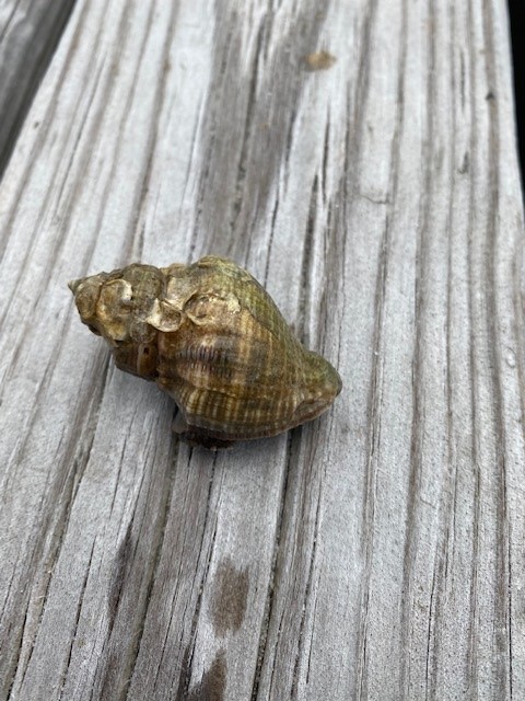
Hermit crabs are abundant here. These are crabs whose abdomens are not covered by shell. So, they must seek abandoned mollusk snails to “hide their rears”. They will select any shell but seem to prefer oyster drill and moon snail shells – possibly because they are more abundant. Oyster drills are snails who use their serrated tooth (a radula) for “drilling” into oyster and consuming them. Crown conchs and ribbed mussels are abundant here.
The shell of the oyster drill.
Photo: Rick O’Connor
These larger creeks sometimes feed directly into the bay, but sometimes they feed into a large open lagoon. These lagoons are full of fish. Mullet, redfish, flounder, stingrays, pinfish, and – if deep enough – even small sharks can be found here. Wading birds, like herons and egrets, and common along the shorelines and diving birds, like osprey and pelicans, are found here. The shoreline near the grasses still has small juvenile fish. The sandy beaches can support the hunting of raccoons and armadillo tracks are common. The alligator encounters I have had are more common here and we often see the heads of terrapins. The river otters I have seen here are usually along the edges.
The open lagoon of the salt marsh. Photo credit: Erik Lovestrand, UF IFAS
Another unique marsh critter is the fiddler crab. Though found throughout the marsh, they seem to be more abundant where there is more sand. Related to the ghost crab of the Gulf side, these small crabs dig burrows down to the water table. When the tide is high, they plug their burrows with mud and sand, then wait. When low tide arrives they emerge in the thousands to scavenge the shoreline for organic material in the sand – forming these round balls of sand as they are cleaning it that I call “coco-puffs”.
All large creeks and lagoons are connected to the open bays of the northern Gulf of Mexico where seagrass meadows form. As you walk the north shores of panhandle barrier islands you find sandy beaches often loosely covered by a variety of grasses. Walking inland you again return to either the tertiary dunes or maritime forest and may be another salt marsh. You have now experienced the primary habitats, and wildlife found within, on our barrier islands. But there are new concerns that could alter the ecology of these systems. One of those are invasive species. We will discuss this one in Part 8.
For some the forest is a scary place; for some it is a magical one; and for others it is spiritual. For wildlife it is a popular place. There are many places to shelter and plenty of food. Though the forest of our barrier islands is not as dense and dark as those of the west coast of the United States or the mountains of Appalachia, it is very wooded provides the same needs. Much of the wildlife on our islands call this part home. Even if they forge in the dunes, or on the beach, it is the forest where they reside.
Forest do exist on barrier islands and provide excellent habitat for a variety of wildlife.
Photo: Rick O’Connor
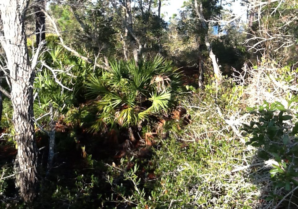
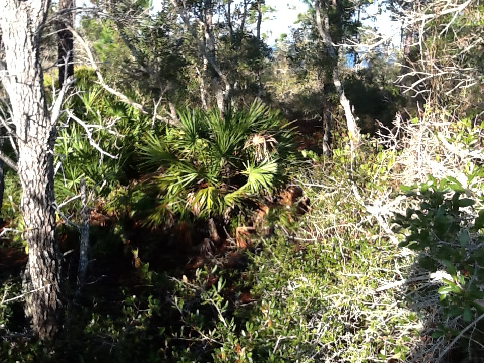
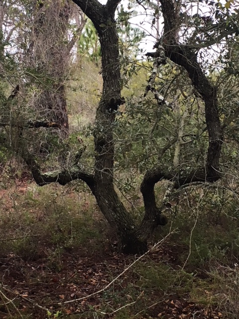
I have hiked through many of these maritime forests. The northern terminus of the Florida Trail ends at the edge of a maritime forest on Santa Rosa Island. They are populated by many of the same species of trees you would find in inland forest. Pine, Oak, and Magnolia are all common. In some locations they short and twist their branches in all sorts of patterns to avoid direct exposure to the salt spray from the Gulf. Those more protected from the spray by large dune fields grow quite tall. Small rolling dunes of quartz sand can still be found on the forest floor, as can palms and palmettos, holly trees, and species of shrubs found in the dune fields themselves. All of these provide good shelter, and some provide food. And, as with the American southwest, these xeric conditions support cactus – there are plenty of cactus in the tertiary dunes and maritime forest of our islands. Covered toed shows are recommended when hiking here.
Due to wind and salt spray many of the trees on barrier islands grow in interesting twists and bends.
Photo: Rick O’Connor
Though not common, within these forest there are small ponds of freshwater. Back in the 1950s there was an attempt to build a pompano hatchery within the forest of Santa Rosa Island. It failed because the water they chose to use (groundwater) was fresher than they thought it would be. Visiting the site today you will find the grow out ponds the farmers dug, full of freshwater. Near Ft. Pickens, on the west end of Santa Rosa Island, there are moats the soldiers dug to protect the fort from attack. These too are filled with freshwater. Between these and the naturally occurring ones, there is habitat for fish. The few samples I have collected over the years have yielded live bearers, like mosquitofish and mollies, and as well members of the killifish family. There could be others, but I have not explored this enough.
This holding pond was dug to grow pompano in an attempt to farm them at the beach. They provide habitat for both fish and wildlife on the islands.
Photo: Rick O’Connor
It is also good habitat to support frogs. I have seen southern leopard frogs and southern toads, and have heard spring peepers on the islands, but I have not conducted formal surveys to determine what other species might exist. There are inland species that do well in dry sandy soils, and you would think would do well on barrier islands if they could reach them. Maybe some have, again – we need to conduct a good survey. I am not aware of any salamanders on these islands, but again I have not looked for them.
The leopard frog are found on barrier islands.
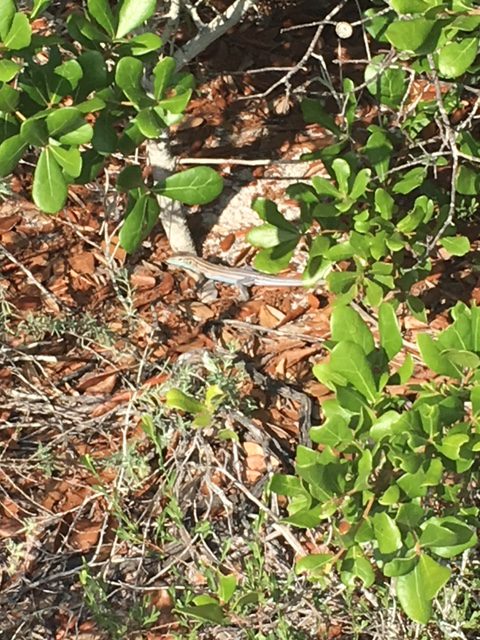
This is the realm of the reptile. As with the deserts of the American southwest, reptiles do very well in dry xeric conditions. Snakes and lizards seem to be the most abundant. Six lined racerunners are quite common, as are other species of skinks (if you look for them in hiding places). The horned toad was once common in all sandy environments in Pensacola, but then were only found on the barrier islands, and now are hard to find there. They are reported to still be found on Santa Rosa Island though I have not seen one in years. One of my colleagues recently saw one on Perdido Key – so, they are still around.
Six lined skinks are island lizards well adapted for the hot conditions out there.
Photo: Rick O’Connor
With snakes, the southern black racers and their close cousins the eastern coachwhip are very common here. I have found garter and ribbon snakes. I have seen the rough green snake in the maritime forest, usually in the branches. I have found both the cottonmouth and the banded water snake near the freshwater ponds. The denser forested areas have a lot of leaf litter on the floor that could support the eastern coral snake. Though I have never seen one on the islands, they could be – they are very secretive. One of the more common snakes – found in all habitats of the barrier island – is the eastern rattlesnake. Encounters with impressive creature is rare. Most of mine have been near the campgrounds and after hurricanes when the National Seashore was closed. When FIRST opened to the public, you see them, then they just disappear.
The eastern diamondback rattlesnake is a classic serpent found in xeric habitats like barrier islands and deserts. They can be found in all habitats on barrier islands.
Photo: Bob Pitts
Alligators are known to haunt the freshwater ponds; I have seen them near the old pompano hatchery. I have seen photographs of them crossing the island, swimming across the intracoastal waterway, and even swimming in the Gulf! But sightings and encounters on our end of the panhandle are rare.
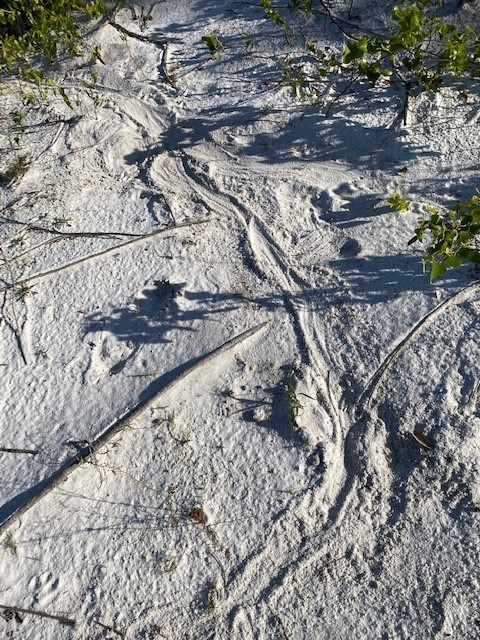
Though not in the maritime forest, these tracks show that the American alligator is a resident of many of our barrier islands.
Photo: Caroline Harper
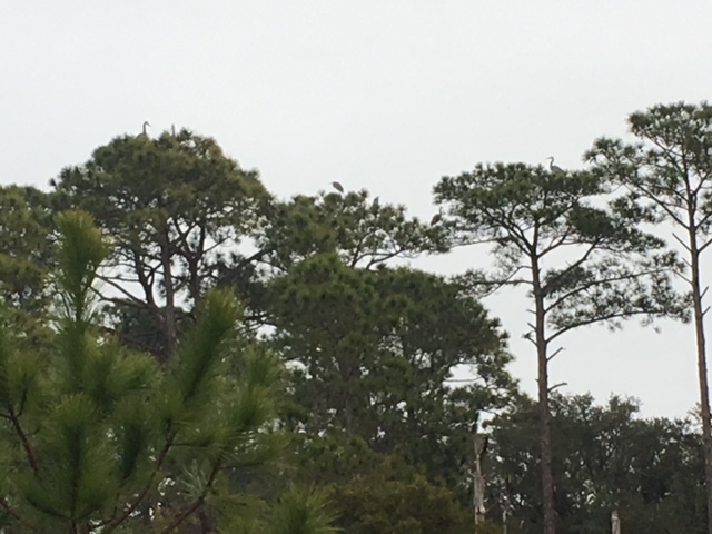
Birds have no problem reaching barrier islands and they love forested areas. There are numerous species of songbirds (passerines). I have seen cardinals, blue jays, mockingbirds, and more. Many of the ones you find just across the intracoastal can be found here. Mourning doves are quite common in all habitats. The forested areas are where you encounter the raptors. I have seen osprey, bald eagles, and great horned owls all nesting here. Within the pines of the forest, you often see the great blue herons nesting. There are other occasional aquatic birds visiting the ponds, including ducks. Duck hunting still happens in the winter on some islands. These barrier islands are popular places to conduct the Audubon Christmas Bird Counts.
If look closely, there are blue herons in the tops of these maritime pine trees.
Photo: Rick O’Connor
And there are plenty of mammals. Though more crepuscular or nocturnal, you often find their tracks in the sand in the morning, and occasional see them. Raccoons and armadillos are abundant, not only in the forested areas, but all island habitats. Skunks were once very common in the maritime forest. I remember days camping at Ft. Pickens when they would approach you eating lunch knowing you were going to leave you food and move away! We encountered them frequently while hiking and saw them inside some of the fortifications. Then… in 2004… Hurricane Ivan rolled over Santa Rosa Island. A study conducted by LSU suggested the entire west end of the island may have rolled over 300 feet north that night. Since then, I have not seen a skunk. They may still be out there, but I have not seen one.
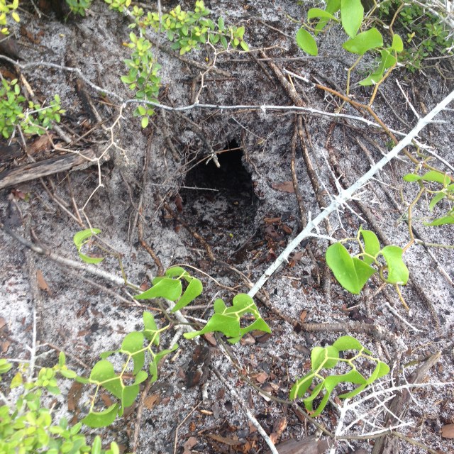
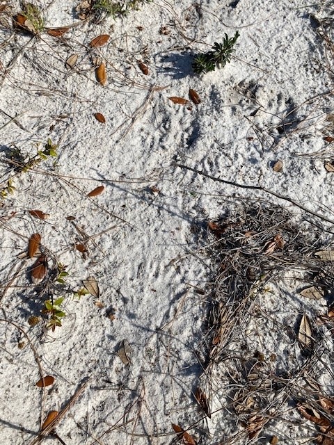
The round entrance of this burrow indicates that is the home of a mammal. most likely an armadillo, but there are others who burrow.
Photo: Rick O’Connor
In recent years there have been more encounters with river otters. They may have always been there but recently more tracks, and more encounters with live animals have occurred. There are squirrels and mice, out there. I have seen deer, fox, and coyotes on the islands. I have heard there are black bears. I have never seen one, nor their tracks, but know they have been encountered a lot recently in coastal Santa Rosa County and also know they are good swimmers. So, these reports could be true. I have looked for bats at dusk and have not seen them, but I am sure they are around. Especially near the forts and old live oak trees.
This is a ‘slide” made by otters using one of the old fish hatchery ponds. Otters are being seen more often by folks visiting the islands.
Time in these maritime forest will yield a lot of wildlife encounters. This is most likely the most diverse location on these islands. I would encourage you to dawn some good hiking boots (waterproof if you can), long pants (the green briar and cactus can be bad), a pair of binoculars, sun protection and water, and explore these amazing forests. Many of them within our state and national parks provide trails for easier access.
We have once last habitat to explore – and that would be the salt marsh. This will be Part 7.
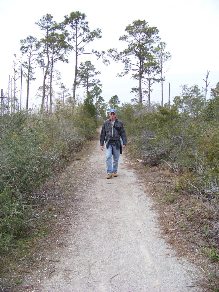
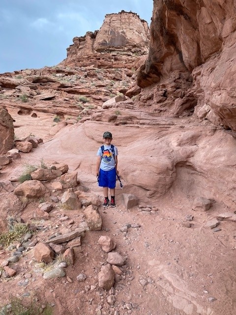
The author exploring the maritime forest of Santa Rosa Island.
The dune fields of the panhandle barrier islands closely mimic those in the deserts of the American southwest. With rolling hills of sand (less the rock), small, spaced shrubs, and high temperatures, hiking through the dunes reminds me a lot of hiking the deserts and canyonlands out west. Oh… and you rarely see wildlife in both habitats.
There are many forms of wildlife that are very hard to find in our area. But we continue to look.
Photo: Rick O’Connor
It’s not that wildlife is not present, its just not visible – and this would be true for both habitats. These systems are more open, easier to spot predator and prey, and the temperatures can be extreme. Because of this the animals who reside here are more active at other times of the day and we are made aware of their presence by tracks or scat.
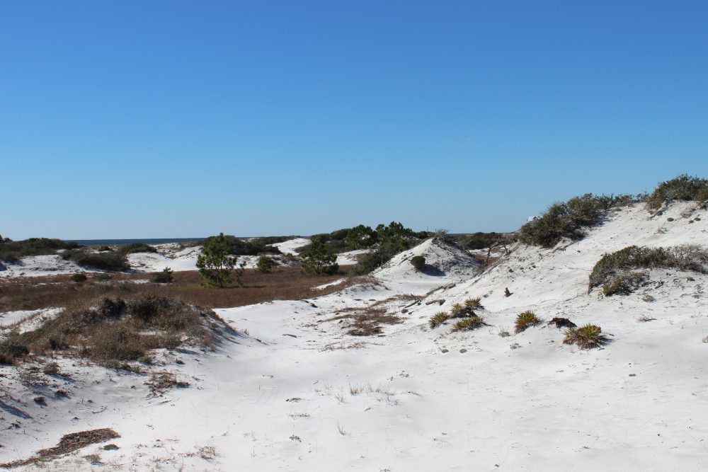
The deserts of the American southwest are ecologically very similar to the dunes of barrier islands.
Photo: Rick O’Connor
In winter the temperatures in the dunes can get quite cold. Being in the eastern United States, and closer to the warm Gulf Stream, the atmosphere is more humid and cold temperatures can feel even colder – the “wet chill” everyone talks about. Add to this the winds from the north and it can be an unpleasant place to be out and about. Many plants have gone dormant not producing flowers or seed, and the leaves falling or shriveled and brown, and you have very little for the herbivores to feed on. When conditions get like this animals have basically two options. One, hunker down, hibernate, wait for conditions and food sources to improve. Two, leave – head south where conditions are more favorable. Either way, you do not see them.
A hike in winter finds little wildlife moving about. Birds are common. Many have flown south from harsher conditions further north and seem to enjoy being out. Unless it is unseasonably cold and windy, you can find a variety of passerines (songbirds) in the shrubs and bushes of the dunes. Mockingbirds, cardinals, and mourning doves are often seen. There are also unique species more common up north. Christmas time is a popular time for the Audubon Society to conduct their annual bird counts. Many volunteers often log species rarely seen during other times of the year.
Mockingbirds are a common passerine bird found on barrier islands. Photo: Rick O’Connor
Mammals and reptiles are not often seen during the daylight hours. Some reptiles may come out of hiding on days when the sun is bright, and the winds are low. They will find a windbreak near a dune and bask in this sunlight for a few hours. But to see them it is one of those “being in the right place and the right time”. Daytime is short this time of year and they are not out very long.
Mammals being endothermic can move around. They are still not frequently seen during the daylight hours because the habitat is too open and hunting not as successful. There are also a lot of humans on our islands now and many mammals are not fond of this and tend to avoid us. So, they change their pattern of activity to other times. Animals who are active during the daytime are called diurnal. Those more active at night are nocturnal. And those more active at dawn and dusk are called crepuscular. During the winter many mammals tend to be more crepuscular because the evenings can get quite cold no matter what the wind is doing. If they are not hibernating, they will hunt for a few hours at dawn or dusk and then hide during the colder parts of the evenings.
During my winter hikes I have seen primarily passerine birds, and occasionally an armadillo. But most sign of wildlife are the tracks of raccoons, coyote, and deer.
Raccoons are common all over the island.
In the spring things change. The earth is tilting more towards the sun, the days become longer, and the cold air masses are met by the more tropical warmer ones. Temperatures and rainfall increases. These warmer temperatures are more inviting to daytime foraging for prey. Ephemeral ponds form due to the increase rainfall. Island amphibians take advantage of this mating and laying their non-cledoic eggs in these ponds while they are still there. The warmer evenings are filled the calls of male frogs seeking females. Mammals are still more crepuscular and nocturnal, but it is a time when your chances of spotting one during the daylight hours increases. Not only is the weather better but the food sources are as well, and some have been hibernating for a couple of months and are quite hungry. Hunger will push them to be more active during daylight than they would otherwise be. The same can be said for reptiles. Snakes moving during daylight is more common this time of year.
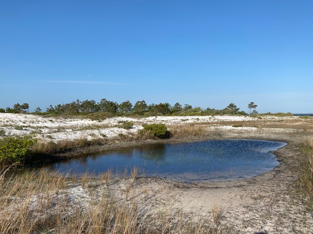
Freshwater ephemeral pond.
This is also the time for mating. It will be warm for several more months and this is the best time to raise a small offspring. The temperatures are warmer (conducive to growth), food more abundant (needed for growth), and you avoid the colder temperatures that can kill small animals. Males of these species are out and about seeking females and defending territories. Nesting birds of several varieties can be found building such nests. Turtles and snakes are breeding and seeking good locations to lay their eggs. With all of this comes more activity and more encounters by human hikers.
Let’s not forget the insects. Actually, you can find these creatures at all times of the day in all seasons. Insects are one of the most resilient groups of animals on the planet, and their high diversity – even on barrier islands – supports this. In the spring when the rains come and the ephemeral ponds are available, insects begin to breed and fill the skies. Spring is a very active time in the dunes.
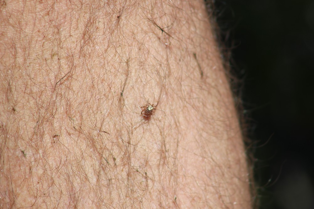
This tick was a hitchhiker on our trip through the dunes.
Photo: Molly O’Connor
Summer brings the heat – particularly late summer. Like the deserts of the southwest, temperatures can rise above 100°F and it is not the best time to be out and about. Much of the wildlife becomes more crepuscular or nocturnal. I have noticed when doing snake surveys, that the snakes may be moving at dawn but by 8:00-9:00am, when you begin to feel the heat of the day, you find no more. They have moved to the shade or a burrow somewhere. BUT the lizards begin to move. Lizards are a popular food for snakes, and it makes sense they would be more active when snakes are not. However, the sand is hot, and birds are also predators. So, lizards, like the six lined skink (Aspidoscelis), move VERY fast across the hot sand from one bush to another. I even notice the passerine birds becoming less common as the heat increases – it is hot out there. Interestingly human activity seems to increase when the temperatures are at their highest. We tend to sleep later than most animals this time of year.
This straight line the sign of a tail drag by a lizard, most likely the six-lined skink.
The fall brings some relief from the heat. As the earth begins to tilt away from the sun and the days become shorter, the temperatures begin to drop, and it is more comfortable coming out during daylight hours. Humans are still around so many will still avoid daylight but it also a time to prepare for winter. Seeking food resources and eating as much as possible is the rule for many. For some it is also a time for breeding. Carrying for offspring in a den or burrow over winter is an option for some species. Because of this they are out seeking mates and may be seen during daylight hours when doing so. This would include some of the snakes like the eastern diamondback rattle snake (Crotalus) and the cottonmouth (Agkistrodon).
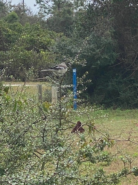
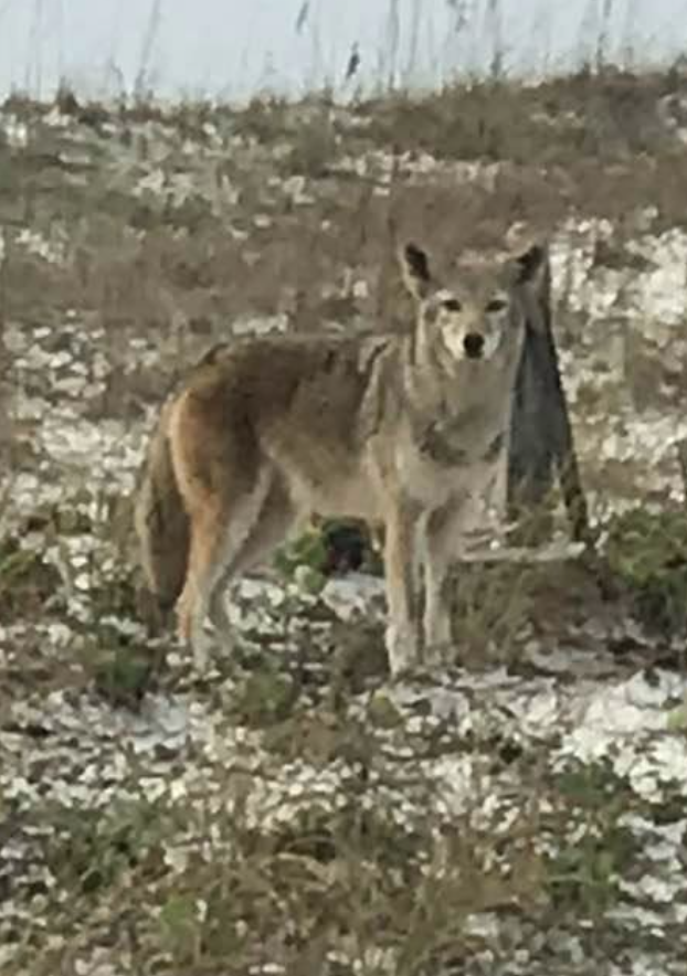
Coyote seen on Pensacola Beach.
Photo: Kristen Marks
Though dunes seem void of wildlife there are actually many species that reside here and even more than transient there from other parts of the island. Hikes through the dunes can bring magnificent sunrises and sunsets, just as you see in the deserts out west, and – if you are there at the right time and not moving too much – some really neat wildlife encounters can occur. But further back on the island exist the maritime forest. Here there are more creatures and more encounters. This will be the focus of Part 6.