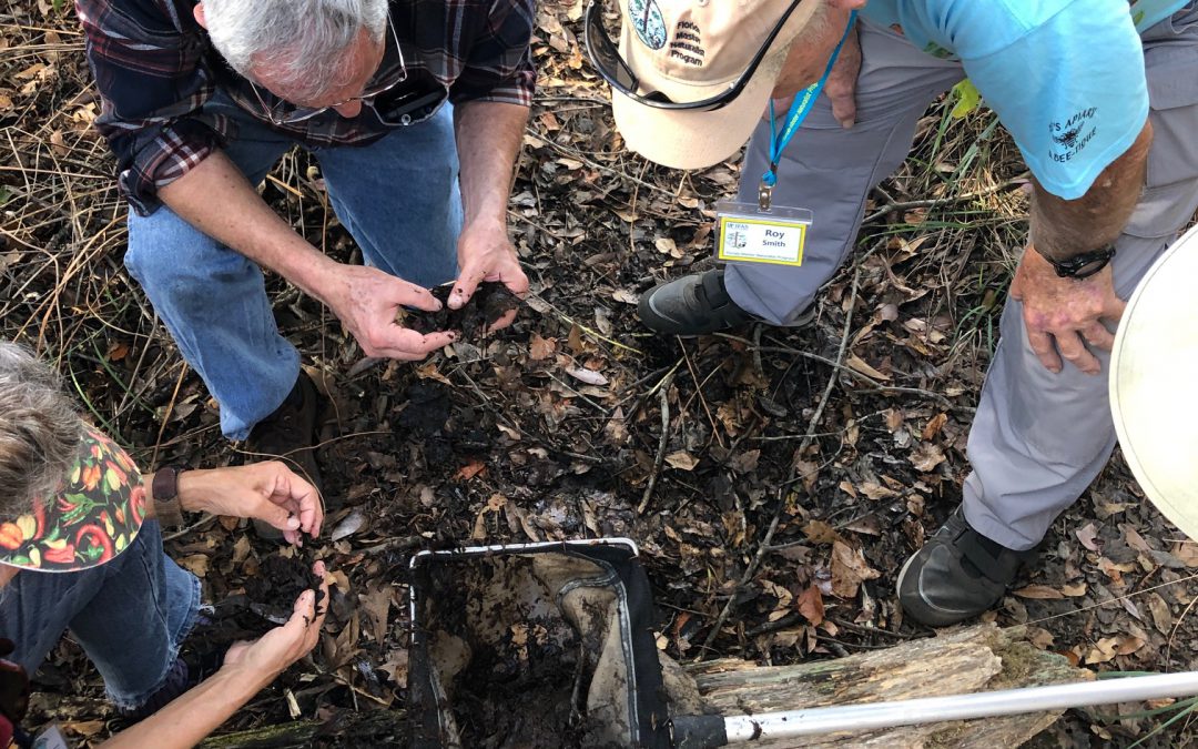
The open grasslands of the American west support huge herds of grazing herbivores such as bison, antelope, and deer. These large herds again support populations of hunters such as wolves, coyotes, and – historically – bears. The huge acres of wetland grasses we call marshes are productive as well, with all sorts of grazing creatures that feed on the grass like snails and insects, which in turn support populations of first order carnivores like birds, crabs, and turtles, who then feed larger predators like alligators, otters, and raccoons.
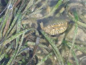
The salt marsh is full of life, if you look close enough. Photo: Rick O’Connor
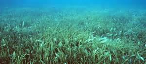
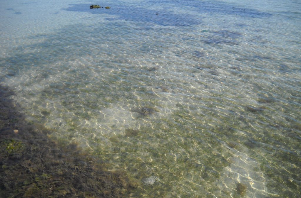
One would think that the submerged seagrass meadows would work in the same way. But there are no large herds of bison like creatures that graze on the grasses. True, manatees and sea turtles do graze on these, but not in the numbers we see with bison and antelope. There are numerous species of snails and crustaceans that live in seagrass, but it is not the grass they are interested in… it is the epibiota. These epibiota are the key to vast diversity of creatures living in seagrasses. If you snorkel or seine through a submerged grassbed you will notice the majority of creatures are small. This place is a nursery for the estuarine and marine environments. These grasses provide excellent hiding places and the epibiota provide the food they need to grow.
Grassbeds are also full of life, albeit small creatures.
Photo: Virginia Sea Grant
So, what are these epibiota?
The term epibiota means “creatures that live on other creatures”. They can be further broken down into epiphytes (plants that growth on other creatures), and epizoids (animals that grow on other creatures). Spanish moss is a familiar example of an epiphyte most people know. Barnacles growing on a turtle shell, or a whale could be an epizoid you are familiar with. Many epibiota are small, even microscopic. You can see the algae growing on the shells of turtles, or the fur of the sloth. There are also numerous epizoids that are microscopic, and no one sees. It is a whole field of microbiology – the study of the natural history and diversity of this tiny world that, certainly in the case of seagrasses, makes the whole thing work.
The wide blades of turtle grass provide habitat for a variety of epibiota.
Photo: UF IFAS
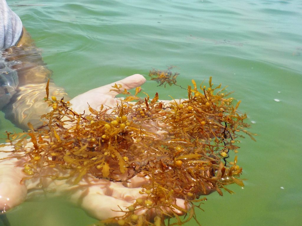
With the seagrasses you will not always see the epibiota we are talking about. At times, there are mats of algae growing on the grass like Spanish moss on oak trees. We typically see these epibiotic macroalgae growing on seagrasses in the spring and summer. Most of these algal mats are red algae. Studies have shown that they support juvenile animals as hiding habitat and can increase the overall biomass of seagrass meadows. But, like with all things, too much of a good thing can have a negative effect on seagrass meadows as well. The seaweed can smother the grasses, reducing needed sunlight, and enhance the decline of seagrasses in some areas.
Gracilaria is a common epiphytic red algae growing in our seagrass beds. Photo: Rick O’Connor
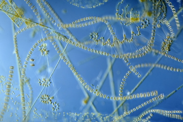
Most of the epibiota feeding the growing populations of shellfish and finfish using these nurseries are microscopic plants and animals that appear to us as “scum” on the blades of the grass. As you might expect, the wider the blade (in this case turtle grass) can support a higher diversity and abundance of growing grazers than the thinner shoal grass.
A study conducted in 1964 listed 113 species of microscopic algae existing on the blades of seagrasses in Florida. They include such creatures as diatoms, cynobacteria, and bryozoans. We will focus on these.
Diatoms are quite abundant on seagrass blades and provide for microscopic grazers.
Photo: University of New Hampshire
Diatoms are single celled plant-like algae that are encased in a clear silica shell. They are one of the most abundant forms of oxygen producing plant-like creatures found in the sea. Many species drift with the phytoplankton layers of the open ocean. Others are benthic, living on the bottom upon rocks, seawalls, turtle shells, and seagrasses. It has been stated that 50% of the oxygen produced on our plant comes from the diatoms and the dinoflagellates (another microscopic plankton).
Cells of a species of cyanobacteria.
Photo: Florida Atlantic University.
Cyanobacteria are what many call blue-green algae. They produce a darker colored green with their photosynthetic pigments – thus the name blue-green algae – but were not initially identified as a bacteria – which they are now because they lack an organized nucleus. Many have heard of the recent cyanobacteria blooms in central and south Florida in freshwater systems. Some species are toxic and have caused fish kills and even made pets, who drank from water with cynaobacteria, very sick. There hundreds of different species found in marine systems. Like diatoms, some live in the water column, others are attached to an object on the bottom – like seagrasses.
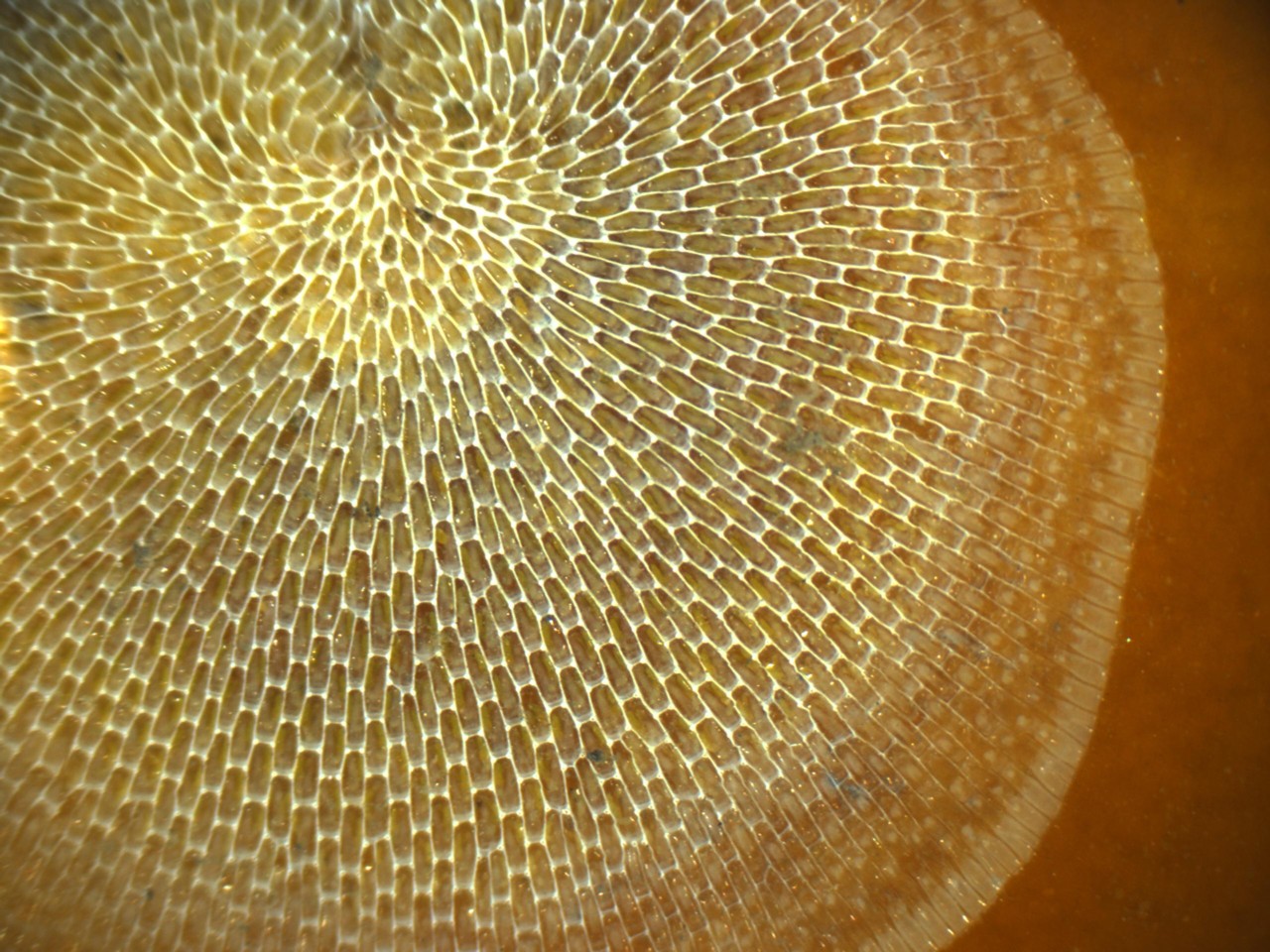
This beautiful matrix was built by a group of microscopic animals known as bryozoans.
Bryozoans are microscopic colonial animals. They act and behave similar to corals, though they are much smaller. Some species appear as a “cast net” over the shell of a snail or clam, and can be seen on blades of turtle grass as well. There are many other species of these colonial creatures that call seagrass home.
We are highlighting these three groups but there are many other forms of epiphytes and epizoids growing on these grass blades. And it is these that the small grazers, like tiny crustaceans, feed upon, which in turn are what the millions of small silver juvenile finfish and crabs are feeding on. The seagrass meadow biodiversity and productivity is dependent on them and most Panhandle folks do not know they are there. Dr. Edward O. Wilson made a comment in his book Half Earth, that we have been focused on conservation of wildlife and habitat for many years now – but we fully do not understand what it is we are trying to conserve. We focus on blue crab and manatee conservation and do not realize that conservation of these micro-communities is essential for conservation, or restoration, success. The first step in conserving such communities is knowing they exist and how they support the system. You now have a little more knowledge of them, but there is SO much more to learn.
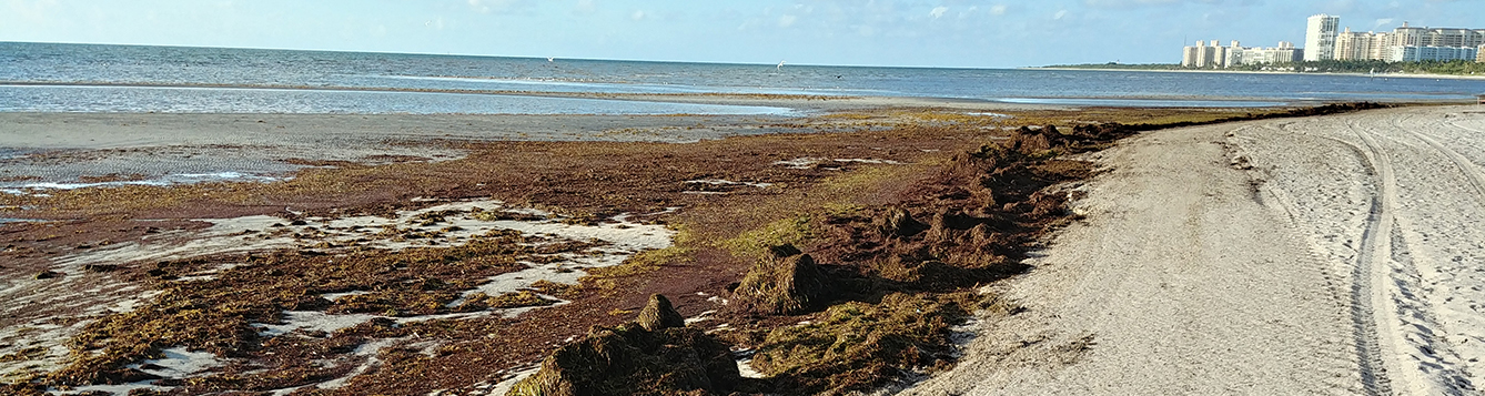
It sounds like one of those Sci-Fi thrillers where there is a giant asteroid heading to Earth and we need a special team led by Bruce Willis to save the planet. But in this case it is not a large rock, but a large mass of seaweed. And the threat is not a huge impact that would form tidal waves and atmospheric black out but large masses of seaweed covering the beaches up to a foot or more. Once on the beach, the mass of seaweed would begin to break down releasing odors and attracting insects that would not be popular with tourists – just as we get into the peak of tourist season around the state.
Mats of Sargassum on a south Florida Beach.
Photo: University of Florida
It is not something new, this has been a problem in south Florida for a few years now, but this year scientists can see the massive blob of seaweed heading this way and it is larger than before. They are expecting some beaches in Florida to be heavily impacted.
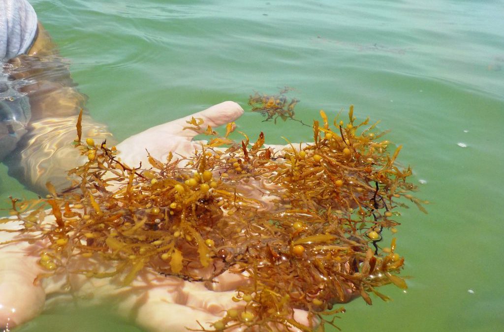
The seaweed in this floating mass is a brown algae known as Sargassum (Gulfweed). Like many brown algae’s, it is yellowish-brown in color and possesses small air bladders called pneumatocysts. These pneumatocysts allow large brown algae, like kelp, to stand tall like a tree in the water column – or, like Sargassum, to float on the surface where they can reach the much-needed sunlight.
Sargassum has small air bladders called pneumatocysts to help them remain afloat on the surface.
Photo: Florida Sea Grant
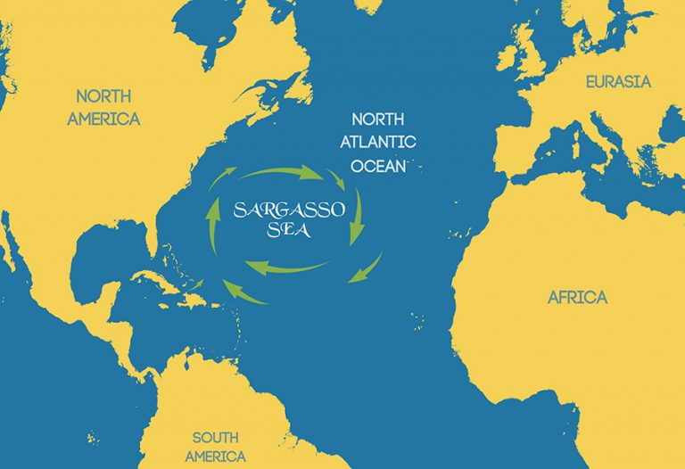
There are two species of Sargassum that are found in the South Atlantic: Sargassum natans and S. fluitans. They are not easily distinguished so most just say “sargassum”. These seaweeds form large floating mats that drift in the ocean currents. The clockwise rotation of the North Atlantic gyre creates a central point around which the currents spin that is calm – similar to the eye of a hurricane. Here, the sargassum collects in large masses and was noted in the logs of Christopher Columbus as the “Sargasso Sea” – a place to avoid for colonial sailors due to the fact there is little wind or current here.
The Sargasso Sea
Image: University of Florida
Mats of this algae creates an ecosystem drifting across the sea housing transient and residential species that have been the study of marine biologists for decades. The seaweed will get caught in currents that bring it close to shore where fishermen seek it out fishing for jacks or mahi-mahi. Baby sea turtles will use it as refuge until they are large enough to return to the shores of the continents and islands. It will at times get caught in currents that bring it ashore where beach combers sift through to see what they can find. As we mentioned, once on dry ground the seaweed begins to die releasing the odors of decaying sea life and attracting an assortment of insects. When this happens coastal communities will use tractors to drag and remove the smelly mats and deposit them in the local landfill.
In recent years, in south Florida, the amount of this seaweed has increased. The seaweed has formed large mounds on the beaches making beach combing an ordeal and the smell unbearable in many communities. Some of the Sargassum finds its way into the canals of the Florida Keys where it sits and decays, decreasing dissolved oxygen and causing a decline in abundance of some local marine communities. They have responded by removing the Sargassum to the local landfill but are experimenting with composting the material for fertilizing other plants.
Several researchers have experimented with the composting idea with some encouraging results. Some have found a use for it as mulch for coastal mangrove shoots that have lost much of their natural fertilizers due to coastal urbanization. There are problems with using this in some plant settings. 1) It could be too salty for some landscape plants. 2) There is the concern of the amount of arsenic present. Studies continue.
The recent large masses of Sargassum coming ashore began in 2011. What is causing this recent increase in Sargassum on the beaches? Researchers are finding the source of this material is not mats rotating off of the Sargasso Sea but forming in the belt of moving water between the North Equatorial Current in the south Atlantic and the equator itself. The exact cause of this increase growth is uncertain but could be linked to an increase of nutrients from regional rivers, like the Amazon, and from increased ocean temperatures due to climate change – both of these are exactly what seaweeds like.
This year the mass of seaweed seen from satellites is particularly large – over 5,000 miles. It is drifting in the currents heading for the Caribbean and Florida. It will most likely impact south Florida, but researchers do not believe the impact will be as large along Florida panhandle beaches. They will continue to monitor and report on the movement of this mass of seaweed over the course of the summer.
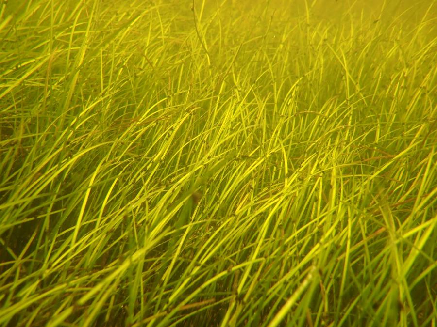
Many in the Florida panhandle are aware of the importance of seagrasses to estuarine ecology. They have heard this many times before and have heard how important it is to protect them. Some are aware that they are important as a nursery for many commercial important fin and shellfish. But fewer are aware of the diversity of life that exists in these “fields of grass”. Much of the life there is small and unnoticeable until you don a mask and explore. Even then, you need to slow down and look closely.
In this series on “Sea of Grass” we will be looking at some of the species that reside in these massive meadows expanding the Florida panhandle. We begin with the grasses themselves.
Seagrasses are just that – grasses that grow “under the sea”. They are similar in many ways to the grasses that grow in your yards. Their blades extend above the sediment and are usually all one sees as they are exploring the meadows. Being true plants, they do have stems – but these stems run horizontally beneath the sediments and are called rhizomes. Rhizomes are like “runners” and extend the plants across the landscape. Many have discovered rhizomes in their yards when pulling weeds. You begin to pull and a the runner exposes itself like pulling a thread from a sweater. From these rhizomes extend the small roots. Like lawn grass, seagrass use the roots to help anchor them in place and remove water and nutrients from the environment. But they are immersed in water and, like many marine creatures, have the ability to desalinate it so they have a source of freshwater.
Like all plants, seagrasses require sunlight for photosynthesis. Thus, they must grow in shallow water. In the western panhandle they are limited by the availability of light and are usually found in the estuaries where the water depth is not more than 10 feet. As you move into the eastern panhandle, particularly close to where the Big Bend begins, there are fewer large rivers depositing muddy water, more expanses of salt marsh to remove sediments from runoff, here seagrasses can grow deeper. Here they can expand into the open Gulf of Mexico itself producing hundreds of thousands of acres of these grass meadows.
Seagrass beds have declined over the last half century.
Photo: Rick O’Connor
They are not fond of high energy systems. Large waves can rip seagrasses from the bottom and deposit them onshore. In the western panhandle the Gulf generates larger waves and thus the grasses are found in the protection of the lagoons, sounds, and bayous. Near the Big Bend natural wave energy is low enough to support them in the open Gulf. It has been estimated that Florida has between 2.2 and 2.5 million acres of seagrass. Most of this is along the west coast of the peninsula running from the Florida Keys to the Big Bend1.
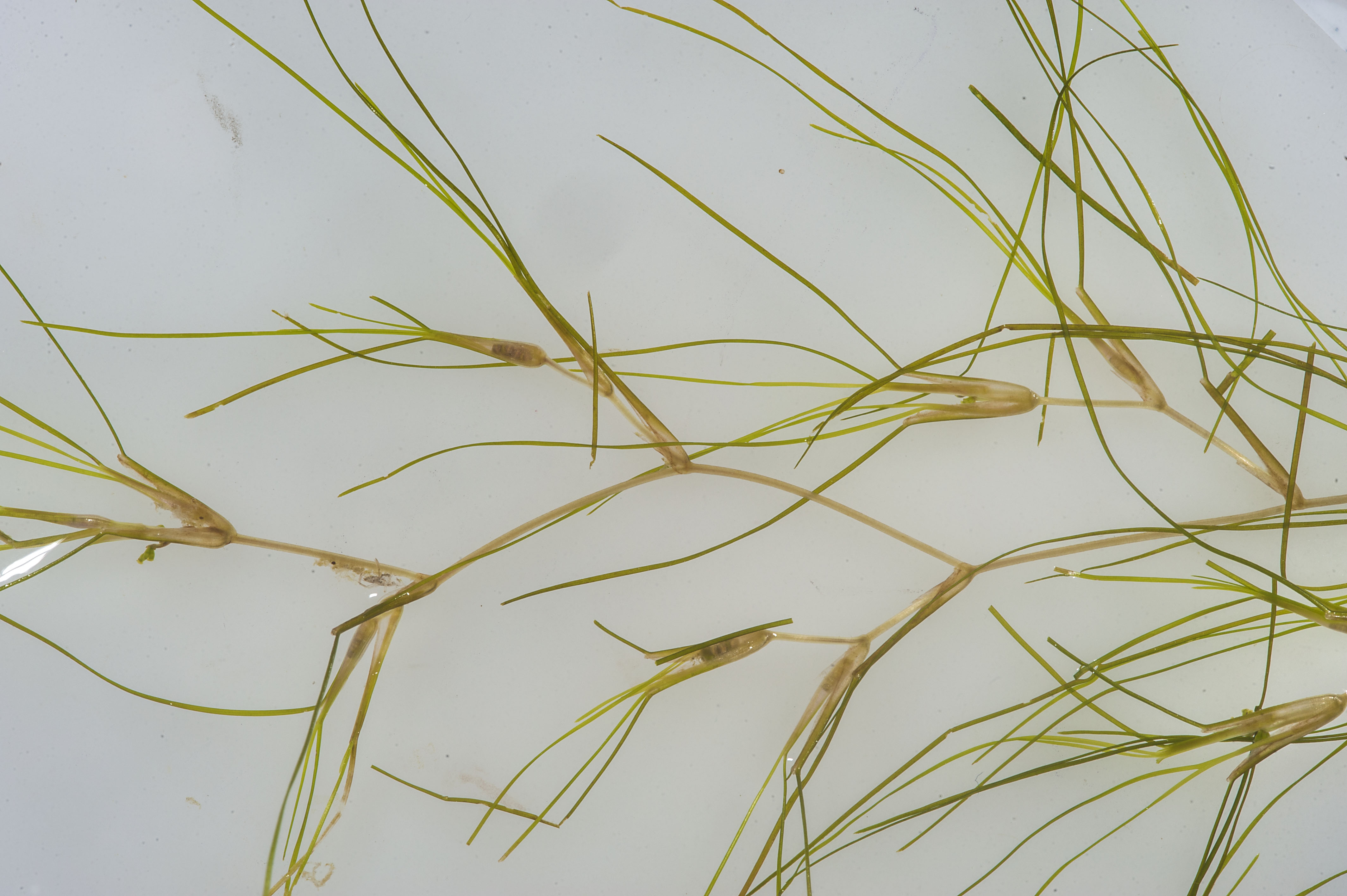
There are seven known species of seagrass in the state. Three of these are common in the panhandle and an additional one, Manatee grass (Syringodium filiforme), is beginning to expand its range into our area.
An amazing meadow of turtle grass.
Photo: Virginia Sea Grant
Two of our common species prefer more saline water – water with a salinity at least 20 parts per thousand (ppt). Those are Turtle grass (Thalassia testudinum) and Shoal grass (Halodule wrightii). These grasses both have flat blades but differ in blade width. Turtle grass is wider (4-12mm) and resembles St. Augustine grass from our lawns. Because of the wider blade, they grow in deeper water (not being able to tolerate the break waves and whitecaps near the surface). Shoal grass is very thin (<4mm) and feels more like human hair when you run your toes and fingers through it. Manatee grass resembles shoal grass in size but has a round blade instead of a flat one. In the Pensacola area we are beginning to find patches of it growing in Big Lagoon and Santa Rosa Sound.
Shoal Grass
Photo: Florida Department of Environmental Protection
Widgeon grass (Ruppia martimia) can tolerate the higher salinities of the lower estuary but can also tolerate the lower salinities of the upper estuary. It dominates the lagoons and bayous of the upper Pensacola Bay system. It has a thin flat blade like shoal grass but differs in that it branches as it grows instead of a single blade extending about the surface.
Widgeon Grass
These meadows of seagrass provide food and habitat for a myriad of marine creatures, who we will meet in other posts in this series. In Part 2 we will begin with one that is very important but very few know is even there – the epiphytes.
A Florida native wildflower is a flowering herbaceous species that had grown wild in the state’s natural ecosystems in the 1560s when Florida’s first botanical records were created. Planting native wildflowers in Florida benefits natural resources, native pollinators, and other beneficial insects. By planting wildflowers, one is providing shelter for pollinators and increasing wild be & natural enemies of insect pests population. When protecting, enhancing, or restoring habitat to benefit pollinators, choose a mix of native plant species that will bloom throughout the year and provide a continuous source of pollen and nectar for many pollinator species. Site planting and preparation are crucial to establishing new pollinator habitats. The site should be manageable, benefit wildlife, and support the overall management practices of the property.
Wildflowers.
Photo: UF IFAS
Wildflower selection
Diversify your selection of seeds. Flowering species native to Florida and suited to specific site conditions are the best choice for attracting and supporting diverse pollinator populations. Try to use seeds that are not native and are produced in Florida. Florida-produced seeds will be better adapted to Florida’s growing conditions. Planting a mixed species that bloom at different times will benefit pollinators throughout the year. Different flower sizes, shapes, colors, and plant heights will attract more pollinators and other insects.
Site Planning & Preparation
Wildflower plots that are planted in full sun provide the most pollen and nectar and are more attractive to pollinators. Bees can start working on flowers early in the day. However, flowers wet with dew may be ignored until they are dry. Plant along field edges on farms, cleared from pesticide drift and areas that will not disturb farming practices. Wildflowers should be planted in areas where the ground is not disturbed regularly. Most bee species do not live in communal colonies or collaborate in rearing offspring; 70% of these solitary bees nest in the ground. Plant in multiple locations that have well-drained. An available water source for irrigation benefits the planting, mainly during seed germination and early seedling establishment. Once plants have been established, additional watering is usually only necessary in drought.
Proper site preparation is needed to minimize weeds throughout plot establishment and growth. At least an entire season of weed eradication before planting is necessary. At least two months before planting, mow the area and remove any thatch. Allow new weed growth to begin, and then treat the site with a non-persistent, post-emergent herbicide. Repeat the herbicide treatment at least twice, two weeks between applications, allowing for more weed growth between treatments. This process can start as soon as weeds grow in early spring. Some herbicides have a residual activity that can kill or prevent the germination of wildflower species typically included in pollinator planting. Herbicide labels list species that are tolerant depending on the rate applied. It is crucial always to follow label instructions. As organic weed management, sites can be prepared using solarization. This technique uses greenhouse plastic to raise high soil temperatures to kill weedy plants and seeds in the top four to six inches of soil. Solarization can be done using large sheets of plastic to control weeds. After either solarization or chemical treatment and mowing, the aim is to have at least 90% of the soil free of plant material to ensure proper seed-to-soil contact during planting.
Photo; Tyler Jones, UF IFAS
Seed the plot
Depending on the region, plots should be planted between September and January in Florida after an entire season of site preparation. No-till planting is recommended. Years of weed seeds are stored within the soil, waiting to be exposed to sunlight and begin germinating. Tilling an area will disturb the seed bank and promote weed growth rather than wildflower growth. When the plot is ready, mix seeds based on size and weight. Annual and perennial seeds can be mixed and planted together. Alternatively, annuals and perennials can be planted in separate blocks to allow each type to be managed individually. Multiple techniques and equipment are used to spread seeds along the soil surface. Using tractor-pulled equipment is the most efficient option for larger plots but is less successful in evenly spreading lightweight seeds. Be cautious of using a too-heavy roller in very sandy soil. Excessive weight will force the seeds too far under the sand, where they will not germinate. A no-till seed drill is an alternative to spreading seed on the plot surface. Equipment costs of renting or purchasing a seed drill can be expensive for small wildflower plots; however, seed drills can be very efficient for larger wildflower establishments.
Crop Management
Undesirable weeds may establish quickly within the wildflower plot in the first year, especially if the site is not thoroughly prepared. Monitor the plants and try to control weeds sooner rather than later. Fertilization generally is not necessary. If competing weedy grasses start establishing in the plot, use a grass-specific herbicide to achieve control as quickly as possible, preferably while the grass weeds are small. However, if you have included native grasses in your planting, consider using a mechanical control method. The herbicide used will depend on the species you are trying to control. Spray using a coarse/large droplet size to avoid overspray onto desired species. Whenever possible, spray at night to prevent times when pollinating species will be present on the flowers. Always follow the product label when applying herbicides of any type. Hand-pull small patches of competing weeds. Cut or use a weed trimmer on larger patches of weeds. Mowing your planting can reduce weed competition. In perennial-only plots, mow throughout the first year to inhibit the growth of annual weeds. Mow plots were planted with annual and perennial wildflowers in the late fall of the first year after planting. Mow at a low enough level to hit and distribute the seed heads but high enough to avoid disturbing the bases of overwintering perennial plants. The actual timing of this mowing will depend on region, soil type, and weather.
Kayaking through a crystal blue spring, hiking among longleaf pines and discovering gopher tortoise burrows, gliding past alligators by boat in Mobile Bay, private tours of the EPA lab on Pensacola Beach, and meeting hundreds of fascinating, like-minded people—these are just a handful of fond memories from my experiences teaching the Florida Master Naturalist Program. Having recently celebrated its 20th anniversary, the Florida Master Naturalist Program (FMNP) has inspired the creation of dozens of similar courses in other states and proven itself to be one of the most popular outreach programs to come out of UF IFAS Extension.
Kayaking Santa Rosa Sound in Navarre is one of the highlights of our Coastal Systems FMNP class. Photo credit: Carrie Stevenson, UF IFAS Extension
The mission of the FMNP is simple—to promote awareness, understanding, and respect of Florida’s natural world among Florida’s citizens and visitors. I have always felt strongly that if you want people to care about something, they need to understand it. And to really understand something, you need to experience it. I know my own passion for science and ecology was ignited early on by teachers who took us outside and helped us encounter the many wondrous surprises in the natural world. With FMNP, we seek to do just that.
Over a span of 40 hours in 7-8 weeks, we spend about half our time with classroom presentations and the other half in the field, seeing the plants, animals, and ecosystems we discuss in class. In addition to classes and field trips, students produce a final project and present it to the class. These can range from labeled collections and slide presentations to building bird houses and new trails. The program is composed of three 40-hour core courses; Coastal, Upland, and Freshwater Systems. Seven “short courses” with 24 hours of class/field time include the Land Steward series (Conservation Science, Habitat Evaluation, Wildlife Monitoring, and Environmental Interpretation) and the Restoration courses (Coastal Restoration, Marine Habitat Restoration, and Invasive Plants). Locally, we try to rotate the core modules every couple of years and incorporate the short courses periodically. The registration fee per core module is $250 – $300 and includes a detailed course manual and, upon completion, FMNP patch, certificate, and pin denoting area of expertise. There are a handful of scholarships available for those interested in applying to offset costs.
This trail and boardwalk in Perdido Key were part of a multi-stage FMNP final project highlighting multiple ecosystem types. Photo credit: Jerry Patee, Master Naturalist
The classes do not count towards university credit, but are an excellent certification and professional development opportunity that look great on a resume. While we’ve had ecotour operators, park rangers, environmental consultants, teachers, and archaeologists (and many seeking employment in the environmental field), most of our FMNP students are not professionals in the field. They come from every background imaginable, but share an interest in the outdoors. Because we meet weekly, class members often bond and create long-lasting friendships during the courses.
Extension Agents in northwest Florida are offering two Master Naturalist courses, starting in the next few weeks. In Escambia and Santa Rosa County, we will have an in-person daytime Coastal Systems class starting March 28 and running through May 16. Walton County is teaming up with Miami-Dade to offer an evening hybrid (online class sessions, in-person field trips) Freshwater Systems course from February 18 to April 13. FMNP classes are restricted to adults 18 and over, but a new “Florida Youth Naturalist” curriculum has been designed through our 4-H program for young people. For more information on that, check out their website.
Master Naturalist students conduct field work in small groups. Photo credit: Carrie Stevenson, UF IFAS Extension
No one species has altered the land, sea, and sky – as well as decreased the overall biodiversity of the planet in such as short time as has Homo sapien. Since we have arrived on this planet we have slowly dispersed across all continents, oceans, and even the polar regions. In our wake we have changed the landscape. Altering forests and changing waterways. We have built communities and cities and, in recent years, increased the amount of waste we produce to impact the land, water, and even change the climate. Our planet has encountered major changes in climate and habitats before – but not at the rate it is currently happening, and many are not able to adapt fast enough. Wildlife over much of the planet has declined due to our activities – and barrier islands are not an exception.
Humans have found our barrier islands. Photo credit: Lydia Weaver
Humans first arrived in the Florida panhandle a little over 10,000 years ago. Most of them built communities along our riverways and deltas. As with much of coastal wildlife, barrier islands were difficult places to inhabit. There is little freshwater, selected game to hunt (though an abundance of seafood – which they did seek), intense heat in the summer and cold in the winter, and tropical storms – where there were few places to hide. It appears humans did visit the islands but did not settle there. The early European colonists tried, but unsuccessfully – they had to moved inland.
In the Pensacola Bay area, the first settlements that were successful were fortifications placed there by the U.S. Army to protect the communities where people lived. These were brick fortifications that held up well against the storms, all built with large cisterns to collect freshwater for the troops stationed there. Soldiers accessed them using ferries.
In the early 20th century locals from Pensacola built a casino at what is now Pensacola Beach. There were casinos, boxing, and food vendors for those who made the day trip by ferry to visit the location.
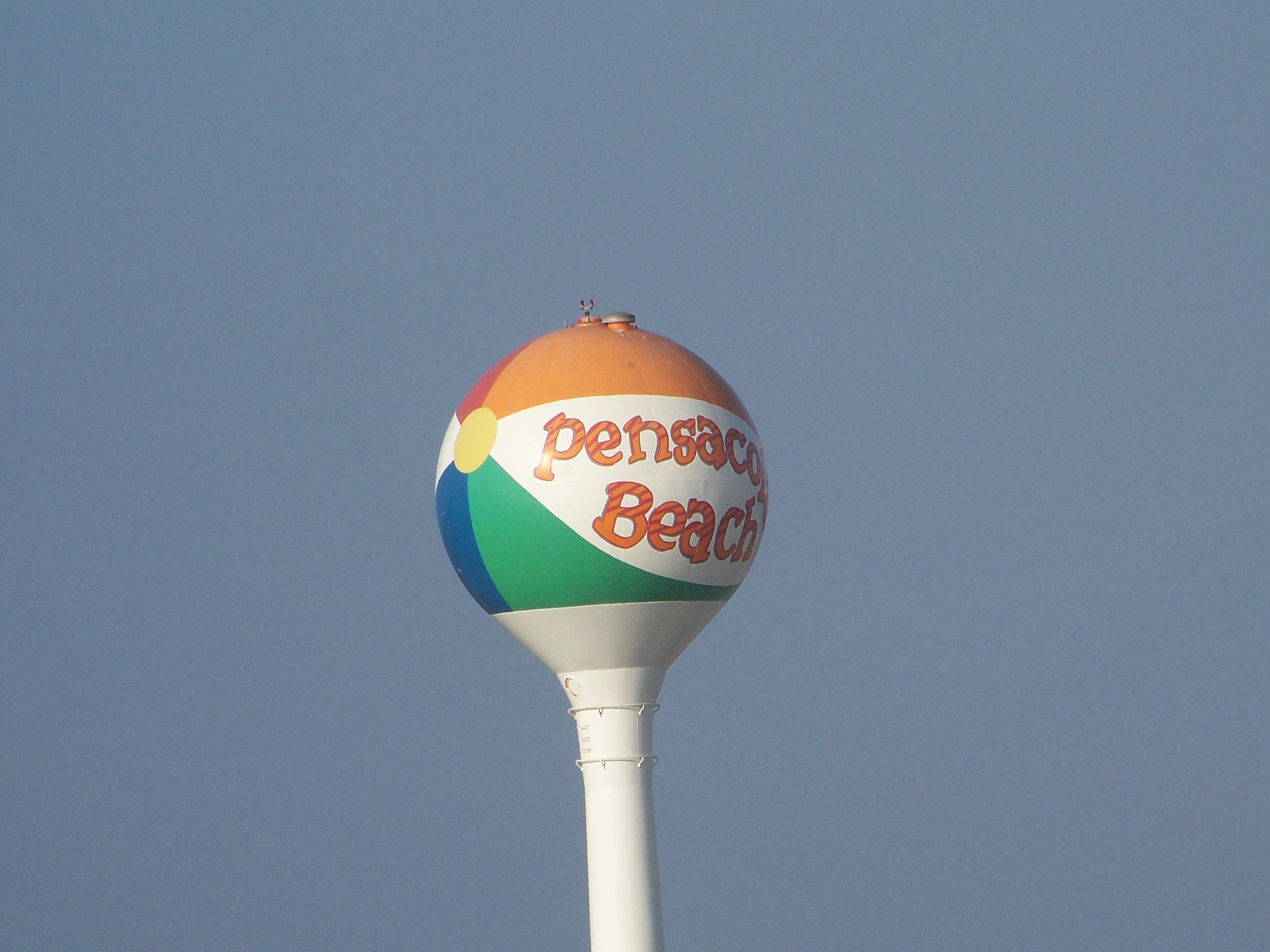
The famous “beach ball” of Pensacola Beach marks the spot where the old casino once stood.
Photo: Molly O’Connor
Much of this early human activity had little impact on the island wildlife. Humans were concentrated in specific locations and did not / could not venture very far from them. But when automobiles became more commonplace with people, bridges soon followed, and things did begin to change. More cars meant more people, and the need for roads. These roads bisected the dune system and altered how they naturally progressed with wind and waves. Not only did dune dynamics change but dunes began to disappear with the new homes and hotels that were built.
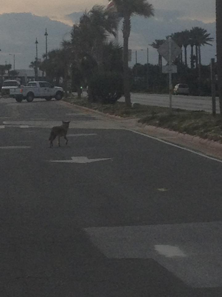
A coyote navigates the roads that are now on our islands.
Photo provided by Shelley Johnson.
Homes, cars, and roads made life for several island creatures tough. Most of the shorebirds using the islands as nesting areas lay their nests on the sand. The white/speckled eggs blend in well with the white sand and the warm sand helped incubate them. There were fewer predators on these beaches and so, protection of the chicks was achieved more by driving off any potential threat by “dive bombing” them. This did not work with humans, nor their cars. The roads became hazards for them, and small chicks were often hit by cars. Today some species are threatened and have been given federal protection.
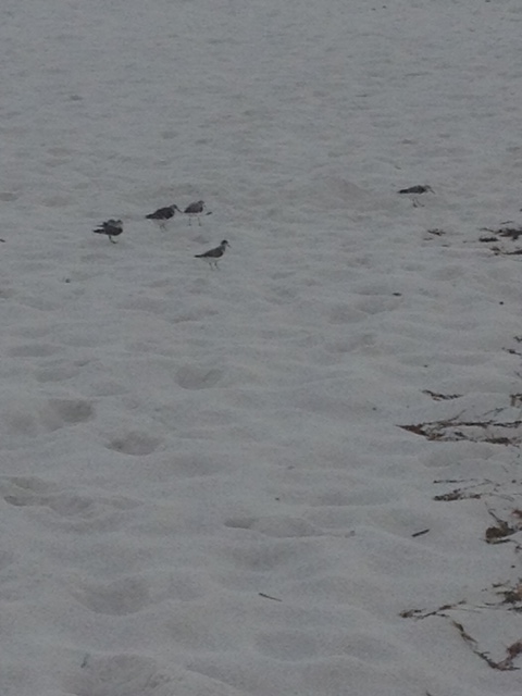
A variety of shorebirds utilize the sand as a nesting area.
Photo: Rick O’Connor
In recent years beaches houses have become true homes, with lawns and gardens. This alters the natural landscape even more. Along with the altering of the dune systems, this impacted many dune creatures like the beach mice. The species on Perdido Key is now considered endangered, and also has federal protection.
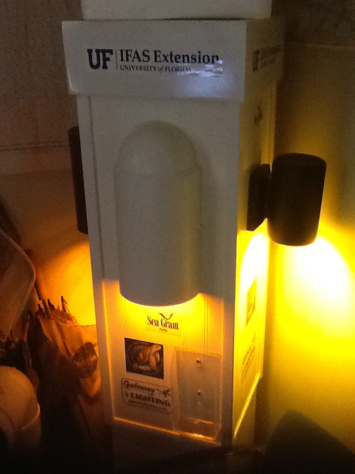
Additional housing, development, and roads led to additional needs in lighting in the evening. Many barrier island creatures need “dark skies,” but notably are the nesting sea turtles. In recent years 50-60% of sea turtle nests on our islands have had adults and hatchlings “disorient” towards the artificial lighting instead of the moon/star light that reflects off of the Gulf. This, along with other human related impacts like structures left in the sand at night, have caused a decline in these turtles and they too are now federal protected.
Turtle friendly lighting.
Photo: Rick O’Connor
You could not mention impacts by the human presence without mentioning solid waste – marine debris. Modern humans produce a wide variety of plastic products which we bring to the beach, and some of it ends up in the environment. Sea turtles, shore birds, and even manatees have been found either entangled in it or having ingested it. Much of this marine debris is problematic for the wildlife there.
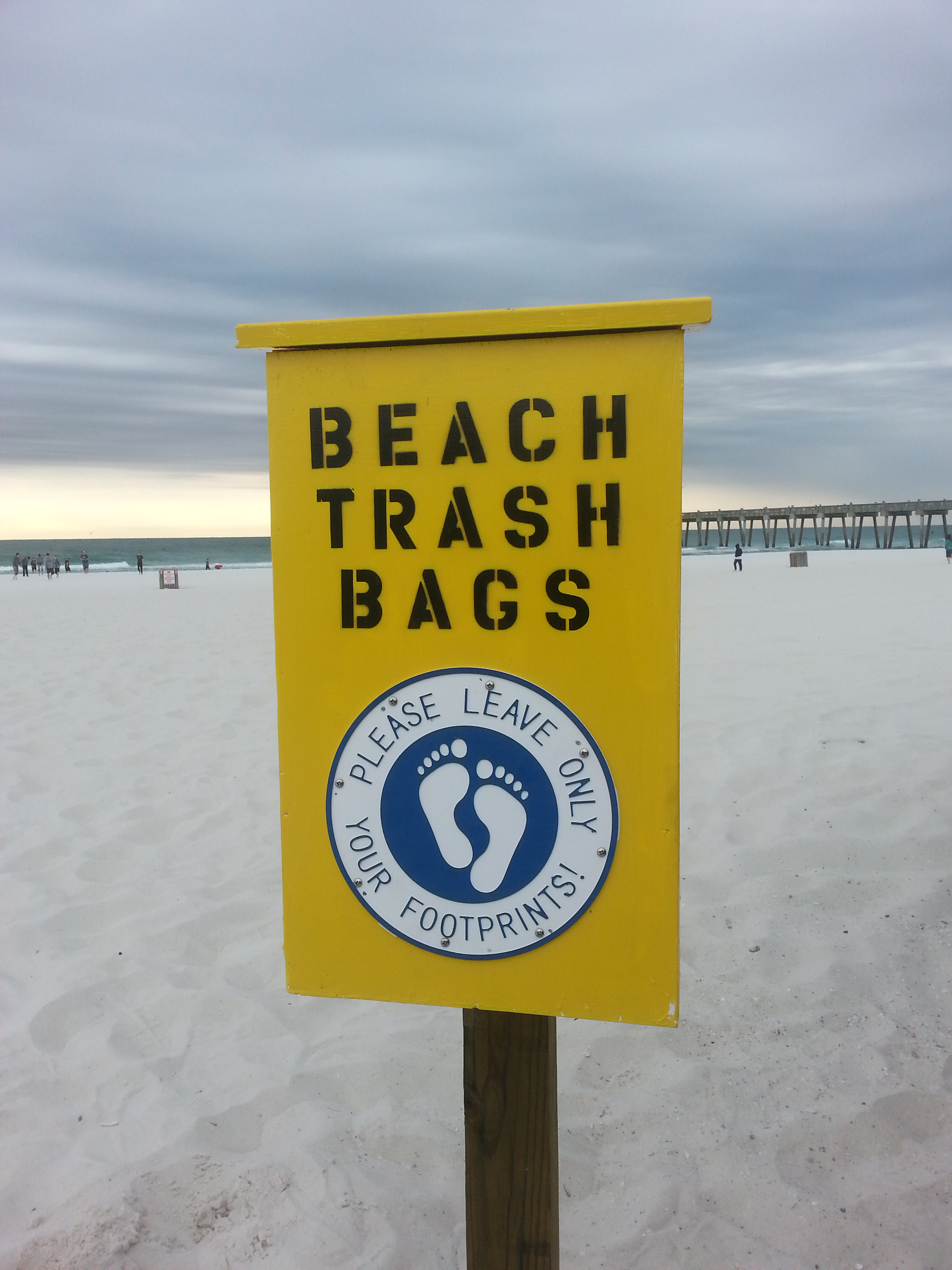
Boxes providing garbage bags and disposal.
Photo: Pensacola Beach Advocates
Recently there has been an increased issue of pet cats that are allowed to roam the island at night. These pets (some strays) are known for the impact they can have on small wildlife like birds.
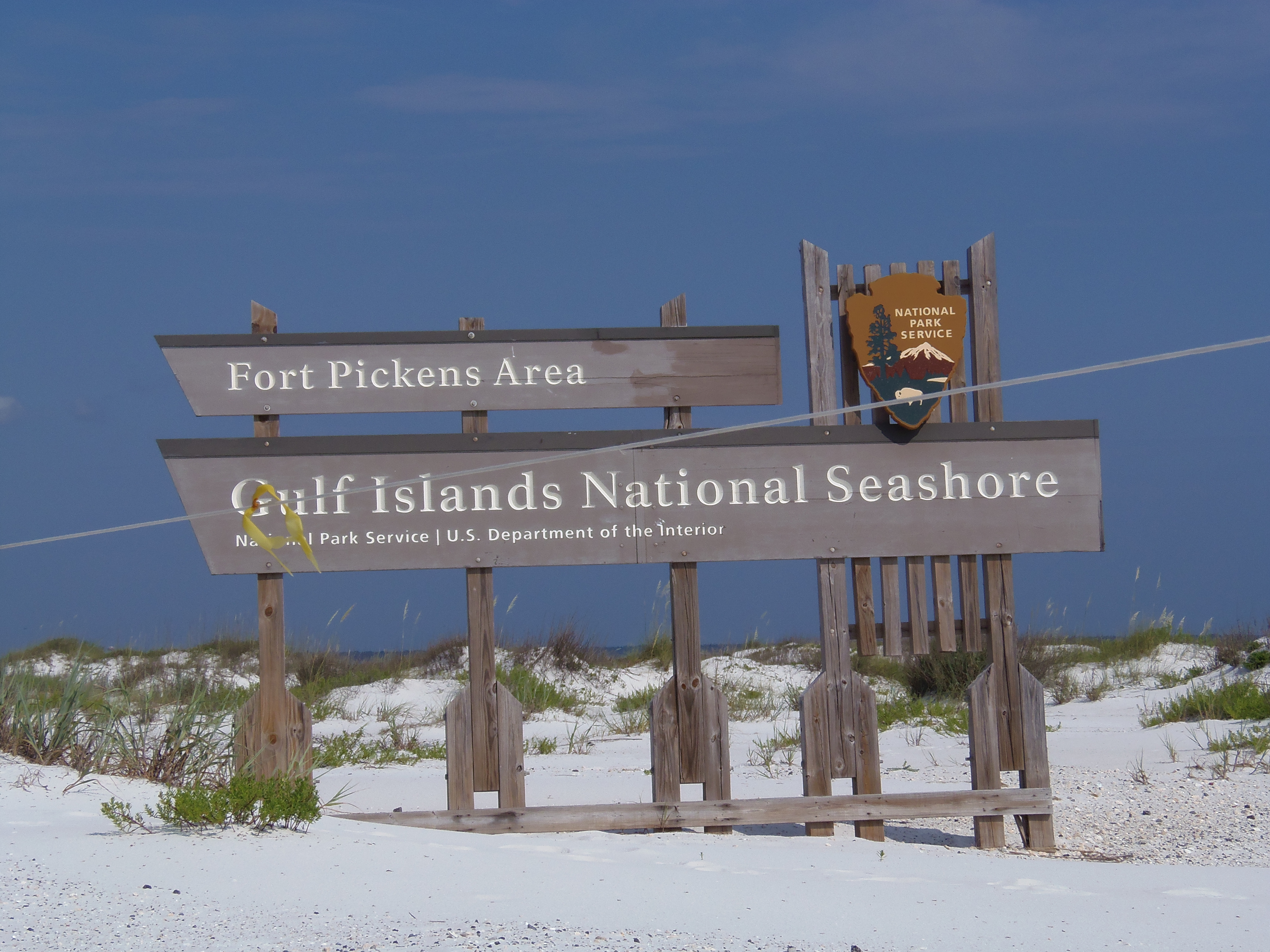
We were lucky in Escambia County during the 1970s to have the National Park purchase about 50% of the island as a National Seashore. This has provided a space for the island creatures and a great nature/cultural tourism destination.
Much of the west end of Santa Rosa Island has remained natural due to the presence of the Gulf Islands National Seashore.
Photo: Molly O’Connor
No one moves to the beach with the intent of harming wildlife, but our sense of changing things when we arrive – which we have been doing for some time – does impact them. The answer to this problem is to learn how to live, and develop, with the wildlife on the islands. The islands play a crucial role in protecting the mainland from storms and providing habitat for several unique species. Many of these species are beneficial to our lives by playing an ecological role in maintaining the island. It can be done.
I hope you have learned something new in this nine-part series on barrier island wildlife. If you have, please let me know by emailing roc1@ufl.edu. I hope you get a chance to explore our islands and maybe see some of these neat creatures.