Embrace the Gulf 2020 – The Gulf Basin
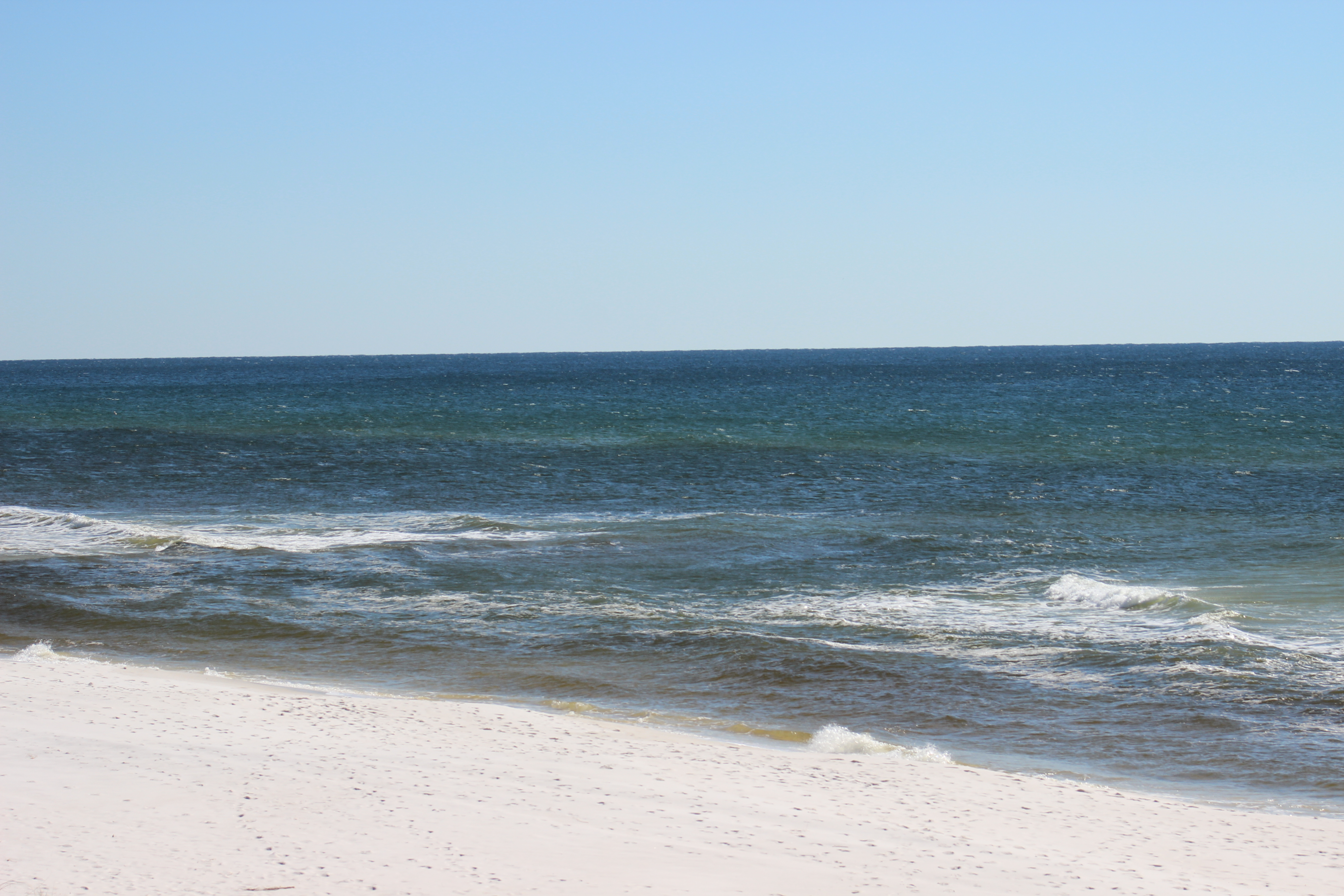
Standing on one of our local beaches, the Gulf of Mexico appears to be a wide expanse of emerald green and cobalt blue waters. We can see the ripples of offshore waves, birds soaring over, and occasionally dolphins breaking the surface. But few of us know, or think, about the environment beneath the waves where 99% of the Gulf lies. We might dream about catching some of the large fish, or taking a cruise, but not about the geology of the bottom, what the water is doing beneath the waves, or what other creatures might live there.

The Gulf of Mexico as seen from Pensacola Beach.
Photo: Molly O’Connor
Scanning the horizon from the beach, you are gazing at 600,000 square miles of open water. It is about 950 miles from the panhandle to Mexico. Traveling at 10 knots, it would take you about 3 days to cross at its widest point. The Gulf is almost an enclosed body of water. The bottom is somewhat “bowl” shaped with the deepest portion slightly west of center at a location known as the Sigsbee Deep. The island of Cuba serves as the “median” between where the ocean enters and exits the Gulf. Cycling water from the Atlantic crosses from Africa, through the Caribbean, and enters the between Cuba and the Yucatan. The seafloor here sinks and spills into the Sigsbee Deep. The pass between Cuba and Yucatan is about 6500 feet deep and the bottom of the Sigsbee Deep is about 12,000. If you are looking due south from the Florida Panhandle, you would be looking at this pass.
If your gaze shifted slightly to the right – maybe “1:00” – you would be looking at the Yucatan. The Yucatan itself forms a peninsula and a portion of it is below sea level extending further into the Gulf. This submerged portion of the Yucatan is what oceanographers refer to as a continental shelf. On the “leeward” side of the Yucatan Peninsula lies an area of the Gulf known as the Bay of Campeche. There is a shallow section of this “bay” known as the Campeche Banks which supports amazing fisheries and some mineral extraction. Off the Yucatan shelf there is a current of water that rises from the ocean floor called an upwelling. These upwellings are usually cold water, high in oxygen, and high in nutrients – producing an area of high biological productivity and good fishing.
Continuing to circle the Sigsbee Deep and looking about “2:00”, northwest of the Bay of Campeche, you enter the western Gulf which extends from Vera Cruz Mexico to the Rio Grande River in Texas. The shelf is much closer to shore here and the marine environment is still tropical. There is a steep continental slope that drops into the Sigsbee Deep. Water from the incoming ocean currents usually do not reach these shores, rather they loop back north and east forming the Loop Current. The shelf extends a little seaward where the Rio Grande discharges, leaving a large amount of sediment. In recent years, due to human activities further north, water volume discharge here has decreased.
In the direction of about “2:30”, is the Northwestern Gulf. It begins about the Rio Grande and extends to the Mississippi Delta. Here the continental shelf once again extends far out to sea. One of the larger natural coral reefs in the Gulf system is located here; the Flower Gardens. This reef is about 130 miles off the coast of Texas. The cap is at 55 feet and drops to a depth of 160 feet. Because of the travel distance, and diving depth, few visit this place. Fishing does occur here but is regulated. This shelf is famous for billfishing, shrimping, and fossil fuel extraction. The Mississippi River, 15th largest in the world and the largest in the Gulf, discharges over 590,000 ft3 of water per second. The sediments of this river create the massive marshes and bayous of the Louisiana-Mississippi delta region, which has been referred to as the “birds’ foot” extending into the Gulf. This river also brings a lot of solid and liquid waste from a large portion of the United States and is home to one of the most interesting human cultures in the United States. There is much to discuss and learn about from this portion of the Gulf over this series of articles.
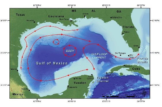
The basin of the Gulf of Mexico showing surface currents.
Image: NOAA
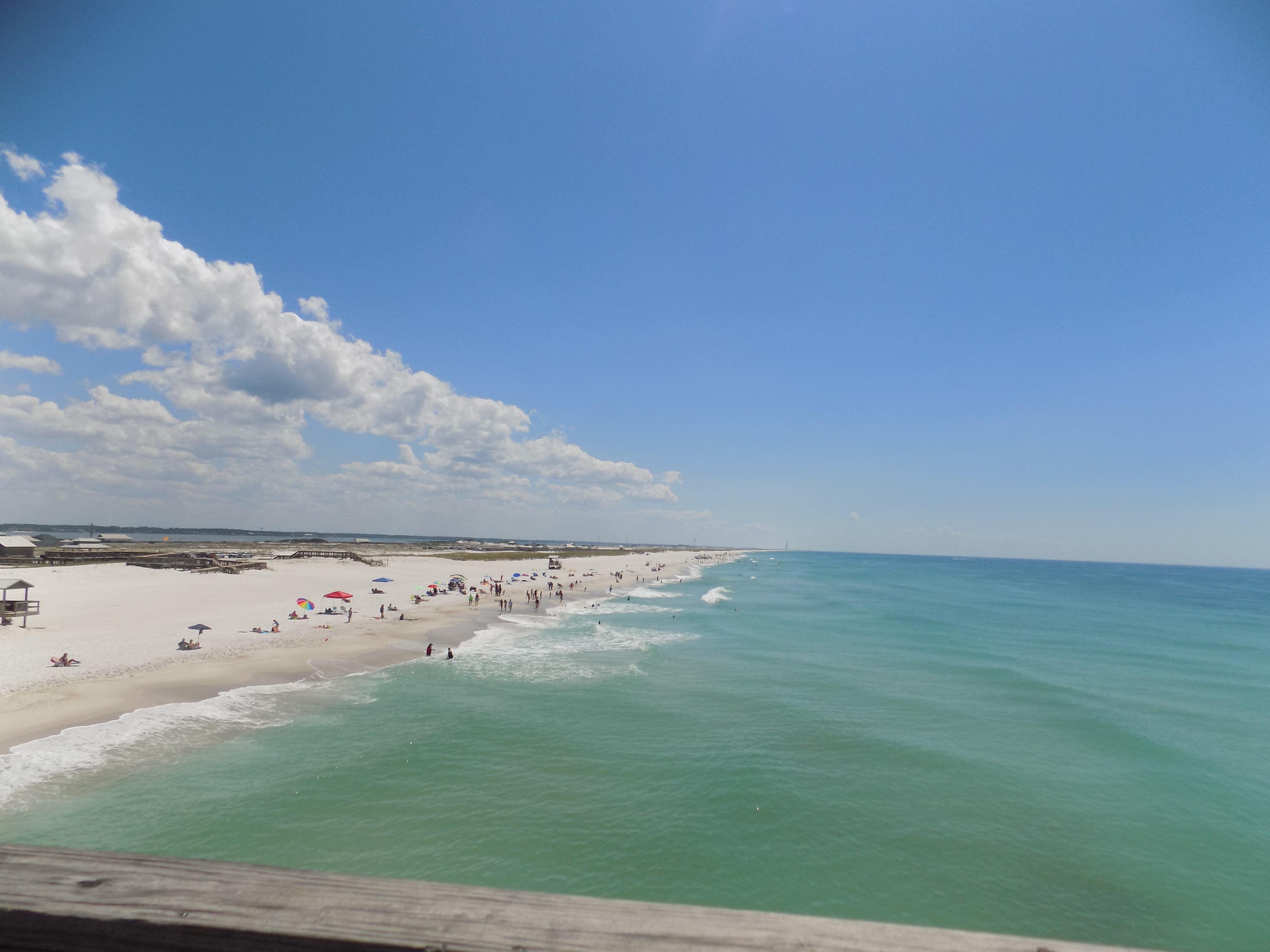
At this point we have almost completely encircled the Sigsbee Deep and move into the eastern Gulf. Things do change here. From the Mississippi delta to Apalachee Bay west of Apalachicola is what is known as the Northeastern Gulf – also known as the northern Gulf – locally called the Gulf coast. This is home to the Florida panhandle and some of the whitest beaches you find anywhere. Offshore the shelf makes a “dip” close to the beach near Pensacola forming a canyon known as the Desoto Canyon. The bottom is a mix of hardbottom and quartz sand. Near the canyon is good fishing and this area, along with the Bay of Campeche, is historically known for its snapper populations. It lies a little north of the Loop Current but is exposed to back eddies from it. Today there is an artificial reef program here and some natural gas platforms off Alabama.
Looking between “9:00-10:00” you are looking at the west coast of Florida and the Florida shelf. Here the shelf extends for almost 200 miles offshore. Off the Big Bend the water is shallow for miles supporting large meadows of seagrass and a completely different kind of biology. The rock is more limestone and the water clearer. In southwest Florida the grassflats support a popular fisheries area and a coral system known as the Florida Middle Grounds. At the edge of the shelf is a steep drop off called the Florida Escarpment, which forms the eastern side of the “bowl”. Another ocean upwelling occurs here.
Looking at “11:00” you are looking towards the Florida Keys. Between the Keys and Cuba is the exit point of the Loop Current called the Florida Straits. It is not as deep as here as it is between Cuba and the Yucatan; only reaching a depth of 2600 feet. This is mostly coral limestone and the base of one of the largest coral reef tracks in the western Atlantic. The coral and sponge reefs, along with the coastal mangroves, forms one of the more biological productive and diverse regions in our area. It supports commercial fishing and tourism.
![]()
We did not really talk about the bottom of the “bowl”. Here you find remnants of tectonic activity. Volcanos are not found but you do find cold and hot water vent communities, which look like chimneys pumping tremendous amounts of thermal water from deep in the Earths crust. These vent communities support a neat group of animals that we are just now learning about. Brine lakes have also been discovered. These are depressions in the seafloor where VERY salty water settles. These “lakes” have water much denser than the surrounding seawater and can even create their own waves. Many of them lie as deep as 3300 feet and can be 10 feet deep themselves. There is one known as the “Jacuzzi of Despair”. They are so salty they cannot support much life.
In the next addition to this series we will begin to look at the some of the interesting plant and animals that call the Gulf home.
Embrace the Gulf.