by Thomas Derbes II | Feb 13, 2026
This article concludes our Southern aquaculture state profile series by highlighting two very different, but equally instructive, states: Tennessee & Texas. While Texas represents one of the most diverse and economically powerful aquaculture sectors in the region, Tennessee illustrates both the constraints and the unrealized potential of smaller, freshwater-focused industries. Together, these state profiles help underscore the breadth of aquaculture systems operating across the South and the importance of tailoring research, extension, and policy support to local conditions.
Tennessee
Compared to Texas, Tennessee’s aquaculture industry is smaller in scale and less visible in statewide agricultural statistics. Aquaculture operations in Tennessee are relatively limited in number and are primarily focused on freshwater species. While detailed aquaculture-specific tables are not prominently featured in recent Census of Agriculture publications for the state, national data and extension assessments consistently place Tennessee among the lower-producing aquaculture states.
Most Tennessee aquaculture operations are small-scale and centered on species such as channel catfish and trout. Some producers have explored alternative species, including tilapia, freshwater prawns, and ornamental fish, but these remain niche endeavors. Historically, aquaculture has not ranked among Tennessee’s top agricultural commodities by value, resulting in lower levels of investment and industry organization compared to larger aquaculture states.
Trout farms are a very popular destination for visitors in the Tennessee Mountains. Trout farms offer visitors a chance to catch their own meal, and usually have a restaurant (or grill) nearby to cook your catch. The term “shooting fish in a barrel” does apply here, and it is typically a very family-friendly adventure!

Bucksnort Trout Ranch – https://www.bucksnorttrout.com/
Despite these limitations, aquaculture has long been identified by extension professionals as a sector with growth potential, particularly if production scale, producer coordination, and marketing strategies improve.
The University of Tennessee Institute of Agriculture (UTIA) serves as the primary statewide research and extension system. Through UT Extension, producers can access research-based agricultural education, though aquaculture-specific programming varies by region and local demand. UT AgResearch supports a broad range of agricultural sciences, with aquaculture-related efforts often embedded within fisheries, water resources, or natural resources research rather than housed in a dedicated aquaculture center.
The University of Tennessee Aquatic and Fish Collections (UTEIC), including the Etnier Ichthyological Collection at the University of Tennessee, Knoxville, represents a significant scientific resource. While primarily focused on fish biodiversity, systematics, and ecology, this work contributes valuable baseline knowledge that supports fisheries management and any future aquaculture development within the state.
| Tennessee Aquaculture |
| Category |
2017 Farms |
2017 Value* |
2023 Farms |
2023 Value* |
+/- Farms |
+/- Value |
| Catfish |
26 |
$111 |
20 |
(D) |
-6 |
– |
| Trout |
11 |
$2,588 |
12 |
$2,134 |
1 |
-$454 |
| Other Food Fish |
6 |
(D) |
17 |
$250 |
11 |
– |
| Baitfish |
11 |
$311 |
7 |
$400 |
-4 |
$89 |
| Crustaceans |
0 |
$0 |
0 |
$0 |
0 |
$0 |
| Mollusks |
0 |
$0 |
1 |
(D) |
1 |
– |
| Ornamental Fish |
9 |
(D) |
6 |
(D) |
-3 |
– |
| Sport/Gamefish |
13 |
$2,327 |
14 |
$2,877 |
1 |
$550 |
| Other Aquaculture |
3 |
(D) |
0 |
$0 |
-3 |
– |
| Total |
79 |
$5,337 |
77 |
$5,661 |
-2 |
$324 |
Texas
Aquaculture in Texas is a diverse and steadily expanding segment of the state’s agricultural economy. Production spans freshwater, brackish, and marine systems, supporting a wide range of species and markets. While the most recent USDA Census of Aquaculture suggested a decline in reported farm numbers and sales, on-the-ground perspectives from Texas aquaculture specialists tell a different story. According to industry experts, including Dr. Todd Sink with Texas A&M AgriLife Extension, the number of active producers has increased, with commercial activity growing, particularly in niche and emerging markets.
Texas is home to an estimated 130–135 aquaculture producers operating across roughly 6,200 acres statewide. Annual farm-gate sales are estimated to exceed $120 million, placing Texas among the more economically significant aquaculture states in the southern United States.
One of Texas’s defining characteristics is its remarkable species diversity. In addition to traditional production of channel catfish, producers raise baitfish, ornamental fish, tilapia, shrimp, crawfish, and a variety of marine finfish. Texas is a national leader in the production of red drum and hybrid striped bass, two high-value food fish species that together contribute approximately $20 million annually to the state’s aquaculture economy.
Crawfish Traps in Flooded Texas Rice Field- Louisiana State University AgCenter
A particularly notable development has been the rapid emergence of oyster mariculture. Legalized in 2019, oyster farming along the Texas Gulf Coast has expanded quickly, with more than 20 new operations established in just a few years. Demand for hatchery-produced oyster seed remains strong, signaling continued growth potential. Industry organizations such as the Texas Aquaculture Association play a key role in supporting producers through collaboration, education, and advocacy across this diverse sector.

Palacios, Texas Oyster Farm – Harte Research Institute
Texas A&M AgriLife Extension and Research provides statewide aquaculture programming, including producer education, diagnostics, and technical assistance. Research efforts span finfish nutrition, hatchery production, pond management, water quality, and system design, with an emphasis on sustainability and diversification. Extension specialists work directly with producers to help develop resilient production models that can adapt to changing markets and environmental conditions.
Marine-focused research is led by the Texas A&M AgriLife Center at Corpus Christi and the associated Center for Marine Aquaculture (CMAQ). These programs emphasize shellfish and marine finfish production, selective breeding, and genomic improvement to enhance growth, disease resistance, and overall performance. CMAQ also plays a critical role in workforce development, commercialization support, and technology transfer, helping bridge the gap between research and industry adoption.
Texas Sea Grant further supports industry growth through its Oyster Mariculture Program, which provides technical assistance for new and expanding oyster farms. This includes guidance on permitting, farm design, husbandry practices, and regulatory navigation along the Gulf Coast.
| Texas Aquaculture |
| Category |
2017 Farms |
2017 Value* |
2023 Farms |
2023 Value* |
+/- Farms |
+/- Value |
| Catfish |
116 |
$18,969 |
62 |
$24,177 |
-54 |
$5,208 |
| Trout |
5 |
(D) |
4 |
$427 |
-1 |
– |
| Other Food Fish |
45 |
$23,482 |
38 |
$21,704 |
-7 |
-$1,778 |
| Baitfish |
11 |
$276 |
23 |
$1,037 |
12 |
$761 |
| Crustaceans |
20 |
$7,932 |
33 |
$9,581 |
13 |
$1,649 |
| Mollusks |
0 |
$0 |
4 |
(D) |
4 |
– |
| Ornamental Fish |
25 |
$1,398 |
12 |
$1,247 |
-13 |
-$151 |
| Sport/Gamefish |
55 |
$15,770 |
51 |
$11,632 |
-4 |
-$4,138 |
| Other Aquaculture |
23 |
$1,029 |
25 |
$2,524 |
2 |
$1,495 |
| Total |
300 |
$68,856 |
252 |
$72,329 |
-48 |
$3,473 |
In the Final Part, we will do a quick recap and compare Southern Aquaculture to the Rest of the USA!
References
https://www.nass.usda.gov/Publications/AgCensus/2022/Full_Report/Volume_1,_Chapter_1_State_Level/Texas/txv1.pdf
https://www.nass.usda.gov/Publications/AgCensus/2022/Full_Report/Volume_1,_Chapter_1_State_Level/Tennessee/tnv1.pdf
by Laura Tiu | Aug 17, 2025
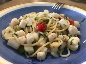
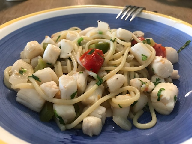
A blue bowl filled with bay scallop linguini in a white wine garlic sauce.
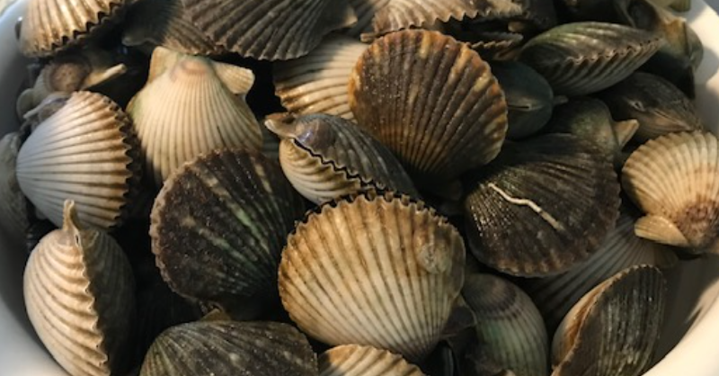
I love harvesting and eating local Bay scallops. Port St. Joe Bay is the scalloping area closest to Walton County. These tasty mollusks live in sea grass beds in shallow water. This makes them easy to find simply snorkeling, on a paddle board, kayak or from a boat.
Scallops used to be plentiful in all our Bays, including the Choctawhatchee Bay. These shellfish, however, are sensitive to environmental changes and due to their relatively short lifespan, are susceptible to periodic collapses. To enjoy recreational scalloping for years to come, it is important that safety and conservation stay top of mind. Following the best practices below will ensure the bay scallop fishery is protected for future generations to enjoy.
- Throw back small scallops. Recreational harvest occurs before scallops are given the chance to reproduce. Smaller ones are younger than older and have a higher chance of living to reproduce in the fall and possibly again in the winter. In Florida, scallops typically live for about 18 months. While it is not legally required, throwing back small scallops (those less than 2 inches) is a great way to do your part to protect the fishery. Also, small scallops have smaller muscle meat so it might not even be worth your while to shuck the small ones.
- Keep only what you will eat. While “limiting out” might seem like an obvious goal, don’t forget that someone will have to shuck all those scallops! One pint of scallop meat (the typical daily limit for one person) is roughly four servings of scallops. Rather than setting a goal of catching your limit, consider setting a more conservative goal based on how much meat you will eat. Scallop meat only keeps in the fridge for 1 day or about 3 months frozen. Plan accordingly!
- Never double dip. Locals and law enforcement officers in the bay scallop harvest areas often report “double dipping”, or scallopers going out for a second trip after landing one limit. Without question, this is illegal. But is is also highly unethical and shows disrespect for the fishery and the people with livelihoods that depend on bay scallops.
- Protect seagrass when boating. Be aware of seagrasses while boating in shallow areas! Many species, including bay scallops, depend on seagrasses. Damage from propellers and boat anchors (called seagrass scarring) reduces habitat quality and resilience of seagrasses over the long-term. Please visit the Be Seagrass Safe website for more information
- Discard shells responsibly. Shells and soft tissues should be disposed of in open Gulf of Mexico waters with moderate to strong currents that are not channels, canals, marinas, springs, or boat ramps. Shells and soft tissues can cause problems for water quality and boating when dumped in high traffic areas close to shore. Shells disposed of in shallow swimming areas, such as springs or sandbars, pose a serious hazard to swimmers. If you clean your catch on shore, dispose of shells/soft tissues in the trash or clean and re-use for crafts or landscaping around the house.
Scalloping
by Laura Tiu | Mar 7, 2025
 As spring approaches, I’ve been receiving more calls from local pond owners looking for advice on preparing their farm ponds for the season. Managing a pond in the Florida Panhandle can be tricky—especially when dealing with spring-fed ponds. While these ponds are often beautifully clear, their constant water turnover makes management a challenge.
If you’re wondering how to get your pond ready for spring, here are some key considerations and resources to help guide you.
Start with a Water Quality Test
The first step in assessing your pond’s health is testing the water. I always recommend that pond owners bring a pint-sized water sample in a clean jar to their local Extension Office for analysis. Keep in mind that not all offices offer this service, and public testing options are limited. However, private labs and DIY testing kits are available—though they can be costly.
The most important parameters to check are pH, alkalinity, and hardness: pH should ideally range between 6 and 9 for a healthy fish population. Local ponds often hover around 6.5, making them slightly acidic.
Alkalinity and hardness measure the water’s ability to neutralize acids and buffer against sudden pH changes. For optimal pond health, alkalinity should be at least 20 mg/L, but many local ponds fall below this level.
Improving Pond Water Quality
If your pond’s water quality is less than ideal, there are two common ways to improve it: liming and fertilization.
Applying Agricultural Lime: Properly adding agricultural lime can raise alkalinity and stabilize pH levels. However, in high-flow ponds, lime tends to wash away quickly, making this method ineffective for ponds with constant discharge.
Fertilizing to Boost Productivity: Fertilization increases phytoplankton growth, which supports the pond’s entire food web, benefiting juvenile fish and invertebrates. Unfortunately, like lime, fertilizer is quickly washed out of high-flow ponds, making it ineffective in these cases.
Making the Best of Your Pond
If your pond has a continuous discharge due to spring flow, the best approach may be to embrace its natural clarity, even if it doesn’t support a thriving fish population. However, if your pond retains water without frequent outflow, you may be able to enhance its productivity with the right amendments.
For personalized guidance, contact your local UF/IFAS Extension Office. You can also start by reviewing this helpful fact sheet: Managing Florida Ponds for Fishing. By understanding your pond’s unique characteristics, you can make informed decisions to keep it healthy and enjoyable throughout the season.
by Laura Tiu | Sep 13, 2024
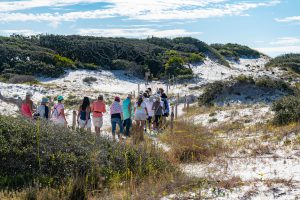
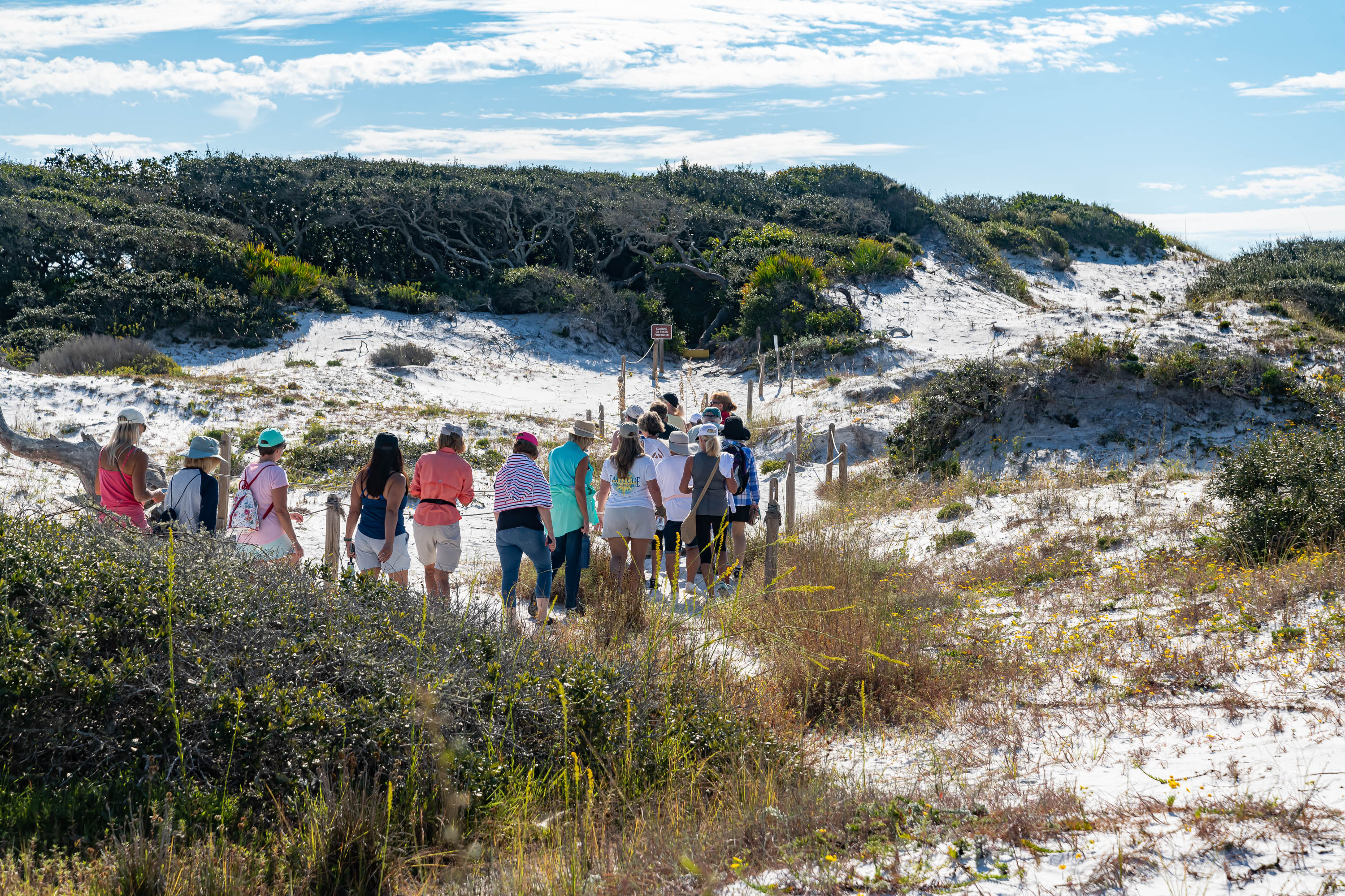
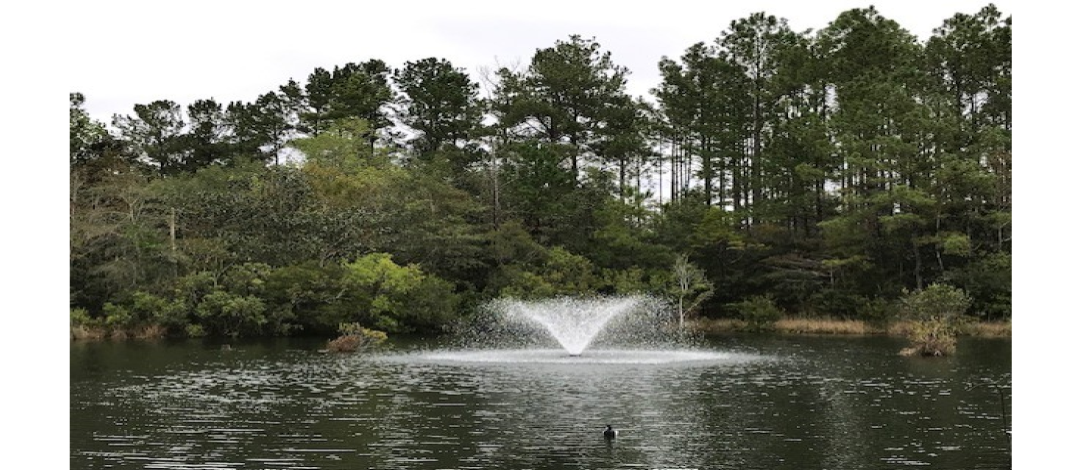
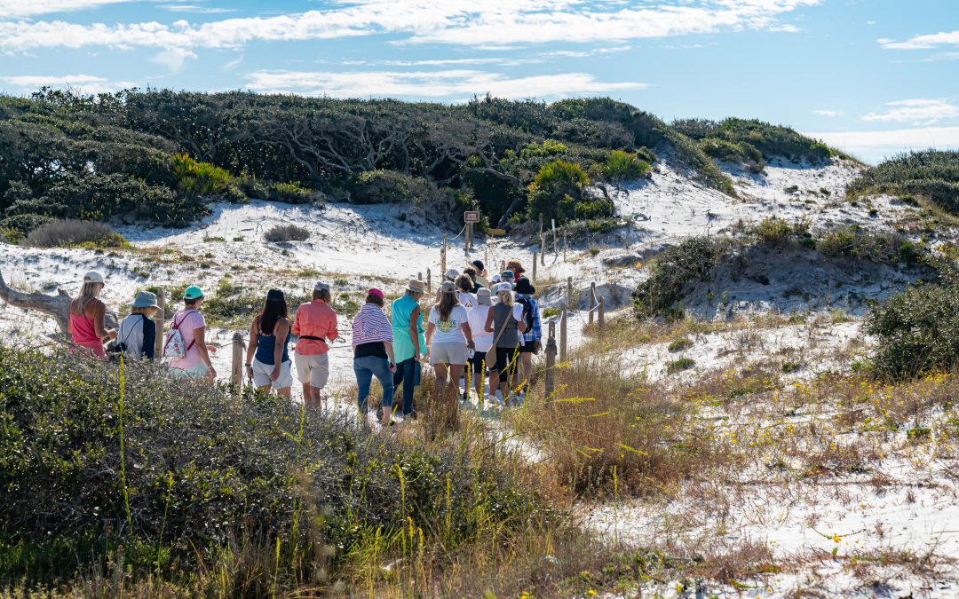
Western Dune Lake Tour
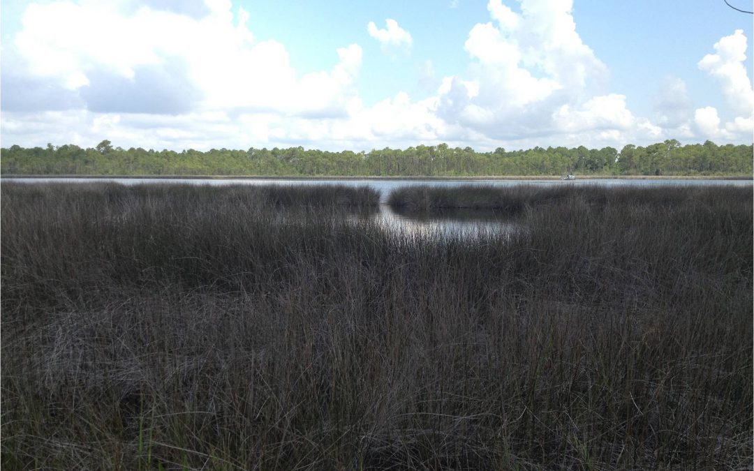
Walton County in the Florida Panhandle has 26 miles of coastline dotted with 15 named coastal dune lakes. Coastal dune lakes are technically permanent bodies of water found within 2 miles of the coast. However, the Walton County dune lakes are a unique geographical feature found only in Madagascar, Australia, New Zealand, Oregon, and here in Walton County.
What makes these lakes unique is that they have an intermittent connection with the Gulf of Mexico through an outfall where Gulf water and freshwater flow back and forth depending on rainfall, storm surge and tides. This causes the water salinity of the lakes to vary significantly from fresh to saline depending on which way the water is flowing. This diverse and distinctive environment hosts many plants and animals unique to this habitat.
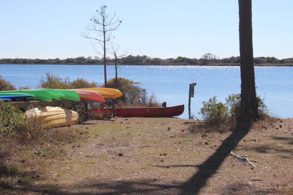
There are several ways to enjoy our Coastal Dune Lakes for recreation. Activities include stand up paddle boarding, kayaking, or canoeing on the lakes located in State Parks. The lakes are popular birding and fishing spots and some offer nearby hiking trails.

The state park provides kayaks for exploring the dune lake at Topsail. It can be reached by hiking or a tram they provide.
Walton County has a county-led program to protect our coastal dune lakes. The Coastal Dune Lakes Advisory Board meets to discuss the county’s efforts to preserve the lakes and publicize the unique biological systems the lakes provide. Each year they sponsor events during October, Dune Lake Awareness month. This year, the Walton County Extension Office is hosting a Dune Lake Tour on October 17th. Registration will be available on Eventbrite starting September 17th. You can check out the Walton County Extension Facebook page for additional information.
by Dana Stephens | Aug 2, 2024
Do you know what is your watershed?
There was, is, and will be the same amount of water on planet Earth. Water is a finite resource. The United States Geologic Survey estimates Earth holds around 1,386,000,000 cubic kilometers of water. Only 330,520 cubic kilometers, less than 1% of all water on Earth, is freshwater. This freshwater is available in the soils, atmosphere, biosphere and used by humans.
We all have different connections with water. Maybe it is swimming. Maybe it is enjoyment of clean laundry. Maybe it is the iconic scenes in the 1992 Academy Award for Best Cinematography, A River Runs Through It. Yet, we all depend on water for life. How and why water moves across a landscape to sustain life is important to us all.

Watersheds in the Continental United States (usgs.gov)
Water located on land is called surface water. Water located underground is called groundwater. A watershed is the area of land where surface water and groundwater drain to a common place. Watersheds vary in size from as small as the size of your foot to as large as the watersheds spanning the continental United States. Larger watersheds are composed of smaller watersheds linked together.
Water gradually flows from higher to lower points in a watershed. Precipitation (i.e., snow, rain and everything in between) collects and moves within the drainage area in the watershed. Not all precipitation falling on a watershed flows out of the watershed. Precipitation soaks into the soil and through porous rock moving to lower points in the watershed, returning to and replenishing water stored underground. This groundwater can return to the surface of the watershed via springs or artesian wells, if the groundwater is under enough pressure.
Water can be removed before flowing out of the watershed as well. Precipitation returns to the atmosphere through evaporation as part of the hydrologic cycle. Plants facilitate evaporation to the atmosphere through transpiration where the roots of plants absorb water from the soil and the water evaporates into the air through the leaves of the plants. Human uses of water also impact how water moves through a watershed. Drinking water supplies, industrial operations, or building dams changes the movement of water through the watershed.
Each of us lives in a watershed. There is much benefit to have healthy watersheds. Healthy watersheds are essential to support ecosystems and the services provided, such as safe drinking water, outdoor recreation, economics, and overall quality of life. There are many metrics and assessments used to measure the health of a watershed. Do you know what is the health of your watershed?
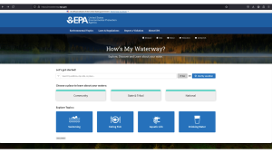
United States Environmental Protection Agency’s How’s My Watershed interactive tool (http://mywaterway.epa.gov)
The United States Environmental Protection Agency developed “How’s My Waterway” to provide the public with information about the condition of their local waters. How’s My Waterway offers three ways to explore your watershed. At the community level, you can see your watershed with details like the water quality, recreation, fish consumption, impairments, and associated plans working to remove impairments. At the state and national levels, you can find information about states/national water program(s) and specific water assessment(s) that affect your watershed.
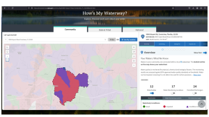
Example–watershed for Okaloosa County UF/IFAS Extension North office.
Let’s give it a try! Go to www.mywaterway.epa.gov in your web browser. Enter the desired address and select >>Go. On the left, you’ll see an interactive map outlining your watershed and the drainage basin(s) that make up the watershed. On the right, there are 10 different tabs allowing you to explore various metrics of the watershed. For example, there is a general tab reviewing the water conditions and states (i.e., good, impaired, or condition unknown) for all surface waters in the watershed. Using the arrow on the right, you can expand each water source to learn specifics about the data-determined state of the water.
Enjoy exploring your watershed! If you have questions about the interactive “How’s My Waterway,” wish to join an educational session to learn more, and/or desire accompanying curriculum, please email Dana Stephens at dlbigham@ufl.edu.
by Erik Lovestrand | Jun 28, 2024
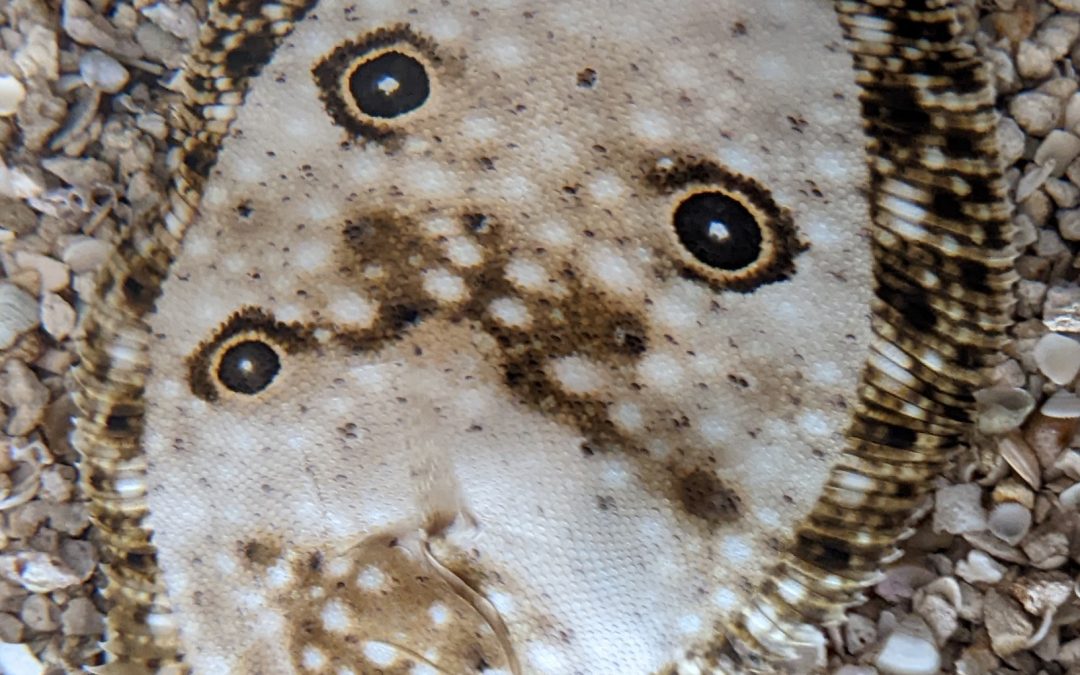
One of several “flatfish” inhabiting our Panhandle coastal waters, the ocellated flounder (Ancylopsetta ommata) is one of the more striking species, in my opinion. From the four distinctive eye spots (ocelli) to its incredible variability in background patterns, I must just say that it is a beautiful creature. Flounders are unique among fish, in that early during larval development one eye will migrate over to join the other and the fish will orient to lay on its side when at rest. Only the top side will have coloration and the bottom side will be white. While the eyes end up on the same side, the pectoral and pelvic fins remain in their traditional positions, although the bottom-side pectoral fin is reduced in size.
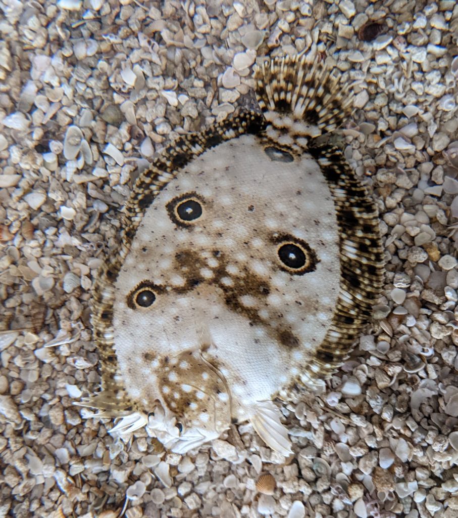
Not the Biggest but Definitely one of the Coolest Flounder Species Around
Ocellated flounders are always left-eyed, meaning if you stood them up vertically with their pelvic fins down, the left side of the body has the eyes. When laying on the ocean floor, their independently moving eyes can keep a lookout in all directions. However, flounders tend to remain immobile when approached, depending on an awesome ability to camouflage themselves from predators. They can flip sand or gravel onto their top side which hides their outline and their ability to match the color and texture of the surrounding substrate is phenomenal.
This species is a fairly small fish, reaching lengths of about ten inches. However, they are by no means the smallest flatfish around. We also have hogchokers (a member of the sole family, 6-8 in.) and blackcheek tonguefish (to 9 in.). These are dwarfed by the larger Gulf flounder and Southern flounder which are highly prized table fare by fishers along our coasts and can reach sizes that earn them the nickname of “doormat” flounders. Regardless of the species of flounder you observe, it is unquestionably one of the super cool animals we have the privilege of living with here along the North Florida Gulf Coast.