by Rick O'Connor | May 22, 2016
ALL PHOTOS: MOLLY O’CONNOR
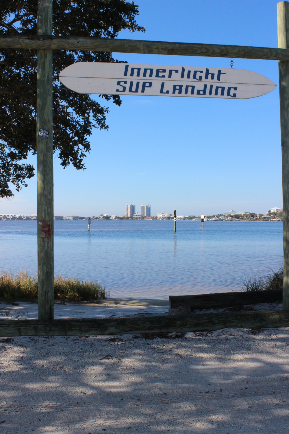
Continuing our “ecotour” of the Florida Panhandle along the ICW, this month’s stop is in Walton County. Arguably one of the fastest growing counties in the state, South Walton has become a favorite with many. Relatively undeveloped (as compared to neighboring counties) Walton has an opportunity to develop smarter… and for a lot of it – they have.
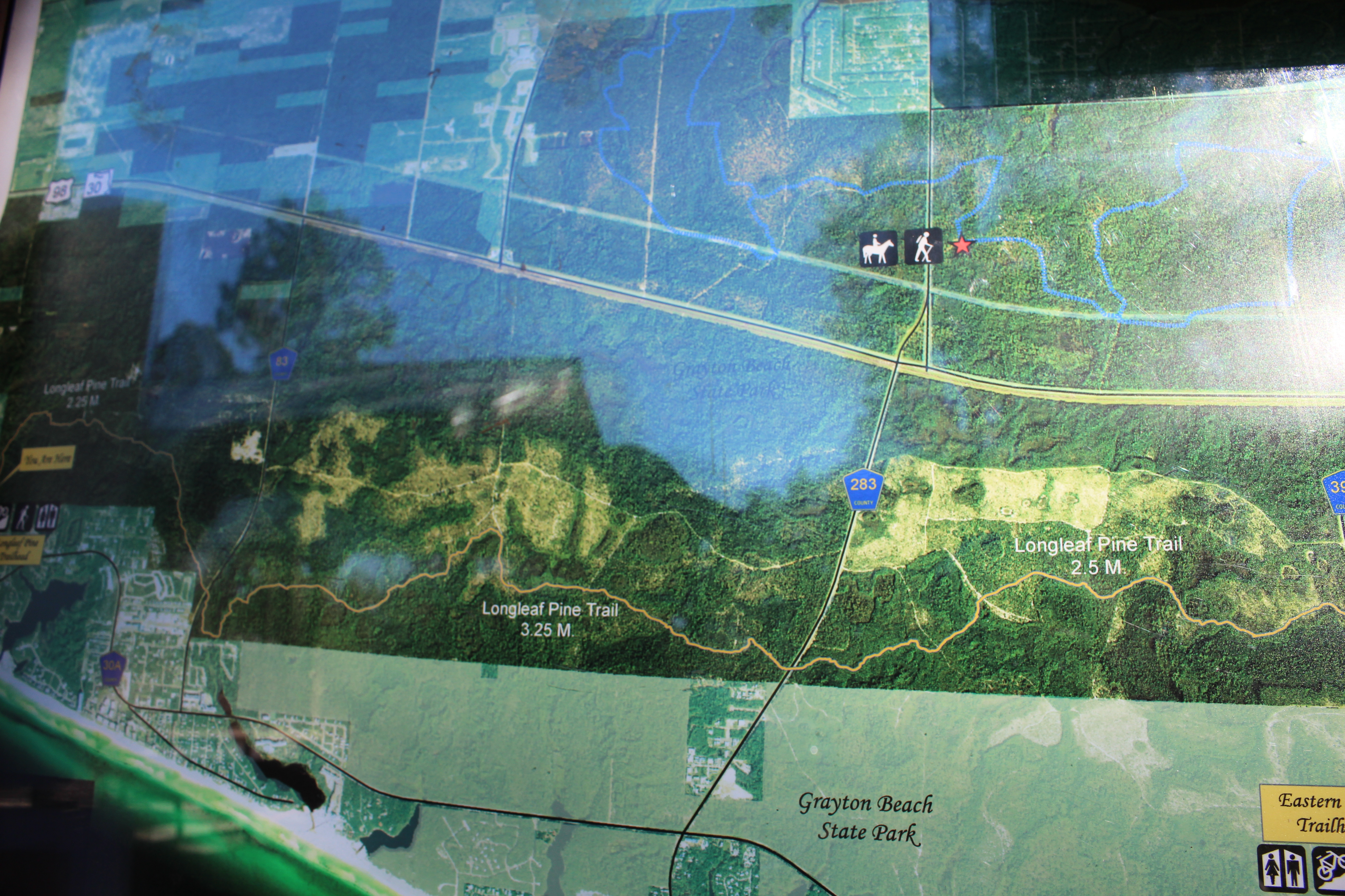
Entering Walton County from the west you leave the concentrated tourism of Destin and enter Sandestin. Though still highly developed it slowly gives way to the Point Washington area and more open ground. Here you begin to encounter the famous Dune Lakes. There are no barrier islands along the coastline of Walton County. Instead the Gulf meets the peninsula separating it from Choctawhatchee Bay to the north. Along the Gulf there are magnificent dune fields and freshwater lakes that periodically are open to the Gulf. The lakes are unique in that they have freshwater habitats and tannic waters as well as saltmarsh and seawater when their “mouths” are open. This unique situation provides an ecosystem found in few places in our state. The now famous 30-A travels along these dune lakes across the entire of South Walton. Two state parks, a state forest, a bike trail, and small communities dot this famous trail.
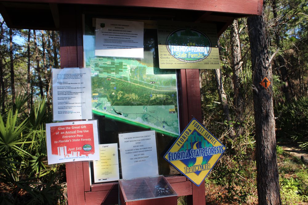
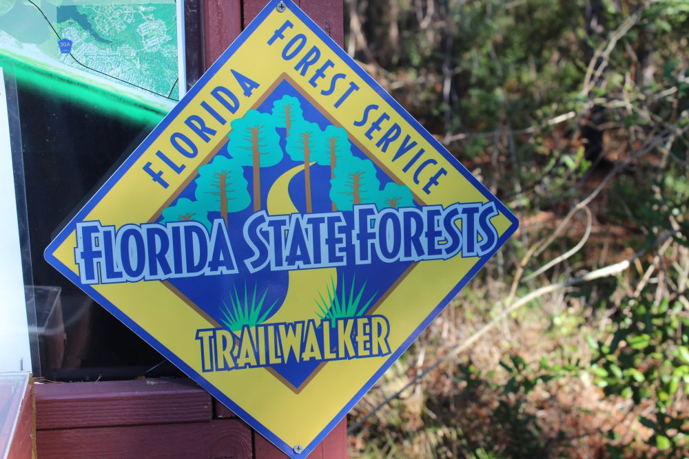
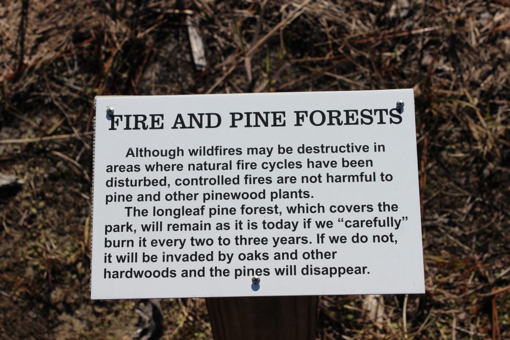
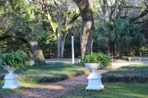
Between 30-A and the Intracoastal Waterway to the north lies the Point Washington State Forest. Here lie acres of well managed pine forest. There are many trails that can be hiked, driven, or traversed by horseback. There are several trails here that are part of state forest’s Trailwalker Program. A major part of this well managed forest is prescribed burning.
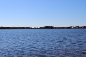
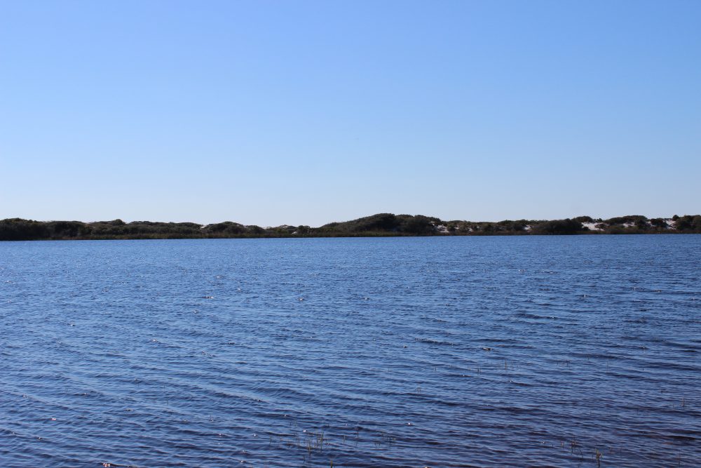
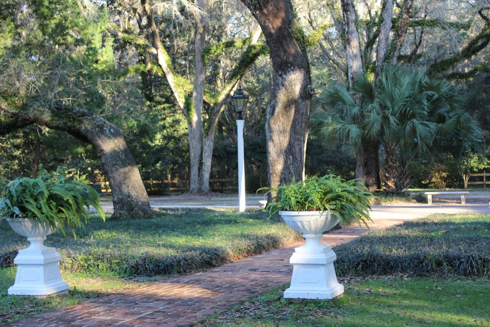
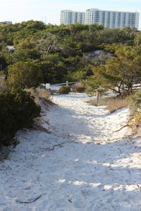
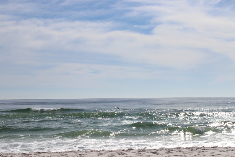
This dune lake at Topsail State Park is one of many “stretched” across South Walton County.

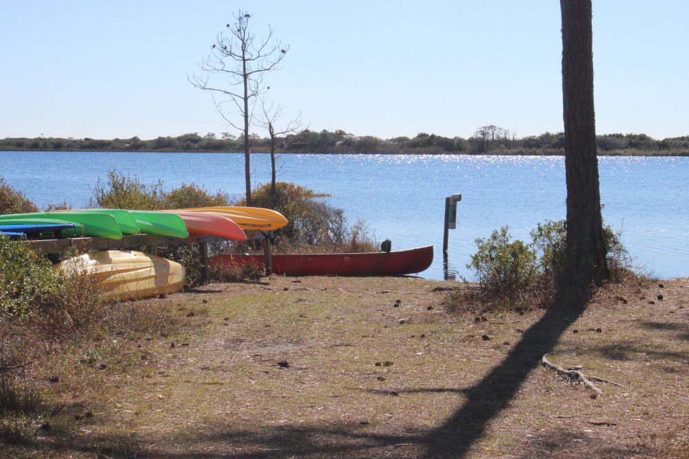
The state park provides kayaks for exploring the dune lake at Topsail. It can be reached by hiking or a tram they provide.
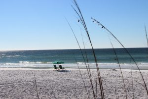
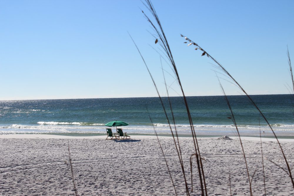
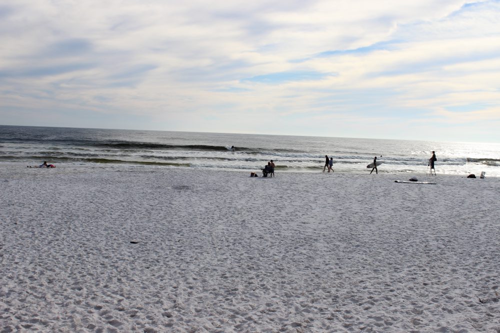
The beautiful beaches of south Walton.
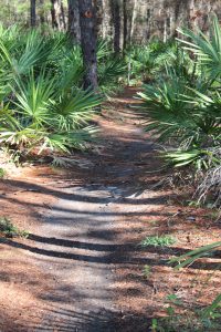
Here is one of the many state forest trails used by hikers and joggers.

The Florida State Forest hiking trail system provides a lot of information about their trails that is very useful.

The Florida State Trailwalkers Program is a neat way to encourage locals to visit their “natural landscape”. You must hike 10 of the selected trails (on their website provided in this article). There is a log you can download and when you have logged your 10 hikes mail it in. You will receive a free patch indicating you are a “Florida Trailwalker”! This is a great way to explore your “natural Florida”.

There are trails that cross Point Washington State Forest that can be driven, hiked, or even explored on horseback.
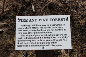
Signage educating the public about the benefits of prescribed burning.
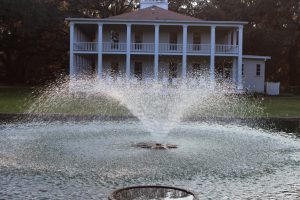
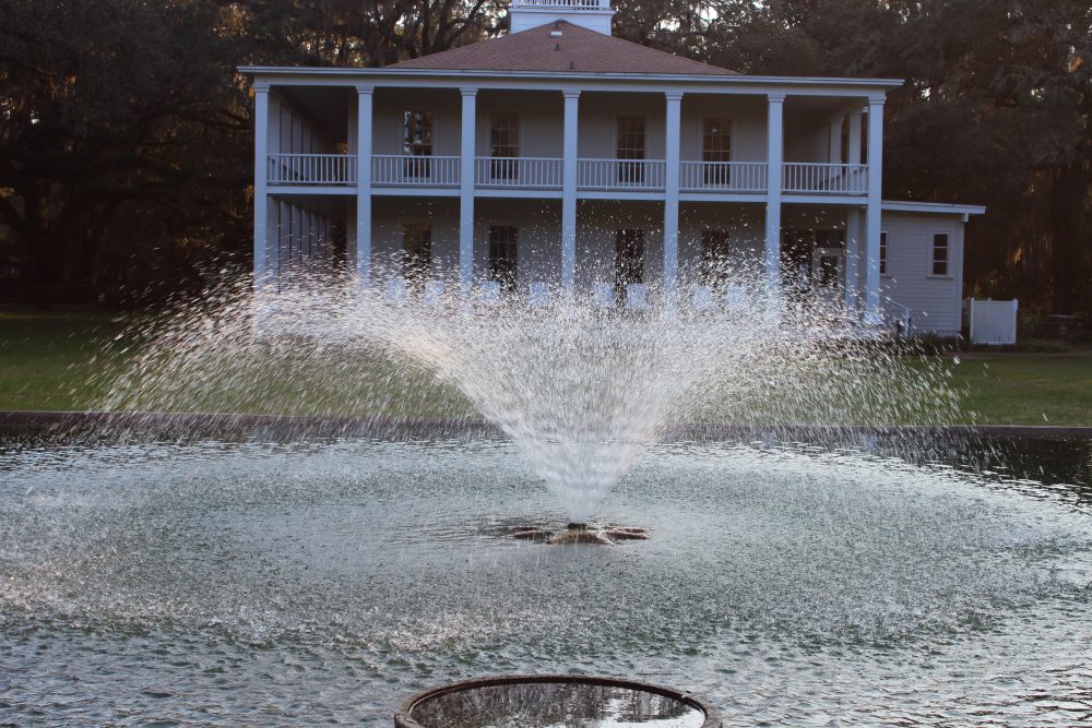
This is the renovated Wesley House at Eden Gardens State Park. The Wesley’s were in the timber industry.
Eden Garden State Park is located north of Highway 98 in south Walton County. It borders the south side of the ICW near Choctawhatchee Bay and is a beautiful getaway.

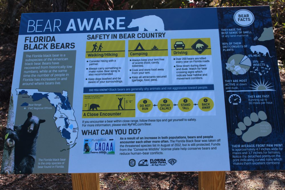
Partly due to successful bear management and partly due to the increase population of humans in the Florida panhandle, bear encounters are in the increase. This sign at Eden Garden State Park provides information on how to deal with an encounter.
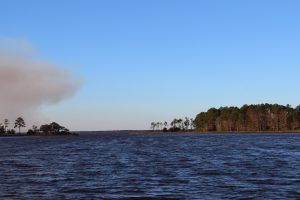
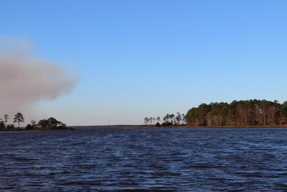
From Eden Garden State Park you can look across the bayou to the point where the ICW leaves Choctawhatchee Bay and enters a manmade canal locals refer to as “the ditch”. Notice the prescribed burn occurring across the bay.
PRESCRIBED BURNING
Now days many are aware of the forest management tool we call “prescribed burning”… but not all. For many people, fires are “wild” and the smoke they generate is an unwanted pain. Much of the southeast, particularly Florida, encounter thunderstorms with frequent lighting. These lighting strikes spark fires which burn across acres of forest. The frequency of the lighting storms – and fires – actually kept the understory below the pines cleared and so the fires typically burned low and slow. The result was an understory of grasses and wildflowers that supported a wide variety of species including deer and quail. When he traveled through the southeast in 1775, William Bartram described the longleaf forest as “open and monotonous – going on for miles”. And this was the case… you could literally see up to a mile across the landscape. But this “monotonous” landscape was misleading in that there were thousands of species found here – many feel one of the most biological diverse systems anywhere.
Today 90% of the longleaf has been logged and much of what remains is fire suppressed. For the reasons mentioned above, residents have resisted the natural burns and many species – gopher tortoises, quail, and indigo snakes to name three – have suffered as well. There is a move across the southeast to restore the old longleaf pine forest. These trees produce excellent timber – though it takes longer to grow than the loblolly and slash pine currently grown – and many are managing their property for quail and deer hunting. Yes… the smoke is a problem but the state forestry system plans their burns to reduce the impact it has on the local community as best they can. If you really want to see the benefits of a well-managed pine forest, take a hike through one – it truly is amazing.

by Rick O'Connor | Apr 22, 2016
ALL PHOTOS: MOLLY O’CONNOR
As many of you already know each month we have posted articles about nature tourism locations along the Intracoastal Waterway in the Florida Panhandle. This month we visit coastal Okaloosa County.
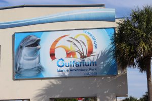
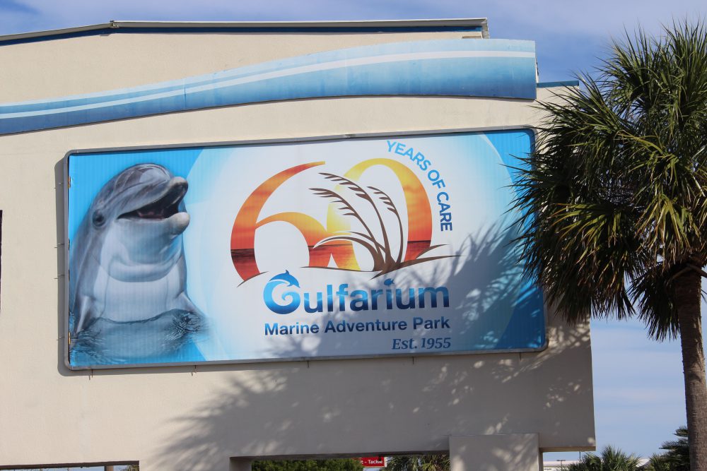
The Gulfarium in Ft. Walton Beach gives those who do not get a chance to go offshore, or dive, to see some of the unique marine organisms found in the Gulf of Mexico.

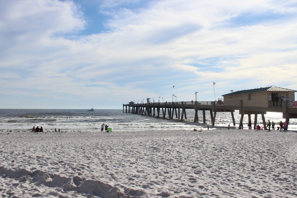
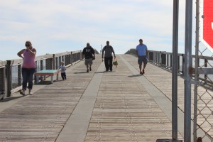
As with many other fishing piers along the panhandle, the Okaloosa Pier not only provides a spot for good fishing but a good spot to watch for marine life and great sunsets.
For years’ tourists have been visiting the beaches of Ft. Walton and Destin. The big draw has been the clean white sand but the area is also known for its really clear water. This clear water has supported a charter fleet that focuses on diving and fishing, but in recent years several operations have included inshore snorkeling and even trawling for marine life for tourists to view.
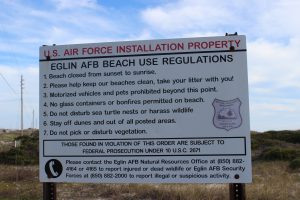
Many feel that you are not allowed on Eglin property. This is true for much of the island under their jurisdiction but there are places where you can park and enjoy the beach – though you must obey their rules.
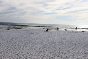
Residents enjoying the beach at one of the public access points on Eglin property.
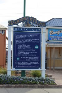
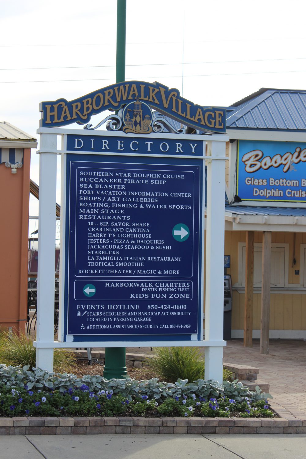
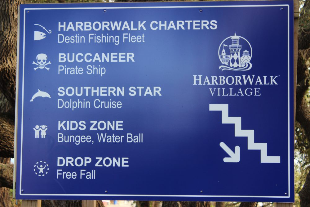
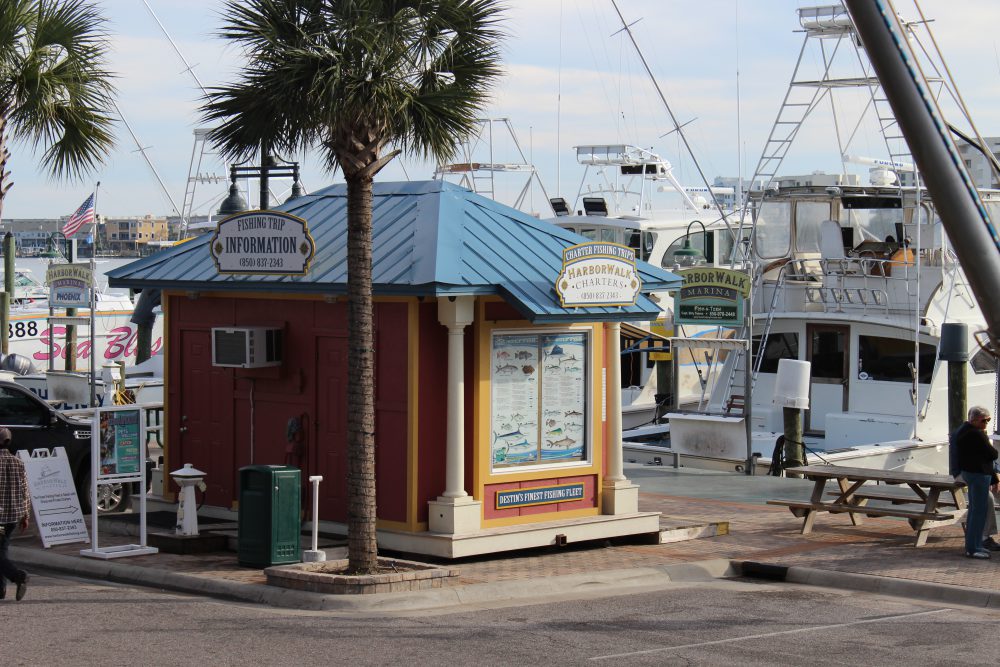
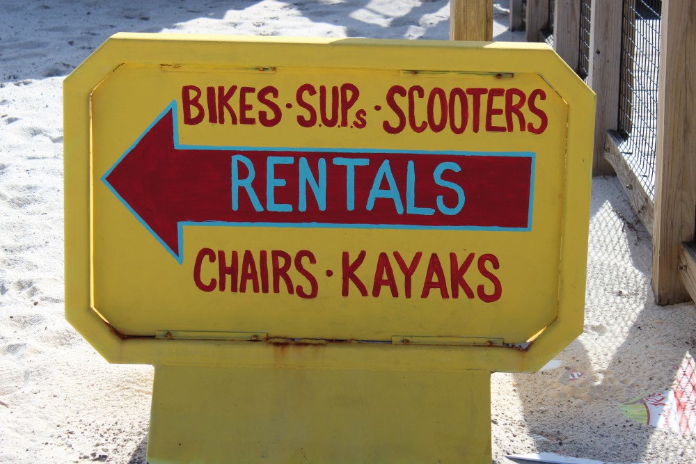
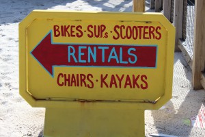
Destin harbor is now home the Haborwalk. There is a lot to see and do on the Haborwalk – and plenty of boat tours.
This sign gives the visitor some idea of the different activities that can be found along the Haborwalk.
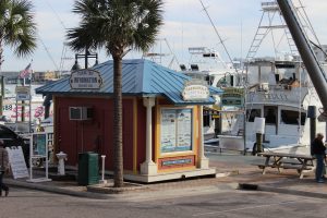
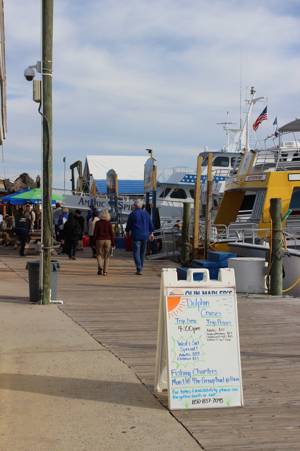
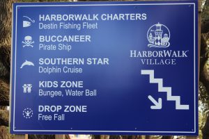
There are numerous types of tours to found along the Harborwalk. Information booths such as this one can help you find what you are looking for.
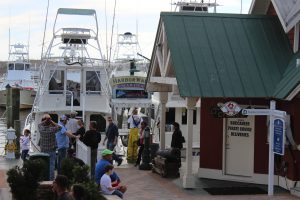
Charters include fishing, diving, snorkeling, and some collect marine life for you to see.

Dolphin cruises are very popular.
There are sailing charters that will allow you to experience the Gulf of Mexico, sunset cruises, and there are some designed with kids in mind.
Henderson State Park is on the south side of Highway 98. It has hiking trails, a campground, and access to the Gulf. This is a nice natural location within a very urban area.
One of the scenic trails where you can explore the natural dune ecosystem in Henderson State Park
ARTIFICIAL REEFS
The natural substrate for most of the northern Gulf of Mexico is quartz sand. There are areas of hard bottom, shell hash, and even some natural reefs but sand dominates the landscape beneath the waves. There is no question that the natural coral reefs of the Florida Keys have been a huge economic engine for that part of the state. The clear, high saline water is filtered by the Everglades and allows much needed light to reach the tiny coral polyps and their symbiotic plant partners, which in turn produce limestone substrate for the polyp colonies to live and grow on.
Locally we have rivers that discharge into the Gulf but the water clarity is still pretty good. The bigger problem for coral development here is the cold winter temperatures and the lack of hard substrate for coral colonies to attach. There are several species of corals, and other encrusting invertebrates and plants, that can tolerate our cooler winters but substrate is still an issue. The answer… artificial substrate… artificial reefs.
Northwest Florida and Alabama have one of the most active artificial reef programs anywhere. Thousands of structures from small concrete pyramids, to chicken coops, to U.S. Navy vessels have been dropped to the bottom. The concept is “build it… and they will come” – meaning the encrusting organisms and eventually larger predatory fishes. At first artificial reefs were just left over rubble and car bodies that were indiscriminately dropped on the Gulf floor. But over years’ marine scientists began to monitor and evaluate what works and what does not and artificial reefs became a science. One question has not been answered… do artificial reefs generate more fish for fishermen – or do they just congregate the existing number of fish into more easily accessible points in the Gulf for easy capture? There is science that supports both arguments… and the debate continues. But if you want to know whether artificial reefs have been an economic success the answer is… yes… by the tens of millions of dollars it has. The charter fleets of Ft. Walton, Destin, Panama City, and Pensacola have all benefited from the artificial reef program. There are numerous structures to dive and many are part of the Florida Panhandle Shipwreck Trail.
If you get a chance take a charter and dive, or fish, one of these interesting and well thought out habitats. Next month we head further east to Walton County and the famous “30A” highway.
by Rick O'Connor | Mar 25, 2016
All Photos: Molly O’Connor
In this monthly series of highlighting outdoor adventures in the Florida Panhandle, we are visiting locations along the Intracoastal Waterway; from the Alabama State line to the Aucilla River. In January we wrote about Perdido Key, last month we visited Pensacola Beach, this month we move east along Santa Rosa Island to the beach community of Navarre.
Navarre Beach is a relatively quiet community on Santa Rosa Island between Pensacola and Ft. Walton Beach. There are some good places to eat, a new RV campground, and plenty of water/outdoor activities. Navarre Beach became famous in the 1970’s as the location for the film Jaws II. I personally witnessed much of the shooting of the film and it was amazing to see how it all actually all works. The hotel that was used in the film is no longer there but the stories are!
On the Island
There are some great kayak and paddle locations on Navarre Beach. Paddling over the grassbeds and to the east of the Navarre Marine Park you can see a lot of coastal wildlife and great sunsets. You can of course paddle the Gulf as well and maybe take a shot at kayak fishing. You will find local kayak rentals and guides by visiting Naturally EscaRosa website.
Paddling in a kayak or on a paddleboard is a great way to view wildlife and natural scenes while visiting Navarre Beach.
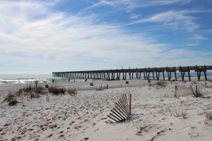
The Navarre Fishing Pier extends over 1500 feet. Not only a great place to fish but a great place to view marine life.
Speaking of fishing, there is the Navarre Beach Fishing Pier which extends 1500 feet out over the Gulf. The pier provides of variety of price options for fishermen of all ages and for $1 you can just walk and enjoy the view. Sharks and sea turtles are often seen from here – and don’t forget the sunsets.
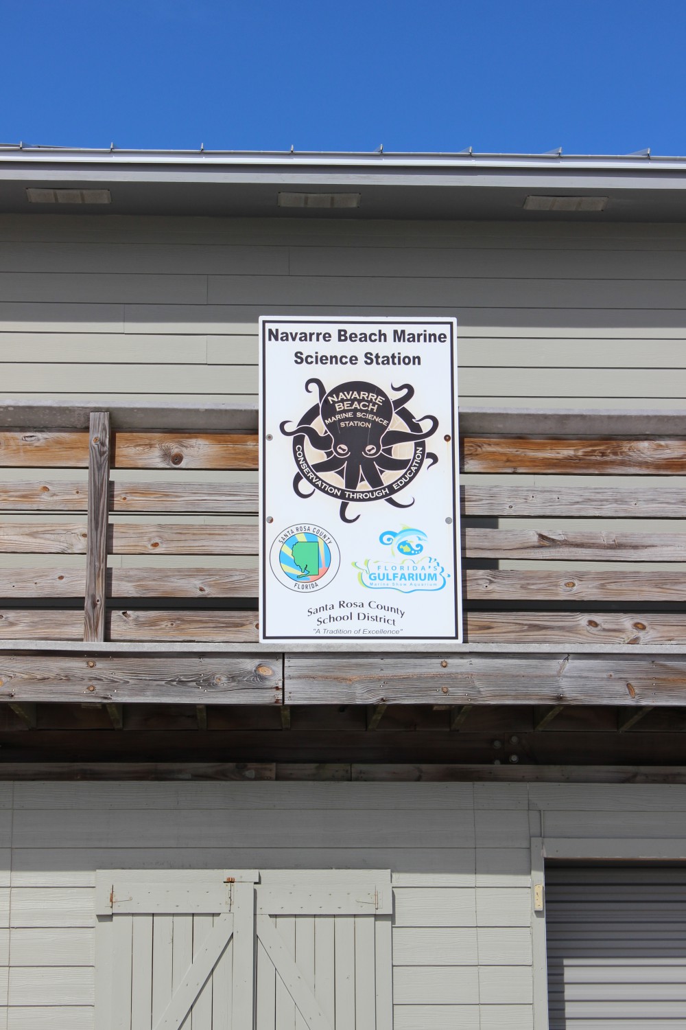
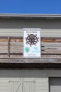
There are two educational interpretive centers on Navarre Beach. The Navarre Beach Marine Science Station is part of the Santa Rosa County School District. They provide programs for elementary, secondary, and dual-enrolled high school-college students. The Station also provides numerous youth camps during the school year and during the summer, as well as providing activities at local community events. To see if they have something going for your young one while you are here visit their website.
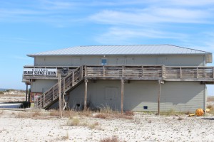
The Navarre Beach Marine Science Station provides education for young and old.
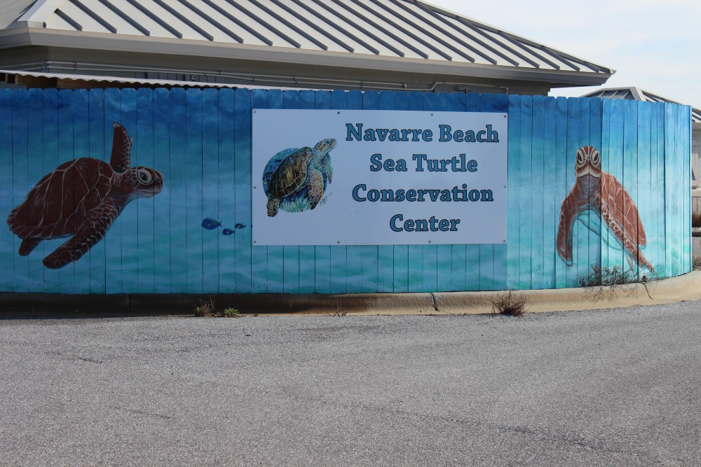
The Navarre Beach Sea Turtle Conservation Center is an educational center that focuses on imperiled marine wildlife but the sea turtle is the star of the show. The center will eventually house an injured sea turtle that can no longer be released but until one arrives, there is plenty to see and learn. Learn more about the center at their website.
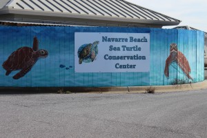
The Navarre Beach Sea Turtle Conservation Center.
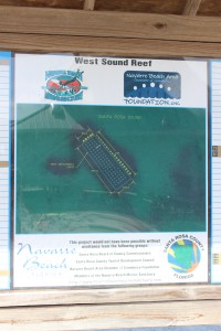
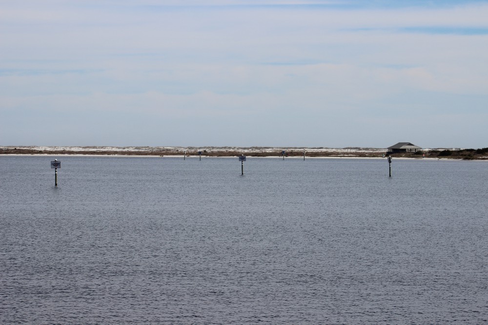
Santa Rosa County also provides a couple of nearshore snorkel reefs for the public. You can find them on both the Gulf and Sound sides.
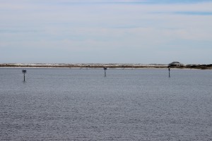
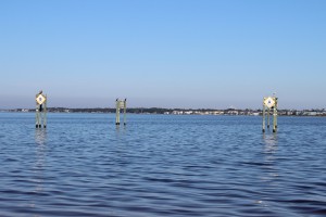
These day markers are marking two nearshore snorkel reefs on the Sound side of Navarre Beach. They can be accessed from the Navarre Marine Park.
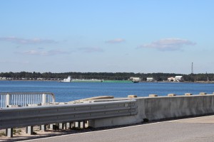
A barge travels beneath the Navarre Beach Bridge as it heads east along the ICW.
Off the island
Actually, you have to leave Santa Rosa at this point. The island between Navarre Beach and Ft. Walton Beach is the property of the United States Air Force.
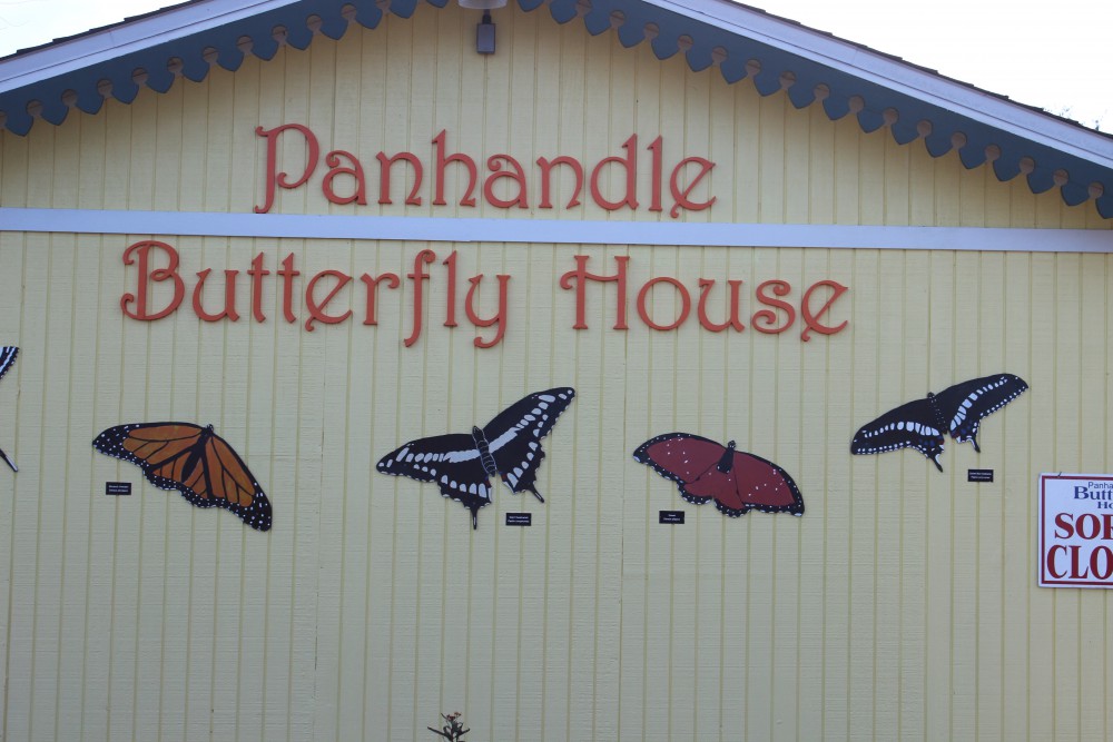
As you leave Navarre Beach to travel the ICW from the north side, you see the Panhandle Butterfly House on your left at the Highway 98 traffic light. This is a great stop. Viewing live butterflies feeding on native plants in all stages of their lives is a cool sight. There are plenty of volunteers to educate you about native butterflies and there is a pond out back with a lot of turtles and birds to view. It’s a neat and relaxing place.
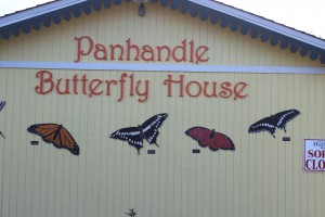
The Panhandle Butterfly House is located just to the west of the traffic light on Highway 98 as you leave Navarre Beach.

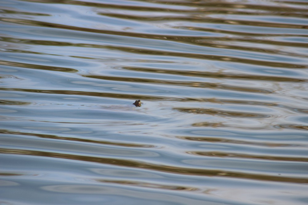
Numerous turtles can be found swimming and basking in the pond behind the butterfly house.

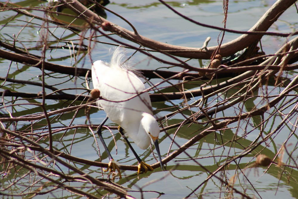
A snowy egret hunts for a meal in the turtle pond behind the butterfly house.
Nature Notes: Sea Turtles
Who doesn’t love sea turtles! These silent, charismatic creatures have been navigating Gulf waters, and nesting on our beaches for centuries. Certainly the largest species of turtle humans will encounter, weighing in between 200-300 pounds – with some reaching 1000 pounds, they are an awesome thing to see. There are five species found in the northern Gulf of Mexico and there are records of four them nesting here. Those species are the Loggerhead, Green, Kemp’s Ridley, Hawksbill, and the giant of them all the Leatherback.
Sea turtles begin their lives within the egg buried on a beach. The sex of the embryo is determined by the temperature of the sand they are incubating in – cold ones become males and 29°C appears to be the cutoff. After 60-70 days incubating the young hatchlings emerge at night and orient towards shortwave light (moon or stars off the water). However, in recent years much of the light we provide in our homes as directed them in the wrong direction (disorientation). There are “turtle friendly lights” that use longwave colors and significantly reduce the disorientation problem. All coastal counties along the panhandle require these lights for island structures. Many of the hatchlings are lost as they wonder to the Gulf. Ghost crabs, fox, coyotes, and now feral cats capture and consume many.
Those lucky enough to reach the water now have to deal with fish and bird predators. These young head offshore seeking the Sargassum mats where they will spend their growing years feeding and hiding.
As immature adults most species will return to the coastal areas to feed on seagrasses or invertebrates. As they become sexually mature they, once again, head to sea. Though they travel far and wide they are known to return to their place of birth for breeding and egg laying. Breeding takes place just offshore and females may come ashore more than once to deposit their clutch of 100+ eggs.
In addition to light pollution, marine debris, boat strikes, commercial fishing nets, and even holes and chairs left on the beach overnight have caused their numbers to decline. You should be aware that most coastal counties have a “leave no trace” ordinance asking you to remove your chairs, tents, and other items at the end of the day – and please fill in any holes you may have dug. All species of marine turtles are currently listed and protected by the U.S. Fish and Wildlife Service. In Florida, the USFWS has yield management of these species to the Florida Fish and Wildlife Conservation Commission. They are truly a magnificent creature and we hope all get to see one while exploring our beaches.
Now it is time to move to Okaloosa County – the April issue will look at Ft. Walton and Destin. Let’s head there and see what cool outdoor adventures await us.
You can find information on ecotourism providers in Escambia and Santa Rosa counties by visiting Naturally EsacRosa.
by Rick O'Connor | Feb 12, 2016
All Photos by Molly O’Connor
We began our series on Nature Tourism along the ICW at the Alabama state line on Perdido Key and discussed the ICW itself. This month we will continue in Escambia County with a visit to Pensacola Beach.

The dune fields of panhandle barrier islands are awesome – some reaching over 50 ft. in height. This one is near the Big Sabine hike (notice white PVC markers).

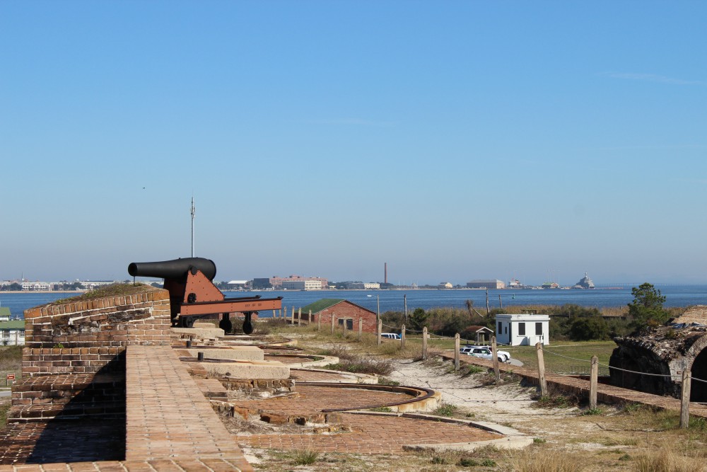
The cannons of Ft. Pickens protected the entrance into Pensacola Bay. The views of the western end of Santa Rosa Island are great from here. There is plenty of nature and history to be discovered at this park. Plan to stay the day.
BARRIER ISLANDS
Pensacola Beach is on Santa Rosa Island. The longest barrier island in the panhandle, Santa Rosa Island stretches 44 miles from Ft. Pickens, at Pensacola Pass, to Destin Pass in Okaloosa County. With miles of some of the whitest beaches in the world, these panhandle islands have a variety of ecosystems. The mineral that makes the beach so white is quartz, one of the minerals found in granite rock. Over eons weathering and erosion has released these minerals from the granite in the Appalachians and sent it downstream to the Gulf coast. The densities of the different minerals force it to settle out at different rates. Quartz, being one of the less dense minerals, reaches the Gulf of Mexico where it encounters longshore currents. In the panhandle these currents more often run east to west moving the quartz in that direction. This sand forms bars and shallows which made colonial navigation a problem and good hiding places for pirates. Some of the bars remain above sea level and form dune fields and plant communities, forming barrier islands. Many animals, such as shorebirds and sea turtles, seek these islands for nesting because of few predators. The xeric conditions favor reptiles and birds, but there are many mammals and insects as well. Freshwater ponds form on many of the islands and here amphibians and fish came claim territory. The high energy beach of the Gulf side supports a community of subterranean organisms which include the mole crab (sand flea) and coquina. The low energy bay side harbors salt marshes along the shoreline and seagrass meadows below the surface. These habitats support a rich variety of marine life, some of the most productive in the world.
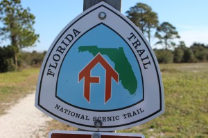
The Florida Trail extends (in sections) over 1,300 miles from Ft. Pickens to the Florida Everglades. It begins at this point.
PENSACOLA BEACH
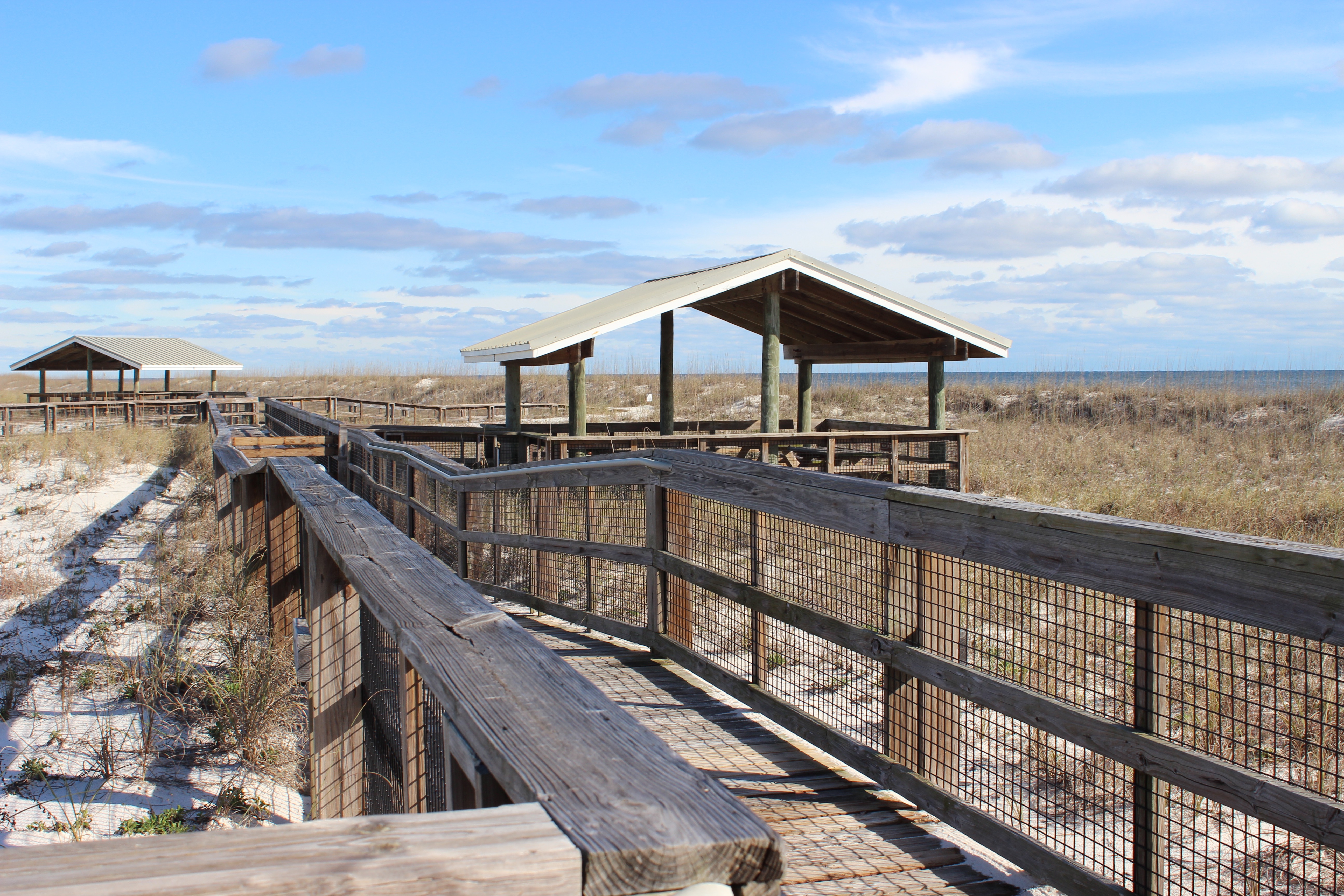
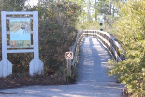
There are many places on Pensacola Beach where visitors can enjoy these natural places. At the west end of the island is Ft. Pickens, part of the Gulf Islands National Seashore. Within the park you will find beaches to comb, piers to view wildlife and fish, jetties to fish or dive, fortifications to view the island, and a nice museum to educate you on both the natural and cultural history of the area. Here the Florida Trail begins. This trail is segmented and stretches from Ft. Pickens to the Everglades, but here it stops at Battery Langdon; it can be hiked or biked. Along the trail there are freshwater ponds and sections of maritime forest with a variety of wildlife viewing and photography. The multiple loop campground is found on this trail.
Between these pilings at Park West is one of the county snorkel reefs. Visibility is tough but the fish are there.
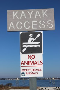
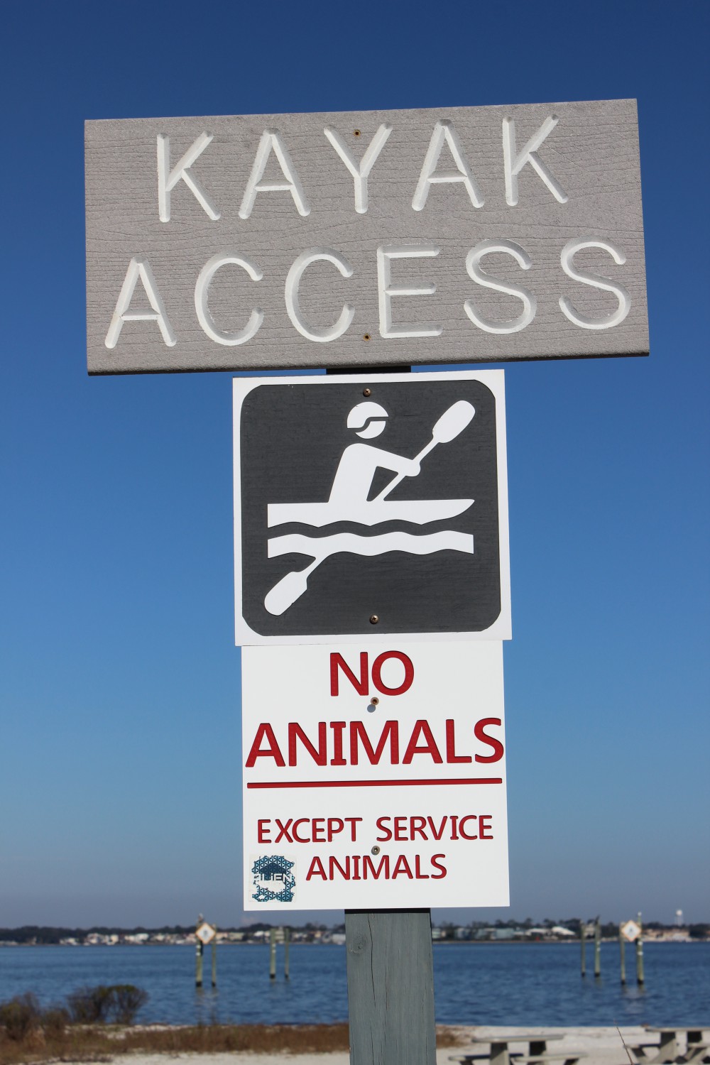
There is a kayak launch at Park West as well.
Just outside the entrance to the park is a county park named Park West. Here there is a kayak launch and nearshore snorkel reef on the bay side, with picnic area and beaches on the Gulf.
In Pensacola Beach proper there are several businesses that rent paddleboards for paddling the shallow seagrass filled Little Sabine. There are two marinas which offer sailing, fishing, and diving charters as well as dolphin tours. There are numerous artificial reefs off of Pensacola including the world’s largest – the U.S.S. Oriskany. On the Gulf side you will find the Pensacola Beach Fishing Pier where not only can you fish but, at times, see marine life. Sharks, sea turtles, dolphins, and large fish are often seen. The sunsets are great here. At the Visitors Center you can get a map to follow the Eco-Trail. This driving trail of 28 kiosks will take you to natural spots and the kiosks provide education about the area. There is a prize if you complete the trail.
Heading east from Pensacola Beach you once again pick up a portion of the Florida Trail. At this location there is a bike path, which can be walked or biked. Park East houses a popular nearshore snorkel reef. This snorkel reef is on the Gulf side and there are beach markers to help the diver locate it. On the bay side is Big Sabine. This area of high dunes and salt marsh has no formal trail but there are PVC pipes placed to help navigate your way in and out.

The paddleboard entry to Little Sabine can be found next to the Pensacola Beach Marina.
The Pensacola Beach Fishing Pier is not only a great spot to catch fish, it’s a great spot to see marine life – and great sunsets.
Further east you once again enter the Gulf Islands National Seashore. Escambia County is lucky to have almost 50% of their portion of the island within this national park. There are miles of natural beach to explore but you must use the public parking lots (no roadside parking) and watch your speed, this area supports several species of nesting shorebirds – some of which are listed as imperiled in the state of Florida.
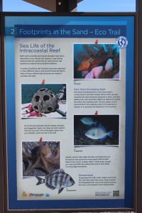
The Santa Rosa island Authority’s Eco-Trail has 28 kiosk to navigate and learn about the natural history of the island. It is a fun and educational car trip. You can get the map for this trail at the visitors center on Pensacola Beach.
To learn more about nature and farm tourism in Escambia County visit www.NaturallyEscaRosa.com and download the free app at the App Store or Google Play
Next month – Santa Rosa County.

Aligning these markers will assist the snorkeler/diver in locating the Gulf snorkel reef at Park East. The swim is a bit further than Park West but the visibility is much better.
by Rick O'Connor | Jan 23, 2016
All photos: Molly O’Connor
More and more visitors to the Gulf coast are seeking nature encounters when on vacation. Of course there are still the amusement park fans but there is an increasing number interested in visiting “The Real Florida” that our state park system promotes. Actually, I have found that many lifelong residents of the Florida panhandle have not visited many of the scenic natural areas of our state.

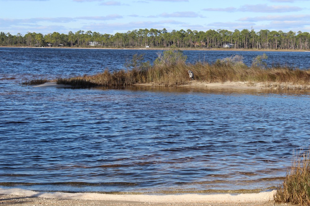
Looking from the kayak launch at Johnson’s Beach you can see across the ICW to Big Lagoon State Park. This body of water has seagrass and salt marshes along 12 miles of natural shoreline ending at an old fortification that can only be accessed by boat. There is plenty of snorkeling, birding, and fishing to do along the way.
At the kayak launch at Johnson’s Beach is a short trail through the dunes of Perdido Key. You will be able to view a variety of plants and birds, or maybe, as I did, find a large coachwhip basking on a dune.
There is no doubt that to conserve something you need to love it… and to love it you need to experience it. We think if you visit some of our natural areas you will fall in love with the area and hopefully we can conserve much of it. Nature-based tourism is a way to support the local economy but we need natural areas for this to happen… fishing is not much fun without fish.
So we are going to begin a series of posts highlighting some of the nature-based tourism locations that visitors and locals can enjoy throughout the panhandle – from dunes of the coast to the forest of “north-end”. To begin the series, we will follow the Intracoastal Waterway from the Alabama state line to the Aucilla River (basically the Florida Panhandle). We begin at the western tip… Perdido Key. But first let’s talk about the Intracoastal Waterway itself.

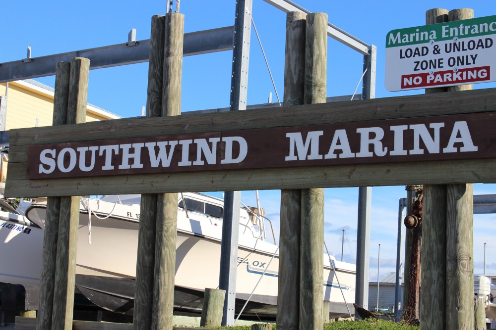
Southwind Marina is found on the northside of the ICW across from Perdido Key. For the visitor who is interested in fishing or diving the vessels can reach the Gulf in just a few minutes. Some dive charters will take you to spear lionfish.
INTRACOASTAL WATERWAY
The concept of the Intracoastal Waterway (ICW) dates back to the 19th century but construction on the northern Gulf section began in 1925. The ICW begins in Brownsville TX along the U.S. coastline to Carrabelle, FL. From here you follow a series of markers across the open Gulf to Anclote Key (near Tampa) where again the inland ICW heads to Ft. Myers. There is a canal that cuts across to Lake Okeechobee, and the east coast of Florida, but many boaters take the Florida Keys route. If crossing the state through the lake you will arrive at Jupiter Inlet on the east coast the ICW which travels north from here to Virginia – a total of about 3000 miles. The waterway was developed to make commercial shipping safer. Plans to cut a canal across north Florida from the Crystal River to the St. Augustine area never happened. The ICW consists of manmade canals, protected lagoons and sounds, and open sections of local bays.
In the Florida panhandle the ICW begins at the state line in Perdido Bay. It follows a narrow section of water north of what the locals call “Old River” between Ono Island AL and Innerarity Point FL. It eventually enters Big Lagoon in Escambia County before crossing the lower portion of Pensacola Bay. It is this portion of the ICW we will focus on in this article.
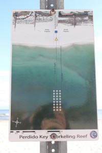
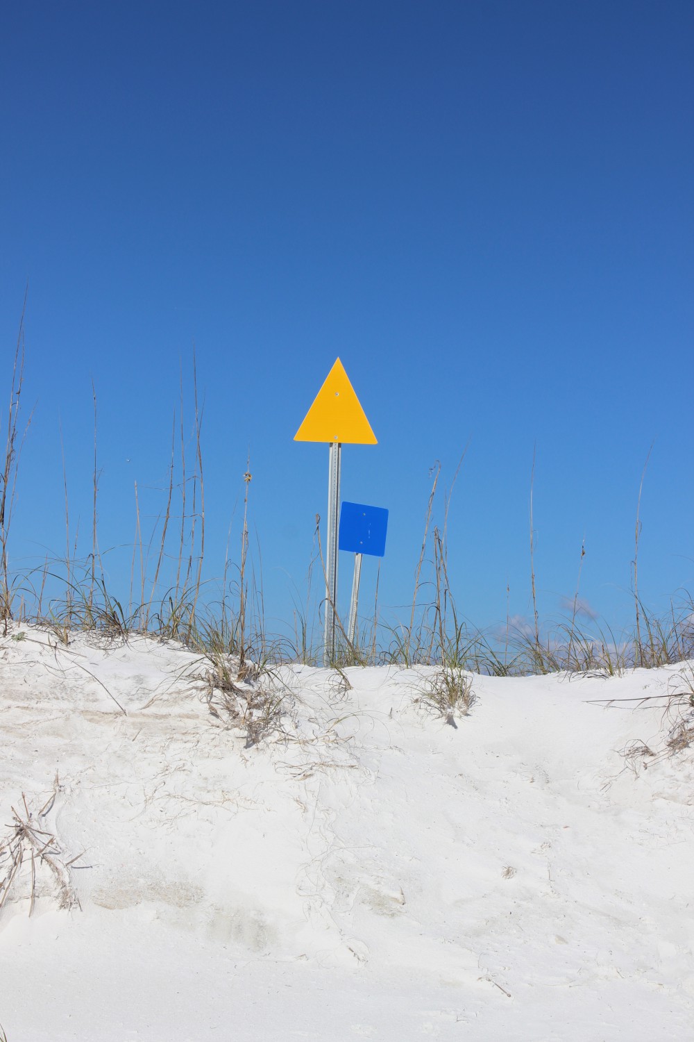
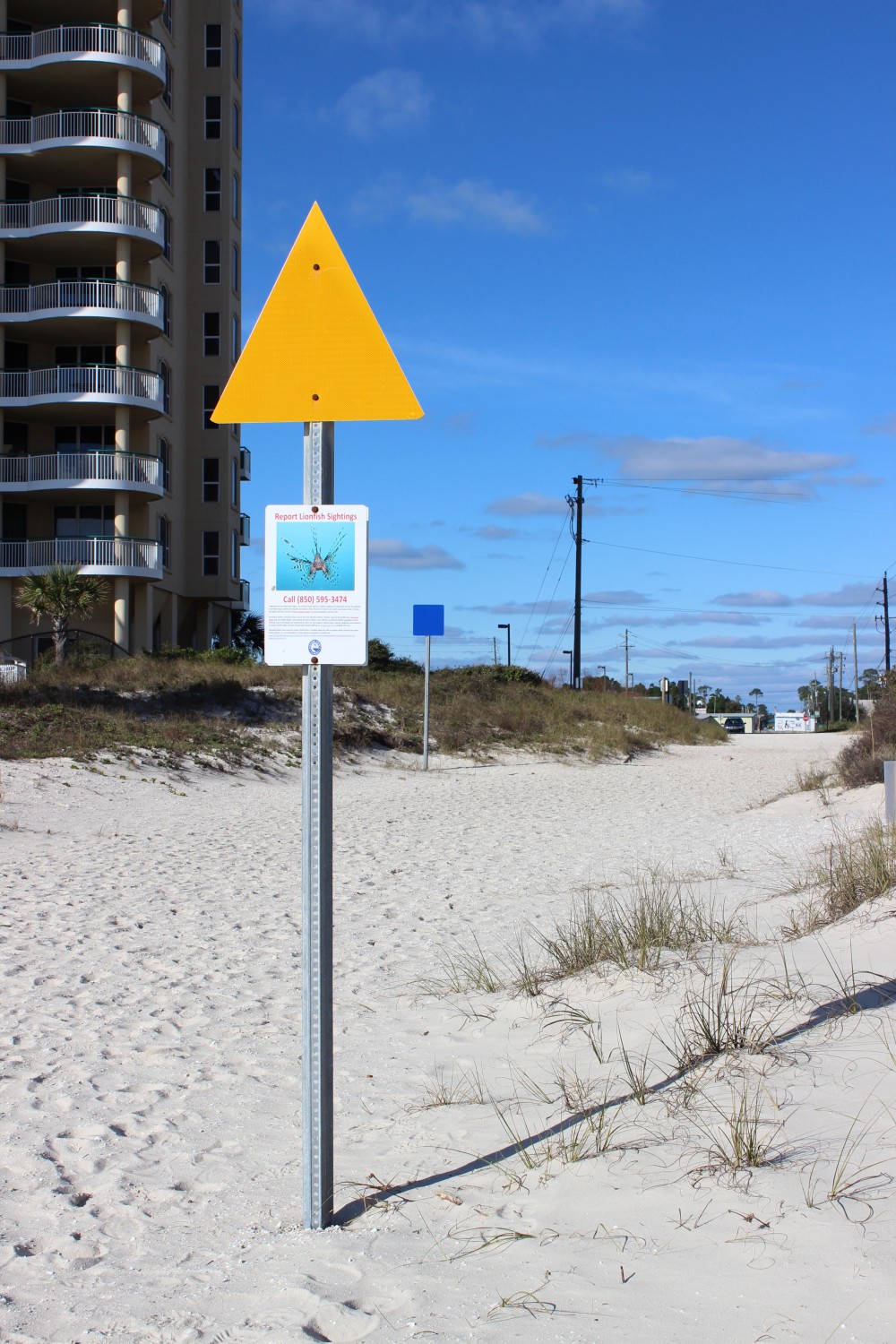
Escambia County Division of Marine Resources has provided three inshore snorkel reefs for the visitor who would like to experience a reef diving but is not a certified diver. The reefs can be found by aligning the blue square and yellow triangle on the beach. This one is on Perdido Key near Johnson’s Beach.

The yellow triangle used to locate the reef while you are swimming. These nearshore reefs have a variety of small reef fish and occasionally, in the warmer months, a sea turtle may visit.
PERDIDO KEY
Perdido Key is a 15-mile-long barrier island stretching from the mouth of Perdido Bay to “Ft. McRae” near NAS Pensacola in the Gulf Islands National Seashore. The western end is actually in Alabama. The state line is near Ono Island and the famous Flora-Bama Bar. North of the Key is “Old River”, then Ono Island AL, then the ICW itself, and eventually Innerarity Point FL. For the nature tourist you have miles of white sandy beaches to the south which are great for shell collecting, birding, and fishing. In the summer the beach comber can find ghost crabs, flowers, and maybe a nesting sea turtle. The “river” side of the island has numerous small islets and seagrass beds that offer good birding, snorkeling, and fishing. Be aware though to stay out of the ICW here. It is very narrow and the passing barges are very large. Dive flags are required of snorkelers in Florida. There is a public kayak launch on the north side along “Old River”. Perdido Key is home to the endangered Perdido Key Beach Mouse. Many locals have lived on the island all of their lives and have not seen one… maybe you will be lucky!
As Perdido Key Drive heads north off of the Key you will find a small side road leading to Johnson’s Beach and a section of the Gulf Islands National Seashore. Just as you turn onto Johnson’s Beach Road you will find Sandy Key Road to the south. There is a public access point here and a public nearshore snorkel reef provided by Escambia County. These Gulf side reefs attract a variety of small reef fish, including many tropicals, as well as larger species such as sheepshead and snapper. Be sure to have your dive flag with you.

This public kayak ramp is found on the north side of Perdido Key. From here the paddler can visit several small islets and snorkel grassbeds. There’s good fishing too. The ICW is narrow here though so you need to be aware of large boat traffic.
The last 12 miles of Perdido Key is part of the Gulf Islands National Seashore. The road only goes about 2 miles of that but you are allowed to hike the rest. The southern shore is more beautiful white beaches and the north is bordered by Big Lagoon. Big Lagoon is pretty shallow and outside the ICW host a lot of seagrass. Here you can snorkel for hours and see fish, crabs, and maybe a scallop or two (they are illegal to harvest here though). Many species of birds can be found here including osprey. There is a short natural trail at the kayak launch on the lagoon side of the park where you can see a variety of dune plants, animal tracks (such as deer), and other wildlife such as coachwhip snakes and the elusive diamondback terrapin. You can paddle from the kayak launch 12 miles to the east point and “Ft. McRae”. Seagrasses, salt marshes, dunes, freshwater ponds, and assorted wildlife can be found here. Back Country Camping is allowed in this portion of the Seashore but you must register at the Ranger station.
As you leave Perdido Key you find Big Lagoon State Park on your right. Located on north shore of Big Lagoon you will find the ICW. This park provides camping, hiking, snorkeling, birding, and kayak rentals. The park has hiking trails and freshwater ponds that harbor a variety of wildlife including species of freshwater turtles. Just down Gulf Beach Highway you will find Southwind Marina, which is home to many charter boats. Also located on Big Lagoon these charters have quick access to offshore reefs in the Gulf of Mexico for those interested in diving and fishing, including trips to hunt the invasive lionfish.

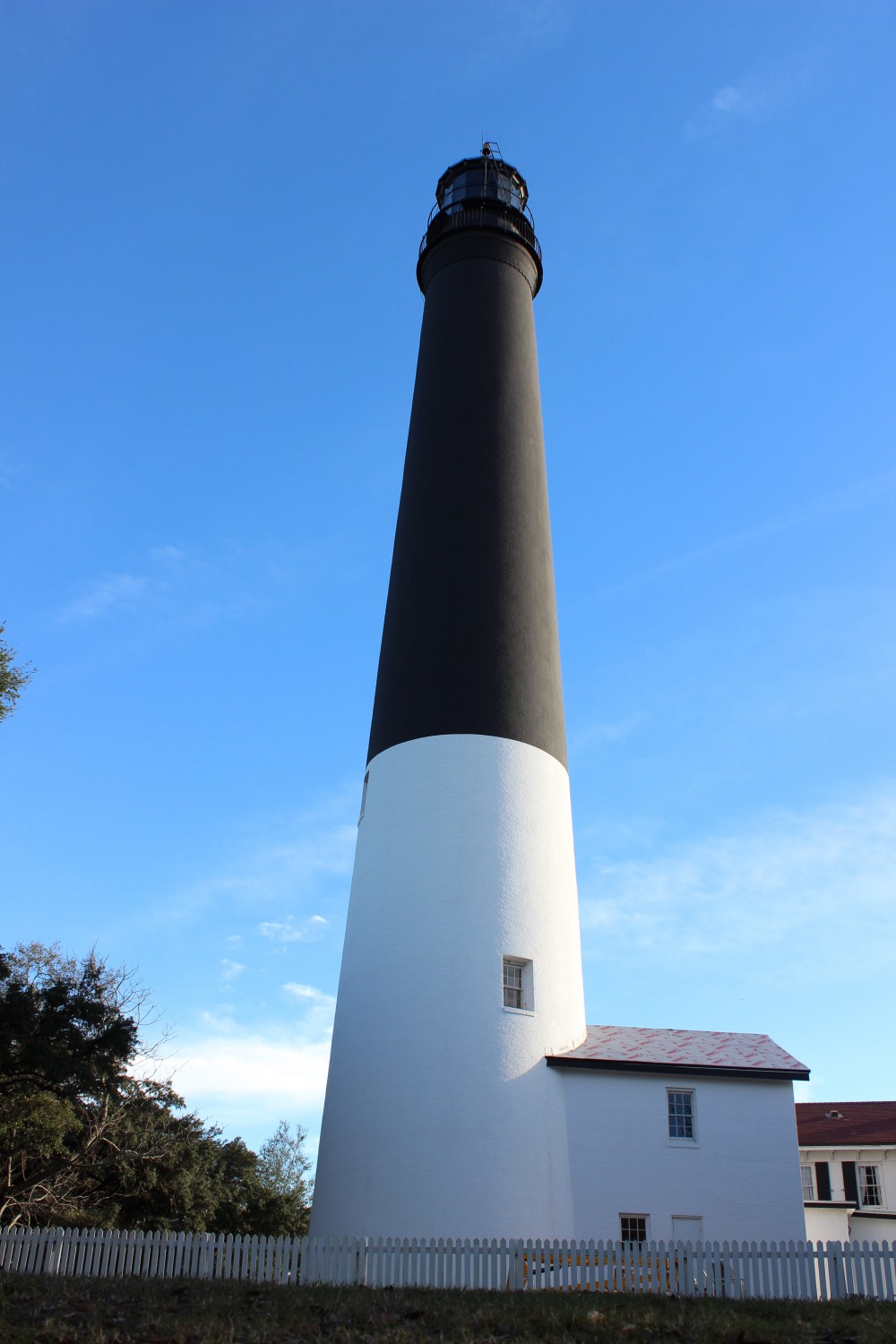
The 150′ Pensacola Lighthouse was first lit in 1859. The distinctive colors made it easy for mariners to identify from offshore and the light signal (time between flashes) is 21 seconds. This is a must see for those visiting the Perdido Key area.
From the Pensacola Lighthouse you get a great view of the open Gulf and the eastern end of Perdido Key. Here the pass separates Perdido Key (on the right) and Santa Rosa Island.
Before you leave the Perdido Key area and head for Pensacola Beach the nature tourist should make a stop at NAS Pensacola. The 150 foot Pensacola Lighthouse is open to the public and the views of the ICW as well as the two barrier islands (Perdido Key and Santa Rosa Island) are wonderful. There is a nature trail aboard NAS called Trout Point which leads you from the main road to the ICW.
To learn more about nature trips in the Perdido Key area contact Sea Grant Agent Rick O’Connor at (850) 475-5230 or roc1@ufl.edu and to find local nature tours visit NaturallyEscaRosa.com
Next stop… Santa Rosa Island.