by Rick O'Connor | Nov 6, 2015
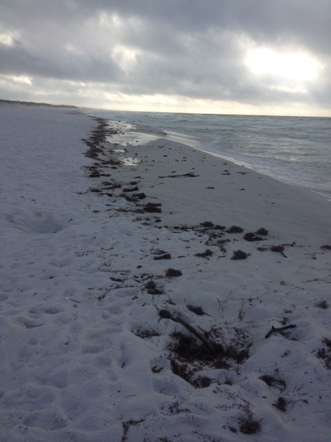
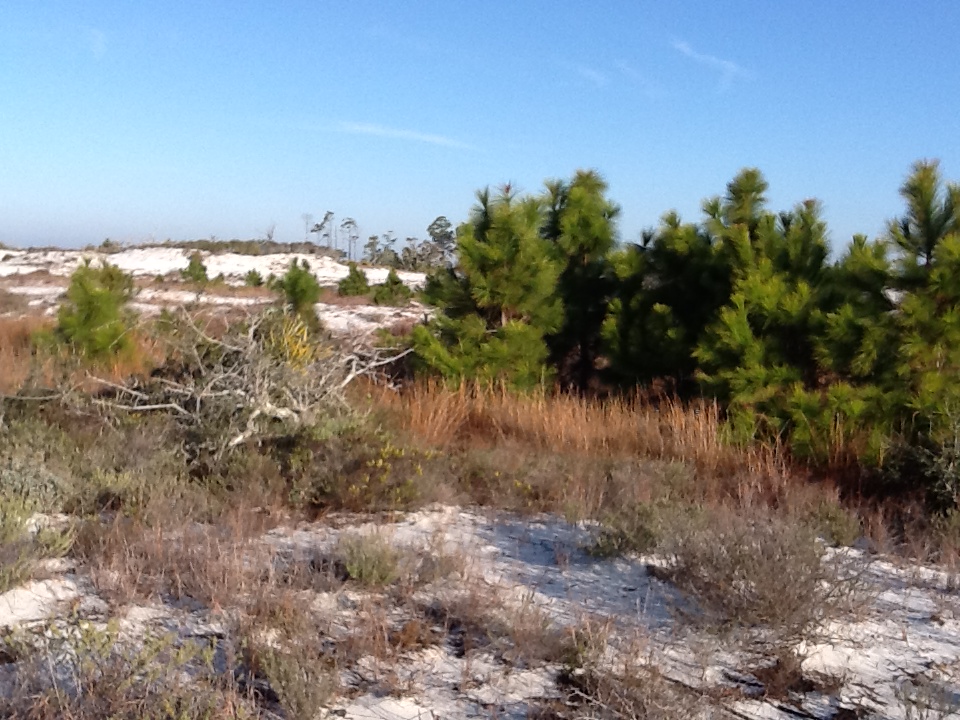
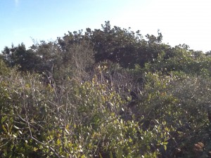
Hernando de Soto and his party crossed the Aucilla River sometime in October of 1539 and celebrated Christmas in what is now Tallahassee. Many things in Florida have changed since de Soto passed this way, but when the 2015 Panhandle Outdoors LIVE! tour hiked the Aucilla Sinks portion of the Florida Trail this September, many things had not.
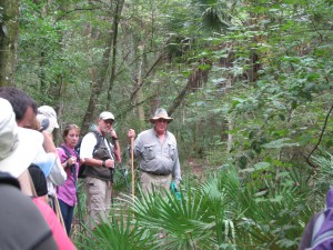
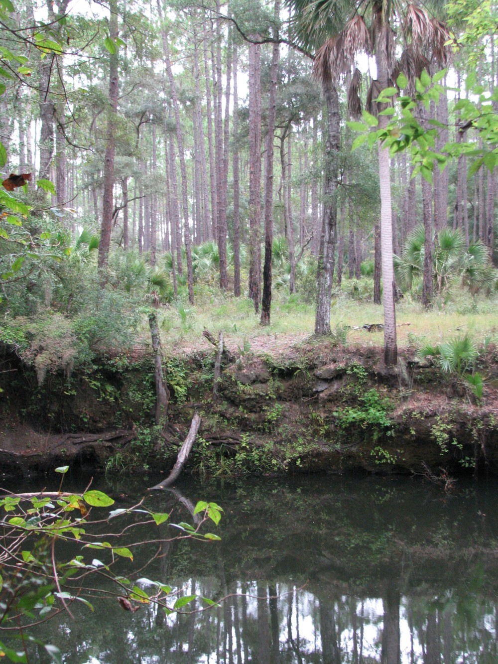
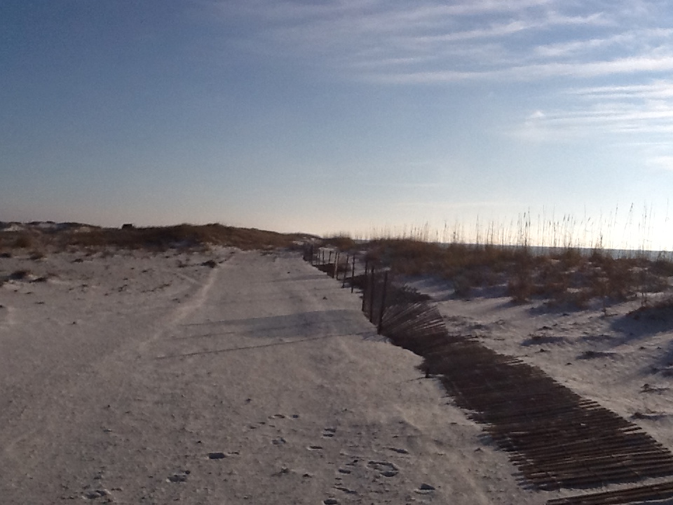
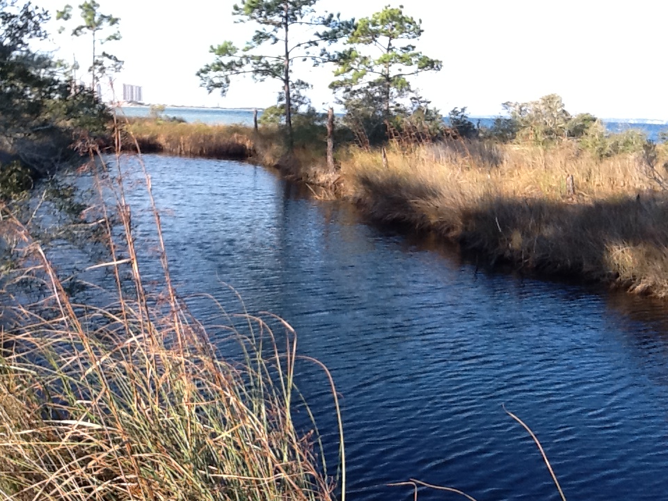
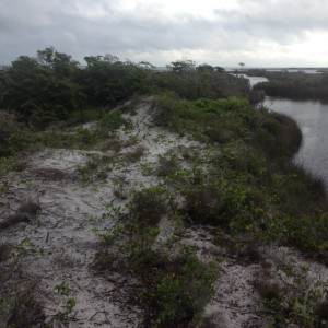
Panhandle residents explore the area of Aucilla Sinks with local guide David Ward.
Photo: Jed Dillard
Yes, the trail is maintained and marked by the Apalachee chapter of the Florida Trail Associations and there are bridges in spots, but the blood sucking bugs that bedeviled deSoto haven’t dissipated. More importantly, the spectacular and distinctive area provides a relatively easy hike that reveals the connections between geology and hydrology in an area with little disturbance by the settlers who followed the first Europeans into North Florida.
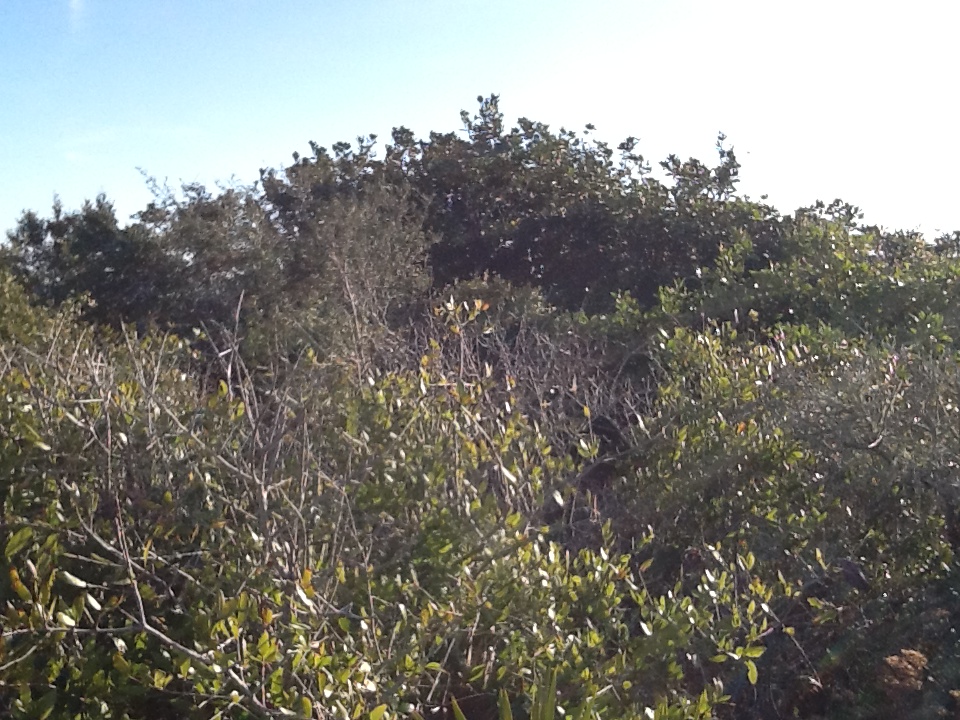
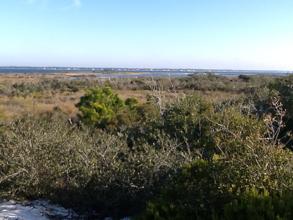
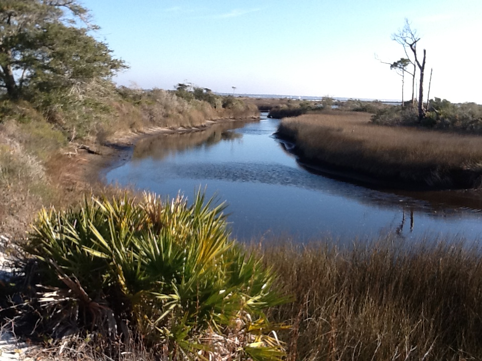
Hikers got up close and personal views of the Karst topography found in North Florida. This topography occurs as the tannic rivers and runoff dissolve the underlying limestone on their way to the aquifer. These connections and voids in the bedrock allow the Aucilla River to “come and go” above and below ground as it moves to the Gulf of Mexico as do all rivers in the Suwannee River Water Management District other than the Suwannee.
Native Jefferson county guide, David Ward pointed out the contrast between tannic water in the river channel and the clear water in caves near the river. “In those caves the water is crystal clear. You are looking at the water of the aquifer itself.”
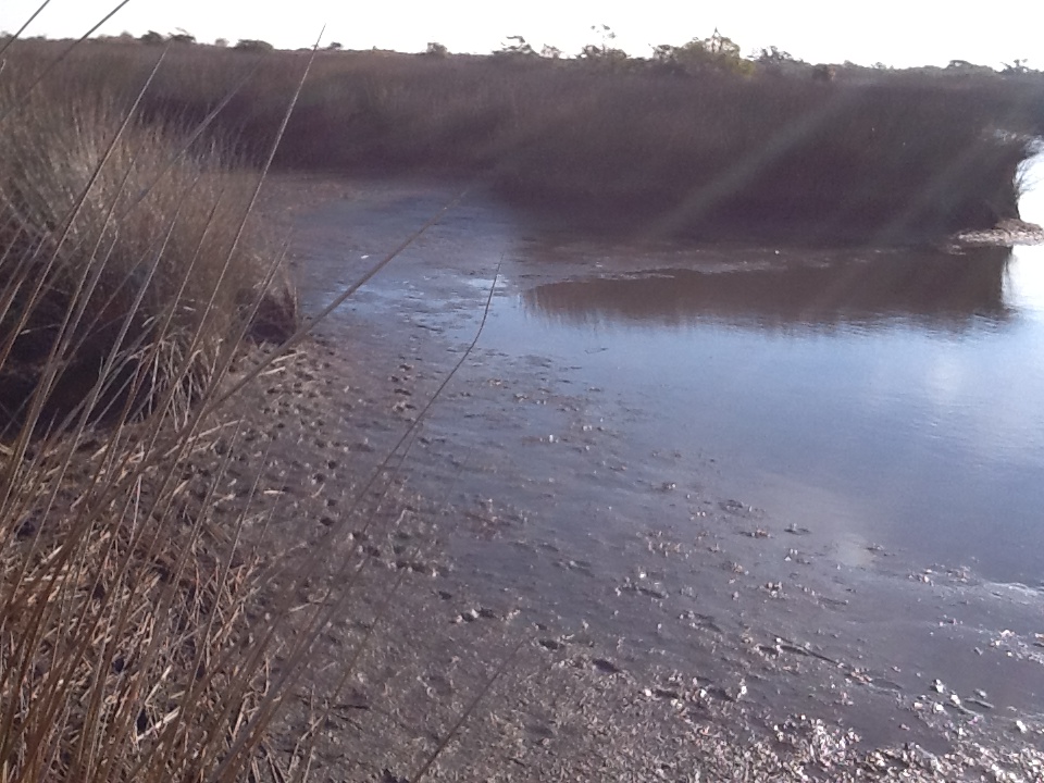
Leon County agent Will Sheftall seized the opportunity to drive home how vulnerable Floridians are to ground water pollution and its effects on our water supply. “Here there’s little distance between the surface and the ground water. In these sandy soils, water moves quickly from the surface to the aquifer. Whatever is in that water can easily get into our ground water. Our personal activities and our public policies need to reflect that to ensure the future of Florida’s water quality.”
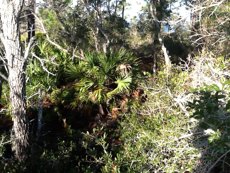
As we reached a slightly elevated area, Ward pointed out a longleaf pine/wiregrass community restored by reinstituting controlled burning. The open vegetation contrasts with the non-fire resistant species such as parsley hawthorn in wetter areas usually untouched by fire. “These pine savannahs were widespread when the Europeans arrived,” Ward noted. “Over my lifetime in these woods, I’ve seen appropriate management bring back these conditions closer to what we know it was like when the Europeans arrived.”

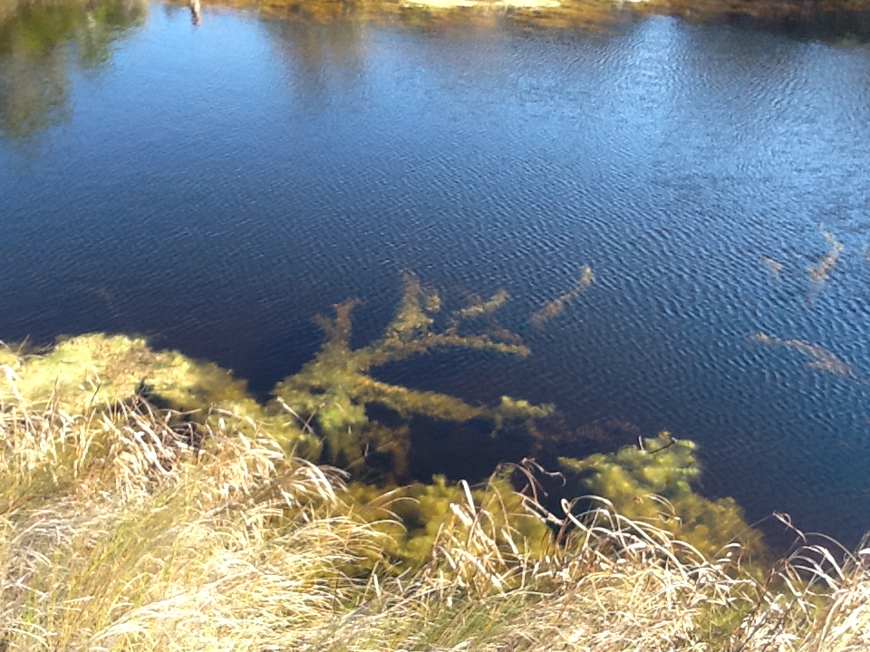
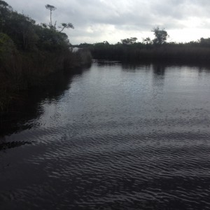
One of the many locations where the Aucilla River “rises from the limestone caverns beneath the earth.
Photo: Jed Dillard
Information on this section of the Florida Trail is available from the Apalachee Chapter of the Florida Trail Association, the Suwannee River Water Management District and Florida Fish and Wildlife Conservation Commission. Humidity never went below 80 percent during our late morning, early afternoon trip. November will likely provide less buggy and surely less muggy conditions. If you’d like to learn about this area from the comfort of your recliner or need some extra encouragement to strike out on the walk, check out this program previously broadcast by WFSU TV. http://wfsu.org/dimensions/viewvideo.php?num=184 Either way, you’ll know more about Florida’s spectacular natural world.
AUTHOR: Jed Dillard; Livestock and Forges Extension Agent; Jefferson County
by Rick O'Connor | Sep 21, 2015
A couple of years a few agencies in south Alabama put together something they called the Alabama Birding Trail. It was a relatively simple idea really – they developed a brochure that marked different locations where visitors could enjoy birding in the two county area. They had large signs posted at those locations so that the visitor knew they were at the correct location. There seemed to be a need for this with some vacationers and they provided… It was a big success. More and more visitors were using the trail. It became so popular they that conducted a survey and found that about 40% of the visitors who come to our Gulf coast are looking for outdoor/wildlife adventures to do. Ecotourism is becoming more and more popular.
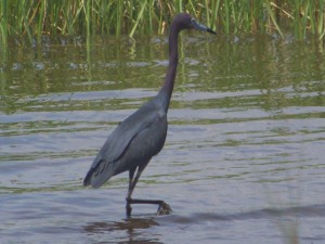
A heron exploring a local salt marsh for food.
Photo: Molly O’Connor
The panhandle is no different. Each year hundreds of thousands to millions of visitors come to our beaches. There is no doubt that we have some of the most beautiful beaches in the world, and they are a huge draw, but we have a lot of outdoor adventures to provide them as well. From scalloping in St. Joe, to snorkeling the jetties in Panama City, to fishing in Destin, to paddling in Navarre, to dolphin cruises in Pensacola the panhandle provides a wide variety of activities for both the local residents and visitors to enjoy – and employment for many.
So what does this have to do with estuaries?
Well, for most of these businesses a healthy wildlife population is needed. A dolphin cruise with no dolphin is not much. Visitors coming to stay on our beaches will certainly enjoy the white sand and emerald waters. They will return home with pictures and stories of how beautiful it was and how they hope to return – but if they saw a sea turtle that week, or went snorkeling and found thousands of tropical fish to view, or kayaked over a lagoon and found horseshoe crabs or stingrays… the stories get better and their urge to return grows. Wildlife and healthy estuaries are good for business – for everyone.
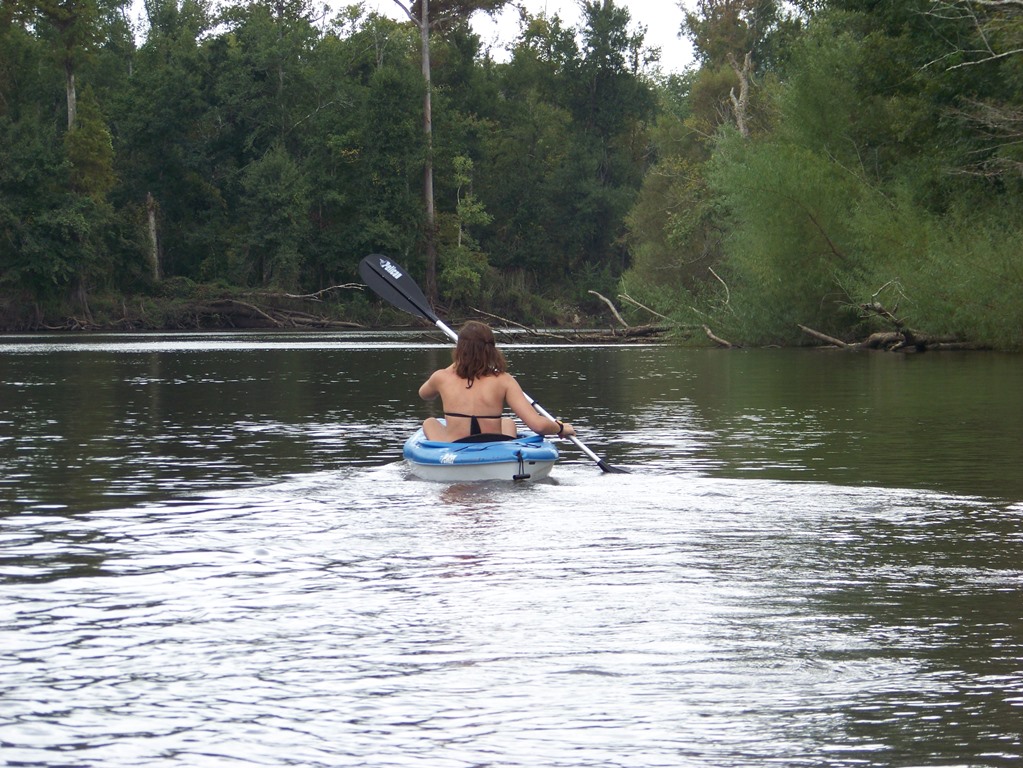
Paddling Blackwater River.
Photo: Adventures Unlimited
In 2014 the Escambia and Santa Rosa county extension offices launched a program called Naturally EscaRosa to help both locals and visitors locate both agritourism and ecotourism businesses in the two county area. The sight provides information on camping, hiking, fishing, sailing, snorkeling, biking, wildlife viewing, and farm tours (of which the popularity is growing across the country). Most of these depend on a healthy bay. Health advisories, fish kills, and loss or degradation of habitat are all problematic for the ecotourism industry. Snorkeling and finding no scallops, paddling over a lagoon and seeing no wildlife, or a slow fishing day on a charter will obviously hurt business – and remember the spin-off’s such as hotels and restaurants as well.
Estuaries have certainly benefitted this industry. From providing a nursery ground for the species we are trying to view or catch, to paddling through a peaceful salt marsh to get away from the hustle and bustle of everyday life, estuaries have been an important part of our lives. And the sunsets… don’t forget the sunsets.

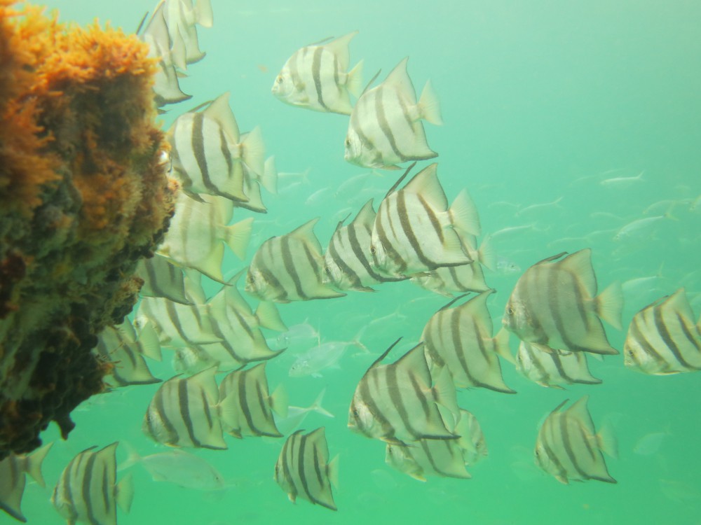
Spadefish on a panhandle snorkel reef.
Photo: Navarre Beach Snorkel
We encourage all locals and visitors to get out and enjoy the beauty of our bays. As the beach season ends the crowds are down, the weather is cooler, and it is a perfect time to venture out. For information about different activities in your area contact your local tourism board, or your county extension office.
by Rick O'Connor | May 29, 2015
This month there were many more plants flowering… it is true that April showers do bring May flowers. May not only brings more flowers but more tourists. Everyone is out enjoying the weather, including some wildlife. I was happy to include Florida Master Naturalist Paul Bennett on this hike and he was very helpful identifying plants. Thanks Paul!

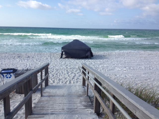
Tent set up on Pensacola beach to protect from the sun. Photo: Rick O’Connor
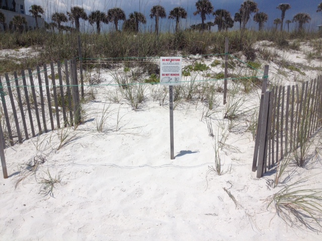
Sign altering and educating folks that this is a sea turtle nest. Photo: Rick O’Connor
It is sea turtle nesting season all along the Florida Panhandle. The season begins in May and ends in October. This time of the season the females are heading up the beach looking for good nesting locations near dunes. There are five species of marine turtles that inhabit the northern Gulf and there are records of each species nesting here. They emerge at night and move towards the dunes where they excavate a deep cavity to lay about 100 eggs. The nest is covered and she returns to the water. The incubation period is between 60-70 days and the temperature of the nest determines the sex of the hatchling; the warmer eggs becoming females. It is illegal to disturb a sea turtle nest.
This tent was occupied when I was there but all too often they are left overnight so folks can return the same spot the following day. Tents and chairs are barriers for both nesting females and emerging hatchlings. If at all possible, remove these for the evening. In some counties it is required. Another problem is artificial lighting. Adult turtles are distracted, and many times abort the nesting activity due to bright lights. Most panhandle counties have a lighting ordinance that requires homes to use turtle friendly lighting. To learn more about the turtle friendly lighting program and local ordinances contact your county Sea Grant Agent at the local Extension office or visit http://myfwc.com/wildlifehabitats/managed/sea-turtles/lighting/.
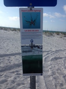
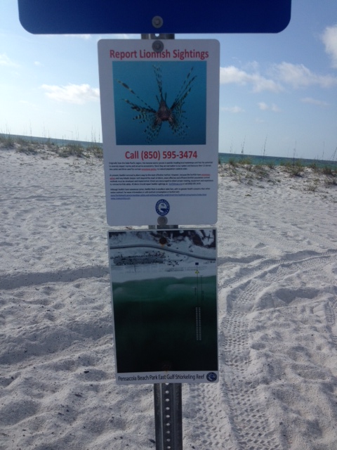
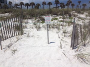
This county sign marks a public snorkel reef and also educates everyone about lionfish. Photo: Rick O’Connor
Mangrove seed washed ashore. Photo: Rick O’Connor
Summer means swimming and in many local counties there are interesting snorkel reefs nearby. We asked that everyone keep an eye out for the invasive lionfish as they enjoy their day. If one is spotted be aware they do have venomous, though not deadly, spines and please contact your local Sea Grant Agent at the county Extension office to let them know. If you are in Escambia County you can log your sighting at www.lionfishmap.org and FWC has a lionfish app for reporting; http://myfwc.com/news/news-releases/2014/may/28/lionfish-app/
The seed is of a red mangrove tree. These are common coastal plants in south Florida and elsewhere in the tropics. The red mangroves drops their seeds (propagules) into the water to drift in the currents to new locations. They frequently wash upon our shores and sometimes take root, but they do not last during our colder winters.
This Whitlow-Wort, also known as “square flower”. Common dune plant. Photo: Rick O’Connor
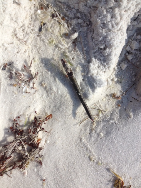
Track of an unidentified snake crossing a dune. Photo: Rick O’Connor
The flower to the left is the Whitlow-Wort, or as some locals call it… “square flower”. The track is of a snake but could not find it so I am not sure which species. The weather warms quickly here along the Gulf coast. A few months ago we may have been able to find this animal but with the increasing heat they were in a cool place somewhere. Snake encounters this time of year are typically at dawn and dusk.
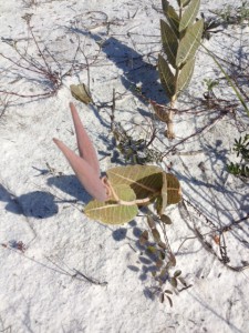
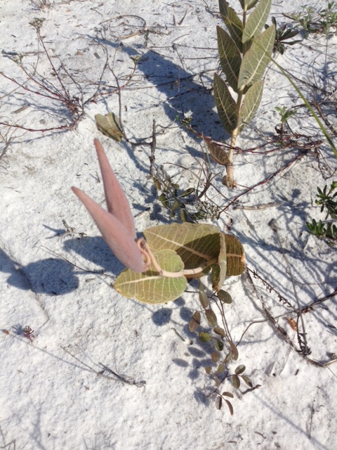
The seed pod of a milkweed. Photo: Rick O’Connor
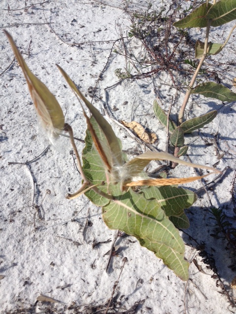
An open seed pod of a milkweed releasing seeds. Photo: Rick O’Connor
The milkweed bloomed a few months ago but here in May we find both the seed pods and, in the photo to the right, the “dandelion-like” seeds being released. This is one of the plants used by the migrating monarchs, which we should see later in the year.

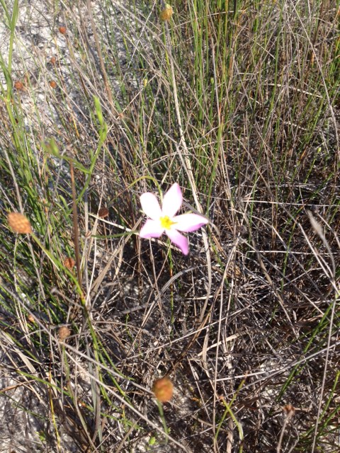
Marsh Pink, a flower found in the wetter areas of the island.
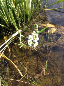
Narrow-leaved Sagittaria. Another water loving plant.
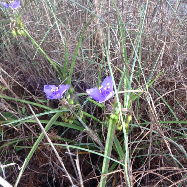
Here are two of the many flowers we saw today. Both of these were found in the freshwater ponds located in the swale areas of the barrier island. The flower to the left is known as Marsh Pink. The one to the right is Narrow-leaved Sagittaria.
The yellow vine called “Love Vine”; correct name is Dodder.
It is good to see bees on the island.
This orange-yellow stringy vine is called “Love Vine” but there is not much love here; this is a parasitic plant called Dodder. This is the first we have seen of it this year and expect to see more. Many residents on the island believe it to be an non-native invasive plant but it is actually a native and quite common out there. I have also seen it in the north end of Escambia County.
We did see a few bees today and this is a good sign. There have been reports in recent years of the decline of our native bees and the impact that has had on gardening and commercial horticulture. In addition to seeing bees Paul and I also came across the famous yellow fly. These were encountered near the marsh on the sound side of the island. Loads of fun there!

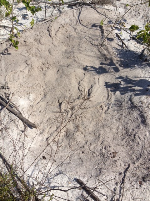
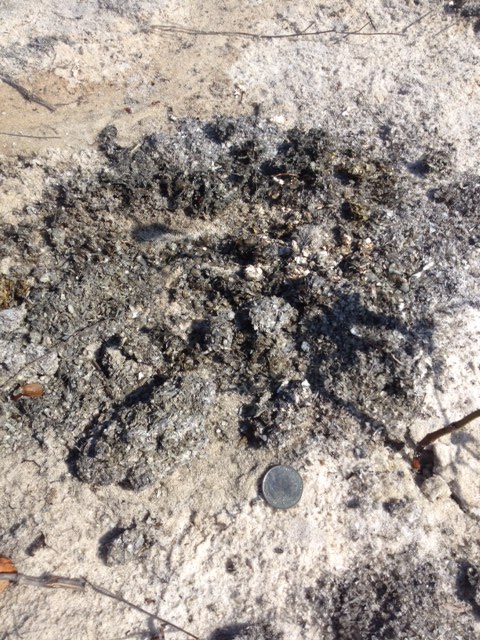
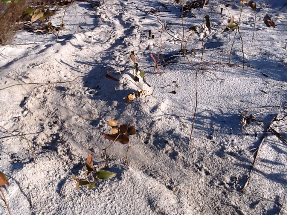
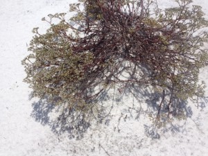
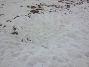
The “bed” made by an unknown animal that has been frequenting this location all year. Photo: Rick O’Connor

This scat pile was near the location of the “bed” and along the drag marks made by this animal.
If you have been following this series since we began in January you may recall the strange “bedding” and drag marks we have encountered near the marsh (you can read other issues on this website). I have seen these drag marks, and apparent bedding areas, every month except last. I showed them to Paul and we are still not sure what is making them. Again, whatever it is seems to move from one body of water to another. We cannot find in foot tracks to help identify it… but we will!
The photo to the right is of a large scat pile approximately 15-16” across. It was relatively fresh and contained crab and shrimp shell parts. Not sure if it was left by the same animal that continually makes the drags but was in the same location so…
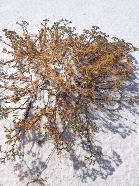
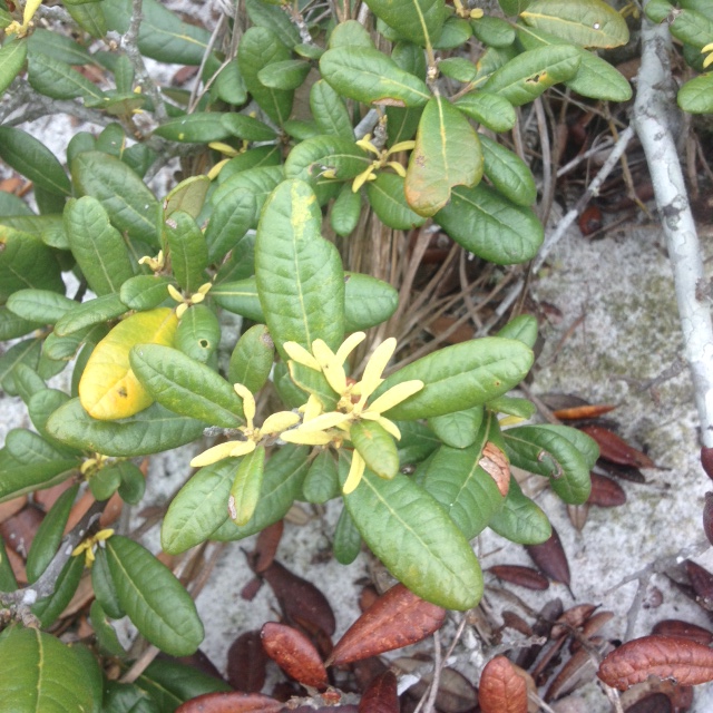
The pretty, but invasive, beach vitex. Photo: Rick O’Connor
Many of the plants on our barrier islands are blooming now, and so is this one. This is Beach Vitex (Vitex rotundifolia). It is an invasive/not-recommended plant. Currently we are only aware of 22 properties in Escambia County that have it. Sea Grant is currently working with the SEAS program at the University of West Florida to assist in removing them. If you believe you have this plant and would like advice on how to remove contact your local Sea Grant Agent at the county Extension office.
Let’s see what shows up in June!
by Rick O'Connor | Apr 17, 2015
As we left the winter months and headed into spring I was expecting a lot of new blooms, new animal tracks, and more live encounters with wildlife… and then the rain began. I do not know if the entire panhandle has been getting what Pensacola has but the rain has been nonstop for over a week now. I track rain days for a water quality project and for the first three months of 2015 the number of days during a month where it rained was between 23-30%. We are about half way through April and so far it has rained 61% of the days. WELL… rain or shine we will make this hike and see what is happening on our barrier island.
Hole left by a sand castle architect. These can be problems for wildlife and rescue vehicles. Photo: Rick O’Connor
The first thing I noticed when I began the trip along the Gulf was this large hole left by a sand castle architect. These can be problematic for some forms of wildlife, including sea turtles, but they can also be a problem for rescue and turtle watch vehicles. Please enjoy the beach and make awesome sand castles, but when you are finished please fill the hole.
Sargassum is floating form of brown algae. Notice the “air bladders” (pneumatocyst) Photo: Rick O’Connor
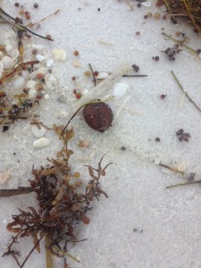
A tropical seed commonly referred to as a sea bean. Photo: Rick O’Connor

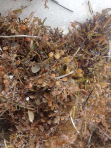
The line of seaweed and debris along the surf zone is called wrack. Photo: Rick O’Connor
The line of seaweed and debris that washes ashore during storms is called the wrack. For the most part it is natural material and provides the nutrients needed for many of the high energy shoreline plants to grow. Many of the beach animals found in the berm and primary dune depend on this wrack as well. Many locals and visitors find this material and eye sore and, at times, producing an unpleasant odor. But this material is an important part of the beach ecology. Sargassum is a drifting member of the brown algae, sometimes called “gulfweed”. It possess small air bladder structures called pneumatocysts that allow it to remain at the surface of the open Gulf where the sunlight is. These large offshore mats of Sargassum have been targets for local fishermen for decades. Many small invertebrates live in these drifting mats and these are targets for small fish, which in turn are targets for even larger sport fish. They are also the hideaway for sea turtle hatchlings. When the little guys head for the Gulf after hatching this is where they are heading. Large ocean currents, including the Gulf Stream, push Sargassum into large mats in the middle of the open ocean. The area within the Atlantic where this happens in known as the Sargasso Sea. If you get a chance this summer, grab a small hand net and mask when the Sargassum is just offshore. Collecting you may find a lot of cool interesting creatures. Sea Beans is a generic word for a variety of tropical seeds that wash ashore in the northern Gulf. Some of these may sprout, including mangroves, but most will not make it through our winters.
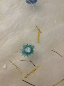
The Blue Button Jellyfish is a tropical cousin of the Portuguese man-of-war. Photo: Rick O’Connor
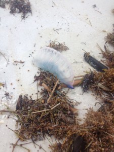
The Portuguese Man-of-War is one of the more venomous jellyfish in Florida waters. Photo: Rick O’Connor.
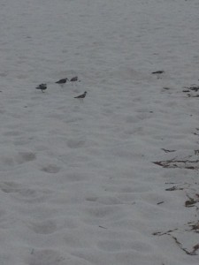
A variety of shorebirds utilize the wrack. Photo: Rick O’Connor
One of the more venomous jellyfish in Florida waters is now making its way onto our shores. The Portuguese man-of-war, named for the many “guns” this animal possess, is well known by locals but not so much by some of our visitors. The man-of-war is actually not one animal but a colony of sedentary polyp jellyfish that produce an inflated bag which floats at the surface carrying them across the sea. The dark blue tentacles hang down into the water column where passing fish are stung and consumed. Each of the polyps have connecting stomachs which helps move the food around to the whole colony. The sting of this jellyfish is quite painful and should be avoided. When they arrive life guards will usually fly a purple flag.
Their close cousins, the Blue Button Jelly, is very similar to the man-of-war albeit they are much smaller and the venom is not as potent. They are more tropical and not common along the northern Gulf but in recent years more have been washing ashore; they are here now.
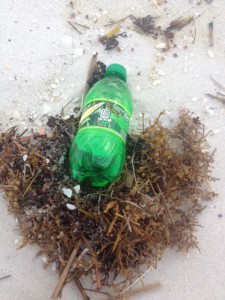
A variety of plastics ends up in the Gulf. Each is a potential problem for marine life. Photo: Rick O’Connor
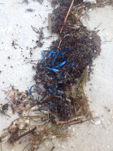
Pieces of plastic ribbon resemble jellyfish tentacles and are frequently consumed by sea turtles. Photo: Rick O’Connor
One of the bigger issues are oceans are facing are discarded plastics. These materials takes years to decompose and are found in all oceans and seas. Even some distant isolated islands have huge piles of this form of marine debris. Plastics can entangle marine organisms or they may actually swallow it, plugging their digestive system and eventually starving them. We encourage locals and visitors alike to help with this problem by taking your trash with you and discarding it in a location where it will not reach the Gulf.
This ephemeral pond formed around a small dune which becomes a temporary island. Photo: Rick O’Connor
The Chinese tallow is an invasive species the entire state is dealing with. Photo: Rick O’Connor
With the heavy rains of the last week ephemeral ponds have formed on parts of the island. These small pockets of freshwater can be “manna from heaven” for many island residents, particularly the amphibians. I have been hiking this section of Pensacola beach for years, leading field trips for all sorts of groups. I have never seen this Chinese Tallow until today. Also known as the “popcorn tree” due to its unique looking fruit, this plant is listed as an invasive in the state of Florida and is very aggressive. I did not see any others and will seek permission to remove it before it spreads to other dunes and out competes the native plants.

One of the few plants blooming in April, the Spiderwort is a common weed in many lawns. Photo: Rick O’Connor
The blossoms of Conradina first appeared in February. They are all but gone this time of year. Photo: Rick O’Connor
I was actually expecting more flowers to be in bloom this month but there were few. The Conradina, which have been in bloom since February, have lost most of its blossoms. The “new kids on the block” are the Spiderwort, the Primrose, the Sandhill Milkweed, and the Devil’s Joint Cactus.
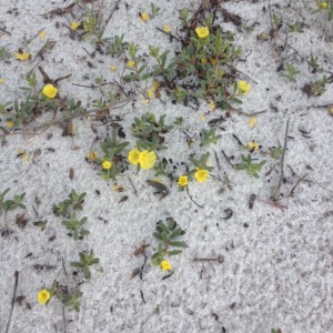
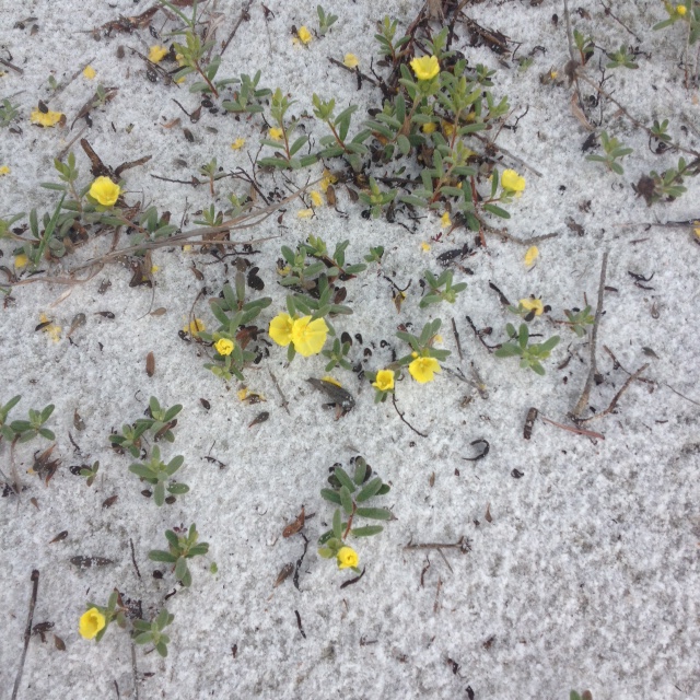
There are a variety of primrose that grow on our barrier islands. They are beginning to bloom now. Photo: Rick O’Connor
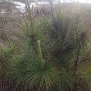
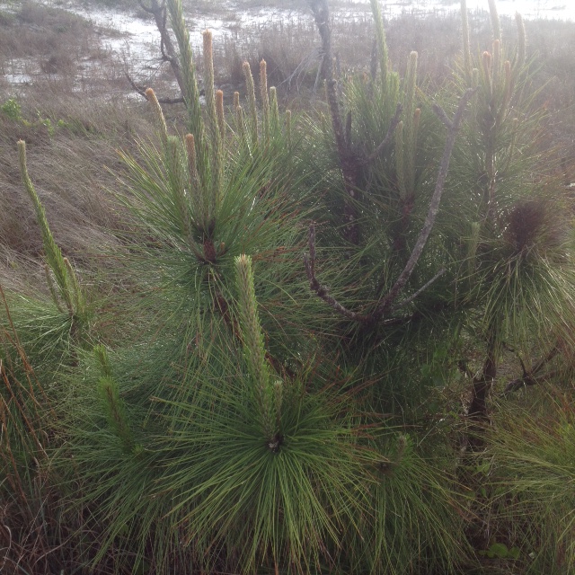
New growth on a pine tree. Photo: Rick O’Connor
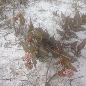
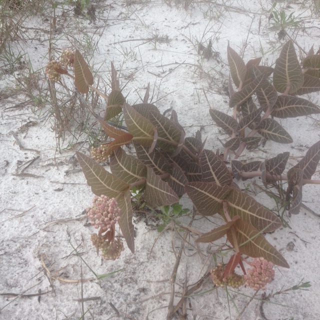
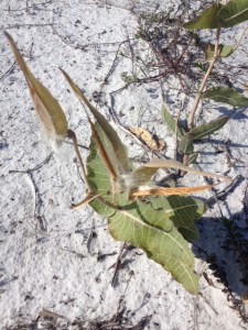
The Sandhill Milkweed. Photo: Rick O’Connor
The Sandhill Milkweed is one of the plants used by the monarch butterfly to gain fuel for their great flight across the Gulf to Mexico. The milky toxic sap of this plant is consumed by the monarch caterpillar but it does not harm it. The chemical toxins therefore become a defense for the monarch and the butterfly has earned the respect of many birds; though it may be a trial and error learning experience.
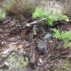
A decomposing log is a microhabitat for many organisms. Photo: Rick O’Connor

New growth on a live oak. Photo: Rick O’Connor
Most environmental centers, state and federal parks, leave fallen trees where they lie. The tree is actually a storage house of nutrients and full of cavities that can be used by a lot of organisms within the beach community.
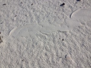
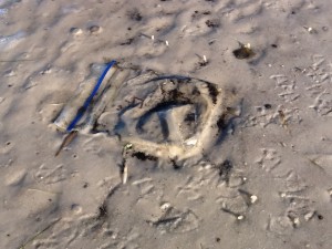
The mysterious “drags” we have seen the last three months were not to be found in April. Photo: Rick O’Connor.

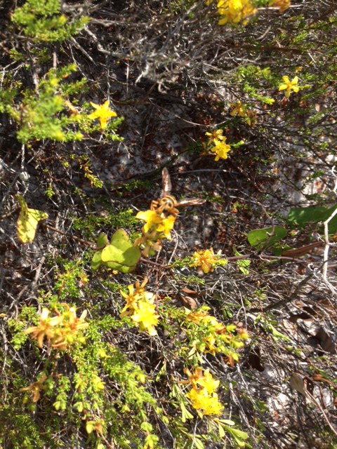
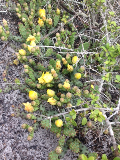
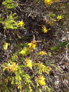
The beautiful yellow bloom of the Devil-Joint cactus. Photo: Rick O’Connor
This month the weather was warm enough for me to venture into the Salt Marsh. Salt marshes are wetlands but differ from swamps in that the dominate plants are grasses, not trees. Our local salt marsh is dominated by two species of grass, the Smooth Cordgrass, and the Black Needlerush. There are many other plants that exist here but these are the most common. This particular marsh is dominated by Black Needlerush. Salt marshes are one of the most productive systems on the planet, producing tons of organic material annually. 90% of the commercially valuable marine species spend part or all of their lives here. There are many unique species to this system as well. Today the water was crystal clear but I saw few fish. I expect as it gets warmer we will see more. It is very possible that with the heavy rains that they have moved to deeper, saltier spots in the Sound.
It’s warm enough to enter the salt marsh. Photo: Rick O’Connor
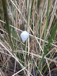
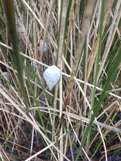
The marsh periwinkle is one of the more common mollusk found in our salt marsh. Photo: Rick O’Connor
The Marsh Periwinkle is an interesting guy. This snail will crawl up the stalks of marsh plants during high tide to avoid predators like blue crab and diamondback terrapins. Both of these predators appear to be on the decline and it will be interesting to see how this impacts the ecology of the marsh. At low tide the periwinkles descend and feed on the organic leaf litter on the muddy bottom.
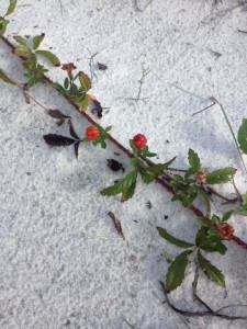
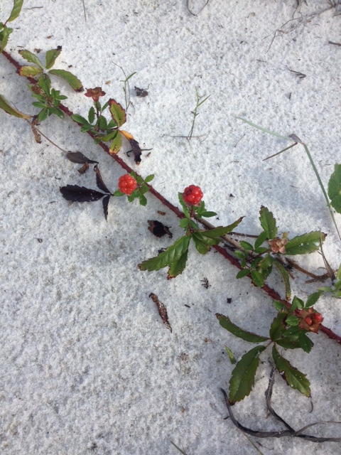
This dewberry has flowered and the dark fruit will be ready next month. Photo: Rick O’Connor

Gracilaria is a common epiphytic red algae growing in our seagrass beds. Photo: Rick O’Connor
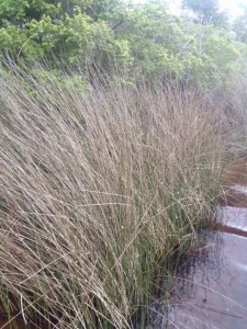
Black Needlerush is one of the two dominant plants of our salt marshes. Photo: Rick O’Connor
Though it has a white appearance, Gracilaria is a member of the red algae group. This algae grows on seagrasses as Spanish moss grows on oaks. The plant is usually kept in check by herbivorous grazers, such as green sea turtles, but in recent decades the number of predators have declined and the amount of nutrient runoff has increased. This has sparked a increase in the growth of this algae and, in some cases, to the determent of the seagrass itself.
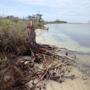
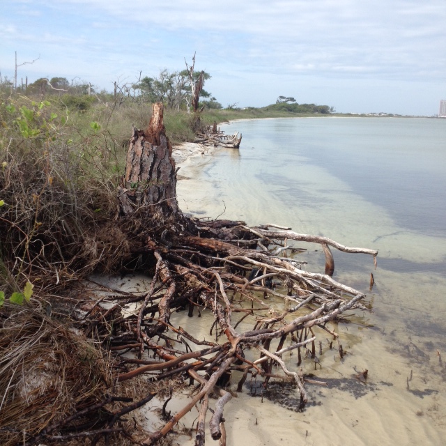
This eroded pine tree gives evidence of the ever changing shorelines of our barrier islands. Photo: Rick O’Connor
This submerged mound of peat is the remnants of a salt marsh which is now below sea level. Photo: Rick O’Connor
These photos of peat and the eroded tree are indications of a changing shoreline. Due to storms, boat wake, and time, the shoreline of Santa Rosa Island, like all barrier islands, is changing. Peat is actually the remnants of an old salt marsh that has now pass the high tide line and is within the Sound.
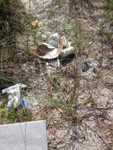
Trash left behind by those enjoying the beach. Photo: Rick O’Connor
We encourage those who pack it in… to pack it out. Photo: Rick O’Connor
As the weather has warmed and spring break has fallen upon us I have noticed an increase in the amount of trash on this hike, both the Gulf of Sound sides. We encourage locals to take their trash with them and encourage visitors to do the same. Let’s try to keep our waste out of our waters.
I am expecting some animal nesting in May. We will see what we find. Until then.
by Rick O'Connor | Jan 16, 2015
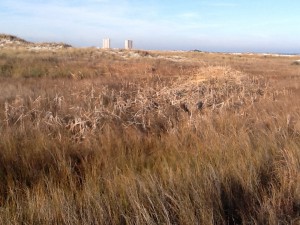
Beginning this month we will be posting a series of natural resource articles high lighting Florida’s Panhandle. The photographs and hikes presented in this series are from Escambia and Santa Rosa counties but the same natural places can be found anywhere between the Perdido and Apalachicola Rivers. We hope our readers will visit these places and DISCOVER FLORIDA’S PANHANDLE on their own. This year we will begin at the Gulf of Mexico and visit our BARRIER ISLANDS. We will visit the same location on Santa Rosa Island in Escambia County each month over the course of a year. During this series we should see how things change each season and learn more about our natural places.
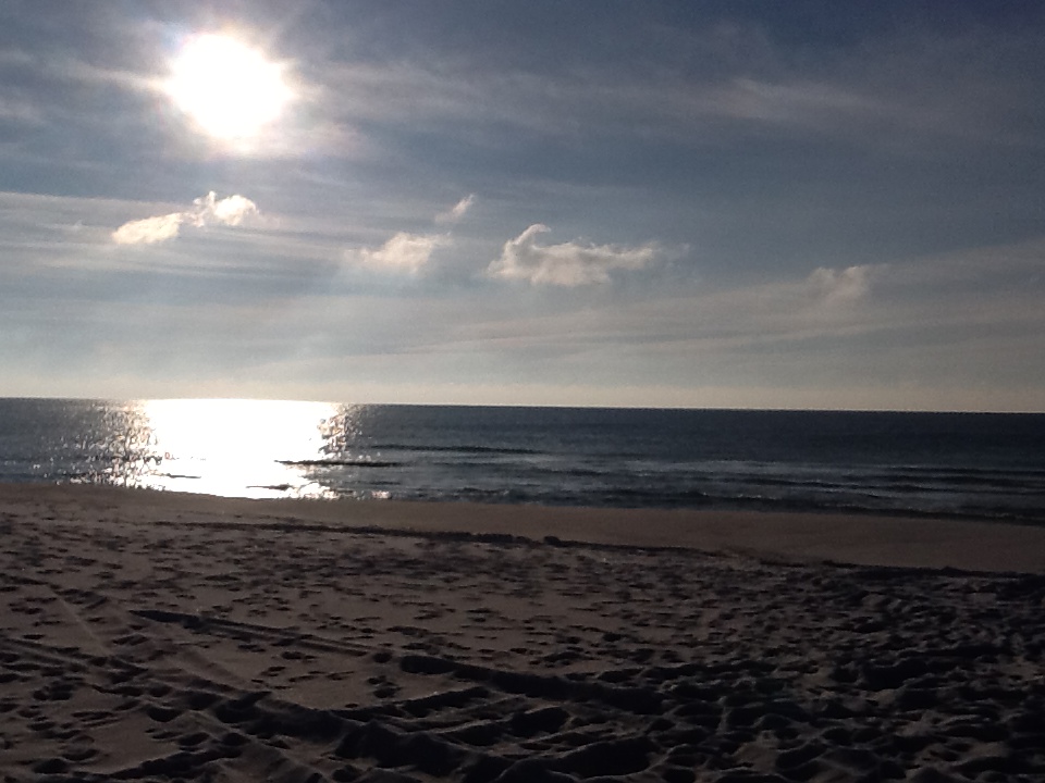
The Gulf of Mexico at sunrise. Photo: Rick O’Connor
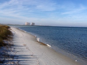
Here is the Gulf of Mexico. The northern Gulf is primary sand but their are areas of hard bottom that provide habitat for many of our commercial important fisheries. 450 feet off the shore from this photo is an artificial reef placed by Escambia County for residents and visitors alike to explore. These reefs attract a variety of reef fish and sea turtles and are great for wildlife viewing. Notice how low the sun is in the sky on this winter morning. The shortest day of the year was December 21 (when the sun was it’s lowest) and will be “climbing” as this series continues. Many beach residents use this as their clock!
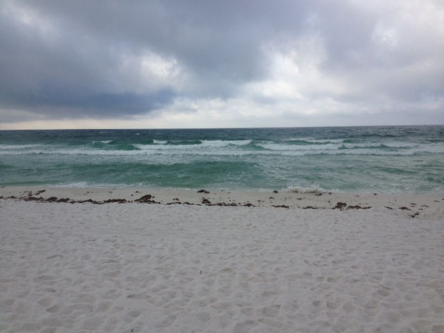
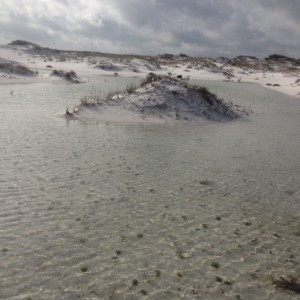
Our barrier islands are considered the “world’s whitest beaches” and this is because of the high amount of quartz deposited here. In this photograph you can see the water is farther from shore than usual. This is due to the strong north winds blowing water offshore; this happens every winter – but provides feeding opportunities for shorebirds. The sand fencing is used by many of our counties to “kick start” dune restoration.
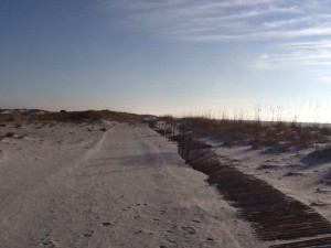
Primary dune line with sand fencing. Photo: Rick O’Connor
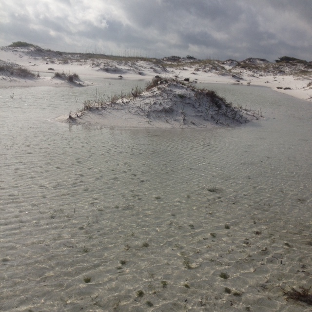
Beyond the primary dune on this portion of the island you will find low areas known as swales. These “depressions” will fill with water during rain events and provide much needed freshwater for the organisms who live out here. Barrier islands are xeric environments (meaning “desert like”) and freshwater habitats are very important for many creatures. Some of these ponds are ephemeral (meaning non-permanent) and dry up during some periods of the year.
Swale with dead cattails. Photo: Rick O’Connor
Small pines on the edge of a swale. Photo: Rick O’Connor

The water in most swales is freshwater. Photo: Rick O’Connor
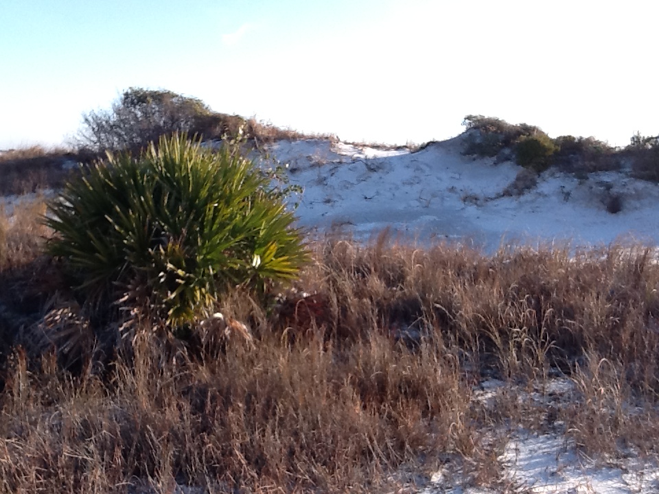
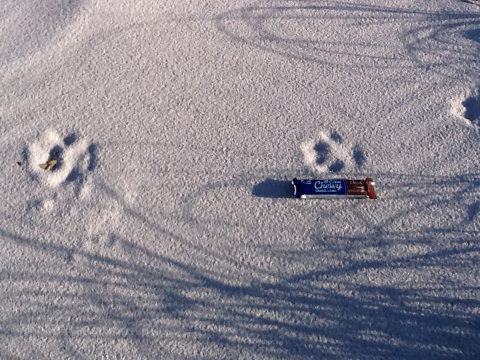
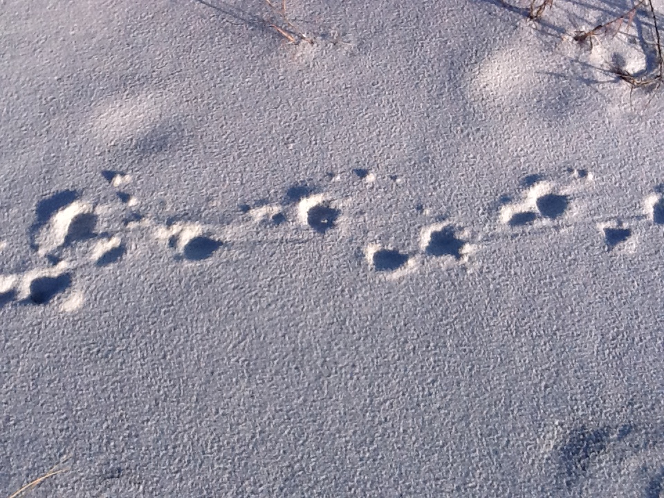
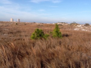
Where the primary dune and swales end the secondary dune fields begin. Because of the primary dunes there is less wind and salt spray which allows different species to take root. The secondary dunes are often identified by their small round shrubs – such as goldenrod and beach heather. These larger plants will trap larger amounts of sand producing larger dunes. On the secondary dunes I usually find lots of tracks. Identifying tracks is difficult (especially in soft sand) but fun. Most of what I saw this winter day were mammals. Raccoons, opossums, and armadillos are very common. Skunks were once common but have been scarce since the hurricane years. Below are tracks of a canine. Many people bring their dogs to the beach but coyote and fox are also found here. These tracks measured about 3.5″ and more round than triangle shaped; suggesting this is a dog.

Small secondary dune with small pine trees.
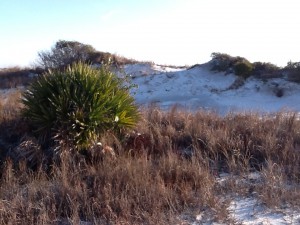
This secondary dune supports a saw palmetto. Many forms of wildlife depending on these shrub areas.

These unidentified canine tracks are probably of a dog; though coyotes are on our islands
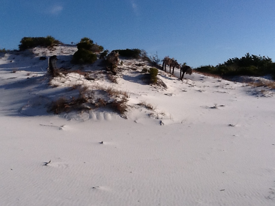
Beyond the secondary dunes are the largest dunes on the island, some measuring over 50′, these are the tertiary dunes. With the secondary dunes blocking wind and salt spray larger plants still are allowed to grow. Here we find actually trees; pine, live oak, magnolia to name a few. With the loss of primary and secondary dunes the tertiary dunes are exposed to the wind and salt spray of the Gulf side, which puts them at risk. This is why sea oats and primary dunes are protected in most counties.

The face of a tertiary dune. Photo: Rick O’Connor
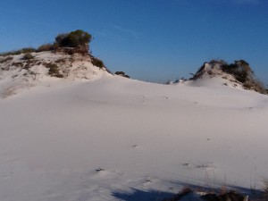
Tertiary dunes are the largest dunes on the island; some reaching over 50′.
Tertiary dunes support trees such as this magnolia and yaupon holly.
The large field of tertiary dunes blocks enough wind that forests and salt marshes can establish themselves on the back side of the island. Here the diversity and abundance of wildlife increases. We have found not only the mammals already mentioned but snakes, freshwater turtles and terrapins, and a variety of birds. This winter day I found several small woodland and mocking birds. Some of our islands have deer and alligators.

From atop a tertiary dune you can view the maritime forest, salt marsh, and sound beyond. Photo: Rick O’Connor
Within the maritime forest you will find a variety of plants and animals.
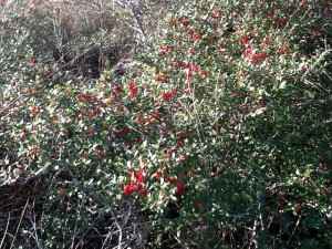
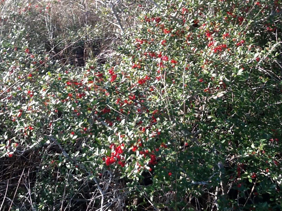
Holly’s are famous for having the bright red berries around Christmas time. Here in January the berries are still found on some of them.
Between the maritime forest and the salt marsh you may find freshwater ponds. Like the swale ponds, these places are great places to find wildlife. Though I have not seen them in many years I have found alligators in this area. These ponds support populations of amphibians and small fishes.

This freshwater pond has bull minnows, amphibians, snakes, and – in the past – alligators. Photo: Rick O’Connor
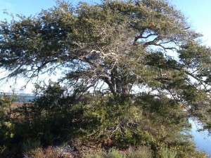
With the dunes blocking offshore winds trees can grow much larger on the back side of the island; like this live oak.

This pond supports a stand of green algae which supports many of the aquatic animals that visit here.
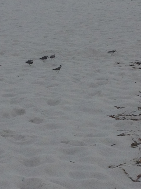
On this winter day I primarily saw bird life. The air temperature was 39 F and the wind was out of the north. Many of the mammals move at night and the reptiles, being cold blooded, were hibernating somewhere; the bird life however was pretty active. Many woodlands birds were out feeding on seeds and berries, herons and egrets were in the marsh hunting fish in the shallow waters, and shorebirds were picking through the beach wrack and some were diving.
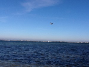
This pelican is searching over Santa Rosa Sound for a fish to feed on. Photo: Rick O’Connor

This unusual drag was found between the salt marsh and the sound side shoreline. It looks like a turtle crawl but at his time of year more probable something being dragged by something.
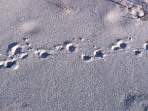
Armadillo tracks can be identified by their “tail drags”.
Salt marshes are one of the most productive systems on earth; and the target for another FLORIDA’S PANHANDLE series. Crabs, shrimp, mollusk, worms, terrapins, fish, and birds are some of the wildlife that call this place home – and maybe we will find some as this series continues into the warmer months. Today I found pelicans, herons, and egrets here eating.

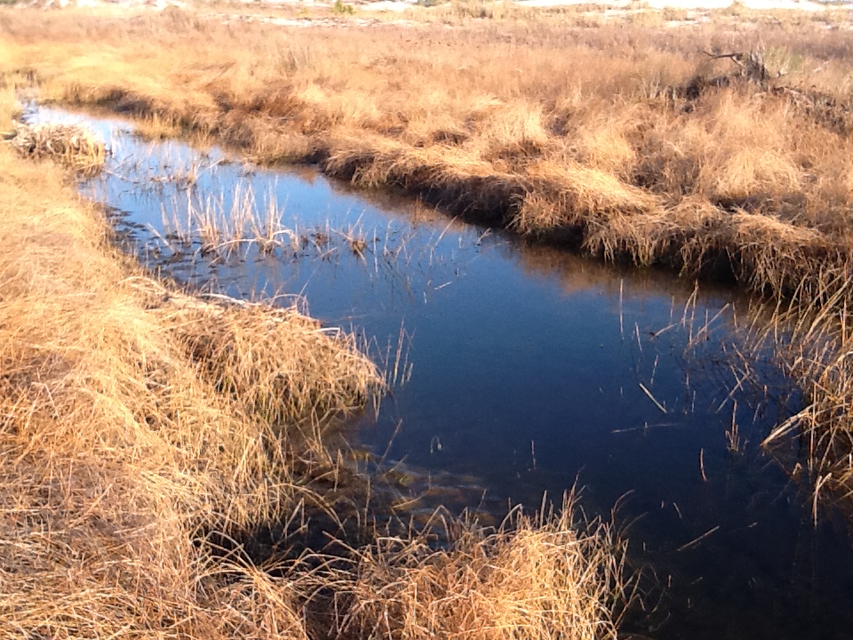
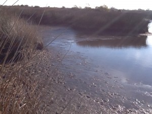
A finger of a salt marsh on Santa Rosa Island. The water here is saline, particularly during high tide. Photo: Rick O’Connor
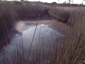
The muck of a salt marsh. This rich organic mud is very loose and the hiker can quickly sink! Notice the tracks of a predator.
Notice the low water levels typical of winter. This congregates fish into smaller pools and makes it easier for birds and mammals to catch them.
The Sound side of the island has wind but less wind than the Gulf side. The wave energy here is also lower supporting seagrass and oyster communities. Like the marsh these places are very productive; though all I really saw moving on this cold winter morning were the birds. There are two species of seagrass common to our sounds; turtle grass and shoal grass. However there have been reports of more tropical species appearing. We may find some when the water warms up. These waters support at least 100 species of fish and many invertebrates we enjoy eating.
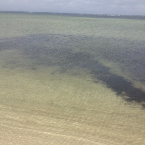
The darker areas in the water are seagrasses. Photo: Rick O’Connor
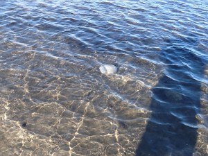
I found this along the shore last winter. These are cannonball jellyfish.

This is a sea nettle. This species of jellyfish has a more painful sting. I only saw one of these today but saw several cannonballs.
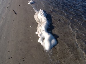
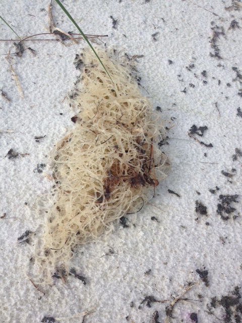
People find this “sea foam” frequently when they visit the beach. It is formed when the winds pick up and there are nutrients in the water. It was up and down the beach today.
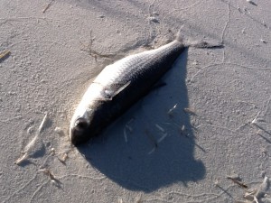
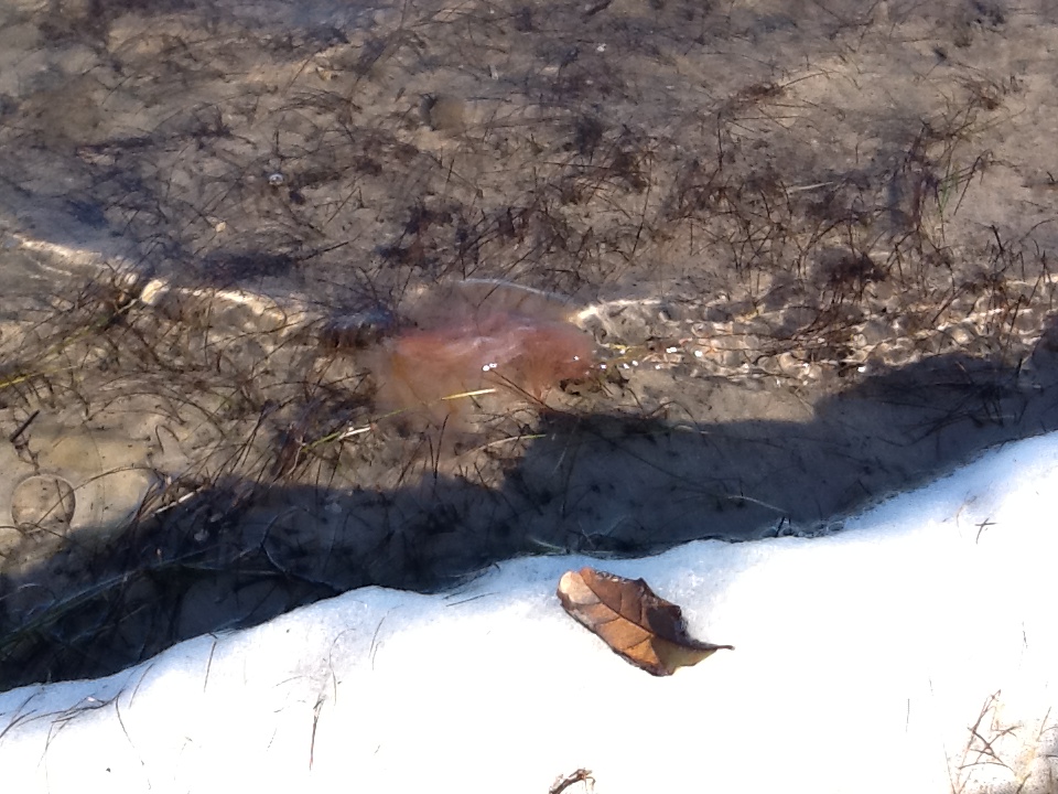
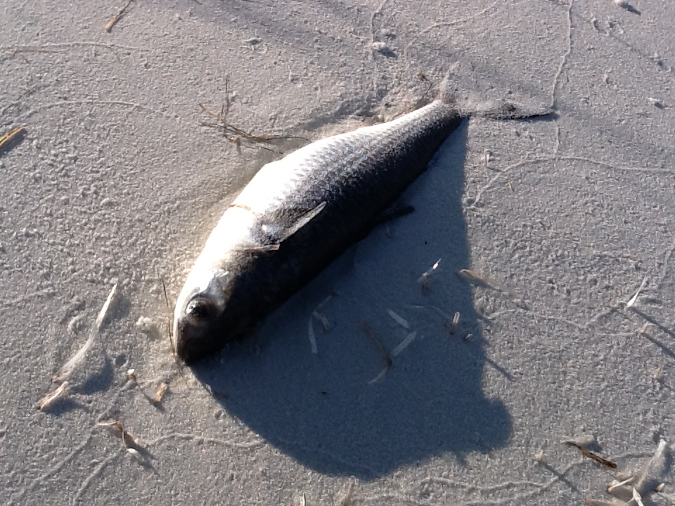
It is not uncommon to find dead fish along the shore after a hard freeze as we have had in recent weeks. When it warms these dead fish will attract scavengers including cottonmouths. Maybe we will see one later in the year.
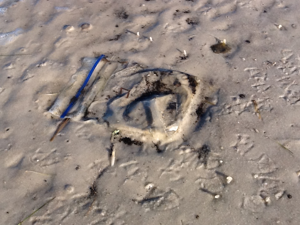
There was very little trash on the island today but it was there. These pieces of debris can cause serious problems for coastal wildlife. We will discuss this issue more as this series moves on.
Well, for January we found the beach to be cold and windy. Very little wildlife was out to be viewed other than birds and the numerous tracks in the dunes, but as the temperatures warm we will see more. Take some time to visit our barrier islands and enjoy them. Until February.