by Carrie Stevenson | Jun 17, 2017
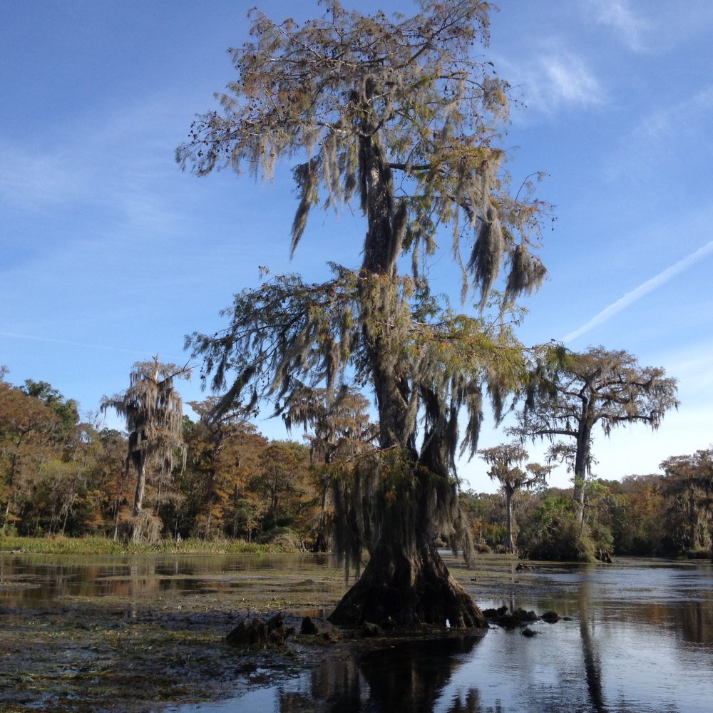
Wakulla Springs is home to some of the best wildlife watching in all of northwest Florida. It’s not unusual to see manatees, alligators, and dozens of species of birds in one boat trip. Photo credit: Carrie Stevenson
What do you imagine when the word “ecotourism” comes to mind? I know I usually daydream about a trip my husband I took to Costa Rica several years ago, surrounded by lush tropical rainforests as we ziplined through the canopy. I might also think about visiting a National Park, following a neatly maintained trail and stopping at signs placed at just the right spot so visitors can read and understand the special features of the place. Ecotourism, done right, brings a visitor to a unique place, tells its story, and immerses the visitor in the sights and sounds in a way that treads lightly on the location. I always know I’ve been on a good ecotour when I’m tired, happy, and have learned or seen something new.
A colleague with The Conservation Fund has stated that sustainable tourism includes: “Authentic experiences that are unique and specialized to the place (its culture, heritage, and natural resources), emphasizes quality over quantity, focuses on distinctive destinations, unspoiled landscapes, and historic buildings, and differs from mass-market tourism by favoring locally-owned businesses, thereby increasing circulation of money in the local economy.” The truly wonderful thing about ecotourism is that local touch; it exists solely because of the place, so it cannot be outsourced. The best storytellers about those places are usually the people who have lived there for many years, so by its very nature, ecotourism provides jobs for local residents.
Northwest Florida has hundreds of unique locations for visitors and locals to explore…we have centuries-old forts, clear-blue springs, endless rivers and creeks to paddle, trails on the coast and up our modest hills. We have caves and underground caverns, waterfalls, pitcher plant prairies, fishing, wildlife watching, and reefs for snorkeling and SCUBA diving. While millions come here for our quartz-sand beaches, other options that highlight our natural ecosystems deserve more attention and notoriety.
A few years ago, several Extension Agents received funding for a project called Naturally EscaRosa. The idea behind that project was to help promote and create businesses that sustainably used our agricultural and natural resources. The website (www.naturallyescarosa.com) has a list of over 100 businesses and locations where locals and out-of-town visitors can explore the less well-traveled areas of Escambia and Santa Rosa County. As you move east down the coast, Walton Outdoors, the local Visit Florida affiliates, and other privately managed media groups have done similar work, providing a showcase for these treasures in our midst.
This summer, try one of the local ecotourism or agritourism venues near you! Moreover, when your friends and family visit from out of town, encourage them to do the same. We cannot have a successful economy without a healthy ecosystem, and supporting these local and regional businesses is good for both.
For more information on sustainable ecotourism, visit the Society for Ethical Ecotourism (SEE), and for information on starting or visiting an agritourism business, try Visit Florida Farms. And as always, reach out to your local County Extension agents, and we will be more than happy to point you in the right direction to discover to places to explore with your family.
by Les Harrison | Jan 27, 2017
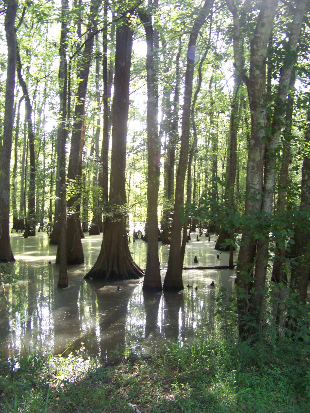
Recent rains have water standing on some Wakulla County real estate, which has been dry for several years. Ponds, natural and dug, are brimming with water reflecting the generous outpouring from the slow and wet weather system, which passed listlessly over the county.

Cypress swamp in Jackson County.
Photo: Molly O’Connor
The rainwater excess is also filling the natural low points known as swamps or wetlands.
A swamp is defined as a forested wetland. Some occur along the flood plain of rivers, where they are dependent upon surplus flow from upstream and from local runoff.
Other swamps appear adjacent to ponds in shallow depressions, which fill during wet periods. Their landscape is covered by aquatic vegetation or trees and plants, which tolerates periodical inundation.
Historically, swamps have an image problem. Legend has all sorts of unsavory creatures, degenerates, and ghost inhabiting the locale waiting for the unsuspecting traveler.
Even the proper British used the term as a pejorative to describe Francis Marion during the American Revolution. The Swamp Fox engaged in guerilla warfare against the conventional forces and hid in the swamps to avoid capture.
Economically, these watery regions have had very low values. Their only significance was as site for trapping, hunting or for logging in dry years.
Medically, swamps were seen as a quick and painful way to the grave. There were all those creatures, which could inflict pain, leeches, snakes, gators and the like.
Then there was disease. As an example, the term Malaria originated from the swamps of southern Europe where it meant bad air in medieval Italian. The mosquito connection was unknown until the early 20th Century.
Hollywood piled on the problem with a series of swamp monster movies. One, “The Creature from the Black Lagoon” was partially filmed at Wakulla Springs.
Reality, as is often the case, is quite different from the initial perception. Even the term swamp has fallen out of favor in some circles, being replaced with wetlands.
Swamps or wetlands serve a variety of functions in the panhandle. Possibly the most critical is as a filtration system for the water table.
Excess rain is held in these shallow depressions and allowed to percolate or filter slowly through the soil. The screening effect of the soil and subsoil layers along with the slow progression cleanses the water of numerous impurities from the surface.
Without the holding capacity of local swamps, most rainwater would end up in streams and rivers. In addition to being a loss for the water table, the excess water would cloud waterways with a glut of surface debris and nutrients.

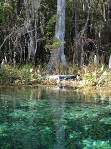
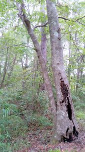
Large bald cypress trees serve as wildlife habitat at Wakulla Springs State Park. Photo credit: Carrie Stevenson
It is true mosquitos favor the still swamp waters, but so do many birds, fish and animals. Swamp rookeries are the nesting home for many wading birds. Mosquito larvae are an important link in the food chain, which supports much of the life in the swamp, and beyond.
Even some of the swamp’s most ostracized residents, snakes, have an important part to play in the overall environmental balance. These reptiles control the population of many destructive insects and rodents.
To learn more about the importance of swamps and wetlands, contact your UF/IFAS County Extension Office.
by Rick O'Connor | Jan 27, 2017
After Hurricane Ivan devastated the Pensacola area in 2004, my son was working to repair docks in local waterways. One day, after working on a project in Bayou Texar (near Pensacola Bay), he came by our house and said that he had seen a bald eagle fly over. My wife and I both responded with amazement but at the same time were thinking… “Yea right”. A few days later, we were sitting on the back porch (we live near Bayou Texar) and glancing up we saw a huge bird flying over… you guessed it… a bald eagle. We both looked at each other and just shook our heads saying “did you just see?… yep, that was a bald eagle”. It was totally cool!
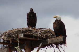
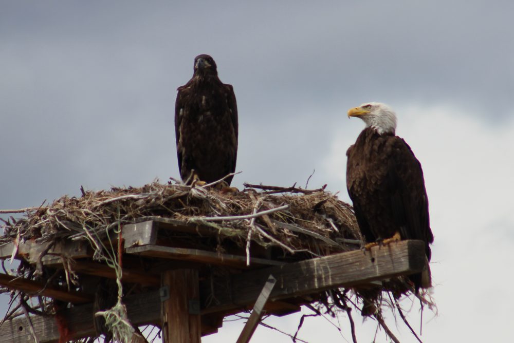
An adult and juvenile bald eagle on nest in Montana.
Photo: Molly O’Connor
In the 1970’s I worked for a local chemical plant on Escambia Bay that had a bird sanctuary on the property. Occasionally a bald eagle would appear during the winter months but it was not annually, and it was a real treat to see it. However, since Ivan sightings in the panhandle have become quite common. Folks are seeing them over Pensacola Bay, Perdido Bay, Garcon area of Santa Rosa County, Gulf Breeze peninsula, almost everywhere! I actually saw three flying together over Big Sabine on Pensacola Beach recently. They are actually now nesting in the area.
These are large birds, 30-40” long with a 7-8 feet wing span, and hard to misidentify – everyone knows a bald eagle. However, the juveniles do not have the distinct white head and tail or the brilliant yellow beak. Rather they are dark brown with possible white spots on their wings, and the beak is darker. The mature color change occurs in 5-6 years. Their diet is mostly fish but they will take small birds and mammals. They are also scavengers, including road-kill, and will “pirate” captured food from other birds. Observations support that ospreys and bald eagles do not really get along.
Bald eagles tend to migrate between their breeding grounds in Canada and those of the Gulf Coast. The migrants are typically non-breeding individuals. Breeding ones tend to remain in their breeding areas year round. As of 2014, Florida has the highest densities of southern breeding populations in the lower 48 states, about 1500 nests. Most return to Florida in the fall for nest building. Their nests are typically in forested areas near waterways. They prefer the tallest trees. The nests are quite large; the record in Florida was 9.5 feet in diameter. They typically lay one clutch of 1-3 eggs but may lay a second clutch if the first is unsuccessful. The young remain in the nests until they can fly – usually April or May. Wintertime is a good time to view these animals in our area.
Their numbers plummeted for a variety of reasons, including the introduction of DDT, and they were placed on the U.S. Fish and Wildlife Endangered Species list. DDT was banned in 1972 and listing them on the ESL protected from them from poaching; they have since recovered. Today they are no longer on the Endangered Species list and were removed from the Florida Fish and Wildlife Conservation Commissions (FWC) imperiled species list. However, they are still protected federally by the Bald / Golden Eagle Protection Act and the Migratory Bird Protection Act; they are also protected in Florida by state law.
Potential viewing locations can be found on FWC’s bald eagles nest location site. https://public.myfwc.com/FWRI/EagleNests/nestlocator.aspx
This site provides known locations between 2012 and 2014. Recent surveys were conducted between 2015 and 2016 in several panhandle counties but those locations have not been posted yet. For those in the Pensacola area, there are four permanently injured bald eagles at the Wildlife Sanctuary of Northwest Florida. The public is welcome to visit the sanctuary Wednesday through Saturday from 12:00 – 3:30PM (self-guided).
105 North S Street, Pensacola FL 32505
http://www.pensacolawildlife.com/
For more information:
http://myfwc.com/wildlifehabitats/managed/bald-eagle/information/
http://myfwc.com/wildlifehabitats/profiles/birds/raptors-and-vultures/bald-eagle/
http://myfwc.com/wildlifehabitats/managed/bald-eagle/faqs/
by | Oct 14, 2016
Beech, magnolia and native
river cane (arundinaria) characterize hardwood forests in the Red Hills
Photo by Jed Dillard
I grew up in the Georgia Piedmont outside Athens, a land of bright red sticky clay, rocks and cold weather. In addition to the ubiquitous Georgia pines, hardwoods including white oaks, hickory and beech grow there. I had no clue the Red Hills of Florida and South Georgia would mimic much of that habitat and provide the benefits of fewer rocks to blunt shovels and less cold weather. Now, I can hardly imagine living anywhere else than in one of its beech – magnolia forests.
A friend of mine was doing some work for my neighbor and took the time to look for wild turkey roosting places and walked down to the creek bed through beech, magnolia, spruce pine, white oak and hickory to where the wild azalea grows. “Those sure are some pretty woods, “he told me.
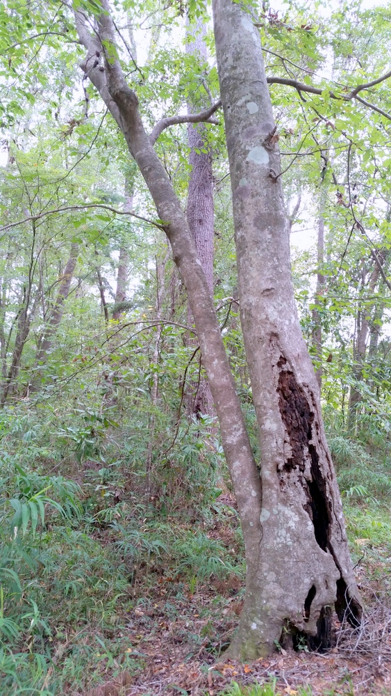
He was describing the upland hardwood forest described by the Florida Natural Areas Inventory as “a well-developed, closed-canopy forest dominated by deciduous hardwood trees on mesic soils in areas sheltered from fire. It typically has a diverse assemblage of deciduous and evergreen tree species in the canopy and midstory, shade-tolerant shrubs, and a sparse groundcover. “ Blaisdell, et al characterized their location as areas “too steep for logging, farming, or grazing and are mesic (wet) enough so that fire rarely occurs in them. “
Many of these areas are relatively small and have escaped intervention. These small areas contribute to patchwork landscapes which provide the key requirements of wildlife habitat- shelter, food and water. Turkeys roost in the spruce pine over the creek and the hens build nests and forage with their poults on the seeds and bugs of the adjacent open fields. I had always thought of Florida as a sandy coastal environment, but these hills have more clay than most Florida sites underneath them. The combination the canopy’s protection of the moisture in layers of organic matter and the soil’s clay maintain a fertile, well-drained soil profile which supports a wide variety of plants and a varied supply of mast.
Of all its flora and fauna, one of its most intriguing species is the Barred Owl, Strix varia. Judy Biss of Calhoun county’s December 4, 2015 Panhandle Outdoors Article, Owls, Florida’s Remarkable Nocturnal Birds of Prey describes the natural history and biology of owls in Florida. The first time I heard a nearby Barred owl, I thought I was in presence of a fierce beast, surely a panther, at least a bob cat. The Tarzan movies filmed at Wakulla Springs used the Barred Owl calls for jungle sounds. Barred owls thrive in this habitat. The open forest floor and mature trees give them room to navigate and an abundant variety of prey. Snags and trees whose limbs are broken off by wind, provide cavities for them and other cavity nesters.
Pretty woods? Upland Hardwood Forests? Climax Beech Magnolia Forests? No matter what you call them, they’re one of the jewels of North Florida’s range of habitats. Get out and enjoy them.
References and additional information.
http://www.sfrc.ufl.edu/extension/4h/ecosystems/upland_hardwoods/upland_hardwoods_description.pdf
“The Role of Magnolia and Beech in Forest Processes in the Tallahassee, Florida, Thomasville, Georgia Area”. Blaisdell, Wooten and Godfrey. Tall Timbers Research Station
http://fnai.org/PDF/NC/Upland_Hardwood_Forest_Final_2010.pdf
by Laura Tiu | May 8, 2016
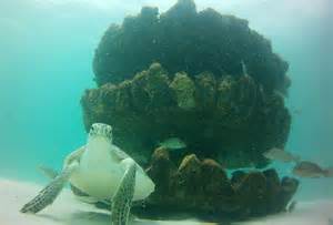
Florida has the highest number of sea turtles of any state in the continental US. Three species are common here including loggerhead, green and leatherback turtles. The Federal Endangered Species Act lists all of sea turtles in Florida as either threatened or endangered.
Sea turtle nesting season for the area began May 1, 2016. Adult females only nest every 2-3 years. At 20-35 years old, adult loggerhead and green female turtles return to the beach of their birth to nest. At this age, they are about 3 feet long and 250-300 pounds. The turtles will lay their eggs from May – September, with 50-150 baby turtles hatching after 45-60 days, usually at night. One female may nest several times in one season.
If you happen to see a sea turtle nesting, or nest hatching, stay very quiet, keep your distance, and turn any lights off (no flash photography). You should never try to touch a wild sea turtle. Also, do not touch or move any hatchlings. The small turtles need to crawl on the beach in order to imprint their birth beach on their memory.
During nesting season, it is important to keep the beaches Clean, Dark and Flat. Clean, by removing everything you brought to the beach including trash, food, chairs and toys; dark, by keeping lights off, using sea turtle friendly lighting and red LED flashlights if necessary; and flat, filling up all holes and knocking down sand castles before leaving the beach. If you see anyone harassing a sea turtle or a sea turtle in distress for any reason, do not hesitate to call the Florida Fish and Wildlife Commission hotline at 1-888-404-3922.
There has been encouraging sea turtle news in Florida as a result of the conservation actions being undertaken. There is an increasing number of green turtle nests and a decreasing number of dead turtles found on beaches.
If you want to see a sea turtle and learn more about these fascinating creatures, visit the Navarre Beach Sea Turtle Conservation Center, Navarre, FL, the Gulfarium Marine Adventure Park on Okaloosa Island, Fort Walton Beach, FL, or Gulf World Marine Park in Panama City, FL.
| County |
Beach nesting area (miles) |
Number of loggerhead sea turtle nests |
Number of green sea turtle nests |
Number of leatherback sea turtle nests |
| Franklin |
56 |
608 |
14 |
0 |
| Gulf |
29 |
451 |
14 |
0 |
| Bay |
44 |
170 |
12 |
5 |
| Walton |
30 |
94 |
4 |
3 |
| Okaloosa |
24 |
73 |
6 |
0 |
| Santa Rosa |
7 |
17 |
4 |
0 |
| Escambia |
39 |
86 |
4 |
1 |
Table 1: Data from the 2015 Florida Statewide Nesting Beach Survey available at: www.myfwc.com.
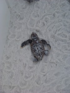
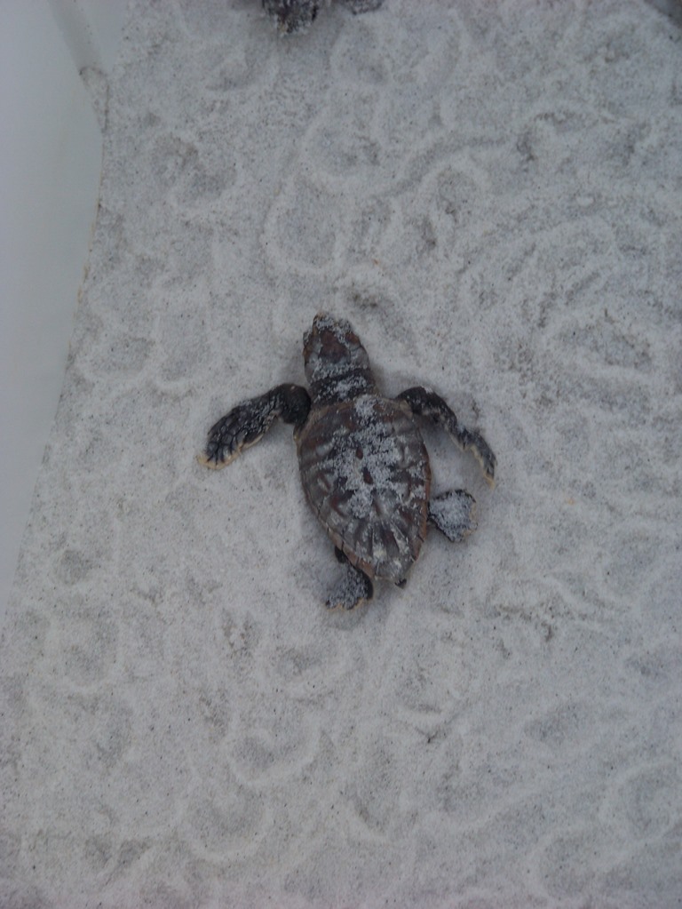
Young loggerhead sea turtle heading for the Gulf of Mexico. Photo: Molly O’Connor
The Foundation for the Gator Nation, An Equal Opportunity Institution.