by Rick O'Connor | Jun 20, 2025
Snails and slugs belong to one of the largest phyla of animals on the planet – the mollusks. Mollusks are known for their calcium carbonate shells and seashell collecting along the shoreline has been a popular hobby for centuries. There are an estimated 50,000 to 200,000 species of mollusk worldwide. One group – the gastropods – have an estimated 40,000 to 100,000 species alone. This is the group that includes the snails and slugs.
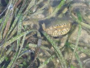
Snails are soft-bodied creatures who produce a single, usually coiled, shell in which they live. The coiled shell has an opening called the aperture through which they can extend some, or most of their body. The elongated soft body “slugs” across the sea bottom searching for food which could be vegetation for some – like the small nerite snails found in our bays, or animals – like the venomous cone snails, or detritivores – like the periwinkle snails.
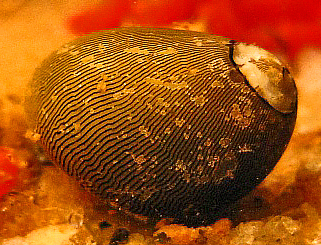
The Olive Nerite.
Photo: Wikipedia.
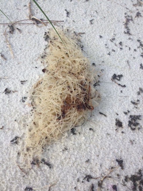
Many species of local snails produce egg cases in which they deposit their developing eggs. These are often found while people are beach combing. The most frequently encountered locally are the tube-shaped clusters of the oyster drill, the coin shaped chain of the lightning whelk, and the one that – to me – resembles the top of a vase or jar belonging to the moon snail.
The egg case of the Lightning Whelk.
Photo: Project Noah
The variety of snails found in the northern Gulf is immense – so, we will cover only a few of the more common.
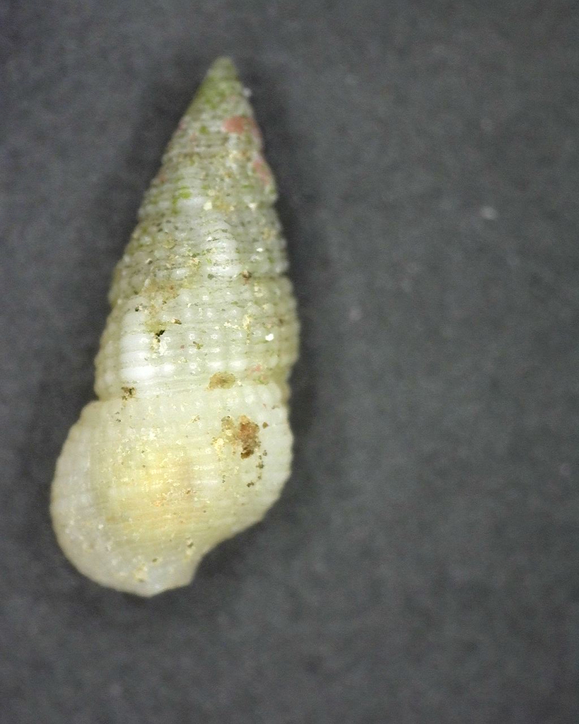
Walking along the Gulf side, gazing down at the shells of snails washed ashore, one often finds the small ceriths. These tiny, elongated shells are small and look like a canine tooth. These are herbivores and detritivores.
Cerith
Photo: iNaturalist
The Florida Fighting Conch is often found – but not always in whole condition. This is a true conch and herbivorous.
Florida Fighting Conch
Photo: iNaturalist
One not as common while beachcombing, but more common while snorkeling is the olive snail. These are fast burrowing snails that feed on bivalves and carrion they may find. I often find trails crisscrossing the sandy bottom made by these snails just off the beach.
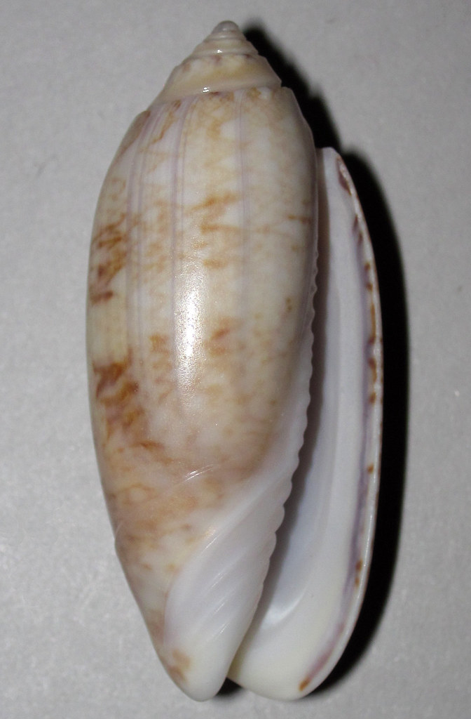
Olive snail
Photo: Flickr
Over on the bay side of the barrier islands you have a better chance of finding live snails. One of the more common in the salt marshes is the marsh periwinkle. This small roundish snail is often seen on the extended leaves of the marsh grasses. It is here during high tide to avoid predators such as blue crabs and diamondback terrapins. At low tide they will descend to the muddy bottom and feed on detritus.
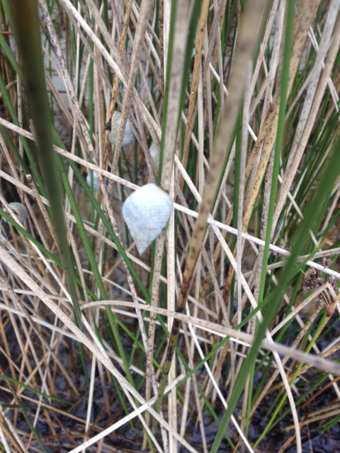
The marsh periwinkle is one of the more common mollusk found in our salt marsh. Photo: Rick O’Connor
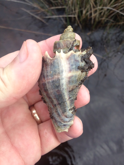
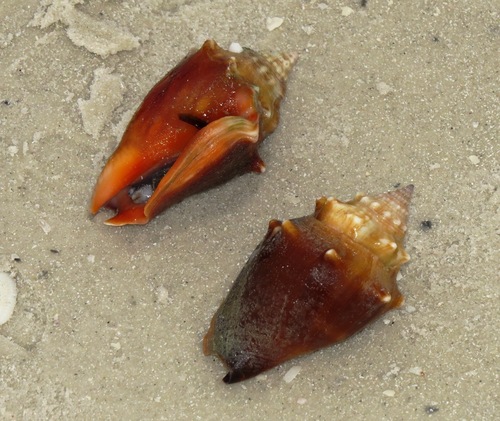
The crown conch is another frequently seen estuarine snail. With spines extending from the top whorl – it appears to have a crown, and where its common name comes from. These are predators of the bay feeding on other mollusks such as periwinkles and oysters.
The white spines along the whorl give this snail its common name – crown conch.
Photo: Rick O’Connor
The oyster drill shell is one of the more common shells you find hermit crabs in, but the snails are out there as well. As the name implies, they use a tooth like structure called a radula to bore into other mollusk shells to feed. They are particularly problematic for non-moving oysters – and where they got their common name from.
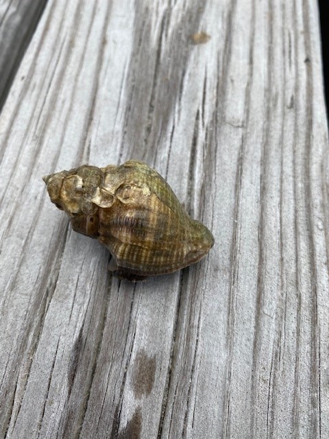
The shell of the oyster drill.
Photo: Rick O’Connor
The only slug I have encountered on our beaches is the sea hare. These slugs can be a greenish or brownish color and are about six inches in length. They lack an external shell but do not move much faster than their snail cousins. They feed on a variety of seaweeds and the color of their skin mimics the seaweeds they are feeding on. Lacking a shell, they produce a toxin in their skin to repel would be predators. They also release ink like the squid and octopus cousins.
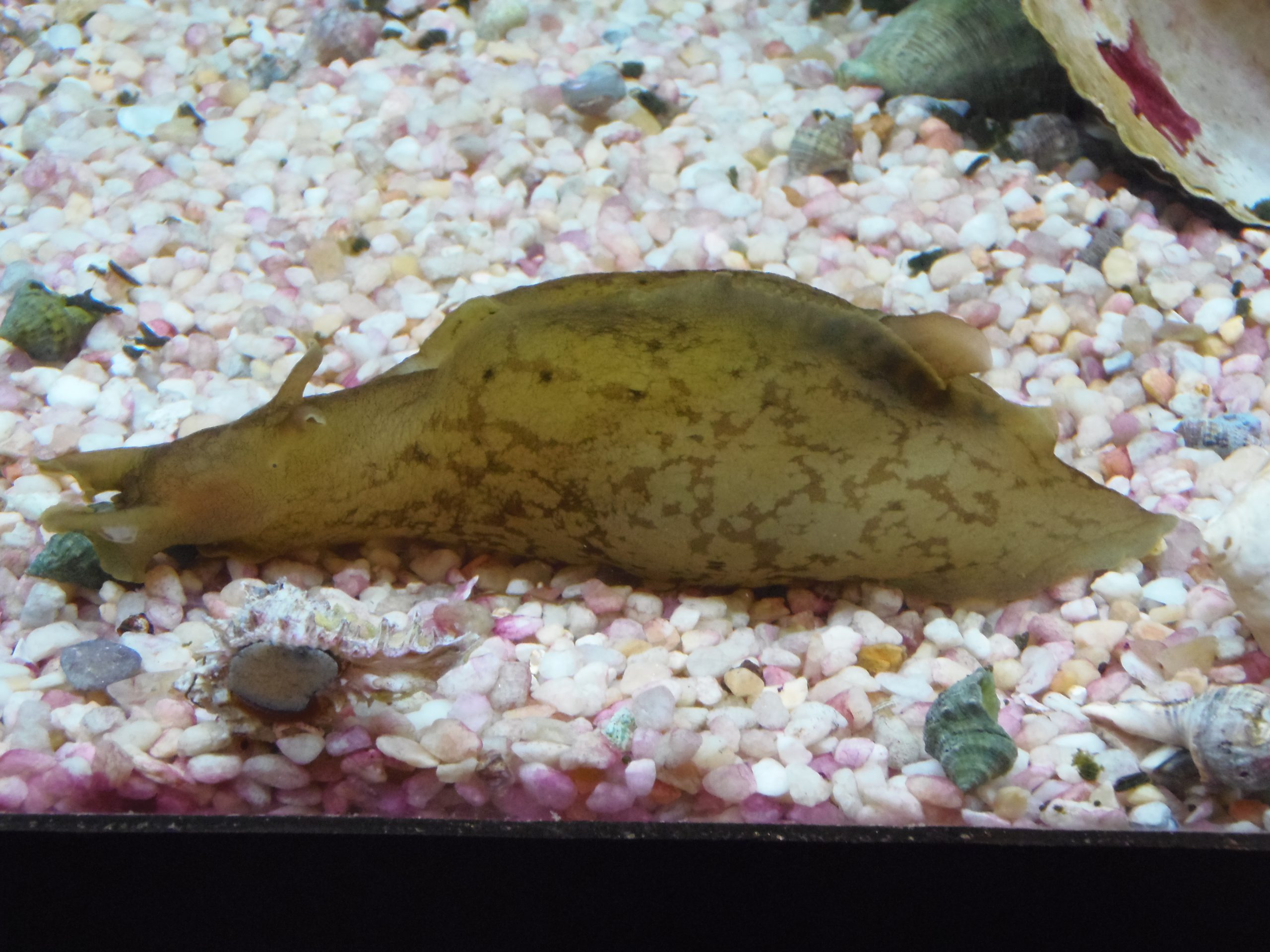
A common sea slug found along panhandle beaches – the sea hare.
This narrative only scratches the surface of the world of snails and slugs in this part of the world. Creating a check list of species and then seeing if you can find them all is great fun.
References
The Mollusca. Sea Slugs, Squids, Snails, and Scallops. University of California at Berkley. https://ucmp.berkeley.edu/taxa/inverts/mollusca/mollusca.php#:~:text=Mollusca%20is%20one%20of%20the,scallops%2C%20oysters%2C%20and%20chitons..
Gastropods. University of Texas San Antonio. https://www.utsa.edu/fieldscience/gastropod_info.htm#:~:text=Gastropods%20are%20another%20type%20of,of%20the%20entire%20Mollusca%20phylum..
by Rick O'Connor | Apr 11, 2025
As we mentioned when we began writing about seaweed, seaweed and seagrass are very different. Seagrasses are true plants in the sense that they have an internal vascular system that runs water and other material throughout the plant. Like the artery and veins of animals – they are called xylem and phloem. Water in the soil is diffused through the tissue of the roots into the xylem, which moves the water up through the stem to the leave where it is used in photosynthesis. The sugars produced by photosynthesis are moved through back down into the plant by traveling through the phloem. Seagrasses produce small flowers that are pollinated by dispersing the pollen in the currents and by small invertebrates, such as amphipods and polychaetae worms. Seagrasses are true plants.
Grassbeds are also full of life, albeit small creatures.
Photo: Virginia Sea Grant
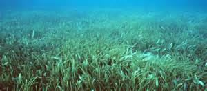
Believed to have originated as land plants, today there are about 72 species of seagrasses found around the world; seven are found in Florida; five found in the Pensacola Bay system. Though found in some open ocean systems, most seagrass beds are found in the protected waters of the estuary. They thrive in areas with low wave energy and clear water. They help stabilize the shoreline and remove pollutants from the water column. There is an abundance of marine creatures who use the seagrass beds as either a source of food, or habitat. It has been determined that at least 80% of the commercially important finfish and shellfish use seagrass beds for at least part of their life cycle.
Three of the five local species can be found in Santa Rosa Sound. Shoal grass (Halodule) has a flat blade but is very thin, between 2-3mm wide. Because it is so narrow, less surface area, it can tolerate waves better than turtle grass, and thus lives closer to the shoreline. Within the shoal grass you can find a variety of small baitfish feeding, as well as blue crabs and hermit crabs scavenging. But it does not provide the hiding spaces that the wider blade turtle grass does.
Shoal grass. One of the common seagrasses in Florida.
Photo: Leroy Creswell
Turtle grass (Thalassia) have blades that are 10mm wide. These wider blades do not handle the waves as well and thus turtle grass grows in deeper waters further off the beach. How deep they can grow is a function of the amount of sunlight reaching the bottom. In the Florida Keys turtle grass has been found at depths of 30 feet. Locally maximum depths are more likely near 10 feet. The wide blades of this grass provide surface area for a variety of small algae and invertebrates to attach. These epiphytes and epizoids are a major player in the food web of seagrass beds. Numerous invertebrates and fish feed on this “scum layer” found on the grass blades. The grazers attract low level predators such as pinfish, puffers, and sea horses. These in turn attract larger predators such as rays, speckled trout, and flounder. Manatees and sea turtles can be found here as well as sharks and the occasional bottled nose dolphin.
The wide blades of turtle grass provide habitat for a variety of epibiota.
Photo: UF IFAS
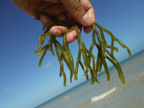
Manatee grass (Syringodium) resembles shoal grass, but the blade is round instead of flat. It can be found forming its own patches or dispersed within the other species. The abundance of this species seems to be increasing in local waters.
Gracilaria is a common epiphytic red algae growing in our seagrass beds. Photo: Rick O’Connor
Widgeon grass (Ruppia) is a common seagrass found in the upper portions of our estuary. Though it can live in the higher salinities near Pensacola Beach, it can also tolerate the lower salinities of the upper bays and thus, with less competition, does very well here. It also resembles shoal grass but differs in that the blade branches as it grows. Like all seagrass beds, widgeon grass can support a lot of marine creatures and increase the overall biodiversity of the bay.

The branched leaves of the widgeon grass.
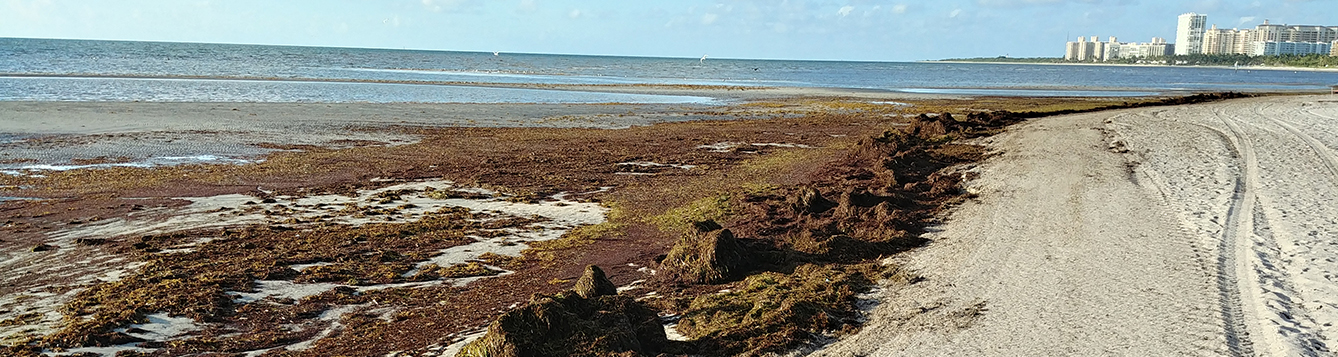
Since the 1950s the northern Gulf coast has witnessed a decline in seagrass acreage. The decline was caused by a combination of factors. One, increased sedimentation with stormwater and development. In some cases, the seagrass was literally buried and in others the sediment decreased water clarity which decreased needed sunlight. Two, shrimp trawls. At one time shrimpers could pull their trawls through the grass to catch shrimp. This ripped and destroyed much of the habitat and the state closed shrimping in all grassbeds. Three, seawalls. Waves reflecting off the seawalls increased the wave energy within the Sound to a point that seagrass could not tolerate it. The landward edge of many grassbeds began to retreat from these seawalls reducing the overall acreage of the seagrass bed. Four, prop scars. Boats running through the grassbeds will cut deep scars in the grass that reach the sand beneath. It can take up to 10 years for the system to restore itself. And, with more boats out there, there are more scars. Five, the increase in the mass of drift algae settling on the grasses. These drift algae populations increase with increased nutrients being discharged into the Sound from land-based run-off. Drift algae cover the grasses decreasing their ability to absorb much needed sunlight.
Monitoring in recent years has shown that our seagrasses are trying to restore themselves and some beds have increased in size during the last couple of decades. Monitoring continues.
References
Florida Seagrass. Florida Department of Environmental Protection. https://floridadep.gov/rcp/seagrass.
Potouroglou, M., Pedder, K., Wood, K., Scalenghe. 2022. What to Know About Seagrass, the Ocean’s Overlooked Powerhouse. World Resources Institute. https://ocean.si.edu/ocean-life/plants-algae/seagrass-and-seagrass-beds#:~:text=Seagrasses%20produce%20the%20longest%20pollen,flower%20and%20fertilization%20takes%20place.
Seagrass and Seagrass Beds. Ocean, Find Your Blue. Smithsonian National Museum of Natural History. https://ocean.si.edu/ocean-life/plants-algae/seagrass-and-seagrass-beds#:~:text=Seagrasses%20produce%20the%20longest%20pollen,flower%20and%20fertilization%20takes%20place..
Seagrass Species Profiles. South Florida Aquatic Environments. Florida Museum of Natural History. https://floridadep.gov/rcp/seagrass.
by Rick O'Connor | Feb 21, 2025
They say life began in the oceans. We know that the lithosphere is cracked, adding new land, subducting land over time. But much of the lithosphere is covered with water – and here life began. Initially it had to begin on either rock or sand. The sand would have been produced by the weathering and erosion of rock. Obviously, this would all have had to occur over a long period of time. But the first forms of life would have to be able to find food and nutrition from a barren seafloor with little to offer. This would take a special community of creatures – ones we call the pioneer community.
It is believed that life began in the ocean.
Phot: Rick O’Connor
Key members of these communities would have been the producers’ ones who produce food. What we know now is that producers absorb carbon dioxide and water and – using the sun as a source of energy – convert this into carbohydrates and oxygen. We have since learned that there are ancient forms of bacteria that can do this with hydrogen sulfide and other compounds. However, it started – it began. One problem with this model is that much of the world’s oceans are too deep for sunlight to reach. Thus, living organisms would need to be close to shore. Today we know two things. One, the ocean’s surface is covered with microscopic plant-like creatures (phytoplankton) who can float and reach the sunlight. Two, some of the ancient chemosynthetic bacteria (those that do not need the sun and can use other compounds to produce carbohydrates) live on the ocean floor.
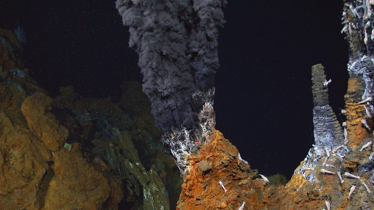
The black smokers – hydrothermal vents – found on the ocean floor.
Photo: Woodshole Oceanographic Institute.
Producers are followed by consumers, creatures who cannot make their own food and must feed on either the producers or on other consumers. There are plankton feeding animals – oysters, sponges, corals, and zooplankton. There are larger creatures that feed on larger plankton – manta rays, menhaden, and whales. There are consumers who feed on the first order of consumers – stingrays, parrotfish, and pinfish. And there are the top predators – orcas, sharks, and tuna. The ocean is a giant food web of creatures feeding on creatures. All creatures evolve defenses to avoid predation. Predators evolve answers to these defenses. Some species survive for long periods of time like the horseshoe crabs and nautilus. Others cannot compete and go extinct.
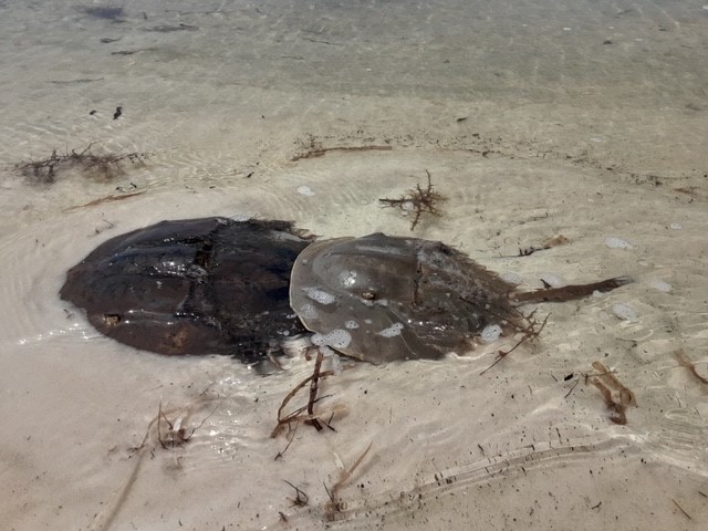
Horseshoe crabs are one of the ancient creatures from our seas. Photo: Bob Pitts
As we mentioned in Part 1 of this series – the hydrosphere is in motion. Different temperatures, pressure, and the rotation of the planet move water all over. These currents bring food and nutrients, remove waste, and help disperse species across the seas. Life spreads to other locations. Some conditions are good – and life thrives. Others not so much – and only specialists can make it. The biodiversity of our oceans is an amazing. Coral reefs, mangrove forests, and seagrass beds are home to thousands of species all interacting with each other in some way. The polar regions are harsh – but many species have evolved to live here, and the diversity is surprising higher than most think. The bottom of the sea is basically unknown. It has been said we know more about the surface of the moon than we do at the bottom of our ocean. But we know there is a whole world going on down there. We believe the basic principles of life function there as they do at the surface – but maybe not!
The magical lights of the deep sea.
Photo: NOAA
Fossil records suggest life here began almost one billion years ago. The fossils they find are of creatures similar and different from those inhabiting our ocean currently. As we stated that the physical planet is under constant change – life is as well. It is a system that has been working well for a very long time. Over the last few centuries humans have studied the physical and living oceans to better understand how these systems function. They have been functioning well for a very long time. And though life began at sea – there was dry land to exploit – for those who could make the trip. That will be next.
by Rick O'Connor | Feb 14, 2025
With this article we will shift from the microscopic creatures of the Gulf of Mexico to the macroscopic ones – ones you can see without a microscope. We will begin with the simplest and most primitive of macroscopic creatures – the seaweeds.
Many locals see the grass washed ashore along the Intracoastal Waterway and call this seaweed, but it is in fact seagrass. Seaweed differs from seagrass in that they are not true plants. True plants are vascular – meaning they have a series of “veins” running through their body called xylem and phloem. These veins move water and material throughout the body – similar to the arteries and veins of an animal. But seaweeds lack this “circulatory” system, rather they absorb water through their tissues and must live in the water environment to do this. Seaweeds lack leaves, stems, and roots. They do not produce seeds or flowers, but they do require sunlight and nutrients and conduct photosynthesis as true plants do. When I was in college seaweed was considered simple plants – just nonvascular ones. Today biologists believe they are too simple to be considered plants and thus are a group existing between the microscopic phytoplankton and the true vascular plants we know from our lawns and forests. They are often called algae as well as seaweed.
Mats of Sargassum on a south Florida Beach.
Photo: University of Florida
Biologists divided the seaweeds into divisions based on their color, which is determined by the photosynthetic pigments they have for photosynthesis. Compared to my college days, the classification of green algae is quite complex. The entire group was once placed in the Division Chlorophyta. Today, most sources consider only the marine forms of green algae in the group Chlorophyta, with numerous other groups consisting of thousands of species. Most green algae live in freshwater and are believed to be the group that led to the land plants we are familiar with. Their photosynthetic pigments include chlorophyll and a and b but also carotene and xanthophyll. The pigments are dominated by the chlorophylls – hence their green color – and the ratio of chlorophyll to carotene and xanthophyll is the same as the plants you find in your yard – hence the argument they led to the evolution of land plants.
Green algae – or any of the seaweeds – are not as common along the northern Gulf of Mexico as you find on other coasts. Not having true roots, stems, or leaves, seaweeds must attach themselves to the seafloor using a suction cup type structure called a holdfast. To attach, the holdfast must have a rock of some type. Along the rocky shores of Maine and California, they are quite common. Even with the limestone rock of south Florida you can find these. But the fine quartz sand of the northern Gulf of Mexico is not as inviting to them. That said, we do find them here and most are found on man-made structures such as jetties, seawalls, and artificial reefs – I found one attached to a beer can.
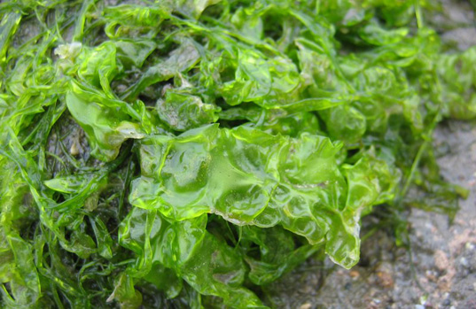
Of all of the green algae that exist in Florida, I have only encountered three. One is called “sea lettuce” in the genus Ulva. Attached to rock jetties and seawalls, it looks just like lettuce and is beautiful, brilliant green in color. It grows to about seven inches in height and is used as a food source in different countries. It can become a problem if local waters are high in nutrients due to pollution from land sources. It will grow abundantly, reducing habitat for other species, and wash ashore during storms where it breaks down releasing gases that can be toxic to shore life and humans. I first encountered it growing on the rock jetties at St. Andrews State Park in Panama City, but it does grow on local hard structures.
Sea Lettuce.
Photo: University of California
“Dead Man’s Fingers” – Codium – is another green algae I first encountered it on the jetties of St. Andrews. The thick finger-like projections of this seaweed extending from the rocks did resemble a glove – or the fingers of a dead man within the rocks. Some species around the world are used for food. But I could not find any references that it is here.
“Deadman’s Fingers”.
Photo: iNaturalist
The third species of green algae I have seen locally is known as the “Mermaids Wine Glass” – Acetabularia. This beautiful seaweed is relatively small and does resemble a wine, or martini glass. They are quite abundant in south Florida and is the one I found growing on a beer can submerged in Santa Rosa Sound.
“Mermaid’s Wineglass”
Photo: Project Noah
Though seaweeds in general are harder to find along the northern Gulf coast, they are fun to search for and do play a role as primary producers here.
References
Green Algae. Wikipedia. https://en.wikipedia.org/wiki/Green_algae.
Deadman’s Fingers. Monterey Bay Aquarium. https://www.montereybayaquarium.org/animals/animals-a-to-z/dead-mans-fingers.
Introduction to Green Algae. University of California/Berkley. https://ucmp.berkeley.edu/greenalgae/greenalgae.html.
Ulva Lactuca. Wikipedia. https://en.wikipedia.org/wiki/Ulva_lactuca.
by Rick O'Connor | Jan 24, 2025
What are meroplankton? How do they differ from regular plankton?
In the plankton world there are those that are plankton (drifters) their whole lives – holoplankton – and those who are plankton for only part of their lives – meroplankton. Most know the meroplankton as larva – the early stages of large creatures like fish, crabs, and shrimp. When you pull a plankton net through the waters of the Gulf of Mexico you will collect a lot of meroplankton – and yes… they are food for the plankton feeders just as the other forms of plankton are. Like most of the holoplankton, most are microscopic and swim through the water using cilia or flagella. Like copepods, they are multicellular and are considered true animals. Here are a few that you could find in a plankton sample…
Planula larva
These are the larva of jellyfish, sea anemones, and corals. They are ciliated cells that move through the water column until they metamorphose into the adult forms. Most will settle out on hard substrate on the seafloor and develop into a flower-like structure called a polyp. Some grow into adult polyps – like sea anemones and corals – while others will go through a second stage and become swimming medusa – the jellyfish.
Trochophore larva
This is another ciliated larval form that is the first stage of some mollusk, annelid worms, and nemertean worms.
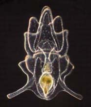
Veliger larva
This is a ciliated larval form of several mollusk. Those that go through the veliger stage begin as trochophores. Some go through the trochophore stage while in the egg, others hatch and go through the trochophore before metamorphosizing into the veliger. The veliger stage will develop the characteristic mollusk shell, and many will develop a foot which can be used in locomotion on the seafloor searching for suitable habitat.

The veliger stage of many mollusks.
Photo: NOAA.
Nauplius larva
This is the first stage of a crustacean. It is very hard to tell which crustacean the nauplius will become but they do resemble crustaceans with segmented body parts and an exoskeleton. Most crustaceans will molt into the zoea stage, and some then into a megalops stage, before becoming the adult.
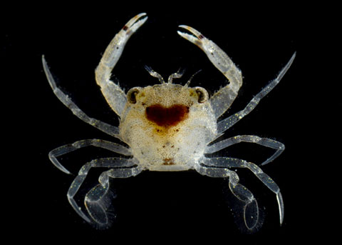
This is the megalops stage of a crab.
Photo: University of California Irvine.
Bipinnaria larva
Another ciliated larval form that will eventually become an echinoderm – starfish, sea urchin, sand dollar.
Bipannaria are the larval stage of starfish and sand dollars.
Photo: NOAA.
Ichthyoplankton
Most of the fishes in the northern Gulf of Mexico begin life as meroplankton as well – these are called “ichthyoplankton” and are quite abundant in a plankton sample. Even large fish, such billfish and swordfish, begin life at this stage.
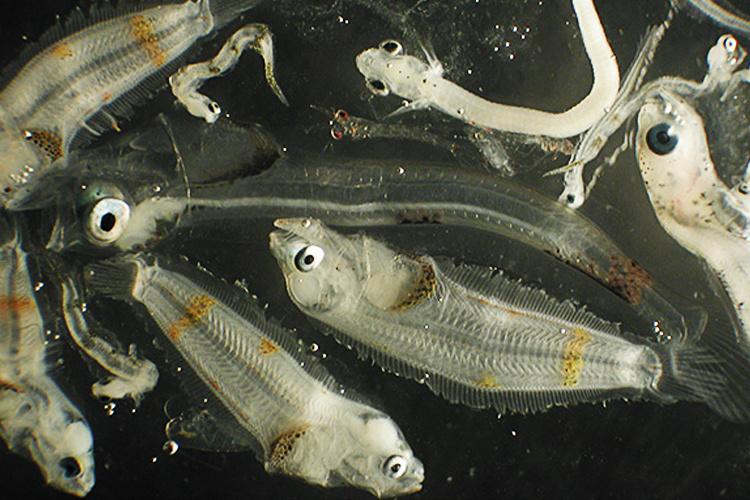
Most fish in the northern Gulf begin their lives as tiny plankton.
Photo: NOAA.
The first nine post in this series have been about microscopic creatures found in the northern Gulf. It goes without saying that there are literally thousands of other forms of plankton we did not mention. It is also important to mention how important these creatures are to the health of the Gulf and why they were as much of a concern during the oil spill as were dolphins, sea turtles, and sea birds. As the plankton go… so goes the Gulf. We will now turn our attention to the larger creatures – ones you do not need a microscope to see.
