Finding Common Ground on Climate Change
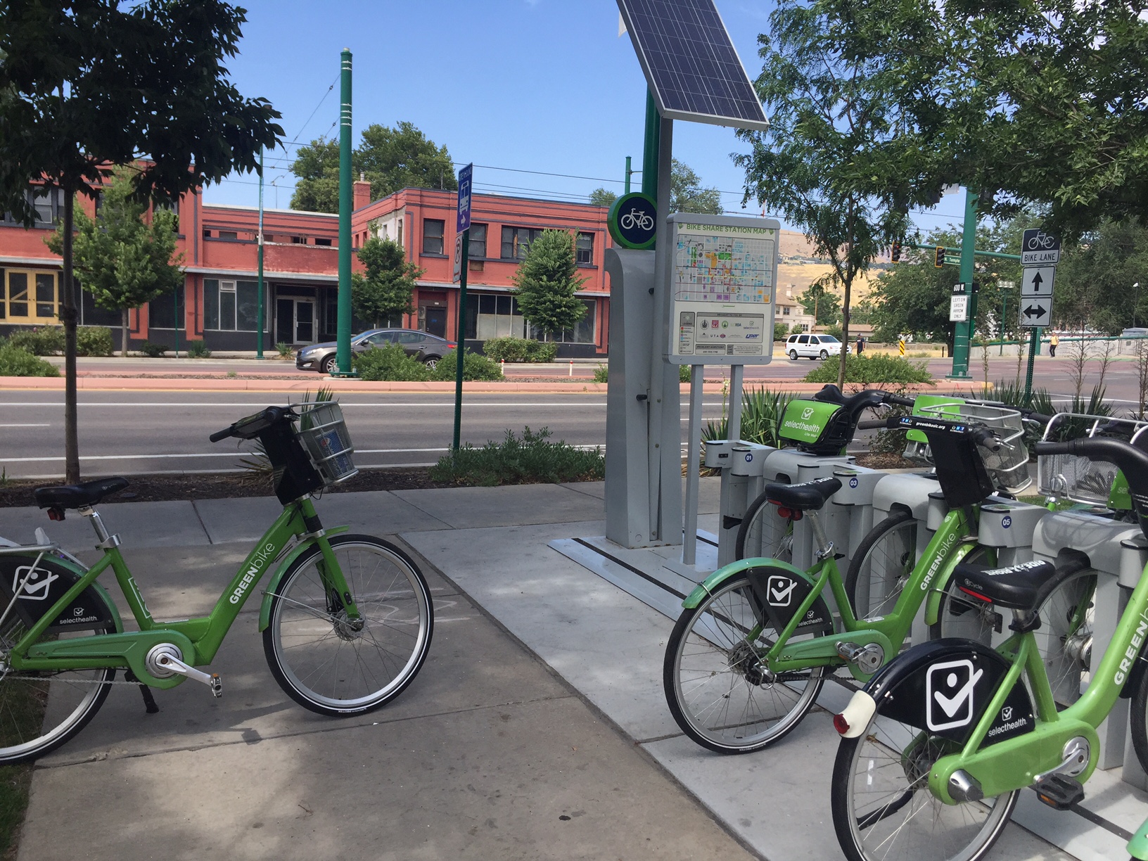
This solar-powered bicycle rental facility provides a healthy alternative to driving around a large city. Photo credit: Carrie Stevenson, UF IFAS Extension
Climate change is one of those topics that most people don’t want to think much about. It can be overwhelming, it can be controversial, and it can be downright frightening. A year ago, Yale and George Mason University completed the most recent surveys in the “Six Americas” study, which determined levels of belief and concern in global warming. The “Six Americas” range from people who are alarmed, concerned, cautious, disengaged, doubtful, or dismissive when asked about climate change. Interestingly enough, 34% of Americans consider themselves concerned while 23% were cautious. Ranking third were 11% who are doubtful about climate change.
When you start to drill down into the individual questions asked on the survey, you see more agreement. For example, when Escambia County citizens were asked whether global warming is caused by human activities, somewhere between 45%-50% said yes. However, when asked whether they think global warming is actually happening (regardless of cause), the percentage went up to 65%-70%. When asked if they support funding research into renewable energy sources, Escambia County residents jumped up to an 80%-85% agreement. That, to me, is nothing short of a miracle, having lived in Escambia County long enough to know there’s rarely that much agreement on anything!
The takeaway message from that survey, to me, is that regardless of where people stand on climate change/global warming, there are some starting points that can be common ground. If the majority of a community believe climate change is happening and that supporting renewable energy research is a good thing, then they can work towards those outcomes to the mutual benefit of all.
An example of one small but significant step towards sustainable energy use includes bicycle share/rental facilities. On a recent trip to Salt Lake City, solar-powered bike stations were strategically placed around the downtown area. For a small fee, the bicycles could be checked out (for 30 minutes at a time) up to 24 hours. This ensures there are plenty of bicycles available for other users, and stations are close enough to one another that it’s easy to check bikes in and out if you need more time. The benefits of encouraging bicycles are numerous; reduced traffic and burning of fossil fuels, reduced need for parking in high-value real estate, and health benefits for riders. The other investment necessary to make biking more prevalent and successful are bike lanes, which were plentiful in Salt Lake City to keep riders and drivers safe. Once safe bike lanes are in place, those who live in the area with their own bikes are more likely to use them on a regular basis, further decreasing vehicular traffic.
There are many great organizations and publications around the country dedicated to increasing bicycle use and safety. For more information, check out Trail Link, Momentum Magazine, or the Burlington Bikeway.