by Laura Tiu | Nov 20, 2015
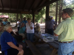
The Panhandle Outdoors LIVE team, with Extension Agents from eight counties, hosted an outdoor field day on August 26, 2015. Twenty-three participants from over eight counties in Florida attended the event and traveled to three local springs: Vortex, Ponce de Leon, and Morrison Springs. The goal of the day was to learn about spring characteristics, history, biodiversity and management issues. These popular springs in the western Panhandle are managed by three different entities – the private sector, local government and a state agency.
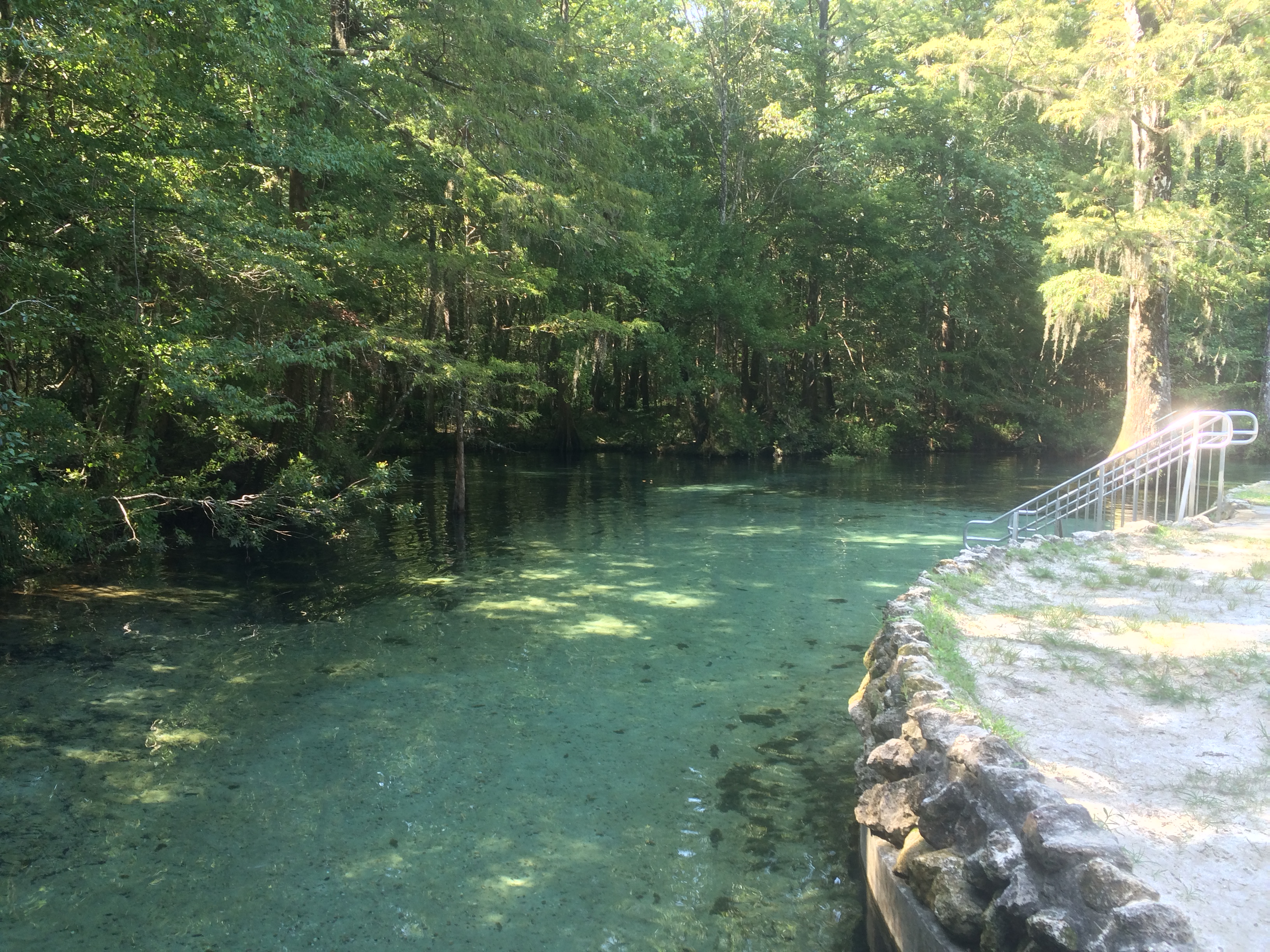
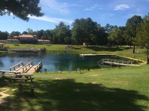
The day began at Vortex Springs. Three generations of the same family have owned and managed this popular dive resort in the Panhandle. The current owners shared the history of the spring along with a family photo album highlighting the growth and development over the years.
Vortex Springs Dive Resort
Vortex Spring produces 28 million gallons of crystal clear water daily at a year-round temperature of 68 degrees. Depths in the spring basin range from about 50 feet for a cavern dive and up to 115 feet for a cave dive. The bottom of the spring bowl is sandy, with limestone near the vent. Vortex waters flow out of the 225-foot-diameter spring pool to form Blue Creek, which flows over a half-mile before entering the Choctawhatchee River. Fish at the spring are tame, coming right up to visitors, and include bluegills, channel catfish, American freshwater eels, gar, redhorse suckers, shadow bass, and exotic species such as koi and goldfish (floridasprings.org). One of the biggest environmental challenges the owners face is controlling an invasive aquatic plant, hydrilla, which rings the basin.
The next stop was Ponce de Leon Springs State Park where participants learned about the springs and had lectures on water quality, Florida Friendly landscapes and storm water management. Managed by a state agency, this beautiful spring is named for Juan Ponce de León, who led the first Spanish expedition to Florida in 1513 – as legend has it – in search of the “Fountain of Youth”. Visitors might well regain their youth by taking a dip in the clear waters where the temperature is a shocking 68 degrees F. year-round.
Leon County Extension Agent, William Sheftall, shares information on watershed management
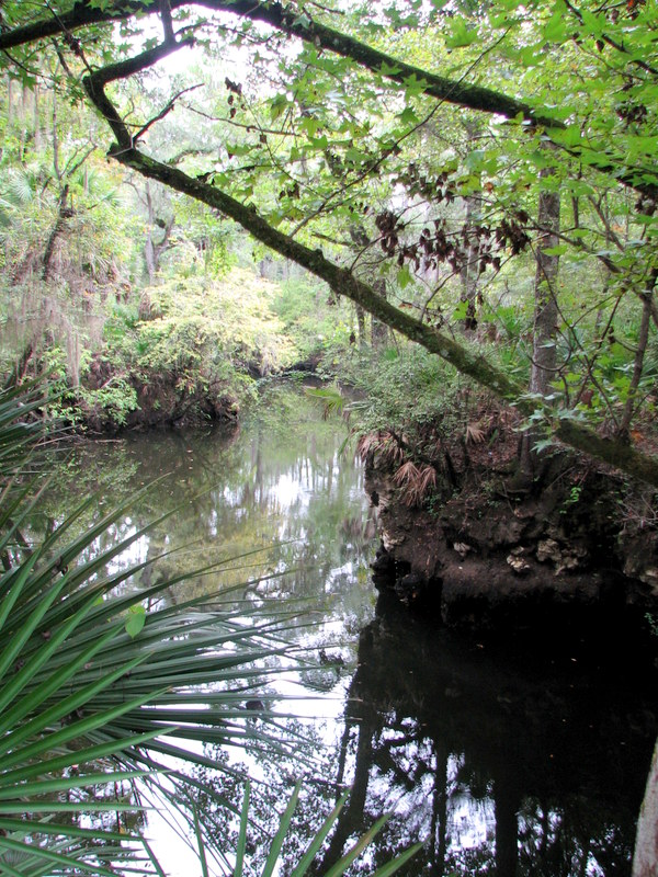
The main spring produces 14 million gallons of water daily into a crescent-shaped basin with depths averaging five feet but increasing to 16 feet over the vents. The bottom is sand and limestone and gives the popular swimming area a light greenish blue appearance. The spring-run is approximately 350 feet in length and flows into Sandy Creek, a blackwater stream, which subsequently flows out of the park and into the Choctawhatchee River (floridasprings.org).

The spring run at Ponce de Leon Springs flowing into Sandy Creek
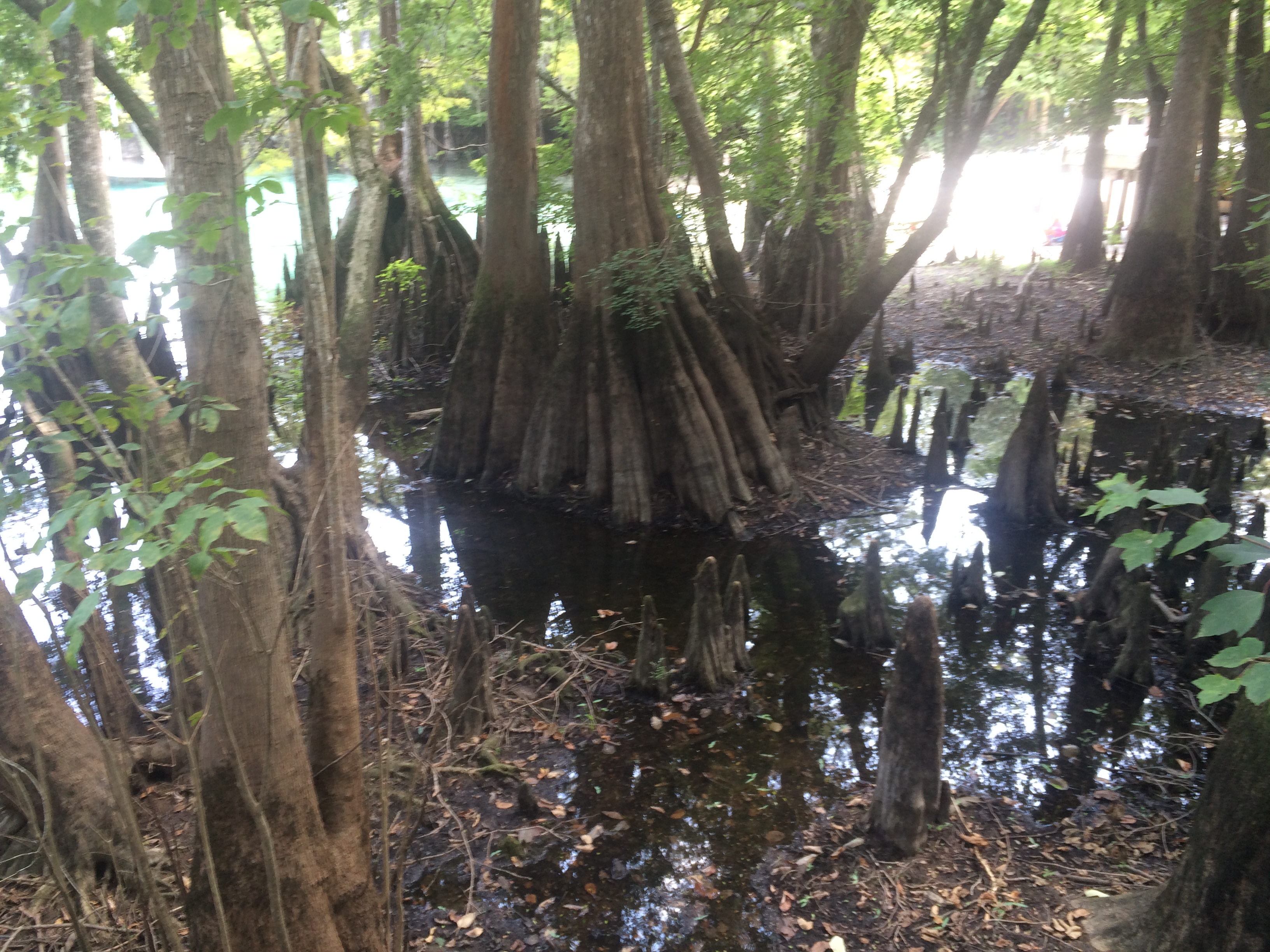
Our final destination was Morrison Springs. Morrison Springs is managed by Walton County, whose Commissioner and Habitat Conservation Plan Coordinator shared the history of the springs and the development work that has been completed. The large, sandy-bottomed spring is surrounded by a 161-acre park and is a popular spot for swimming, snorkeling, diving, birding, photography and nature walks . Morrison Spring discharges an average of 48 million gallons of crystal-clear water each day to create a 250-foot-diameter spring pool and a spring run that flows into the Choctawhatchee River (floridasprings.org). The springs are home to a healthy fish population with largemouth bass, bluegill, carp, white mullet, and pickerel all being seen that day.
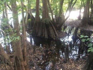
Beautiful cypress trees and knees ring Morrison Springs
Field day participants (86%) reported an increase in knowledge of the springs after the event with 59% indicating that they would change their behavior based on the information presented. Behavior changes mentioned were cleaning up trash, controlling personal fertilizer applications, making sure their lawn care company was certified, controlling erosion, conserving water and planting native plants. All of the participants (100%) reported being interested in attending future Panhandle Outdoor Live events. That is just the kind of encouragement the team needed, so be sure to watch our website for future event announcements.

by Carrie Stevenson | Nov 13, 2015
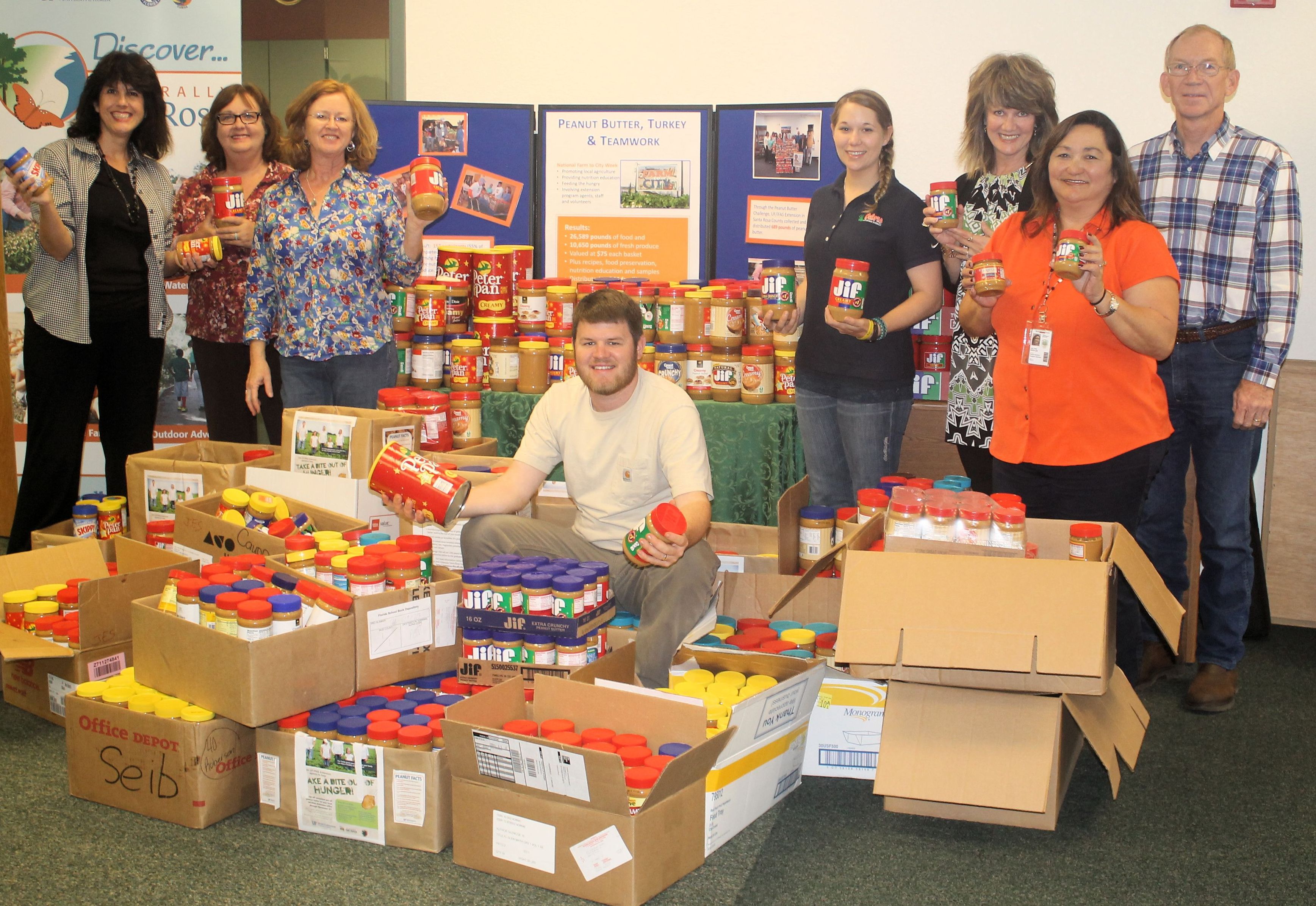
Next time  you are the grocery store, consider purchasing an extra jar or two of peanut butter and donating it to your local Extension office as part of the annual Peanut Butter Challenge. The Challenge is a food collection drive of peanut butter from within each of the 16 UF/IFAS Extension Northwest District Counties. UF/IFAS Extension Northwest District agents have been partnering with the Florida Peanut Producers Association since 2012 to collect peanut butter and distribute the bounty to local food pantries in each county. Annually, Ken Barton and the Florida Peanut Producers Association Board of Directors provide an additional two pallets of peanut butter (approximately 2800 jars) to be divided between the counties. Not only does the Peanut Butter Challenge help publicize the important contribution of north Florida’s peanut growers to the peanut industry, but it also helps provide a healthy and universally loved product, made from a locally grown product, to food pantries in northwest Florida communities from Pensacola to Monticello.
In 2014, Santa Rosa County collected 1477 jars resulting in more than a ton of peanut butter for their local food pantries. Escambia County was blessed by the support Helton Farms and Tri-County Peanut Buying Point. Rodney and Mike Helton and Tri-County purchased two additional pallets of peanut butter from Peanut Proud and helped to distribute to Escambia County Florida and Escambia and Baldwin counties in Alabama. In Washington County, the Public Library is doing a “Food for Fines” campaign, whereby patrons can bring in food in lieu of money for overdue fines. The library director is changing her campaign to require peanut butter donations as the food for fine forgiveness. They will collect peanut butter through November 30 and make a joint presentation with Extension to the local food bank.
As you can see, there are many different ways to get involved. Across the panhandle, 3463 jars of peanut butter were donated in 2014, amounting to almost 5000 pounds of peanut butter. We’d really like to surpass that number, so please consider helping us by donating as many jars of peanut butter as you can afford. The collection continues to November 25, 2015. Contact your local Extension office to find out where you can drop off peanut butter.
by Rick O'Connor | Nov 6, 2015
Hernando de Soto and his party crossed the Aucilla River sometime in October of 1539 and celebrated Christmas in what is now Tallahassee. Many things in Florida have changed since de Soto passed this way, but when the 2015 Panhandle Outdoors LIVE! tour hiked the Aucilla Sinks portion of the Florida Trail this September, many things had not.
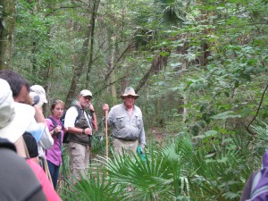
Panhandle residents explore the area of Aucilla Sinks with local guide David Ward.
Photo: Jed Dillard
Yes, the trail is maintained and marked by the Apalachee chapter of the Florida Trail Associations and there are bridges in spots, but the blood sucking bugs that bedeviled deSoto haven’t dissipated. More importantly, the spectacular and distinctive area provides a relatively easy hike that reveals the connections between geology and hydrology in an area with little disturbance by the settlers who followed the first Europeans into North Florida.
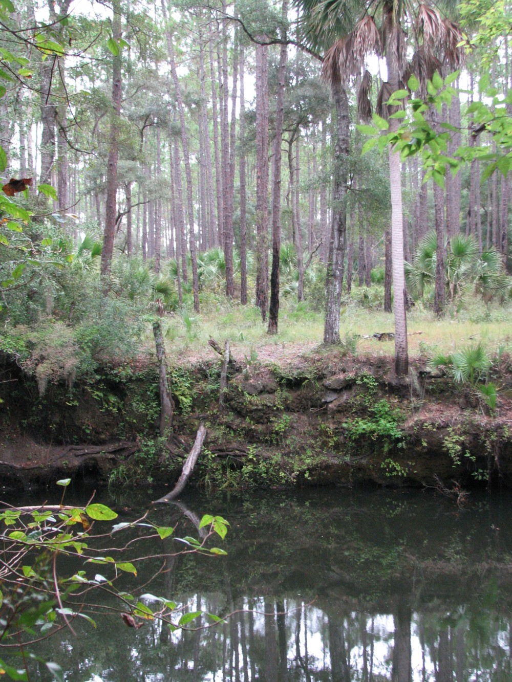
Hikers got up close and personal views of the Karst topography found in North Florida. This topography occurs as the tannic rivers and runoff dissolve the underlying limestone on their way to the aquifer. These connections and voids in the bedrock allow the Aucilla River to “come and go” above and below ground as it moves to the Gulf of Mexico as do all rivers in the Suwannee River Water Management District other than the Suwannee.
Native Jefferson county guide, David Ward pointed out the contrast between tannic water in the river channel and the clear water in caves near the river. “In those caves the water is crystal clear. You are looking at the water of the aquifer itself.”
Leon County agent Will Sheftall seized the opportunity to drive home how vulnerable Floridians are to ground water pollution and its effects on our water supply. “Here there’s little distance between the surface and the ground water. In these sandy soils, water moves quickly from the surface to the aquifer. Whatever is in that water can easily get into our ground water. Our personal activities and our public policies need to reflect that to ensure the future of Florida’s water quality.”
As we reached a slightly elevated area, Ward pointed out a longleaf pine/wiregrass community restored by reinstituting controlled burning. The open vegetation contrasts with the non-fire resistant species such as parsley hawthorn in wetter areas usually untouched by fire. “These pine savannahs were widespread when the Europeans arrived,” Ward noted. “Over my lifetime in these woods, I’ve seen appropriate management bring back these conditions closer to what we know it was like when the Europeans arrived.”

One of the many locations where the Aucilla River “rises from the limestone caverns beneath the earth.
Photo: Jed Dillard
Information on this section of the Florida Trail is available from the Apalachee Chapter of the Florida Trail Association, the Suwannee River Water Management District and Florida Fish and Wildlife Conservation Commission. Humidity never went below 80 percent during our late morning, early afternoon trip. November will likely provide less buggy and surely less muggy conditions. If you’d like to learn about this area from the comfort of your recliner or need some extra encouragement to strike out on the walk, check out this program previously broadcast by WFSU TV. http://wfsu.org/dimensions/viewvideo.php?num=184 Either way, you’ll know more about Florida’s spectacular natural world.
AUTHOR: Jed Dillard; Livestock and Forges Extension Agent; Jefferson County
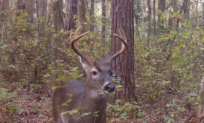
by Jennifer Bearden | Oct 31, 2015
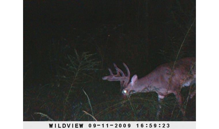
Deer in velvet. Photo by Jennifer Bearden
When hunting, food safety begins in the field. The goal is to have safe meat for you and your family to eat. Here are a few ways to keep your food safe:
- Shot placement – that’s right. Food safety begins with an accurate shot. Your goal should be to prevent the contents of the digestive tract from touching the meat. A gut shot can quickly ruin meat and make cleaning the animal harder.
- The quicker you get the meat chilled the better. Improper temperature is meat’s number one enemy. The recommended storage temperature to prevent bacterial growth is 35-40°F.
- Handle the knife with one hand and the carcass with the other. The hide can harbor dirt and pathogens so care should be taken to prevent contamination of the meat.
- Have vinegar water and chlorine water on hand. Vinegar water (50/50) can be sprayed on areas where hair or hide touch the meat. Rinse hands and tools periodically in a bucket of sanitizing solution of 1 tbsp of chlorine per gallon of water.
- Think food safety through the whole process. Prevent cross contamination by keeping anything from contacting the meat unless it has been sterilized. Keep the digestive tract intact and prevent the contents of it from contacting the meat. Chill the meat as quickly as possible. When further processing, continue to use sterile surfaces and tools.
For more information on wild game processing safety, you can attend our upcoming Wild About Deer: Game Processing Program on November 14 from 10am to 2pm. We will teach processing safety from field to table. A home-cooked venison meal will be provided. The cost is $20. Please pre-register by calling 850-689-5850.
Wild about Deer Flyer
by Rick O'Connor | Oct 31, 2015
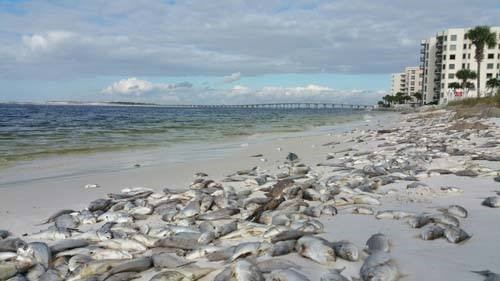
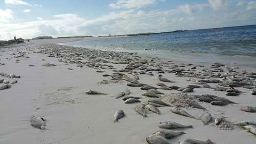
Many coastal Panhandlers woke up this week to the sight and smell of dead fish. Thousands of them washed ashore from Panama City to Pensacola. This mass die off included a variety of species including whiting, sheepshead, hake, cusk eels, and even lionfish; there were also reports of dead bass from the Dune Lakes in Walton and Okaloosa counties. What caused this mass die off of fish?
The suspect is red tide…
Most of us along the panhandle have heard of red tide but we may not know what it is or what causes it. Many attribute the red tide events to human impacts, stormwater runoff etc., but in fact they have been around for centuries. There are records suggesting that the European colonials experienced them and I have read one account that the Red Sea got its name from the frequency of these events there. So what is this “red tide” and what causes it?

Dead fish line the beaches of Panama City.
Photo: Randy Robinson
It is actually a bloom of small single celled plants called dinoflagellates. There are thousands of species of dinoflagellates in the world’s oceans and not all cause red tide, but there are several species that do. These small microscopic plants drift near the surface of the ocean acquiring sunlight to photosynthesize. They possess two small “hairs” called flagella (hence the name “dinoflagellate”) to help orient themselves in the water column. Most have a shell covering their body called a theca and some shells have small spines to increase their surface area to resist sinking. One method of defense found in some dinoflagellates is the production of light – bioluminescence. This light is produced by a chemical reaction triggered by the creature as a flash of blue – many locals refer to it as “phosphorus”. Other dinoflagellates instead will release a toxin… some of these are ones we call “red tide”.
Red tide organisms are always in the water column of marine environments but are usually in low concentrations, maybe 300-500 cells per milliliter of water. But under favorable conditions, warm water with nutrients, they multiple… sometimes in great numbers, such as 3000-5000 cells/ml, and we have a “bloom”. The number of cells within these blooms can be high enough that we can actually see the water change color… hence “red tide”.
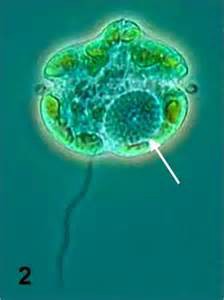
The dinoflagellate Karenia brevis.
Photo: Smithsonian Marine Station-Ft. Pierce FL
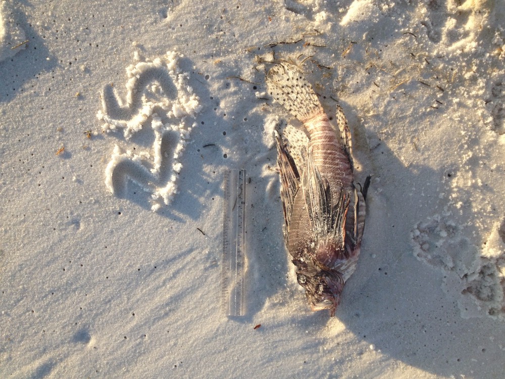
The most common red tide dinoflagellate associated with the Gulf of Mexico is Karenia brevis. Karenia blooms typically form offshore and are of little impact to the coastal communities. However when the wind and tides are right these blooms will drift towards shore. When they do fish kills occur and humans have eye and throat irritations. Marine mammals in particular struggle with red tide. As the bloom comes near shore it reaches the bottom of the water column and many of the bottom dwelling fish suffer. Most of the photos of fish I saw in the October 2015 fish kill were bottom dwellers, including many invasive lionfish.
Is there anything we can do to prevent red tides?
Not really… Again, they are naturally occurring event. We may increase the frequency of the events by discharging excessive nutrients into the water from our run-off but they would probably occur anyway. Red tide events are not as common in the panhandle as they are in southwest Florida. The Gulf waters near Charlotte Harbor are shallow, warm, and near the many manicured lawns, gold courses, and the discharge of much of the agriculture in the state. Occasionally blooms formed in that part of the state drift north but this year a bloom formed off of Bay and Gulf counties in early October. The recent storm that passed through probably pushed the bloom inland and to the west. The biggest hazard of humans is eye, throat, and skin irritation. It is quite uncomfortable to be around these blooms. In 1996 a local bloom was concentrated enough that the campground at Ft. Pickens had to be closed. I was in Galveston Texas when I heard about the red tide occurring in the Florida panhandle. As I was leaving Galveston the newspaper reported the closer of all oyster harvesting in Texas due to a red tide generated in the Padre Island area and was moving north. Seems that red tide is covering a large portion of the Gulf coast the last week of October. That said… anything communities can do to reduce nutrient runoff will certain decrease the frequency of red tides.
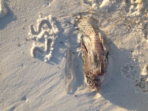
The carcass of the invasive lionfish was part of the October red tide kill.
Photo: Shelly Marshall
The Florida Fish and Wildlife Conservation Commission post red tide updates from around the state on their website and the Escambia County Extension Office post a local water quality update each Friday that has red tide information as well.
FWC
http://myfwc.com/research/redtide/
Escambia County Extension
http://escambia.ifas.ufl.edu