When snorkeling the grassbeds of the Florida panhandle encountering a reptile has a low probability, but it is not zero. Of all the reptiles that call this part of the state home, few enter marine waters and most of those are very mobile, moving up and down the coast heading from one habitat to another. In fact, there are no marine reptiles that would be considered residents of our seagrasses, only transients.
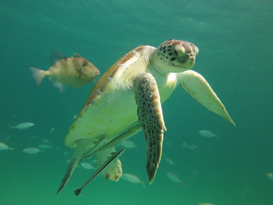
The one species that you might encounter is the green sea turtle (Chelonia mydas). This is the largest of the “shelled” sea turtles and has a vegetarian diet. With a serrated lower jaw, they can be found grazing in the seagrass beds feeding on both the grasses and the species of algae found there. The carapace length of these large reptiles can reach four feet and they can weigh up to 400 pounds. Their coloration is similar to that of the loggerhead sea turtle (Caretta caretta) but their heads are smaller and there are only two large scutes between the eyes rather than the four found in the loggerheads. The colors of the skin and shell have shades of brown, yellow, orange, and some black and can be quite beautiful. The name “green” sea turtle comes from the color of their internal fatty tissue. Feeding on a diet of seagrasses, it becomes green in color, and this was discovered by early fishermen who hunted and consumed this species. It is the one used most often in what is called turtle soup and is actually farmed for this dish in other countries.
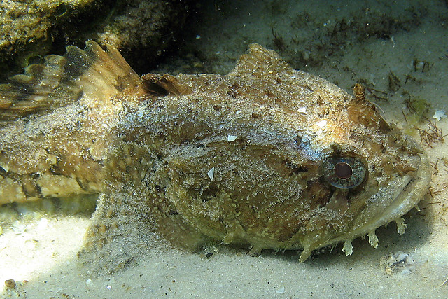
The green sea turtle.
Photo: Mile Sandler
Like all sea turtle species, they are born on the Gulf side of our barrier islands. If they successfully hatch, they work their way to the open water and spend their early years in the open sea. Some have been associated with the mats of Sargassum weed floating offshore, feeding on the variety of small invertebrates that live out there. They will also nip at the Sargassum itself. As juveniles they will move back into the coastal estuaries where they begin their vegetarian lifestyle. As adults they will switch time between the open sea and the grass filled bays. Once unfortunate side effect of feeding in our grassbeds is the frequency of boat strikes. There are tens of thousands of motored vessels speeding through our grassbeds and the turtles surfacing for air can be targets for them. Our hope is that more mariners are aware of this problem and will be more vigilant when recreating there.
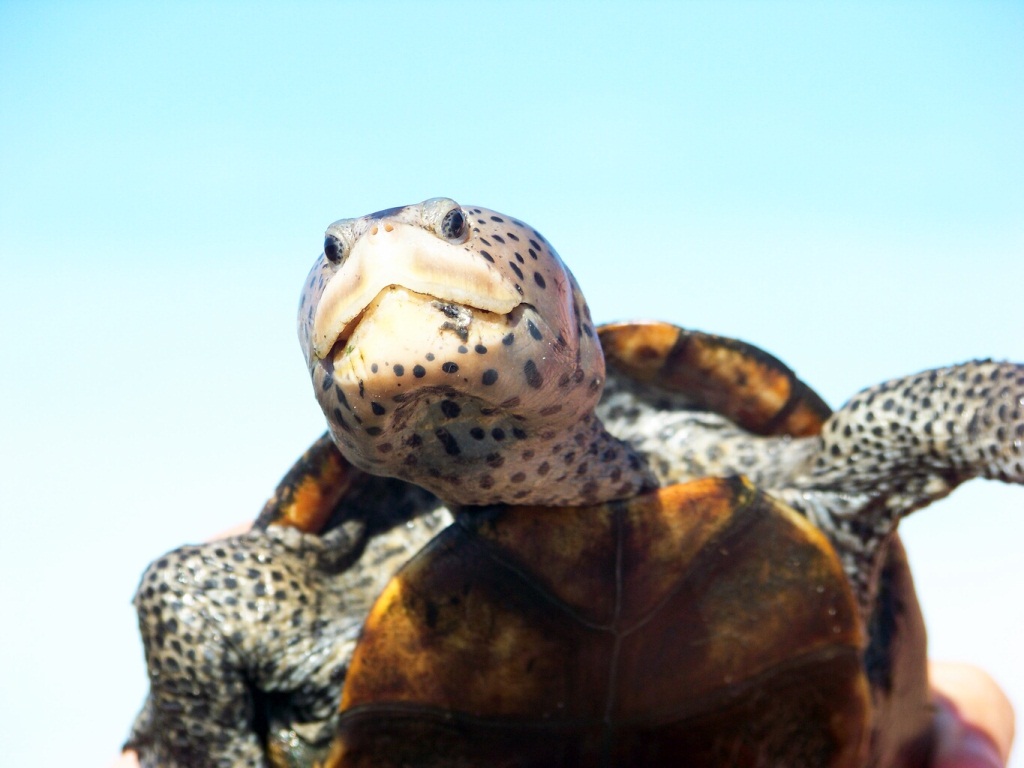
Another turtle who IS a resident of the estuary is the much smaller diamondback terrapin. Though terrapins much prefer salt marshes they will enter seagrass beds, and some spend quite a bit of time there. Terrapins prefer to feed on shellfish so, moving through the grassbeds it is the snails and bivalves they seek. Because of their size they feed on the smaller mollusk. A typical terrapin will have a carapace length of about 10 inches and may weigh two pounds. They will take small crabs and shrimps when the opportunity is there, and they are known to swim into submerged crab traps seeking the bait. Unfortunately, being air breathing reptiles, they will drown after becoming entrapped. It is now required that all recreational crab traps in Florida have bycatch reduction devices (BRDs) on each of the funnel openings to reduce this problem. Many studies, both here in Florida and elsewhere, have shown these BRDs do not significantly reduce crab catch and so you can still enjoy crabbing – just not while catching terrapins. Encountering one snorkeling would be a very rare event, but – particularly in the eastern panhandle – has happened.
Diamondback terrapin.
Photo: Rick O’Connor
A third reptile that has been seen in our grassbeds is the American alligator (Alligator mississippiensis). Preferring freshwater systems, encounters with alligators in an open seagrass bed are rare, but do happen. There are plenty of freshwater ponds on some of our barrier islands that the alligators will use. They have been seen swimming out into the seagrass beds and often will cross the bay, or Intracoastal Waterway, to mainland side. They have also been seen swimming near shore in the Gulf of Mexico. Though they can tolerate saltwater, they have a low tolerance for it and do not spend much time there.
Alligators are top level carnivores feeding on a variety of wildlife. Like most predators, they tend to seek and capture the easiest prey. Most often these are fish, reptiles, or small mammals. But they will take on large birds or deer if the opportunity presents itself. Despite their natural fear of humans, they have taken pets and also have attacked humans.
Having only canines in their mouths, they must grab the prey and swallow it. Lacking molars, they cannot chew. So, more often than not, they select prey they can swallow whole. If they do grab a larger animal, they are known to drown the creature in what has been termed the “death role” and cache it beneath the water under a log (or some structure) where it will soften to a point where they can cut small pieces and swallow it. All of the alligators I have seen in our grassbeds were definitely heading somewhere. They were not spending time there. After heavy rains the salinity may drop enough to where they can tolerate being out there longer and encounters could increase. But they are still rare.
Alligator
Photo: Molly O’Connor
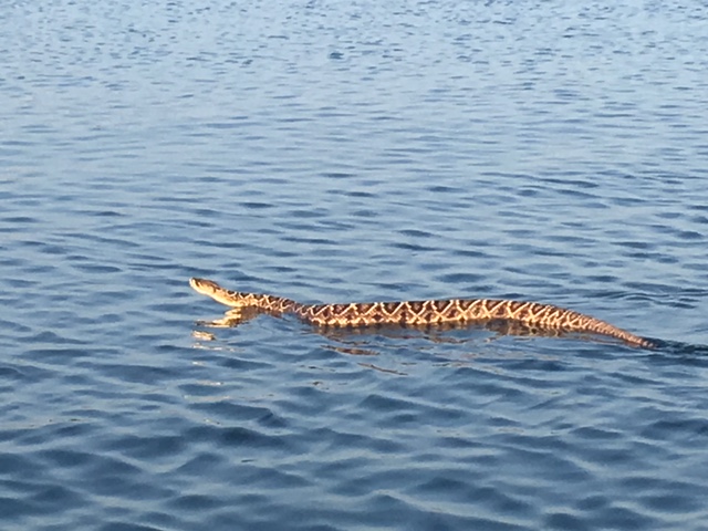
I will mention here that there are several species of snakes that, like the alligator, are swimming from one suitable habitat to another – crossing the seagrass in route. All snakes can swim and encounters in brackish water are not unheard of. I have several photos of diamondback rattlesnakes (Crotalus adamanteus) swimming across the Intracoastal Waterway between the mainland and the islands.
Eastern diamondback rattlesnake swimming in intracoastal waterway near Ft. McRee in Pensacola.
Photo: Sue Saffron
Encounters with reptiles are rare in our seagrass beds but pretty exciting when they do occur. There is certainly no need to fear swimming or snorkeling in our bay because they are so rare. But maybe one day you will be one of the lucky ones who does see one.
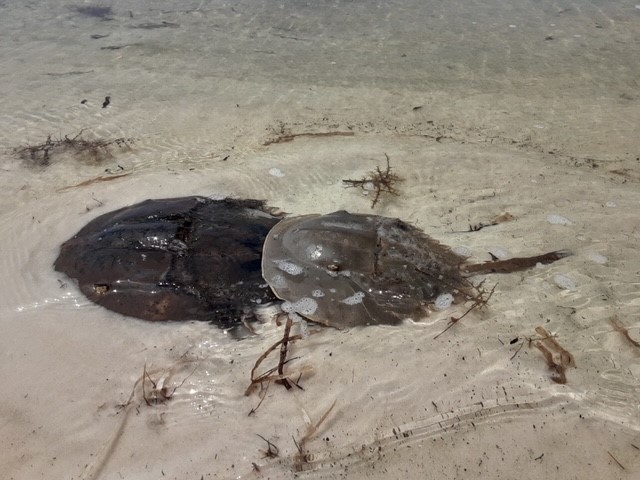
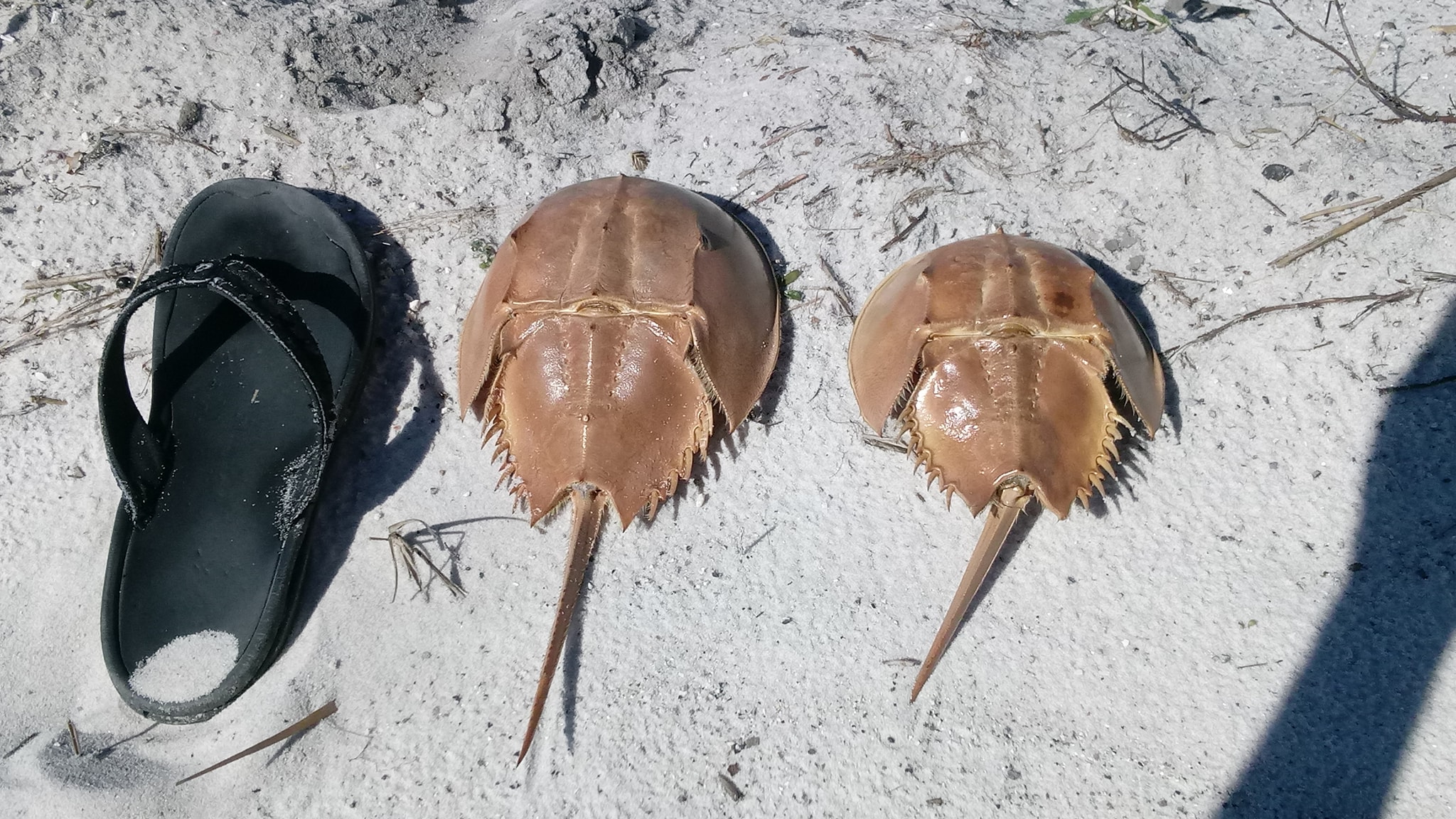
One of the community science volunteer projects I oversee in the Pensacola area is the Florida Horseshoe Crab Watch. The first objective of this project is to determine whether horseshoe cabs exist in your bay – FYI, they do exist in Pensacola Bay. The second objective is to determine where they are nesting – we have not found that yet, but we have one location that looks promising. One of the things my volunteers frequently find are the molts of the horseshoe crabs. Many keep them and I have quite a few in my office as well. One volunteer was particularly interested in the fact that they even molted and that they could leave this amazing empty shell behind and yet still be crawling around out there. So, I decided to write an article explaining the process in a little more depth than I typically do.
Horseshoe crab molts found on the beach near Big Sabine.
Photo: Holly Forrester.
I titled the article “The Molting of Crabs” but it could be the molting of any member of the Phylum Arthropoda – they all do this. The Phylum Arthropoda is the largest, most diverse, and successful group of animals on the planet. There are at least 750,000 species of them. This is three times the number of all other animal species combined. One thing unique to this group is the presence of an exoskeleton.
The exoskeleton is made of chiton and is secreted by the animal’s hypodermis in two layers. It provides the protection that the calcium carbonate shells of mollusk do but is much lighter in weight and allows for much more movement. Arthropods have jointed legs, hence their name “arthropod – jointed foot”, to enhance this movement even more. The entire body is covered by this exoskeleton.
The outer layer is thin and called the epicuticle. It is composed of proteins and, in many arthropods, wax. The inner layer is the thicker procuticle. The procuticle consists of an outer exocuticle and an inner endocuticle. These are composed of chiton and protein bound to form a complex glycoprotein. The exocuticle is absent at joints in the legs and along lines where the shell will rupture during molting. In the marine arthropods the procuticle includes salts and minerals. Where the epicuticle is not waxy and is thin, gases and water can pass into the animal’s body. The cuticle also has small pores that allow the release of compounds produced by glands within the animal. Not all of the cuticle is produced on the outside of the body. Some portions of it are produced around internal organs.
The colors of the crabs and other arthropods are produced by concentrations of brown, yellow, orange, and red melanin pigments within the cuticle. Iridescent greens, purples, and other colors are produced by striations of the epicuticle refracting light.
One disadvantage of the protective exoskeleton is the fact that it does not grow as fast as the interior soft tissue. They have solved this problem by periodic shedding, or molting, of the shell. Science calls this ecdysis, but we will continue to call it “molting”.
Step one is the detachment of the hypodermis from the skeleton. The hypodermis now secretes a new epicuticle. Step two, the hypodermis releases enzymes which pass through the new epicuticle and begin to erode the untanned endocuticle of the old skeleton. During this process the muscles and nerves are not affected and the animal can continue to move and feed. Step three, the old endocuticle is now completely digested. With the new procuticle produced by the hypodermis, the animal is now encased by both the old and new skeleton. Step four, the old skeleton now splits along predetermined lines, and the animal pulls out of the old skeleton. The new exoskeleton is soft – hence, the “soft-shelled blue crab” – and can be stretched to cover the increased size of the new animal. This stretching occurs due to tissue growth during steps 1-3, and from the uptake of air and water. The hardening of the new skeleton occurs due to the tanning of the new cuticle.
Stages between molts become longer as the animal grows older. Thus, there are numerous molts when the animal is young and as they age, they become fewer and farther between. Most insects have a finite number of molts they will go through. The marine arthropods seem to molt throughout their lives, though some species of crabs cease molting once they reach sexual maturity.
Molting is under hormonal control. Ecdyisone is secreted by certain endocrine glands, circulated through the blood stream, and acts directly on the epidermal cells. There are hormones that, if secreted, will inhibit the molting process. These are usually released if the animal senses trouble and that is not a good time.
During the period when the old shell is being digested many of the salts and minerals are absorbed by the tissue of the animal. Some people can eat crab but have allergic reactions when consuming soft shell crabs – most likely due to the increased salts and minerals in the tissue at this time. During step 3, many crustaceans will seek shelter and will remain there for a period of time after molting allowing the new shell to harden. The regeneration of lost limbs occurs during the molting process as well.
Molts of many species are hard to find because the “soft-shelled” animal can consume the molt to increase needed salts and minerals – or other marine animals may do so for the same reason. But horseshoe crab molts are pretty common and cool to collect. Another common molt found is that of the cicadids in the pine forest areas of our panhandle. The entire process is pretty amazing.
Reference
Barnes, R.D. 1980. Invertebrate Zoology. Saunders College Publishing. Philadelphia PA. pp. 1089.
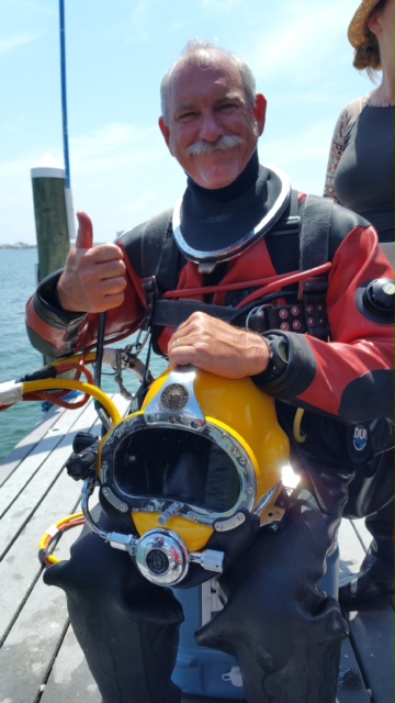
In the diving world there are basically three forms of diving: free diving, compressed air diving, and 1-Atmosphere diving. After the recent accident with the OceanGate Titian we thought we would give some basics as to how this form of diving works. Let’s look at all three.
Free Diving
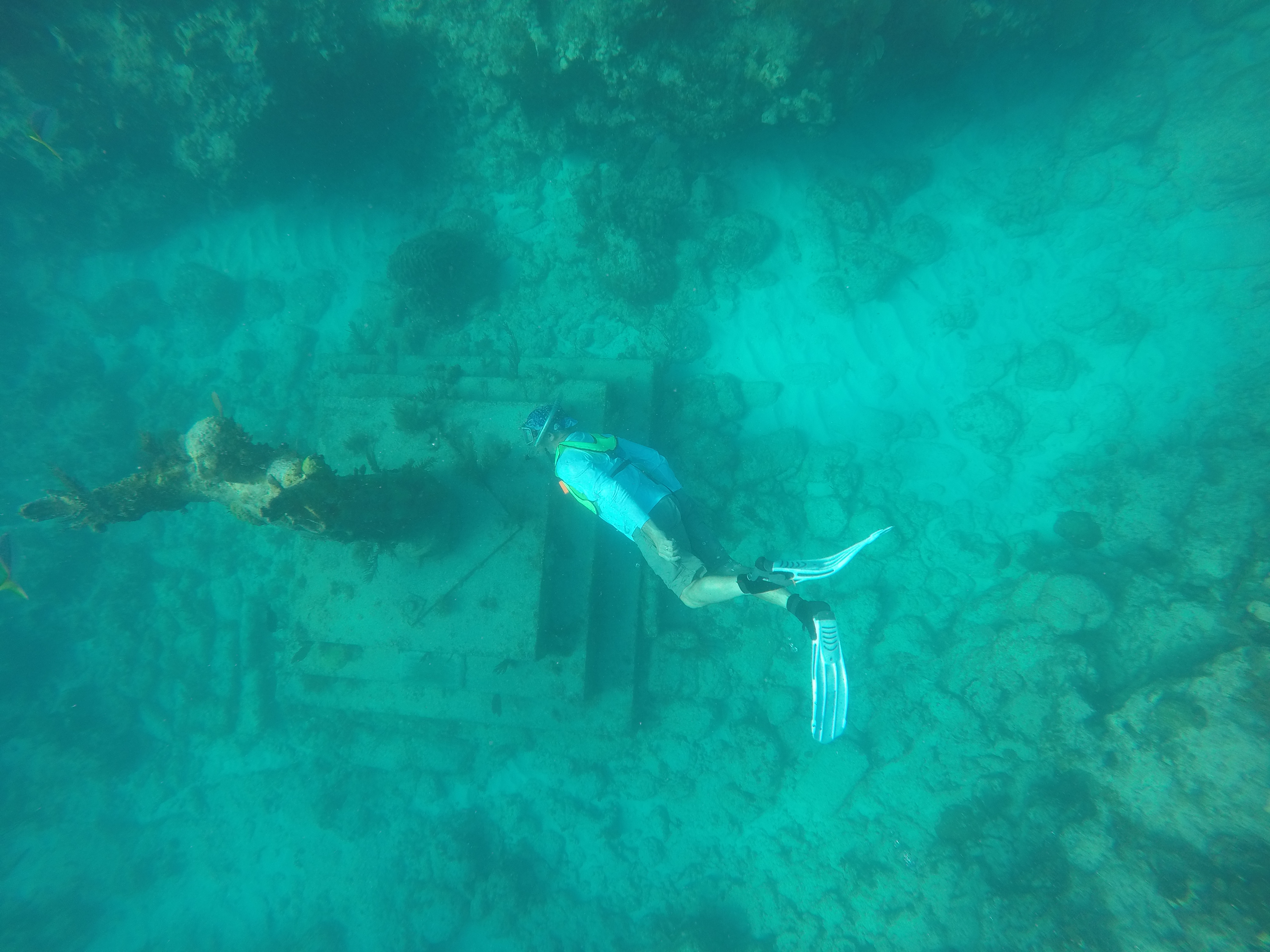
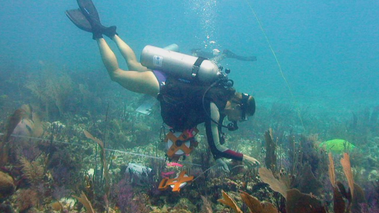
Free diving is just that… free of any diving apparatus. It is just you and the ocean. Frequently called “snorkeling” these days, the diver dons a mask (and at times snorkel), holds their breath and descends as deep and long as they can. Most sport free divers enjoy viewing the bottom in waters less than 10 feet deep. Through practice and training, others can go deeper. Some have dived as deep as 80 feet hunting fish using spearguns and have held their breath well over 2 minutes. There are of course the free diving championships where free divers descend by sleds to extreme depths under extreme pressure and ascend by air lift bags. This form of diving has not been of great use in science because the diver cannot go very deep and cannot stay very long. This makes behavior observations and data collecting difficult. Though it has been useful for shallow water surveys to do more “science” under the sea a different form of diving would be needed. One where you can go deeper and stay longer.
A free diver can explore 30-50 feet but for only a short period of time.
Photo: Molly O’Connor
Compressed Air Diving
Very early in science history they saw the need to develop some form of diving that would allow scientists to reach greater depths for longer periods of time. This meant taking the air with you. Dive bells made from crude materials were developed and tried as early as the 18th century. But most were very unreliable due to the materials used.
The concept of compressed air diving is that of using an air compressor to compress atmospheric air into a hose down to the diver. The diver would be able to regulate the air flow using a “regulator”. This concept was first used in what we now call hardhat diving. Divers wore heavy canvas suits with weighted boots and weight belts to reach the bottom. Air would be compressed using an air compressor on deck and fed to the diver using a tethered hose. The air would reach the diver within a brass helmet that had small view ports and a regulator on the back to regulate the air flow. Special care had to be taken to avoid getting exhaust from the air compressor into the air mix going to the diver, which could be toxic. There was also the threat of the air compressor running out of fuel and stopping the flow to the diver, who in their weighted apparatus could not reach the surface by swimming.
Another part of the problem was the pressure under which the diver is exposed. Standing on the surface of the earth you are under pressure. The atmosphere above is being pulled to the surface by the earth’s gravity and all objects are in its way. There is pressure from the air around you squeezing on your body at about 14.7 pounds for every square inch of your body (pounds per square inch – p.s.i.). We call this 1-Atmospheric pressure (14.7 p.s.i.). You do not feel this pressure because your body adjusts to it. However, when climbing a mountain, or flying a plane, there is less air above you and the atmospheric pressure decreases. We feel this in our ears (which helps adjust for pressure change) and feel the “equalization” of this pressure when we lightly blow our nose, or yawn – our ears “pop” and we do not feel the pressure any longer.
Water weighs more than air. As you descend into the ocean you feel the atmospheric pressure above the ocean surface AND the water pressure above you as well. The deeper you go, the greater the pressure. The rate of change is 14.7 psi every 33 feet (10 meters). At the surface we say we are at 1-Atmosphere (14 psi – 1-ATM). At 33 feet below the sea, you are at 2-ATMs (29.4 psi). At 66 feet you are at 3-ATMs (44.1 psi) and so on. Compressed air divers are exposed to this pressure as they descend and must equalize by “clearing” (lightly blow your nose while pinching it or yawning). Due to their sinus situation, some divers can clear more often than others and dive deeper. You do not dive with a head cold or other sinus problems, because you will not be able to clear. Even with good sinuses, there is a limit the human body can take. Most sport divers today dive to around 100 feet (4 ATMs – 58.8 psi). Some can/do dive to 200 feet (7 ATMs – 103 psi), but to dive deeper requires technical training and equipment. Technical divers need to be in good physical shape. Some professional technical divers have reached depths of 400 feet (13 ATMs – 191 psi). Below this is very hard on the human body. This is about the limit for compressed air diving.
But as Jacques Cousteau stated… “the problem is not so much going down… it’s coming back”.
What the famous ocean explorer meant by this was that the pressure on the diver not only squeezed your sinuses, but it also squeezed all of the gases in your tissues. The air you are breathing is about 78% nitrogen, 21% oxygen, and 1% trace gases. As you descend these gases are squeezed into your tissues and circulatory system. If you return too fast, these gases will expand in your tissues and cause what is called “the bends” (due to the fact your limbs begin to bend when it happens). It can be lethal and must be avoided. The deeper you go and the longer you stay, the more gas you squeeze into your system and the slower you must go to return to the surface to allow these gases to escape your system. Years ago, the U.S. Navy developed dive tables that told the diver how much time they had at a certain depth to safely return to the surface without stopping (non-decompression dives). Even though you could safely return without stopping, you were taught not to pass your bubbles as you ascended to make sure you were not coming up too fast. For example, a dive to 80 feet allowed you 30 minutes bottom time. You would descend, clearing your ears to adjust for the pressure change, make your dive watching time on your dive watch, and slowly ascend not passing your bubbles at, or before, the 30-minute time limit. Even once you were back on the surface there were still dissolved gases in your system and the table would let you know how long you had to sit to completely clear your system. Today, dive computers are used by divers to track this. They have alarms on them to let them know when it is time to ascend, and all divers now make a safety stop at 15 feet for five minutes JUST to make sure. Those who remain at 80 feet for longer than 30 minutes are considered “decompression divers” and the dive tables (dive computers) let you know at what depth you must stop (and for how long) to allow the dissolved gases to escape your system and safely return to the surface.
But the Bends were only one issue. Excessive amounts of nitrogen squeezed into your system could cause nitrogen narcosis during the dive. This gives the diver a “drunk” feeling, you begin to see things that are not there, your view of the sea bottom is inverted or flipped where the bottom is up and the water down. Just as driving drunk, this can be very dangerous. The diver is no longer alert and can make some fatal mistakes. And then there are embolisms. When you ascend the gases expand, if you are holding your breath the gases in your lungs will expand and may rupture the alveoli in your lungs. This is an embolism.
With hardhat diving you are tethered to the ship, you could only explore as far as your tether would allow you. In the 20th century they developed the Self-Contained Underwater Breathing Apparatus – SCUBA. A cylinder, originally made of steel and now aluminum, was filled with atmospheric air using an air compressor. This cylinder was strapped to the divers back and rigged with a two staged regulator that you could place in your mouth. The air was provided on demand by the diver. Today SCUBA diving is enjoyed by sportsman, adventurers, and scientists the world over. But the lessons mentioned above must be learned. No one should try SCUBA without attending a SCUBA certification course to learn how to do so safely.
Hardhat diving provides compressed air to the diver through a tethered hose, but limits their movement. SCUBA allows the compressed air diver more freedom over movement than hardhat diving.
Photo: NOAA
1-Atmosphere Diving
There is still a depth and time limit with compressed-air diving. Safe SCUBA is usually less than 200 feet, and you can explore as long as your air supply within the tank will allow you. Hardhat diving can supply more air, and increase time on the bottom, but there is still a depth limit and, as explained above, the longer you stay the more problems can occur for the diver. Those problems for the diver are due to the body being exposed to pressure (5-6 ATMs = 74-88 psi). IF the diver could remain at 1 ATM throughout the entire dive, then the Bends, Narcosis, and Embolisms would not be a concern. But how do you build a vessel where the inside pressure is 14.7 psi, and the outside is 100 psi? Could you build one that would keep the ocean from imploding it? And 100 psi is where compressed air divers can reach now. Could we build one that could reach 1000 feet (31 ATMs = 445 psi), or 10,000 feet (304 ATMs = 4454 psi). Imagine that… a vessel where the inside pressure is 14.7 psi and the outside environment is pushing in at 4454 psi!, could this be done?
Because we wanted to explore the deep sea, engineers began designing vessels for such a dive almost a century ago. Through design and testing, they learned quickly that a sphere was the best shape to use. With no corners, there are spaces for the external pressure to “grab” and either push or pull. You would want to use the strongest material available, and at that time it was steel. So, a steel sphere might do the trick. There was the issue of a window, or view port. If you had a steel sphere that could hold up to great pressure, could you put a window in it? If not, what is the point of going? Science developed an acrylic plastic (Plexiglas) that would bend some. Engineers discovered that cutting this acrylic glass window into a shape of a cone would absorb more pressure and allow the vessel to descend deeper allowing the 1-ATM divers to see outside. One window had an internal light that could illuminate the ocean outside so they could see.
Testing of such a vessel began in the early 20th century. The first dives came with a vessel called the bathysphere. This was designed by engineer Otis Barton and operated by himself and marine scientist Dr. William Beebe. The sphere was about five feet in diameter, 1 inch steel walls, and two viewing ports filled with crushed quartz glass (no acrylic glass yet). It would be lowered by a cable that also included a phone line for communication. Air was provided by cylinders within the vessel and there were absorbent materials to collect the expelled CO2. Air was moved around via a fan. The vessel was tested many times at varying depths before they allowed divers on board. The first dives were to depths of about 500 feet (16 ATMs = 223 psi), but they eventually reached a depth of 3000 feet (91 ATMs = 1336 psi). There were several issues during the course of these dives. Early on, the cables would become twisted, and they had to develop a method to keep this from happening. On one dive, water began leaking in after only going a few feet down. Once back on deck it was discovered one of the brass bolts that held the hatch shut was not tightened properly (showing the importance of COMPLETE review of the vessel before descending). The most catastrophic incident came during a test dive. There were initially three viewing ports on the bathysphere, and one had been covered with a steel plug. Dr. Beebe wanted to switch out the steel plug for another crushed quartz glass window so that he could do a video of a dive. They did, and during the test dive (to several hundred feet with no humans onboard) the new quartz window filled with water upon return. Dr. Beebe himself decided to unbolt the door. The intense pressure of water (due to the leak at depth) shot the brass bolt across the deck of the support ship like a bullet, then came the explosion of water that shot all the way across the deck to the crane that lowered the bathysphere. Reaffirming the dangers to this form of diving and the need for safety and detailed inspection of all equipment. Unmanned testing was a must for any new innovation tried on the system.
Using this sphere design the Trieste was designed by Swiss engineer Auguste Piccard. The goal of this vessel was to reach the very bottom of the ocean – the Challenger Deep at the bottom of the Marianna’s Trench – 36,000 feet = 1090 ATMs = 16,036 psi. This 1-ATM vessel would have an internal pressure of 15 psi and an external pressure of 16,000 psi. Obviously great care, thought, designing, and testing had to be done to pull this off. The sphere was steel, five inches thick, and had a diameter of seven feet. Unlike the bathysphere Dr. Beebe dove in, the Trieste was unthethered, so called a bathyscaphe. It operated like a hot air balloon. A large hull was attached above the sphere filled with gasoline (less dense than seawater and would float like hot air balloon). To sink, portions of the vessel would fill with seawater and there were conical cylinders filled with iron pellets (which would be released so the vessel would float back to the surface, just as bags of sand are dropped to allow the hot air balloon to rise). The view ports did use acrylic glass.
The dive took place in 1960. It took about four hours to reach the bottom. At 30,000 feet one of the exterior acrylic glass windows did crack but it did not impact the sphere nor the crew and the dive continued. They were on the bottom for about 20 minutes and were able to observe living organisms at the deepest part of our ocean. The pellets were dropped, and the ascent took about three hours. It was a marvel of engineering.
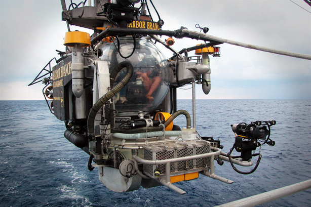
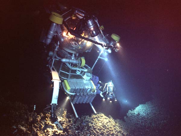
In the latter half of the 20th century the material for the spheres switched from steel to titanium. Electric motors were added so the pilot could literally drive around on the ocean floor. After speaking with a submersible pilot, he told me it was like driving a golf cart. An array of sampling equipment (buckets, vacuums, mechanical claws, etc.) were added to these vessels in order to collect from the seafloor. Many are outfitted with video cameras, and many have cameras that automatically photograph every so many minutes. The business of 1-ATM diving has vastly improved. One new design owned by the Harbor Branch Oceanographic Institute in Florida has a sphere made of the acrylic glass material. It is five inches thick, and your view is almost 360o. However, due to the material of the sphere being less than titanium, it has been certified to depths of no more than 3000 feet (92 ATMs = 1336 psi).
One of the more famous deep-sea submersibles is Alvin. Built in the 1960s, it has made more than 4000 dives to the deepest parts of the ocean, including the Titanic. It has been certified to depths up to 21,000 feet (637 ATMs = 9354 psi). It has discovered deep-sea hydrothermal vents, viewed deep ocean rift valleys, as well as videoed numerous deep-sea creatures. It has truly expanded marine science.
The Johnson Sea Link submersible The Johnson Sea Link submersible.
When the recent accident involving the submersible Titan occurred, I was camping out west in an area with no service. I did not hear about it until it was basically over. I did not get a lot of questions about I from the public but was interested in what went wrong. I did some reading and found the following.
Titan was owned and operated by a company called OceanGate based in the state of Washington.
OceanGate developed two submersibles – Cyclops 1 and Cyclops 2. Cyclops 2’s name was changed to Titan.
The vessel had a pressure hull made of titanium but was using reinforcement bars made from carbon fiber instead of steel.
The company stated that the pressure hull had been tested by the Applied Physics Lab at the University of Washington. It was approved for 4285 psi. That is 3000 meters, 9800 feet, 298 ATMs.
The Titanic sits at 12,500 feet, 3676 meters, 380 ATMs, 5568 psi.
It made several dives to the Titanic in 2021 and 2022. No incidents. A reporter who made one of those dives stated that they had to sign a waiver that stated they understood it was an experimental vessel.
The CEO was quoted several times stating “safety impedes innovation”.
There were emails from engineers prior to the first dive to Titanic that it was not safe to do so in this vessel. One billionaire from the west coast was offered a trip down but declined because of the safety issue.
Looking over the remains of Titan that reached the surface, one engineer stated that the implosion may have been due to the use of carbon fibers, or, an issue with one of the viewing ports. They were not sure. More reivew was needed.
As with so many airplane, shuttle, and ship accidents, the debris from the wreck will be examined more thoroughly and we will have a report of the most probable cause of the implosion.
It was a horrible accident, and we feel for the families of those lost during this dive. The statement about safety certainly catches our attention. This was a dive to 12,500 feet. Safety should have been a priority. The same can be said for any machine we use. I drive a camper van out west, several thousands of miles. We did, and should, make sure the vehicle was prepared for this. I have a safety check list for our camper before we pull it for miles. We should do the same for our cars. Many of you jump in your boats and head miles out into the Gulf of Mexico for a day of fishing. Do not neglect a safety check of your vessel before leaving. We know SCUBA divers check their gear before they dive, we know that airlines check their planes, we know the US Navy will not let a Blue Angel leave the ground unless it has passed a safety check. I have had friends who have dived on the Johnson Sea Links and Alvin. They have told me the crew goes over the vessel several times the night before a dive to make sure all is good, and the ship is ready. As a dive buddy of mine who served as a US Navy SEAL told me once – “Take care of your equipment… and your equipment will take care of you.” This is good advice for everyone.
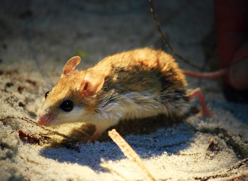
“I can’t do what? – because of a mouse? – it’s only a mouse.”
This was a comment made by many who lived on Perdido Key when a small beach mouse found only there was added to the endangered species list. It is a comment heard often when many species are listed. A major reason most species begin to decline and become endangered is loss of habitat. We enter and change the habitat to suit our needs. Much of this includes construction of buildings and altering landscapes to a more artificial setting and much of the local wildlife is lost. So is the case with this little mouse.
The Choctawhatchee Beach Mouse is one of four Florida Panhandle Species classified as endangered or threatened. Beach mice provide important ecological roles promoting the health of our coastal dunes and beaches. Photo provided by Jeff Tabbert
The Perdido Key beach mouse (Peromyscus polionotus trissyllepsis) is one of seven subspecies of beach mice found in Florida, five of those found in the Florida panhandle. Beach mice are a subspecies of the Old-Field mouse (Peromyscus polionotus). They are small, about 5 inches long, with tails that have hair (which are an additional 2 inches). Beach mice typically have a brown/gray color on top and a lighter white underbelly allowing them to blend into their environment very well. The difference between the subspecies is the extent of the coloration.
The subspecies status, and genetic isolation, is part of the reason these mice are listed. Members of a population who are genetically isolated from others can undergo a process called speciation where the genetic changes that occur in one isolated group cannot/do not flow through the gene pool of the other isolated group. Over time, the genetics, and morphology, of one isolated group becomes different enough that a new subspecies, or even species, develops. This is the case with the Perdido Key beach mouse. It is isolated on Perdido Key, a barrier island, and does not interbreed with their closest neighbors – the Alabama beach mouse (P.p. ammobates) and the Santa Rosa beach mouse (P.p. leucocephalus). Because of this, ALL of the Perdido Key beach mice in the world live on Perdido Key. Their population is small and vulnerable.
These mice are dune dwellers living in small burrows. They prefer the primary dunes (closest to the Gulf) which are dominated by the grasses whose seeds they like to feed on. They forage at night (nocturnal) feeding on the seeds of the sea oat (Uniola paniculate), panic grass (Panicum amarum), and blue stem (Schizachrium maritimum) usually in the secondary dunes. Highly vegetated swales (low wet areas between the primary and secondary dunes) are used to move between these habitats, and they are also found in the tertiary dunes (on the backside of the island where trees can be found) where their burrows are more protected from storm surge during hurricanes. During periods when seeds are not available, beach mice will turn to small invertebrates to support their diet. Their foraging range averages around 50,000 ft2.
Breeding takes place in the winter, though can occur anytime of year if enough food is available. They are monogamous (males pairing with only one female for life) with the females giving birth after 23 days to four pups. New members of the family can move up to half a mile in search of a foraging range for themselves. It is understood that with limited available habitat on an isolated island, the carry capacity of the beach mouse would be low. Owls and snakes are some of the predators they face, but the beach mice have evolved to deal with few predator issues.
The increase of humans onto the barrier islands has negatively impacted them. The leveling of dunes for houses, condos, swimming pools, and shopping centers has significantly reduced suitable habitat for them as well as reduced the seed food source. Introduced feral and free roaming domestic cats have also been a large problem. Bridges connecting these islands to the mainland have allowed foxes and coyotes to reach, and increase pressure on, them. With these increased pressures, and small populations, these mice are now listed under the Endangered Species Act.
Conservation measures have included, predator control, building and landscaping restrictions, translocation (moving mice from large populations to those that are smaller), and reintroduction (releasing mice into areas where they once existed but no longer do). There has been success with the Choctawhatchee beach mouse in the Grayton Beach area, as well as the Perdido Key beach mouse in Gulf Islands National Seashore. Things that beach residents can do to help beach mice populations include keeping your pets inside at night, plant native grasses in your landscape, reduce night lighting, do not walk over dunes – use the cross walks.
Things seem to be improving for beach mice, but the development pressure is still there. Hopefully we will have these creatures as part of our panhandle barrier island communities for many years to come.
References
Beach Mouse Fun Facts. Gulf Islands National Seashore. U.S. Department of Interior.
When visiting and exploring seagrass beds, most are hoping, and expecting, to see fish. As we have seen in this series, there are a lot of creatures that can be found living within a seagrass meadow, but it is the fish that get our attention and what we talk most about afterwards.
According to Hoese and Moore’s Fishes of the Gulf of Mexico; Texas, Louisiana, and Adjacent Waters, there are 497 species of fish found in the Gulf of Mexico. In my surveys of Pensacola Bay over the years, I have logged 101 of those in the estuary. I am sure there are more, but I can confirm there are at least those. Many spend all or part of their time in our seagrasses. As you seine or snorkel in the grassbeds you will notice most of them are very small. Much of this is due to the fact that the seagrasses are nursery areas for many species, and it is the young that we find here. But many are also small as adults, and the grass provides food and shelter for them. There are far too many to mention in an article like this, but let’s look at some of them.
Sardines and Anchovies
As you snorkel through the grass, or even look at it from a boat or dock, you see numerous silver colored baitfish flashing as they dart in and out of the grass. There are all sorts of silver baitfish in the seagrasses with sardines and anchovies being two of them. In my experience seining for fish, they appear to be seasonal. I did not capture them all year but when I did, I would capture a lot. These species are famous for being the ones in small tins that people consume, though there is no fishery for them here locally. Anchovies have also been considered an indicator species; their presence suggests good water quality.
The striped anchovy is a fish often found in our seagrass beds.
Photo: NOAA.
Silverside Minnows
Also known as silversides and glass minnows, these are one of the most common fish collected in seine nets. They are abundant year-round and are an important food source for many of the larger predators living here. Small and transparent, you do not see them while snorkeling. Their huge presence is only discovered when you pull a seine net through the grass. There are several species of them, but they are not easily identified and more often are just logged as “silversides”. They are an important member of the seagrass community.
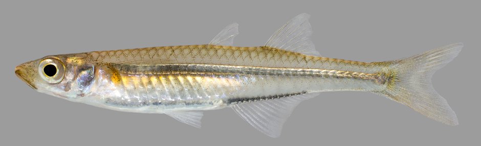
The silverside, or “glass” minnow.
Photo: U.S. Geological Survey
Seahorses and Pipefish
These two fish are highly specialized for living in seagrasses. They look like grass and move very little making them hard to detect. Like silverside minnows, it is rare to see them while snorkeling but make their presence known when seining. Their bodies are covered in armor-like scales, and they have tubed mouths for “vacuuming” small invertebrates from the water column. They are very slow swimmers and have to avoid detection by blending in with the environment. And yes, it is the males that carry the eggs in their brood pouches. These are amazing fish and always bring excitement when they are captured in the net. There are two species of seahorses and seven species of pipefish found in our waters.
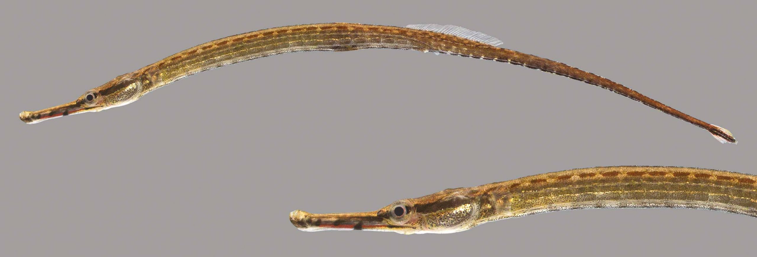
The seahorse-like pipefish.
Photo: University of Florida
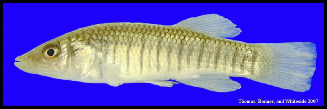
Killifish
Often called “bull minnows” by anglers, these small fish are, at times, very abundant. There are seven species of killifish in our bays but the Gulf Killifish, Longnose Killifish, and the Bayou Killifish are the ones we most often collected.
This longnose killifish has the rounded fins of a bottom dwelling fish.
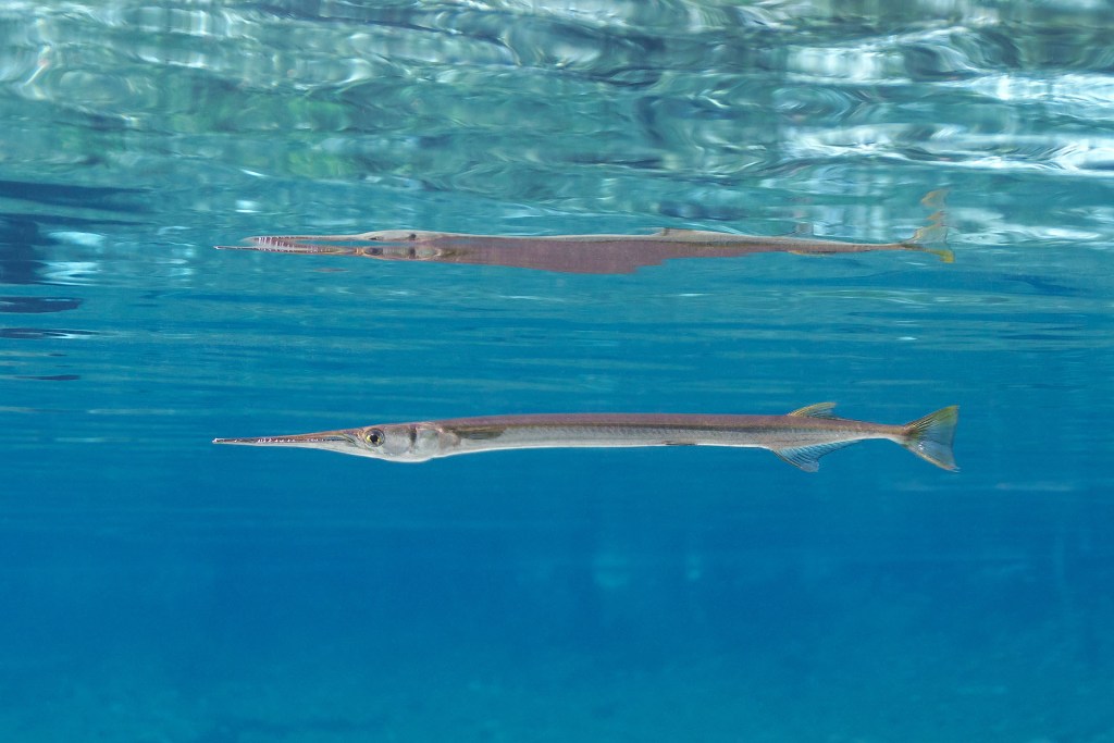
Needlefish
These are common, frequently seen, fish swimming at the surface of the water. Long and needle-shaped, these fish have long snouts full of sharp teeth indicating they are one of the predators of this system. There are four species of them, and they are not easy to tell apart. They are harmless to humans unless you capture them in your net at which time they will try to bite.
Swimming near the surface is a common place to find needlefish.
Photo: Florida Springs Institute
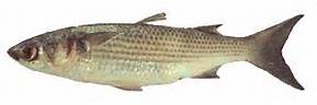
Mullet
Another very common fish found year-round here. This species are the ones famous for jumping while you are fishing, paddling, or just watching from the beach. Those who do not visit the Gulf coast often always ask “I just saw a fish jump!” and the reply from a local (without even looking up to see what it was) will reply “It’s a mullet”. These schooling fish can get pretty large (average length is 30 inches) and it is common to see fishermen out with their cast nets trying to catch a few. It is a popular food fish for those along the Gulf coast. Mullet fries, with beans and grits, are a way of life here. The fish are easily seen swimming and darting over the grass as you paddle by, and their young are found seasonally in seine nets. They are bottom feeders, feeding mostly on algae from the grass blades. There are actually two species, the white and the striped mullet. The striped mullet, also known as the black mullet, is the one most often sold in the seafood markets.
The Striped Mullet.
Image: LSU Extension
Drums and Croakers
With 18 species within this family, this is the largest family of inshore fish in the Gulf. Growing up along the panhandle people learn quickly about croakers. Back in the day when gill nets were used to harvest mullet, croakers were a common catch as well, and often consumed. Today they are still sought by some shore-based anglers and juveniles are common in seine nets. The species I most often captured were the spot and Atlantic croaker. Spot croakers were common year-round, Atlantic croakers were more seasonal.
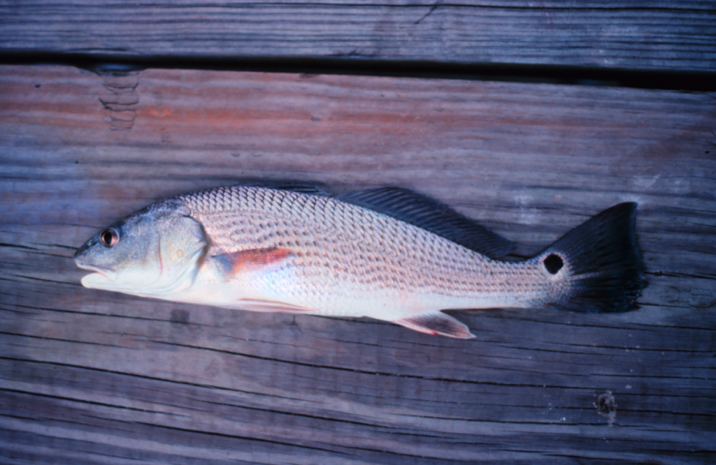
Drums are larger members of this family. There are several species more associated with sandy bottoms and the shoreline of the Gulf, many of these are called whiting, but the red drum (redfish) and black drum can be found in the grassbeds. Redfish are particularly common here and one of the reasons many anglers get out of bed in the morning. They are very popular sportfish across the region. Black drums are not found as often, and like being around pilings and structures that offer certain foods they prefer. Both species can get quite large. Redfish average 5 feet while black drums can reach an average of 3 feet.
All of the fish in this family are famous for their “croaking” “drum” sounds they make using their swim bladder, and it is rare not to capture at least one kind in a seine net.
The classic look of a bottom fish. This is the redfish, or red drum.
Photo: NOAA
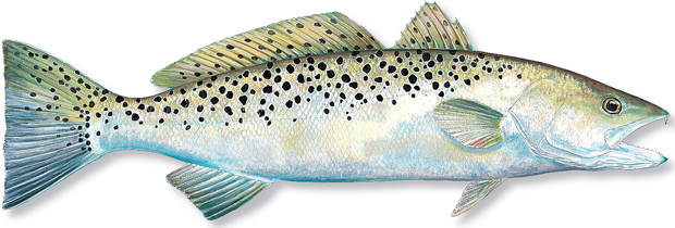
Spotted Seatrout; Speckled Trout; “Specks”
There is no “trout family” in the fish world. Most freshwater trout are members of the salmon family while the marine versions are members of the drum/croaker family. This is the case with the famous speckled trout – or speck. There are white trout and silver seatrout in this family, and all are sought after by anglers, but it is the speckled trout that is most associated with seagrasses, most sought after by anglers, and is one of the top predators in this system. They reach an average length of 4 feet.
From my experience both snorkeling and seining the grasses, I would say – hands down – that pinfish is the most common species found in our grasses. For many young anglers this is the first fish they ever catch. You can see them easily while snorkeling and they are the most numerous species in the nets throughout the year. Their huge numbers play an important role in the food web of this system. Feeding on a variety of small invertebrates in and around the grass blades, pinfish are a large part of the diet of the larger sportfish we target. Throwing cast nets and dropping pinfish traps is popular with anglers to collect this abundant baitfish for their life bait fishing efforts. They are called pinfish because of the sharp spines in their dorsal fins. These are also the fish that nip at your ankles while you are standing still in the water.
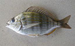
Sheepsheads are larger members of the porgy family (the ones these two species belong to). As adults sheepsheads prefer hard structure where they can use their incisors to chip away at barnacles and other shellfish, but they are sometimes found roaming the grassbeds and their young will spend their growing years hiding and feeding in the grass.
One of the most common fish in our grassbeds; the pinfish.
Photo: Nicholls State University.
Pigfish
When first captured in the seine net, pigfish are often confused with pinfish – they look very similar. But a closer look at the striping/spotted pattern on their sides, and the position of their mouth, you realize you have something different. Being members of the grunt family, they also “croak” like croakers and drums – hence their common name “pigfish” – due to the grunting sounds. This helps with identifying which fish you have. Though common in the grasses, I did not catch these as frequently as pinfish and they were not as abundant.
Spotfin Mojarra
This is a common silver baitfish that resembles the pinfish and is frequently collected in our seine nets. The mojarra is in a different family than pinfish. They lack sharp spines and incisor teeth, rather they have a sort of “vacuum” like mouth which they use to suck small invertebrates from the sand.
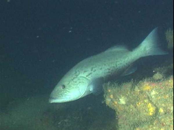
Gag Grouper
This is a popular sport and commercial fish from the wrecks and reefs of the Gulf of Mexico. But gags begin their lives in the seagrass beds, and we have collected medium sized individuals in our seine nets. This underscores the importance of these grassbeds to the fisheries so many love. We need to protect these systems from our activity both on land and in the water.
Gag grouper.
Photo: National Oceanic and Atmospheric Administration
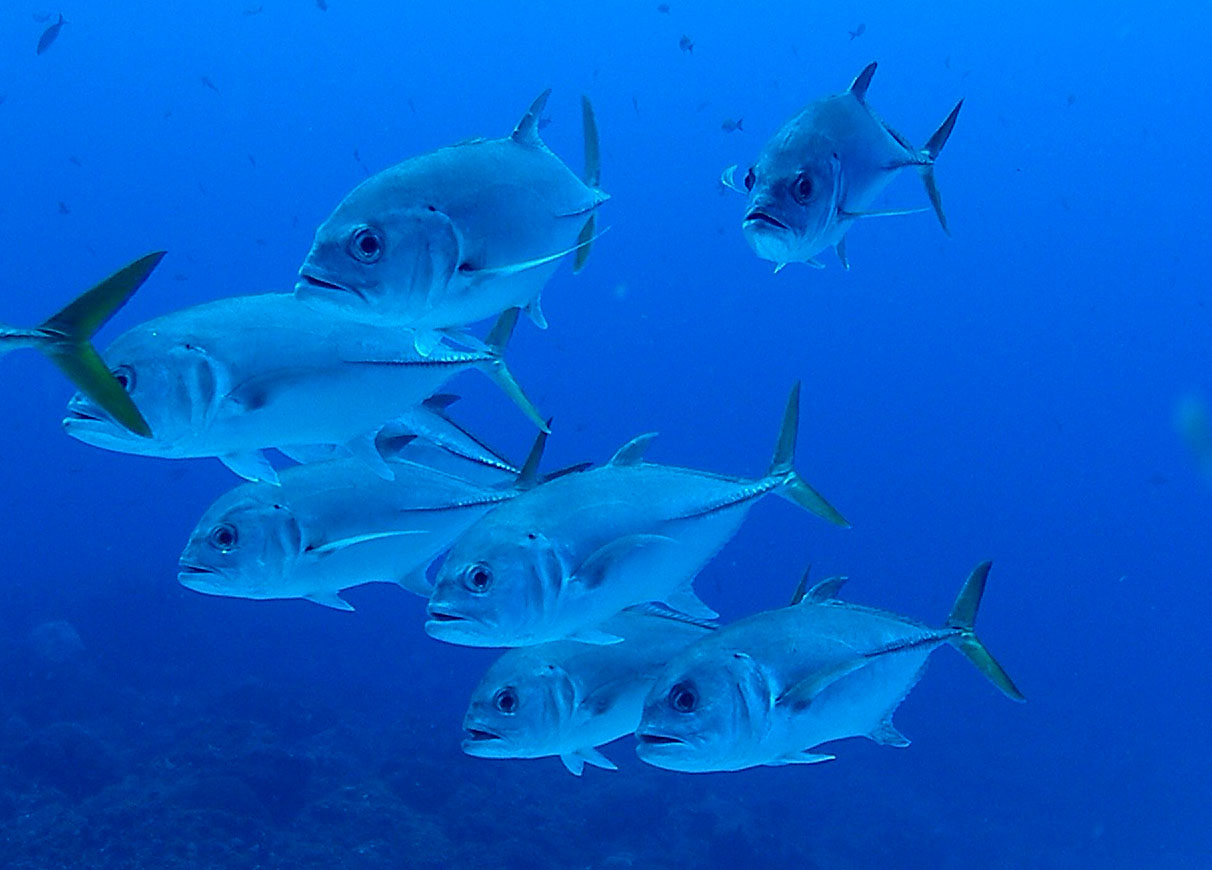
Jacks
Another popular group with anglers, many species of jacks use these grasses as their nurseries. We most often collected juvenile lookdowns, pompano, and crevalle in our nets. At times we caught a small member of the family called a leatherjacket. These were seasonal and associated with breeding. Once again, underscoring the importance of having healthy seagrasses.
Jacks have the sleek, fast design of the typical open water marine fish.
Photo: NOAA
Toadfish
One of the creeper looking fish in the seagrass community is the Gulf toadfish (also known as the oyster dog). This monstrous looking bottom fish lives in burrows scattered around the grassbeds where they lie in wait to ambush prey. Their large mouths and sharp teeth can grab a variety of creatures, including the human finger. At times small toadfish will move into an empty can or bottle discarded by people instead of a burrow where they grow to a size they can no longer escape. It is said there may be a mild venom associated with their bite. Though no one has ever died, or been sent to the hospital, due their bite, it is painful and should be avoided.
The common estuarine Gulf toadfish.
Photo: Flickr
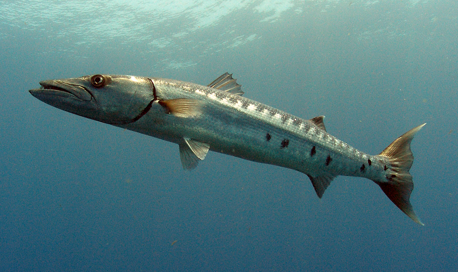
Barracuda
Yes, barracuda can be found in seagrasses. But in our case, these have all been juveniles. There are three species of them, and they are not easy to tell apart. They also appeared to be seasonal in our collections. We never found them high numbers, usually one or two in a seine. But they are present.
The Great Barracuda. Photo: NOAA
Lizardfish
This is another medium sized, sharp toothed, bottom dwelling predator of the grassbed community. There are seven species of them, and all have that “snake” “lizard” look to them having many sharp canine teeth. They spend their time buried in the sand waiting to ambush potential prey. Snorkelers may see them as they dart away tossing up sand when we get too close. I rarely see them snorkeling but occasionally capture them in the seine net to the delight of the students assisting.
Blennies and Gobies
These are very small fish that are almost impossible to find while snorkeling but are often collected in the seine net. They resemble the freshwater darters and, lacking a swim bladder, spend their time on the bottom. There are many species associated with rocks and artificial reefs but there are some who call the seagrasses home. They use their incisor teeth to feed on small invertebrates in and on the grasses. Being territorial, they can give a little nip to your hand. Gobies differ from blennies in that their two pelvic fins are fused together to form a sort of “cup” or “sucker disk”.
Puffers
Another one of the more popular fish with students who help me seine. Everyone loves to see them inflate with either water or air into a “balloon” to make it very difficult for predators to consume them. There are eight species of puffers in the Gulf of Mexico, five of them have been captured in our seines. Most are small with little “bumps” on their bodies instead of spines. But there is the Burrfish, who is a member of a different family that is medium sized, has spines, and is very common in the grassbeds.
Striped Burrfish
Photo: NOAA
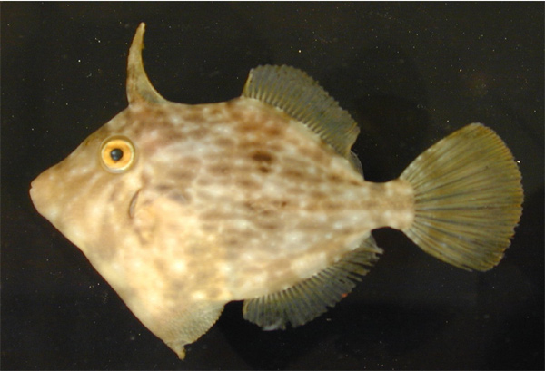
Filefish
Our grassbeds are full of a small cousin to the triggerfish – the planehead filefish. Like triggerfish, filefish have a thick sharp spine that is found at the front of the dorsal fin – called a “trigger” on the triggerfish. The planehead filefish is a small species (nine inches average length), green to brown in color, and very common in the grassbeds; though you will probably not see one unless you catch it in a net.
Planehead Filefish.
Photo: NOAA.
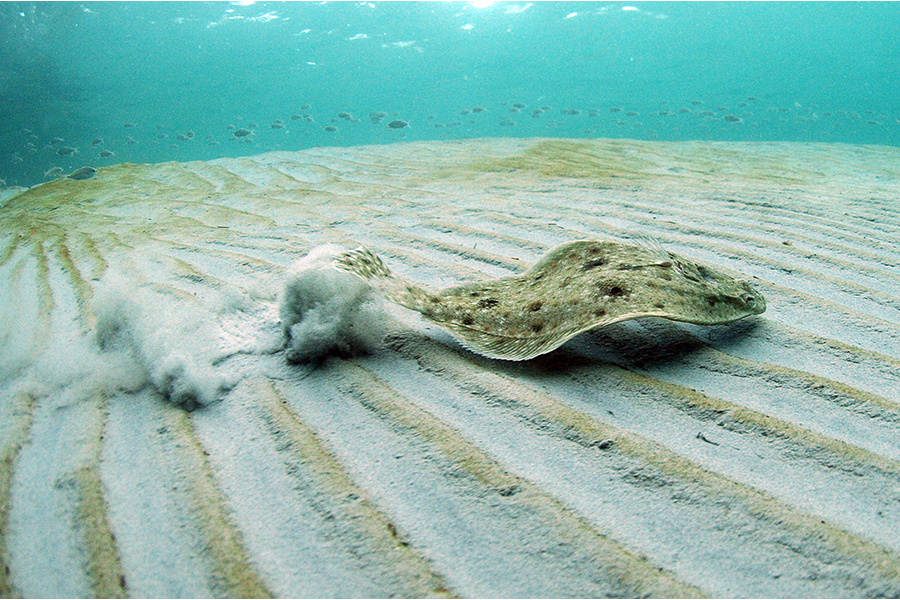
Flounders and Soles
A favorite food fish for many locals, flounders spend a lot of time buried in the sand near grassbeds to ambush prey. Born with a typical fish design, early in development one of their eyes will move to the other side of the head, giving them two eyes on one side. By doing this, they have increased their binocular vision, improving their ability to judge accurate distance of the prey, and making hunting easier. They lose color on the side where the eye has left and have chromatophores (cells) on the side where the eyes are that, like octopus and squid, allow them to change colors and blend in. In our part of the Gulf, if the eyes move to the left side of the head, they are called flounders. If they move to the right, they are called soles. Soles in our part of the Gulf of small not of much interest to anglers. One small species is often collected by shrimpers who feed them to hogs. This sole can “cup” their body in defense making like a suction cup and they do this in the throat of the hogs sometimes killing them. They are called “hogchokers”. Flounders on the other hand are very popular with anglers. Some fish for them using rod and reel, others prefer gigging them at night using lanterns. There are 17 species of flounder, some reaching lengths of three feet.
A flounder scurrying across the seafoor.
Photo: NOAA
Tonguefish
Tonguefish are small flat fish with eyes on one side of their heads like flounder. They differ than that their tails come to a point and there is no caudal fin present, as there is in flounders. As mentioned, they are small – ranging from 3 to 8 inches in length. The Blackcheek tonguefish is particularly common in our grassbeds. But like so many, you will not see it unless you catch it in a net.
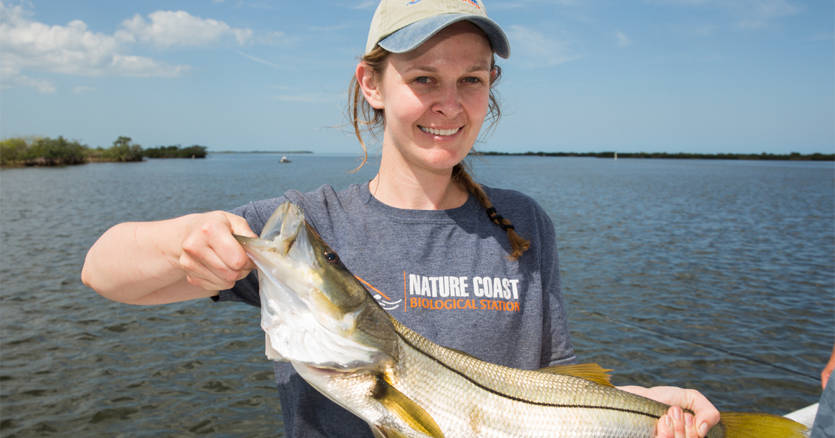
Snook
This is a very popular gamefish from south Florida associated with several habitats including grassbeds. Due to a process some call “tropicalization” – the movement of tropical species north due to climate change – snook are now, albeit in small numbers, reported in the Florida panhandle. This is a new species you may see while exploring or fishing out there.
This snook was captured near Cedar Key. These tropical fish are becoming more common in the northern Gulf of Mexico.
Photo: UF IFAS
There are many more species of fish found in our grassbeds we could talk about, but we will end it here. As we mentioned in the beginning, this is a group of animals that many come to the beach to find. Whether for fun or for food, finding fish makes for a good day. See how many different species you can find.