by Rick O'Connor | Sep 15, 2017
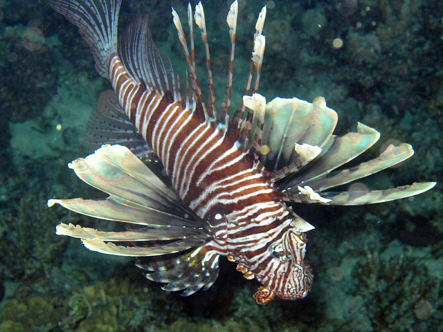
In the late 1980’s a few exotic lionfish were found off the coast of Dania Florida. I do not think anyone foresaw the impact this was going to have. Producing tens of thousands of drifting eggs per female each week, they began to disperse following the Gulf Stream. First in northeast Florida, then the Carolina’s, Bermuda, the Caribbean, and eventually the Gulf of Mexico. The invasion was one of the more dramatic ones seen in nature.

The Invasive Lionfish
Lionfish are found on a variety of structures, both natural and artificial, and are known from shallow estuaries to depths of 1000 feet in the ocean. They are opportunistic feeders, engulfing whatever is within their range and fits in their mouths, and have few predators due to their neurotoxicity spines. These fish are well-designed eating machines with a high reproductive rate, and perfectly adapted to invading new territories, if they can get there.
And they got here…
Like so many other invasive species, humans brought them to our state. Some arrive intentionally, some by accident, but we brought them. Lionfish came to Florida intentionally as an aquarium fish. Beautiful and exotic, they are popular at both public aquariums and with hobbyists… Then they escaped.
So what now?
What impact will these opportunistic fish have on the local environment? On the local economy?
This is, in essence, the definition of an invasive species. The potential for a negative impact on either the ecosystem or local fishing is there. We now know they are found on many local reefs, in many cases the dominant fish in the community. We know they can produce an average of 25,000 fertilized per female per week and breed most of the year. We also know they consume a variety of reef fish, about 70 species have been reported from their stomachs.
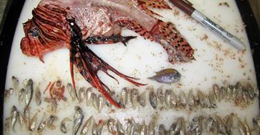
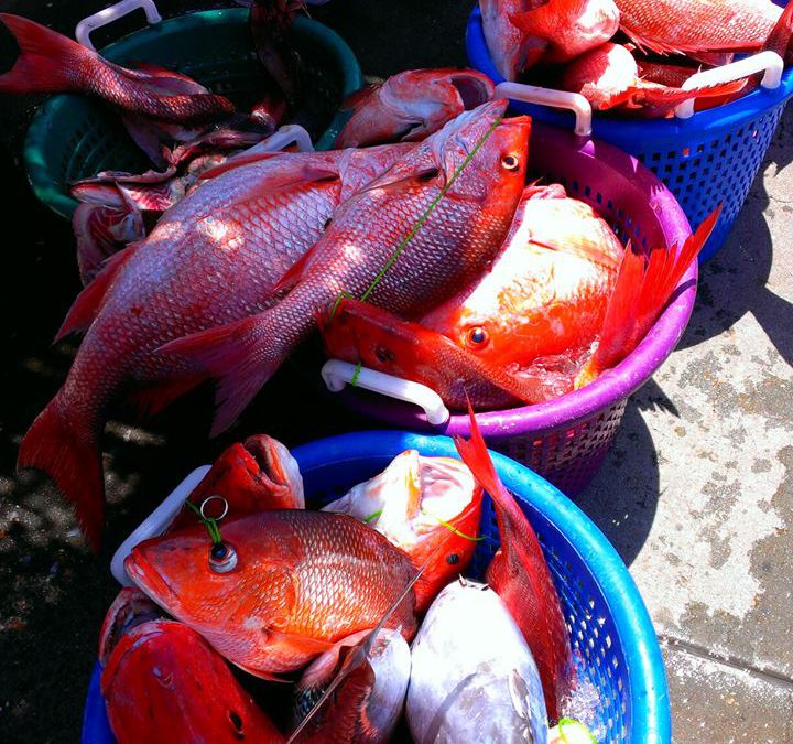
Over 70 species of small reef fish have been found in the stomachs of lionfish; including red snapper.
Photo: Bryan Clark
However, what impact is this having on local fisheries?
Well, we do know there have been more reports of fishermen catching them on hook and line. We also know that scientists are examining the DNA of their stomach content that cannot be identified visually, and some of the results indicate commercially valuable species are on the menu.
Area high school students are now conducting dissections using this same methodology. Under the direction of Dr. Jeff Eble, over 900 area high school students examined the stomach contents of local lionfish last year. Students from Escambia, Gulf Breeze, Navarre, Pensacola, Washington, and West Florida high schools – along with Woodlawn Middle School – identified 16 different species in lionfish stomachs. Of economic concern were snapper; 42% of the prey identified were Vermillion Snapper – 4% were Red Snapper.
Though the consumption of non-commercial species can affect the population of commercial ones, the direct consumption of commercial species is concerning. The commercial value of Vermillion Snapper landed in Escambia County in 2016 was about $800,000 (highest in the state).
This year two more high schools will participate in the dissection portion of this project; those being Tate and Pine Forest. These students need lionfish and we are seeking donations from local divers to help support this project. If interested in helping, please contact me at roc1@ufl.edu or (850) 475-5230.
References
Dahl, K.A. W.F. Patterson III. 2014. Habitat-Specific Density and Diet of Rapidly Expanding Invasive Red Lionfish (Pterois volitans), Populations in the Northern Gulf of Mexico. PLOS ONE. Vol 9 (8). Pp. 13.
FWC Commercial Landing Summaries. 2017. https://public.myfwc.com/FWRI/PFDM/ReportCreator.aspx.
by Rick O'Connor | Sep 15, 2017
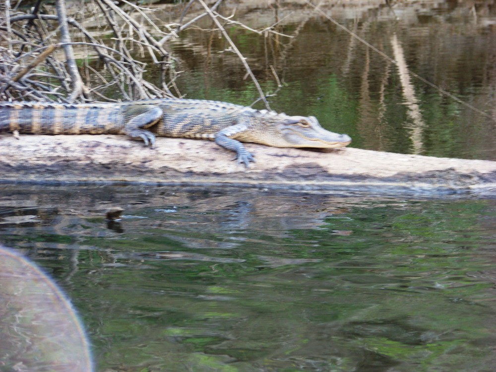
I recently saw a photograph of an American Alligator (Alligator mississppiensis) crossing Perdido Key Drive on a heavy rain day. This encounter would surprise some, and unnerve many. The majority of the nuisance wildlife calls I receive are for snakes. I have never received a call for an alligator but no doubt, my colleagues in central and south Florida have. They certainly will with the landfall of Irma. Just as humans relocate for storms, wildlife does as well. High, dry ground is a need for all, and as our friends return to their homes after the storm, they will no doubt encounter creatures in the debris that can be a bit unnerving.
Alligator basking on a shoreline; photo: UF/IFAS Communications
“Nuisance” is in the eye of the beholder. Defined by the Merriam-Webster dictionary as being annoying, unpleasant, or obnoxious, a nuisance species is one we would rather not have in our yard. Snakes are one of those. Most of the people who call about snakes wish them no harm; they just do not want them on their porch or in their pool. Venomous snakes in particular raise anxiety levels, especially when children or pets are around. Though we do not get many calls on alligators, the feeling a homeowner would have if they found one in their driveway would be the same.
There were no calls on the alligator on Perdido Key. Actually, not everyone believed the photo to be legit. I cannot verify it, but I did receive a call earlier this summer when an American alligator was found swimming and basking on a Gulf beach in Navarre and later near Ft. Pickens. Though not as common as they are in central and south Florida, alligators do live here and they are found on our barrier islands. Though encounters with them are rare, how should a homeowner deal with this potential nuisance? When I give a program on snakes I typically go over four points. Let us go over the same with the alligators.
Is it venomous or not?
Obviously, this is not a question here – no crocodilian is venomous. They do have bacteria in their mouths that have caused problems for some who have survived an attack, but there is no venom. However, in south Florida identification is still important because there is more than one crocodilian roaming the landscape. The American Crocodile (Crocodylus acutus) is a native species found in coastal waters of south Florida, the northern reach of its range. The Speckled Caiman (Caiman crocodylus) is an exotic species from Central and South America that is now found in freshwater canals and lakes of southeastern Florida. It is likely that post Irma cleanup will include encounters with these two. However, this is not likely for the panhandle – our winters are too cold.
How do I avoid encounters?
Generally encounters with nuisance wildlife occur for one of two reasons; (a) we have moved into their habitat or (b), they have come to us.
With the population of Florida growing at an ever increasing rate, currently 21 million people and a growth rate of 1.77%, development continues to expand into habitat where these animals have remained out of our sight for some time. As we continue to move into these habitats, encounters with nuisance wildlife will increase. They will be forced to visit our yards and pools. It is no different with bears.
In other cases we, either knowing or unknowingly, provide food and shelter for them. Predators tend to select the easiest prey to kill, the ones that take the less energy. Human development tends to provide habitat for vermin, such as rats, in concentrated areas. This makes hunting for predators, such as snakes, bears, and alligators, much easier – and they will take advantage of this.
With alligators, (a) is more problematic than (b). Alligators have a natural fear of humans and do not typically seek us out looking for easy prey. They seem to prefer to live and hunt away from us. However, feeding alligators changes this and thus, it is a felony to do so in our state. In 2015, the state legislature developed a tiered penalty system for assessing fines and charges. As we continue to develop in areas where alligators live, it will be harder to avoid encountering them.
What do I do if I encounter one?
The general nature of wildlife is reacting to predators, prey, reproduction, and shelter. Alligators are top predators and feed on a variety of species. They are opportunistic hunters, selecting prey they can easily swallow and are relatively easy to catch. Much of these are smaller animals. If the opportunity to make a large kill presents itself, they will – however, they will drown the creature and leave it underwater to soften the carcass so they can swallow.
The method of capture usually involves lying still and waiting for prey to move within range. If encountering an alligator the questions that come to mind are: (1) am I within range? (2) are we near water? – remember they need to submerged large prey. Keep in mind that small children and pets are easier prey and care should taken when in alligator habitat.
Resources provide the following suggestions if an encounter occurs:
- They have a nature fear of humans and will try to retreat. This is true. Provide an avenue of escape for the animal. Do your best not to corner it. Remember it may react to pets and children as prey and could approach.
- If they hiss, they are warning you that you are getting too close and they are feeling threatened. Back away slowly. Sudden movements could be misinterpreted and they may defend themselves by attacking.
- Keep in mind they are fast moving for several yards, so do not think of them as slow and lethargic.
- Females guarding a nest may attack. They will charge to drive you off but typically return to the nest once you have moved to a safe distance (safe in their minds). Alligators build nests of leaf litter above ground in quiet water areas within their range. You may encounter one while hiking along shore. Avoid these nesting areas.

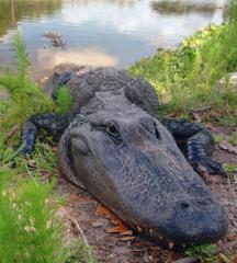
Alligator basking on the Escambia River; photo: Molly O’Connnor
And what if I’m bitten?
This question makes sense if you are talking snakes. With snakes, you are bitten and the snake withdraws. So the question comes up, now what? Not so much with alligators. Though alligators tend to feed on smaller and softer prey, as they increase in age and size, their skull structure adjust to where they can crush turtle shells and mammal bones. Forces have been recorded between 12 and 9452 Newtons, depending on age. When they bite they do not typically withdraw, but rather will drag you into water. Do whatever you can to avoid being dragged into water. Since 1948 there have been 388 alligator attacks, 24 were fatal. That averages to 6 attacks/year statewide and about 1 fatality every 4 years – so it is not very common. But remember, human development is encroaching and we will need to learn to live with them as our ancestors did when the animals were more numerous.
In Florida, an alligator is not considered a nuisance unless it is at least 4 feet in length. If you feel there is a nuisance alligator in your neighborhood you can call.
1-866-FWC-GATOR
References
American Crocodile: Species Profile. National Park Service. https://www.nps.gov/ever/learn/nature/crocodile.htm.
Caiman. 2017. Florida Fish and Wildlife Conservation Commission. http://www.myfwc.com/wildlifehabitats/managed/american-crocodile/caiman/.
Erickson, G.M., A.K. Lappin., A.K. Vilet. 2003. The Ontogeny of Bite-Force Performance in American Alligator (Alligator mississippiensis). Journal of Zoology. Vol 260 (3). Pp. 317-327. https://www.cambridge.org/core/journals/journal-of-zoology/article/the-ontogeny-of-bite-force-performance-in-american-alligator-alligator-mississippiensis/150E92D79C5FAEB821DDBF563888E773. P
Florida Population 2017: Demographics, Maps, and Graphs. 2017. World Population Review. http://worldpopulationreview.com/states/florida-population/.
Merriam-Webster Online Dictionary. https://www.merriam-webster.com/dictionary/nuisance.
Statewide Nuisance Alligator Program. 2017. Florida Fish and Wildlife Conservation Commission. http://myfwc.com/wildlifehabitats/managed/alligator/nuisance/.
Swiman, E., M. Hostetler, S. Webb Miller, M. Main. 2017. Living with Alligators: A Florida Reality. University of Florida Institute of Food and Agricultural Science Extension Electronic Data Information Source (EDIS) publication WEC203.
http://edis.ifas.ufl.edu/pdffiles/UW/UW23000.pdf.
Texas Parks and Wildlife. If You See An Alligator. https://tpwd.texas.gov/huntwild/wild/species/alligator/safety/index.phtml.
Wildlife Feeding Rules and Penalties. 2017. Florida Fish and Wildlife Conservation Commission. http://myfwc.com/news/resources/fact-sheets/feeding-rules-and-penalties/.
by Rick O'Connor | Aug 18, 2017
Join us to learn about identifying and controlling some of the most troublesome invasive exotic plants like cogongrass, Japanese climbing fern, privet, and others. We will also address exotic insects that are causing, or will cause, big headaches for forestry and natural resource professionals. Earn pesticide applicator CEU’s, forestry CEU’s and connect with partnership and assistance opportunities.
Presented by the Six Rivers CISMA and the Florida Forest Stewardship
September 28, 2017
9:00 – 3:00 CDT
Okaloosa County Extension Office
3098 Airport Rd.
Crestview FL 32539-7124
invasive_species17_six_rivers_announcement
Registration:
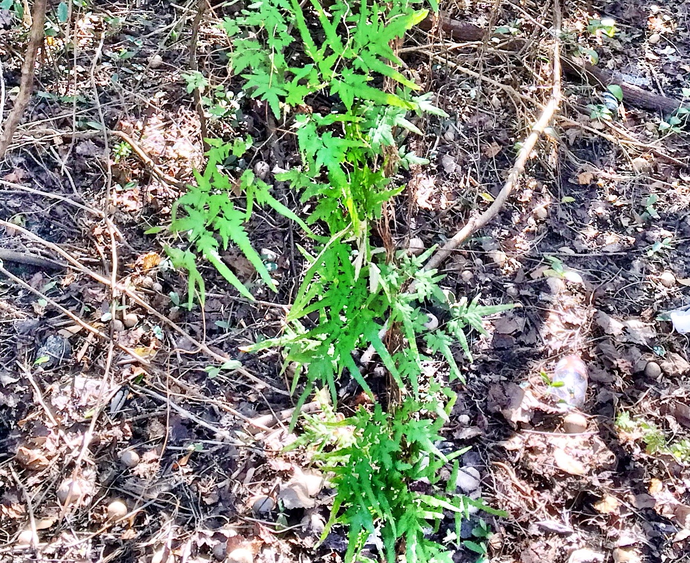
Japanese Climbing Fern can quickly cover natural vegetation. Spores and small plants can be potentially transported in pine straw. Climbing ferns are a problem for managed timber and home landscapes. Photo by L. Scott Jackson
$10 per person; lunch and materials included
http://fsp-workshop092817.eventbrite.com/
Or, call Okaloosa County Extension at (850) 689-5850
by Rick O'Connor | Aug 18, 2017
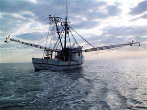
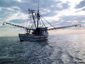
Shrimping in the Gulf of Mexico.
Photo: NOAA
Actually, if you like seafood – it’s all good! However, not everyone does and sometimes when this question is asked they are interested in not how it taste but where the seafood came from.
In recent years, there has been a move across the country to learn more about where their food comes from. Whether that is because they are concerned what the livestock and chickens have been fed, their living conditions, or whether they came outside the United States – more people are asking and it is affecting how they purchase their food. Is it the same for seafood?
In some cases, yes. Several years ago, I ran the marine science program at Washington High School. We were discussing whether, with a growing human population, the ocean could sustain the demand for seafood. Would we need to focus our production on aquaculture? We decided to survey locals to see whether (a) they liked seafood, and (b) if so, would it matter whether the product came from the ocean or a farm. Over a 10-year period, we found that (a) the percentage of locals who did not like seafood increased. (b) Those who did like seafood did not have strong feelings whether it was from a farm or from the sea. Curious as to why those who did not like seafood felt that way, we followed up with those questions and found it was not as much a concern with seafood safety in that they just did not like the taste of it. Of course, this was a high school science project and not a formal science investigation, but they did a good job with it and the results were interesting.
That was almost 20 years ago, do people feel the same? According to Dr. George Baker (Florida Sea Grant), yes… things are about the same. If they can get access to wild harvested seafood at a good price, they will buy. If it is not available, or to expensive, they will, purchase farm raised. Moreover, more people do not like seafood.
What about the local issue? In California, there is a program that allows you to find out which boat captain caught your fish. In Florida, there are studies going on to determine what type of filet you are actually buying. As with produce and livestock, people seem to be interested in where their seafood comes from – and for many, if effects where and how they buy seafood.
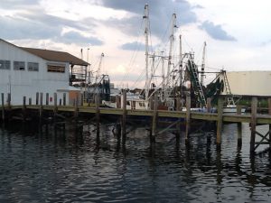
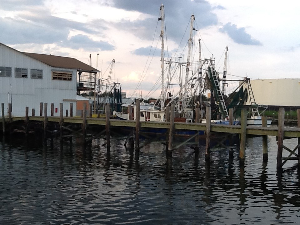
Commercial seafood in Pensacola has a long history.
Photo: Rick O’Connor
So what is local?
Well, we call any seafood product harvested or cultured within 250 miles local. For Pensacola, that would include Alabama, Mississippi, and eastern Louisiana. We know that between 80-90% of the seafood you currently purchase is imported from both commercial fishing and aquaculture overseas. That said, local seafood is still here and available.
The commercial fishing in Pensacola goes WAY back. It was one of the first industries to get off the ground shortly after Florida became a U.S. territory. According to Dr. Jack E. Davis, in his book The Gulf; The Making of an American Sea, Cuban fishermen harvested seafood from the Gulf coast of peninsula Florida prior to our becoming a territory. Shortly after becoming a U.S. territory, New England fishermen came to harvest the Gulf, including one by the name of Leonard Destin. Soon a fishing industry was operating in Pensacola. They sold a variety of species but in 1840 they found red snapper – and the boom was on. Shrimp followed but water quality, habitat loss, and overharvesting have plagued the industry over the years. Fishermen did well for a time, then the landings decreased, the fishermen believed the fish had moved, and so the fleet would move. This continued until they have literally moved all over the Gulf of Mexico seeking fish. At this point quotas had to be initiated and regulation has been the norm ever since. Add to this an increase interest in recreational fishing, increasing the number of fishermen, and increased regulation with this sector. Today we can include the introduction of invasive species as another stressor.
All that said, local seafood is still available. Some species have become quite pricey, but they are still available. The Gulf & South Atlantic Fisheries Foundation created a Gulf Coast Seafood Species Chart. This chart indicates when selected species are in peak season for commercial harvest. This chart suggests they are in season year round but there are peak months. It varies from one state to another, but the list below includes Florida and Alabama.
| Species |
Months in Peak Season |
Comments |
| Blue crab |
No peak season |
|
| Blue crab
Soft shell |
Mar – Jun |
|
| Black drum |
No peak season |
|
| Red drum |
No peak season |
Subject to quotas and closures |
| Clams |
All year – FL only |
Clams are now cultured in FL and are available year round |
| Crawfish |
Apr – Jun – LA only |
LA only, but close to us |
| Flounder |
Jul – Aug; Oct-Nov |
Subject to quotas and closures |
| Grouper |
No peak season |
Subject to quotas and closures |
| King mackerel |
Jan – Feb; Jul-Sep; Dec |
Subject to quotas and closures |
| Mahi-Mahi |
May – Jun |
|
| Mullet |
Jan; Sep – Dec |
|
| Oysters |
Jan – Apr; Sep – Dec |
|
| Pompano |
Jan – Apr; |
|
| Sheepshead |
No peak season |
|
| Brown shrimp |
May – Sep |
|
| Pink shrimp |
Jan – Jul |
|
| Rock shrimp |
Jun – Sep |
|
| White shrimp |
May – Nov |
|
| Snapper |
Peak season year round |
Subject to quotas and closures |
| Yellowtail snapper |
Mar – Jun |
|
| Spanish mackerel |
Jan – May; Aug – Sep; Dec |
Subject to quotas and closures |
| Spiny lobster |
Aug – Sep; Oct – Nov |
|
| Spotted seatrout |
No peak season |
Subject to quotas and closures |
| Stone crab |
Oct – Dec |
|
| Swordfish |
Sep – Nov |
|
| Yellowfin tuna |
Jun – Oct |
|
The health benefits from consuming seafood are understood. We certainly think it should be part of your of weekly dinner menu. There are concerns for safety in some seafood products, as in mercury and king mackerel, and we will address that in another article – but the lack of consuming seafood can create health issues as well. We hope you enjoy local Gulf seafood.
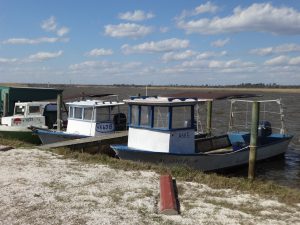
Commercial crab boats docked on Escambia Bay.
Photo: Rick O’Connor
References
Baker, G. 2017. personal communication.
Davis, J.E. 2017. The Gulf; Making of an American Sea. Liveright Publishing. New York NY. Pp. 530.
Gulf & South Atlantic Fisheries Foundation. 2013. Gulf Coast Seafood. www.eatgulfseafood.com
by Rick O'Connor | Aug 11, 2017
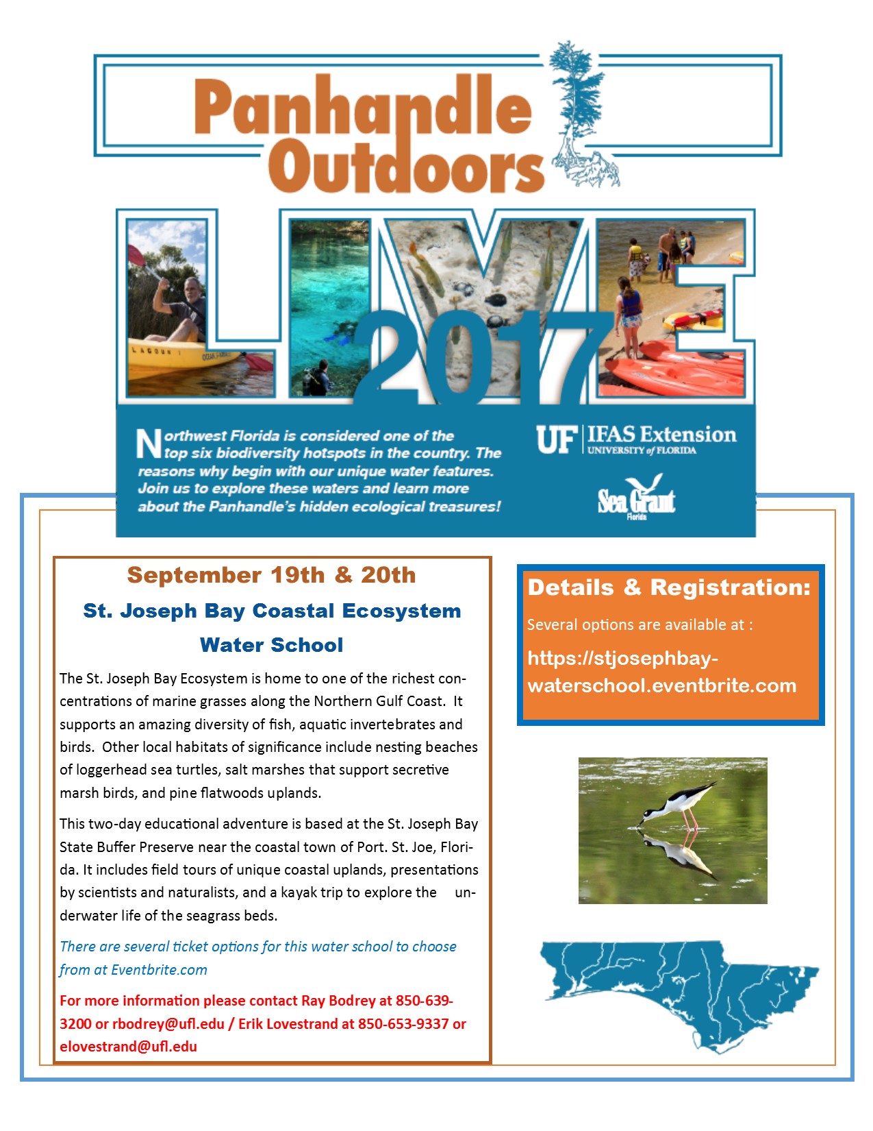
Our first POL program will happen this week – August 17 – at the Navarre Beach snorkel reef, and is sold out! We are glad you all are interested in these programs.
Well! We have another one for you. The Natural Resource Extension Agents from UF IFAS Extension will be holding a two-day water school at St. Joseph Bay. Participants will learn all about the coastal ecosystems surrounding St. Joe Bay in the classroom, snorkeling, and kayaking. Kayaks and overnight accommodations are available for those interested. This water school will be September 19-20. For more information contact Extension Agent Ray Bodrey in Gulf County or Erik Lovestrand in Franklin. Information and registration can be found at https://stjosephbay-waterschool.eventbrite.com.