by Rick O'Connor | Apr 22, 2016
Many folks are putting together a “bucket list” of things they would like to do or see before they can no longer do them. For many interested in natural resources there are certain national parks and scenic places they would like to visit. Other natural resource fans have a list of wildlife species they would like to see.
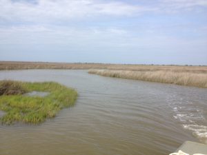
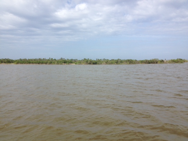
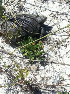
Terrapins inhabit creeks, such as this one, within the expanse of the salt marsh. Here you can see their heads pop up above the water and you may get lucky enough to find one basking.
Photo: Rick O’Connor
Recently I hooked with famed Alabama outdoorsman Jimbo Meador to search for locations to find Alabama turtles. Jimbo has been fishing, hunting, and enjoying the Mobile Bay area all of his life and he now using that knowledge as a guide in a nature-based tourism project. He recently received a call from a group of gentleman from another part of the country who had on their bucket list viewing 1000 reptilian species in their native habitat. In Alabama they were interested in the Black-knobbed Map Turtle, the Alabama Red Belly, and the Diamondback Terrapin. Jimbo has just begun the first module of the Florida Master Naturalist Program and reached out to us for advice on where to find these guys. Luckily, after working with scientists from the University of Alabama at Birmingham, I knew where to find diamondback terrapins – and have a pretty good idea on the others.
These “diamonds of the marsh” – as they are sometimes called – are very elusive creatures. They inhabit muddy bottom creeks within extensive salt marsh habitat all along the Gulf and East coast of the United States. I spent two years searching the Florida panhandle before I found my first live animal. It was one of the odd things though – once you have seen one, you now know what you are looking for and begin to find more.
I took Jimbo to a location near Dauphin Island where about 150 terrapins are believed to exist. Terrapins spend most of their day within creeks that meander through acres of salt marsh. The odd thing is there may be hundreds of creeks within these marshes and the terrapins – for some reason – will select their favorites and hang there. You can spend all day paddling through perfect looking creeks not seeing a head at all… then all of sudden… you enter one creek… not really any different than the others… and there they are.
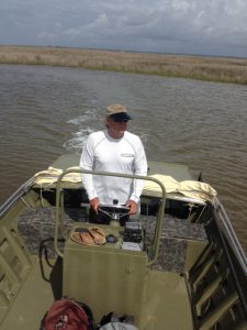
Veteran waterman and outdoor guide, Jimbo Meador, explores the marshes near Dauphin Island for the elusive diamondback terrapin.
Photo: Rick O’Connor
Within these creeks they feed on a variety of shellfish but particularly like the marsh periwinkles. These small snails are the ones that climb the cordgrass and needlerush plants during high tide to avoid their nemesis the blue crab and the diamondback terrapin. Terrapins do crawl out of the water to bask in the sun and have been known to bury in the loose fine mud. Females must find high dry ground to lay her eggs. She may swim as far as 5 miles from her home creek to find a suitable beach. They do like sandy beaches that are open and free of most plants. They emerge onto these beaches during May and June to lay about 7-10 eggs. Most females will lay more than one clutch each season emerging once every 16 days or so. Different from sea turtles – terrapins nest during the daylight hours. Actually the sunnier – the better. Raccoons are a big problem… find and consuming the eggs; on some beaches researchers have reported 90% or more of the nest have been raided by the furry guys. Crows, snakes, and possibly armadillos will take nests as well. If the developing young survive the 60+ days of incubation, they will emerge and head for the grass areas of the marsh… not the water. Here they will spend the first year of their life living more like a land turtle before they make their way to the brackish waters of the salt marsh.
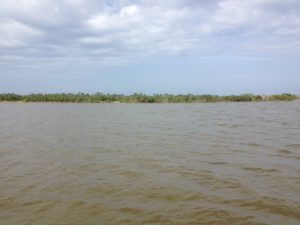
Open sandy beaches, such as the one in this photograph, are the spots females terrapins seek when they are ready to dig a nest.
Photo: Rick O’Connor
These are fascinating creatures and should be on everyone’s natural resource bucket list. The hard effort of finding them really makes doing so very rewarding. On this day Jimbo saw only one head – I did not see any. I have found in my study site that I see more heads in the afternoon (we were out in the morning). I do not know if this is the case at all terrapin nesting sites, but something to consider when looking. Though we did not find many that day he now knows what to look for when searching for them. Next we will have to hunt the Alabama Red Belly Turtle. That is another story for another day.
We will continue this series with other interesting wildlife creatures to “hunt” in the Florida panhandle.
by Rick O'Connor | Apr 8, 2016
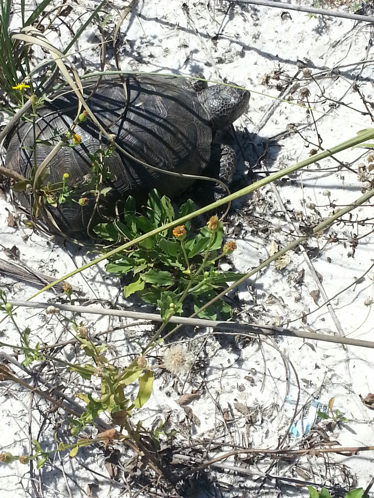
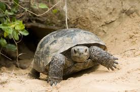
This gopher tortoise was found in the dune fields on a barrier island – an area where they were once found.
Photo: DJ Zemenick
The state of Florida has designated Sunday April 10 as “Gopher Tortoise Day”. The objective is to bring awareness to this declining species and, hopefully, an interest in protecting it.
During his travels across the southeast in the late 18th century, William Bartram mentioned this creature several times. As he walked through miles of open longleaf pine he would climb sand hills where he often encountered the tortoise. These turtles do like high dry sandy habitats. Here they dig their famous burrows into the earth.
These burrows can extend almost 10 feet vertically below the surface but, being excavated at an angle, can extend 20 feet in length. There is only one entrance and the tortoise works hard to maintain it. Field biologists have been able to identify over 370 species of upland creatures that utilize these burrows as refuge either for short or long periods of time. These include the declining diamondback rattlesnakes, gopher frogs, and the endangered indigo snakes, but most are insects and small mammals. Because of the importance of the burrows to these species, gopher tortoises are listed as keystone species – meaning their decline will trigger the decline of the others and can upset the balance of the ecosystem. Gopher burrows can be distinguished from mammal burrows in that they are domed across the top but flat along the bottom, as opposed to being oval. The width of the burrow is close to the length of the tortoise. When danger is encountered the tortoise will turn sideways – effectively blocking the entire entrance. Though there are cases of multiple tortoises in one, the general rule is one tortoise per burrow.
Tortoises are herbivores, feeding on a variety of young herbaceous shoots, and fruit when they can get find them. Fire is important to the longleaf system and it is important to the gophers as well. Fires encourage new young shoots to sprout. If an area does not receive sufficient fire, and the ground vegetation allowed grow larger with tougher leaves, the tortoise will abandon their burrow and seek more suitable habitat – which, especially in Florida – is becoming harder and harder to find. They typically breed in the fall and will lay their 5-10 eggs in the loose sand near the entrance of the burrow in spring. In August the hatchlings emerge and may hide beneath leaf litter, but will quickly begin their own burrows.
This tortoise is only found in the southeast of the United States and it is in decline across the region. They are currently listed as threatened in Florida but are federally protected in Louisiana, Mississippi, and western Alabama. They are found across our state as far south as the Everglades. There are several reasons why their numbers have declined. Human consumption was common in the early parts of the 20th century, and still is in some locations – though illegal. Some would, at times, pour gasoline down the burrow to capture rattlesnakes – this of course did not fare well for the tortoise. A big problem is the loss of suitable habitat. Much of upland systems require periodic fires to maintain the reproductive cycle of community members. The suppression of fire has caused the decline of many species in our state including gopher tortoises. These under maintained forest have forced tortoises to roadsides, power line fields, airports, and pastures. In each case they have encountered humans with cars, lawn mowers, and heavy equipment. Keep in mind also that our growing population is forcing us to clear much of these upland habitats for developments where clearing has caused the burial (entombment) of many burrows.
This is a unique turtle to our region and honestly, is a pleasure to see. We hope you will take the time to learn more about them by visiting FWC’s Gopher Tortoise Day website, enjoy watching them if they live near you, and help us conserve this species for future generations.
by Rick O'Connor | Mar 25, 2016
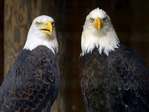
The majestic bald eagle. Their numbers are increasing along the Florida Panhandle.
Photo: Pensacola New Journal
ARTICLE BY DOROTHY KAUFMANN – Wildlife Sanctuary of Northwest Florida
Orphaned bald eagles are being fostered by two non-releasable adult eagles at the Wildlife Sanctuary of Northwest Florida.
The amazing story of these eagles began on St. George Island when concerned neighbors, Kevin and Chantel Burdett, Lauren Levi, and Kenny Piotrowski, rescued two fallen chicks after their nest tree came down in a storm. Emergency care began with Chris Beatty, Florida wildlife Mammal Association in Crawfordville, after being transported by Apalachicola National Estuarine Research Reserve staff. One eaglet sustained injuries from the fall while the other remained uninjured. Plans were immediately underway to rebuild a nest and return the uninjured chick. The following day both eaglets were stable enough to be transferred to the Wildlife Sanctuary in Pensacola for continued care and treatment.
A team continued working to reunite the healthy eaglet with its parents but first a replacement nest had to be built. Next, a secure tree nearby the original site had to be found for the new nest. Finally, get the nest and chick to the top of the tree. Just how many people does it take? Well, this time it was three state agencies, two wildlife rehabilitators, one veterinarian, Duke Energy – the largest electric utility in the country, with their bucket truck, one EagleWatch Program professional, several concerned citizens, and one federal agency to attempt to reunite this eaglet. “It wasn’t long before we had our ducks (eaglets) in a row for a coordinated effort to try sand reunite parents with chicks”, said Erik Lovestrand, director of the UF/IFAS Franklin County Extension Office. “Duke Energy is proud to have been part of the effort to find these baby eagles a new home”, said David Collins – government and community relations manager with Duke Energy.
The weather that had been the reason for the home nest to fall continued to dictate the little eaglet’s destiny. The reunion day turned out to be very cold and rainy for everyone. Efforts to reunite the eaglet were unsuccessful. Foster parents… yes… that’s plan B… the eaglets are both being raised by experienced “eagle parents” to have the best chance at a later release back to the wild. These adults are permanently injured bald eagles and residents of the Wildlife Sanctuary of NWFL. The injured eaglet is currently recovering at WSNF from a fractured leg and wing. Both eaglets are off display to the public due to the need to keep them wild. Video cameras at the Sanctuary allow viewing of the eagle family without any disturbance.
“Though I know we are all very disappointed that the parents did not return, we all pulled together to try to help this young eaglet which was a very awesome experience. We were so honored to be amongst such a wonderful and caring group of people”, commented Chris Beatty.
How amazing that what seemed to be a day about a single family of eagles… is actually an ongoing lesson in caring, awareness, and community.
SPECIAL NOTES:
Attending veterinarian Dr. Tommy Knight of Westside Animal Hospital
The new eagle nest site was selected by Erik Lovestrand (UF/IFAS Extension), Lauren Levi (Apalachicola NERR), and Lynda White (AEW).
Supplies for the platform were provided by Jenna Harper (Apalachicola NERR) and constructed by Kenny Piotrowski (local carpenter).
The platform was secured and eaglet placed within by Duke Energy.
Neighbor Kevin Burdett also played an important role in encouraging the adult eagles to remain in the nesting area – he played audio calls of the eaglets.
Others attending the attempted eagle reunion monitored the activity and remained in an inconspicuous location awaiting the adult eagles return.
by Rick O'Connor | Mar 25, 2016
All Photos: Molly O’Connor
In this monthly series of highlighting outdoor adventures in the Florida Panhandle, we are visiting locations along the Intracoastal Waterway; from the Alabama State line to the Aucilla River. In January we wrote about Perdido Key, last month we visited Pensacola Beach, this month we move east along Santa Rosa Island to the beach community of Navarre.
Navarre Beach is a relatively quiet community on Santa Rosa Island between Pensacola and Ft. Walton Beach. There are some good places to eat, a new RV campground, and plenty of water/outdoor activities. Navarre Beach became famous in the 1970’s as the location for the film Jaws II. I personally witnessed much of the shooting of the film and it was amazing to see how it all actually all works. The hotel that was used in the film is no longer there but the stories are!
On the Island
There are some great kayak and paddle locations on Navarre Beach. Paddling over the grassbeds and to the east of the Navarre Marine Park you can see a lot of coastal wildlife and great sunsets. You can of course paddle the Gulf as well and maybe take a shot at kayak fishing. You will find local kayak rentals and guides by visiting Naturally EscaRosa website.
Paddling in a kayak or on a paddleboard is a great way to view wildlife and natural scenes while visiting Navarre Beach.
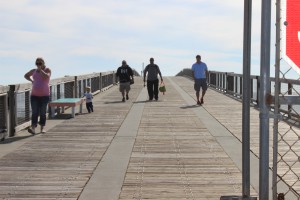
The Navarre Fishing Pier extends over 1500 feet. Not only a great place to fish but a great place to view marine life.
Speaking of fishing, there is the Navarre Beach Fishing Pier which extends 1500 feet out over the Gulf. The pier provides of variety of price options for fishermen of all ages and for $1 you can just walk and enjoy the view. Sharks and sea turtles are often seen from here – and don’t forget the sunsets.
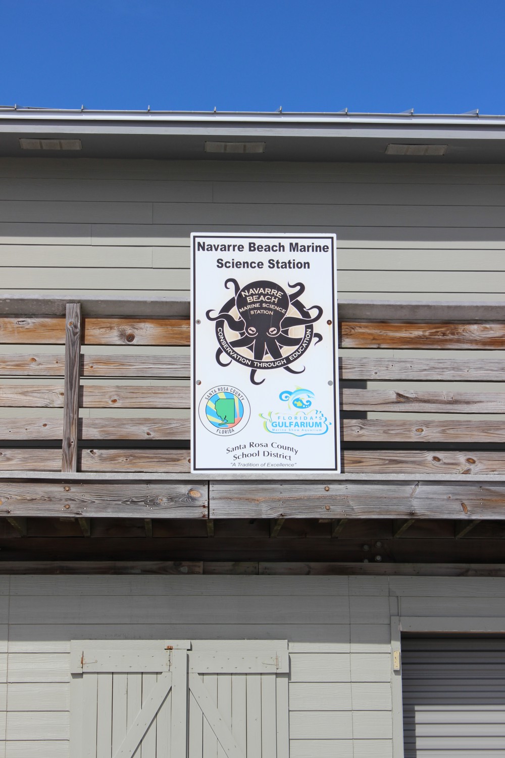
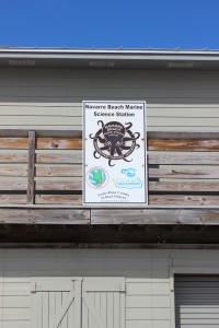
There are two educational interpretive centers on Navarre Beach. The Navarre Beach Marine Science Station is part of the Santa Rosa County School District. They provide programs for elementary, secondary, and dual-enrolled high school-college students. The Station also provides numerous youth camps during the school year and during the summer, as well as providing activities at local community events. To see if they have something going for your young one while you are here visit their website.
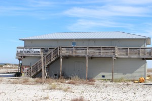
The Navarre Beach Marine Science Station provides education for young and old.
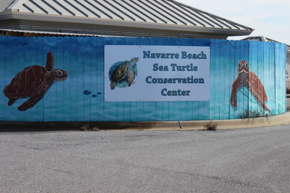
The Navarre Beach Sea Turtle Conservation Center is an educational center that focuses on imperiled marine wildlife but the sea turtle is the star of the show. The center will eventually house an injured sea turtle that can no longer be released but until one arrives, there is plenty to see and learn. Learn more about the center at their website.
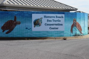
The Navarre Beach Sea Turtle Conservation Center.
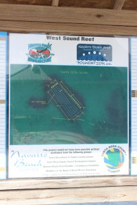
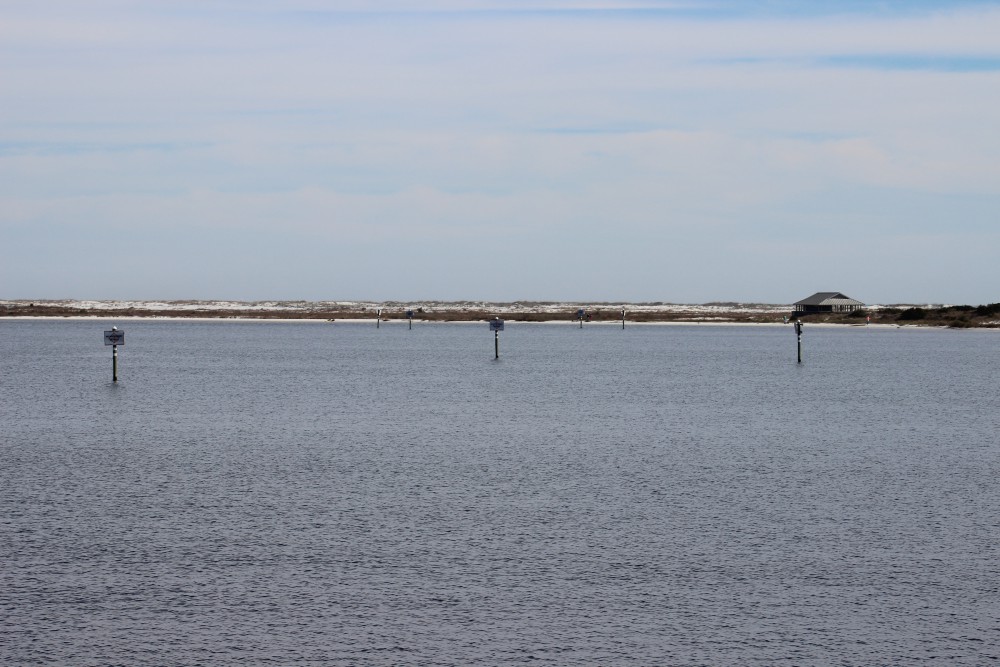
Santa Rosa County also provides a couple of nearshore snorkel reefs for the public. You can find them on both the Gulf and Sound sides.
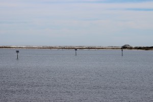
These day markers are marking two nearshore snorkel reefs on the Sound side of Navarre Beach. They can be accessed from the Navarre Marine Park.
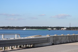
A barge travels beneath the Navarre Beach Bridge as it heads east along the ICW.
Off the island
Actually, you have to leave Santa Rosa at this point. The island between Navarre Beach and Ft. Walton Beach is the property of the United States Air Force.
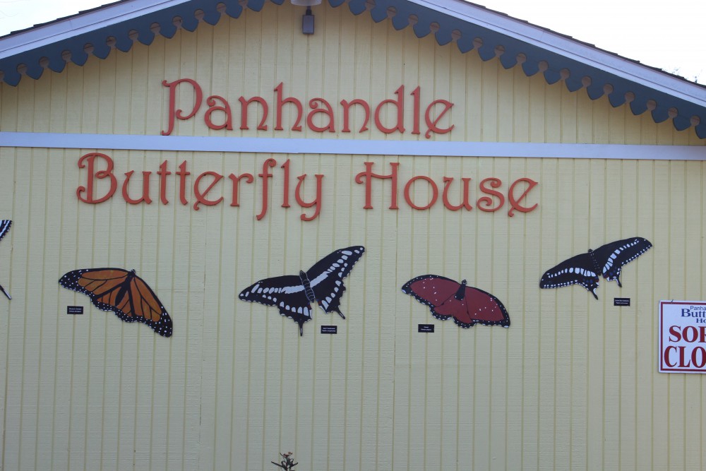
As you leave Navarre Beach to travel the ICW from the north side, you see the Panhandle Butterfly House on your left at the Highway 98 traffic light. This is a great stop. Viewing live butterflies feeding on native plants in all stages of their lives is a cool sight. There are plenty of volunteers to educate you about native butterflies and there is a pond out back with a lot of turtles and birds to view. It’s a neat and relaxing place.
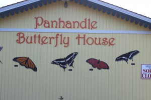
The Panhandle Butterfly House is located just to the west of the traffic light on Highway 98 as you leave Navarre Beach.

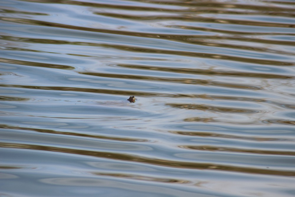
Numerous turtles can be found swimming and basking in the pond behind the butterfly house.

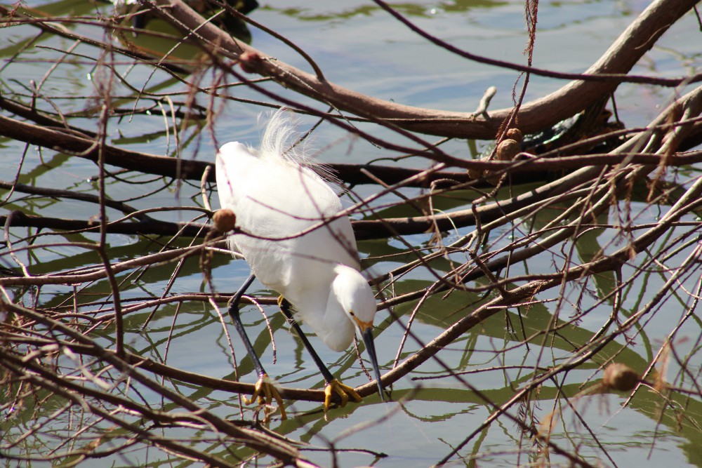
A snowy egret hunts for a meal in the turtle pond behind the butterfly house.
Nature Notes: Sea Turtles
Who doesn’t love sea turtles! These silent, charismatic creatures have been navigating Gulf waters, and nesting on our beaches for centuries. Certainly the largest species of turtle humans will encounter, weighing in between 200-300 pounds – with some reaching 1000 pounds, they are an awesome thing to see. There are five species found in the northern Gulf of Mexico and there are records of four them nesting here. Those species are the Loggerhead, Green, Kemp’s Ridley, Hawksbill, and the giant of them all the Leatherback.
Sea turtles begin their lives within the egg buried on a beach. The sex of the embryo is determined by the temperature of the sand they are incubating in – cold ones become males and 29°C appears to be the cutoff. After 60-70 days incubating the young hatchlings emerge at night and orient towards shortwave light (moon or stars off the water). However, in recent years much of the light we provide in our homes as directed them in the wrong direction (disorientation). There are “turtle friendly lights” that use longwave colors and significantly reduce the disorientation problem. All coastal counties along the panhandle require these lights for island structures. Many of the hatchlings are lost as they wonder to the Gulf. Ghost crabs, fox, coyotes, and now feral cats capture and consume many.
Those lucky enough to reach the water now have to deal with fish and bird predators. These young head offshore seeking the Sargassum mats where they will spend their growing years feeding and hiding.
As immature adults most species will return to the coastal areas to feed on seagrasses or invertebrates. As they become sexually mature they, once again, head to sea. Though they travel far and wide they are known to return to their place of birth for breeding and egg laying. Breeding takes place just offshore and females may come ashore more than once to deposit their clutch of 100+ eggs.
In addition to light pollution, marine debris, boat strikes, commercial fishing nets, and even holes and chairs left on the beach overnight have caused their numbers to decline. You should be aware that most coastal counties have a “leave no trace” ordinance asking you to remove your chairs, tents, and other items at the end of the day – and please fill in any holes you may have dug. All species of marine turtles are currently listed and protected by the U.S. Fish and Wildlife Service. In Florida, the USFWS has yield management of these species to the Florida Fish and Wildlife Conservation Commission. They are truly a magnificent creature and we hope all get to see one while exploring our beaches.
Now it is time to move to Okaloosa County – the April issue will look at Ft. Walton and Destin. Let’s head there and see what cool outdoor adventures await us.
You can find information on ecotourism providers in Escambia and Santa Rosa counties by visiting Naturally EsacRosa.
by Rick O'Connor | Mar 11, 2016
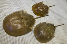
Talk about weird and cool at the same time! The horseshoe crab is one of the oldest living species we have in the Gulf of Mexico. Fossils of this animal date back to almost 500 million years… this is before there was such a thing as fish! The separating of Pangea, the rise and fall of the dinosaurs, oh what stories these guys could tell! And they are here today, trudging along in the soft sands of estuaries along the Atlantic and Gulf coasts… but they seem to be on the decline. After all they have been through… they may be slipping away.
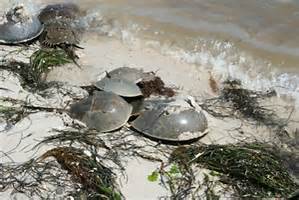
Horseshoe crabs breeding on the beach.
Photo: Florida Sea Grant
Actually, horseshoe crabs are not crabs at all. They belong to the same large group of animals the crabs belong to, Arthropods, but differ from true crabs in that they have fewer jointed legs and no antennae. They are actually more closely related to spiders and scorpions. There are 4 species remaining on Earth. Limulus polyphemus is the local variety with the other three living in Asia. They are tolerant of a wide range of environmental conditions. Huge swings in water temperature and salinity do not bother them. This is not surprising considering all of the environmental changes that have occurred since the species first appeared on the planet. They are scavengers, plowing through the soft bottom of estuaries, they feed on worms, mollusk, and whatever else their crop-gizzard system can breakdown. Their protective shell deters many predators; most horseshoe crabs meet their fate on the beach – where they must go to breed.
Breeding occurs all year in Florida. It typically takes place three days before and after the new or full moon. The smaller males come near shore and patrol for the oncoming females. As the females are intercepted the males will use their “hook” to hold on and the pair ride onto the beach. This usually happens at night (though not always) during the peak of a spring high tide. The female digs a small depression and deposits between 200 and 300 eggs, the male fertilizes them, and the female buries them. They leave the young on their own for a month, at which time the next spring tide arrives and the larva, which resemble trilobites, emerge. Many fall prey to shorebirds and many adults actually become stranded on the beach during nesting and die.
So why the population decline?
Well, they do tolerate large swings in environmental change, so increase temperatures, rainfall, salinities, do not bother them. Studies have shown that they are actually quite tolerant of many of the pollutants, including oil, we discharge into our bays – though mercury is a problem for the developing trilobite larva. Along the Atlantic coast the animals are collected for bait and the biomedical industry. Horseshoe crabs are used in eel traps and there are several medical uses for their blood. Some biomedical industries collect the crabs, remove some of the blood, and return them – but not all survive this. A big problem they are facing, and this would be closer to home, is the loss of nesting habitat. Seawalls, jetties, groins, and coastal development in general have disturbed nesting beaches.
That said, they seem to be making a comeback on Pensacola Beach. There have been sightings at both Big and Little Sabine. We would like to record where they are nesting in the panhandle. If you would like to help – the full moon for the next few months will occur on March 22, April 22, May 21, and June 20. The new moon will occur March 8, April 7, May 6, and June 4. If you do see a horseshoe crab please contact me at (850) 475-5230, or email at roc1@ufl.edu.