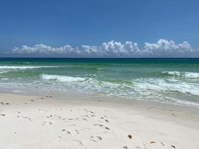
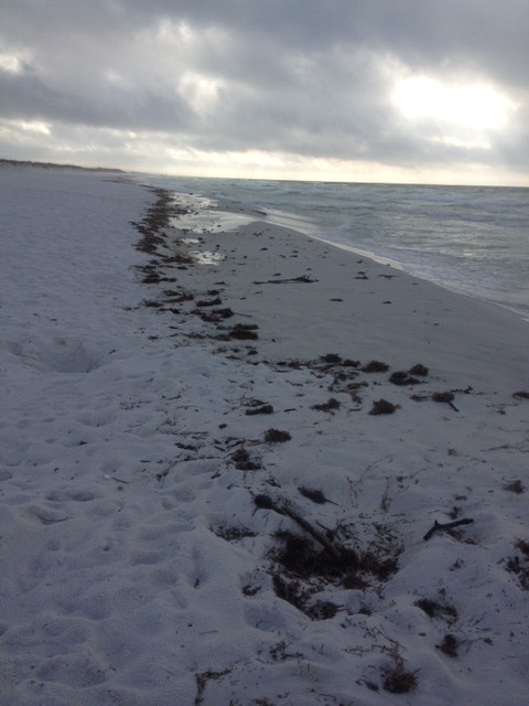
The open sandy beach is one of the hardest habitats to live in on a barrier island. There is no where to hide and almost nothing to eat. Add to this the direct wind and waves from the Gulf of Mexico and you have a barren landscape with continuous climate and ocean energy. But creatures do live here.
The beach is void of plant life and takes a well adapted animal to reside here.
Phot: Rick O’Connor
Before we go further let’s define a few terms. The beach is actually the dry sandy portion of this environment. The area where the sand squeaks as you walk through it, the place where you set your chairs, umbrellas, and lunch for your day at the beach. The berm is the harder packed sand near the waters edge. The place where you like walk when you walk the beach (it’s easier) and the waves wash over every few seconds. Living in these two would be very different. Second, we will define resident and transient. A resident is a creature who actually resides there. A transient is just passing through but lives somewhere else.
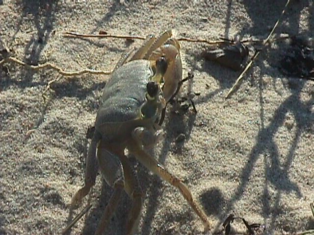
As you look across the beach you will notice there is NO WHERE to hide from the elements… except beneath the sand. One of the more common creatures who lives beneath the is the ghost crab (Ocypode quadrata). This crustacean digs burrows down to the water table where they can keep their gills wet and this can be as deep as four feet. On these flat beaches they are easy target for predators. They have several ways to deal with the problem. (1) Their compound eyes are on stalks above their head to give them a wider, and longer, range of view. (2) They are white in color and blend in with the quartz sand well. (3) They are more active at night, nocturnal. (4) They are very fast.
The trick to speed is to break contact with the ground. If you were to ask someone “what is the fastest way to get to Los Angeles?” They would answer “flying”, and this would be correct. Birds are some of the fastest creatures around. They fly. They lift off the ground and do not touch again until they reach their destination. It does not get any better than that. Cheetahs are very fast as well. But if you watch them in slow motion, you will see they are basically leaping from one point to the next. They touch the ground very few times over a certain distance. They are trying to fly but cannot. If look at video of a human, or centipede, or slug. Not sot good. Crabs are crustaceans and by definition they have 10 legs. When they move across the surface, they usually use eight of those (two being their claws). The same is true for the ghost crabs. But when they decide to run, they only run on three of them. They raise the other five above their heads. This means fewer legs touching the sand which means they are faster.
The common ghost crab. Photo: Virginia Institute of Marine Sciences
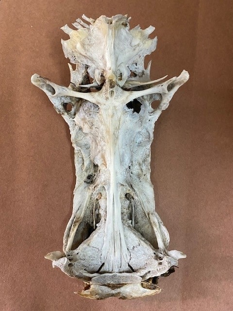
Food is another issue. Due to direct high wind (filled with salt), plants do not grow on the beach. Hence the classic food chain (plant – herbivore – carnivore) cannot exist. So, what do ghost crabs eat? They are scavengers. They emerge from their burrows, usually at night, to seek what dead creatures the tide may have washed in. Post storms are particularly good feeding times. Surf fishermen along the Gulf beach often catch hardhead catfish and, not liking them, often toss them on the beach to die. In the evening the ghost crabs will drag these to the entrance of their burrows where they feast for quite a while. They eventually clean to fish to the bone leaving their “hard head” (the skull). When you look at the skull from underneath it appears to be Jesus on the crucifix. These skulls are often collected and sold in novelty stores as “crucifix fish”.
The bones in the skull of the hardhead catfish resemble the crucifixion of Christ and are sold as “crucifix fish”.
Photo: Rick O’Connor
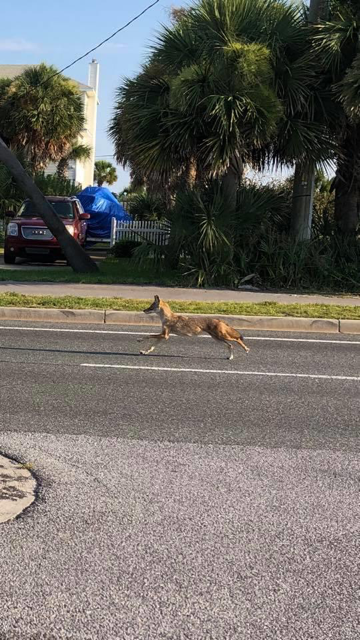
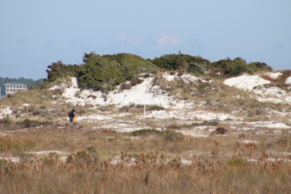
Another prize for ghost crabs are sea turtle eggs. Sea turtles are obvious transients to the beach environment, coming here only during nesting season. The females usually approach the beach close to where they were born at night. She will labor her way across the beach to the first dune line, though some will lay theirs in the open beach area. She could spend several hours digging a hole three to five feet deep. Loggerhead Sea Turtles (the most common on our beaches) simply dig a hole. The Green Sea Turtle will use her flippers to dig a form for her body before digging the nest. She will deposit about 100 eggs before burying them and returning to the Gulf. Ghost crabs, and other beach transients like coyotes, fox, and raccoons, will find and raid these nests.
Tracks left by a nesting Green Sea Turtle. Courtesy of Gulf Islands National Seashore.
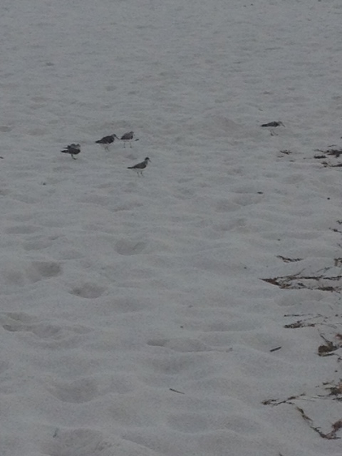
The wrack (a line of debris that includes seaweed, shells, and other flotsam from the Gulf) offers a variety of food for ghost crabs. Another who is often found scavenging the wrack are shore birds. There are numerous species of terns, gulls, pipers, and plovers that will pick through the wrack for food.
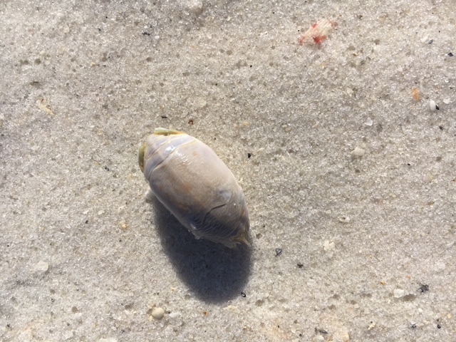
The berm is a tougher place to make home. You are in the surf zone and must deal with breaking waves every few seconds. As you might expect, there are no plants here, and very few animals. Those that do reside here bury in the sand knowing that the surf will most likely expose them and could carry them to another location. The two most common animals in this zone are the mole crab and the coquina.
The mole crab is often called a “sand flea”.
Photo: Rick O’Connor
The mole crab (Emerita talpoida) is also known by surf fishermen as the “sand flea”. It is a small oval shaped crab that has a hard paddle like telson to dig into the wet sand tail first. With its head exposed it will extend antenna that are covered with small hair-like structures designed to collect plankton from the water that covers it when the waves come in. The surf often exposes them, but they flip over and dig back in very quickly.
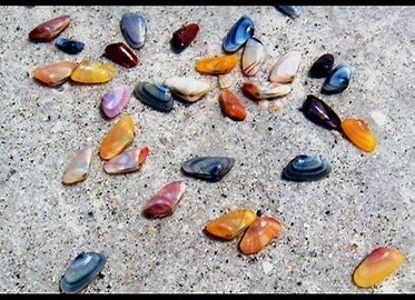
The coquina (Donax variabilis) is a small clam that comes in a variety of colors (hence it’s species name). Like all clams, it has a fleshy foot which it uses to quickly dig into the wet sand covering most of its body. Like the mole crab, it exposes its head into the surf extending two fleshy tubes called siphons that draw water into the clam where it can collect planktonic food.
Coquina are a common burrowing clam found along our beaches.
Photo: Flickr
Predators do exist here, but they are not residents. They would include transient fish that come close to shore waiting for the surf to wash these small animals into the Gulf. One of the more common is the Florida Pompano. Surf fishermen like to use “sand flea” baskets, dragging them through the sand near the waters edge to capture the mole crabs for bait seeking these tasty fish. Others would include an assortment of shorebirds like sand pipers and plovers who run to the wet sand when the surf recedes back into the Gulf probing for the mole crabs and coquina, then quickly running back towards the beach when the surf returns.
A variety of shorebirds utilize the wrack. Photo: Rick O’Connor
The diversity of life in the beach-berm zone is not high, but this is a tough place to make a living. Ghost crabs, mole crabs, and coquina clams have all adapted to living here and have done quite well. But more wildlife prefers the dunes. It is a little easier there and the next stop in Part 5 of this series.
The classic model of ecological succession begins with new land. This could be new land formed by a sand bar, or a new landscape formed after a volcanic eruption, but new land none the less. Then the pioneer community begins. Based on the model, the plants need to be first, herbivores cannot survive unless there are plants already present. When we teach students about maintaining aquaria, we actually begin with the bacteria community needed to breakdown the organic waste from the plants and animals when they arrive. So, some would say “begin there”. As the pioneer plant communities form, the pioneer herbivores arrive. This would be followed by more advanced communities of plants and then more advanced communities of animals, until you reach the climax community.
Beach
The open beach is how most barrier island ecosystems begin awaiting the arrival of the pioneer community.
Phot: Rick O’Connor
But science understands that it is more complicated than that. Each new member of the community would make chemical and physical changes to the environment that could allow new species to thrive while other existing ones die off. Then those would make changes as well and the process is ALWAYS changing. That there is never a true climax community, change is happening all of the time. Then there was the case of Mt. St. Helens.
St. Helens erupted in 1980 destroying 229 square miles of habitat. This new landscape gave ecologists an opportunity to witness ecological succession firsthand. Like everyone, they expected the pioneer plant community to arrive first, and so on. But in some areas, it was the carnivores that arrived first, completely against the classic model. These carnivores apparently survived the blast and began to wonder the new landscape. How did they survive? They survived by feeding on each other. But eventually the pioneer plants did arrive, all creatures “got in line” and the world was good once again. The interesting thing was it did not happen the way they thought it would. It also shows the resiliency of life.
Mt. St. Helens destroyed almost 300 square miles and produced new habitat.
Photo: University of Washington.
So, how did this process unfold on our barrier islands? I do not know. You would guess that it unfolded the way the model suggests – pioneer plants first, pioneer animals, more complex plants, more complex animals, barrier island ecosystem. But as we have seen, there are several ways it could have started.
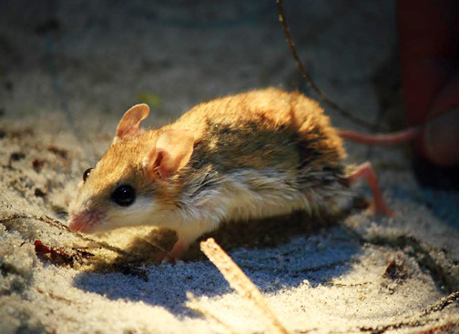
What we do know is that the animals who made it to the islands had to do so by either swimming, flying, or walking. For those who reached our islands on foot – beach mice, ants, etc. this must have happened at a time when the island was still connected to the mainland.
The Choctawhatchee Beach Mouse is one of four Florida Panhandle Species classified as endangered or threatened. Beach mice provide important ecological roles promoting the health of our coastal dunes and beaches. Photo provided by Jeff Tabbert
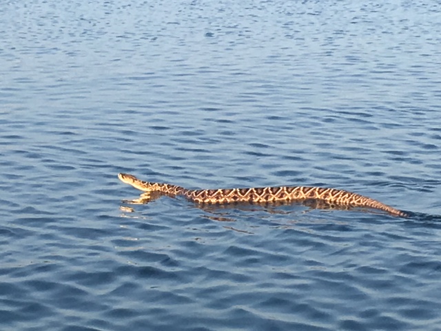
For the swimmers, short swims like Indian Pass could be achieved by several species. Deer and other small mammals may have been able to do this. I have seen bears swim and assume coyotes could make short swims. As the island continued to move with the tide and currents, the distance to the island would have increased. The pass across the mouth of our estuaries, or across the intracoastal waterway, is now daunting for many of these swimmers – but not all. I have seen eastern diamondback rattlesnakes swim across the ICW and have heard bears can still make this trip. For the flyers, these distances do not seem to be an issue. They easily, and often, do so.
Eastern diamondback rattlesnake swimming in intracoastal waterway near Ft. McRee in Pensacola.
Photo: Sue Saffron
If you imagine the early days of an island being low elevated sand, the new wildlife arrivals would face a daunting landscape. Burrowers, such as ghost crabs, could easily make a living here. Their burrows protect them from the elements and being scavengers, they would feed on anything the Gulf washed ashore – something they still do. Sea turtles and shorebirds could easily use the sand bars for nesting, and probably preferred it due to the few predators around. But eventually, the pioneer plants would become more established, allowing selected herbivores (who could survive in low elevation sand) to move in. Next the dunes would form, providing new habitat (read part 2 of this series). Additional herbivores, if they could reach the island, could now become established and at some point, the carnivores would enter the picture.
The line of seaweed and debris along the surf zone is called wrack. Photo: Rick O’Connor
There would initially be a finite amount of space for inhabitation and competition for that space and its resources would be high. Some would be more adapted to the environment than others, or physically stronger, or have a higher reproductive rate, to give them an edge over the others and the island wildlife community would begin. This community would include such things as insects, worms, amphibians, reptiles, birds and mammals. The marsh habitat would include aquatic species such as snails, clams, crabs, shrimp, and fish. All would have had to be able to reach the island, find a suitable habitat for their needs, find suitable food, and out compete others who had made the trip across as well. I was asked once as a college student – “who is a rhinoceros’s greatest competition?” It was an oral exam, and I was very nervous. My mind began reeling in all directions trying to think of what a rhino would have to compete for and WHO would be their greatest competitor. And then, with a little discussion from my professors, it dawned on me. Their greatest competitor would be another rhino. The other rhino would be seeking the same resources, habitat, and mates as the original one. Your first problem is with your own kind. And so, it would be for barrier island wildlife.
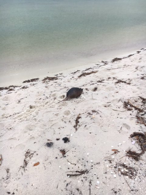
The bizarre looking armadillo enjoys a walk on the beach.
Photo: Rick O’Connor
With the arrival of humans, with their bridges and boats, additional creatures would be able to reach the islands and play a role in the competition, but that is another story, and we will discuss this more down the road. In Part 4 we will look at the species that have inhabited the beaches of our barrier islands.
The habitats of a barrier island are defined and driven by the plant communities there. Seeds from the mainland must first reach the new island and they can do so using a variety of different methods. Some come by wind, some by water, some by birds and other wildlife. Some of these germinate, some do not. Those that do, do so on a sandy island with little or no relief and must deal with the winds off the Gulf, which has salt spray. Many of these mainland plants cannot tolerate this and never make it. But some can… and do.
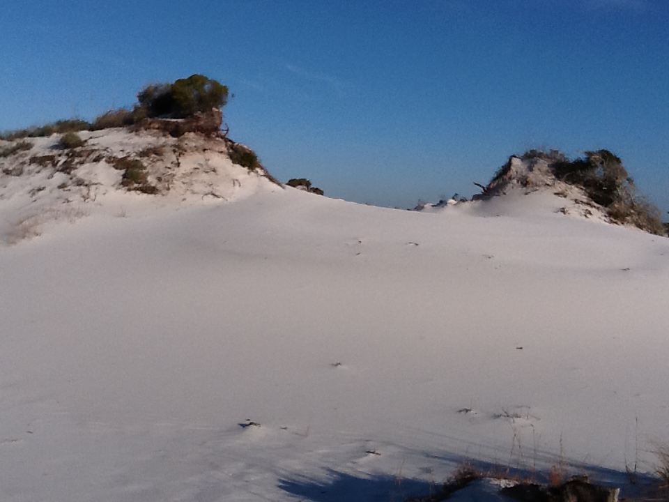
The dune fields of panhandle barrier islands are awesome – so reaching over 50 ft. in height. This one is near the Big Sabine hike (notice white PVC markers).
These early plant communities are known as the pioneer community – meaning the earliest settlers. In the process of succession pioneer communities are made of creatures that can tolerate the harshest conditions, the early days of ecosystem development. There are usually few nutrients, extreme climatic conditions, and for the animals, few prey to select from. But these pioneers are adapted to survive in these conditions and over time alter the conditions so that other creatures can move in.
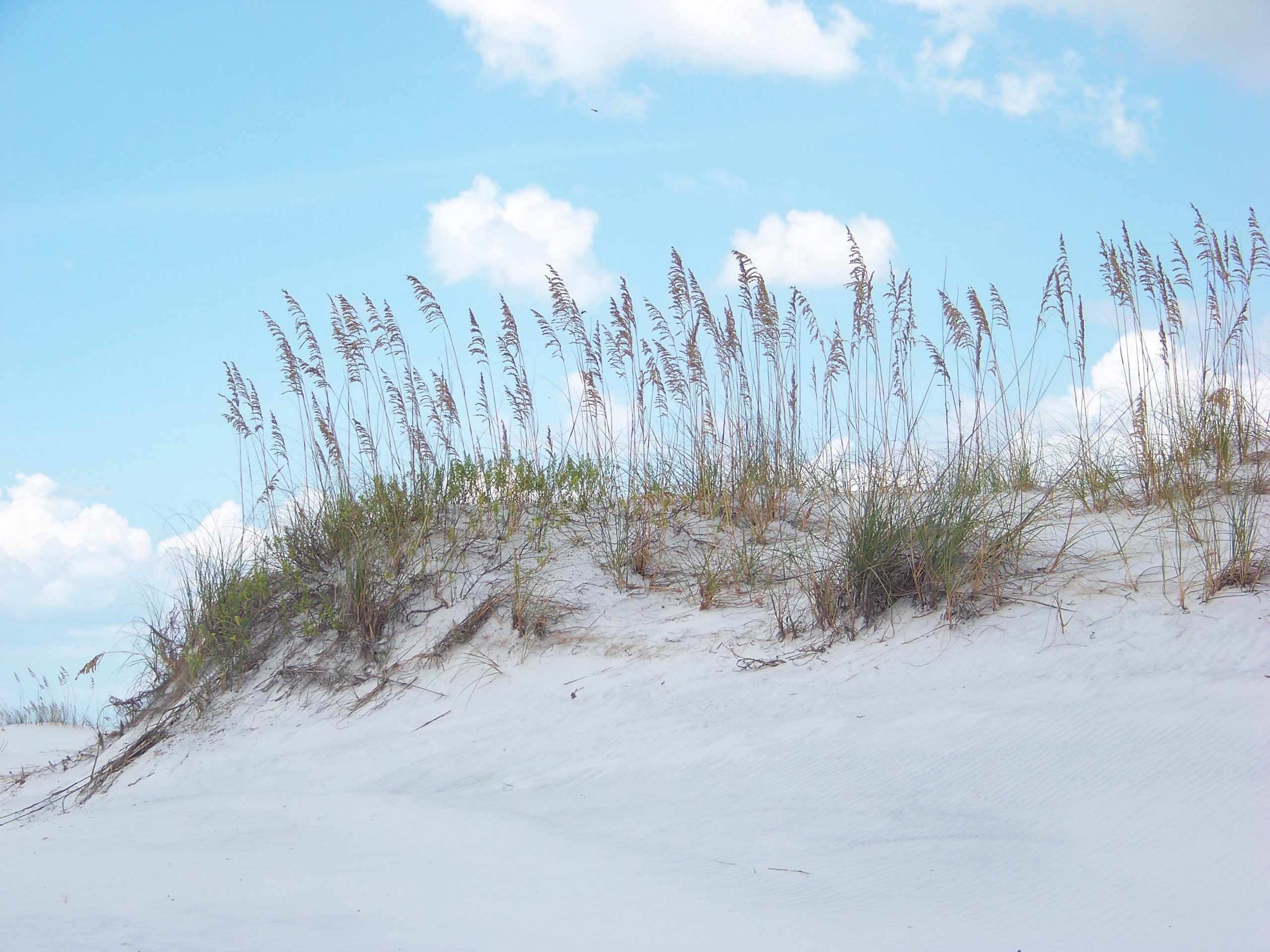
For the barrier islands, grasses seem to be the plants who do best in the early stages of succession. Though small shrubs and trees may reach the island, the high winds and salt spray will not allow growth. There are numerous species of grasses that can live here, the most famous are the sea oats (Uniola paniculata). This grass can be found on the smallest of barrier islands. Their fibrous root system runs beneath the ground sprouting new grasses all over. Their seed heads blow with the wind starting new populations of plants on other locations and the landscape is soon dominated by them. However, there are other species as well. Panic grass (Panicum amarium), salt hay (Spartina patens), and beach elder (Iva imbricata) to name a few. All these grasses can tolerate the wind and salt spray as well as the low nutrient, low rainfall often found on these islands. They also all have fibrous roots systems that not only connect grasses across the land scape but also trap blowing sand – forming dunes.
The primary dune is dominated by salt tolerant grasses like this sea oat. Photo: Rick O’Connor.
The dunes closest to the Gulf are dominated by grass due to the higher winds and salt spray there. These are called the primary dunes and create one of the first habitats on the island for wildlife. The primary dunes vary in height and how far from the Gulf they range but they do form a wind break for portions of the island landward of the Gulf.
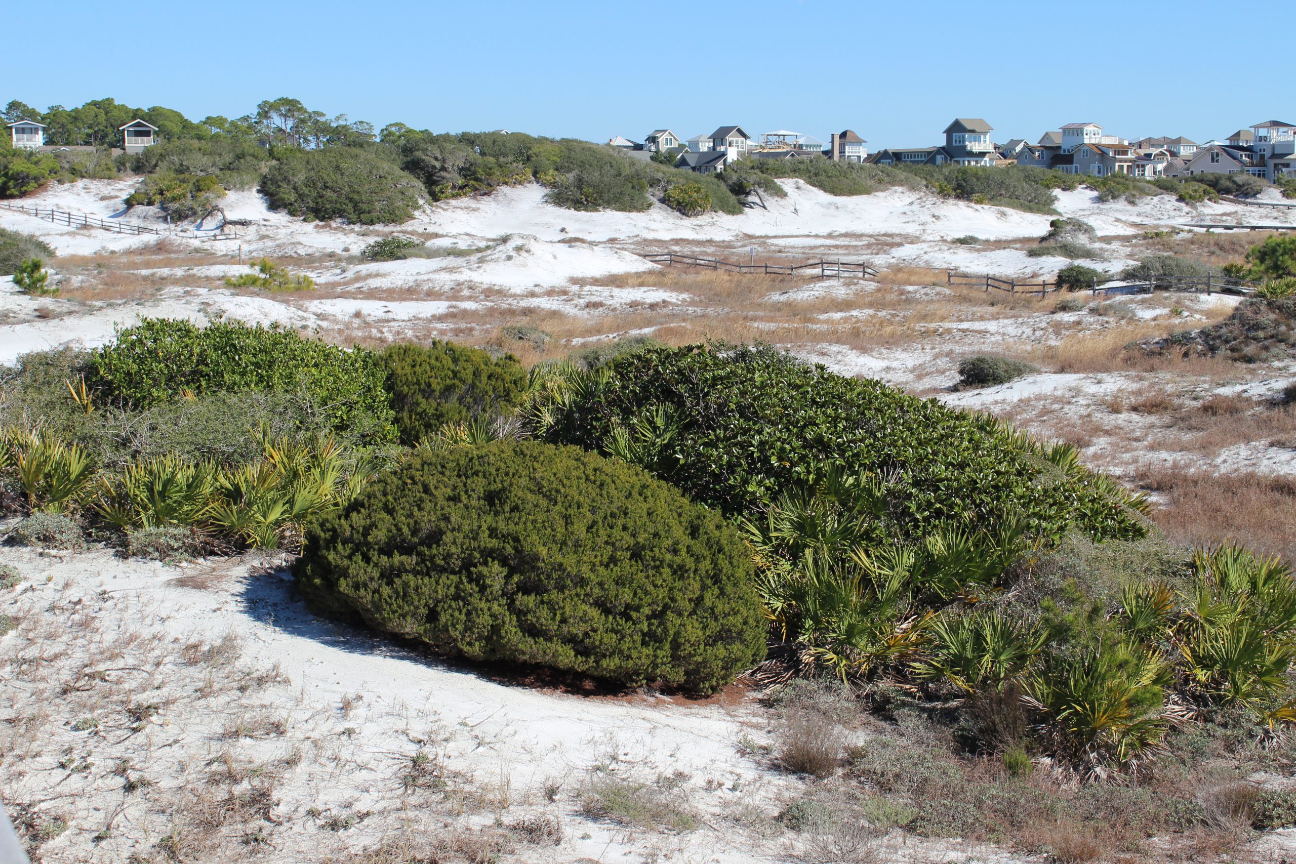
Here smaller shrubs and plants like seaside golden (Solidago sempervirens) and seaside rosemary (Ceratiola ericoides) can grow. With less wind their seeds will germinate and survive. What wind is still there forces the plants to grow in a round shape resembling green sheep on a white field, instead of white sheep on a green field. My professor referred to them as “beach sheep”. This area of the barrier island is called the secondary dune and includes other species such as false rosemary (Conradina canescens), square flower (Odontonychia corymbosa), and sandhill milkweed (Asclepias humistrata). Though they cannot tolerate the high winds as grasses do, they do have to tolerate climatic extremes and low rainfall.
Small round shrubs and brown grasses within the swales are characteristic of the secondary dune field.
Photo: Rick O’Connor
These secondary dunes vary in elevation and can become taller than the primary dunes. In the low areas between dunes are areas where freshwater water can collect and form ephemeral ponds. These areas are known as swales and create unique habitats much sought after by some wildlife. More bog like plants grow here such as water dock (Rumex orbiculatus) and marsh pink (Rhexia nashii) but also includes the carnivorous plants like the sundew (Drosera rotundifolia). There are many insects who used these ephemeral ponds and many spiders and sundews to take advantage of this.
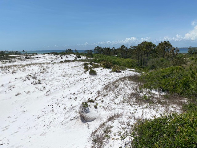
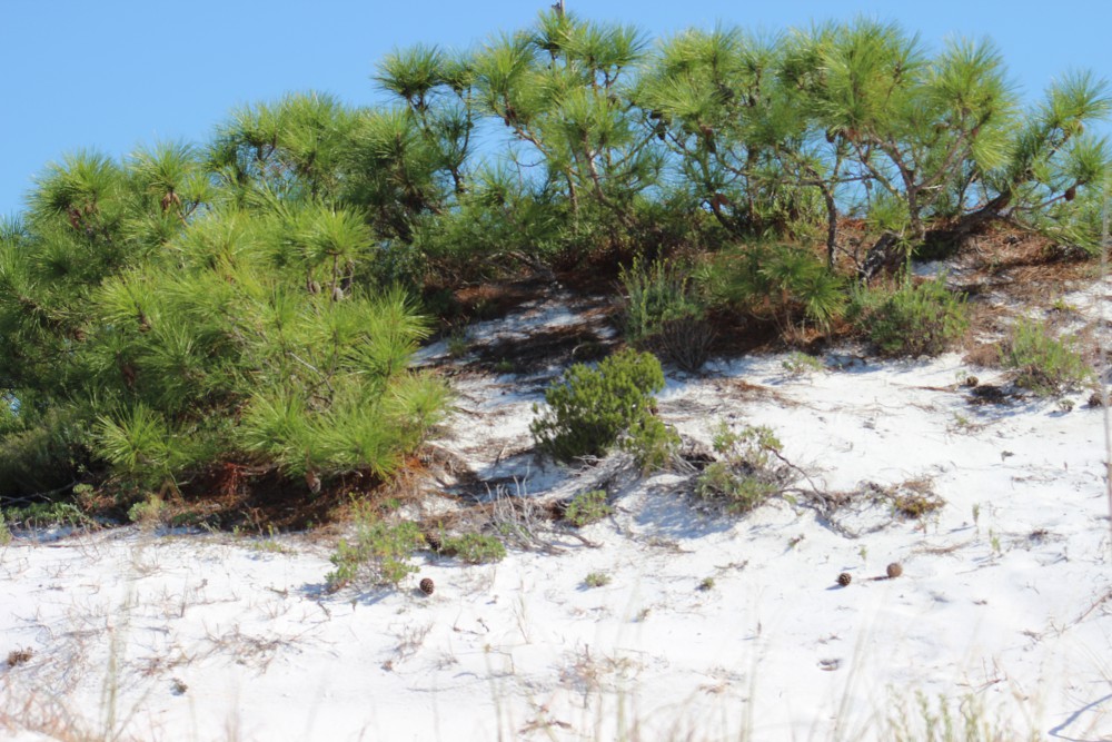
Behind the larger secondary dunes, the wind is even less, and the dune wind breaks higher. Here trees can germinate, if they can tolerate the climatic conditions, and grow. Though the species that grow out there are some of the same you find on the mainland, here they grow differently. Barrier island trees tend grow out, not up, to avoid direct contact with wind and salt spray. And, when they do reach the wind the portion of tree directly facing the wind tends to be stunted in growth, giving it the appearance that someone has “combed” the tree back towards the bay – something they call wind sculpting. Trees that seem do well in what they call the tertiary dune include sand live oak (Quercus geminata), pine (Pinus sp.), and magnolia (Magnolia grandiflora). Yaupon holly (Ilex vomitoria) and even cactus like the prickly pear (Opuntia humifusa) and the devil’s joint (Opuntia pusilla) can be found growing here.
The top of a pine tree within a tertiary dune.
Photo: Molly O’Connor
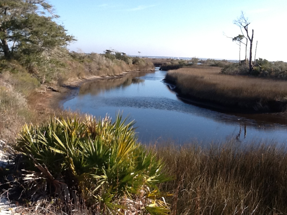
Tertiary dunes are some of the largest on the island, with elevations reaching 50 feet or more. These provide excellent wind breaks from the Gulf and allow the formation of salt marshes along the bay side shoreline. Marshes are habitats dominated by grass, but these grasses must be able to tolerate periods emersed in salt water, at least at high tide. Close to the dunes the marsh is dominated by dense stands of black needlerush (Juncus roemerianus). In some locations within the needlerush marsh are areas of bare sand known as salt pans. These are low areas within the marsh where water remains when the tide recedes. These small marsh ponds begin to evaporate in the intense sunlight and the salinity increases to a level where it kills off much of the plant life leaving an area of bare sand. These salt pans are used by some wildlife on the islands. Eventually you will reach the waters edge where smooth cordgrass (Spartina alterniflora) grows. This marsh grass can tolerate water for longer periods than needlerush and supports both island wildlife and estuarine fisheries.
A finger of a salt marsh on Santa Rosa Island. The water here is saline, particularly during high tide. Photo: Rick O’Connor
As you can imagine, the process of establishing the pioneer community of grasses on a new, small sand bar, to an island filled with dunes and vegetation takes time – years, decades, maybe centuries – but eventually it will reach what we call the climax community and provides a variety of habitats to support wildlife.
In part 3 we will begin to look at how animal species colonize the islands as these habitats form.
There are a lot of cool and interesting creatures that live on the barrier islands of Northwest Florida. The conditions out there require they make changes and adaptations different from what they would do in a more upland or wetland environment. Some creatures are unique to these beach and dune systems and found nowhere else. But to begin this series lets first look at the islands themselves.
The white beaches of the Florida panhandle are primarily quartz. Photo: Rick O’Connor.
The name barrier island comes from the fact that they do serve as a barrier between the open Gulf of Mexico and the mainland of the Florida panhandle, protecting coastal communities from storm surge and waves of the all too frequent hurricanes and tropical storms. They are basically sandbars formed with sands from the Appalachian Mountains. There the wind, rain, and temperature erode the granite rock into its mineral components and wash them downstream. First in the fast-moving mountain streams, then into creeks, into rivers which eventually discharge into the Gulf. The different minerals settle out based on their size, type, and densities. Quartz is one of the less dense and is the dominant mineral forming the coastal barrier islands, making them some of the whitest beaches on the planet.
When these quartz sands reach the Gulf, they encounter longshore currents that are formed from the winds blowing across the open water. In this part of the Gulf of Mexico these currents tend to move from the east to the west in most cases. As the rivers reach the passes that connect the estuaries to the open Gulf and the longshore currents move the sand into long thin spits at the mouth of the bays running parallel to the coastline. In some cases, the sand bars form perpendicular to the coastline, and we call them capes. Initially still connecting to land, many creatures can venture out on these sand spits searching for food. Some of the sand spits are very small and seem to come and go as the winds and waves move them. At times these smaller spits may actually close off the opening into the bay as they once did on Perdido Bay and still do with the Walton County dune lakes. In other cases, the spits accumulate more sand, become long and can eventually break contact with the mainland forming an island.
From the Pensacola Lighthouse you get a great view of the open Gulf and the eastern end of Perdido Key. Here the pass separates Perdido Key (on the left) and Santa Rosa Island. Photo: Molly O’Connor.
At first these islands can be nothing more than sand bars. Barely above sea level, moving and changing very quickly, sometimes disappearing and reappearing in slightly different locations after storms, such as Sand Island off Dauphin Island Alabama. In others they are larger, harder to move quickly and may be vegetated so that movement is slower and the island more established, such as Santa Rosa Island near Pensacola. The creatures on any of these islands will need to be able to adapt to the new conditions. Some will be able to leave and return the mainland when they need or want to. Birds are very common on all forms of barrier islands due to the fact they can fly. In some cases, the distance from the mainland is not a far swim for those who can, such at Indian Pass near St. Vincent Island. In some cases, the distance may not be as close and the currents between very swift during tide changes making crossing more difficult. In these cases, the creatures who find themselves on these islands must adapt to the new conditions or risk losing their populations entirely.
Island conditions can be tough. There is a lot of wind, and this wind carries salt spray. There is little cover from the intense sun during the summer months. Needed freshwater can be hard to find. Some islands will develop freshwater systems, but others will not. And then there is the fact that it is an island. Thus, a finite amount of resources and space for each species, and, at times, fierce competition for those.
In Part 2 we will explore the different habitats that developed on these islands that available for the different wildlife that exploit them.
The wind sculpted plants of the tertiary dunes. Photo: Rick O’Connor.
Most of us have heard of invasive cogongrass (Imperata cylindrica). It arrived in the early part of the of the 20th century near Mobile Alabama and has spread across the lower southeast. It is an aggressive growing grass with serrated leaves and silica imbedded in its tissue. This makes it very undesirable for livestock and a threat to pastureland across the region – though there are reports of wild hogs consuming it. It can also invade timberlands where it burns hot during prescribed fires to a point where it can kill the trees you are trying to manage. It is considered one of America’s worst noxious weeds.
A relatively new patch of cogongrass recently found in Washington County.
Photo Credit: Mark Mauldin
The abundance of this grass across the uplands of the Florida panhandle would indicate that it is far too established for eradication to occur. But what about the barrier islands? Is it a threat there and, if so, can it be eradicated?
I personally have seen the plant growing on Perdido Key in western Escambia County. I know of two locations where it currently resides. One is on public land, the other private, but we have not conducted a proper survey of the distribution on the Key at this point. Something we plan to do in 2023.
I also know it is found along Highway 98 at Gulf Islands Naval Live Oaks near Gulf Breeze in Santa Rosa County. I am not sure how many records the National Park has of the plant, or how widespread it is on the Gulf Breeze peninsula, nor do I know if it is on Santa Rosa Island/Pensacola Beach. Again, surveys are planned for 2023. We obviously need to know this before we can answer the question.
As of Nov 27, 2022 – there are 82,106 records of cogongrass in the U.S. – all are in the lower southeastern portion of the country. There are records as far north as North Carolina and as far west as the LA/TX line. Alabama is completely covered, as is much of the Florida panhandle.
As far as barrier islands, it is found on each of those within the state of Mississippi (10 records total). There are eight records on Dauphin Island AL, 16 on Ft. Morgan peninsula, eight in Gulf Shores AL proper, and nine in the Orange Beach AL area.
In Florida there are five records on Perdido Key proper, 13 more along the north shore of Big Lagoon, 125 along coastal NAS Pensacola, seven at Ft. Pickens on Santa Rosa Island in Escambia County, seven more at Naval Live Oaks in Gulf Breeze, six on Eglin property on Santa Rosa/Okaloosa Island, and 32 on Okaloosa Island between Ft. Walton and Destin. Here the western panhandle islands end. Between Perdido Key, Santa Rosa, and Okaloosa Islands proper – there are 50 records of the grass.
Along the coast between Okaloosa Island and Shell Island in Bay County, there are 44 records. There are no records on Shell Island itself but there are 86 records on Tyndall AFB. There is one record on Cape San Blas in Gulf County, one on St. Vincent Island and another along Highway 98 just west of Apalachicola in Franklin County. The barrier islands between Apalachicola and Bald Point have no records.
Based on this, the islands at the far eastern end of the panhandle should easily be able to eradicate these plants. The islands on the western end have more work to do, but a total of 50 records ON THE ISLANDS should be doable. This, of course, is based on the number of records being accurate, and I am sure they are under reported.
Step 1 – conduct surveys.
As with beach vitex, the first step is to accurately survey our islands to determine how widespread the problem really is, and then develop a management plan to possibly eradicate them.
Step – management
There are currently no known biological controls for this invasive plant.
Repeated disking and deep plowing have been shown to be effective in agricultural lands where it is possible to do. Mowing and/or burning when not in seed AND THEN CHEMICAL treatment has also had success. This should be done in the fall. Mechanical management alone has not been effective.
The chemical active ingredients of choice are glyphosate and/or imazapyr. As mentioned in the beach vitex article, imazapyr has a much longer soil activity and replanting cannot be achieved for several months. Replanting with native plants has been found to help control cogongrass but to do so quickly would require the use of glyphosate. In all studies, one chemical treatment was not enough.
This is a very tough noxious weed and early detection – rapid response (EDRR) is crucial at eradicating this species. We will begin Step 1 in Escambia County this year. If there are groups in other counties interested in doing the same, let us know and we will help where we can (roc1@ufl.edu).
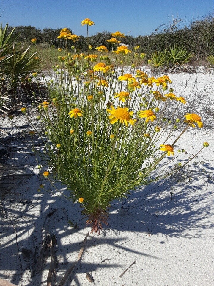
Coastal plain honeycombhead blooms through the summer on local beaches. Photo credit, Bob Pitts, National Park Service
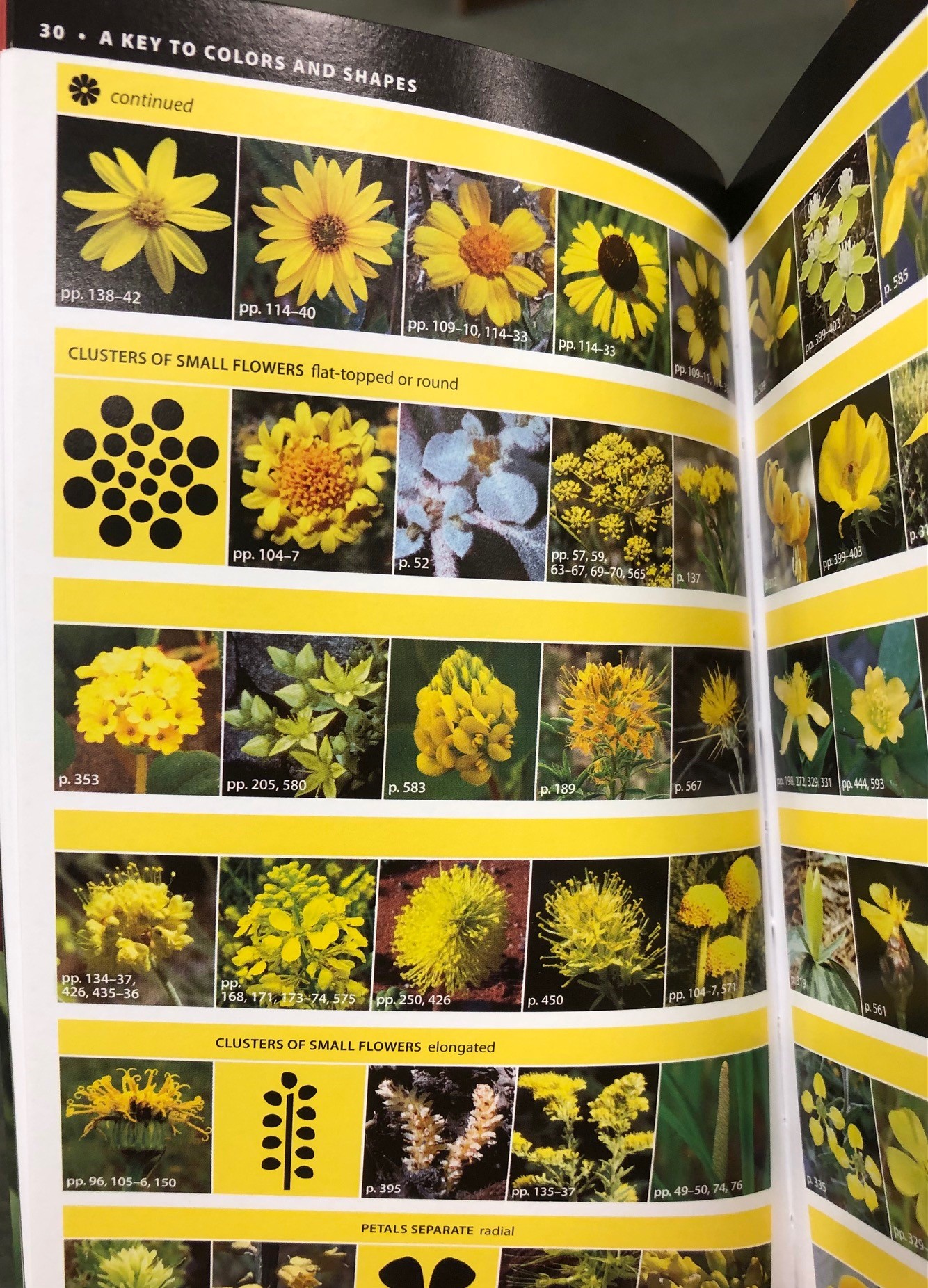
Over my years of leading people on interpretive trail hikes, I have learned it is particularly important to know the names of whatever happens to be in bloom. These flowers are eye-catching, and inevitably someone will ask what they are. In fact, one of my favorite wildflower identification books is categorized not by taxonomy, but by bloom color—with a rainbow of tabs down the edge of the book for easy identification.
Wildflower identification can be tough, but color-coded guidebooks are really helpful! Photo credit: Carrie Stevenson, UF IFAS Extension
In our coastal dunes right now, several plants are showing off vibrant yellow blooms. Seaside goldenrod, coreopsis, and other asters are common. Rarer, and the subject of today’s post, is the Coastal Plain Honeycombhead (Balduina angustifolia). It has bright yellow flowers, but often gets more notice due to its unusual appearance when not in bloom. The basal leaves are bright green and similar in shape and arrangement to a pine cone or bottlebrush (albeit a tiny one), sticking straight up in the sand. The plants are typically found on the more protected back side of primary dunes or further into secondary dunes, a little more inland from the Gulf.
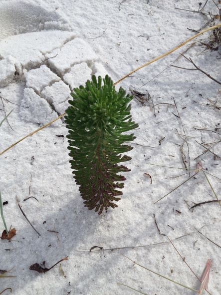
When not in bloom, the plant resembles a green pinecone planted in the sand. Photo credit: Carrie Stevenson, UF IFAS Extension
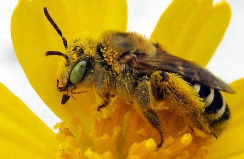
The plant plays a special role in beach ecology, as a host plant for Gulf fritillary butterflies and the Gulf Coast solitary bee (Hesperapis oraria). The bee is a ground-dwelling pollinator insect that forages only in the barrier islands of Mississippi, Alabama, and Florida. The species is currently the subject of a University of Florida study (they’re out at Ft. Pickens right now), as the endemic bee’s sole source of nectar and pollen is the honeycombhead flower. As of publication date, no bee nests have been discovered. Researchers are interested in learning more about the insect’s life cycle and nesting behaviors to better understand and protect its use of local habitats. Based on closely related species, it is believed the Gulf Coast solitary bee builds a multi-chambered nest under the soft sands of the dunes.
Adult female Hesperapis oraria foraging on coastal plain honeycombhead (Balduina angustifolia). Photograph by John Bente, Florida Department of Environmental Protection, Florida Park Service.
While the honeycombhead plant is found in peninsular Florida and coastal Georgia, the bee has been identified only in a 100 km² area between Horn Island, MS, and St. Andrews Bay, FL. Luckily for the bee, large swaths of this land are preserved as part of Gulf Islands National Seashore and several state parks. Nonetheless, these coastal dune habitats are threatened by hurricanes, sea level rise, and development (outside the park boundaries). Due to its rarity and limited habitat, a petition has been submitted to the Fish and Wildlife Service for protection under the Endangered Species Act. 0


 0
0