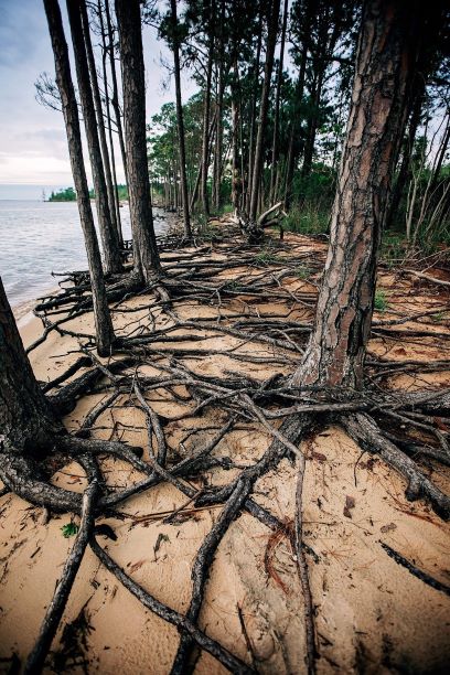
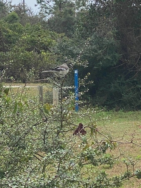
As the name implies, they are haunting—long stretches of standing, dead trees with exposed roots. These “ghost forests” are an unsettling scene in unsettling times for the environment. While coastal erosion is a fact of life—incoming waves, hurricanes, longshore drift of beach sand—the rate of its occurrence is startling lately.
Exposed roots of a ghost forest forming along the Escambia Bay. Photo credit: Deanie Sexton
Global rises in sea level due to increased atmospheric carbon levels mean more saltwater is moving into flat, coastal habitats that once served as a buffer from the open water. Salt is an exceedingly difficult compound for plants to handle, and only a few species have evolved mechanisms for tolerating it. Low-growing salt marshes and thick mangrove stands have always served as “first line of defense” buffers to take in wave action and absorb saltwater. If shorelines have too much wave action for marshes to form, wide stretches of sandy beach and dunes serve the same function, protecting the inland species of shrubs and trees. Many coastal areas are flat and stay at or just above sea level for thousands of yards, or even miles. This means that even a small increase in sea level can send saltwater deep into previously freshwater systems, drowning the marsh and flooding stands of oak and pine. The salt and sulfate in seawater will kill a tree quickly, although it may remain standing, dead, for months or years. Hurricanes and tropical storms exacerbate that damage, scouring out chunks of shoreline and knocking down already-unstable trees.
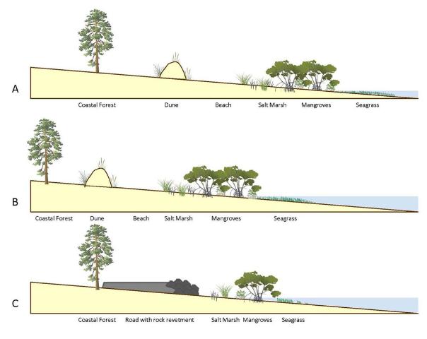
A slow increase in sea level could be tolerated and adapted to as salt marshes move inland and replace non-salt tolerant species. But this process of ecological succession can be interrupted if erosion and increased water levels occur too quickly. And if there is hard infrastructure inland of the marshes (like roads or buildings), the system experiences “coastal squeeze,” winnowing the marsh to a thin, eventually nonexistent ribbon, with no natural protection for that expensive infrastructure.
This diagram outlines the changes in coastal vegetation and shorelines as sea level rises. With “ghost forests,” the sea level moves into that coastal forest section. Figure credit: W. Gray, IAN Image Library
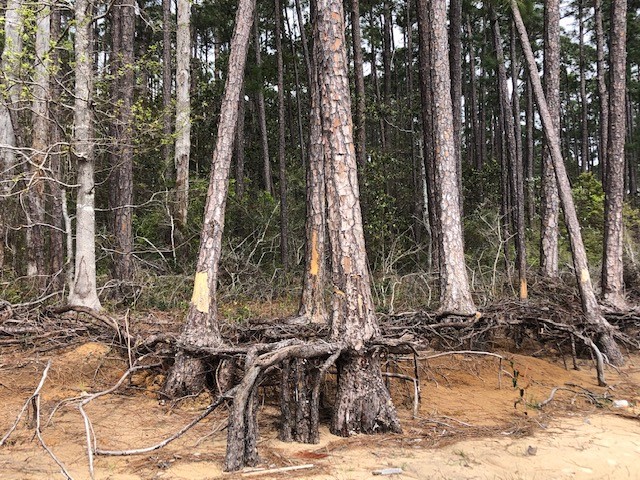
Ghost forests are popping up everywhere. Last year, Popular Mechanics magazine reported on a recently published study that used satellite imagery to document how 11% of a previously healthy forest was converted to standing dead trees along the coast of North Carolina. The trees died within a span of just 35 years (1984-2019). During that time frame, this stretch of coastline also experienced an extended drought and Category 3 Hurricane Irene. These impacts sped up the habitat loss, with over 19,000 hectares converted from forest to marsh and 1100 hectares of marsh vegetation gone, becoming open water.
A ghost forest forming along the shoreline of Blackwater Bay in Santa Rosa County. Photo credit: Carrie Stevenson, UF IFAS Extension
Due to increased coastal flooding and saltwater standing in forested areas, U.S. Fish and Wildlife Service employees are concerned that the historic Harriett Tubman Byway in Maryland—part of the famed underground railroad of the Civil War era—will soon be gone. Over 5,000 acres of tidal marsh have converted to open water in the area and large stands of trees have died. Even locally, trees along Escambia and Blackwater Bay are dying due to salt damage and heavy erosion. Hurricane Sally delivered a knockout punch to many remaining trees along the scenic bluffs of the bay.
Sea level has risen over 10” in the past 100 years in the Pensacola Bay area, and even mid-range Army Corps of Engineers estimates expect 0.6 to 1.4 feet of rise in the area by 2045. There are some actions we can take to mitigate future damage. Building a “living shoreline” of vegetation along a piece of waterfront property instead of using a seawall can help, especially if the vegetation growth outpaces sea level rise. You can also visit the City of Pensacola’s Climate Task Force report to learn more about climate action recommended (and being taken) locally, such as increasing the use of renewable energy and dedicating staff to sustainability measures.
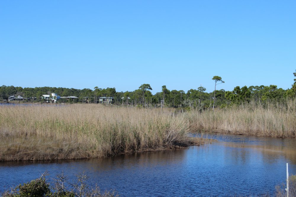
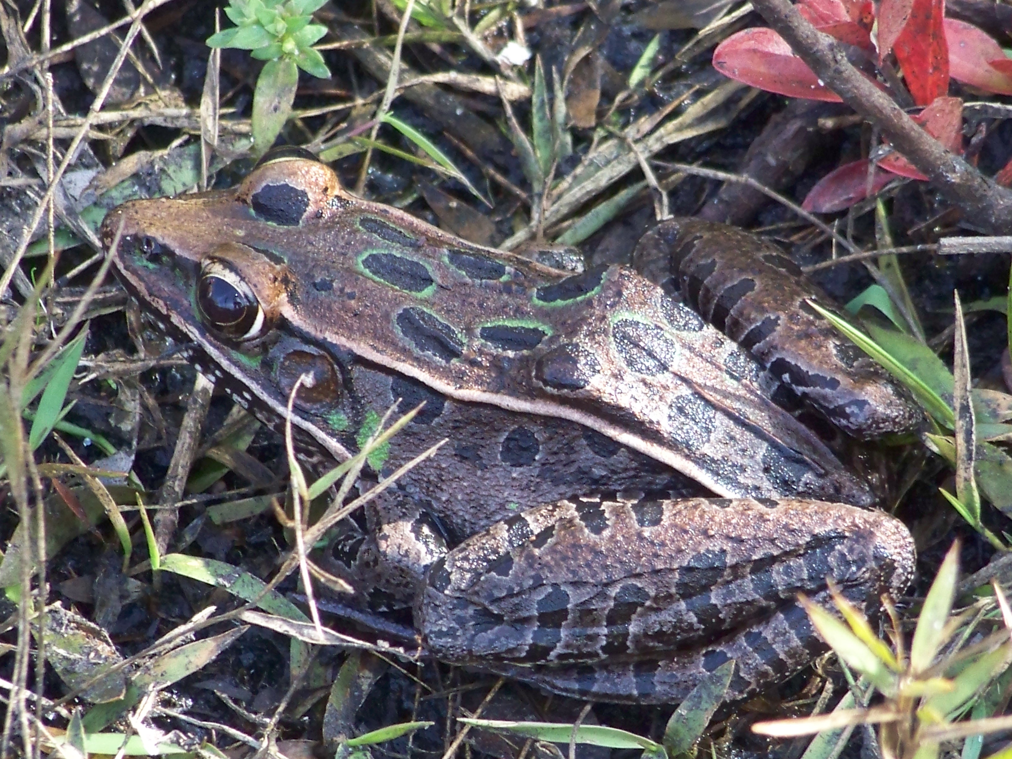
The land of the wet and muddy – that’s what lot of folks call the salt marsh. If you have ever experienced walking through one you know why they call it that. Salt marshes are wetlands that are dominated by grasses and are partially flooded with salt water during high tide; some portions of the marsh are still flooded at low tide. The grasses that grow there are halophytes (salt tolerant). Their diversity is low, but abundance is high.
Salt marshes are wetlands dominated by grass.
Photo: Molly O’Connor
Salt marshes grow on the protected side of the island – the bay side – and even there they do better in protective coves and inlets off of the main shoreline. They are not big fans of high wave energy. The grasses that live there are spaced in zones. Smooth cordgrass (Spartina) is more water and salt tolerant than black needlerush (Juncus) and is found along the marsh edge close to the shore of the bay itself. Black needlerush dominates the upper marsh closer to the maritime forest and tertiary dunes.
If you approach the marsh from the dune/forest side, you will encounter a dense field of needlerush. As you step into it you will experience soupy layers of black mud and detritus. Your feet sink and, if you do not have on secured shoes, you will lose them. You will get the odor of rotten eggs as you walk. This is hydrogen sulfide released by bacteria who are decomposing the leaf litter, and other organic matter, that is trapped and collected with the rising and falling tide. There is not a lot of wildlife in this area. The mud is deep, and the food sources are few. You will notice small white snails on the needlerush blades. These are marsh periwinkles. During high tide they move up the grass blades to avoid predators, at low tide they come down to feed on the organic material on the exposed mud.
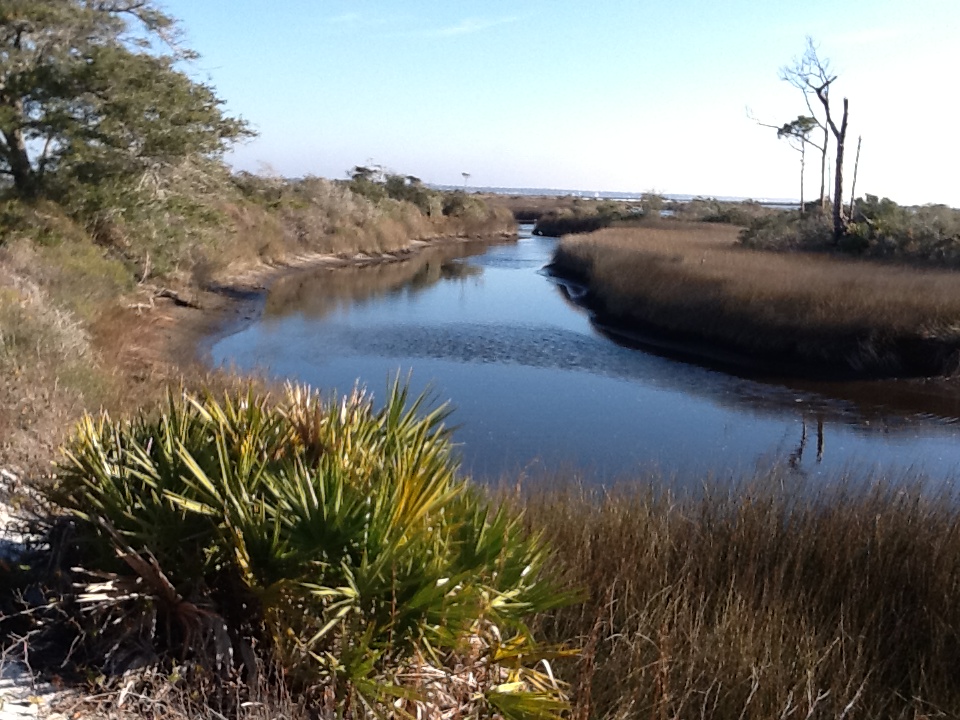
Eventually you find small creeks heading towards the bay. Here the water is murky and the bottom still very muddy. Scattered amongst the needlerush are mounds of high dry ground covered in salt bush (Baccharis) where some animals can move around much better. Raccoons frequently these small “islands” seeking the numerous fish and shellfish that can be found in the creeks. Ribbed mussels can be found attached the base of the needlerush and are a particular favorite of the raccoons. Juvenile blue crabs can be found scavenging food sources in the creeks, juvenile mullet is common, as are small killifish and mollies. These can provide food for wading birds like the great blue heron who has widespread feet that resist sinking in the mud and allow them to hunt. Sometimes oysters and crown conchs are found in the creeks. Oysters do not move and cement to each other forming clumps. They filter feed in the water column collecting organic material and improving the water clarity – unless you walk through and sir up the mud and silt.
A creek within a salt marsh on Santa Rosa Island. The water here is saline, particularly during high tide. Photo: Rick O’Connor
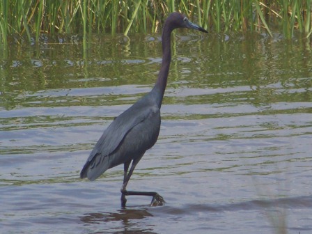
These small creeks become wider and deeper as you approach the bay. In places the bottom becomes sandier, and all of this allows other species to forage. The above mentioned are still present. Oyster clumps become more numerous because they are not covered by the silt of the upper marsh. In the sandier areas flounder can be found feeding on the small fish and shrimp that reside here. This part of the marsh can be an important nursery for many open estuarine species. A variety of shrimp are found here, crabs, and juvenile fish as well. With more sand it is easier for herons to walk and hunt.
This little blue heron is stalking prey in a Gulf coast salt marsh.
Photo: Molly O’Connor
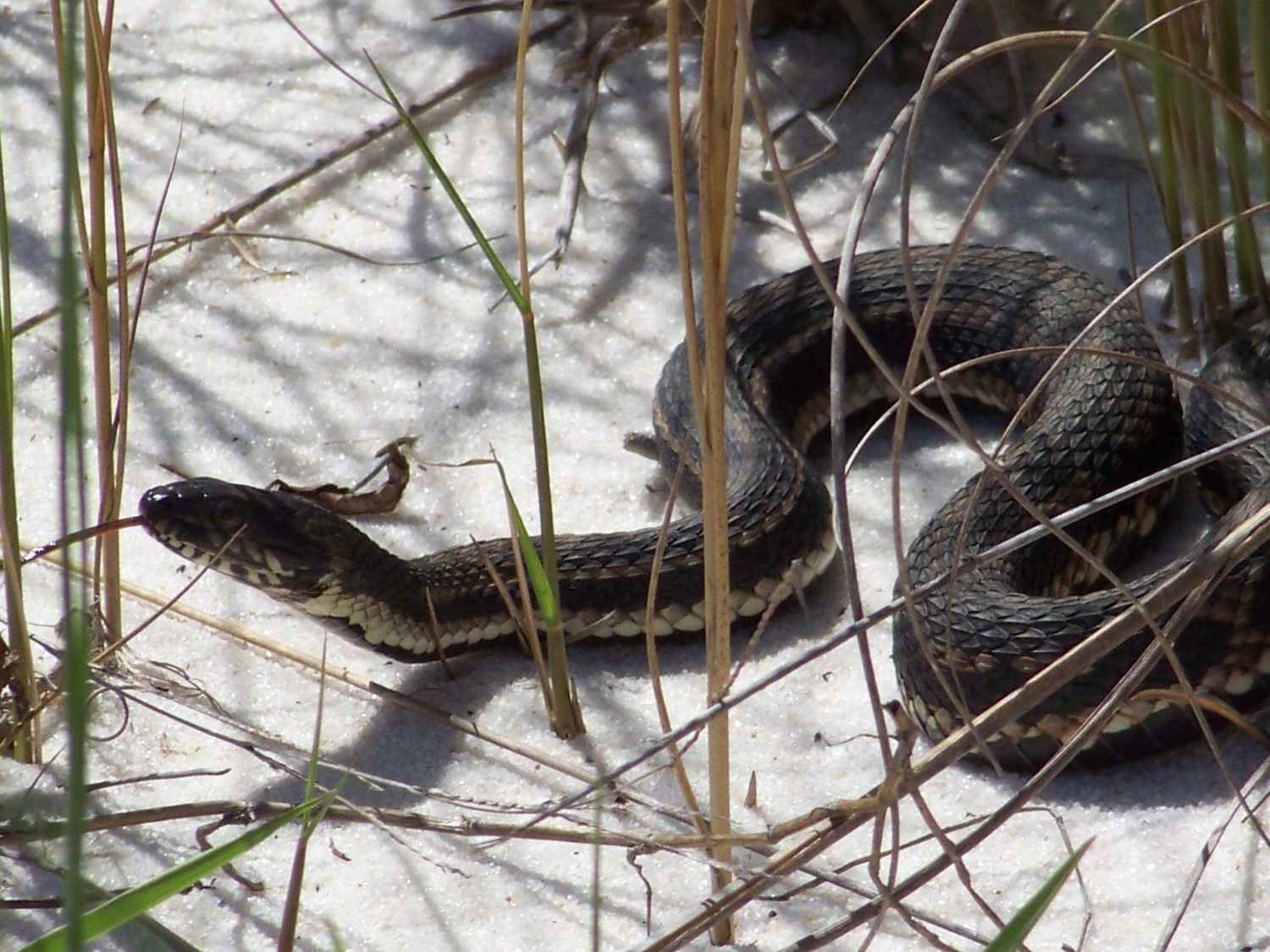
There are also a few reptiles found here. The American alligator can be found at times, but are more common in the open lagoons. The Gulf salt marsh snake (Nerodia) resides here. They are nocturnal and rarely seen. But in the spring when breeding is going on, they can be encountered during daylight hours. These are none venomous snakes.
The nonvenomous Gulf Salt marsh Snake.
Photo: Molly O’Connor
Interestingly the venomous cottonmouth can be found here. This is an interesting story. The cottonmouth is associated with freshwater. It is not surprising, or uncommon, to find them near the freshwater ponds we have discussed already. By they do not have the lachrymal glands found in sea turtles and terrapins that allow them to swallow seawater, excrete the salt through glands in their eyes, and use this as a freshwater source. It appears that the cottonmouth needs freshwater for drinking. Despite this they are being encountered more often in more saline areas. One barrier island near Cedar Key, Seahorse Key, supports a large population of cottonmouths. It has been stated there may be more per square meter there than anywhere in Florida – and there is no source of freshwater. Researchers from the University of Florida have found they drink from pools of freshwater that form after heavy rains and are very opportunistic when it comes to selecting prey – including other cottonmouths. The species found on Seahorse Key is Agkistrodon conanti (Florida Cottonmouth). The eastern cottonmouth (A. piscivorous) is the one most common in and around our freshwater systems. It would be interesting to determine which species is living on our barrier islands, and how they use the landscape. Though I have never seen them swimming in the larger creeks of the marsh, I have seen them basking along its edges many times. I am sure they use this saline environment.
This cottonmouth is basking in a salt marsh on Perdido Key.
Photo: Jen Aicher
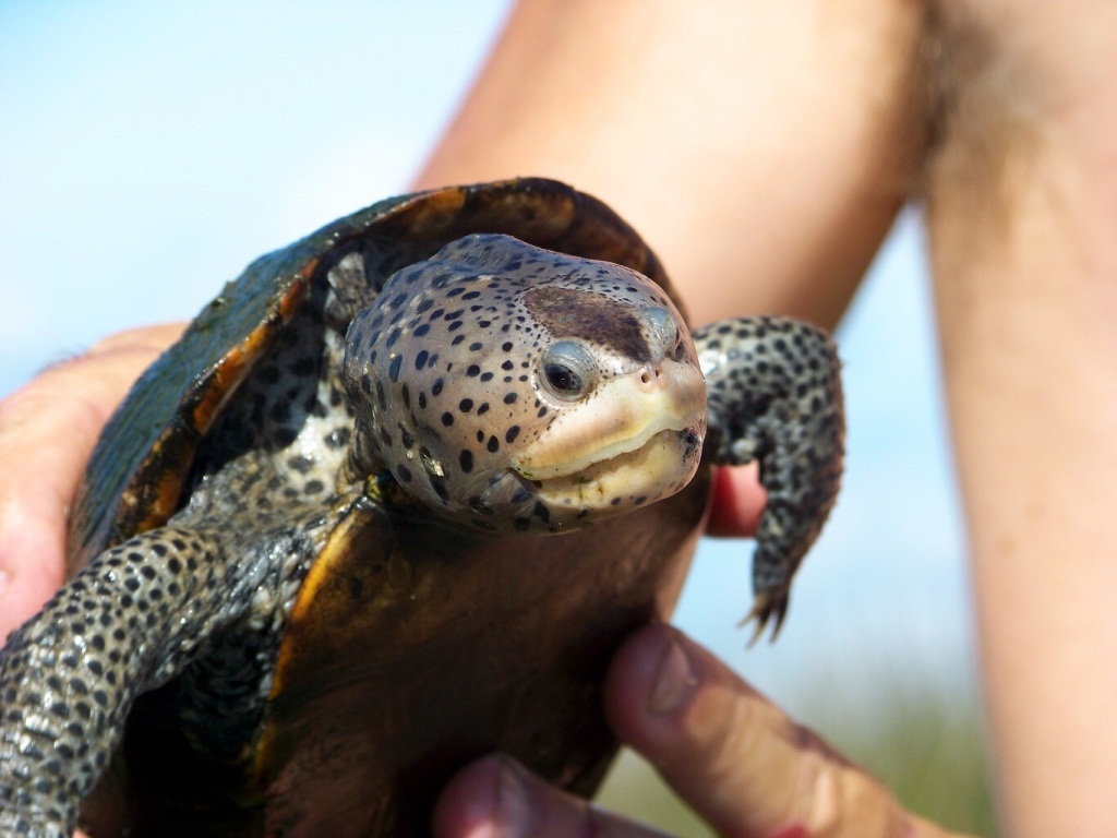
Another unique marsh reptile is the turtle known as the diamondback terrapin. This is the only resident estuarine turtle in the United States. They are related to the freshwater pond turtles people frequently see but prefer the more saline marshes of these islands. They feed primarily on shellfish and have a preference for the marsh periwinkle snails that climb the grass blades.
River otters have been found swimming in these large creeks searching for food. They seem to like both fish and shellfish. Redfish can be found in the wider deeper creeks. The mullet and flounder found here are larger.
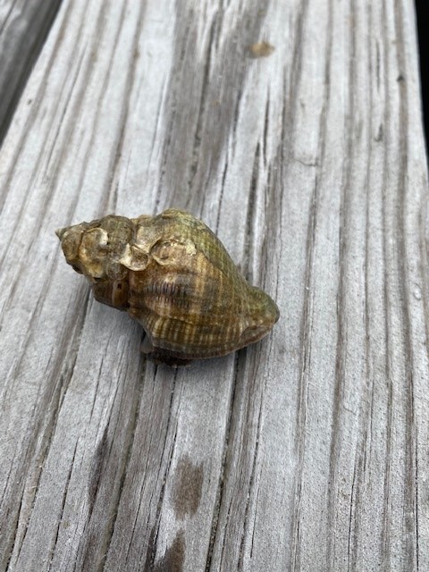
Hermit crabs are abundant here. These are crabs whose abdomens are not covered by shell. So, they must seek abandoned mollusk snails to “hide their rears”. They will select any shell but seem to prefer oyster drill and moon snail shells – possibly because they are more abundant. Oyster drills are snails who use their serrated tooth (a radula) for “drilling” into oyster and consuming them. Crown conchs and ribbed mussels are abundant here.
The shell of the oyster drill.
Photo: Rick O’Connor
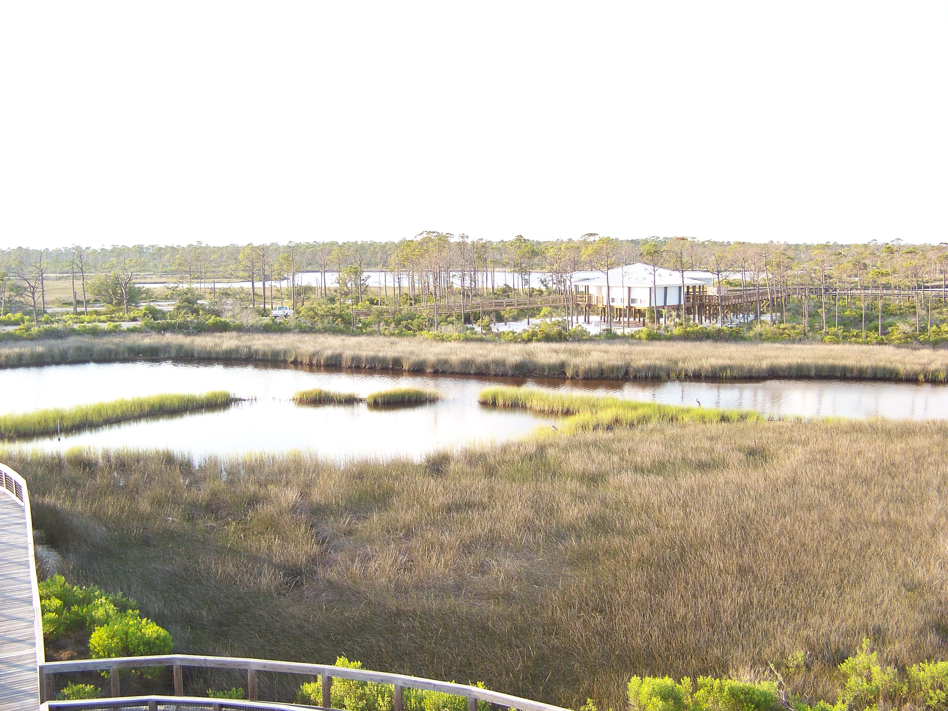
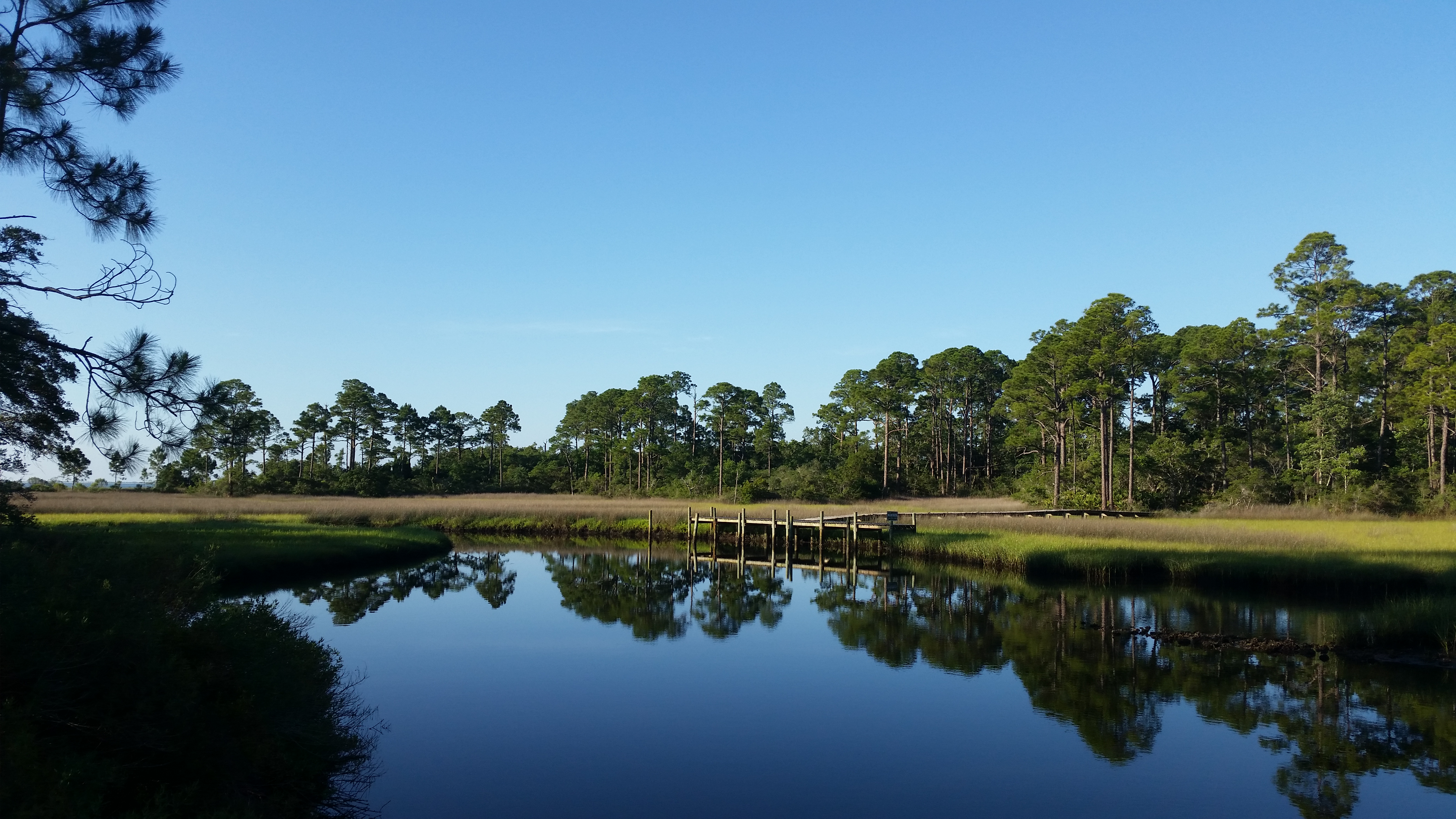
These larger creeks sometimes feed directly into the bay, but sometimes they feed into a large open lagoon. These lagoons are full of fish. Mullet, redfish, flounder, stingrays, pinfish, and – if deep enough – even small sharks can be found here. Wading birds, like herons and egrets, and common along the shorelines and diving birds, like osprey and pelicans, are found here. The shoreline near the grasses still has small juvenile fish. The sandy beaches can support the hunting of raccoons and armadillo tracks are common. The alligator encounters I have had are more common here and we often see the heads of terrapins. The river otters I have seen here are usually along the edges.
The open lagoon of the salt marsh. Photo credit: Erik Lovestrand, UF IFAS
Another unique marsh critter is the fiddler crab. Though found throughout the marsh, they seem to be more abundant where there is more sand. Related to the ghost crab of the Gulf side, these small crabs dig burrows down to the water table. When the tide is high, they plug their burrows with mud and sand, then wait. When low tide arrives they emerge in the thousands to scavenge the shoreline for organic material in the sand – forming these round balls of sand as they are cleaning it that I call “coco-puffs”.
All large creeks and lagoons are connected to the open bays of the northern Gulf of Mexico where seagrass meadows form. As you walk the north shores of panhandle barrier islands you find sandy beaches often loosely covered by a variety of grasses. Walking inland you again return to either the tertiary dunes or maritime forest and may be another salt marsh. You have now experienced the primary habitats, and wildlife found within, on our barrier islands. But there are new concerns that could alter the ecology of these systems. One of those are invasive species. We will discuss this one in Part 8.
For some the forest is a scary place; for some it is a magical one; and for others it is spiritual. For wildlife it is a popular place. There are many places to shelter and plenty of food. Though the forest of our barrier islands is not as dense and dark as those of the west coast of the United States or the mountains of Appalachia, it is very wooded provides the same needs. Much of the wildlife on our islands call this part home. Even if they forge in the dunes, or on the beach, it is the forest where they reside.
Forest do exist on barrier islands and provide excellent habitat for a variety of wildlife.
Photo: Rick O’Connor
I have hiked through many of these maritime forests. The northern terminus of the Florida Trail ends at the edge of a maritime forest on Santa Rosa Island. They are populated by many of the same species of trees you would find in inland forest. Pine, Oak, and Magnolia are all common. In some locations they short and twist their branches in all sorts of patterns to avoid direct exposure to the salt spray from the Gulf. Those more protected from the spray by large dune fields grow quite tall. Small rolling dunes of quartz sand can still be found on the forest floor, as can palms and palmettos, holly trees, and species of shrubs found in the dune fields themselves. All of these provide good shelter, and some provide food. And, as with the American southwest, these xeric conditions support cactus – there are plenty of cactus in the tertiary dunes and maritime forest of our islands. Covered toed shows are recommended when hiking here.
Due to wind and salt spray many of the trees on barrier islands grow in interesting twists and bends.
Photo: Rick O’Connor
Though not common, within these forest there are small ponds of freshwater. Back in the 1950s there was an attempt to build a pompano hatchery within the forest of Santa Rosa Island. It failed because the water they chose to use (groundwater) was fresher than they thought it would be. Visiting the site today you will find the grow out ponds the farmers dug, full of freshwater. Near Ft. Pickens, on the west end of Santa Rosa Island, there are moats the soldiers dug to protect the fort from attack. These too are filled with freshwater. Between these and the naturally occurring ones, there is habitat for fish. The few samples I have collected over the years have yielded live bearers, like mosquitofish and mollies, and as well members of the killifish family. There could be others, but I have not explored this enough.
This holding pond was dug to grow pompano in an attempt to farm them at the beach. They provide habitat for both fish and wildlife on the islands.
Photo: Rick O’Connor
It is also good habitat to support frogs. I have seen southern leopard frogs and southern toads, and have heard spring peepers on the islands, but I have not conducted formal surveys to determine what other species might exist. There are inland species that do well in dry sandy soils, and you would think would do well on barrier islands if they could reach them. Maybe some have, again – we need to conduct a good survey. I am not aware of any salamanders on these islands, but again I have not looked for them.
The leopard frog are found on barrier islands.
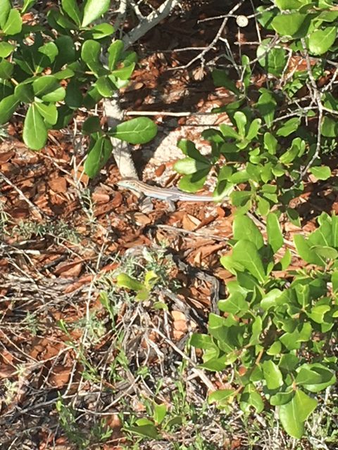
This is the realm of the reptile. As with the deserts of the American southwest, reptiles do very well in dry xeric conditions. Snakes and lizards seem to be the most abundant. Six lined racerunners are quite common, as are other species of skinks (if you look for them in hiding places). The horned toad was once common in all sandy environments in Pensacola, but then were only found on the barrier islands, and now are hard to find there. They are reported to still be found on Santa Rosa Island though I have not seen one in years. One of my colleagues recently saw one on Perdido Key – so, they are still around.
Six lined skinks are island lizards well adapted for the hot conditions out there.
Photo: Rick O’Connor
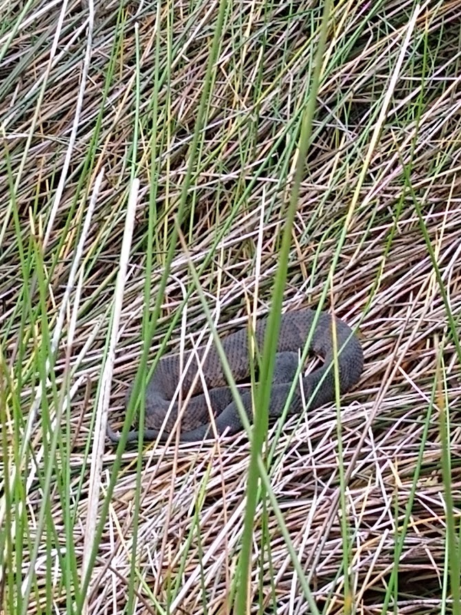
With snakes, the southern black racers and their close cousins the eastern coachwhip are very common here. I have found garter and ribbon snakes. I have seen the rough green snake in the maritime forest, usually in the branches. I have found both the cottonmouth and the banded water snake near the freshwater ponds. The denser forested areas have a lot of leaf litter on the floor that could support the eastern coral snake. Though I have never seen one on the islands, they could be – they are very secretive. One of the more common snakes – found in all habitats of the barrier island – is the eastern rattlesnake. Encounters with impressive creature is rare. Most of mine have been near the campgrounds and after hurricanes when the National Seashore was closed. When FIRST opened to the public, you see them, then they just disappear.
The eastern diamondback rattlesnake is a classic serpent found in xeric habitats like barrier islands and deserts. They can be found in all habitats on barrier islands.
Photo: Bob Pitts
Alligators are known to haunt the freshwater ponds; I have seen them near the old pompano hatchery. I have seen photographs of them crossing the island, swimming across the intracoastal waterway, and even swimming in the Gulf! But sightings and encounters on our end of the panhandle are rare.
Though not in the maritime forest, these tracks show that the American alligator is a resident of many of our barrier islands.
Photo: Caroline Harper
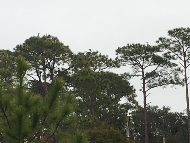
Birds have no problem reaching barrier islands and they love forested areas. There are numerous species of songbirds (passerines). I have seen cardinals, blue jays, mockingbirds, and more. Many of the ones you find just across the intracoastal can be found here. Mourning doves are quite common in all habitats. The forested areas are where you encounter the raptors. I have seen osprey, bald eagles, and great horned owls all nesting here. Within the pines of the forest, you often see the great blue herons nesting. There are other occasional aquatic birds visiting the ponds, including ducks. Duck hunting still happens in the winter on some islands. These barrier islands are popular places to conduct the Audubon Christmas Bird Counts.
If look closely, there are blue herons in the tops of these maritime pine trees.
Photo: Rick O’Connor
And there are plenty of mammals. Though more crepuscular or nocturnal, you often find their tracks in the sand in the morning, and occasional see them. Raccoons and armadillos are abundant, not only in the forested areas, but all island habitats. Skunks were once very common in the maritime forest. I remember days camping at Ft. Pickens when they would approach you eating lunch knowing you were going to leave you food and move away! We encountered them frequently while hiking and saw them inside some of the fortifications. Then… in 2004… Hurricane Ivan rolled over Santa Rosa Island. A study conducted by LSU suggested the entire west end of the island may have rolled over 300 feet north that night. Since then, I have not seen a skunk. They may still be out there, but I have not seen one.
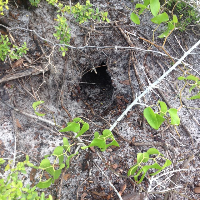
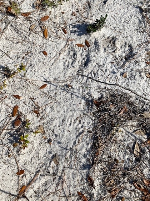
The round entrance of this burrow indicates that is the home of a mammal. most likely an armadillo, but there are others who burrow.
Photo: Rick O’Connor
In recent years there have been more encounters with river otters. They may have always been there but recently more tracks, and more encounters with live animals have occurred. There are squirrels and mice, out there. I have seen deer, fox, and coyotes on the islands. I have heard there are black bears. I have never seen one, nor their tracks, but know they have been encountered a lot recently in coastal Santa Rosa County and also know they are good swimmers. So, these reports could be true. I have looked for bats at dusk and have not seen them, but I am sure they are around. Especially near the forts and old live oak trees.
This is a ‘slide” made by otters using one of the old fish hatchery ponds. Otters are being seen more often by folks visiting the islands.
Time in these maritime forest will yield a lot of wildlife encounters. This is most likely the most diverse location on these islands. I would encourage you to dawn some good hiking boots (waterproof if you can), long pants (the green briar and cactus can be bad), a pair of binoculars, sun protection and water, and explore these amazing forests. Many of them within our state and national parks provide trails for easier access.
We have once last habitat to explore – and that would be the salt marsh. This will be Part 7.
The author exploring the maritime forest of Santa Rosa Island.
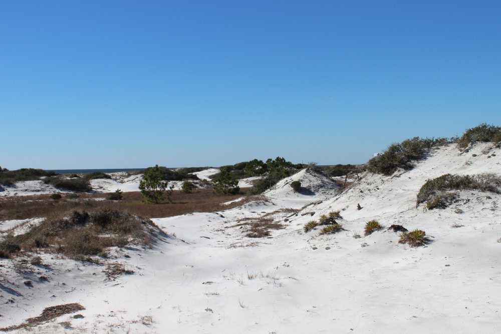
The dune fields of the panhandle barrier islands closely mimic those in the deserts of the American southwest. With rolling hills of sand (less the rock), small, spaced shrubs, and high temperatures, hiking through the dunes reminds me a lot of hiking the deserts and canyonlands out west. Oh… and you rarely see wildlife in both habitats.
There are many forms of wildlife that are very hard to find in our area. But we continue to look.
Photo: Rick O’Connor
It’s not that wildlife is not present, its just not visible – and this would be true for both habitats. These systems are more open, easier to spot predator and prey, and the temperatures can be extreme. Because of this the animals who reside here are more active at other times of the day and we are made aware of their presence by tracks or scat.
The deserts of the American southwest are ecologically very similar to the dunes of barrier islands.
Photo: Rick O’Connor
In winter the temperatures in the dunes can get quite cold. Being in the eastern United States, and closer to the warm Gulf Stream, the atmosphere is more humid and cold temperatures can feel even colder – the “wet chill” everyone talks about. Add to this the winds from the north and it can be an unpleasant place to be out and about. Many plants have gone dormant not producing flowers or seed, and the leaves falling or shriveled and brown, and you have very little for the herbivores to feed on. When conditions get like this animals have basically two options. One, hunker down, hibernate, wait for conditions and food sources to improve. Two, leave – head south where conditions are more favorable. Either way, you do not see them.
A hike in winter finds little wildlife moving about. Birds are common. Many have flown south from harsher conditions further north and seem to enjoy being out. Unless it is unseasonably cold and windy, you can find a variety of passerines (songbirds) in the shrubs and bushes of the dunes. Mockingbirds, cardinals, and mourning doves are often seen. There are also unique species more common up north. Christmas time is a popular time for the Audubon Society to conduct their annual bird counts. Many volunteers often log species rarely seen during other times of the year.
Mockingbirds are a common passerine bird found on barrier islands. Photo: Rick O’Connor
Mammals and reptiles are not often seen during the daylight hours. Some reptiles may come out of hiding on days when the sun is bright, and the winds are low. They will find a windbreak near a dune and bask in this sunlight for a few hours. But to see them it is one of those “being in the right place and the right time”. Daytime is short this time of year and they are not out very long.
Mammals being endothermic can move around. They are still not frequently seen during the daylight hours because the habitat is too open and hunting not as successful. There are also a lot of humans on our islands now and many mammals are not fond of this and tend to avoid us. So, they change their pattern of activity to other times. Animals who are active during the daytime are called diurnal. Those more active at night are nocturnal. And those more active at dawn and dusk are called crepuscular. During the winter many mammals tend to be more crepuscular because the evenings can get quite cold no matter what the wind is doing. If they are not hibernating, they will hunt for a few hours at dawn or dusk and then hide during the colder parts of the evenings.
During my winter hikes I have seen primarily passerine birds, and occasionally an armadillo. But most sign of wildlife are the tracks of raccoons, coyote, and deer.
Raccoons are common all over the island.
In the spring things change. The earth is tilting more towards the sun, the days become longer, and the cold air masses are met by the more tropical warmer ones. Temperatures and rainfall increases. These warmer temperatures are more inviting to daytime foraging for prey. Ephemeral ponds form due to the increase rainfall. Island amphibians take advantage of this mating and laying their non-cledoic eggs in these ponds while they are still there. The warmer evenings are filled the calls of male frogs seeking females. Mammals are still more crepuscular and nocturnal, but it is a time when your chances of spotting one during the daylight hours increases. Not only is the weather better but the food sources are as well, and some have been hibernating for a couple of months and are quite hungry. Hunger will push them to be more active during daylight than they would otherwise be. The same can be said for reptiles. Snakes moving during daylight is more common this time of year.
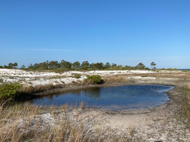
Freshwater ephemeral pond.
This is also the time for mating. It will be warm for several more months and this is the best time to raise a small offspring. The temperatures are warmer (conducive to growth), food more abundant (needed for growth), and you avoid the colder temperatures that can kill small animals. Males of these species are out and about seeking females and defending territories. Nesting birds of several varieties can be found building such nests. Turtles and snakes are breeding and seeking good locations to lay their eggs. With all of this comes more activity and more encounters by human hikers.
Let’s not forget the insects. Actually, you can find these creatures at all times of the day in all seasons. Insects are one of the most resilient groups of animals on the planet, and their high diversity – even on barrier islands – supports this. In the spring when the rains come and the ephemeral ponds are available, insects begin to breed and fill the skies. Spring is a very active time in the dunes.
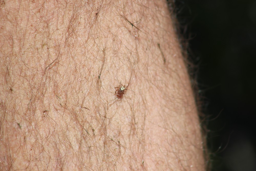
This tick was a hitchhiker on our trip through the dunes.
Photo: Molly O’Connor
Summer brings the heat – particularly late summer. Like the deserts of the southwest, temperatures can rise above 100°F and it is not the best time to be out and about. Much of the wildlife becomes more crepuscular or nocturnal. I have noticed when doing snake surveys, that the snakes may be moving at dawn but by 8:00-9:00am, when you begin to feel the heat of the day, you find no more. They have moved to the shade or a burrow somewhere. BUT the lizards begin to move. Lizards are a popular food for snakes, and it makes sense they would be more active when snakes are not. However, the sand is hot, and birds are also predators. So, lizards, like the six lined skink (Aspidoscelis), move VERY fast across the hot sand from one bush to another. I even notice the passerine birds becoming less common as the heat increases – it is hot out there. Interestingly human activity seems to increase when the temperatures are at their highest. We tend to sleep later than most animals this time of year.
This straight line the sign of a tail drag by a lizard, most likely the six-lined skink.
The fall brings some relief from the heat. As the earth begins to tilt away from the sun and the days become shorter, the temperatures begin to drop, and it is more comfortable coming out during daylight hours. Humans are still around so many will still avoid daylight but it also a time to prepare for winter. Seeking food resources and eating as much as possible is the rule for many. For some it is also a time for breeding. Carrying for offspring in a den or burrow over winter is an option for some species. Because of this they are out seeking mates and may be seen during daylight hours when doing so. This would include some of the snakes like the eastern diamondback rattle snake (Crotalus) and the cottonmouth (Agkistrodon).
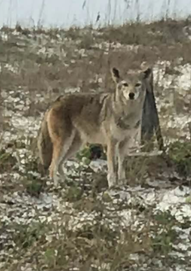
Coyote seen on Pensacola Beach.
Photo: Kristen Marks
Though dunes seem void of wildlife there are actually many species that reside here and even more than transient there from other parts of the island. Hikes through the dunes can bring magnificent sunrises and sunsets, just as you see in the deserts out west, and – if you are there at the right time and not moving too much – some really neat wildlife encounters can occur. But further back on the island exist the maritime forest. Here there are more creatures and more encounters. This will be the focus of Part 6.
The open sandy beach is one of the hardest habitats to live in on a barrier island. There is no where to hide and almost nothing to eat. Add to this the direct wind and waves from the Gulf of Mexico and you have a barren landscape with continuous climate and ocean energy. But creatures do live here.
The beach is void of plant life and takes a well adapted animal to reside here.
Phot: Rick O’Connor
Before we go further let’s define a few terms. The beach is actually the dry sandy portion of this environment. The area where the sand squeaks as you walk through it, the place where you set your chairs, umbrellas, and lunch for your day at the beach. The berm is the harder packed sand near the waters edge. The place where you like walk when you walk the beach (it’s easier) and the waves wash over every few seconds. Living in these two would be very different. Second, we will define resident and transient. A resident is a creature who actually resides there. A transient is just passing through but lives somewhere else.
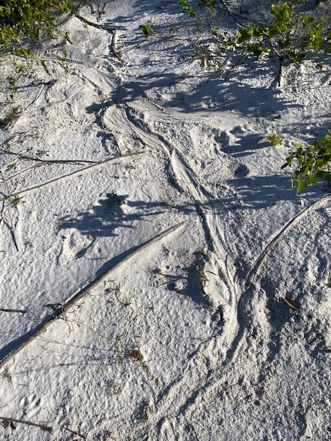
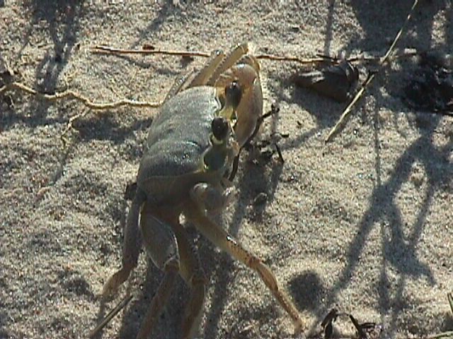
As you look across the beach you will notice there is NO WHERE to hide from the elements… except beneath the sand. One of the more common creatures who lives beneath the is the ghost crab (Ocypode quadrata). This crustacean digs burrows down to the water table where they can keep their gills wet and this can be as deep as four feet. On these flat beaches they are easy target for predators. They have several ways to deal with the problem. (1) Their compound eyes are on stalks above their head to give them a wider, and longer, range of view. (2) They are white in color and blend in with the quartz sand well. (3) They are more active at night, nocturnal. (4) They are very fast.
The trick to speed is to break contact with the ground. If you were to ask someone “what is the fastest way to get to Los Angeles?” They would answer “flying”, and this would be correct. Birds are some of the fastest creatures around. They fly. They lift off the ground and do not touch again until they reach their destination. It does not get any better than that. Cheetahs are very fast as well. But if you watch them in slow motion, you will see they are basically leaping from one point to the next. They touch the ground very few times over a certain distance. They are trying to fly but cannot. If look at video of a human, or centipede, or slug. Not sot good. Crabs are crustaceans and by definition they have 10 legs. When they move across the surface, they usually use eight of those (two being their claws). The same is true for the ghost crabs. But when they decide to run, they only run on three of them. They raise the other five above their heads. This means fewer legs touching the sand which means they are faster.
The common ghost crab. Photo: Virginia Institute of Marine Sciences
Food is another issue. Due to direct high wind (filled with salt), plants do not grow on the beach. Hence the classic food chain (plant – herbivore – carnivore) cannot exist. So, what do ghost crabs eat? They are scavengers. They emerge from their burrows, usually at night, to seek what dead creatures the tide may have washed in. Post storms are particularly good feeding times. Surf fishermen along the Gulf beach often catch hardhead catfish and, not liking them, often toss them on the beach to die. In the evening the ghost crabs will drag these to the entrance of their burrows where they feast for quite a while. They eventually clean to fish to the bone leaving their “hard head” (the skull). When you look at the skull from underneath it appears to be Jesus on the crucifix. These skulls are often collected and sold in novelty stores as “crucifix fish”.
The bones in the skull of the hardhead catfish resemble the crucifixion of Christ and are sold as “crucifix fish”.
Photo: Rick O’Connor
Another prize for ghost crabs are sea turtle eggs. Sea turtles are obvious transients to the beach environment, coming here only during nesting season. The females usually approach the beach close to where they were born at night. She will labor her way across the beach to the first dune line, though some will lay theirs in the open beach area. She could spend several hours digging a hole three to five feet deep. Loggerhead Sea Turtles (the most common on our beaches) simply dig a hole. The Green Sea Turtle will use her flippers to dig a form for her body before digging the nest. She will deposit about 100 eggs before burying them and returning to the Gulf. Ghost crabs, and other beach transients like coyotes, fox, and raccoons, will find and raid these nests.
Tracks left by a nesting Green Sea Turtle. Courtesy of Gulf Islands National Seashore.
The wrack (a line of debris that includes seaweed, shells, and other flotsam from the Gulf) offers a variety of food for ghost crabs. Another who is often found scavenging the wrack are shore birds. There are numerous species of terns, gulls, pipers, and plovers that will pick through the wrack for food.
The berm is a tougher place to make home. You are in the surf zone and must deal with breaking waves every few seconds. As you might expect, there are no plants here, and very few animals. Those that do reside here bury in the sand knowing that the surf will most likely expose them and could carry them to another location. The two most common animals in this zone are the mole crab and the coquina.
The mole crab is often called a “sand flea”.
Photo: Rick O’Connor
The mole crab (Emerita talpoida) is also known by surf fishermen as the “sand flea”. It is a small oval shaped crab that has a hard paddle like telson to dig into the wet sand tail first. With its head exposed it will extend antenna that are covered with small hair-like structures designed to collect plankton from the water that covers it when the waves come in. The surf often exposes them, but they flip over and dig back in very quickly.
The coquina (Donax variabilis) is a small clam that comes in a variety of colors (hence it’s species name). Like all clams, it has a fleshy foot which it uses to quickly dig into the wet sand covering most of its body. Like the mole crab, it exposes its head into the surf extending two fleshy tubes called siphons that draw water into the clam where it can collect planktonic food.
Coquina are a common burrowing clam found along our beaches.
Photo: Flickr
Predators do exist here, but they are not residents. They would include transient fish that come close to shore waiting for the surf to wash these small animals into the Gulf. One of the more common is the Florida Pompano. Surf fishermen like to use “sand flea” baskets, dragging them through the sand near the waters edge to capture the mole crabs for bait seeking these tasty fish. Others would include an assortment of shorebirds like sand pipers and plovers who run to the wet sand when the surf recedes back into the Gulf probing for the mole crabs and coquina, then quickly running back towards the beach when the surf returns.
A variety of shorebirds utilize the wrack. Photo: Rick O’Connor
The diversity of life in the beach-berm zone is not high, but this is a tough place to make a living. Ghost crabs, mole crabs, and coquina clams have all adapted to living here and have done quite well. But more wildlife prefers the dunes. It is a little easier there and the next stop in Part 5 of this series.
The habitats of a barrier island are defined and driven by the plant communities there. Seeds from the mainland must first reach the new island and they can do so using a variety of different methods. Some come by wind, some by water, some by birds and other wildlife. Some of these germinate, some do not. Those that do, do so on a sandy island with little or no relief and must deal with the winds off the Gulf, which has salt spray. Many of these mainland plants cannot tolerate this and never make it. But some can… and do.
The dune fields of panhandle barrier islands are awesome – so reaching over 50 ft. in height. This one is near the Big Sabine hike (notice white PVC markers).
These early plant communities are known as the pioneer community – meaning the earliest settlers. In the process of succession pioneer communities are made of creatures that can tolerate the harshest conditions, the early days of ecosystem development. There are usually few nutrients, extreme climatic conditions, and for the animals, few prey to select from. But these pioneers are adapted to survive in these conditions and over time alter the conditions so that other creatures can move in.
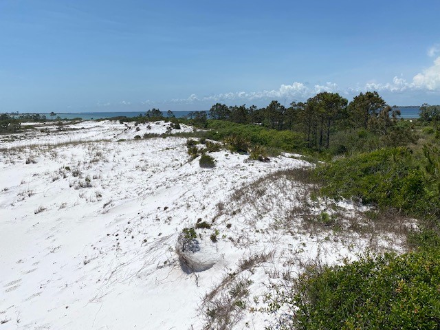
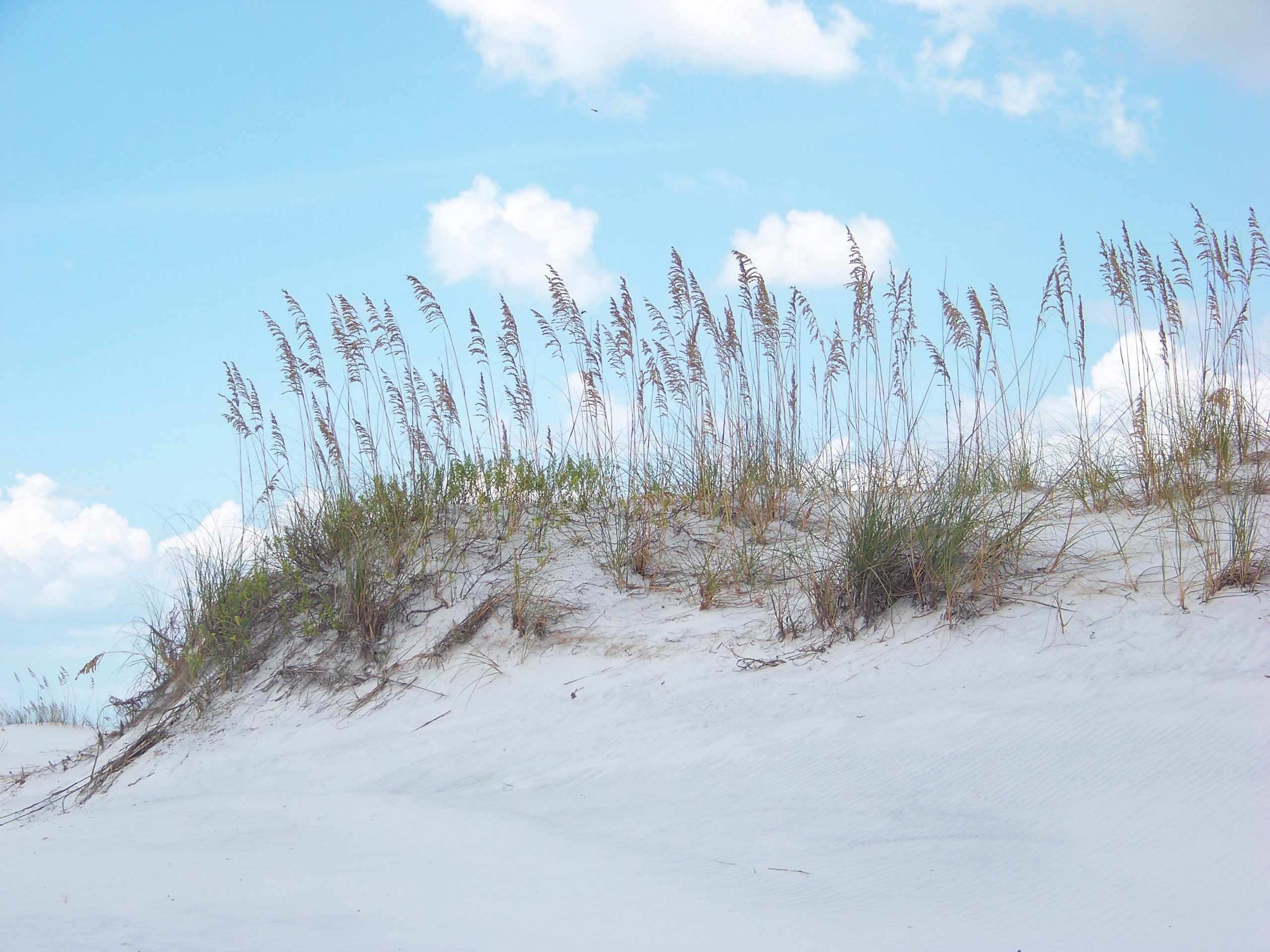
For the barrier islands, grasses seem to be the plants who do best in the early stages of succession. Though small shrubs and trees may reach the island, the high winds and salt spray will not allow growth. There are numerous species of grasses that can live here, the most famous are the sea oats (Uniola paniculata). This grass can be found on the smallest of barrier islands. Their fibrous root system runs beneath the ground sprouting new grasses all over. Their seed heads blow with the wind starting new populations of plants on other locations and the landscape is soon dominated by them. However, there are other species as well. Panic grass (Panicum amarium), salt hay (Spartina patens), and beach elder (Iva imbricata) to name a few. All these grasses can tolerate the wind and salt spray as well as the low nutrient, low rainfall often found on these islands. They also all have fibrous roots systems that not only connect grasses across the land scape but also trap blowing sand – forming dunes.
The primary dune is dominated by salt tolerant grasses like this sea oat. Photo: Rick O’Connor.
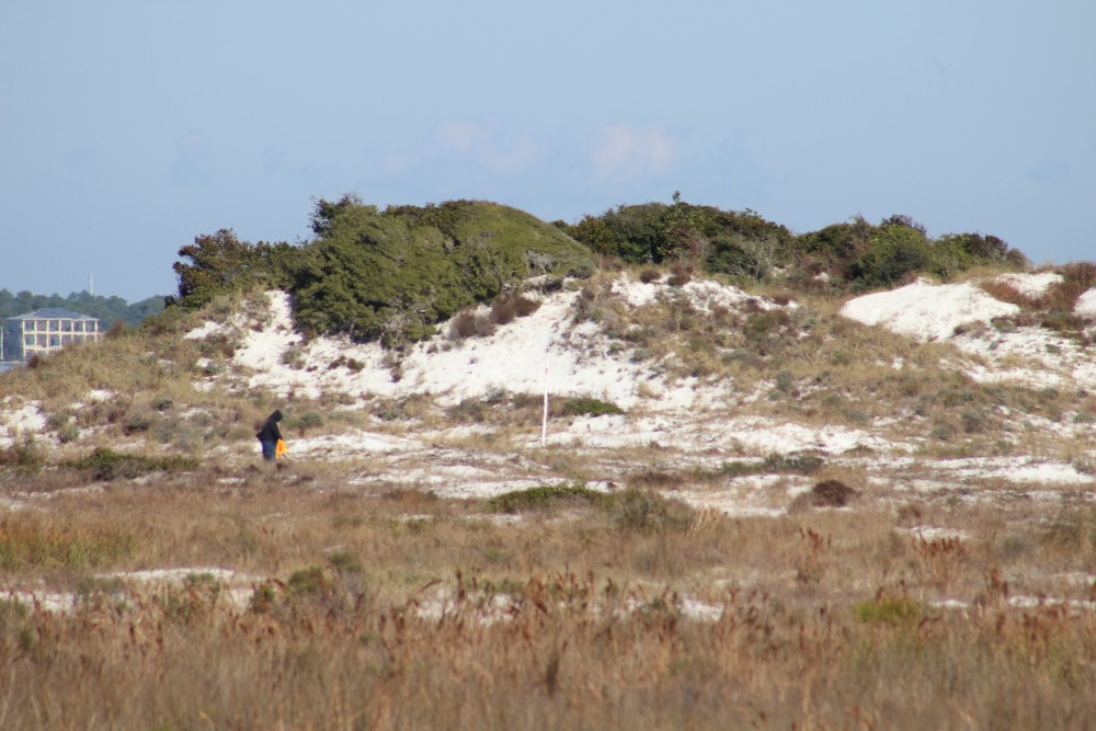
The dunes closest to the Gulf are dominated by grass due to the higher winds and salt spray there. These are called the primary dunes and create one of the first habitats on the island for wildlife. The primary dunes vary in height and how far from the Gulf they range but they do form a wind break for portions of the island landward of the Gulf.
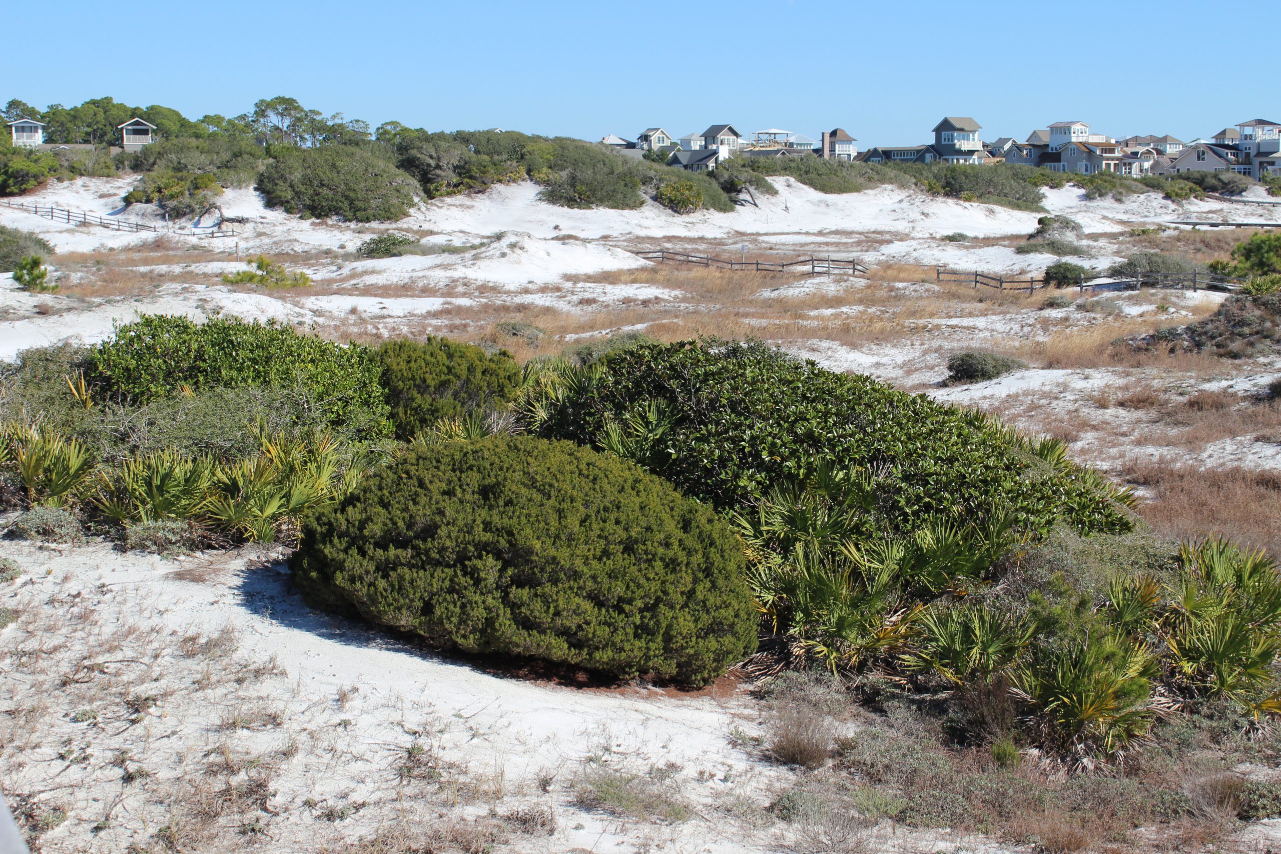
Here smaller shrubs and plants like seaside golden (Solidago sempervirens) and seaside rosemary (Ceratiola ericoides) can grow. With less wind their seeds will germinate and survive. What wind is still there forces the plants to grow in a round shape resembling green sheep on a white field, instead of white sheep on a green field. My professor referred to them as “beach sheep”. This area of the barrier island is called the secondary dune and includes other species such as false rosemary (Conradina canescens), square flower (Odontonychia corymbosa), and sandhill milkweed (Asclepias humistrata). Though they cannot tolerate the high winds as grasses do, they do have to tolerate climatic extremes and low rainfall.
Small round shrubs and brown grasses within the swales are characteristic of the secondary dune field.
Photo: Rick O’Connor
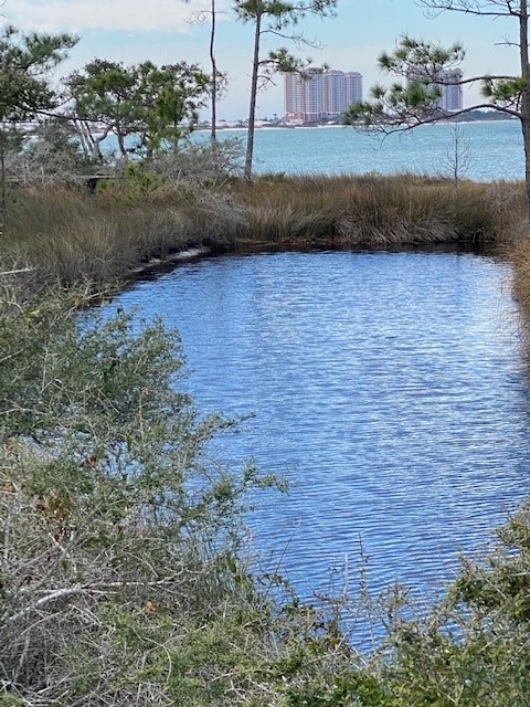
These secondary dunes vary in elevation and can become taller than the primary dunes. In the low areas between dunes are areas where freshwater water can collect and form ephemeral ponds. These areas are known as swales and create unique habitats much sought after by some wildlife. More bog like plants grow here such as water dock (Rumex orbiculatus) and marsh pink (Rhexia nashii) but also includes the carnivorous plants like the sundew (Drosera rotundifolia). There are many insects who used these ephemeral ponds and many spiders and sundews to take advantage of this.
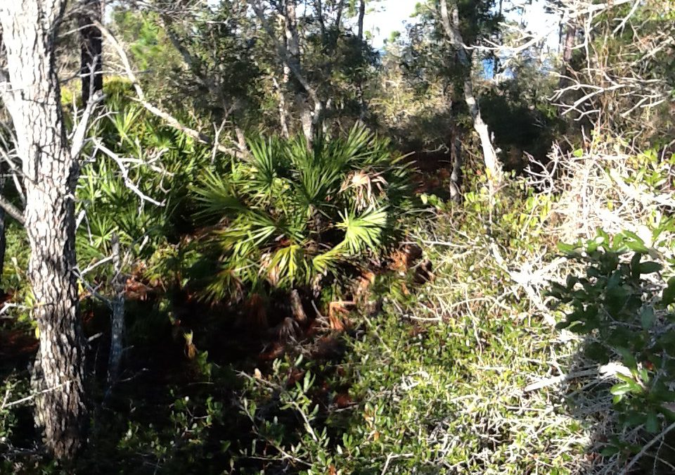
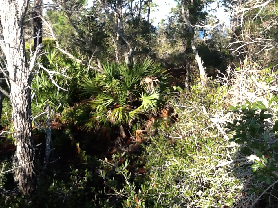
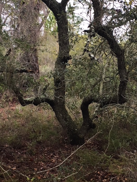
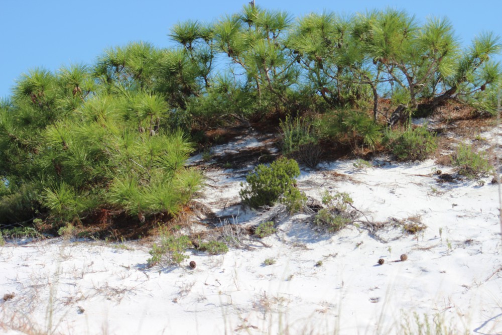
Behind the larger secondary dunes, the wind is even less, and the dune wind breaks higher. Here trees can germinate, if they can tolerate the climatic conditions, and grow. Though the species that grow out there are some of the same you find on the mainland, here they grow differently. Barrier island trees tend grow out, not up, to avoid direct contact with wind and salt spray. And, when they do reach the wind the portion of tree directly facing the wind tends to be stunted in growth, giving it the appearance that someone has “combed” the tree back towards the bay – something they call wind sculpting. Trees that seem do well in what they call the tertiary dune include sand live oak (Quercus geminata), pine (Pinus sp.), and magnolia (Magnolia grandiflora). Yaupon holly (Ilex vomitoria) and even cactus like the prickly pear (Opuntia humifusa) and the devil’s joint (Opuntia pusilla) can be found growing here.
The top of a pine tree within a tertiary dune.
Photo: Molly O’Connor
Tertiary dunes are some of the largest on the island, with elevations reaching 50 feet or more. These provide excellent wind breaks from the Gulf and allow the formation of salt marshes along the bay side shoreline. Marshes are habitats dominated by grass, but these grasses must be able to tolerate periods emersed in salt water, at least at high tide. Close to the dunes the marsh is dominated by dense stands of black needlerush (Juncus roemerianus). In some locations within the needlerush marsh are areas of bare sand known as salt pans. These are low areas within the marsh where water remains when the tide recedes. These small marsh ponds begin to evaporate in the intense sunlight and the salinity increases to a level where it kills off much of the plant life leaving an area of bare sand. These salt pans are used by some wildlife on the islands. Eventually you will reach the waters edge where smooth cordgrass (Spartina alterniflora) grows. This marsh grass can tolerate water for longer periods than needlerush and supports both island wildlife and estuarine fisheries.
A finger of a salt marsh on Santa Rosa Island. The water here is saline, particularly during high tide. Photo: Rick O’Connor
As you can imagine, the process of establishing the pioneer community of grasses on a new, small sand bar, to an island filled with dunes and vegetation takes time – years, decades, maybe centuries – but eventually it will reach what we call the climax community and provides a variety of habitats to support wildlife.
In part 3 we will begin to look at how animal species colonize the islands as these habitats form.