After Hurricane Ivan devastated the Pensacola area in 2004, my son was working to repair docks in local waterways. One day, after working on a project in Bayou Texar (near Pensacola Bay), he came by our house and said that he had seen a bald eagle fly over. My wife and I both responded with amazement but at the same time were thinking… “Yea right”. A few days later, we were sitting on the back porch (we live near Bayou Texar) and glancing up we saw a huge bird flying over… you guessed it… a bald eagle. We both looked at each other and just shook our heads saying “did you just see?… yep, that was a bald eagle”. It was totally cool!
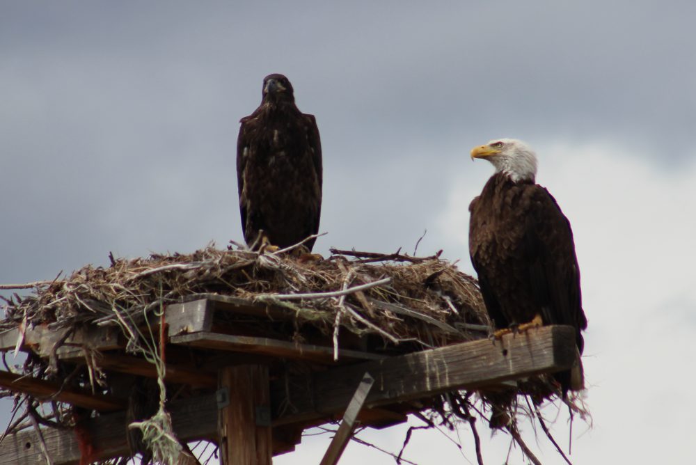
An adult and juvenile bald eagle on nest in Montana. Photo: Molly O’Connor
In the 1970’s I worked for a local chemical plant on Escambia Bay that had a bird sanctuary on the property. Occasionally a bald eagle would appear during the winter months but it was not annually, and it was a real treat to see it. However, since Ivan sightings in the panhandle have become quite common. Folks are seeing them over Pensacola Bay, Perdido Bay, Garcon area of Santa Rosa County, Gulf Breeze peninsula, almost everywhere! I actually saw three flying together over Big Sabine on Pensacola Beach recently. They are actually now nesting in the area.
These are large birds, 30-40” long with a 7-8 feet wing span, and hard to misidentify – everyone knows a bald eagle. However, the juveniles do not have the distinct white head and tail or the brilliant yellow beak. Rather they are dark brown with possible white spots on their wings, and the beak is darker. The mature color change occurs in 5-6 years. Their diet is mostly fish but they will take small birds and mammals. They are also scavengers, including road-kill, and will “pirate” captured food from other birds. Observations support that ospreys and bald eagles do not really get along.
Bald eagles tend to migrate between their breeding grounds in Canada and those of the Gulf Coast. The migrants are typically non-breeding individuals. Breeding ones tend to remain in their breeding areas year round. As of 2014, Florida has the highest densities of southern breeding populations in the lower 48 states, about 1500 nests. Most return to Florida in the fall for nest building. Their nests are typically in forested areas near waterways. They prefer the tallest trees. The nests are quite large; the record in Florida was 9.5 feet in diameter. They typically lay one clutch of 1-3 eggs but may lay a second clutch if the first is unsuccessful. The young remain in the nests until they can fly – usually April or May. Wintertime is a good time to view these animals in our area.
Their numbers plummeted for a variety of reasons, including the introduction of DDT, and they were placed on the U.S. Fish and Wildlife Endangered Species list. DDT was banned in 1972 and listing them on the ESL protected from them from poaching; they have since recovered. Today they are no longer on the Endangered Species list and were removed from the Florida Fish and Wildlife Conservation Commissions (FWC) imperiled species list. However, they are still protected federally by the Bald / Golden Eagle Protection Act and the Migratory Bird Protection Act; they are also protected in Florida by state law.
This site provides known locations between 2012 and 2014. Recent surveys were conducted between 2015 and 2016 in several panhandle counties but those locations have not been posted yet. For those in the Pensacola area, there are four permanently injured bald eagles at the Wildlife Sanctuary of Northwest Florida. The public is welcome to visit the sanctuary Wednesday through Saturday from 12:00 – 3:30PM (self-guided).
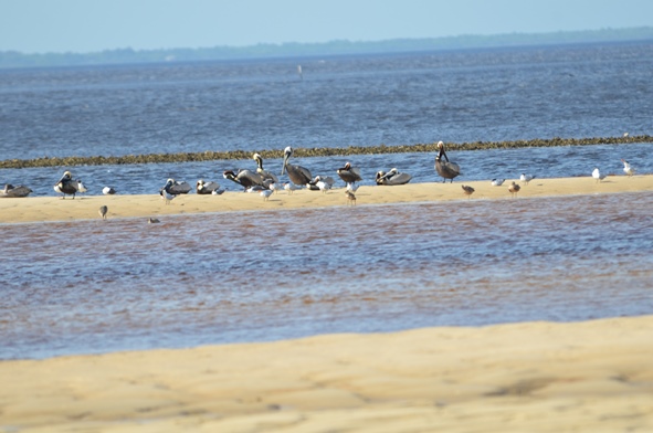
Some of the most picturesque and scenic natural areas along north Florida’s Gulf Coast are found in Bald Point State Park. The 4,065 acre park is located on Alligator Point, where Ochlockonee Bay meets Apalachee Bay.
Easy access to water activities at Bald Point State Park. Photo: Les Harrison
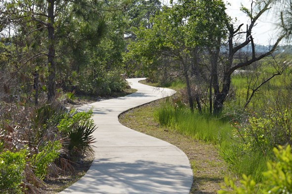
Bald Point State Park offers a variety of land and water activities. Coastal marshes, pine flatwoods, and oak thickets foster a diversity of biological communities which make the park a popular destination for birding and wildlife viewing.
These include shorebirds along the beach, warblers in the maritime oak hammocks, wading birds, and birds of prey in and around the marsh areas. The boardwalk and observation deck overlook the marsh near the beach.
During autumn bald eagles and other migrating raptors, along with monarch butterflies are frequently viewed heading south to a warmer winter.
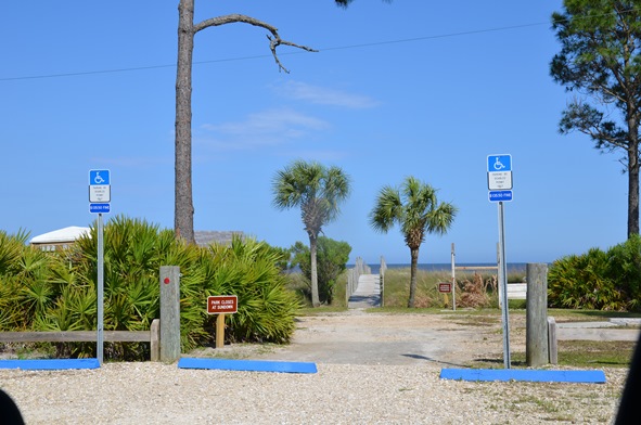
Bald Point offers access to two Apalachee Bay beaches for water sports and leisure activities, and these facilities include a fishing dock and picnic pavilions at Sunrise beach, North End beach and Maritime Hammock beach. Grills and restrooms are also available, but pets are prohibited on the beach.
Pre-Columbian pottery helped archaeologists identify the park’s oldest site, placing the earliest human activity 4,000 years ago. These early inhabitants hunted, fished, collected clams and oysters, and lived in relatively permanent settlements provided by the abundant resources of the coast and forests.
In the mid-1800s and late 1900s, fishermen established seineyards at Bald Point. These usually primitive campsites included racks to hang, dry and repair nets. Evidence of the 19th to 20th century turpentine industry is visible on larger pine trees cut with obvious scars.
Bald Point is an excellent location for both wildlife viewing and birding. Photo: Les Harrison
Among the varieties of saltwater fish found in the brackish tidal waterway are redfish, trout, flounder and mackerel.
Today’s visitors may fish on the bridge over tidal Chaires Creek off of Range Road, and in Tucker Lake, by canoe or kayak. Sea trout, red fish, flounder and sheepshead are common catches, and this is an excellent area to cast net for mullet or to catch blue crabs.
Bald Point State Park is open 8:00 a.m. to sunset daily, with a charge $4.00 per car with up to eight people, or $2.00 per pedestrian or bicycle
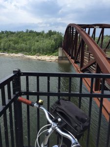
The bridge over the Winooski River was a scenic stop on our bicycle tour. Photo credit: Carrie Stevenson
If you told me earlier this summer that I would “accidentally” bike 18 miles one afternoon, I’d have laughed. I’ve always loved biking, but rarely have time for long distance rides. As part of the mobile workshops for an Extension professional development meeting in Burlington, Vermont, fifteen of us met up with the coordinator of Local Motion, a grassroots bike advocacy organization. Their mission is “to bring the joy of walking and biking within reach for all Vermonters by helping Vermont communities become great places to walk and bike.” The purpose of the tour was to get an on-the-ground lesson in community development and learn how the group has worked with residents to overcome challenges in implementing a successful project.
Burlington’s “Island Line Trail” is a classic rails-to-trails project–not unlike the Blackwater Heritage Trail in Santa Rosa County–that has resulted in significant economic development and increased use by area residents. The original rail service operated from 1899 to the early 1960’s. Since the 1990’s, 14 miles of railway has been converted to a biking/walking trail. Part of the Island Line’s charm is the diversity of scenery it encompasses.
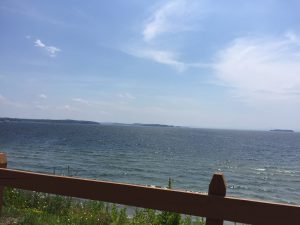
Sweeping views of Lake Champlain were part of what kept us riding far beyond our initial endpoint! Photo credit: Carrie Stevenson
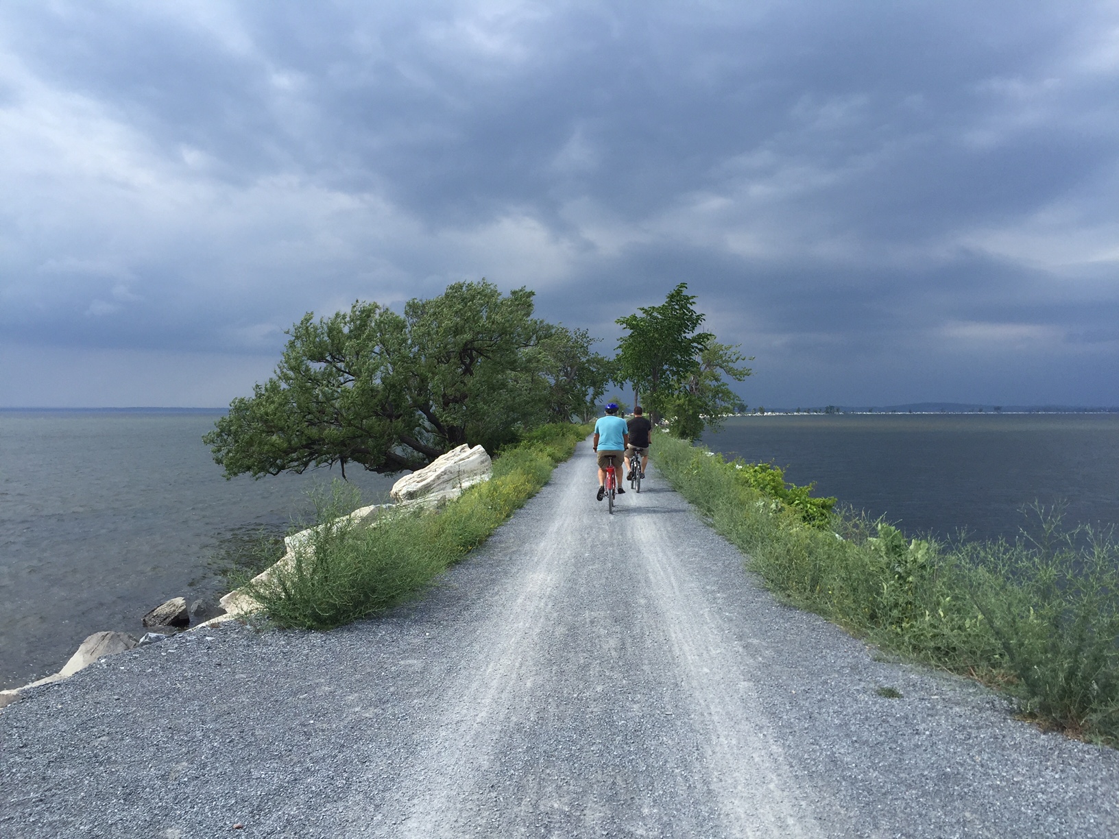
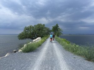
Starting in the heart of downtown Burlington, there are museums, shops, and restaurants within blocks of the trail, many of which cater directly to and exist because of the trail users. The entire stretch runs adjacent to Lake Champlain, providing scenic views along the path. Throughout the trail there are residential areas (which are highly desired because of their proximity to the trail), public parks, and a community center. After crossing a bridge over the Winooski River, we embarked upon a 3-mile open causeway with sweeping views of Malletts Bay on both sides. The trail also includes one of the country’s few bike ferries, which is located where a swing bridge used to operate for the railway. It was the constantly changing scenery and surroundings that kept a handful of us going far beyond the initially planned 6-mile trip.
The causeway over Malletts Bay includes a bike ferry, one of the few in the country. Photo credit, Carrie Stevenson
In addition to providing a recreational trail for local residents and visitors, Local Motion is dedicated to promoting bicycle safety and education. Workshops for hesitant adult bikers interested in biking more attracted over 450 adults last year, while 7,300+ kids participated in bicycle safety camps and training. As a result of all of the activity, youth bike rentals increased by 43% in 2015 over the prior year.
Much of the success in Burlington is transferable to Florida. In the Panhandle, we are looking at connecting existing trails to create a large-scale multi-county, multi-state bicycle trail. The successes in Vermont were inspirational and instructional as we embark upon our new project and a design workshop in late September.
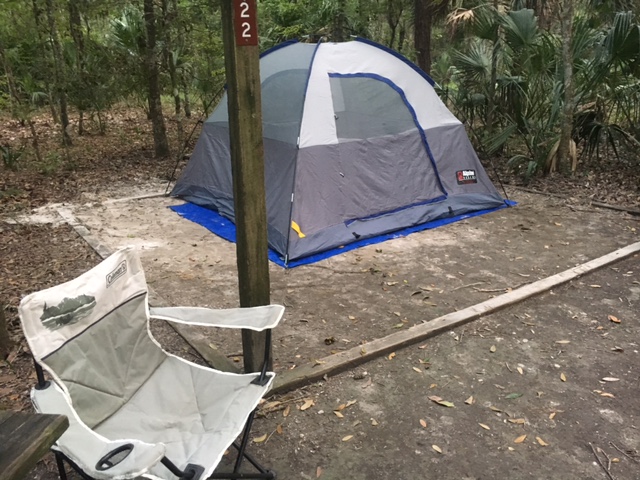
This past week I was camping at a state park near Gainesville. Working on a variety of computer related items while sitting in my chair, I was acutely attuned to the sounds of life around me. A small “pat-pat-pat” could be heard in the leaf litter around the tent. Curious as to what was making the sound, I moved the leaves until numerous small frogs showed themselves – and immediately settled on my tent. The wind rustling through the trees, the distinct “kee kee kee” of the red shouldered hawk, and the sounds of numerous woodland song birds filled the senses and all caused me to pause my work and listen to life.
Camping is a great way to clear the mind, think through problems, and experience the natural world. Photo: RIck O’Connor
The evenings were no different… the loud rustling of digging armadillos, the distinct calls of at least two types of owls, and the howling of coyotes could be heard every night. Then one evening…nothing… it all stopped. I heard no owls, coyotes, or frogs. The woods had become completely silent. Funny how you notice silence as much as you do the “calls of the wild”.
The following morning the skies were different. They were not dark but you could sense rain was in the area. I moved into the tent in time for the rain to begin…a light rain, but rain none the less. And it rained all day… and most of the night. I was dry within my tent – continued to work on my computer – but was aware of the extent of the rain and of the silence around me. It was not until later that evening that I heard there was a tropical system on the Atlantic coast. The woods had become silent the afternoon before…did they know it was coming?
Camping does this… it reconnects us to the natural world. We can experience Florida the way our ancestors would have. To listen to the animal sounds, sense the changes in the weather, and explore. Yes, explore. You can only sit at the campsite for so long. Most campgrounds provide hiking trails and swimming areas where you can not only explore nature but get much needed exercise. Some campgrounds provide elevated observation towers with benches where you can sit, listen, look, and let the hub-bub of typical daily life escape you for a while. Honestly… here I get some of my best ideas for work. I think clearer and can prioritize a hectic schedule of “to-do’s”. I recommend bringing a small notebook to jot down ideas as they come. It is very relaxing and productive at the same time.
If you have kids… perfect! There are fewer “wild areas” within neighborhoods for kids to explore their natural world. Many youth today have not experienced finding hermit crabs or frogs. Camping is a great way for them to do this. I understand that some are nervous about different forms of wildlife while camping (snakes) but honestly, I rarely see them. They have learned to stay clear of open areas – I have bigger problems with squirrels and ants. Do not let that stop you from enjoying Florida.
There are several state parks with camp grounds in the Florida Panhandle; Torreya State Parkeven has a couple of yurts! You may need to reserve a site. There are campgrounds scattered in the Apalachicola National Forest, which are less visited. If you are in the Escambia / Santa Rosa area – you can visit Naturally EscaRosa.com to find camping options in that area.
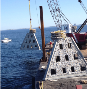
Earlier this year, Bay County completed an artificial reef project in Gulf waters approximately 3 nautical miles (nm) south of the Panama City Beach Pier (Pier Park) and 11 nm west of St Andrew Bay Pass in Small Area Artificial Reef Site D. On May 14, five Super Reefs were deployed, each weighing approximately 36,000 lbs and rising 18 feet from the ocean floor. Typical artificial reef modules are only about 8 feet tall. This was the first time Super Reefs were deployed in western Bay County in the Panama City Beach area. The project provides marine habitat comparable to sinking a large vessel.
Mexico Beach Artificial Reef Association (MBARA) supported Bay County and Walter Maine during the deployment efforts. MBARA provided this YouTube video documenting the deployment and post-deployment dive survey. During the survey, divers noted baitfish already utilizing the new habitat. The Super Reef module coordinates and details were verified as follows:
Patch Reef #
Latitude
Longitude
Depth (ft)
Permit Area
BC2015 Set 17 (1)
30° 10.196N
85° 54.607 W
74
SAARS D
BC2015 Set 18 (2)
30° 10.179 N
85° 54.567 W
75
SAARS D
BC2015 Set 19 (3)
30° 10.176 N
85° 54.603 W
75
SAARS D
BC2015 Set 20 (4)
30° 10.153N
85° 54.594 W
73
SAARS D
BC2015 Set 21 (5)
30° 10.138 N
85° 54.602 W
73
SAARS D
Previous monitoring and research suggest it takes 3 to 5 years for new reefs to reach full development of the associated marine ecosystem. Bay County will work with local anglers, divers, reef associations, and agencies to evaluate the performance of the new reef materials and the reef design.
Bay County artificial reef projects seek to use material that meets program goals and objectives. In this case, larger reef materials were selected to support larger reef fish such as amberjack, grouper, and snapper. Individual reef modules were spaced to support fish forage areas and accommodate multiple users including anglers and divers.
Walter Marine’s Maranatha deploying one of the five Super Reefs placed 3 nm south of Pier Park. The Super Reefs weigh more than 18 tons and are 18 feet tall. Photo by Bay County Artificial Reef Coordinator, Allen Golden.
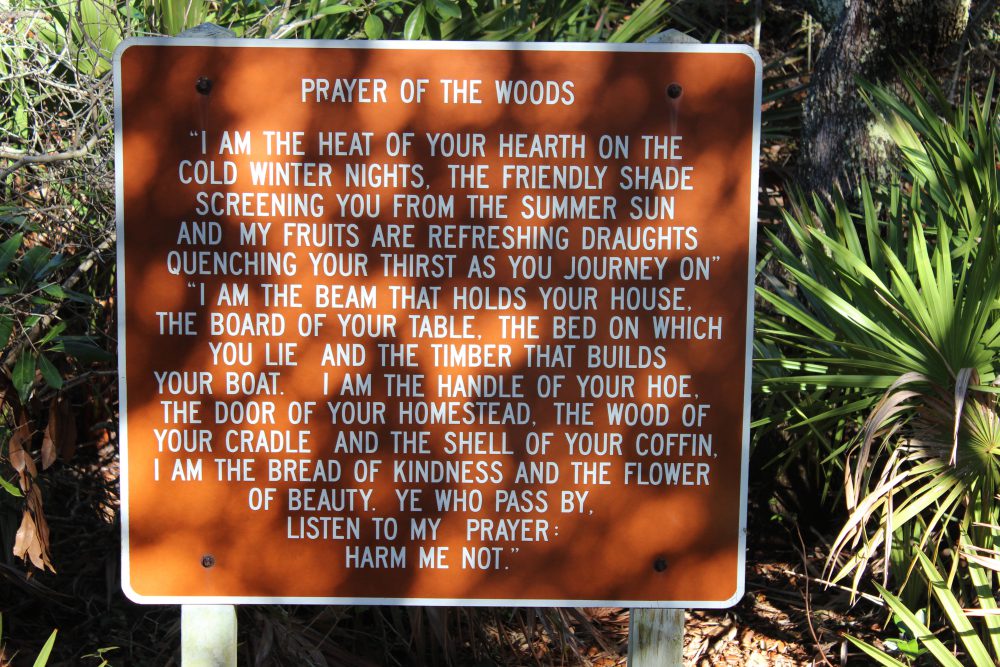
The “Prayer of the Woods” is an attitude that many in this part of the panhandle try to live.
Photos: Molly O’Connor
30A in south Walton County is a special place.
Undiscovered for years, then developed… but developed more sustainably than most coastal panhandle communities – this area has now become a go-to destination for many in the southeastern U.S. Grayton Beach, Seaside, Water Color, and others were developed with idea of walkable-biking community and allowing as much nature to remain as possible. Many subdivisions use native plants for their landscaping. It is a neat area to explore.
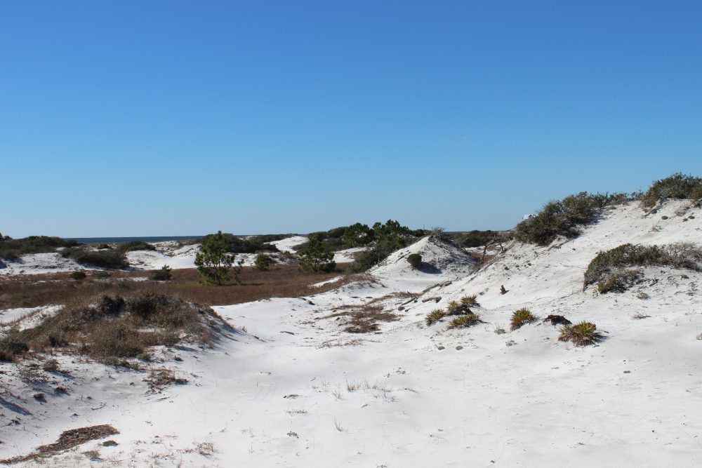
My base camp for this part of our ICW tour was Topsail State Park. Though there are numerous other locations to camp, they were all full… the 30A Song Writers Festival was going on at the time. The first thing I noticed was a bike trail that extends much of 30A itself. There were locations along the way where visitors can rent bicycles and it is a great way to take in the scenery… and there is scenery. Some of the more majestic dunes I have seen anywhere along the panhandle are found here. Dunes in Pensacola use to look like these but storms have taken their toll – somehow the dunes of 30A were spared.
The spectacular dunes of south Walton County.
The wind sculpted plants of the tertiary dunes.
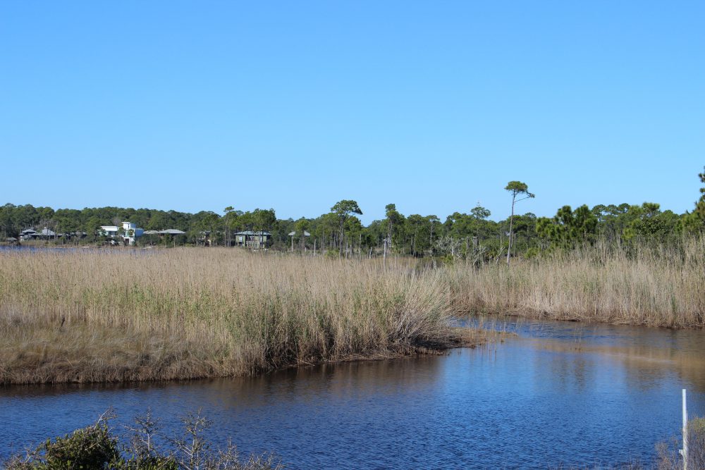
You cannot talk about the dunes without talking about the dune lakes. Scattered across much of the panhandle the highest concentration, and least impacted, of these lakes are found here in Walton County. These freshwater lakes are separated from the high saline Gulf of Mexico by a field of dunes. There are channels that connect them but these are sometimes closed by moving sand. When open, these channels allow the brown tannic waters of the lakes to spill into the Gulf – a weird sight which trigger thoughts of pollution. You can see evidence of high tides entering the lakes with the presence of cordgrass and needlerush (classic salt marsh plants) and species of marine fish such as stingray and redfish. There is access to some of the dune lakes via the state parks. Here there are trails along the shore and through the dunes, and kayaks to rent. The gulf is not but a few feet away – this is a great place to bring snorkel gear or binoculars for birding.
One of the many “jewels of south Walton” – the dune lakes.
In the distance you can see the brown-tannic water of a dune lake entering the Gulf of Mexico.
Black Needlerush is one of the species of marsh grasses that live in brackish conditions.
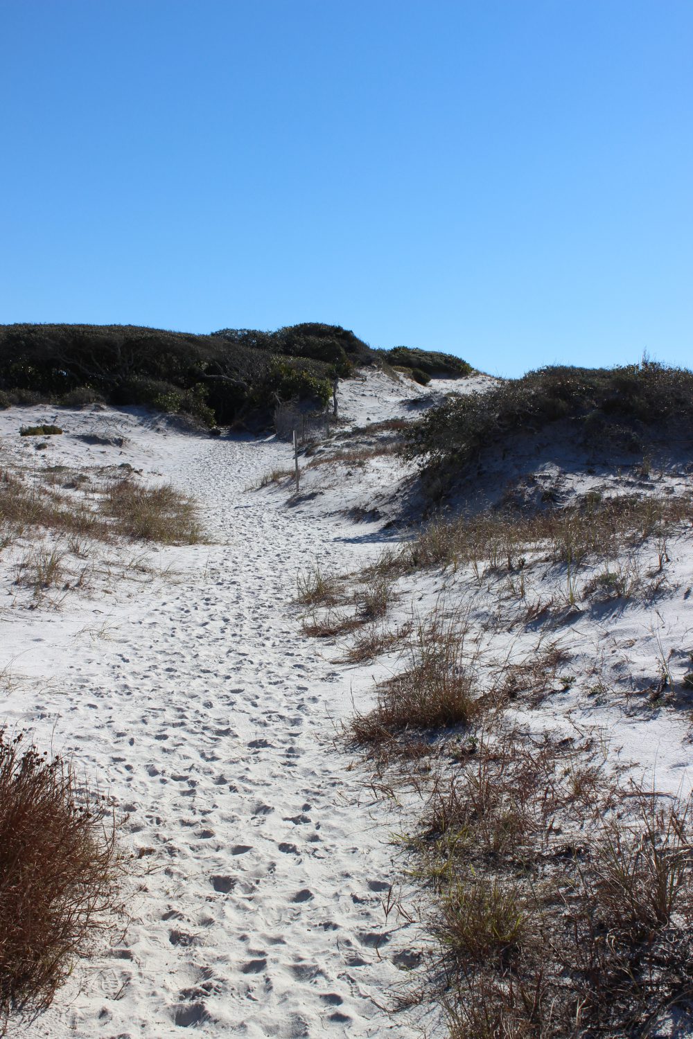
Dune trail at Grayton Beach State Park
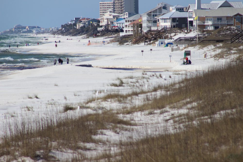
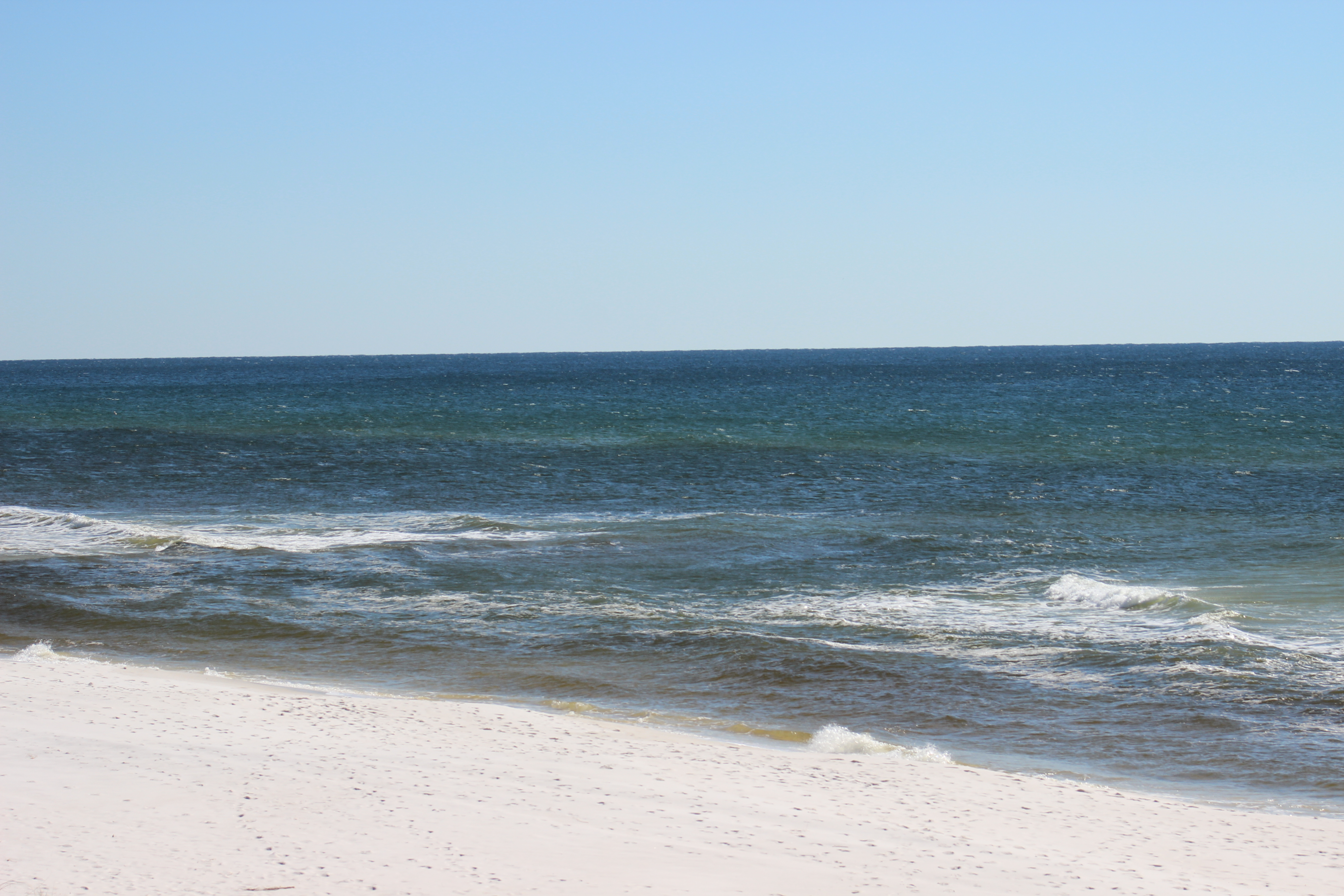
The Gulf of Mexico in south Walton County.
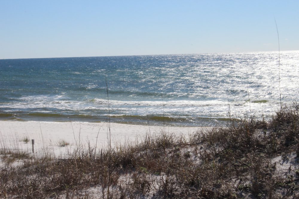
Another view of the Gulf of Mexico.
The boardwalk of Deer Lake State Park off of Highway 30-A. you can see the tracks of several types of mammals who pass under at night.
There are additional state park and state forest trail heads along 30A to explore. Accommodations are hard to come by during peak season so you will have to plan ahead – but a few days here is worth it.
If visiting the Escambia / Santa Rosa area be sure to check out the Naturally EscaRosa website and download the app to find great outdoor adventures in the western panhandle.