by Laura Tiu | May 12, 2018
Are you interested in learning about marine life, going fishing, or exploring the underwater world with a mask and snorkel? If so, this is the camp for you! This local education opportunity for budding marine scientists will be happening this summer at Camp Timpoochee in Niceville, FL. The camps enable participants to explore the marine and aquatic ecosystems of Northwest Florida; especially that of the Choctawhatchee Bay. Campers get to experience Florida’s marine environment through fishing, boating snorkeling, games, STEM (science, technology, engineering & math) activities and other outdoor adventures. University of Florida Sea Grant Marine Agents and State 4-H Staff partner to provide hands-on activities exploring and understanding the coastal environment.
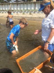
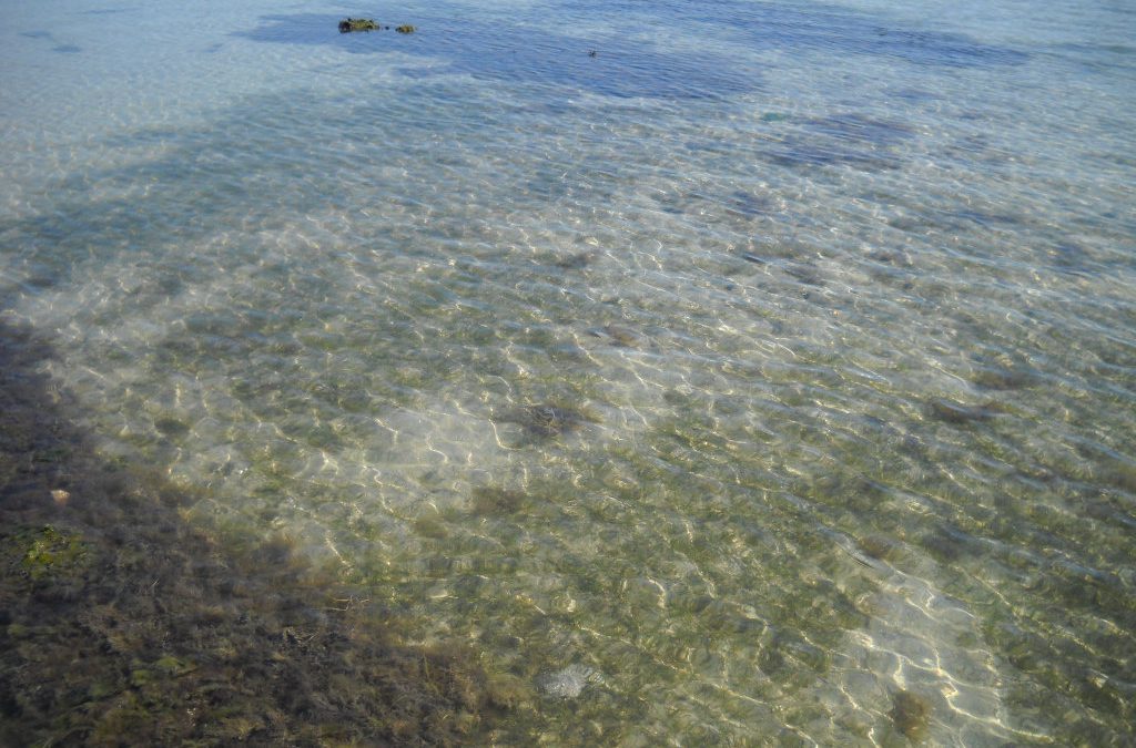
Sampling the benthic community at Timpoochee.
Florida Sea Grant has a long history of supporting environmental education for youth and adults to help them become better stewards of the coastal zone. This is accomplished by providing awareness of how our actions affect the health of our watersheds, oceans and coasts and marine camp is a great opportunity for sharing that information. Many of the Sea Grant youth activities use curriculum developed by the national Sea Grant program and geared toward increasing student competency in math, science, chemistry and biology. The curriculum is fun and interesting!
Marine Camp is open to 4-H members and non 4-H members between the ages of 8-13 (Junior Camp) and, new this year, ages 14-17 (Senior Camp). There will be two Junior Camps in 2018. The July 23-27 camp is full, but there are still openings for the June 25-29 session. The cost for Junior Marine Camp is $275.00 for the week. A more intensive Senior Marine Camp has been scheduled for July 16-20. This camp will contain a community service component and costs $300 for the week.
If Marine Camp sounds interesting to someone you know, visit the Camp Timpoochee website at http://florida4h.org/camps_/specialty-camps/marine/ for the 2018 dates and registration instructions. A daily snack from the canteen and a summer camp T-shirt are included in the camp fees, along with three nutritious meals per day prepared on site by our certified food safety staff. All cabins are air-conditioned. So many surprises await at marine camp, come join the fun.
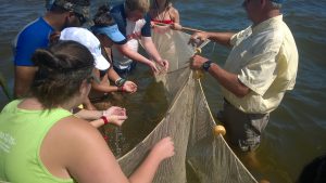
Seining the sea grass at Timpoochee.

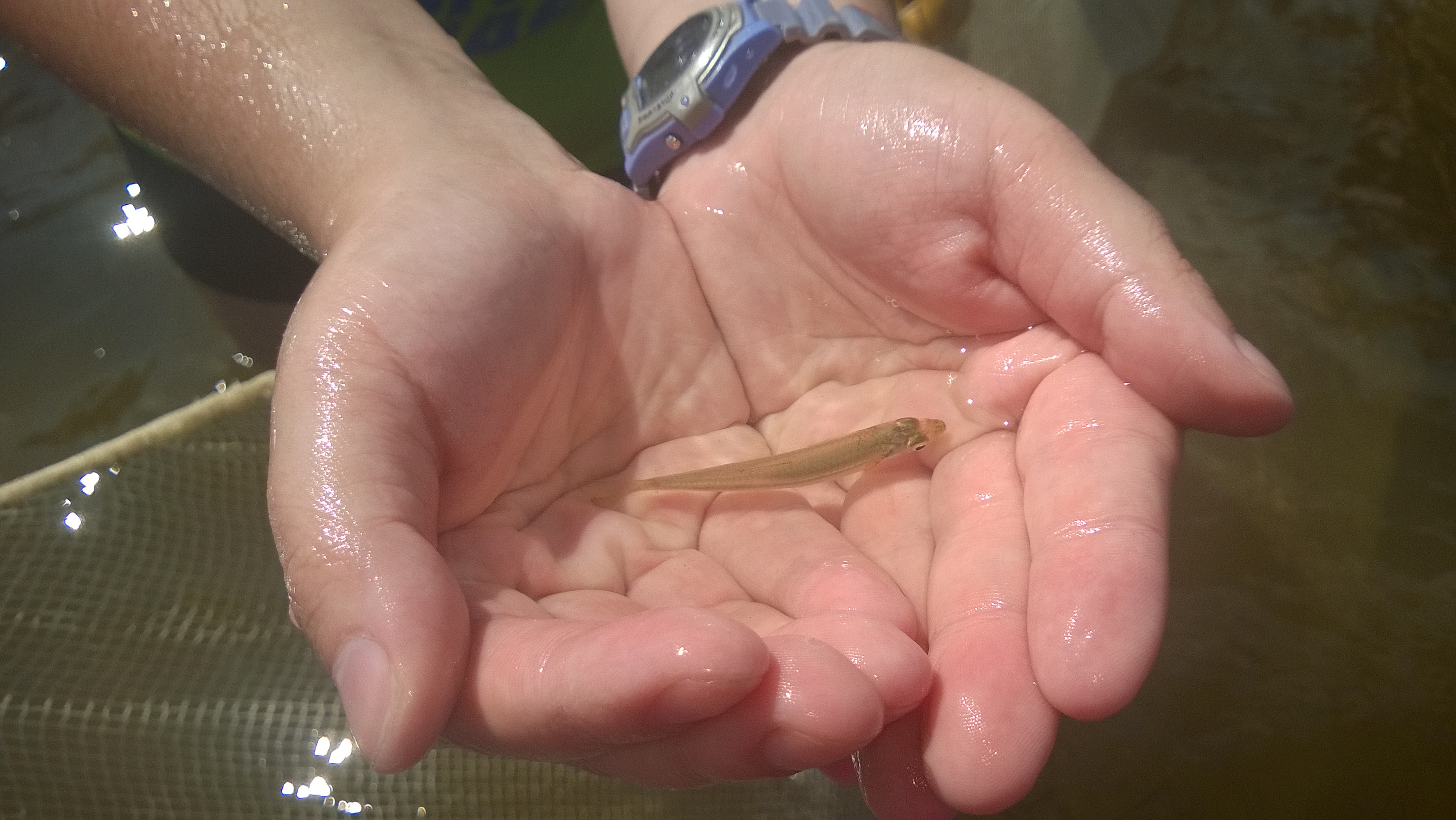
Larval fish in the Timpoochee oyster reef.
by Rick O'Connor | May 12, 2018
Records of the variety of aquatic life in Pensacola Bay go back to the 18th century. According to these reports, over 1400 species of plants and animals call Pensacola Bay home. Many of them depend on seagrass, oyster reefs, or marshes to complete their life cycle. The greatest diversity and abundance are found on the oyster reefs. Finfish and shellfish in the bay have sustained humans as a food source for centuries. However, we know that the alligator, turtles, and a variety of birds and mammals have also been important. In this article, we will focus on the aquatic species.
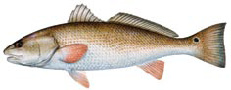
Red Drum – photo credit Florida Fish and Wildlife
When people think of aquatic life in the bay, they first think of fish. About 200 species call Pensacola Bay home. The most abundant are the true estuarine fish, such as croakers, sardines, and minnows. There are a variety of marine transient fish that can be found such as jacks, mackerels, and some species of sharks. Spot and Atlantic Croaker are the most abundant members of the croaker family, and are still an important target fish for locals. Anyone who has snorkeled or cast a line with cut bait knows how common pinfish can be, and those who have pulled bait nets are very familiar with the silverside minnows and anchovies.
I have pulled many a seine net over the years assessing the diversity and abundance of the nearshore fish populations and logged 101 species. In addition to those listed above, killifish (also locally known as “bull minnows”) are a common capture. For a few years, we were involved in trawling in deeper waters where we collected a variety of flounder, silver perch, grunts and snapper. Sea robins are an interesting member of our community and gag grouper were captured occasionally. The number and variety of fish found varies with seasons and is greatest in June. The diversity and abundance of estuarine fishes in our bay is very similar to neighboring estuaries.
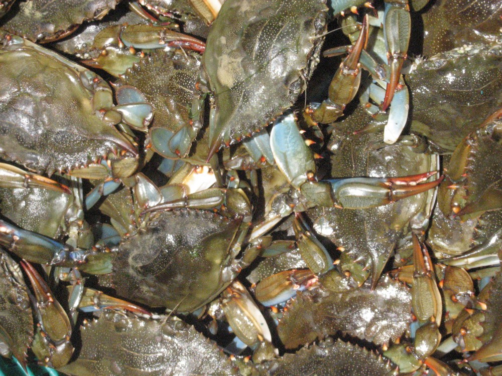
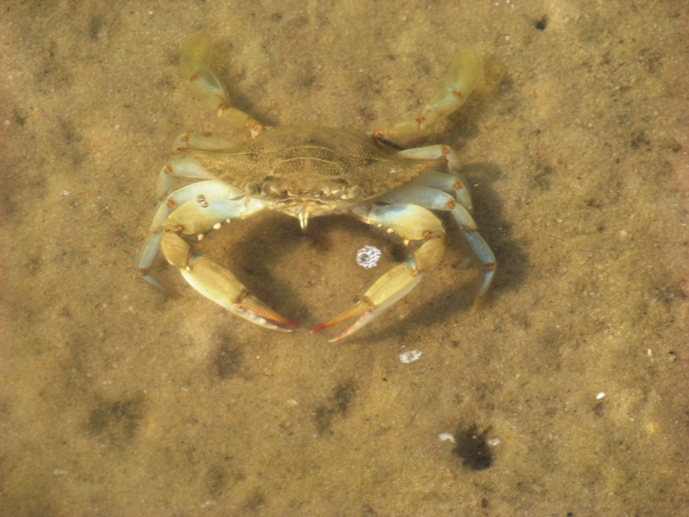
The second thing people think of when they think of aquatic life in the bay are shellfish. These would include the crabs, shrimp, and oysters. However, the most abundant macro-invertebrates in our bay are those that can tolerate environmental stress and live in the surface layers of the sediments – these are the worms and crustaceans. There are numerous varieties of segmented polychaete worms, who are famous for building tunnels with “volcano” openings. They are also common within oyster reefs, feeding on all sorts of organic debris. Blue crab are common throughout the bay and provided both a commercial and recreational fishery for years. Brown and white shrimp are both found and have been the most popular seafood with locals for years.
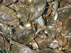
The famous blue crab.
Photo: FWC
During my lifetime, the only marine mammal commonly seen has been the Atlantic Bottlenose Dolphin, and these are found in many parts of the bay. Years back, I heard accounts of harbor porpoise, but never actually saw one. An historic occurring marine mammal, who seems to be making a comeback, is the Florida Manatee. Sightings of this animal have been reported in a variety of locations in recent years.
Snakes, turtles, and alligators are all found in the bay area. There is really only one saline snake and this is the gulf coast salt marsh snake. However, nontraditional estuarine snakes, such as the cottonmouth, are becoming more common in and near the bay. Though we have a great variety of turtles in our rivers, only one true estuarine turtle exist in the country, the diamondback terrapin – and this turtle can be found in parts of our bay. Sea turtles do venture into the bay searching for food, particularly the green turtle who is fond of seagrasses.
Many forget the small planktonic animals that drift in the water column, but they are there – about 100 species of them. Copepods are small roach looking crustaceans that are by far the most abundant member of the zooplankton, particularly the species known as Acartia tonsa – which makes up 82% of the abundance in our bay. These small animals are an important link in the food chain of almost every other member of the bay community. The zooplankton variety in Pensacola Bay is very similar to those of neighboring estuaries.
And then there are the plants…
By far, the most diverse group of organisms in the bay are the microscopic plants known as phytoplankton – with over 400 species reported. Much of the bay is too deep to support traditional forms of plants and so these become a key producer of food for many species. The diversity and abundance is greatest in the spring and fall. 70% of the phytoplankton are from a group called dinoflagellates, small plants that have two hair-like flagella to orient, and even propel, themselves. Some of them produce the bioluminescence we sometimes see and others produce what we call red tide. During the summer, the populations change and the more abundant forms are diatoms. These lack the flagella of the dinoflagellates, but they do produce beautiful shells of silica.
There are at least 400 species of periphytic algae (attaching). Green algae are the most abundant and are most common in the local bayous. Cyanobacteria, which were once thought to be algae, are the most abundant in the marshes and periphytic diatoms dominate in the Sound.
And last, are the submergent and emergent grasses.
Submergent grasses are known as seagrasses. We have three species that like the higher saline waters. These are turtle, shoal, and widgeon grass. Turtle and shoal grass need the water to be at least 25 parts per thousand and are the dominate species in the lower portions of the bay. Widgeon grass can tolerate waters as low as 10 ppt and are found in the bayous and the upper portions of the bay system. Tapegrass only survives in freshwater and are found in the lower reaches of the rivers where they meet the bay.
Emergent grasses are what we call marsh grasses. Two species, Black Needlerush and Smooth Cordgrass dominate these. There are pockets of salt marshes found all over the bay system.
So how is the health of our aquatic life?
As you might expect, the diversity and abundance have declined over time, particularly since the 1950’s. One firsthand account of the change, describe a bayou that was clear, full of grass, and harbored shrimp the size of your hand. Then they were gone. He remembered the first change being water clarity. As development along our waterfront increased, the clarity decreased and the aquatic life declined. This has happened all over the bay system. Increase in run-off not only brought sand and sediment lowering water clarity, it also brought chemicals that both the plants and animals could not tolerate. Much of the point source pollution has been controlled but non-point pollution is still problematic. Fertilizers, pesticides and herbicides, oils and grease, and sediment have all been problematic. These can be reduced. Following recommendations from the Florida Friendly Landscaping website, (http://www.deactivated_site/.) property owners can alter how they are currently managing their landscape to reduce their impact on the aquatic life on the bay. Clean Marina (https://floridadep.gov/fco/clean-marina ) and Clean Boater (https://floridadep.gov/fco/cva/content/clean-boater-program ) recommendations can help reduce the impact from the boating community. Sustainable fishing practices, such as safe catch and release methods for unwanted fish and removing all monofilament are good practices. In 2019, Sea Grant will begin a program training local citizens how to monitor the diversity and abundance of aquatic species. If interested in volunteering, stay tuned.
Reference
Lewis, M.J., J.T. Kirschenfeld, T. Goodhart. 2016. Environmental Quality of the Pensacola Bay System: Retrospective Review for Future Resource Management and Rehabilitation. U.S. Environmental Protection Agency. Gulf Breeze FL. EPA/600/R-16/169.
by Rick O'Connor | May 4, 2018
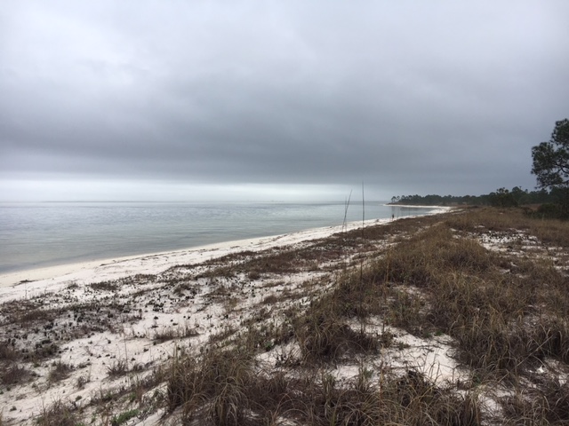
Humans have inhabited the shores of Pensacola Bay for centuries. Impacts on the ecology have happened all along, but the major impacts have occurred in the latter half of the 20th century. There has been an increase in human population, an increase in development, a decrease in water clarity, a decrease in seagrasses, and a decrease in the abundance of some marine organisms – like horseshoe crabs, scallops, and some marine fishes. There has also been an increase in inorganic and organic compounds from stormwater run-off, fish kills, and health advisories due excessive nutrients and fecal bacteria in local waters.
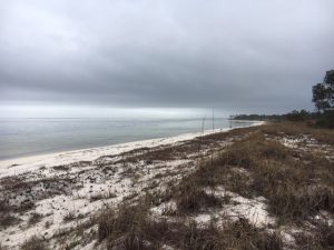
A view of Pensacola Bay from Santa Rosa Island.
Photo: Rick O’Connor
Since the 1970’s, there have been efforts to help restore the health of the bay. Seagrasses have returned in some areas, fish kills have significantly reduced, and occasionally residents find scallops and horseshoe crabs – but there is still more to do. In this series of articles, I will present information provided in a recent publication (Lewis, et. al. 2016) and from citizen science monitoring. We will begin with an introduction to the bay itself.
The Pensacola Bay System is the fourth largest estuarine system in the state of Florida. The system includes Blackwater, Escambia, East, and Pensacola Bays. There are numerous smaller bayous, such as Indian, Mulat, and Hoffman, and three larger ones, which include Texar, Chico, and Grande. There are two lagoons that extend east and west of the pass. To the west is Big Lagoon and to the east is Santa Rosa Sound. The surface area of this bay system is about 144 mi2 and the coastline runs about 552 miles in length. There are four rivers that discharge into the system: the Escambia, Blackwater, Yellow, and East Rivers. The majority of watershed is in Alabama and covers about 7000 mi2. The mouth of the bay is located at the Pensacola Pass near Ft. Pickens and is 0.5 miles across. Depending on the source, the flush time for the entire bay has been reported between 18 and 200 days.
There are several ecosystems found within the bay system. Seagrasses are be found throughout the bay and bayous, but are more prevalent in Big Lagoon and Santa Rosa Sound. Oyster reefs have provided income for some in the East Bay area in the past, but production has declined in the last 50 years. Salt marshes are found throughout the bay as well, but the greatest acreage is in the Garcon area of Santa Rosa County. There are, of course, freshwater marshes near the mouths of the rivers with the largest being at the mouth of the Escambia River.
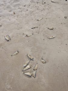
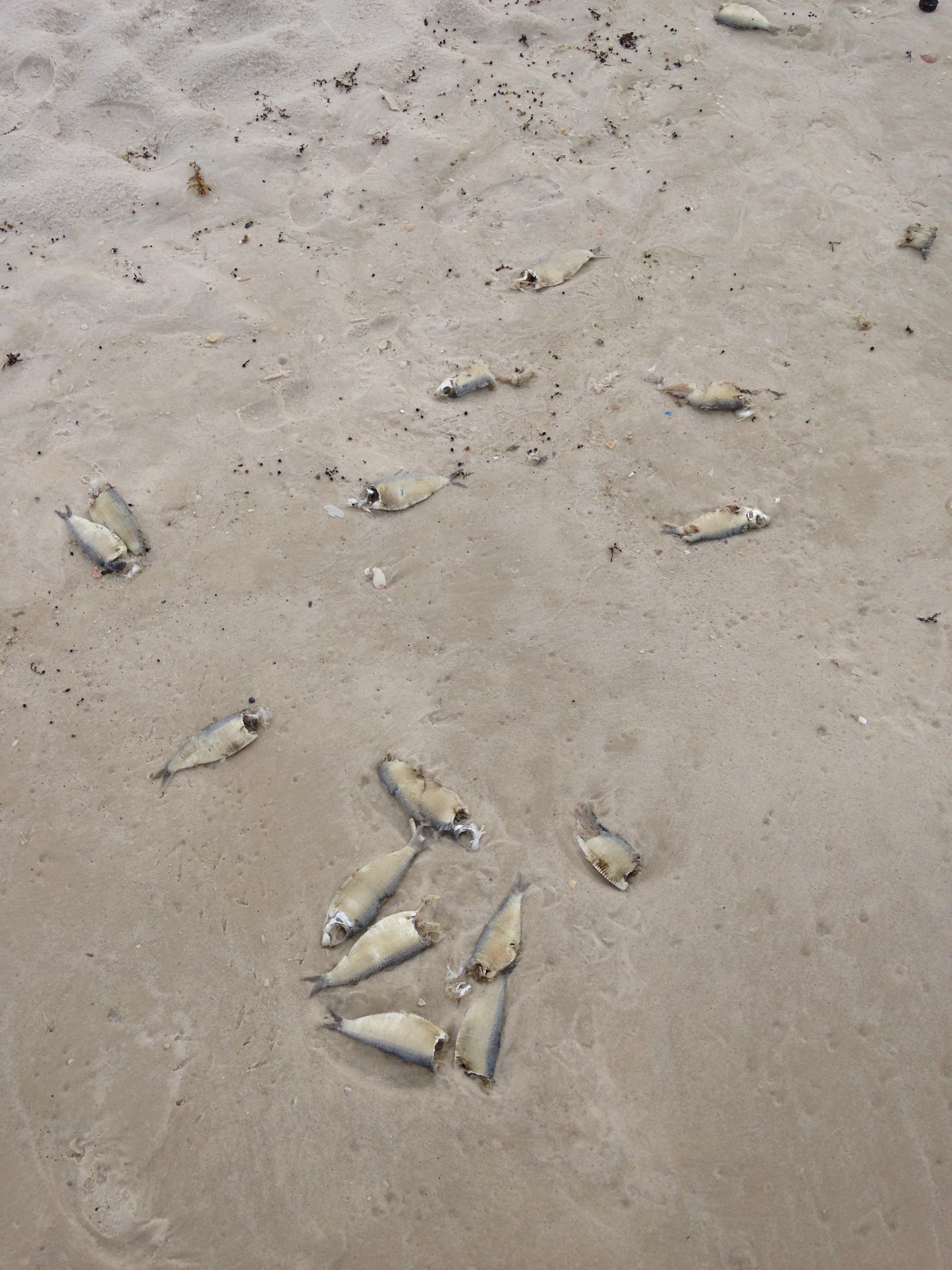
Members of the herring family are ones who are most often found during a fish kill triggered by hypoxia.
Photo: Madeline
Members of the drum family are one of the more common fishes found in the system and would include fish like the Spot and Atlantic Croaker. However, speckled trout, striped mullet, redfish, several species of flounder, have also been targets for local fishermen. Target fish include sardines, silversides, stingrays, pinfish, and killifish. Brown shrimp, oysters, and blue crab have historically provided a fishery for locals, but other invertebrates include several species of jellyfish, stone crabs, fiddler crabs, hermit crabs, grass shrimp, several species of snails, clams, bay squid, octopus, and even starfish. There is also a variety of benthic worms found within the sediments.
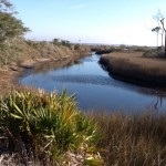
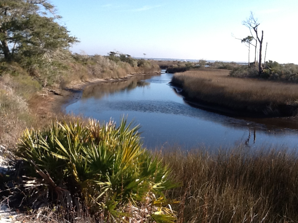
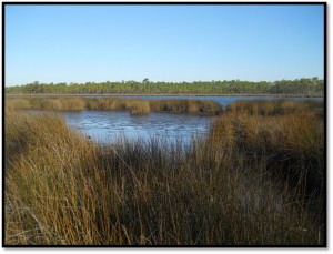
A finger of a salt marsh on Santa Rosa Island. The water here is saline, particularly during high tide. Photo: Rick O’Connor
There has been a decline in overall environmental quality since 1900 but, again, the biggest impacts have been between 1950 and 1970. Fish kills, a reduction in shrimp harvest, and hypoxia (a lack of dissolved oxygen) have all been problems.
In the articles to follow we will look deeper into specific environmental topics concerning the health of Pensacola Bay.
References
Lewis, M.J., J.T. Kirschenfeld, T. Goodhart. 2016. Environmental Quality of the Pensacola Bay System: Retrospective Review for Future Resource Management and Rehabilitation. U.S. Environmental Protection Agency. Gulf Breeze FL. EPA/600/R-16/169.
by Rick O'Connor | Apr 14, 2018

Shoal grass. One of the common seagrasses in Florida.
Photo: Leroy Creswell
For many, it really does not matter. But is there a difference? Yes… there is. Seagrass is what typically washes ashore on the Sound side – seaweed is what we typically see on the Gulf.
So what is the difference?
Seagrasses are actually grasses. They are true plants in the sense they have roots, stems, and leaves. They also produce flowers, but they are so small it is very hard to see them. Pollen and seed dispersal is via the currents. What the observer sees when snorkeling in seagrass meadows are the leaves – in this case called blades. The stems run horizontal beneath the sand, as many grasses in our lawns do. These are called rhizomes, and the roots extend from them. Turtle grass and Shoal grass are the two most common types we have here.
Seaweeds on the other hand, are not true plants because they lack roots, stems, and leaves. They are often called algae and must be submerged in water in order to absorb it. They are either float and drift in the currents, or can attach to hard objects on the seafloor using a structure called a holdfast. June grass and Sargassum are two common types that drift ashore.
So why don’t seagrasses grow in the Gulf?
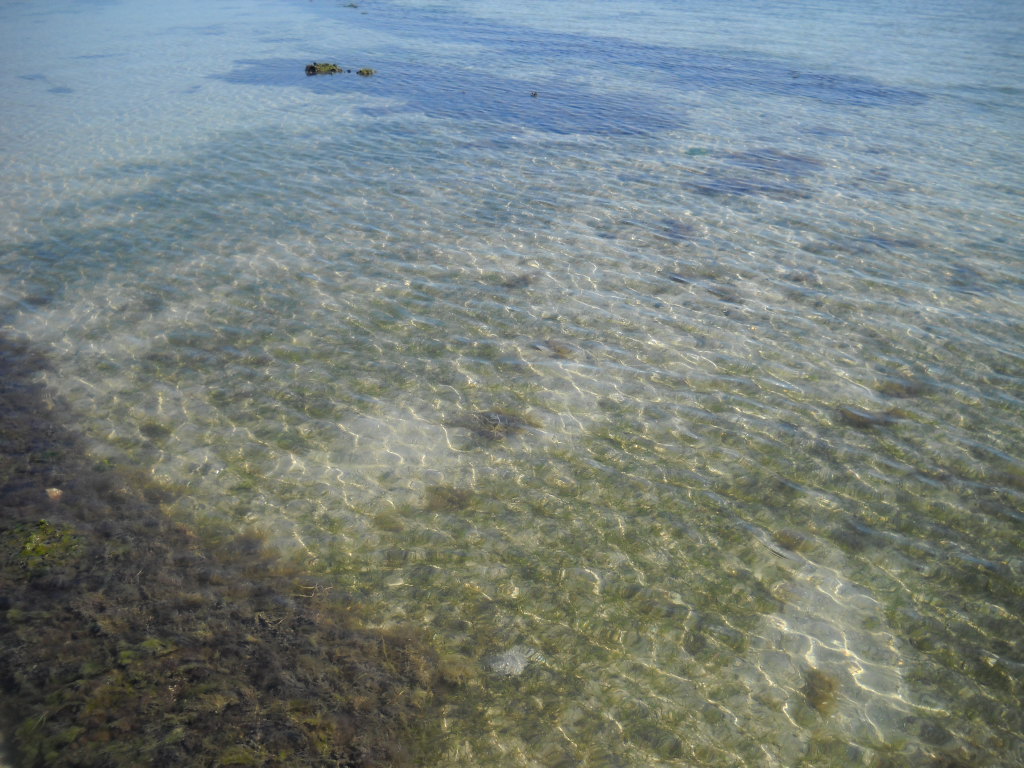
Like all plants, seagrasses need sunlight. At least 25% of the sunlight reaching the surface must reach the bottom for them to photosynthesize. Near the shore, there is enough sunlight for seagrass, but they cannot tolerate the larger waves that our nearshore Gulf produces – thus they are restricted to the quieter waters of the Sound. We do have seagrasses growing in Big Lagoon, Old River, parts of Pensacola Bay, and even in some of the local bayous. This ecosystem is important to the overall health of our bay. It is known that 80-90% of the commercially and recreationally important finfish and shellfish require seagrasses, or salt marshes, for at least part of their life cycle – so they are important economically as well.
Seaweeds also need sunlight. In rocky areas, you can find them attached in sunlit waters. Much of our area is sand, so we do not see as many forms of seaweed as they do in the Keys or in California. However, we do have floating forms.
March is “Seagrass Awareness Month”. Many people provide opportunities to educate locals about our seagrasses and the issues they are facing. Excessive run-off from parking lots, ramps, homes, etc. – increase the turbidity and decrease the salinity of the water – both of which are detrimental to seagrass health. This run-off also contains pollutants that are problematic – particularly nutrients from fertilizers. The fertilizers trigger algal blooms which block sunlight and, in some cases, smoother the surface of the grass blades. Then there is prop scarring. The shallow waters where they live are also popular spots for boaters to visit. The propeller scarring leaves open tracts throughout the seagrass meadows and, unlike some grasses in our yards, can take years – even decades – to recover. There has been significant loss of seagrass all across the Gulf region, including Pensacola Bay. The loss of seagrass have also affected species such as bay scallop and horseshoe crabs. There are signs of recovery and we need to continue reducing our impact to keep this trend going. Florida Friendly Landscaping, Clean Boater practices, and Living Shorelines are some methods that can help. Contact your local County Extension Office to learn more about these programs.
by Rick O'Connor | Apr 14, 2018
In my job, I get many calls about snakes. Most people want to know how to tell a venomous from a nonvenomous one and how to keep them out of the yard. I was recently reading a new book out by Dr. Sean Graham entitled American Snakes and in the chapter on snake defenses, he provided a long litany of local creatures who consumed snakes – some surprised me. Check this out…
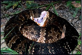
The “cottonmouth” gape of this venomous snakes is a warning. Notice the banded coloration of this individual.
Photo: UF IFAS Wildlife
First, most who do only consume smaller species of snakes – but the list is still surprising. Spiders… spiders were on the list. He specifically called out the black widow – who probably could kill a small snake, but indicated there were others. Scorpions, centipedes, fire ants, carpenter ants, giant water bugs, crayfish, and crabs made the list as well. Some of these may consume snakes only after they are dead – but some can kill small ones.
From the vertebrate world he mentions the larger salamanders (such as the hellbender), and other snakes (such as the short-tailed snake and the coral snake). There are several mammals including shrews, moles, and even the rodents themselves are consumers of snakes! He describes how hoofed mammals (such deer, goat, and horses) do not consume snakes, but can completely destroy one by raising and stopping on them – leaving only small segments remaining. They have found the remains of snakes in the stomachs of all predatory mammals but the snake’s greatest threat are birds… by a long shot. Species from passerines to raptors have been known to kill and consume snakes.
What about venomous snakes – who consumes rattlesnakes and cottonmouths?
There are surprises here as well…
Bullfrogs… bullfrogs basically consume what they can get into their mouths but this includes snakes – and venomous ones as well (though they would be small ones). From the fish world, both the gar and largemouth bass are known to consume venomous snakes.
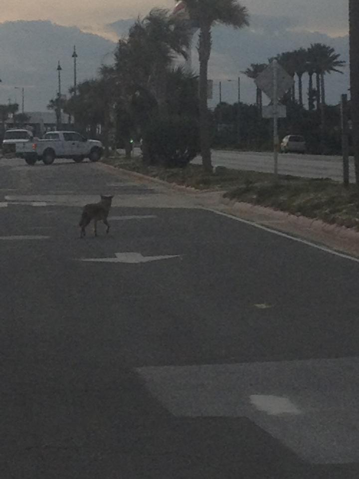
A coyote moving on Pensacola Beach near dawn.
Photo provided by Shelley Johnson.
Opossums are known to consume at least 12 species of snakes, including venomous ones. They also consume ticks, fire ants, and have a very low occurrence of rabies – a cool animal to have around.
Other mammal consumers of venomous snakes include raccoons, otters, fox, bobcats, coyotes, and black bears. It is understood they must take smaller members of the venomous snake population – but a snake control is snake control.
Most wading birds in our marshes consume snakes, including venomous ones, but it is the red-tailed hawk and the great horned owl that are the masters. Red-tailed hawks are known to consume at least 35 species of snakes, including venomous ones, and – unlike other snake predators – are a larger part of their diet, they seek them out. Great Horned Owls consume at least 13 species, and venomous ones are on the menu.
From the reptile world we begin with the alligator, who has little problem consuming large specimens of both the rattlesnake and the cottonmouth. However, many are snakes… yes, snakes eat snakes and some consume venomous ones. Coral snakes, coachwhips, and cottonmouths have been known to consume other snakes. However, it is the Eastern Indigo and the Kingsnakes who actively seek out venomous species. It is known that kingsnakes have a protein in their blood that makes them immune to the viper’s venoms – and it appears the vipers know this and avoid them. It is not known whether the indigo is immune, but it is known they will seek out venomous snakes and consume. Both of these snakes can take relatively large venomous species.
Of these two, it is the Kingsnake who is the “king” – consuming at least 40 species of snakes. However, both the kingsnakes and the indigo are on the declined. The eastern indigo is currently federally listed as endangered – there has not been a verified record of one in the Florida panhandle since 1997. However, there are anecdotal reports and we encourage anyone who has seen one to send us a photograph. There is an active indigo restoration program going on in Alabama and in the Apalachicola River area. These are the largest native snakes in the U.S. (about 8 feet) and, along with the six-foot kingsnakes, are frequently killed. There is evidence that as the eastern kingsnake populations decline copperhead populations increase, and Vis versa. Some areas near Atlanta are currently experiencing a copperhead “boom”. Clearly, we should reconsider killing both the indigo and kingsnakes. We also understand that habitat loss is another cause of their decline, particularly in the case of the indigo.
When looking at this list of snake consumers we see species that cause other problems – alligators, raccoons, coyotes, and bears have all have had their negative issues. But many we just do not like, such as the opossum, really cause us no harm and control snake populations. Everything has its place in the local environment and not one species seeks out humans for the purpose of harming us – this would include snakes. The negative encounters are for other reasons. But for those who have a deep fear, or are currently experiencing high snake numbers, seeing one of the animals on this in the neighborhood could be a relief.
References
Graham, S. 2018. American Snakes. John Hopkins University Press. Baltimore MD. Pp 293.
O’Connor, M. 2018. Personal communication.
by Sheila Dunning | Apr 14, 2018
Having just completed the Okaloosa/Walton Uplands Master Naturalist course, I would like to share information from the project that was presented by Ann Foley.
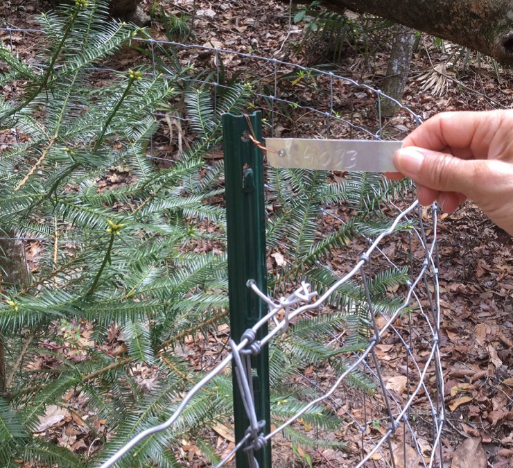
The Florida Torreya. Photo provided by Shelia Dunning
The Florida Torreya is the most endangered tree in North America, and perhaps the world! Less than 1% of the historical population survives. Unless something is done soon, it may disappear entirely! You can see them on public lands in Florida at Apalachicola Bluffs and Ravines Preserve and beautiful Torreya State Park.
The Florida Torreya (Torreya taxifolia) is one of the oldest known tree species on earth; 160 million years old. It was originally an Appalachian Mountains ranged tree. As a result of our last “Ice Age” melt, retreating Icebergs pushed ground from the Northern Hemisphere, bringing the Florida Torreya and many other northern plant species with them.
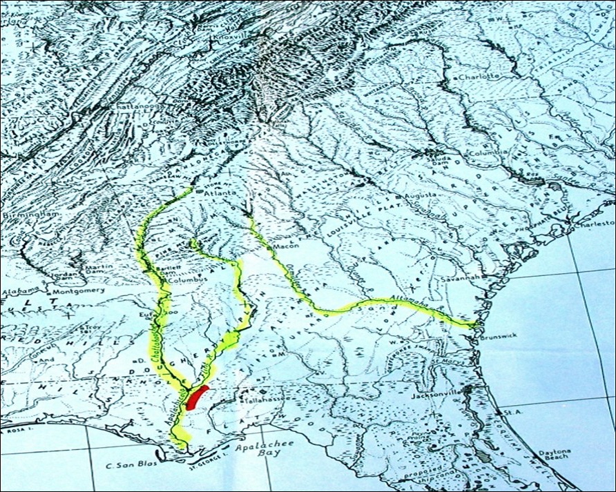
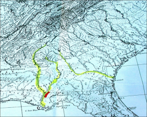
The Florida Torreya was “left behind” in its current native pocket refuge, a short 40 mile stretch along the banks of the Apalachicola River. There were estimates of 600,000 to 1,000,000 of these trees in the 1800’s. Torreya State Park, named for this special tree, is currently home to about 600 of them. Barely thriving, this tree prefers a shady habitat with dark, moist, sandy loam of limestone origin which the park has to offer.
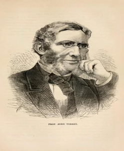
Hardy Bryan Croom, Botanist, discovered the tree in 1833, along the bluffs and ravines of Jackson, Liberty and Gadsen Counties, Florida and Decatur County in Georgia. He named it Florida Torreya (TOR-ee-uh), in honor of Dr. John Torrey, a renowned 18th century scientist.
Torreya trees are evergreen conifers, conically shaped, have whorled branches and stiff, sharp pointed, dark green needle-like leaves. Scientists noted the Torreya’s decline as far back as the 1950’s! Mature tree heights were once noted at 60 feet, but today’s trees are immature specimens of 3-6 feet, thought to be ‘root/stump sprouts.’
Known locally as “Stinking Cedar,” due to its strong smell when the leaves and cones are crushed, it was used for fence posts, cabinets, roof shingles, Christmas trees and riverboat fuel. Over-harvesting in the past and natural processes are taking a tremendous toll. Fungi are attacking weakened trees, causing the critically endangered species to die-off. Other declining factors include: drought, habitat loss, deer and loss of reproductive capability.
With federal and state protection, the Florida Torreya was listed as an endangered species in 1983. There is great concern for this ancient tree in scientific community and with citizen organizations. Efforts are underway to help bring this tree back from the edge of extinction!
Efforts include CRISPR gene editing technology research being done by the University of Florida Dept. of Forest Resources and Conservation- making the tree more resistant to disease. Torreya Guardians “rewilding and “assisted migration”. Reintroducing the tree to it’s former native range in the north near the Biltmore Estate in Asheville, NC, which has maintained a grove of Torreya trees and offspring since 1939 and supplying seeds for propagation from their healthy forest. Long before saving the earth became a global concern, Dr. Seuss (Theodor Seuss Geisel), spoke through his character the Lorax warning against urban progress and the danger it posed to the earth’s natural beauty. All of these groups, and many others, hope their efforts will collectively help bring this tree back from the brink!