by Chris Verlinde | Nov 19, 2021
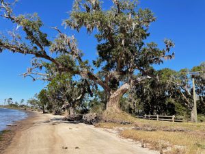
Photo: Chris Verlinde
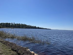
Photo: Chris Verlinde
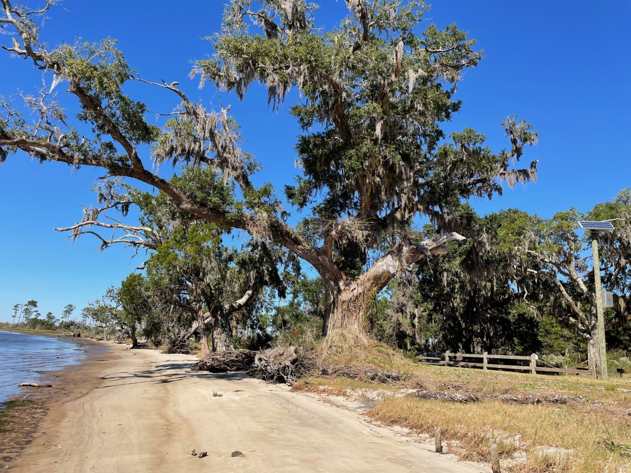
The diversity and natural beauty of the Escribano Point Wildlife Management area is breathtaking. These six square miles of conservation lands provides many types of outdoor recreation including: birdwatching, kayaking, camping, swimming, fishing and hiking. The bays, estuaries, river swamps and other coastal habitats are managed to preserve native plants and animals. Visit Escribano Point Wildlife Management Area (WMA) soon and discover this piece of old Florida.
The Escribano Point WMA is part of state-owned conservation lands that provide habitat for rare plants and animals and promote water quality in Blackwater Bay, East Bay and the Yellow River. The diverse habitats found in Escribano Point WMA provide home to many types of wildlife including, deer, turkey, Florida Black Bears, birds, reptiles amphibians and fish.
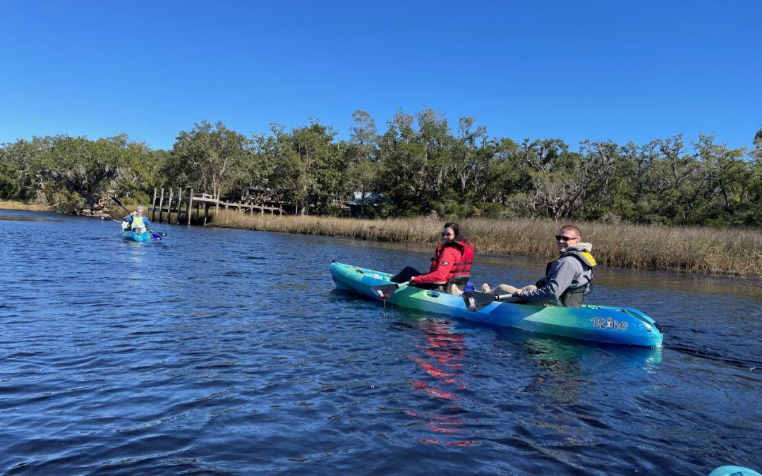
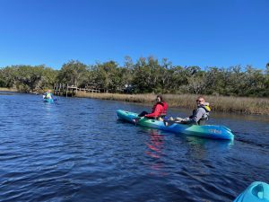
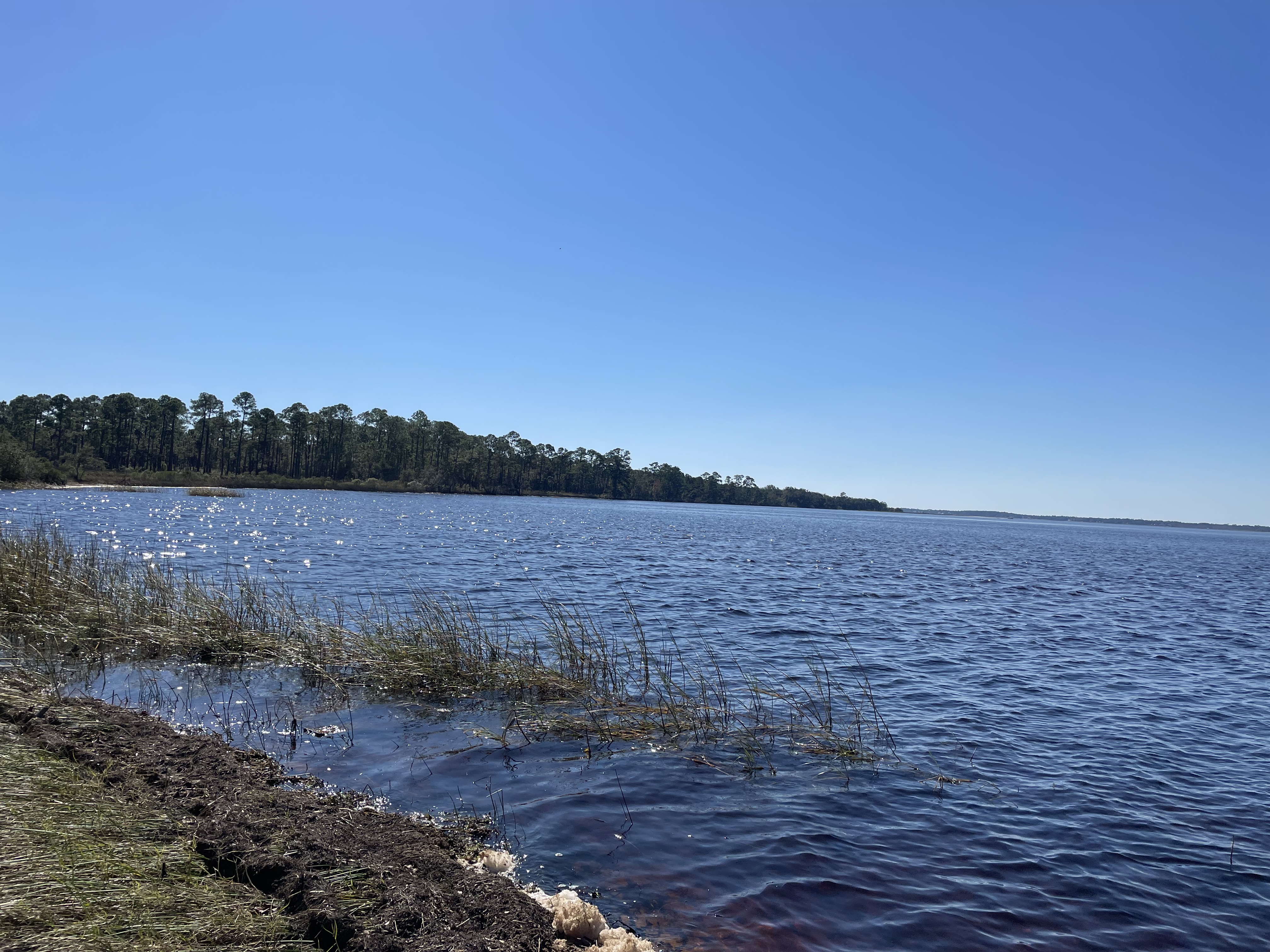
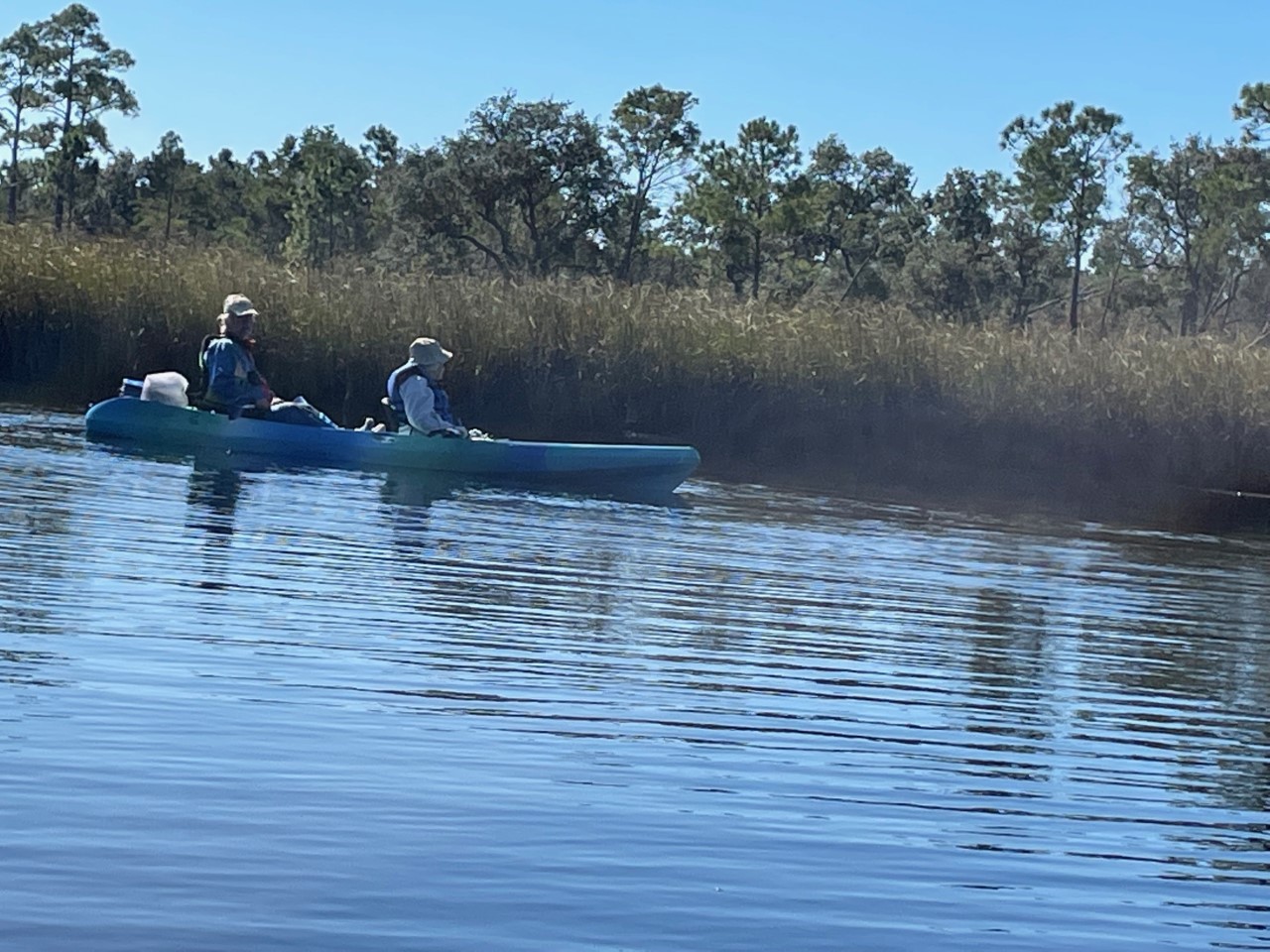
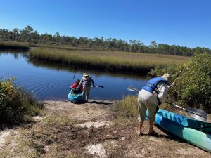 As part of the Florida Master Naturalist Program’s 20th Anniversary, a small but mighty group hit the water just as the air temperature broke 60 degrees on Saturday. We kayaked up Fundy Bayou and out to Fundy Cove located along the southeast side of Blackwater Bay in Santa Rosa County, Fl.
We traveled through freshwater and saltwater marshes, along scrubby flat woods, beach and mesic hammock habitats. Ospreys, a kingfisher, and red-headed woodpecker entertained the group. The air temperature warmed as we paddled. When we arrived at the junction of Fundy Creek and Blackwater Bay, Blackwater Bay was rough. We paddled to the campground for lunch and enjoyed the peaceful beauty around us.
Thanks to Kayak Dave, one member of the group checked an action on her bucket list to paddle again.
Escribano Point WMA is a treasure located in Santa Rosa County, FL., approximately 20 south of Milton, FL . Take some and visit for a day or two, there are 2 campgrounds located at this WMA. Enjoy!
by Chris Verlinde | Mar 5, 2021
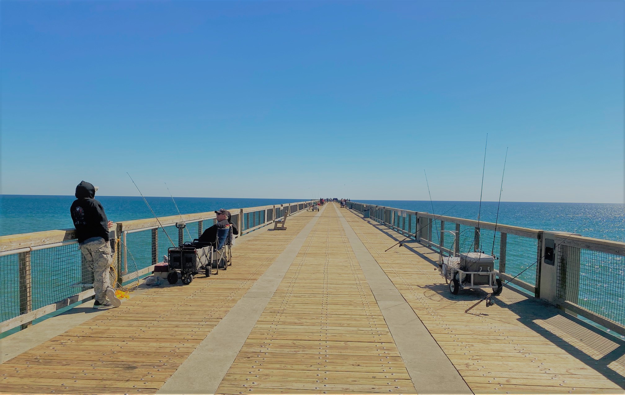
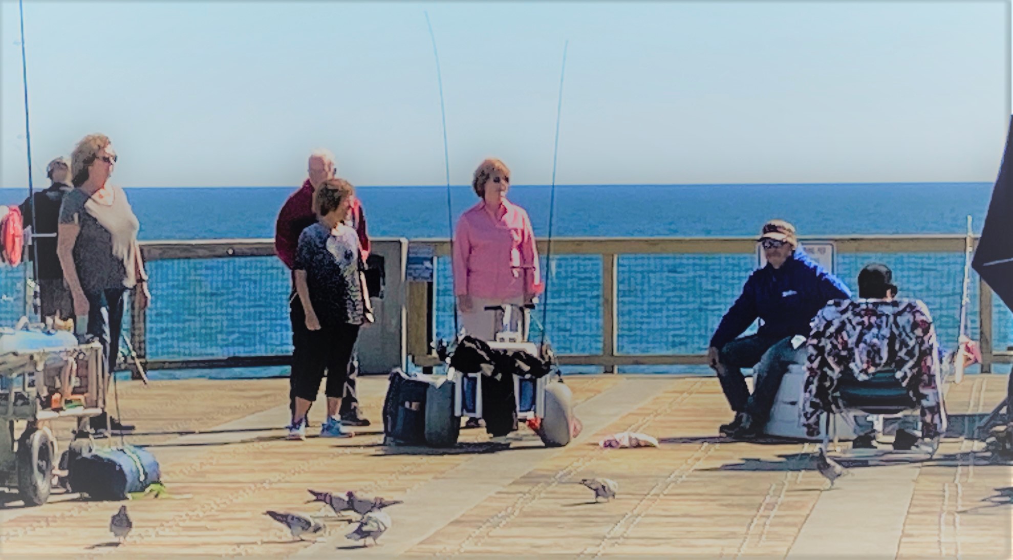
On most days, if you walk to the end of the Navarre Beach Fishing Pier, you will find a group of shark anglers that provide valuable data to the National Oceanic and Atmospheric Administration (NOAA) Cooperative Volunteer Shark Tagging program. Led by Earnie Polk, 50-60 team members have participated in the cooperative tagging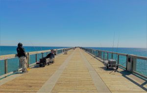 program in the twenty-five years he has been involved.
This group not only provides research data to NOAA, but are also stewards of pier etiquette, Navarre Beach and the surrounding area. Tourists and locals alike are treated to stories of local history, fish tales and general information about the area from Earnie and Team True Blue members. In addition, visitors may see a shark tagged and released or the group catching large fish to be used for shark bait
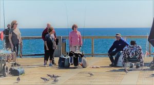
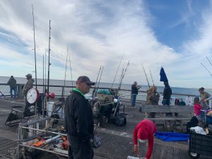

Photo Credit Earnie Polk
The NOAA Cooperative Shark Tagging program has been in existence since 1962. Today thousands of anglers along the Gulf of Mexico and Atlantic Coast have tagged more than 295,000 sharks representing 52 different species. More than 17,500 sharks have been recaptured! This program provides information on shark migration patterns, numbers, locations, migrations, age and growth rates, behavior and mortality.
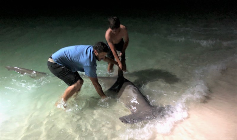
Earnie estimates he has tagged more than one-thousand sharks for the program. He has refined handling methods to have the least impact on the animal to ensure the survival of the shark after release. The team brings the shark to shore to measure the length and tag the shark just behind the dorsal fin. 
Earnie shared an interesting story about tagging at least eighty Dusky sharks during a red tide event during the late fall of 2015. He noticed as the north winds blew the red tide out, an open area was created along the coast. This allowed clear water for the sharks to travel closer to shore and within distance of the tag and release team.
Today, the tiger shark is the most common shark the team tags and releases. Recently, the team tagged and released a 12’6” tiger shark. Randy Meredith, of the Navarre Newspaper agreed to share the video he edited of the Navarre Fishing Pier and the tag and release of the tiger shark in February 2021.
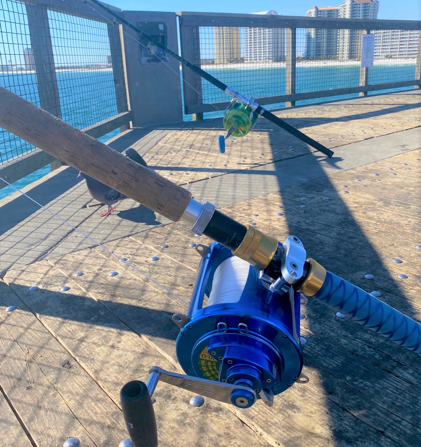
 The team uses heavy gear, 200-pound test line and Everol reels that have drag pressure for a shorter fight to reduce stress on the animal for a better survival rate. Gear is spread along the rails at the end of the pier. Baited lines range from approximately 75 to 400 yards off the end of the pier. You probably wonder how they get their line 400 yards off the pier. Earnie has modified a fiberglass kayak with a battery powered motor. It is lowered to the surface of the water; team members drop their lines onto the kayak and Earnie pilots the kayak out to deeper water.
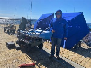
Their strategy is that by dropping more lines, at different depths and locations a shark is bound to trip over one of the lines. They use bait they catch on the pier or other fishing trips. Something big had hit on a cow nose ray over the weekend, so most members were using rays for bait. One team member said, “if the fish had hit on a watermelon, we all would be using watermelon for bait.” These guys have a great sense of humor!!
Make sure that the next time you visit Navarre Beach, you take time to walk out to the end of the fishing pier to learn about local sharks,  history and the area from these interesting, funny and helpful anglers. On clear days you may see sharks, rays, sea turtles and other types of marine life as you venture out.
Be sure to stop at the pier store to pay the $1.00 per-person fee to enjoy the view!
by Chris Verlinde | Jan 22, 2021
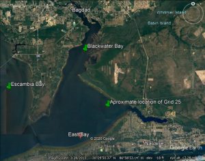
Santa Rosa Portion of the Oyster Mapping and Assessment Project
Santa Rosa County R.E.S.T.O.R.E. has funded the SRC Oyster shell recycling program and the Pensacola, East and Blackwater Bays Intertidal and Subtidal Oyster Reef mapping and Assessment projects. The Nature Conservancy is managing the oyster reef mapping and assessment project and has contracted with MREC Environmental, LLC to get the work done.
The purpose of the project is to map and assess the condition of known and potential intertidal and subtidal oyster reef resources in the Santa Rosa County portion of the Pensacola Bay system. Results of this mapping project will establish a baseline of the existing locations and condition of oyster resources in SRC. This information will help to guide future restoration projects.
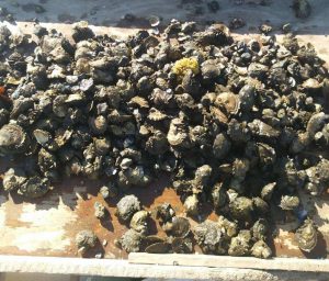
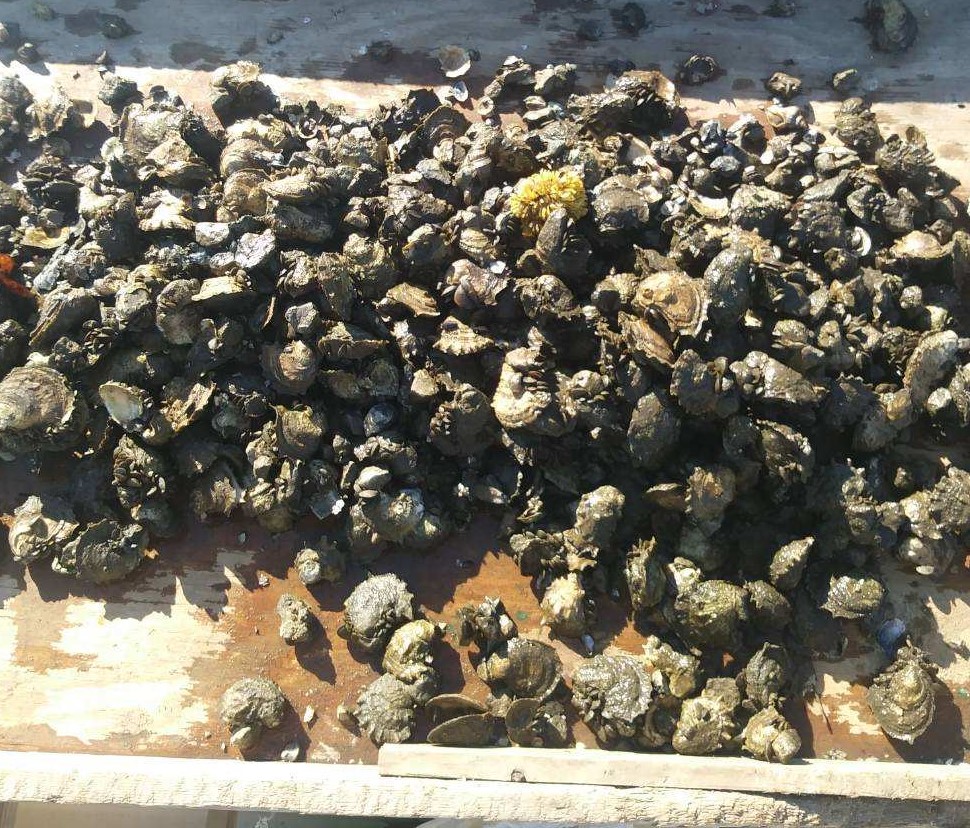
Subtidal oysters are harvested in clumps and are culled using a large knife or hatchet. Photo credit: Calvin Sullivan
Intertidal reefs are typically exposed at low tides and found along the shoreline of our bay system. Sub-tidal reefs are found under water. Gabe Johnson, owner of MREC Environmental has verified existing intertidal reefs using a jet-ski in the fall of 2020. Our bay system does not have as many natural intertidal reefs as in other parts of Florida. There are existing intertidal reefs that have been installed for shoreline protection and habitat enhancement.
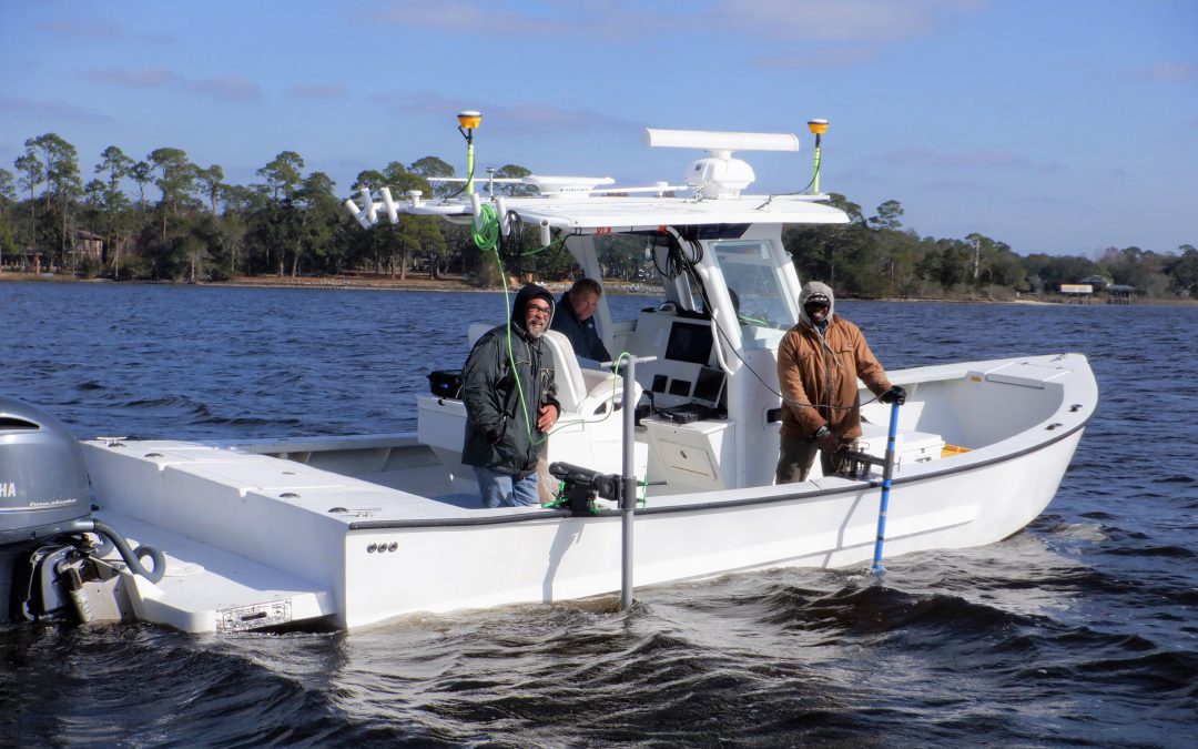
Gabe Johnson and the crew of MREC Environmental are working to complete the initial bottom survey in early 2021. He has set up grids based on historic locations of oyster reefs throughout the Santa Rosa County portion of the Pensacola Bay system. He will then verify his findings by diving sites where oyster shell was found during the bottom survey.

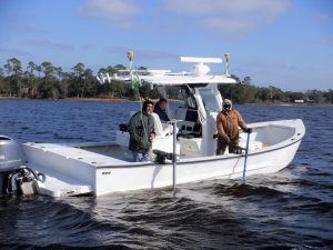
From left to right: Dale, Gabe and Reese of MREC Environmental. Phot credit: Chris Verlinde
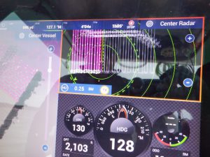
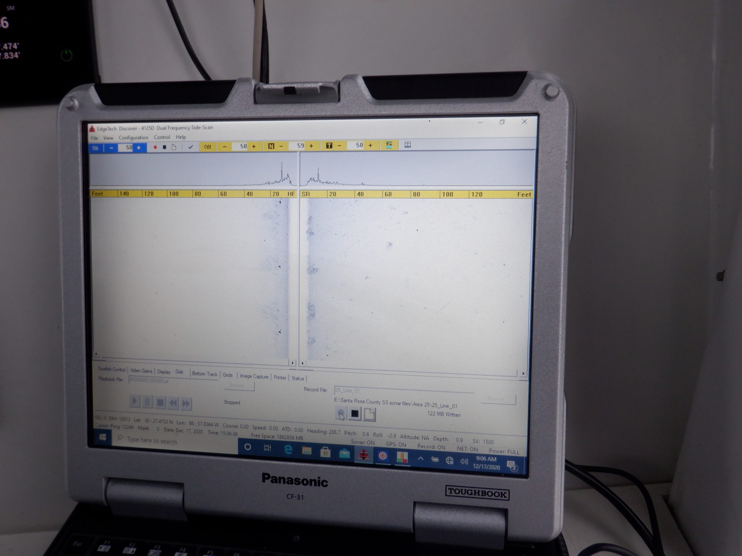
Side scan sonar and echosounder along the side of the boat. Photo Credit: Chris Verlinde
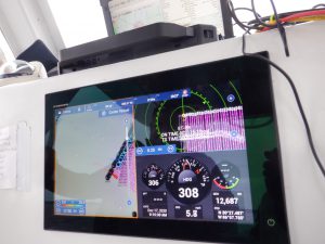
Gabe and his crew are using one Side Scan Sonar, an Edgetech 4125i to map images of the bottom. The other instrument they are using is a Singlebeam Hydrographic Echosounder (Teledyne Odom Echotrac CV100). The echosounder is used to collect water depth data and contours of the water bottom. The echosounder is connected to a transducer. The side scan sonar and the transducer from the ecosounder are placed along the side of the boat and submerged while the boat travels over the transects to collect the underwater images and parameters.
The pink lines are the transect lines of grid #25. Photo credit: Chris Verlinde
About two thirds of grid #25 are completed. Photo credit: Chris Verlinde
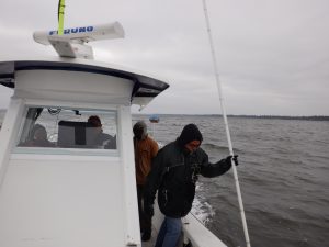
Dale dropping the pole to assess bottom characteristics. Photo credit: Chris Verlinde
On a cold day in December 2020, Gabe and his crew covered 149.3 acres in grid #25, just west of the power lines in East Bay. Grid 25 included 32 parallel transect lines (2468 feet long), spaced 100 feet apart. This grid was completed in approximately three and a half hours by running the boat along each transect and recording data. In addition to the electronic data, one of the crew members used a fiberglass pole to assess bottom conditions. Approximately, every 10 feet or so, the pole guy would lower the pole and shout the condition of the bottom, either sand, mud, or shell. Gabe then recorded the point and code on his mapping software.
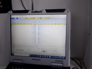
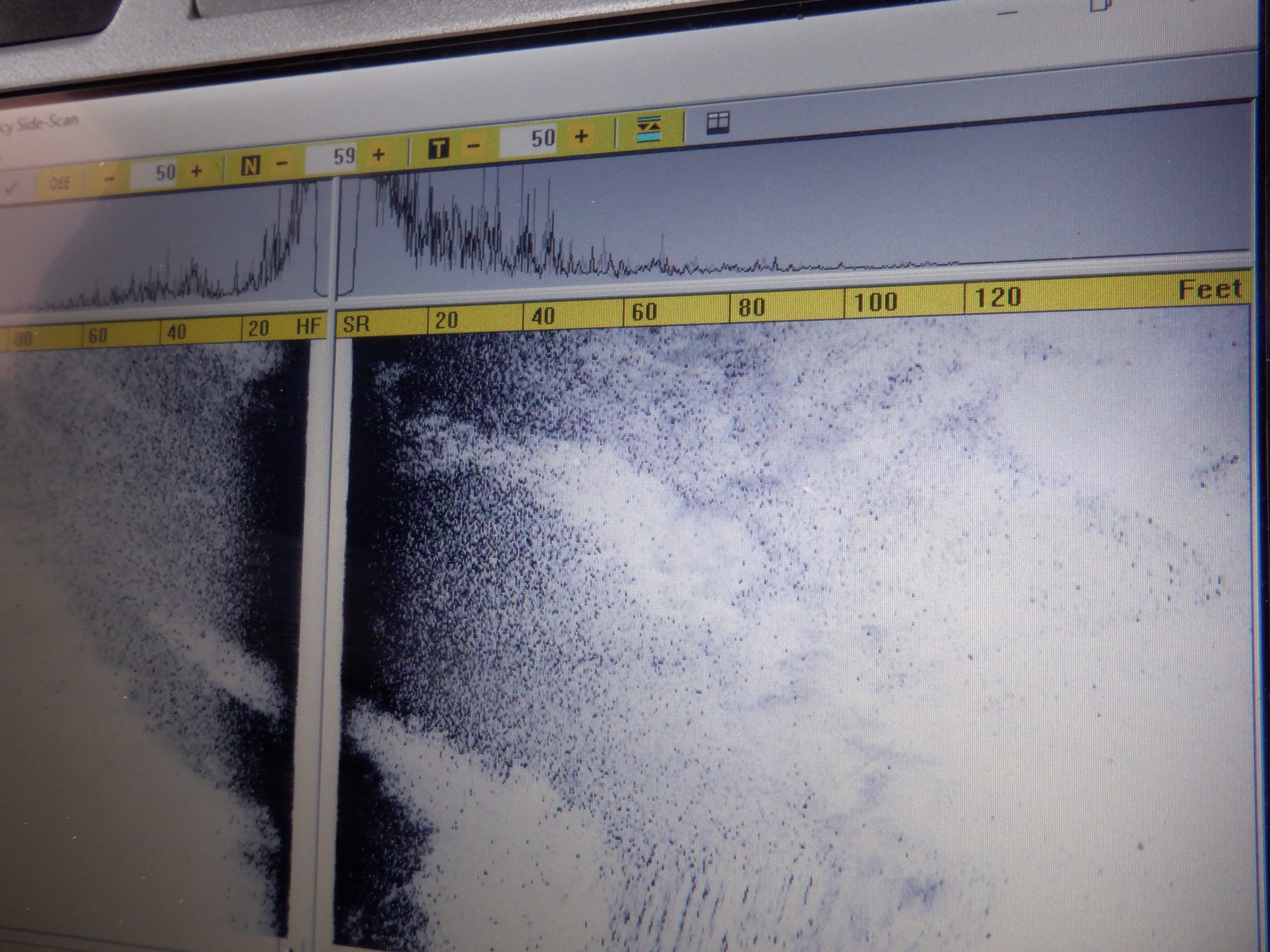
Image from the side scan sonar showing a sand bottom. Photo credit: Chris Verlinde
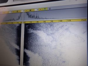
Side scan image of bottom with showing potential shell (the darker scatter area). Photo credit: Chris Verlinde
The raw data will be compiled into maps and a report that will be used to based future oyster fishery and habitat enhancement restoration efforts in East, West and parts of Escambia Bay.
by Chris Verlinde | May 1, 2020
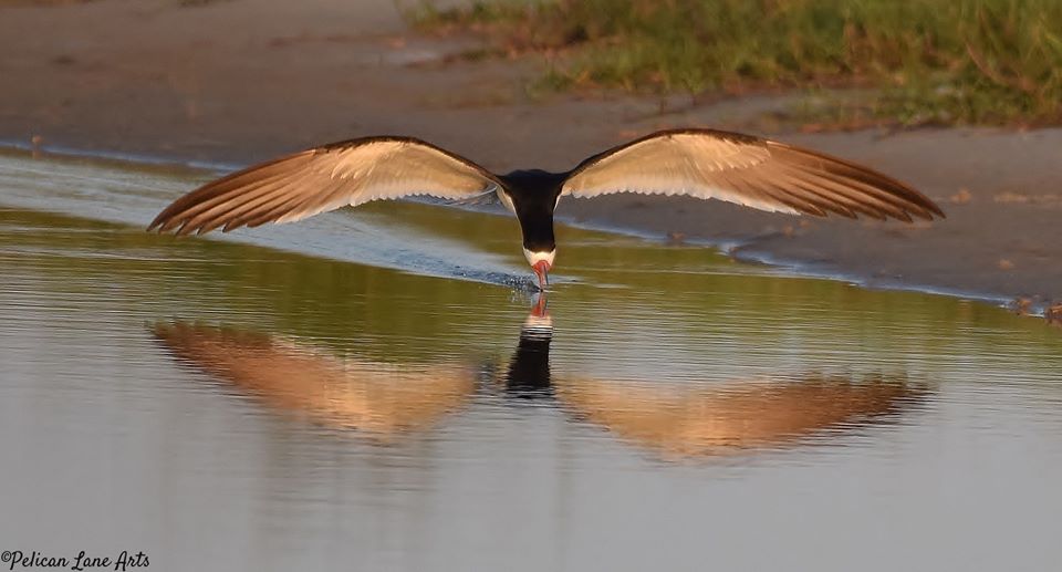
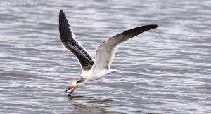
Black Skimmers foraging for fish. Photo Credit: Jan Trzepacz, Pelican Lane Arts.
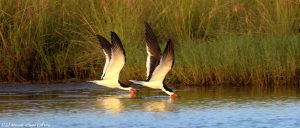
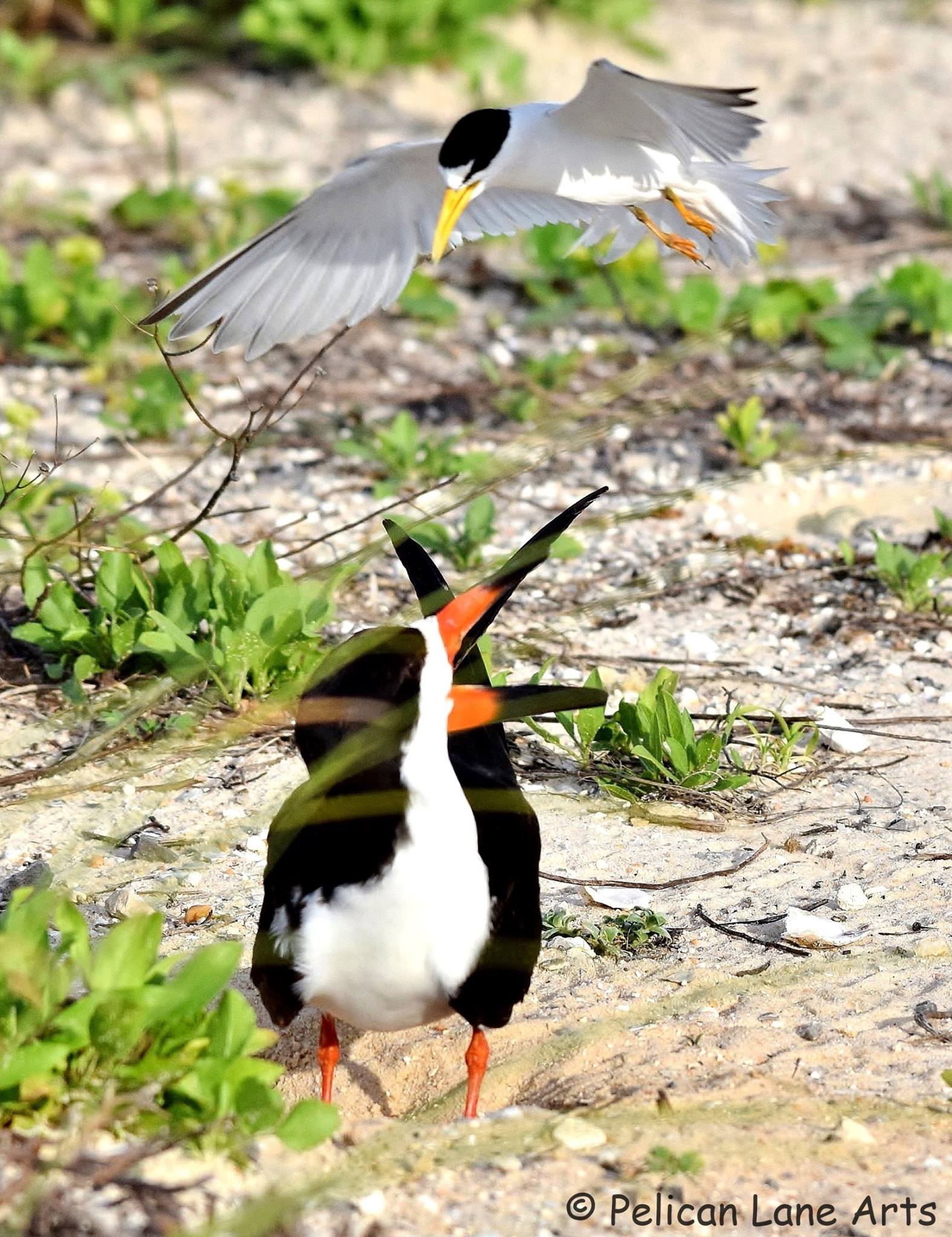
Black Skimmers and Least Terns, state listed species of seabirds, have returned along the coastal areas of the northern Gulf of Mexico! These colorful, dynamic birds are fun to watch, which can be done without disturbing the them.
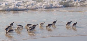
Shorebirds foraging. Photo Credit: Jan Trzepacz, Pelican Lane Arts.
Black Skimmer with a fish. Photo Credit: Jan Trzepacz, Pelican Lane Arts.
What is the difference between a seabird and shorebird?
Among other behaviors, their foraging habits are the easiest way to distinguish between the two. The seabirds depend on the open water to forage on fish and small invertebrates. The shorebirds are the camouflaged birds that can found along the shore, using their specialized beaks to poke in the sandy areas to forage for invertebrates.
Both seabirds and shorebirds nest on our local beaches, spoil islands, and artificial habitats such as gravel rooftops. Many of these birds are listed as endangered or threatened species by state and federal agencies.
Juvenile Black Skimmer learning to forage. Photo Credit: Jan Trzepacz, Pelican Lane Arts.
Adult black skimmers are easily identified by their long, black and orange bills, black upper body and white underside. They are most active in the early morning and evening while feeding. You can watch them swoop and skim along the water at many locations along the Gulf Coast. Watch for their tell-tale skimming as they skim the surface of the water with their beaks open, foraging for small fish and invertebrates. The lower mandible (beak) is longer than the upper mandible, this adaptation allows these birds to be efficient at catching their prey.

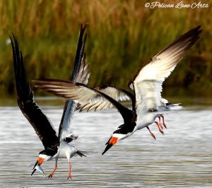
Least Tern “dive bombing” a Black Skimmer that is too close to the Least Tern nest. Photo Credit: Jan Trzepacz, Pelican Lane Arts.
Adult breeding least terns are much smaller birds with a white underside and a grey-upper body. Their bill is yellow, they have a white forehead and a black stripe across their eyes. Just above the tail feathers, there are two dark primary feathers that appear to look like a black tip at the back end of the bird. Terns feed by diving down to the water to grab their prey. They also use this “dive-bombing” technique to ward off predators, pets and humans from their nests, eggs and chicks.

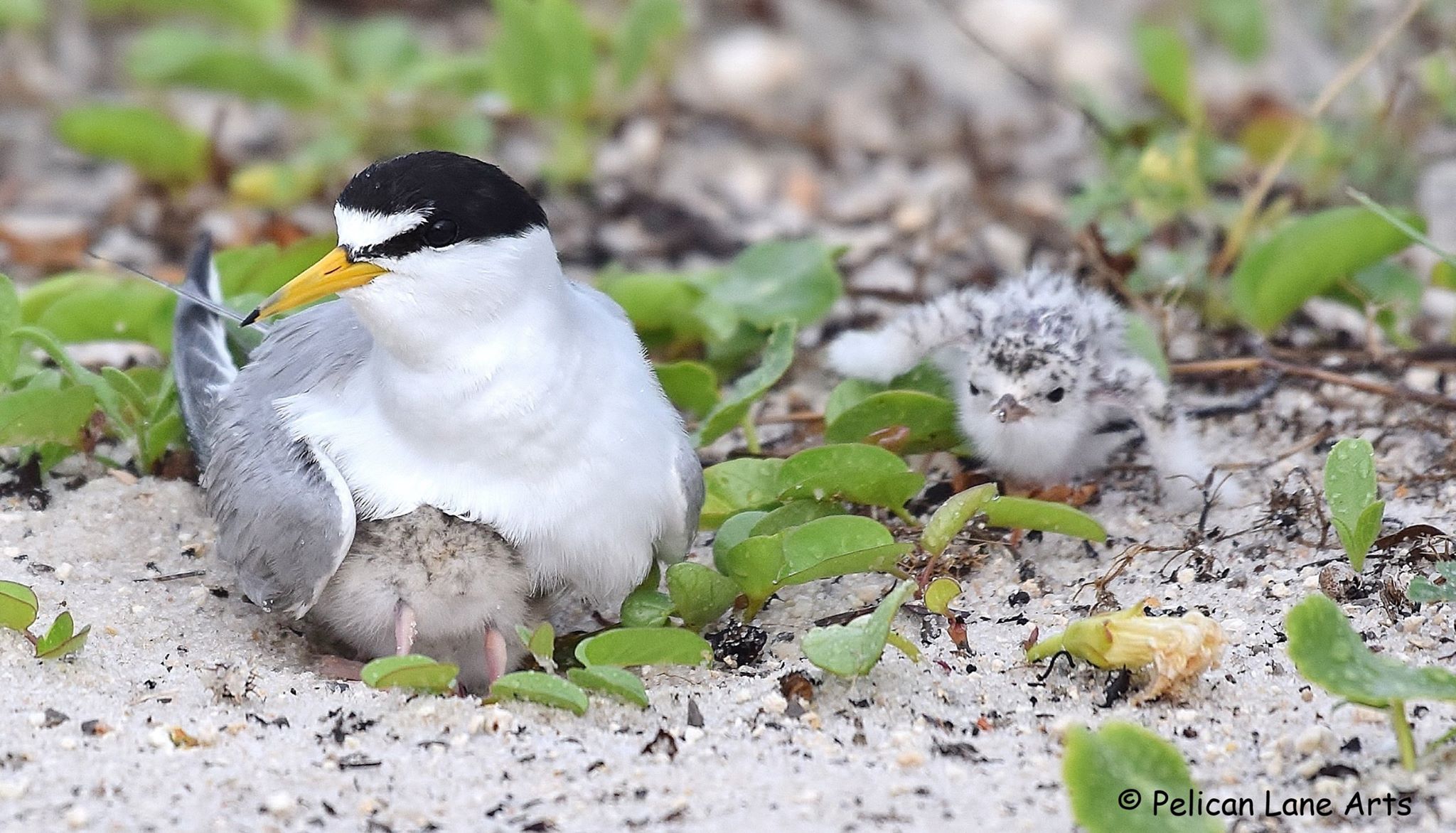
Least Tern with chicks. Photo Credit: Jan Trzepacz, Pelican Lane Arts.
Both Black Skimmers and Least Terns nest in colonies, which means they nest with many other birds. Black skimmers and Least Terns nest in sandy areas along the beach. They create a “scrape” in the sand. The birds lay their eggs in the shallow depression, the eggs blend into the beach sand and are very hard to see by humans and predators. In order to avoid disturbing the birds when they are sitting on their nests, known nesting areas are temporarily roped off by Audubon and/or Florida Fish and Wildlife Conservation Commission (FWC) representatives. This is done to protect the birds while they are nesting, caring for the babies and as the babies begin to learn to fly and forage for themselves.
Threats to these beautiful acrobats include loss of habitat, which means less space for the birds to rest, nest and forage. Disturbances from human caused activities such as:
- walking through nesting grounds
- allowing pets to run off-leash in nesting areas
- feral cats and other predators
- litter
- driving on the beach
- fireworks and other loud noises
Audubon and FWC rope-off nesting areas to protect the birds, their eggs and chicks. These nesting areas have signage asking visitors to stay out of nesting zones, so the chicks have a better chance of surviving. When a bird is disturbed off their nest, there is increased vulnerability to predators, heat and the parents may not return to the nest.
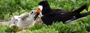
Black Skimmer feeding a chick. Photo Credit: Jan Trzepacz, Pelican Lane Arts.
To observe these birds, stay a safe distance away, zoom in with a telescope, phone, camera or binoculars, you may see a fluffy little chick! Let’s all work to give the birds some space.
Special thanks to Jan Trzepacz of Pelican Lane Arts for the use of these beautiful photos.
To learn about the Audubon Shorebird program on Navarre Beach, FL check out the Relax on Navarre Beach Facebook webinar presentation by Caroline Stahala, Audubon Western Florida Panhandle Shorebird Program Coordinator:
In some areas these birds nest close to the road. These areas have temporarily reduced speed limits, please drive the speed limit to avoid hitting a chick. If you are interested in receiving a “chick magnet” for your car, 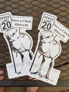 to show you support bird conservation, please send an email to: chrismv@ufl.edu, Please put “chick magnet” in the subject line. Please allow 2 weeks to receive your magnet in the mail. Limited quantities available.
by Chris Verlinde | Feb 28, 2020
What’s the big deal about seagrasses?
Seagrass meadows are made up of plants that live under water in our local estuaries. Just like the grass and plants in our yards where many types of insects, worms and small animals live, seagrass meadows provide habitat for many types of young fish and invertebrates, such as crabs and shrimp.

Between 70 and 90% of fish, crabs and shrimp that recreational and commercial fishermen catch, spend some time during their life in seagrass beds. In 2014, the commercial fishing industry contributed nearly $140 million, while recreational fishing spending contributed $6 billion to Florida’s Economy. If we did not have healthy seagrasses, we would not have this economic impact on our coastal economies (http://gulffishinfo.org/Gulf-Fisheries-Economics).
In addition:
· As seagrass blades move with the currents and tides, sediments are removed from the water, which contributes to improved water clarity.
· Seagrasses are the same type of plants that grow on land, they produce oxygen for marine life.
· Seagrasses filter excess nutrients from the water.
· Provide food and shelter for juvenile fish, shrimp and crabs.
· Endangered species such as manatees and green sea turtles depend on seagrass beds for food.
· Migratory birds depend on seagrass beds for foraging needs.
What can you do to help protect seagrasses?
While boating:
• Avoid seagrass beds. If you do run aground in a seagrass bed, turn off your engine, tilt up the engine and walk or pole your boat out of the shallow water.
• Be safe and know water depths and locations of seagrass beds by studying navigational charts.
• Seagrasses are usually found in shallow water and appear as dark spots or patches. Wear polarized sunglasses (to reduce glare) to help locate these areas.
• Always choose to use a pump-out station for your marine sanitation device.
• Stay in marked channels.
At home:
• To reduce pollution from entering our waterways, keep a buffer of native plants along your shoreline. This will also help to protect your property from erosion and slow flood waters during storm events.
• To save money, plant native plants that don’t require a lot of fertilizers and pesticides. Avoid seagrass beds when planning for dredging activities or pier construction.
• Comply with Shoreline Protection construction codes
• Maintain septic tanks.
In your community:
• Families and children can get out and snorkel these areas! Many sites are easy to access from public parks.
• Get involved with local organizations that promote nature protection.
• Working together, we can share with community members what we have learned about seagrasses at the 20th annual Seagrass Awareness Celebration, March 6, 2020 from noon until 4 pm at Shoreline Park South in Gulf Breeze Fl.
• Don’t litter!
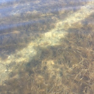
The scarring of seagrass but a propeller.

 As part of the Florida Master Naturalist Program’s 20th Anniversary, a small but mighty group hit the water just as the air temperature broke 60 degrees on Saturday. We kayaked up Fundy Bayou and out to Fundy Cove located along the southeast side of Blackwater Bay in Santa Rosa County, Fl.


