by Rick O'Connor | Mar 11, 2016
Talk about weird and cool at the same time! The horseshoe crab is one of the oldest living species we have in the Gulf of Mexico. Fossils of this animal date back to almost 500 million years… this is before there was such a thing as fish! The separating of Pangea, the rise and fall of the dinosaurs, oh what stories these guys could tell! And they are here today, trudging along in the soft sands of estuaries along the Atlantic and Gulf coasts… but they seem to be on the decline. After all they have been through… they may be slipping away.
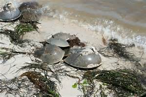
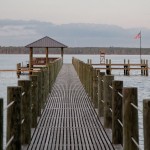
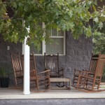
Horseshoe crabs breeding on the beach.
Photo: Florida Sea Grant
Actually, horseshoe crabs are not crabs at all. They belong to the same large group of animals the crabs belong to, Arthropods, but differ from true crabs in that they have fewer jointed legs and no antennae. They are actually more closely related to spiders and scorpions. There are 4 species remaining on Earth. Limulus polyphemus is the local variety with the other three living in Asia. They are tolerant of a wide range of environmental conditions. Huge swings in water temperature and salinity do not bother them. This is not surprising considering all of the environmental changes that have occurred since the species first appeared on the planet. They are scavengers, plowing through the soft bottom of estuaries, they feed on worms, mollusk, and whatever else their crop-gizzard system can breakdown. Their protective shell deters many predators; most horseshoe crabs meet their fate on the beach – where they must go to breed.
Breeding occurs all year in Florida. It typically takes place three days before and after the new or full moon. The smaller males come near shore and patrol for the oncoming females. As the females are intercepted the males will use their “hook” to hold on and the pair ride onto the beach. This usually happens at night (though not always) during the peak of a spring high tide. The female digs a small depression and deposits between 200 and 300 eggs, the male fertilizes them, and the female buries them. They leave the young on their own for a month, at which time the next spring tide arrives and the larva, which resemble trilobites, emerge. Many fall prey to shorebirds and many adults actually become stranded on the beach during nesting and die.
So why the population decline?
Well, they do tolerate large swings in environmental change, so increase temperatures, rainfall, salinities, do not bother them. Studies have shown that they are actually quite tolerant of many of the pollutants, including oil, we discharge into our bays – though mercury is a problem for the developing trilobite larva. Along the Atlantic coast the animals are collected for bait and the biomedical industry. Horseshoe crabs are used in eel traps and there are several medical uses for their blood. Some biomedical industries collect the crabs, remove some of the blood, and return them – but not all survive this. A big problem they are facing, and this would be closer to home, is the loss of nesting habitat. Seawalls, jetties, groins, and coastal development in general have disturbed nesting beaches.
That said, they seem to be making a comeback on Pensacola Beach. There have been sightings at both Big and Little Sabine. We would like to record where they are nesting in the panhandle. If you would like to help – the full moon for the next few months will occur on March 22, April 22, May 21, and June 20. The new moon will occur March 8, April 7, May 6, and June 4. If you do see a horseshoe crab please contact me at (850) 475-5230, or email at roc1@ufl.edu.
by Rick O'Connor | Feb 12, 2016
All Photos by Molly O’Connor
We began our series on Nature Tourism along the ICW at the Alabama state line on Perdido Key and discussed the ICW itself. This month we will continue in Escambia County with a visit to Pensacola Beach.

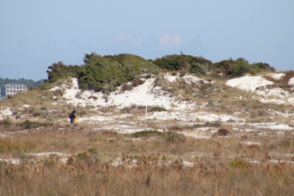
The dune fields of panhandle barrier islands are awesome – some reaching over 50 ft. in height. This one is near the Big Sabine hike (notice white PVC markers).

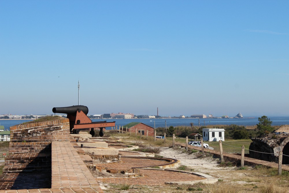
The cannons of Ft. Pickens protected the entrance into Pensacola Bay. The views of the western end of Santa Rosa Island are great from here. There is plenty of nature and history to be discovered at this park. Plan to stay the day.
BARRIER ISLANDS
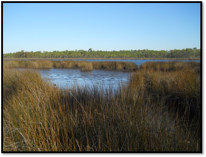
Pensacola Beach is on Santa Rosa Island. The longest barrier island in the panhandle, Santa Rosa Island stretches 44 miles from Ft. Pickens, at Pensacola Pass, to Destin Pass in Okaloosa County. With miles of some of the whitest beaches in the world, these panhandle islands have a variety of ecosystems. The mineral that makes the beach so white is quartz, one of the minerals found in granite rock. Over eons weathering and erosion has released these minerals from the granite in the Appalachians and sent it downstream to the Gulf coast. The densities of the different minerals force it to settle out at different rates. Quartz, being one of the less dense minerals, reaches the Gulf of Mexico where it encounters longshore currents. In the panhandle these currents more often run east to west moving the quartz in that direction. This sand forms bars and shallows which made colonial navigation a problem and good hiding places for pirates. Some of the bars remain above sea level and form dune fields and plant communities, forming barrier islands. Many animals, such as shorebirds and sea turtles, seek these islands for nesting because of few predators. The xeric conditions favor reptiles and birds, but there are many mammals and insects as well. Freshwater ponds form on many of the islands and here amphibians and fish came claim territory. The high energy beach of the Gulf side supports a community of subterranean organisms which include the mole crab (sand flea) and coquina. The low energy bay side harbors salt marshes along the shoreline and seagrass meadows below the surface. These habitats support a rich variety of marine life, some of the most productive in the world.
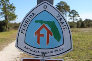
The Florida Trail extends (in sections) over 1,300 miles from Ft. Pickens to the Florida Everglades. It begins at this point.
PENSACOLA BEACH
There are many places on Pensacola Beach where visitors can enjoy these natural places. At the west end of the island is Ft. Pickens, part of the Gulf Islands National Seashore. Within the park you will find beaches to comb, piers to view wildlife and fish, jetties to fish or dive, fortifications to view the island, and a nice museum to educate you on both the natural and cultural history of the area. Here the Florida Trail begins. This trail is segmented and stretches from Ft. Pickens to the Everglades, but here it stops at Battery Langdon; it can be hiked or biked. Along the trail there are freshwater ponds and sections of maritime forest with a variety of wildlife viewing and photography. The multiple loop campground is found on this trail.
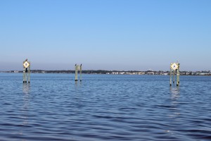
Between these pilings at Park West is one of the county snorkel reefs. Visibility is tough but the fish are there.
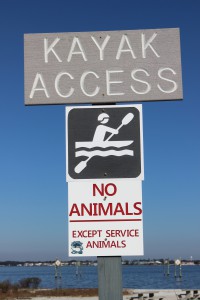
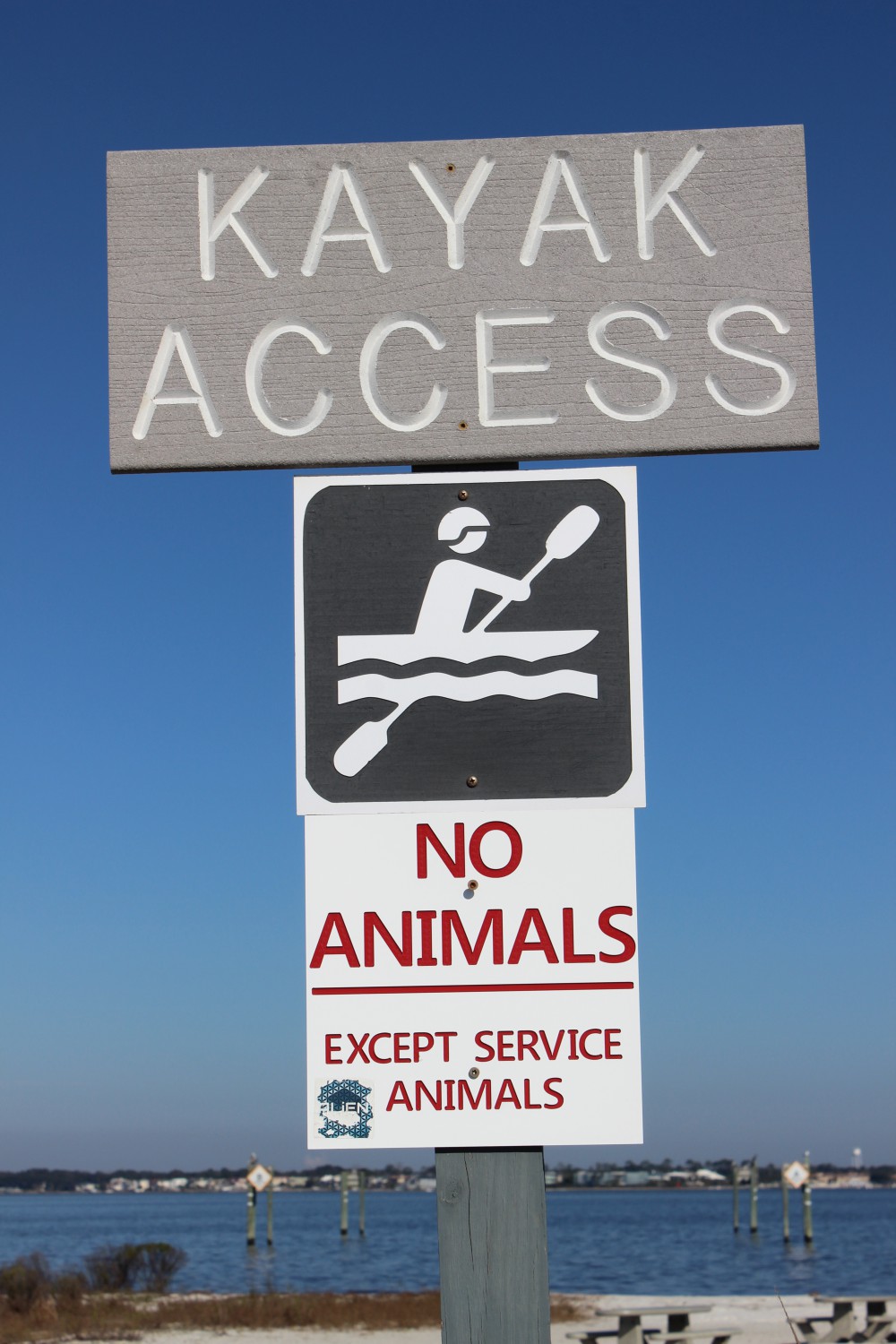
There is a kayak launch at Park West as well.
Just outside the entrance to the park is a county park named Park West. Here there is a kayak launch and nearshore snorkel reef on the bay side, with picnic area and beaches on the Gulf.
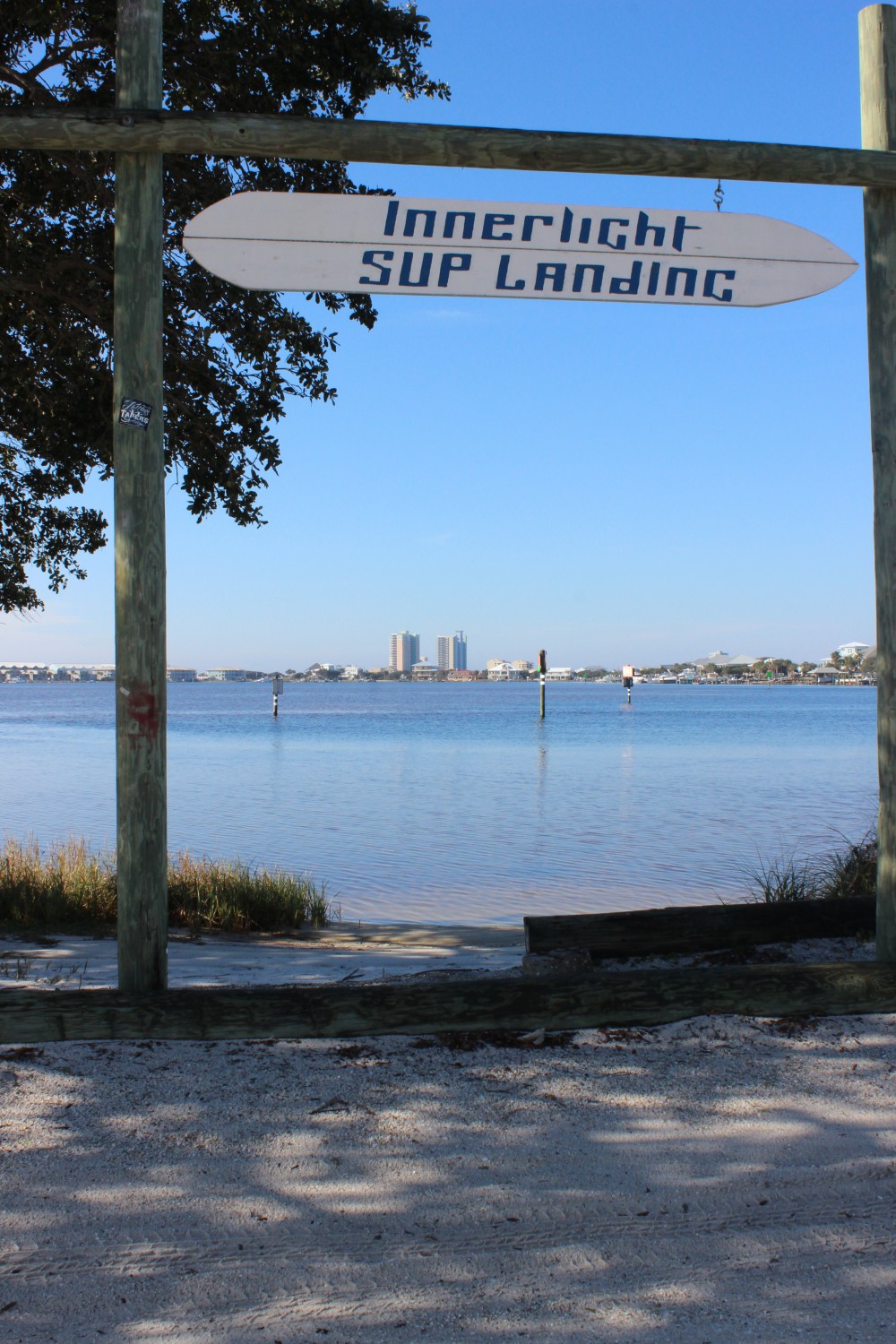
In Pensacola Beach proper there are several businesses that rent paddleboards for paddling the shallow seagrass filled Little Sabine. There are two marinas which offer sailing, fishing, and diving charters as well as dolphin tours. There are numerous artificial reefs off of Pensacola including the world’s largest – the U.S.S. Oriskany. On the Gulf side you will find the Pensacola Beach Fishing Pier where not only can you fish but, at times, see marine life. Sharks, sea turtles, dolphins, and large fish are often seen. The sunsets are great here. At the Visitors Center you can get a map to follow the Eco-Trail. This driving trail of 28 kiosks will take you to natural spots and the kiosks provide education about the area. There is a prize if you complete the trail.
Heading east from Pensacola Beach you once again pick up a portion of the Florida Trail. At this location there is a bike path, which can be walked or biked. Park East houses a popular nearshore snorkel reef. This snorkel reef is on the Gulf side and there are beach markers to help the diver locate it. On the bay side is Big Sabine. This area of high dunes and salt marsh has no formal trail but there are PVC pipes placed to help navigate your way in and out.

The paddleboard entry to Little Sabine can be found next to the Pensacola Beach Marina.
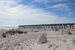
The Pensacola Beach Fishing Pier is not only a great spot to catch fish, it’s a great spot to see marine life – and great sunsets.
Further east you once again enter the Gulf Islands National Seashore. Escambia County is lucky to have almost 50% of their portion of the island within this national park. There are miles of natural beach to explore but you must use the public parking lots (no roadside parking) and watch your speed, this area supports several species of nesting shorebirds – some of which are listed as imperiled in the state of Florida.
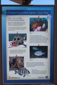
The Santa Rosa island Authority’s Eco-Trail has 28 kiosk to navigate and learn about the natural history of the island. It is a fun and educational car trip. You can get the map for this trail at the visitors center on Pensacola Beach.
To learn more about nature and farm tourism in Escambia County visit www.NaturallyEscaRosa.com and download the free app at the App Store or Google Play
Next month – Santa Rosa County.

Aligning these markers will assist the snorkeler/diver in locating the Gulf snorkel reef at Park East. The swim is a bit further than Park West but the visibility is much better.
by Rick O'Connor | Feb 8, 2016
by Carrie Stevenson | Feb 5, 2016
On “project day” students share their knowledge with the class. Photo credit: Carrie Stevenson
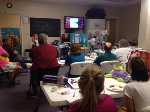
The Florida Master Naturalist Program is a 40-hour experiential learning course offered by UF IFAS Extension. While we spend time in class with presentations, by far everyone’s favorite aspects of the course are field trips and “project day.” As part of the course, each participant produces an educational tool—a display, presentation, skit, or lesson—that delves deeper into a topic of interest. The students and instructors are able to use these tools again and again to teach others.
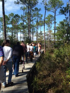
Master Naturalist students walk “The Way” boardwalk in Perdido Key. Photo credit: Carrie Stevenson
One example of a multi-year student project is “The Way” nature trail, located at Perdido Bay United Methodist Church. Master Naturalist Jerry Patee worked with volunteers from his church and community to design and permit a boardwalk and nature trail leading to Bayou Garcon. The unique trail is less than a mile, but traverses upland, freshwater wetland, and coastal habitats, making it a perfect ecological teaching tool. The trail is open to the public and maintained as a place of quiet contemplation. The project is ongoing, with educational signage planned, but it is an excellent new resource for the community.
“The Way” is just one of many positive contributions made by Master Naturalist students over the years. To enroll in a Florida Master Naturalist course near you, visit the FMNP page or talk with an instructor at your local county Extension office.
by Rick O'Connor | Feb 5, 2016
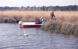
Fishermen fish the marshes of Weeks Bay while a pelican looks on. Photo: WeeksBay.org
Mobile Bay?… part of the Florida panhandle?… Really?…
Well… yes… during the colonial period “West Florida” extended west to the Biloxi area and besides, all western panhandlers know we are really “lower Alabama”; we hear it a million times a year… so YES, it’s part of the Florida panhandle! We’ll go with it.
The shallow, muddy, and productive waters of Mobile Bay as they pass the port city of Mobile AL.
Photo: Auburn University
Approximately 35 miles long and 10 miles wide, Mobile Bay is one of the largest estuaries on the Gulf coast; draining close to 1/5th of the eastern United States. This wide, shallow, and muddy bay supports a variety of fresh and brackish water ecosystems. Wildlife from the Mississippi delta, the red hills of the Piedmont region, and the Florida panhandle all converge here making this one of the more biologically diverse areas in the country. It was home to both Dr. E.O. Wilson and Dr. Archie Carr who deeply loved the area and it has been a hub for estuarine research for decades. The rich abundance of wildlife supports commercial and recreational fishing and hunting as well as a growing ecotourism industry. Though the shallow bay must be dredged to support it, the Port of Mobile in one of the busiest in the Gulf region.
Weeks Bay is a small tributary to this bay system. Fed by the Fish and Magnolia Rivers on the southeastern shore of Mobile Bay, Weeks Bay discharges into Bon Secour, which supports a commercial fishing business. Lined with salt marshes, cypress swamps, and bogs, this area is great for wildlife viewing and fishing. It is also the area of Mobile Bay that experiences the famous crab jubilees; where levels of low dissolved oxygen on the bottom of the bay force benthic animals – such as crabs and flounder – to shallow water seeking oxygen. About 6,000 acres of this estuarine habitat is now part of NOAA’s National Estuarine Research Reserve system. At the reserve there are interactive exhibits, trails, and pontoon boat rides to explore and appreciate this special place.
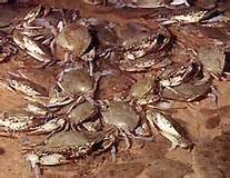
Crab jubilees occur along the eastern shore of Mobile Bay during very warm summer evenings.
Photo: NOAA
What better place to learn about the estuaries of the Gulf coast! The Panhandle Outdoor LIVE program will conduct one of our four 2016 watershed schools at this reserve. We will have lectures on estuarine ecology, the seafood industry in Mobile Bay – highlighting oyster farming, and on the mission of the Research Reserve itself. We will also have a local outfitter lead a kayak/canoe trip through the estuary as well an interpretive nature hike at the reserve’s visitor center. It will be set up as an overnight trip for those traveling and we will be staying at Camp Beckwith, which on Weeks Bay. Registration for this trip will open at the end of February. If you have questions about this watershed school you can contact Carrie Stevenson or Rick O’Connor at (850) 475-5230; or Chris Verlinde at (850) 623-3868.
A relaxing spot at Camp Beckwith on Weeks Bay.
Photo: Camp Beckwith
by | Jan 25, 2016
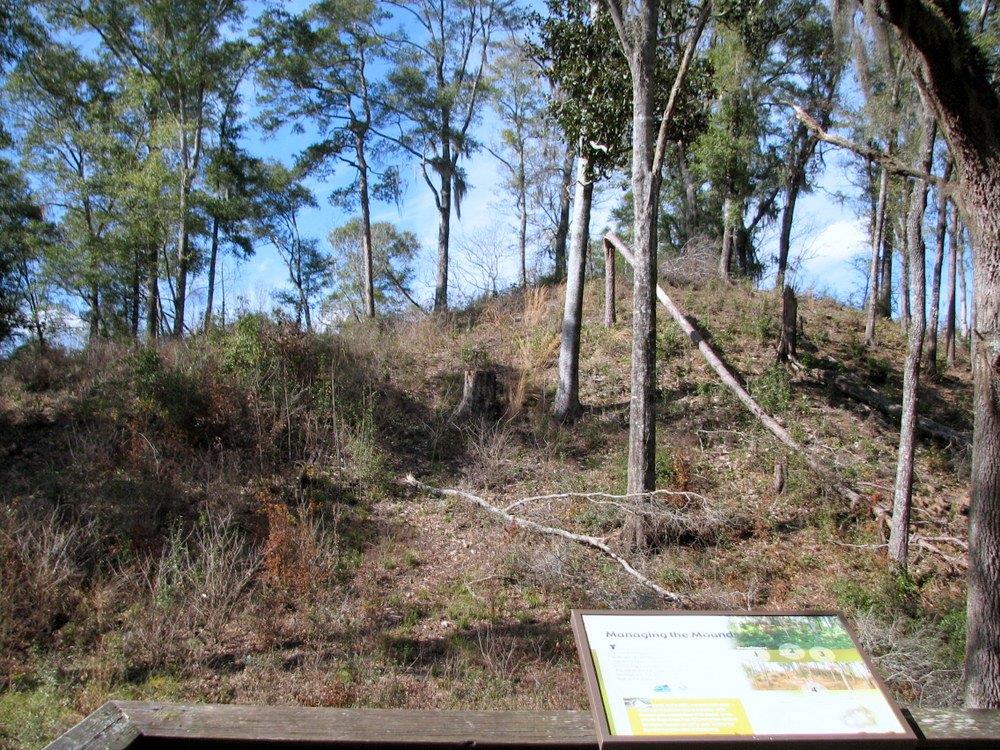
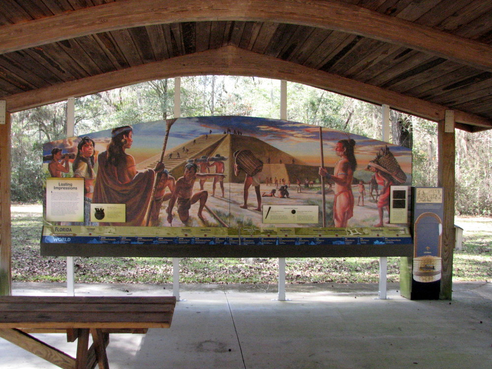
It’s a calm clear weekday in January. There’s a single buzzard soaring above, two squirrels scurrying in the trees and a pileated woodpecker calling in the distance. It’s hard to imagine this site was the capital of civilization in North Florida some 1200 or more years ago. The visible exception is the weathered remnant of “The Great Mound”, a massive earthen mound forty-six feet high and over 300 feet wide at its base. This is the largest Native American ceremonial mound in Florida, containing millions of twenty pound baskets of earth. Archeological sampling shows the builders mixed different types of earth to create a more stable structure. The mound’s persistence confirms the builders’ wisdom.

Twelve hundred years of erosion and overgrowth contrast with this Park depiction of the Great Mound in it’s heyday
Photo: Jed Dillard

Artifacts show the site was occupied up to 12, 000 years ago, long before the mound was built. The mound’s builders are believed to have been members of the late Swift Creek (200-450 A.D.) and early to middle Weeden Island cultures, a group of Native Americans who lived in North Florida between 450 and 900 A.D. Other authorities have suggested the mound was more of the style of later cultures, for example the Mississippians. Either way, these were relative new comers compared to the Paleoindians. Paleoindian tool marks were found on a mastodon tusk from the Aucilla River bottom and a stone point was found in the skull of a Bison antiquus raised from the Wacissa River bottom. Bison antiquus is believed to have disappeared around 10,000 years ago and the mastodon tusk was carbon dated as 12,000 years old.
The Letchworth-Love Mounds archeological site in western Jefferson County preserves Mound 1, as it’s called in documents. Discovered in 1932, but officially unrecorded until 1975, the mound is surrounded by over twenty mounds outside the park in the area on the shore of Lake Miccosukee. The Lake Jackson Mounds Archeological State Park north of Tallahassee is believed to be a later, separate settlement.
At the height of its functions, the immediate Great Mound complex had 10 smaller mounds and two plazas. The Mound itself had two side platforms, an earthen ramp and a peak styled similar to Meso-American structures. The main village was to the south of the complex near Lloyd Creek. Other high ground near water in the county hold evidence of at least temporary camps and towns.
Now the capital of Florida civilization is 30 miles west in another skyscraper, and the chiefs are debating ownership of the artifacts from the oldest capital. Wouldn’t this be a good time to learn more about our history?
The park is located on South Sun Ray Road off US 90 and is open from sunrise to sunset. Don’t expect a crowd.