by Rick O'Connor | Jun 22, 2018
What is bioaccumulation of toxins?
Our bodies come in contact, and produce, toxins every day. The production of toxins can result during simple metabolism of food. However, our bodies are designed with a system to rid us of these toxins. Toxins are processed by our immune system and removed via our kidneys. Some chemical compounds are structured in a way that they are not as easily removed, thus they accumulate in our bodies over time, often in fatty tissues, and sometimes they are toxic – this is bioaccumulation.
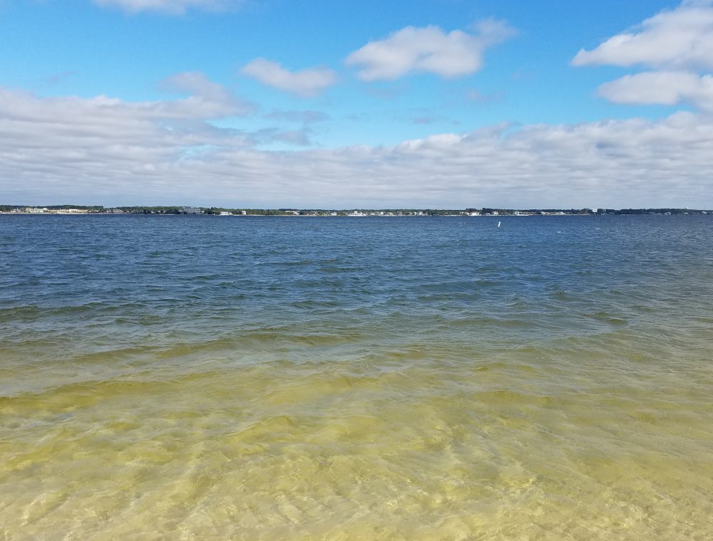
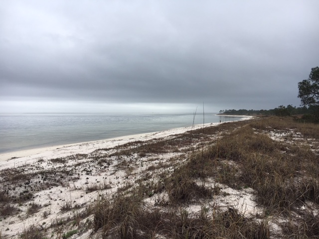
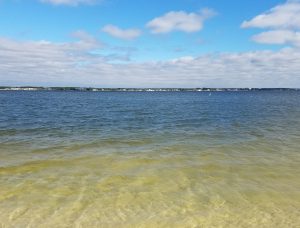
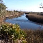
A view of Pensacola Bay from Santa Rosa Island.
Photo: Rick O’Connor
Biomagnification takes it a step further. In many cases, the concentrations of bioaccumulating toxic substances in the water may be in low enough concentrations to have little effect on human health. They are ingested by small organisms in the environment, such as plankton or juvenile marine fish, and – again are at low concentrations. However, they are accumulated in their tissues and as the next level of the food chain begin to consume them – they too accumulate the toxic compounds in their tissues. Small fish consume large amounts of plankton and thus, large amounts of the toxins they have accumulated – increasing the concentration within their own tissues. This continues up the food chain to a point where, in the larger predators, the concentrations of these toxins have increased enough that they now pose a threat to human health – this is biomagnification.
The presence, and amount, of any one bioaccumulating compound varies with species, their size, their age, their gender, their life stage, whether they are mobile or not, their diet, and whether the sample included the skin (which is lipid heavy and a common location for accumulated toxins). In the Pensacola Bay System, about 30 species of marine plants and animals have been analyzed for the presence of these accumulating compounds.
Species collected from Pensacola Bay that were analyzed for contaminants
| Plants |
3 species of seagrass
1 species of seaweed
Colonized algal periphyton |
| Invertebrates |
4 species of freshwater mussels
Eastern oyster
1 species of brackish water clams
1 species of barnacle
Several species of shrimp
Blue crab
Oyster drill (snail) |
| Vertebrates |
2 species of catfish
5 species of scaienids (drums, croakers, trout)
Bluegill
Bluefish
Several species of flounder
2 species of jacks
Largemouth bass
Sheepshead
Striped mullet |
Trace Metal Accumulation
Much of what has been studied in terms of metal accumulation has come from shellfish – particularly eastern oysters. Ten different metals have been found in oysters with zinc being in the highest concentration and lead the lowest. A 2005 study found that levels of arsenic, lead, and nickel collected from mussels collected at selected locations in the PBS were regionally high (meaning higher than other estuaries in the region). Another study (2003) found that levels of 16 different metals in shellfish were three times higher in Bayou Chico than samples from East Bay. A 1993 study found that organisms attached to pieces of treated wood in Santa Rosa Sound had elevated levels of metals. However, another study (2008) found low concentrations of metals in five species of fish collected in Escambia Bay near the I-10 Bridge.
The bioaccumulation potential within plants is less understood than animals. That said – concentrations within seagrass were relatively low when compared to the sediments they were growing in and periphytic algae attached to them.
Total Mercury Concentrations (ng/g – dry weight) for Local Marine Organisms
Lewis and Chaney (2008)
| Range (ng/g) |
Species |
| 0-200 |
Sediments, seagrass, oysters |
| 200 – 400 |
Periphytic algae |
| 400 – 600 |
Mussels |
| 600 – 800 |
Brackish clams, blue crabs |
| 800 and higher |
Fish |
The above table shows biomagnification.
Comparing trace metal concentrations between Pensacola Bay and other Regional Estuaries
(USEPA unpublished data)
| Pensacola Bay, Escambia Bay, Escambia River, Bayou Texar, Bayou Chico, Bayou Grande, Santa Rosa Sound |
Grand Lagoon (Bay Co.), Mississippi Sound, Old River, Suwannee River, Withlacoochee River, Bay La Launch |
| Cadmium |
Higher in PBS; highest in Bayou’s Grande and Texar |
| Chromium |
Similar to other estuaries |
| Copper |
Slightly elevated in Bayou Chico and Escambia River; highest in Withlacoochee |
| Total Mercury |
Much higher in PBS; particularly in the bayous |
| Nickel |
Lower in PBS |
| Lead |
Higher in PBS; particularly in the bayous |
| Zinc |
Higher in PBS; particularly in the bayous |
There are higher concentrations of trace metals in PBS and particularly in the bayous.
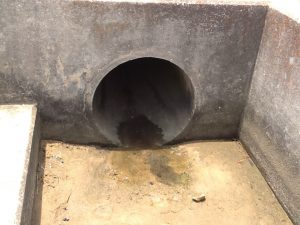
One of 39 stormwater drains into Bayou Texar.
Photo: Rick O’Connor
Non-Nutrient Organic Chemicals
These are compounds such as PCBs, DDT, and PAHs; many are actually families of multiple forms of compounds. Information on the bioaccumulation of these compounds in PBS is less common than those of trace metals. However, this information is important since they have long half-lives and magnify within the food web.
That said – there are studies on these compounds that go back to the 1970’s. They looked at DDT, pesticides, and PAHs in oysters and croakers. One study (1986-96) found DDT concentrations in oysters at 60 ppb or less. A follow up study (2004-05) at those same locations found concentrations between 8-20 ppb. One study (2008) found the order of accumulating non-nutrient organic compounds with PAHs as the highest and dieldrin at the lowest. Downward trends were reported (2004-05) for many of these compounds including PAHs and PCBs.
Some of these compounds have entered the PBS via unlined ponds associated with on-land Superfund sites. Creosote and pentachlorophenol were stored for years in such ponds and have leached into area waters such as Bayou Chico and portions of upper Pensacola Bay. A study (1987-88) found oyster drills sampled in these areas had concentrations 10x higher than reference sites in other parts of the PBS.
So what can we do about this?
The compounds that are there – are there. Many of these trace metals are heavy and sink into the sediments. There occurrence within the food web has decreased over time and some have suggested the safest thing to do is to leave them where they are. No doubt, any project requiring sediment movement requires much review and permitting.
To try to remove these compounds would be extremely expensive – hence the Superfund Program. So if we cannot clean the sediments without a lot of labor and money, can we reduce the amount that enters the bay today?
Many of these compounds come from industrial processing of products we really want or need. Reduction of the production of some will be difficult, but there is much industry can do to reduce the chance of those compounds reaching our estuaries – and they are doing this. Point source pollution (direct discharge from an industry) has reduced significantly since the 1970’s. Non-point sources (indirect discharge from you and I) is still a problem. We can choose products that contain less (or none) of the compounds we discussed. Following an IPM program for dealing with household and lawn pests (see article on Florida Friendly Yards – https://blogs.ifas.ufl.edu/escambiaco/2018/06/08/restoring-the-health-of-pensacola-bay-what-can-you-do-to-help-a-florida-friendly-yard/) can help a lot. As can practices that reduce the amount of run-off reaching our bays. Reducing your use of lawn watering, using rain barrels, or rain gardens, and planting living shorelines (all mentioned in the FFY article) can certainly help.
Reference
Lewis, M.J., J.T. Kirschenfeld, T. Goodhart. 2016. Environmental Quality of the Pensacola Bay System: Retrospective Review for Future Resource Management and Rehabilitation. U.S. Environmental Protection Agency. Gulf Breeze FL. EPA/600/R-16/169.

by Rick O'Connor | Jun 8, 2018
We have been posting articles discussing some of the issues our estuaries are facing; this post will focus on one of the things you can do to help reduce the problem – a Florida Friendly Yard.
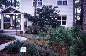
Florida Friendly Landscaping saves money and reduces our impact on the estuarine environment.
Photo: UF IFAS
The University of Florida IFAS developed the Florida Friendly Landscaping Program. It was developed to be included in the Florida Yards & Neighborhoods (FYN) program, HomeOwner and FYN Builder and Developer programs, and the Florida-Friendly Best Management Practices for Protection of Water Resources by the Green Industries (GI-BMP) Program in 2008.
A Florida Friendly Yard is based on nine principals that can both reduce your impact on local water quality but also save you money. Those nine principals are:
- Right Plant, Right Place – We recommend that you use native plants in the right location whenever possible. Native plants require little fertilizer, water, or pesticides to maintain them. This not only reduces the chance of these chemicals entering our waterways but also saves you money. The first step in this process is to have your soil tested at your local extension office. Once your soil chemistry is known, extension agents can do a better job recommending native plants for you.
- Water Efficiently – Many homeowners in the Florida panhandle have irrigation systems on timers. This makes sense from a management point of view but can lead to unnecessary runoff and higher water bills. We have all seen sprinkler systems operating during rain events – watering at that time certainly is not needed. FFY recommends you water only when your plants show signs of wilting, water during the cooler times of day to reduce evaporation of your resource, and check system for leaks periodically. Again, this helps our estuaries and saves you money.
- Fertilize Appropriately – No doubt, plants need fertilizer. Water, sunlight, and carbon dioxide produce the needed energy for plants to grow, but it does not provide all of the nutrients needed to create new cells – fertilizers provide needed those nutrients. However, plants – like all creatures – can only consume so much before the remainder is waste. This is the case with fertilizers. Fertilizer that is not taken up by the plant will wash away and eventually end up in a local waterway where it can contribute to eutrophication, hypoxia, and possible fish kills. Apply fertilizers according to UF/IFAS recommendations. Never fertilize before a heavy rain.
- Mulch – In a natural setting, leaf litter remains on the forest floor. The environment and microbes, recycling needed nutrients within the system, break down these leaves. They also reduce the evaporation of needed moisture in the soil. FFY recommends a 2-3” layer of mulch in your landscape.
- Attract Wildlife – Native plants provide habitat for a variety of local wildlife. Birds, butterflies, and other creatures benefit from a Florida Friendly Yard. Choose plants with fruits and berries to attract birds and pollinators. This not only helps maintain their populations but you will find enjoyment watching them in your yard.
- Manage Yard Pests Responsibly – This is a toughie. Once you have invested in your yard, you do not want insect, or fungal, pests to consume it. There is a program called the Integrated Pest Management Program (IPM) that is recommended to help protect your lawn. The flow of the program basically begins with the least toxic form of pest management and moves down the line. Hopefully, there will not be a need for strong toxic chemicals. Your local county extension office can assist you with implementing an IPM program.
- Recycle – Return valuable nutrients to the soil and reduce waste that can enter our waterways by composting your turfgrass clippings, raked leaves, and pruned plants.
- Reduce Stormwater Runoff – ‘All drains lead to the sea’ – this line from Finding Nemo is, for the most part, true. Any water leaving your property will most likely end in a local waterway, and eventually the estuary. Rain barrels can be connected to rain gutters to collect rainwater. This water can be used for irrigating your landscape. I know of one family who used it to wash their clothes. Rain barrels must be maintained properly to not produce swarms of mosquitos, and your local extension office can provide you tips on how to do this. More costly and labor intensive, but can actually enhance your yard, are rain gardens. Modifying your landscape so that the rainwater flows into low areas where water tolerant plants grow not only reduces runoff but also provides a chance to grow beautiful plants and enhance some local wildlife.
- Protect the Waterfront – For those who live on a waterway, a living shoreline is a great way to reduce your impact on poor water quality. Living shorelines reduce erosion, remove pollutants, and enhance fisheries – all good. A living shoreline is basically restoring your shoreline to a natural vegetative state. You can design this so that you still have water access but at the same time help reduce storm water runoff issues. Planting below the mean high tide line will require a permit from the Florida Department of Environmental Protection, since the state owns that land, and it could require a breakwater just offshore to help protect those plants while they are becoming established. If you have questions about what type of living shoreline you need, and how to navigate the permit process, contact your local county extension office.
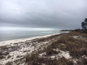
Santa Rosa Sound
Photo: Dr. Matt Deitch
These nine principals of a Florida Friendly Yard, if used, will go a long way in reducing our communities’ impact on the water and soil quality in our local waterways. Read more at http://fyn.ifas.ufl.edu/about.htm.

by Rick O'Connor | May 25, 2018
In the mid 1990’s, the Bay Area Resource Council was created. This multi-county (Escambia and Santa Rosa) organization included local scientists and decision makers to help better understand the health of Pensacola Bay, develop a plan for restoration, and work collaboratively to acquire funding to do so. At the inaugural meeting, many different scientists spoke on a variety of topics. There were several take-home messages – one of them was that sediments of Pensacola Bay were in poorer health than the water within the water column above it.
Grabs are used by marine scientist to collect samples of sediments from the bottom of the bay.
Photo: Coastal Science NOAA
So, what is wrong with the sediments, and how has this changed since the mid ‘90’s?
Based on sediment sample analysis, some researchers consider the Pensacola Bay System the most polluted in the state of Florida… but not everyone. The three bayous (Chico, Texar, and Grande), Escambia Bay, and the downtown waterfront of Pensacola Bay had some of the poorest sediment samples within the system. Contaminants monitored include trace metals, mercury, non-nutrient organics, pesticides, and dioxins. These contaminants are dense and do not remain in the water column long. Instead, they sink into the sediments. At that time, some suggested that attempts to remove the contaminants could increase their levels within the water column and do more harm than good – thinking it would be better to leave the sediments as they are. Many of the compounds entered the estuary through run-off. In some cases in the past, they were discharged directly into a bay or river.
Chemicals found in Pensacola estuarine sediments include Arsenic, Zinc, and Copper. Mercury levels at some locations in the bay are higher than other estuaries around the northern Gulf region. Some non-nutrient organic compounds were not as high as other local estuaries however; bioaccumulation (the increase in contaminant concentrations via the food chain) has been occurring and should be monitored. Many chemical compounds banned in the 1970’s have long half-lives and are still detected in the sediments today. Chlorinated pesticides, such as dieldrin, chlordane, DDE, DDD, and DDT are still found in the bayous – and at higher concentrations than neighboring estuaries.
This all sounds bad, but are the levels high enough to be toxic to marine organisms?
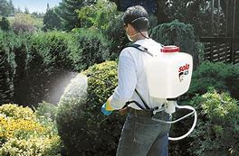
Herbicides and pesticides can find their way into estuarine systems and contaminate the sediments.
Photo: UF IFAS Washington County Extension
One location, in upper Bayou Texar, seems to be quite toxic to the species of bacteria, invertebrates, fish, and plants tested. These toxic concentrations are partially from chemicals present in run-off, but there is also seepage coming from groundwater contaminated from a nearby Superfund site. Most of the test suggest that the lethal concentrations are more chronic in nature than acute.
So what can be done? What can we do?
Well… removing and treating these sediments is quite expensive and is not an option at this time. There are plans to dredge portions of Bayou Chico but the process has undergone extensive scrutiny and permitting. One thing we can do is reduce the amount that is still entering the bay. How do we do this?
- Consider re-landscaping your yard to be “Florida Friendly”. Using the suggestions given within this University of Florida program (http://fyn.ifas.ufl.edu/) you can reduce the amount of fertilizer, herbicide, and pesticides you use – thus reducing the amount entering the estuaries.
- Florida Friendly Landscaping practices can also reduce the amount of watering your lawn needs. This reduces the amount of run-off reaching the bay and always reduces the amount of money you spend on watering and lawn chemicals.
- The Florida Department of Environmental Protection’s Clean Boater program provides tips and suggestions that reduce the amount of hazardous chemicals that enter the bay from cleaning and maintaining vessels. https://floridadep.gov/fco/cva/content/clean-boater-program.
The sediments of the bay have suffered the abuse of the past. However, with better practices, we can reduce our impact in the future.
Florida Friendly Landscaping saves money and reduces our impact on the estuarine environment.
Photo: UF IFAS
Reference
Lewis, M.J., J.T. Kirschenfeld, T. Goodhart. 2016. Environmental Quality of the Pensacola Bay System: Retrospective Review for Future Resource Management and Rehabilitation. U.S. Environmental Protection Agency. Gulf Breeze FL. EPA/600/R-16/169.
by Rick O'Connor | May 12, 2018
Records of the variety of aquatic life in Pensacola Bay go back to the 18th century. According to these reports, over 1400 species of plants and animals call Pensacola Bay home. Many of them depend on seagrass, oyster reefs, or marshes to complete their life cycle. The greatest diversity and abundance are found on the oyster reefs. Finfish and shellfish in the bay have sustained humans as a food source for centuries. However, we know that the alligator, turtles, and a variety of birds and mammals have also been important. In this article, we will focus on the aquatic species.
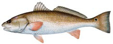
Red Drum – photo credit Florida Fish and Wildlife
When people think of aquatic life in the bay, they first think of fish. About 200 species call Pensacola Bay home. The most abundant are the true estuarine fish, such as croakers, sardines, and minnows. There are a variety of marine transient fish that can be found such as jacks, mackerels, and some species of sharks. Spot and Atlantic Croaker are the most abundant members of the croaker family, and are still an important target fish for locals. Anyone who has snorkeled or cast a line with cut bait knows how common pinfish can be, and those who have pulled bait nets are very familiar with the silverside minnows and anchovies.
I have pulled many a seine net over the years assessing the diversity and abundance of the nearshore fish populations and logged 101 species. In addition to those listed above, killifish (also locally known as “bull minnows”) are a common capture. For a few years, we were involved in trawling in deeper waters where we collected a variety of flounder, silver perch, grunts and snapper. Sea robins are an interesting member of our community and gag grouper were captured occasionally. The number and variety of fish found varies with seasons and is greatest in June. The diversity and abundance of estuarine fishes in our bay is very similar to neighboring estuaries.
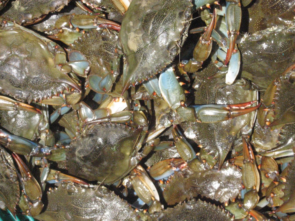
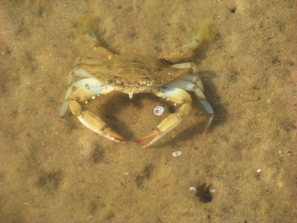
The second thing people think of when they think of aquatic life in the bay are shellfish. These would include the crabs, shrimp, and oysters. However, the most abundant macro-invertebrates in our bay are those that can tolerate environmental stress and live in the surface layers of the sediments – these are the worms and crustaceans. There are numerous varieties of segmented polychaete worms, who are famous for building tunnels with “volcano” openings. They are also common within oyster reefs, feeding on all sorts of organic debris. Blue crab are common throughout the bay and provided both a commercial and recreational fishery for years. Brown and white shrimp are both found and have been the most popular seafood with locals for years.
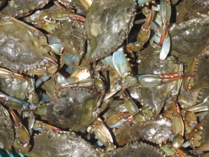
The famous blue crab.
Photo: FWC
During my lifetime, the only marine mammal commonly seen has been the Atlantic Bottlenose Dolphin, and these are found in many parts of the bay. Years back, I heard accounts of harbor porpoise, but never actually saw one. An historic occurring marine mammal, who seems to be making a comeback, is the Florida Manatee. Sightings of this animal have been reported in a variety of locations in recent years.
Snakes, turtles, and alligators are all found in the bay area. There is really only one saline snake and this is the gulf coast salt marsh snake. However, nontraditional estuarine snakes, such as the cottonmouth, are becoming more common in and near the bay. Though we have a great variety of turtles in our rivers, only one true estuarine turtle exist in the country, the diamondback terrapin – and this turtle can be found in parts of our bay. Sea turtles do venture into the bay searching for food, particularly the green turtle who is fond of seagrasses.
Many forget the small planktonic animals that drift in the water column, but they are there – about 100 species of them. Copepods are small roach looking crustaceans that are by far the most abundant member of the zooplankton, particularly the species known as Acartia tonsa – which makes up 82% of the abundance in our bay. These small animals are an important link in the food chain of almost every other member of the bay community. The zooplankton variety in Pensacola Bay is very similar to those of neighboring estuaries.
And then there are the plants…
By far, the most diverse group of organisms in the bay are the microscopic plants known as phytoplankton – with over 400 species reported. Much of the bay is too deep to support traditional forms of plants and so these become a key producer of food for many species. The diversity and abundance is greatest in the spring and fall. 70% of the phytoplankton are from a group called dinoflagellates, small plants that have two hair-like flagella to orient, and even propel, themselves. Some of them produce the bioluminescence we sometimes see and others produce what we call red tide. During the summer, the populations change and the more abundant forms are diatoms. These lack the flagella of the dinoflagellates, but they do produce beautiful shells of silica.
There are at least 400 species of periphytic algae (attaching). Green algae are the most abundant and are most common in the local bayous. Cyanobacteria, which were once thought to be algae, are the most abundant in the marshes and periphytic diatoms dominate in the Sound.
And last, are the submergent and emergent grasses.
Submergent grasses are known as seagrasses. We have three species that like the higher saline waters. These are turtle, shoal, and widgeon grass. Turtle and shoal grass need the water to be at least 25 parts per thousand and are the dominate species in the lower portions of the bay. Widgeon grass can tolerate waters as low as 10 ppt and are found in the bayous and the upper portions of the bay system. Tapegrass only survives in freshwater and are found in the lower reaches of the rivers where they meet the bay.
Emergent grasses are what we call marsh grasses. Two species, Black Needlerush and Smooth Cordgrass dominate these. There are pockets of salt marshes found all over the bay system.
So how is the health of our aquatic life?
As you might expect, the diversity and abundance have declined over time, particularly since the 1950’s. One firsthand account of the change, describe a bayou that was clear, full of grass, and harbored shrimp the size of your hand. Then they were gone. He remembered the first change being water clarity. As development along our waterfront increased, the clarity decreased and the aquatic life declined. This has happened all over the bay system. Increase in run-off not only brought sand and sediment lowering water clarity, it also brought chemicals that both the plants and animals could not tolerate. Much of the point source pollution has been controlled but non-point pollution is still problematic. Fertilizers, pesticides and herbicides, oils and grease, and sediment have all been problematic. These can be reduced. Following recommendations from the Florida Friendly Landscaping website, (http://www.deactivated_site/.) property owners can alter how they are currently managing their landscape to reduce their impact on the aquatic life on the bay. Clean Marina (https://floridadep.gov/fco/clean-marina ) and Clean Boater (https://floridadep.gov/fco/cva/content/clean-boater-program ) recommendations can help reduce the impact from the boating community. Sustainable fishing practices, such as safe catch and release methods for unwanted fish and removing all monofilament are good practices. In 2019, Sea Grant will begin a program training local citizens how to monitor the diversity and abundance of aquatic species. If interested in volunteering, stay tuned.
Reference
Lewis, M.J., J.T. Kirschenfeld, T. Goodhart. 2016. Environmental Quality of the Pensacola Bay System: Retrospective Review for Future Resource Management and Rehabilitation. U.S. Environmental Protection Agency. Gulf Breeze FL. EPA/600/R-16/169.
by Rick O'Connor | May 4, 2018
Humans have inhabited the shores of Pensacola Bay for centuries. Impacts on the ecology have happened all along, but the major impacts have occurred in the latter half of the 20th century. There has been an increase in human population, an increase in development, a decrease in water clarity, a decrease in seagrasses, and a decrease in the abundance of some marine organisms – like horseshoe crabs, scallops, and some marine fishes. There has also been an increase in inorganic and organic compounds from stormwater run-off, fish kills, and health advisories due excessive nutrients and fecal bacteria in local waters.
A view of Pensacola Bay from Santa Rosa Island.
Photo: Rick O’Connor
Since the 1970’s, there have been efforts to help restore the health of the bay. Seagrasses have returned in some areas, fish kills have significantly reduced, and occasionally residents find scallops and horseshoe crabs – but there is still more to do. In this series of articles, I will present information provided in a recent publication (Lewis, et. al. 2016) and from citizen science monitoring. We will begin with an introduction to the bay itself.
The Pensacola Bay System is the fourth largest estuarine system in the state of Florida. The system includes Blackwater, Escambia, East, and Pensacola Bays. There are numerous smaller bayous, such as Indian, Mulat, and Hoffman, and three larger ones, which include Texar, Chico, and Grande. There are two lagoons that extend east and west of the pass. To the west is Big Lagoon and to the east is Santa Rosa Sound. The surface area of this bay system is about 144 mi2 and the coastline runs about 552 miles in length. There are four rivers that discharge into the system: the Escambia, Blackwater, Yellow, and East Rivers. The majority of watershed is in Alabama and covers about 7000 mi2. The mouth of the bay is located at the Pensacola Pass near Ft. Pickens and is 0.5 miles across. Depending on the source, the flush time for the entire bay has been reported between 18 and 200 days.
There are several ecosystems found within the bay system. Seagrasses are be found throughout the bay and bayous, but are more prevalent in Big Lagoon and Santa Rosa Sound. Oyster reefs have provided income for some in the East Bay area in the past, but production has declined in the last 50 years. Salt marshes are found throughout the bay as well, but the greatest acreage is in the Garcon area of Santa Rosa County. There are, of course, freshwater marshes near the mouths of the rivers with the largest being at the mouth of the Escambia River.
Members of the herring family are ones who are most often found during a fish kill triggered by hypoxia.
Photo: Madeline
Members of the drum family are one of the more common fishes found in the system and would include fish like the Spot and Atlantic Croaker. However, speckled trout, striped mullet, redfish, several species of flounder, have also been targets for local fishermen. Target fish include sardines, silversides, stingrays, pinfish, and killifish. Brown shrimp, oysters, and blue crab have historically provided a fishery for locals, but other invertebrates include several species of jellyfish, stone crabs, fiddler crabs, hermit crabs, grass shrimp, several species of snails, clams, bay squid, octopus, and even starfish. There is also a variety of benthic worms found within the sediments.
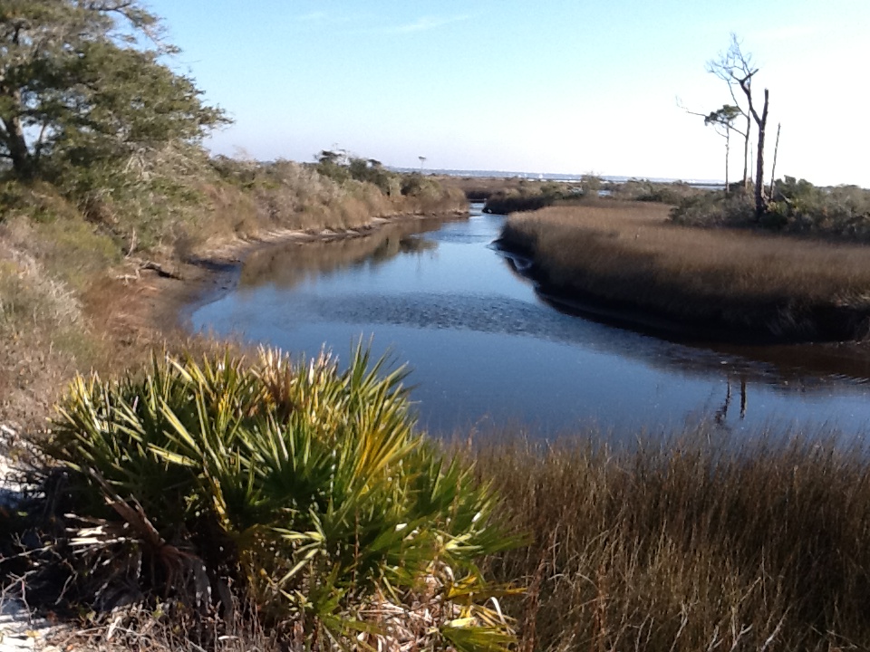
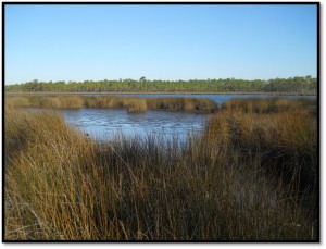
A finger of a salt marsh on Santa Rosa Island. The water here is saline, particularly during high tide. Photo: Rick O’Connor
There has been a decline in overall environmental quality since 1900 but, again, the biggest impacts have been between 1950 and 1970. Fish kills, a reduction in shrimp harvest, and hypoxia (a lack of dissolved oxygen) have all been problems.
In the articles to follow we will look deeper into specific environmental topics concerning the health of Pensacola Bay.
References
Lewis, M.J., J.T. Kirschenfeld, T. Goodhart. 2016. Environmental Quality of the Pensacola Bay System: Retrospective Review for Future Resource Management and Rehabilitation. U.S. Environmental Protection Agency. Gulf Breeze FL. EPA/600/R-16/169.
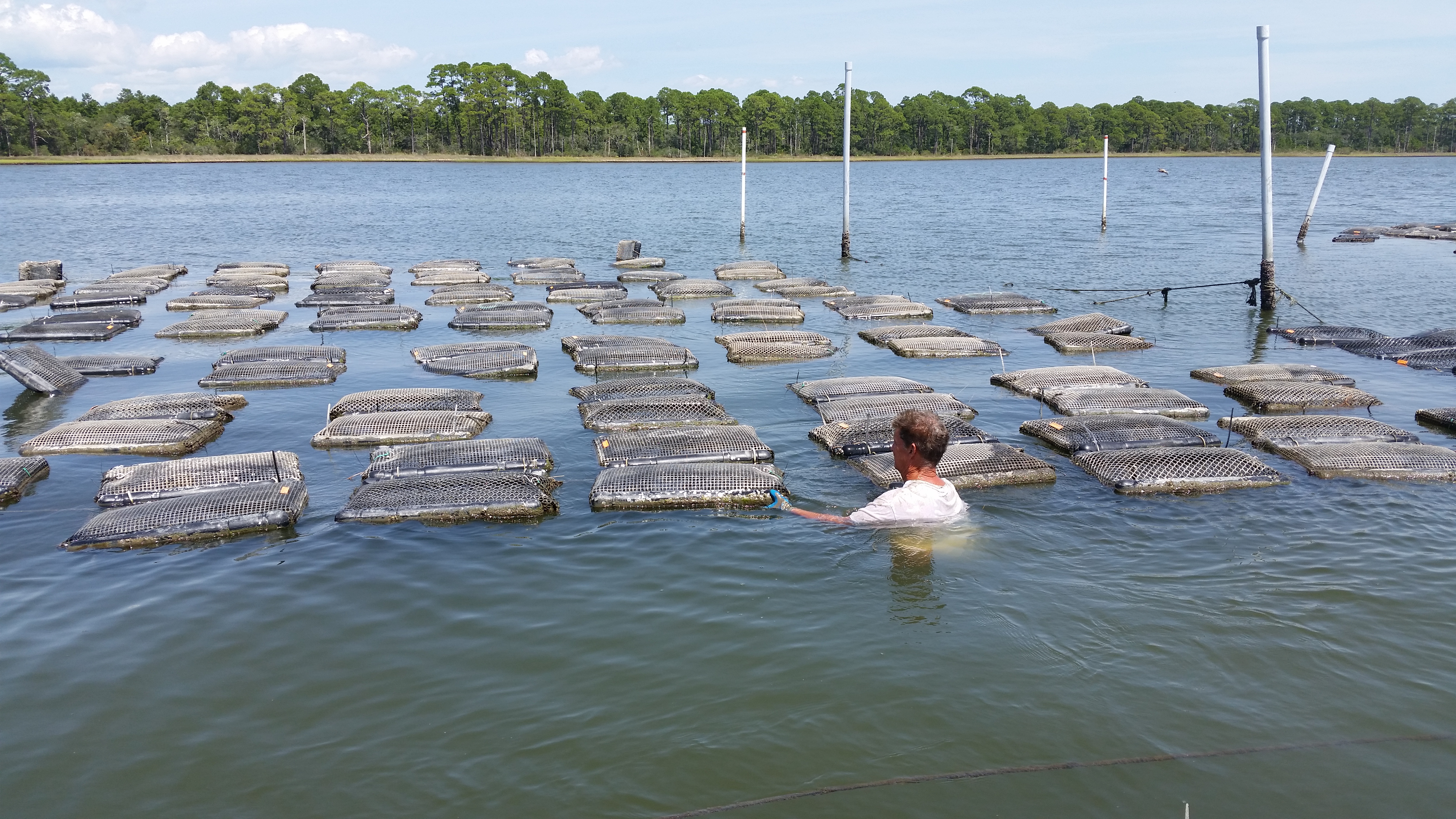
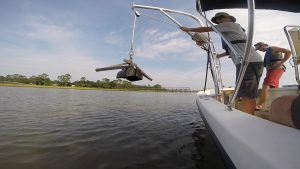
by Erik Lovestrand | Feb 2, 2018
Sorting and re-caging take place on-site at the lease
Photo: Erik Lovestrand
There are a number of parallels than can be drawn between shellfish farming and traditional forms of agriculture that take place on the land. The most obvious similarities are the amount of hard work, grit and faith that are required of the farmer on land or sea. In spite of this there are many “salty” farmers in the Florida Panhandle who have mustered the faith requirement and are now putting in the hard work necessary to help build this budding industry in the Southeastern U.S.
Market demand for quality oysters has continued to outstrip available supplies for several years of late. This has been due in part to better marketing strategies employed by growers as well as clientele becoming aware of the health benefits of fresh oysters; a great supply of important vitamins and minerals, including vitamin C and B vitamins, zinc, selenium and iron. However, supply/demand ratios are not the only important factor in developing a thriving oyster aquaculture industry. Also required, is the necessary infrastructure to support the grower’s equipment needs, enough sources of baby oyster “seed”, a reliable refrigerated transportation network for live shellfish, and the support of regulatory agencies in making water leases available in suitable growing areas.
Fortunately, the stars seem to be aligning for many of these industry-growth necessities and the business of oyster farming is gaining a firmer foundation to build upon. One of the important milestones for Florida was the approval of “full-water-column” leases, which allows the use of floating oyster cages or bags. Previously, oysters were required to be grown on the bay bottom and this made them susceptible to higher levels of predation from crabs and snails and severe biofouling (barnacles and algae) on the exterior of the mesh bags. Heavy biofouling reduces the water flow through the oyster’s growing environment, thus the available food for this filter feeding bivalve.
One critical need for this industry is the availability of quality “seed” (baby oysters) to put in the growing waters. Seed oysters are supplied by hatcheries where oyster brood stocks are spawned and babies are raised to the necessary age for grower needs. Some growers use baby oyster larvae that have not settled and attached yet. These “eyed larvae” are put in a tank with old oyster shell and allowed to attach on the shells, which are then deployed at a lease site. Other growers use seed that has already attached to a small particle of crushed shell and are sold as individual oysters to be placed in grow-out bags or cages. The more recent development of oyster stocks with 3 sets of chromosomes (triploids) have provided growers with an oyster that gets to market size faster. Triploid oysters are infertile and do not use energy for spawning, thereby putting more energy into shell and tissue growth. Federal and state laws also govern where growers can buy their seed in an effort aimed at stopping the spread of shellfish disease from one body of water to another (i.e. Atlantic to Gulf of Mexico, etc.).
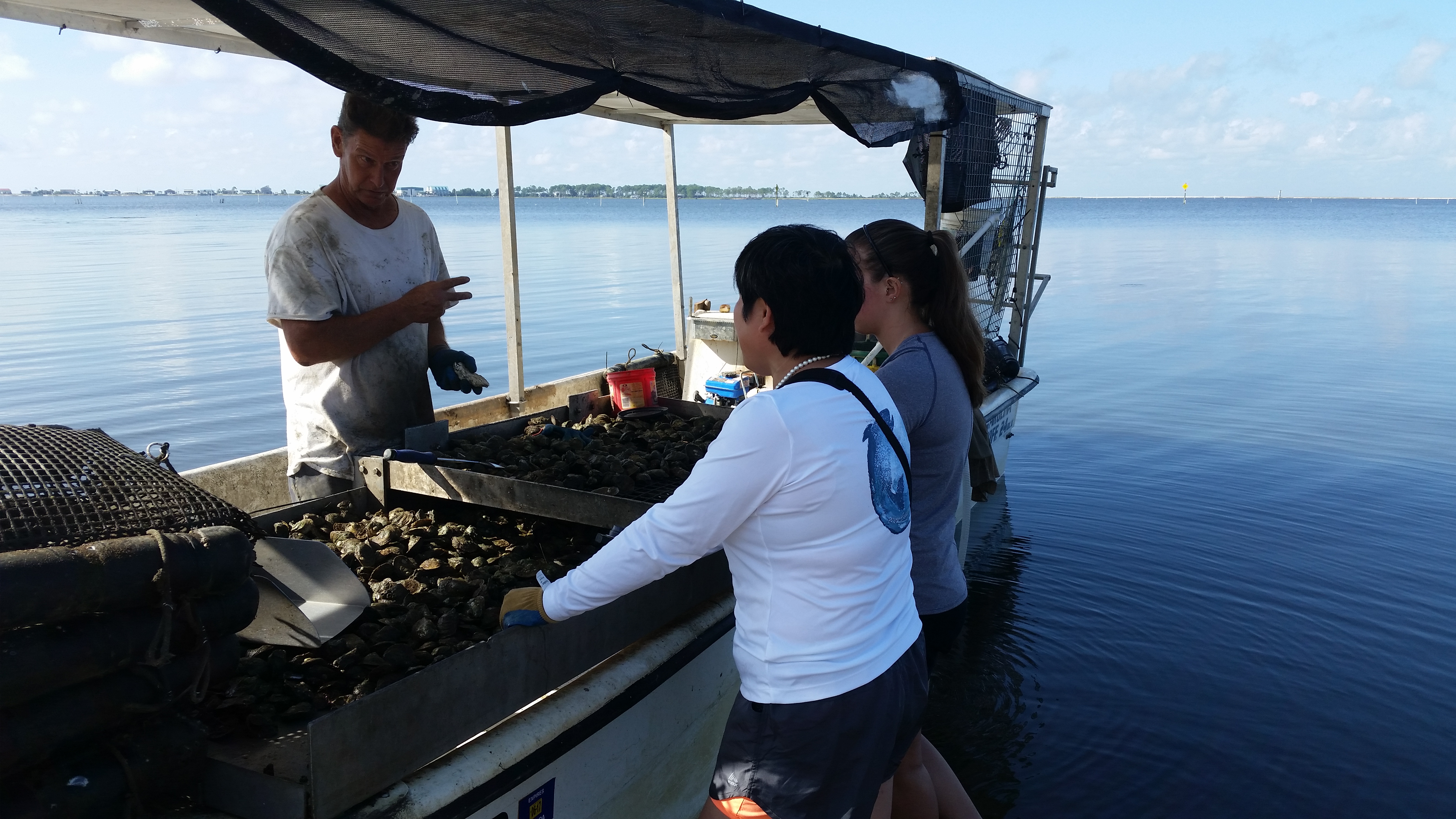
Even if all of the hardware and infrastructure is in place, there is still one other factor that plays a significant role in whether an oyster farmer will be successful. Just like the dairy farmer, the cattle rancher, the cotton or peanut grower, or the blueberry producer; backbreaking labor is necessary for many stages of the production cycle. Oyster growers work their leases either bending over the gunnels of a boat or actually being in the water, lifting heavy bags or cages of shellfish, sorting by size, re-caging, and moving lots of materials to and from the lease area. True grit and a dogged determination to stay on top of things, regardless of unpleasant conditions, are vital to raising a successful crop of oysters. And by the way, don’t forget that Mother Nature will have the final word. As all farmers know, they are required to be a good listener when she speaks.