by Shep Eubanks | Sep 13, 2019
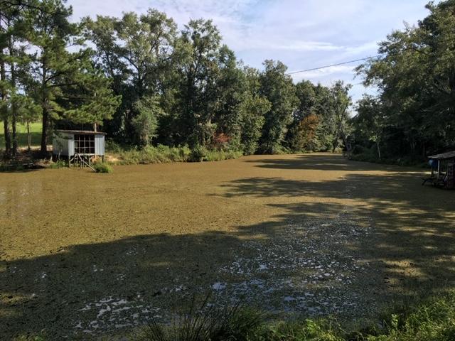
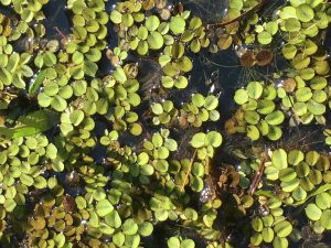
Common Salvinia Covering Farm pond in Gadsden County
Photo Credit – Shep Eubanks UF/IFAS Gadsden County Extension
Close up of common Salvinia
Photo Credit – Shep Eubanks UF/IFAS Gadsden County Extension
Aquatic weed problems are common in the panhandle of Florida. Common Salvinia (Salvinia minima) is a persistent invasive weed problem found in many ponds in Gadsden County. There are ten species of salvinia in the tropical Americas but none are native to Florida. They are actually floating ferns that measure about 3/4 inch in length. Typically it is found in still waters that contain high organic matter. It can be found free-floating or in the mud. The leaves are round to somewhat broadly elliptic, (0.4–1 in long), with the upper surface having 4-pronged hairs and the lower surface is hairy. It commonly occurs in freshwater ponds and swamps from the peninsula to the central panhandle of Florida.
Reproduction is by spores, or fragmentation of plants, and it can proliferate rapidly allowing it to be an aggressive invasive species. When these colonies cover the surface of a pond as pictured above they need to be controlled as the risk of oxygen depletion and fish kill is a possibility. If the pond is heavily infested with weeds, it may be possible (depending on the herbicide chosen) to treat the pond in sections and let each section decompose for about two weeks before treating another section. Aeration, particularly at night, for several days after treatment may help control the oxygen depletion.
Control measures include raking or seining, but remember that fragmentation propagates the plant. Grass carp will consume salvinia but are usually not effective for total control. Chemical control measures include :carfentrazone, diquat, fluridone, flumioxazin, glyphosate, imazamox, and penoxsulam.
For more information reference these IFAS publications:
Efficacy of Herbicide Active ingredients Against Aquatic Weeds
Common salvinia
For help with controlling Common salvinia consult with your local Extension Agent for weed control recommendations, as needed.
by Rick O'Connor | Jun 28, 2019
Or just mullet… maybe you prefer “mu-lay”…
Either way it is a fish we all know and love. Those of us who grew up here on the Gulf coast know this fish as part of our culture. I remember numerous family gatherings where fried mullet was the order of the day. Along with grits, baked beans, cole slaw, and iced tea you had your “mullet plate”. It is the fish of choice for Catholic fish fries during Lent. It is the icon of the “Mullet Toss” event at the Flora-Bama, which draws huge crowds and people plan for all year. It almost became the mascot of minor league baseball team. One my favorites was a story told to me by a colleague who used to teach at the old Booker T. Washington High School when it was on “A” street. He told me each morning the janitorial staff would catch mullet for the school lunches. They would have your classic “mullet plate” for lunch everyday – fresh from the bay – how good is that. It is the fish that “jumps” and everyone knows what it is.
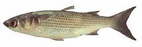
The Striped Mullet.
Image: LSU Extension
I paddle area waters monitoring a variety of things assessing the health status of Pensacola Bay. While out there I see a lot of wildlife, but mullet is one of the more common ones. Wherever I go, open intracoastal waterway, grassbeds, bayous, marshes, even backwater creeks where the water is almost stagnant, I find mullet. You see their swirls, schools gliding beneath your paddleboard or kayak, I even watched one make unusual circles with its head above water once. And always the “jump”, they are always jumping. But I had never really thought much about their biology. Many folks observe and study more unusual, or problematic fish, like lionfish. But the mullet slips by the radar. It is more like… “oh yea, then there is the mullet”, and we do not think of them more than that.
Local recreational and commercial fishermen are aware of their movements and behaviors. They know when and where they will be at different times of the year. But I thought I would do some digging and educate the rest of you about this amazing fish who is like part of the family.
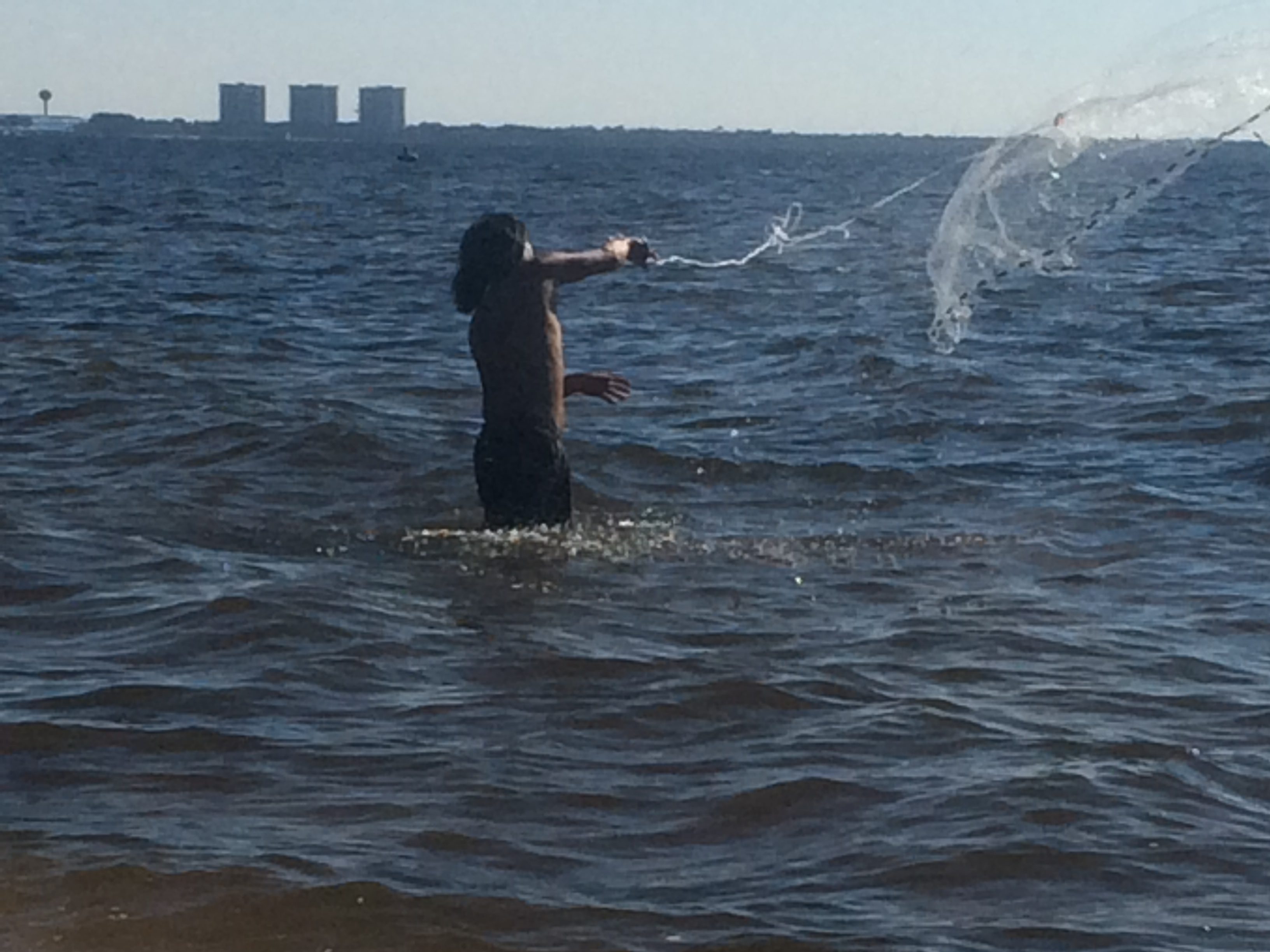
There are actually two species of mullet swimming in area waters. The striped mullet (Mugil cephalus) is more common. It is one that the commercial fishermen seek, FWC lists as the “black mullet” on their commercial guides. The other is the white mullet (Mugil curema). They differ in that the anal fin of the white mullet has 9 soft rays; the striped has 8. Large striped mullet will have stripes, which the large white mullet lack. The juveniles of both species lack stripes. When caught and still alive, the white mullet will have a bright gold spot on the operculum (the bone covering the gills), this is lacking on the striped mullet.
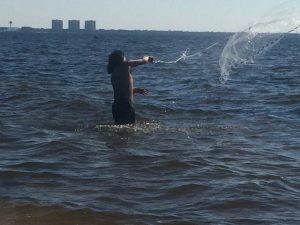
A fisherman throws a cast net to catch mullet at White Point in Choctawhatchee Bay
Mullet are euryhaline… meaning they can tolerate a wide range of salinities and can be found in fresh or saltwater. They travel in schools, feeding off of the bottom. Their diet consists of bacteria and single-celled algae found attached to plants. They pick at the bottom, and scrape seagrasses consuming these.
They spawn most of the year, but the peak is between October and December. Spawning takes place in the open Gulf of Mexico, sometimes far offshore. They become sexual mature at three years old and can produce 0.5 – 4 million eggs. Mullet roe (fish eggs) is a local delicacy for some. They have been reported at an age of 16 years – long time for a fish.
While studying marine biology in college, I remember someone asked our professor why mullet jump. He paused for several seconds and then replied – “for the same reason manta rays jump”… there was a long pause… so we bit the bait – “okay, why do manta rays jump?” “We don’t know”. Classic…
However, they now have an idea why. It is believed they clean their gills doing this and also oxygenate those gills in stagnant, warm, low oxygen waters that mullet find themselves in periodically.
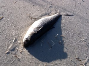
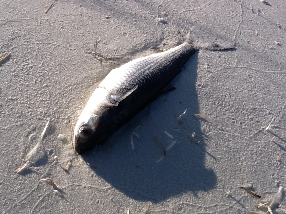
A striped mullet died during cold stress.
It is a local commercial fishery. Between 2018-2019 412,421 pounds of mullet were landed in Escambia County, another 151,638 pounds in Santa Rosa. This made it the number one fish for the season. Between the two counties the value of the fishery was $456,892 but sells better as a bait than as food.
It is truly a magnificent fish. Their numbers have increased since the 1995 net ban and has become one of the more common fish we see while exploring local estuarine waters. I certainly will not take them for granted any longer.
by Scott Jackson | Jun 21, 2019
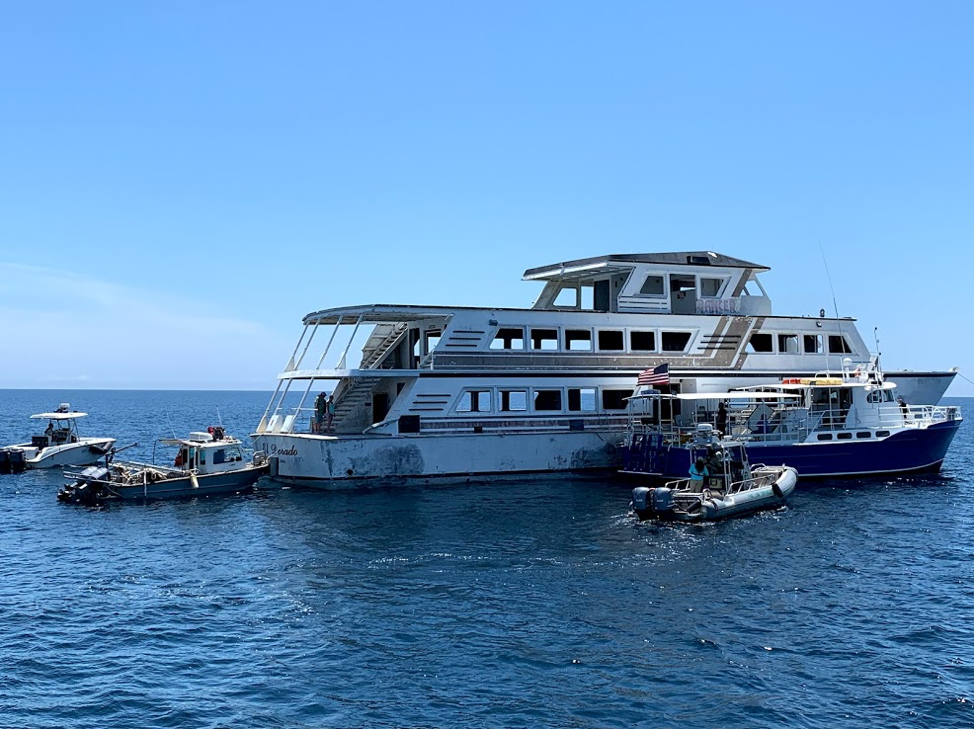
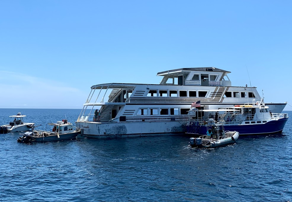
Panama City Dive Center’s Island Diver pulls alongside of the El Dorado supporting the vessel deployment by Hondo Enterprises. Florida Fish and Wildlife crews also are pictured and assisted with the project from recovery through deployment. The 144 foot El Dorado reef is located 12 nautical miles south of St Andrew Pass at 29° 58.568 N, 85° 50.487 W. Photo by L. Scott Jackson.
In the past month, Bay County worked with fishing and diving groups as well as numerous volunteers to deploy two artificial reef projects; the El Dorado and the first of the Natural Resources Damage Assessment (NRDA) reefs.
These sites are in Florida waters but additional opportunities for red snapper fishing are available this year to anglers that book for hire charters with captains holding federal licenses. Federal licensed Gulf of Mexico charters started Red Snapper season June 1st and continue through August 1st. Recreational Red Snapper fishing for other vessels in State and Federal waters is June 11th – July 12th. So booking a federally licensed charter can add a few extra fish to your catch this year.
The conversion of the El Dorado from a storm impacted vessel to prized artificial reef is compelling. Hurricane Michael left the vessel aground in shallow waters. This was in a highly visible location close to Carl Grey Park and the Hathaway Bridge. The Bay County Board of County Commissioners (BOCC) acquired the El Dorado, January 14, 2019 through negotiations with vessel owner and agencies responsible for recovery of storm impacted vessels post Hurricane Michael.
The El Dorado was righted and stabilized, then transported to Panama City’s St Andrews Marina by Global Diving with support from the Coast Guard and Florida Fish and Wildlife. Hondo Enterprises, was awarded a contract to complete the preparation and deployment of the vessel for use as an artificial reef.
Reefing the El Dorado provides new recreational opportunities for our residents and tourists. The new reef delivers support for Bay County’s fishing and diving charters continuing to recover after Hurricane Michael. Several local dive charter captains assisted in the towing and sinking of the El Dorado.
The El Dorado was deployed approximately 12 nm south of St. Andrew Bay near the DuPont Bridge Spans May 2, 2019. Ocean depth in this area is 102 feet, meaning the deployed vessel is accessible to divers at 60 feet below the surface.
The Bay County Board of County Commissioners continues to invest in the county’s artificial reef program just as before Hurricane Michael. Additional reef projects are planned for 2019 – 2020 utilizing Natural Resources Damage Assessment (NRDA) and Resources and Ecosystems Sustainability, Tourist Opportunities, and Revived Economies of the Gulf Coast States Act (RESTORE Act) funds. These additional projects total over 1.3 million dollars utilizing fines as a result of the Deepwater Horizon Oil Spill. Deployments will occur in state waters in sites located to both the east and west of St. Andrew Bay Pass.
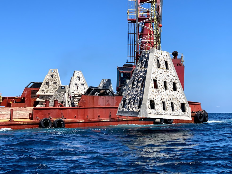
Walter Marine deploys one of nine super reefs deployed in Bay County’s NRDA Phase I project located approximately 12 nautical miles southeast of the St. Andrew Pass. Each massive super reef weighs over 36,000 lbs and is 15 ft tall. Multiple modules deployed in tandem provides equivalent tonnage and structure similar to a medium to large sized scuttled vessel. Photo by Bob Cox, Mexico Beach Artificial Reef Association.
The first of these NRDA deployments for Bay County BOCC was completed May 21, 2019 in partnership with Mexico Beach Artificial Reef Association, Florida Fish and Wildlife Conservation Commission, and Florida Department of Environmental Protection using a $120,000 portion of the total funding. The deployment site in the Sherman Artificial Reef Permit Area is approximately 12 nm south east of St Andrew Bay Pass at a depth of 78 – 80ft.
| Patch Reef # |
Latitude |
Longitude |
| BC2018 Set 1
(6 Super Reefs and 4 Florida Specials) |
29° 55.384 N |
85° 40.202 W |
| BC2018 Set 2
(1 Super Reef and 4 Florida Specials) |
29° 55.384 N |
85° 39.739 W |
| BC2018 Set 3
(1 Super Reef and 4 Florida Specials) |
29° 55.384 N |
85° 39.273 W |
| BC2018 Set 4
(1 Super Reef and 4 Florida Specials) |
29° 55.384 N |
85° 38,787 W |
In 2014, Dr. Bill Huth from the University of West Florida, estimated in Bay County the total artificial reef related fishing and diving economic impact was 1,936 jobs, $131.98 million in economic output and provided $49.02 million in income. Bay County ranked #8 statewide in artificial reef jobs from fishing and diving. Bay County ranked #3 in scuba diving economy and scuba diving was 48.4 % of the total jobs related to artificial reefs. Dr. Huth also determine that large vessels were the preferred type of artificial reef for fishing and diving, with bridge spans and material the next most popular. Scuba diving and fishing on artificial reefs contributes significantly to the county’s economic health.
For more information and assistance, contact UF/IFAS Extension Bay County at 850-784-6105 or Bay@ifas.ufl.edu. Follow us on Facebook at http://faceboook.com/bayifas .
An Equal Opportunity Institution. UF/IFAS Extension, University of Florida, Institute of Food and Agricultural Sciences, Nick T. Place, Dean for UF/IFAS Extension. Single copies of UF/IFAS Extension publications (excluding 4-H and youth publications) are available free to Florida residents from county UF/IFAS Extension offices.
This article is also available through the the Panama City New Herald
by Scott Jackson | Nov 26, 2018
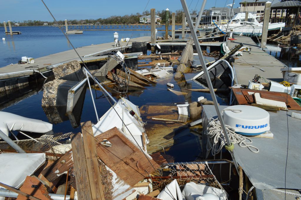
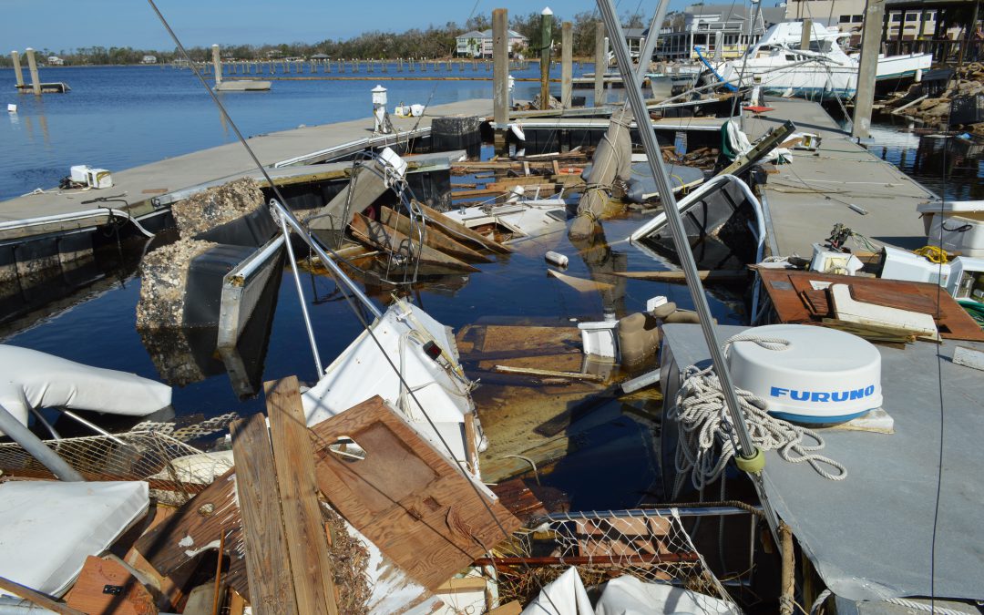
There was a special Fishery Disaster declaration post-Hurricane Michael. Here is an example of the damage to marinas and vessels that service our local fisheries. Unseen is the economic damage to fishing crews and supporting shore base businesses such as seafood processors, bait and tackle shops, and tourism related businesses. (Photo by Allen Golden).
Florida Governor Scott requested Fishery Disaster Assistance because of Hurricane Michael October 23, and the US Secretary of Commerce official responded with a determination letter providing additional disaster assistance to impacted fishing businesses and individuals October 31, 2018. https://www.commerce.gov/news/press-releases/2018/11/us-secretary-commerce-wilbur-ross-declares-fishery-disaster-florida
This link provides an outline for the established process to obtain Fishery Disaster Assistance: https://www.fisheries.noaa.gov/insight/frequent-questions-fishery-disaster-assistance
Additional Hurricane Michael relief funds and resources for local fisheries are welcome and encouraging. However, there are several steps before these specific program funds will be available. After the Secretary of Commerce sends the Florida Governor a determination letter, there are additional steps before those funds will reach the industry. The timing of these specific fisheries disaster resources varies; Hurricane Irma (2017) funds have not made it through the entire process at this time. A funding plan for Irma was recently developed by the state of Florida in September 2018. http://myfwc.com/conservation/special-initiatives/irma
Other disaster recovery programs, including those for Hurricane Michael, can be accessed now by fishing and coastal businesses. There is a helpful document written to help guide fishermen to other recovery resources with examples of how fishing businesses accessed some of these program funds. See more at https://www.fisheries.noaa.gov/webdam/download/66759294
One important immediate aid program to consider is the Florida Small Business Development Center ‘bridge” loan program. Solo proprietors can borrow $25,000 while businesses with paid employees can qualify for up to $50,000 for one year interest free. This program is meant to provide immediate dollars to assist business owners while they await other payments from insurance or federal assistance such as the Small Business Administration loan. Important Deadline: Applications will be accepted through December 7, 2018. Learn more about the Florida SBDC Bridge Loan program at http://www.floridadisasterloan.org
Federal Small Business Administration Disaster Loan Program is a long term loan to aid in business or personal recovery. https://disasterloan.sba.gov/ela/Documents/Three_Step_Process_SBA_Disaster_Loans.pdf
Business Recovery Centers (BRC) provide one on one counseling and assistance from both the Florida SBDC and US SBA to help individuals navigate the recovery process. The current location of the Hurricane Michael Business Recovery Centers is available at: http://floridasbdc.org/services/business-continuation/disaster/
The Florida SBDC also has permanent offices throughout Florida. Visit http://floridasbdc.org/locations/ to find a location near you.
If you need additional information assistance for your marina, commercial fishing, or for-hire charter business related to Hurricane Michael, please contact your local UF/IFAS Extension Office and Florida Sea Grant Extension Agent.
Bay County – Scott Jackson – LSJ@UFL.EDU
Gulf County – Ray Bodrey – RBODREY@UFL.EDU
Franklin and Wakulla Counties – Erik Lovestrand – ELOVESTRAND@UFL.EDU
Okaloosa and Walton Counties – Laura Tiu – LGTIU@UFL.EDU
by Erik Lovestrand | Nov 26, 2018

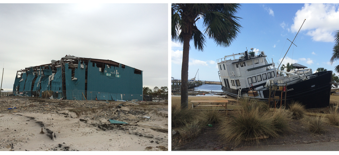
Oyster grow bag left hanging by Michael’s storm surge.
Erik Lovestrand, UF/IFAS Franklin County Extension
It may be a long time before the memories of Hurricane Michael begin to fade in the mind’s eye for residents of the Florida Panhandle. A record-breaking tropical cyclone in many respects, Michael caught a lot of people in the region off guard as it continued to gain strength on its rapid path through the Northern Gulf of Mexico. When many people went to bed the night before landfall, they had no idea what terrifying news would greet them upon hearing that a still-strengthening category 4 hurricane was about to rumble ashore.
It was not long after the wind slackened that folks began looking around and realizing the devastation left behind. Cotton crops in the path of the storm in North Florida and South Georgia suffered near 100% losses. Peanut crops were also severely impacted just at the time that harvest was beginning. The estimated damage to timber harvests alone were coming in around 1.3 billion dollars for Florida as virtually entire forests had been leveled. Even more damage was realized near the coastline where storm surge across the region ranged from 8 to 14 feet above normal water levels; smashing or flooding structures near the coast and carving new inlets across St. Joseph Peninsula near Cape San Blas.
Another industry that took a hard hit in much of the area was the seafood industry; everything from the producers to the dealers, processors, retail markets, restaurants, fueling and ice house facilities that service fishing vessels. Governor Scott requested a fisheries disaster declaration from the Federal Government and on November 1 the Secretary of the Department of Commerce granted the request. This determination provides an opportunity for Congress to appropriate fishery disaster assistance for the new fiscal year, which began in October. To further facilitate recovery efforts in Florida and beyond, the Department of Commerce can look to the Economic Development Administration, which spearheads the Federal government’s efforts to deliver economic assistance and support long-term growth after natural disasters.
Oyster growers in the region who had equipment and a crop of shellfish in the water took some losses as well. For those who were able to scramble to their leases before the storm and sink their floating baskets or cages to the bay bottoms, losses of gear were minimal as storm waves above the submerged gear had less impact. Gear that was unable to be submerged was more prone to break loose and drift away. However, even the growers that sunk gear experienced some significant oyster mortality due to sediments from churned up water smothering the shellfish in a layer of mud. Shellfish leases in Alligator Harbor were dealt another blow by an incredible field of debris that was washed off Alligator Point and blown through the lease area. Everything from boats to large sections of docks, structural walls, refrigerators and freezers was in the mix. These items were caught up in oyster long-lines and broke some while pulling up anchor poles on others, leaving quite a mess for growers to untangle.
Marinas, docks and vessels were also not immune to Hurricane Michael’s wrath in Gulf and Bay Counties. Government agencies estimate the number of damaged vessels in both Gulf and Bay counties to exceed 400. It will take some time for charter boat and commercial fishing operations to rebound. Scallop restoration projects in both St. Joseph Bay and St. Andrews Bay have suffered setbacks, as well. The hurricane has not only devastated coastal Gulf county economically and ecologically, but also geographically. There are two sizable inlets that have now been carved into the St. Joseph Peninsula. T.H. Stone State Park is closed until further notice.
Overall, the impacts from this storm will take a long time to recover from for many segments of our regional economy. Lessons learned by industries as well as individuals should improve our chances to reduce the loss of life and property in the future. The name of the game is “resiliency,” both in the spirit of the people who call this place home and in the way we learn to better adapt to what Mother Nature throws at us. Hang in there. Day by day.
by Laura Tiu | Nov 26, 2018
Red Tide has been a persistent presence in the Panhandle since September and responsible for many reported fish kills and respiratory distress in some people. Over the past week, red tide was still present in low to medium concentrations in or offshore of Escambia County to Bay County.
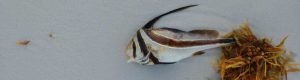
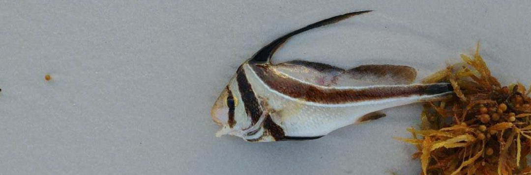
Jack-knife fish killed by red tide Miramar Beach, Florida
Red tide is a natural occurrence and Florida experienced red tides long before humans settled here. The tides originate 10-40 miles off shore and winds and currents bring them inshore. Red tide is fueled by nutrient typically stemming from land-based runoff.
During winter, the northerly winds and southbound currents will push the tide back offshore. There was hope that Hurricane Michael might help carry the red tide back out to sea. Unfortunately, it seems the nutrient run-off from the storm’s heavy rain or retreating storm surge may have contributed to the intensity and duration of the bloom.
In our economy, which is heavily dependent on tourism, the red tide is continuing to take a toll, especially on waterfront businesses. According to the Florida Fish and Wildlife Conservation Commission, store-bought and restaurant served shellfish are safe to eat during a red tide bloom because shellfish are monitored for safety and tested for red tide toxins before they are sold. The edible parts of crabs, shrimp and fish are not affected by the red tide organism and can be eaten, but guts should be discarded.
Many remember the local red tide bloom in 2015. The longest red tide bloom ever recorded lasted 30 months from 1994 to 1997. Warmer water due to climate change is predicted to cause algae to bloom more often, more intensely, and in more water bodies. It is imperative that we reduce nutrient inputs to our lakes, rivers, estuaries and coastal ocean waters today.