A blowout tide at sunrise along Santa Rosa Sound. Photo credit: Bonnie Kane
Every season living on the Gulf Coast reveals its surprises and interesting natural phenomena. Recently, my social media feed was ‘flooded” with photos of extreme low tides in local bays, bayous, and even the Gulf. The water was so low in some places that people could easily walk 200 yards offshore onto dry land that is typically submerged. The timing also corresponded with some extremely low temperatures—icy below-freezing mornings with thermostat readings in the low 20’s. So, what’s going on?
Seagrasses are exposed during an extreme low tide at Shoreline Park in Gulf Breeze. Photo credit: Carrie Stevenson, UF IFAS Extension
A couple of factors played into these extreme conditions. First, winter tides tend to be much lower than in warmer seasons, due to the position of our planet in space. As we all learned in science class, the gravitational pulls of the moon (primarily) and sun (secondarily) dictate tidal cycles. In winter, we are the farthest away from the sun as we are during the year, so that pull is weaker and the tides are noticeably lower.
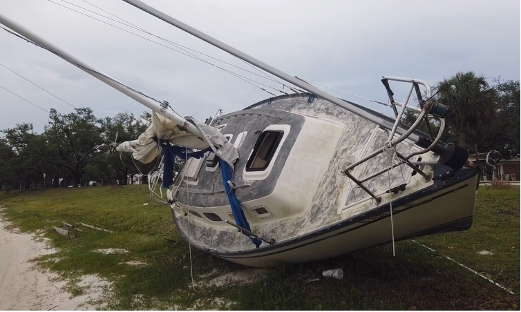
The recent blowout tide stranded fishing boats all along shores in south Louisiana. Photo credit: Scot Pilie, Meteorologist
But the biggest player in these “blowout tides” was tied to an extreme cold front that came through in early February. The freezing weather brought strong and continuous north winds, which physically pushed the water south and away from shorelines. Over the same timeframe that extreme low tide observations were noted around Pensacola Bay, news stories from Mobile and New Orleans highlighted the same phenomenon. Also known as a “reverse storm surge,” this movement of water offshore looks a lot like what happens before a tsunami when waters are sucked offshore. Thankfully, these blowout tides aren’t nearly so dangerous when the water moves back in place.
The mudflats remaining during a blowout tide can beach boats—fishermen in south Louisiana were stranded for several days due to the extreme ebb tides. Locally, observers found small fish, jellyfish, and even an octopus stuck on the sea bottom where tides left them exposed. Blowout tides are not unique to the Gulf region—news abounds of similar experiences and impacts to shipping all along the east coast of the United States and beyond.
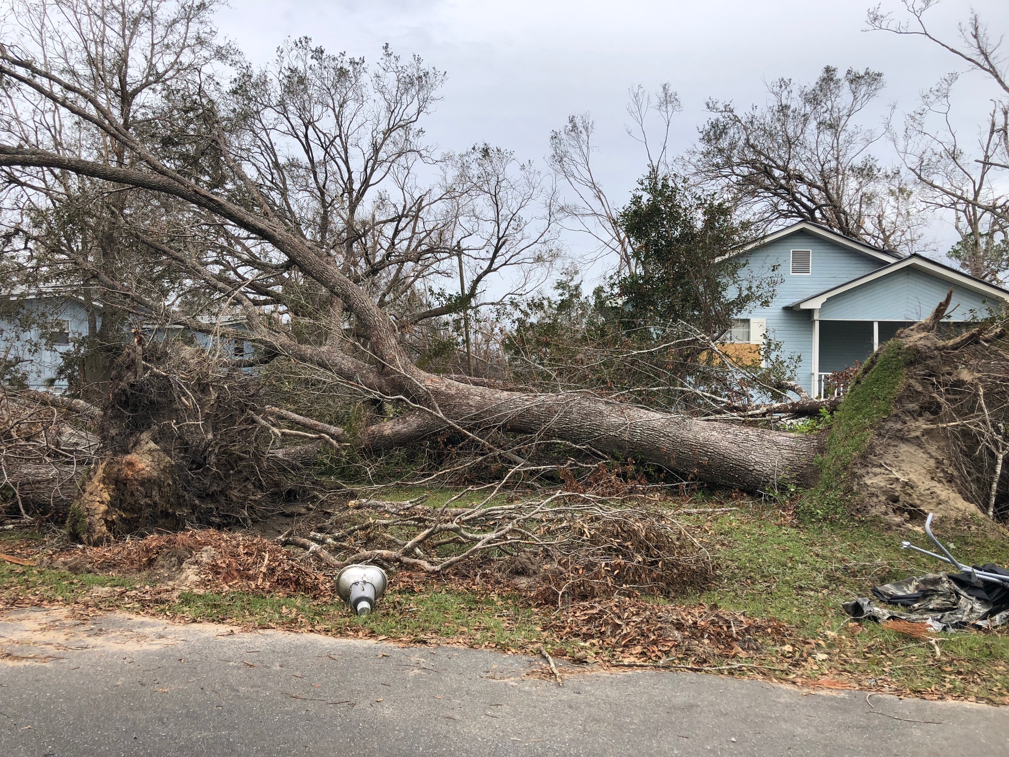
This tree was downed during Hurricane Michael, which made a late-season (October) landfall as a Category 5 hurricane. Photo credit: Carrie Stevenson, UF IFAS Extension
There are plenty of jokes about the four seasons in Florida—in place of spring, summer, fall, and winter; we have tourist, mosquito, hurricane, and football seasons. The weather and change in seasons are definitely different in a mostly-subtropical state, although we in north Florida do get our share of cold weather (remember that snow this year?!).
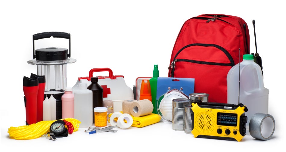
A disaster supply kit contains everything your family might need to survive without power and water for several days. Photo credit: Weather Underground
All jokes aside, hurricane season is a real issue in our state. With the official season having recently begun (June 1) and running through November 30, hurricanes in the Gulf-Atlantic region are a legitimate concern for fully half the calendar year. According to records kept since the 1850’s, Florida has been hit with more than 120 hurricanes, double that of the closest high-frequency target, Texas. Hurricanes can affect areas more than 50 miles inland, meaning there is essentially no place to hide in our long, skinny, peninsular state.
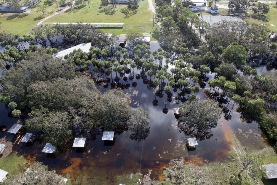
Flooding and storm surge are the most dangerous aspects of a hurricane. Photo credit: Carrie Stevenson, UF IFAS Extension
I point all these things out not to cause anxiety, but to remind readers (and especially new Florida residents) that is it imperative to be prepared for hurricane season. Just like picking up pens, notebooks, and new clothes at the start of the school year, it’s important to prepare for hurricane season by firing up (or purchasing) a generator, creating a disaster kit, and making an evacuation plan. We even have disaster preparedness sales tax exempt holidays in Florida; one in early June and another in the heart of the season, August 24-September 6.
Peak season for hurricanes is September. Particularly for those in the far western Panhandle, September 16 seems to be our target—Hurricane Ivan hit us on that date in 2004, and Sally made landfall exactly 16 years later, in 2020. But if the season starts in June, why is September so intense? By late August, the Gulf and Atlantic waters have been absorbing summer temperatures for 3 months. The water is as warm as it will be all year–in 2023 even reaching over 100 degrees Fahrenheit–as ambient air temperatures hit their peak. This warm water is hurricane fuel—it is a source of heat energy that generates power for the storm. Tropical storms will form early and late in the season, but the highest frequency (and often the strongest ones) are mid-August through late September.
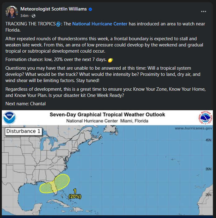
Pay attention to local meteorologists on social media, news, and radio. This alert was posted just yesterday online by the Escambia County Emergency Management Coordinator.
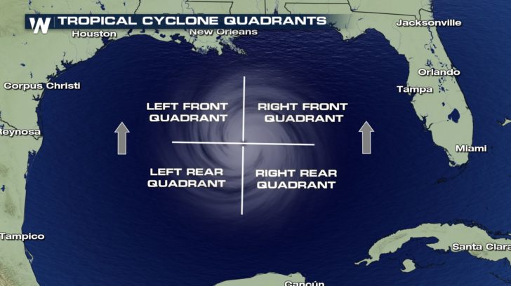
If you have lived in a hurricane-prone area, you know you don’t want to be on the front right side of the storm. For example, here in Pensacola, if a storm lands in western Mobile or Gulf Shores, Alabama, the impact will nail us. Meteorologists divide hurricanes up into quadrants around the center eye. Because hurricanes spin counterclockwise but move forward, the right front quadrant will take the biggest hit from the storm. A community 20 miles away but on the opposite side of a hurricane may experience little to no damage.
The front right quadrant of a hurricane is the strongest portion of a storm. Photo credit: Weather Nation
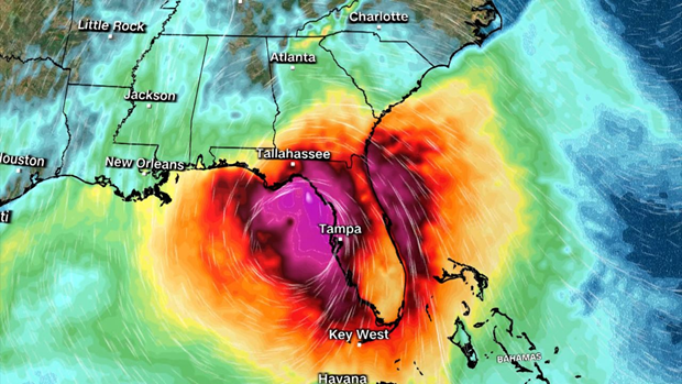
Hurricanes bring with them high winds, heavy rains, and storm surge. Of all those concerns, storm surge is the deadliest, accounting for about half the deaths associated with hurricanes in the past 50 years. Many waterfront residents are taken by surprise at the rapid increase in water level due to surge and wait until too late to evacuate. Storm surge is caused by the pressure of the incoming hurricane building up and pushing the surrounding water inland. Storm surge for Hurricane Katrina was 30 feet above normal sea level, causing devastating floods throughout coastal Louisiana and Mississippi. Due to the dangerous nature of storm surge, NOAA and the National Weather Service have begun announcing storm surge warnings along with hurricane and tornado warnings.
Coastal wetlands are some of the most ecologically productive environments on Earth. They support diverse plant and animal species, provide essential ecosystem services such as stormwater filtration, and act as buffers against storms. As Helene showed the Big Bend area, storm surge is devastating to these delicate ecosystems.
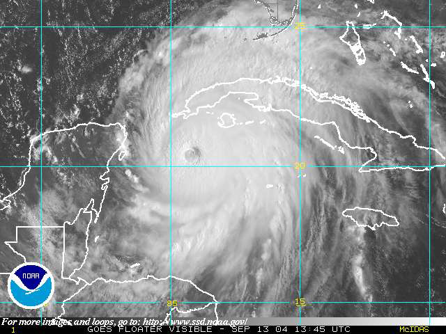
Hurricane Track on Wednesday evening.
As the force of rushing water erodes soil, uproots vegetation, and reshapes the landscape, critical habitats for wildlife, in and out of the water, is lost, sometimes, forever. Saltwater is forced into the freshwater wetlands. Many plants and aquatic animal species are not adapted to high salinity, and will die off. The ecosystem’s species composition can completely change in just a few short hours.
Prolonged storm surge can overwhelm even the very salt tolerant species. While wetlands are naturally adept at absorbing excess water, the salinity concentration change can lead to complete changes in soil chemistry, sediment build-up, and water oxygen levels. The biodiversity of plant and animal species will change in favor of marine species, versus freshwater species.
Coastal communities impacted by a hurricane change the view of the landscape for months, or even, years. Construction can replace many of the structures lost. Rebuilding wetlands can take hundreds of years. In the meantime, these developments remain even more vulnerable to the effects of the next storm. Apalachicola and Cedar Key are examples of the impacts of storm surge on coastal wetlands. Helene will do even more damage.
Many of the coastal cities in the Big Bend have been implementing mitigation strategies to reduce the damage. Extension agents throughout the area have utilized integrated approaches that combine natural and engineered solutions. Green Stormwater Infrastructure techniques and Living Shorelines are just two approaches being taken.
So, as we all wish them a speedy recovery, take some time to educate yourself on what could be done in all of our Panhandle coastal communities to protect our fragile wetland ecosystems. For more information go to:
Flooding due to heavy rains can cause septic systems to fail. Image: B. White NASA. Public Domain
About 30% of households in Florida rely on septic systems to treat and dispose of household wastewater. This includes all water from bathrooms and kitchens, and laundry machines.
Conventional septic systems are made up of a septic tank (a watertight container buried in the ground) and a drain field, or leach field. The septic tank’s job is to separate out solids (which settle on the bottom as sludge), from oils and grease, which float to the top and form a scum layer. Bacteria break down the solids (the organic matter) in the tank. The liquid wastewater or effluent, which is in the middle layer of the tank, flows out through pipes into the drain field and underlying soil, where most of the treatment takes placeDuring floods or heavy rains, the soil around the septic tank and in the drainfield become saturated, or water-logged, and the effluent from the septic tank can’t properly drain though the soil. Special care needs to be taken with your septic system during and after a flood or heavy rains.
Diagram of a conventional septic system. Courtesy of the Leon County Public Works Department.
What should you do after flooding occurs?
The U.S. Environmental Protection Agency (EPA) offers these guidelines:
If your water supply comes from a private well, have it tested for bacteria (total coliform bacteria and E. coli) to make sure it’s safe for consumption, which includes drinking, brushing teeth and cooking. Contact your local County Health Department for testing information. Use an alternate water source or boil your water (bring it to a rolling boil for at least 1 minute) before using it.
Relieve pressure on the septic system by using it less or not at all until floodwaters recede and the soil has drained. For your septic system to work properly, water needs to drain freely in the drainfield. Under flooded conditions, water can’t drain properly and can back up in your system. Remember that in most homes all water sent down the pipes goes into the septic system. Clean up floodwater in the house without dumping it into the sinks or toilet.
Avoid digging around the septic tank and drainfield while the soil is water logged. Don’t drive heavy vehicles or equipment over the drainfield. By using heavy equipment or working under water-logged conditions, you can compact the soil in your drainfield, and water won’t be able to drain properly.
Don’t open or pump out the septic tank if the soil is still saturated. Silt and mud can get into the tank if it is opened and can end up in the drainfield, reducing its drainage capability. Pumping under these conditions can cause a tank to pop out of the ground.
If you suspect your system has been damage, have the tank inspected and serviced by a professional. How can you tell if your system is damaged? Signs include: settling, wastewater backs up into household drains, the soil in the drain field remains soggy and never fully drains, a foul odor persists around the tank and drain field.
Keep rainwater drainage systems away from the septic drainfield. As a preventive measure, make sure that water from roof gutters doesn’t drain into your septic drainfield – this adds an additional source of water that the drainfield has to manage.
This tree was downed during Hurricane Michael, which made a late-season (October) landfall as a Category 5 hurricane. Photo credit: Carrie Stevenson, UF IFAS Extension
There are a lot of jokes out there about the four seasons in Florida—instead of spring, summer, fall, and winter; we have tourist, mosquito, hurricane, and football seasons. The weather and change in seasons are definitely different in a mostly-subtropical state, although we in north Florida do get our share of cold weather (particularly in January!).
All jokes aside, hurricane season is a real issue in our state. With the official season about to begin (June 1) and running through November 30, hurricanes in the Gulf-Atlantic region are a legitimate concern for fully half the calendar year. According to records kept since the 1850’s, our lovely state has been hit with more than 120 hurricanes, double that of the closest high-frequency target, Texas. Hurricanes can affect areas more than 50 miles inland, meaning there is essentially no place to hide in our long, skinny, peninsular state.
A disaster supply kit contains everything your family might need to survive without power and water for several days. Photo credit: Weather Underground
I point all these things out not to cause anxiety, but to remind readers (and especially new Florida residents) that is it imperative to be prepared for hurricane season. Just like picking up pens, notebooks, and new clothes at the start of the school year, it’s important to prepare for hurricane season by firing up (or purchasing) a generator, creating a disaster kit, and making an evacuation plan.
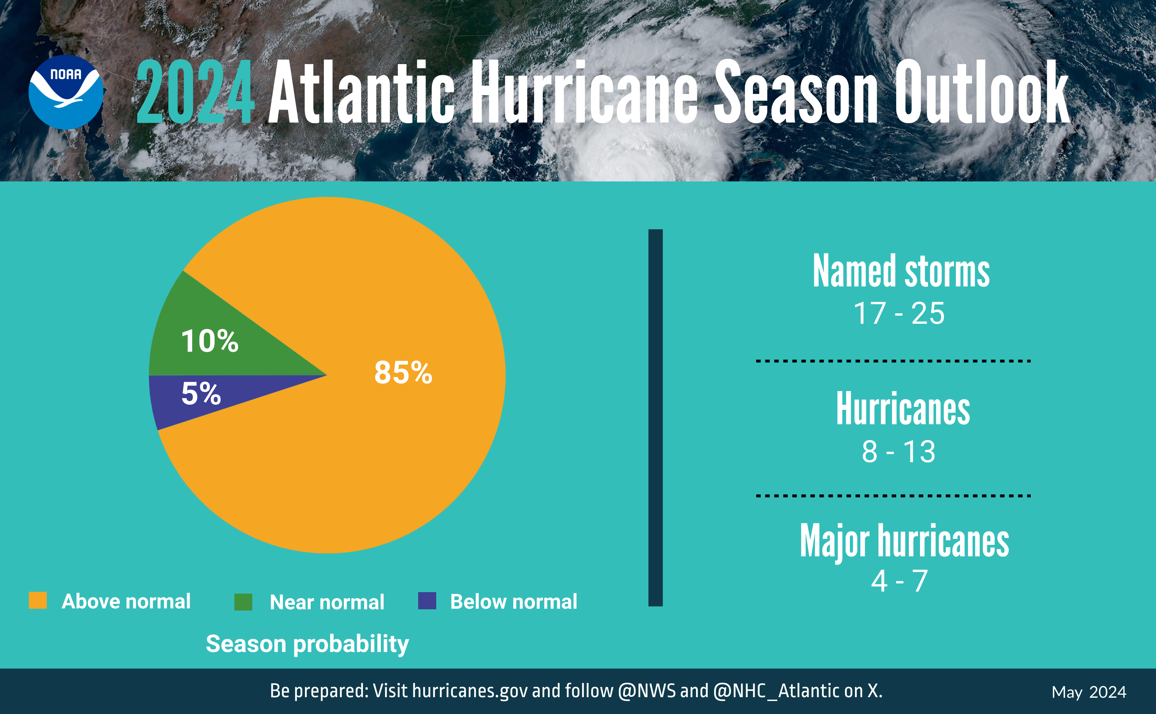
A summary infographic showing hurricane season probability and numbers of named storms predicted from NOAA’s 2024 Atlantic Hurricane Season Outlook. (Spanish version) (Image credit: NOAA)
Peak season for hurricanes is September. Particularly for those in the far western Panhandle, September 16 seems to be our target—Hurricane Ivan hit us on that date in 2004, and Sally made landfall exactly 16 years later, in 2020. But if the season starts in June, why is September so intense? By late August, the Gulf and Atlantic waters have been absorbing summer temperatures for 3 months. The water is as warm as it will be all year, as ambient air temperatures hit their peak. This warm water is hurricane fuel—it is a source of heat energy that generates power for the storm. Tropical storms will form early and late in the season, but the highest frequency (and often the strongest ones) are mid-August through late September. We are potentially in for a doozy of a season this year, too–NOAA forecasters are predicting a very active season, including up to 25 named storms. According to a recent article from Yale Climate Connections, Gulf waters are hotter this May than any year since oceanographers started measuring it in 1981.
The front right quadrant of a hurricane is the strongest portion of a storm. Photo credit: Weather Nation
If you have lived in a hurricane-prone area, you know you don’t want to be on the front right side of the storm. For example, here in Pensacola, if a storm lands in western Mobile or Gulf Shores, Alabama, the impact will nail us. Meteorologists divide hurricanes up into quadrants around the center eye. Because hurricanes spin counterclockwise but move forward, the right front quadrant will take the biggest hit from the storm. A community 20 miles away but on the opposite side of a hurricane may experience little to no damage.
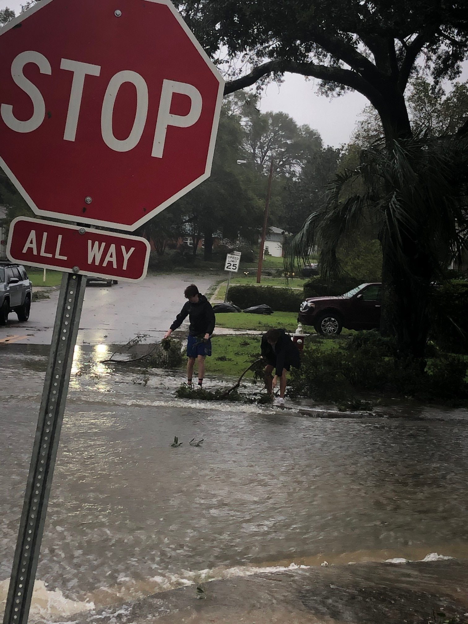
Flooding and storm surge are the most dangerous aspects of a hurricane. Photo credit: Carrie Stevenson, UF IFAS Extension
Hurricanes bring with them high winds, heavy rains, and storm surge. Of all those concerns, storm surge is the deadliest, accounting for about half the deaths associated with hurricanes in the past 50 years. Many waterfront residents are taken by surprise at the rapid increase in water level due to surge and wait until too late to evacuate. Storm surge is caused by the pressure of the incoming hurricane building up and pushing the surrounding water inland. Storm surge for Hurricane Katrina was 30 feet above normal sea level, causing devastating floods throughout coastal Louisiana and Mississippi. Due to the dangerous nature of storm surge, NOAA and the National Weather Service have begun announcing storm surge warnings along with hurricane and tornado warnings.
Summertime always makes me think of the supermarket. At least one time each of the past few summers, I clearly remember being at the supermarket during a rainstorm and watching the water wash over the parking lot, talking with all the other people debating whether to run to their car with a buggy full of food. Supermarkets, home goods stores, medical facilities, libraries, and shopping centers all provide important services that we depend on for our everyday life, but their development has altered the natural processes that control the movement of water from the landscape to creeks and ultimately to the bays and bayous around us (collectively referred to as receiving waters). Concrete, asphalt, and building roof surfaces are impervious, meaning that water cannot pass through them. As a result, more water washes off the rooftops, parking lots, driveways, and roads than before the area was developed. Less water sinks into the ground to move slowly toward receiving waters and to recharge aquifers. More impervious surface leads to more runoff to receiving waters, resulting in greater erosion and higher levels of pollutants like nitrogen, phosphorus, and silt in these waterways. These extra pollutants from the landscape and from eroding stream banks have harmful effects many types of organisms that call these waterways home.
New development in Florida is required to include features that “treat” a fraction of the surface water that runs off impervious surfaces before flowing into receiving waters. Treating surface water runoff means holding it back and preventing it from running quickly off the developed landscape; as it is held back, some pollutants may settle out or be consumed by plants. Treatment is commonly accomplished through features like dry retention basins or wet detention ponds, where water is stored and then slowly moves through soil pathways toward receiving waters. These features are common parts of our developed landscape: the big pond behind the supermarket or in front of the new truck stop, or the grassy pit next to the gas station. While these satisfy regulations, they occupy a considerable amount of land, typically are aesthetically lacking, and may not actually reduce pollutant runoff or stormwater volume as intended. They also can be neglected and become a nuisance in the landscape.
Nature-based stormwater infrastructure projects can play an important role in protecting communities in northwest Florida from the effects of heavy rainfall that occurs periodically in the region. Nature-based stormwater projects are designed primarily to incorporate the natural processes of infiltration that occur in undeveloped areas in the developed landscape, treating stormwater by reducing volumes of surface runoff and concentrations of pollution that could otherwise flow directly into receiving waters. Depending on their design, these features can also provide aesthetic enhancements that can increase the value of properties and the overall wellbeing of the communities where they are implemented. When used in coordination, nature-based projects such as roadside treatment swales, bioretention cells, rain gardens, green roofs, and porous pavement can provide similar levels of stormwater treatment as dry retention basins and detention ponds while also enhancing the aesthetic, recreational, or functional potential of the landscape.
Local government and extension staff across northwest Florida are working to introduce more nature-based stormwater projects into the panhandle landscape. To learn more about recent demonstration projects that have been implemented in our region, visit the WebGIS project https://arcg.is/1SWXTm0.
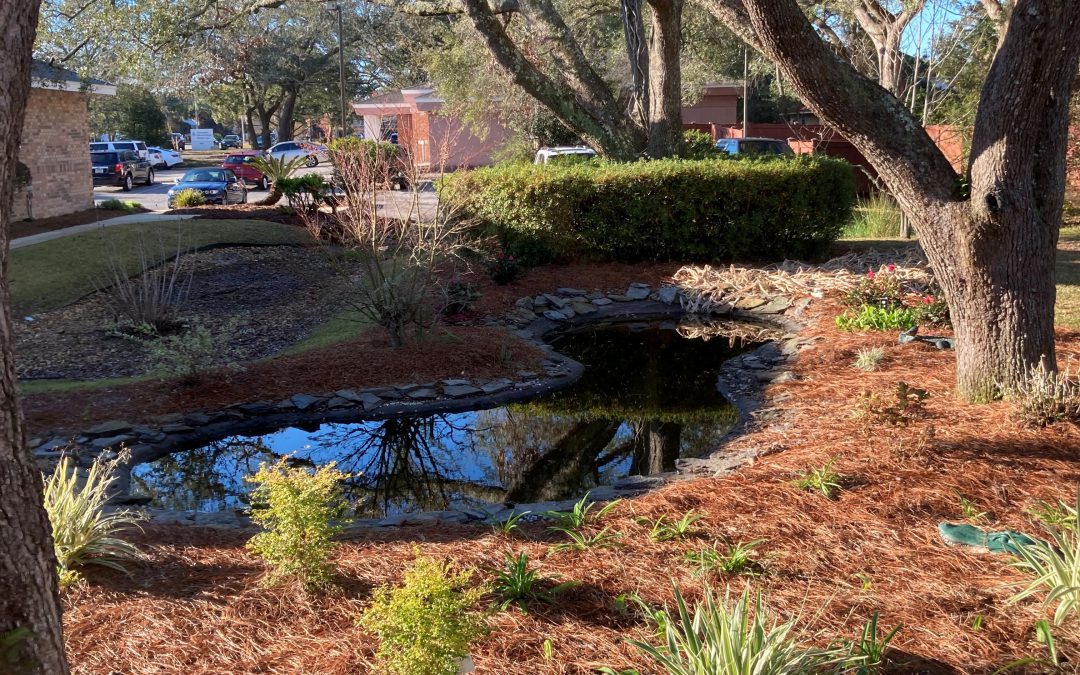
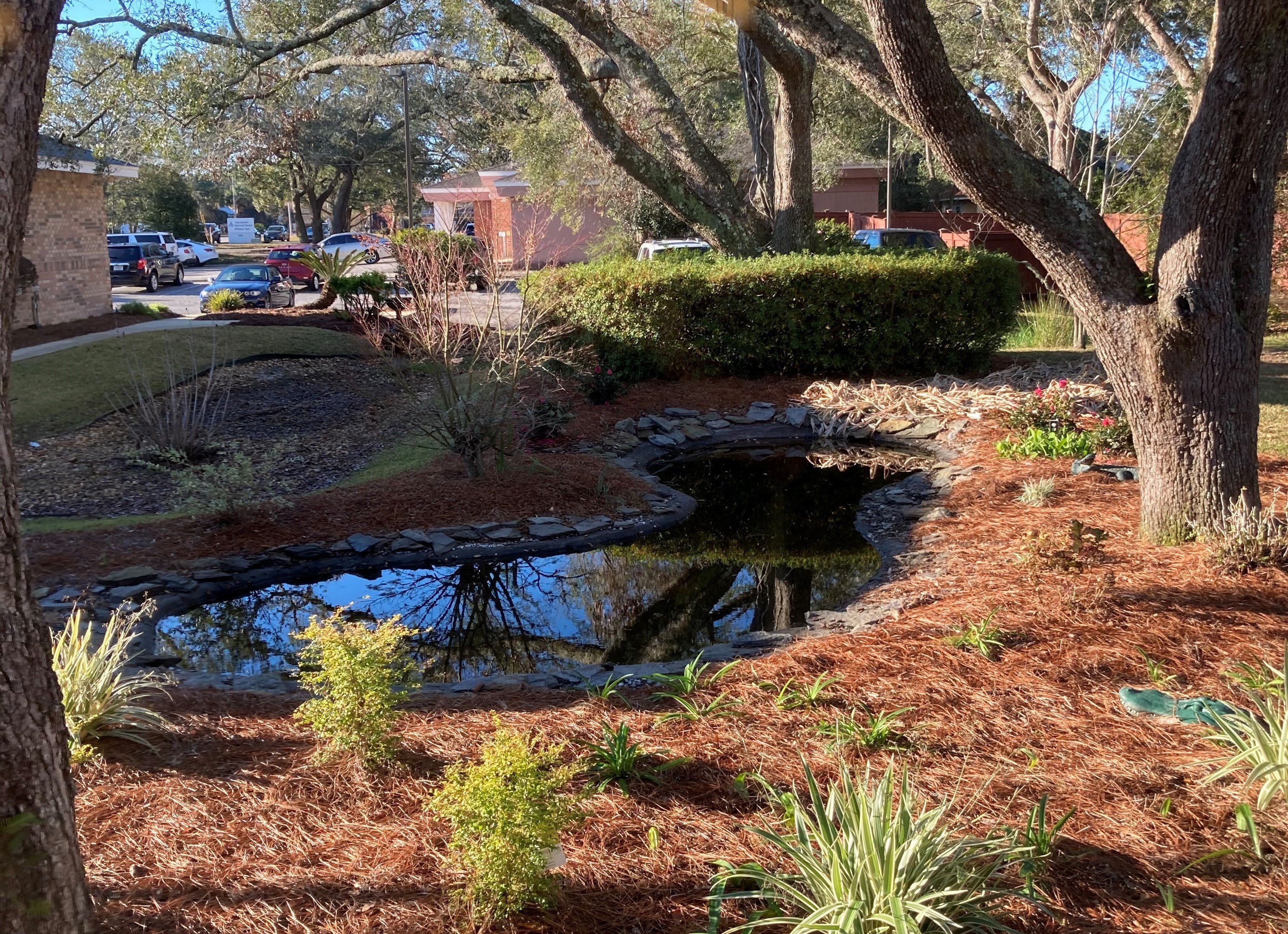
Rain garden/biofiltration cell at a medical office in Pensacola, Florida.