I was having dinner with my family on a cool March evening when one said “I have not seen any Swallow-tailed Kites yet. We usually see them this time of year”. To which I replied, “I saw one today!” – and I had. It was March 23, a very windy afternoon, and I saw it briefly zip over our backyard. The Swallow-tailed Kites were back.
Back in the sense they were back from their long migration from South America. The Swallow-tailed Kite resides there and ventures north to Central and North America during the summer for the breeding season.
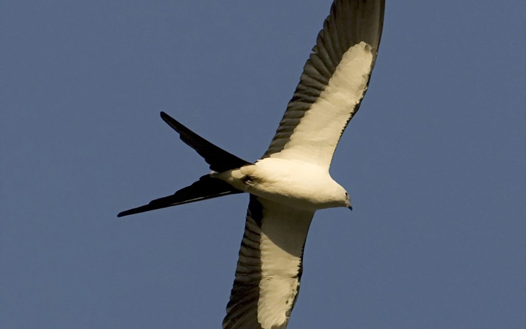
The Swallow-tailed Kite. Photo: Cornell University
It is a magnificent bird, described as “one of the most awesome birds in the U.S.”. Their long slender bodies are sharp in contrast with a brilliant white head and a deep black body. They have long pointed wings which they use to soar with grace, rarely flapping their wings, and their key feature of the scissor-looking forked tail. They are a relatively large bird somewhere between the size of a crow and a large goose. Swallow-tailed kites are often seen soaring just above the treetops searching for food but can also be seen at higher elevations gliding along with the wind. It is a bird that many get excited about when they see it.
Arriving in the United States in late February and March, they seek out opportunities for nesting habitat. Their preference are tall trees, usually 60 feet or taller, and most often select pine trees, though have been known to nest in cypress and other large trees. They usually select trees close to water or open fields. These locations provide an abundance of their favorite prey – insects. They can be seen zooming close to the trees to grab unwary prey and will, at times, take larger creatures like treefrogs, lizards, and small snakes. Their beaks are small however, and so prey selection is limited.
Both the males and females participate in nest building. Swallow-tailed kites are monogamous and mate pairing often occurs during the migration. They usually build a new nest each season but often is the same location. Males are territorial of these nest locations and defend them with local vocalizations. Despite this, many swallow-tailed kite nests can be found near each other.
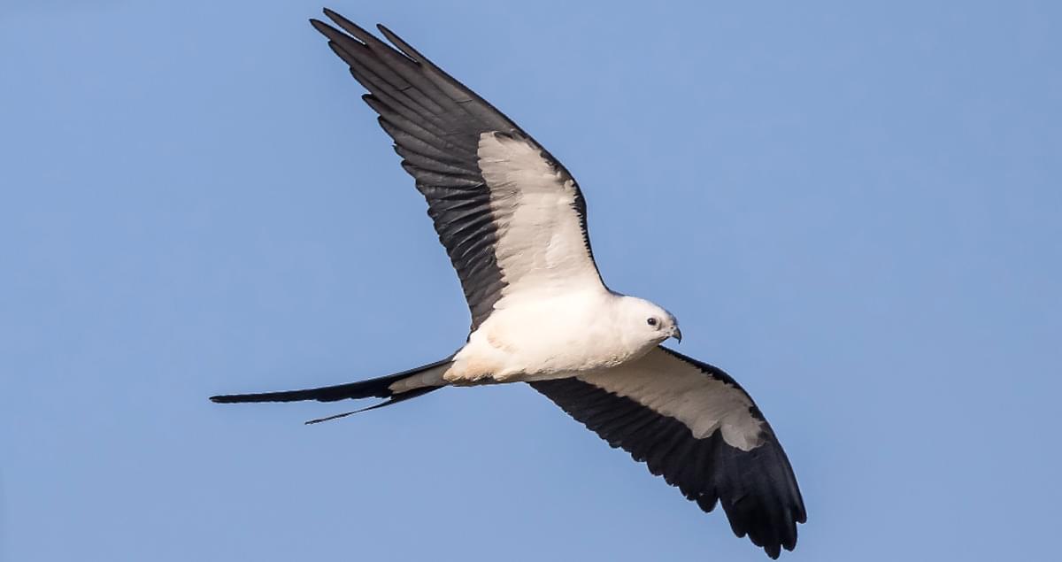
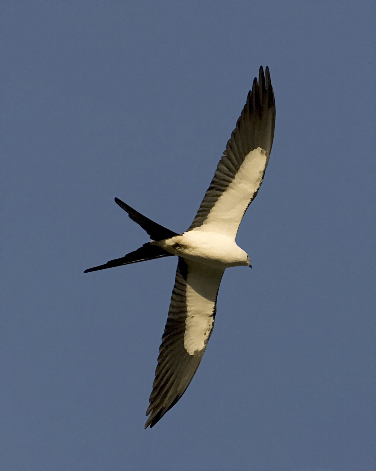
The Swallow-tailed Kite. Photo: Rodney Cammauf – National Park Photo.
Once the young hatch, the female remains with them while the male forages for food. He typically brings it back to the nest in his talons, perches and transfers the food to his beak, and the provides it to the female who in turn feeds the chicks. After fledging, around August or September, it is time to head back to South America and they leave our area until next spring.
Swallow-tailed kites were once common all along the Mississippi River drainage as far north as Minnesota. However, the numbers declined significantly, primarily due to humans shooting them, and today they are only found in the lower coastal regions of the southeastern U.S. Today they can be found, but are uncommon, in coastal Louisiana, Mississippi, Alabama, Georgia, and South Caroline. In Florida they are considered uncommon in the panhandle but common in the peninsula part of the state. Their numbers seem to be increasing but the loss of tall nesting trees is a major issue today. The clearing of these tall trees due to agriculture and urban development have kept them from reestablishing their original range. But for now – the swallow-tailed kites are back.
For more information on this amazing bird read the following.
Swallow-tailed Kite. All About Birds. Cornell Lab. Cornell University.
Organized and sponsored by Florida Sea Grant, the “Stem to Stern” workshop in November 2023 at the Emerald Coast Convention Center marked a significant gathering in marine conservation and management. This event drew together legal experts, representatives from the Florida Fish and Wildlife Conservation Commission (FWC), local marine resource coordinators, law enforcement, and industry stakeholders to tackle critical issues facing Florida’s marine environments. Through discussions that ranged from legal frameworks for boating and waterway access to environmental conservation strategies, the workshop facilitated a deep dive into the complexities of marine policy and stewardship. Discover new programs, insights, and collective expertise shared at “Stem to Stern.”
Florida Sea Grant Boating and Waterways Workshop
November 2, 2023 Emerald Coast Convention Center
1250 Miracle Strip Parkway SE – Ft. Walton Beach FL
9:00 – 9:25 WELCOME AND INTRODUCTIONS
Welcome
Rick O’Connor (Florida Sea Grant UF IFAS Extension)
Moderators –Mike Norberg and Jessica Valek (Okaloosa County)
3:15 – 3:45 WRAP UP – Robert Turpin (Escambia County Marine Resources)
PROGRAM SPONSORS
Acknowledgement
We extend our deepest gratitude to all who contributed to the success of the “Stem to Stern” workshop. To our esteemed speakers, whose expertise and insights into marine conservation and management have been invaluable, we offer our sincere thanks. Your presentations were not only informative but also inspirational, guiding us toward a more sustainable future for our waterways.
A special acknowledgment goes to the members of the planning and program committee. Your dedication and hard work in organizing this event did not go unnoticed. From the initial planning stages to the execution of the workshop, your efforts have been the backbone of this successful gathering.
We also want to thank the authors of the surveys that have provided us with essential data and perspectives. Your research and analysis contribute significantly to our understanding of the challenges and opportunities within Florida boating and waterways.
Lastly, we are incredibly grateful for the support from our sponsors. Your generosity and commitment to Florida Sea Grant and marine conservation have been crucial in bringing this workshop to life. Your support not only made this event possible but also highlights your dedication to safeguarding our marine ecosystems.
Together, we have taken an important step towards protecting and enhancing Florida’s waterways. Thank you for your contributions, commitment, and shared vision for a sustainable future.
Information edited and compiled by: L. Scott Jackson, Chantille Weber, and Amon Philyaw, UF/IFAS Extension Bay County
An Equal Opportunity Institution. UF/IFAS Extension, University of Florida, Institute of Food and Agricultural Sciences, Andra Johnson, Dean. Single copies of UF/IFAS Extension publications (excluding 4-H and youth publications) are available free to Florida residents from county UF/IFAS Extension offices.
Pompano?! More like Pompa-YES! Growing up in the Panhandle of Florida, I was exposed to many great fishing seasons and opportunities, from the Cobia (Rachycentron canadum) run in the spring to the “Bull” Red Drum (Sciaenops occelatus) run of the fall, but my absolute favorite season was the Florida Pompano (Trachinotus carolinus) run on the beaches. While I enjoyed being on the boat scouring the beaches with a small bucktail jig, casting at sliver flashes in the cuts of the sandbar, I had my most memorable trips on the beach with a few rods, sand spikes, and a “flea rake.” There were no bad days on the beach (as they say, it’s better than a day in the office), and when you happen upon a honey hole, it makes for an incredible day with very little effort and usually an incredible dinner to follow. Since we are rapidly approaching peak pompano season, I will pay homage to the “Silver Surfers of the Emerald Coast” with a little overview of the life of a Florida Pompano.
Beach Fishing for Florida Pompano is for Everyone, Young and Old – Thomas Derbes II
Florida Pompano have a very wide range, from Massachusetts to Brazil, and are a member of the family Carangidae (aka the Jack Family). It is a very popular sport and commercial fishery, and its rapid growth rate makes it a prime candidate for aquaculture. Florida Pompano are highly migratory fish, and they can run from the Florida Keys all the way to Texas and back in a season. In the Florida Panhandle, the Florida Pompano run starts in April/May lasting until July, with a bonus fall run in October/November when they are returning south. When fishing off the sandy beaches of the Florida Panhandle, you can run into its cousins the Permit (Trachinotus falcatus) and Palometa (Trachinotus goodei) who often get mistaken for a Florida Pompano. Another thing they have in common with Florida Pompano is their love of crustaceans including the Mole Crab (aka Sand Fleas) (Emerita portoricensis) and Atlantic White Shrimp (Litopenaeus setiferus).
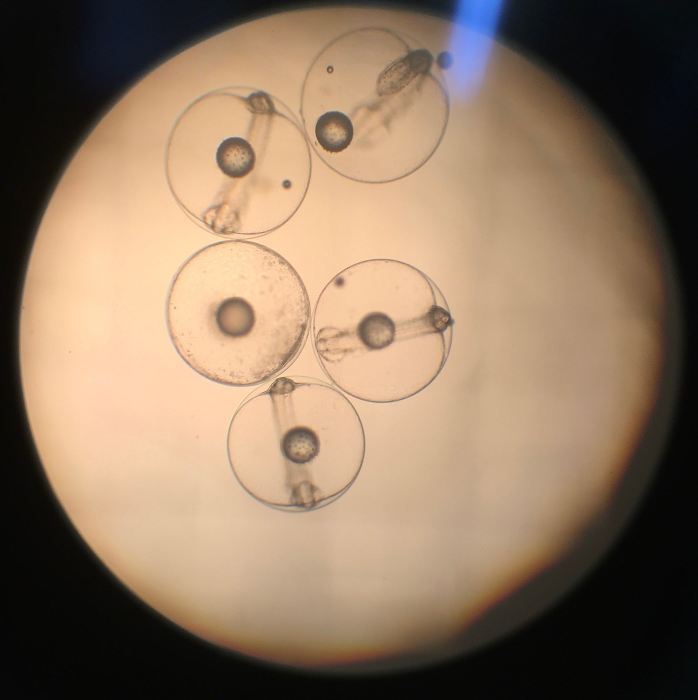
Just like most members of the family Carangidae, Florida Pompano are considered “batch spawners.” A batch spawner is when a female releases her eggs into the water column and a male simultaneously releases his sperm into the water column. Female Florida Pompano can release upwards of 800,000 eggs per spawning season, and Florida Pompano typically head offshore in early spring to October in the Gulf of Mexico to spawn, and their juveniles return to the beach to grow along the shoreline. Florida Pompano can reach an aquaculture harvest size of 12 inches within one year, and males reach maturity in 1 year whereas females mature after 2 to 3 years.
Florida Pompano Eggs 12 Hours Post Fertilization – Thomas Derbes II
When it comes to table fare, Florida Pompano ranks very high on my personal fish list, and many chefs love serving pompano at their restaurants due to the great, mild taste and fillets that are of even thickness. Their diet of crustaceans helps yield a buttery, almost crab flavor and the meat is very flaky and white. There are many preparation techniques for Florida Pompano, from grilled whole to pan-fried, and pompano have even inspired their own cooking technique, “Pompano en Papillote,” or baking pompano in parchment paper.
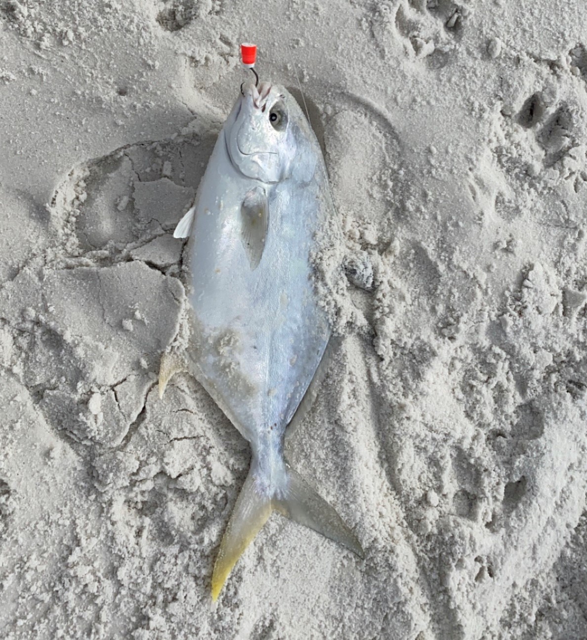
Beautiful Florida Pompano Caught Off Pensacola Beach, Florida – Thomas Derbes II
When fishing for Florida Pompano off the beach, most anglers employ a large rod (usually a 10ft rod) with a 20lb fluorocarbon double drop loop rig and pyramid weight. The larger rod allows for maximum casting distance from the beach, giving beach anglers a chance to reach behind the first sandbar. Most anglers will bring either fresh dead shrimp or a flea rake with them to catch the prized bait, mole crabs. Pro tip, when casting out the rods, make sure you have a bait close to the shore in the “trough” and not just past the sandbar. (Learn More About Rigging Here!) If you plan to harvest a Florida Pompano, make sure you check your local regulations. In the Florida Panhandle, Florida Pompano must be 11 inches (fork-length) or larger with a daily limit of 6 per angler.
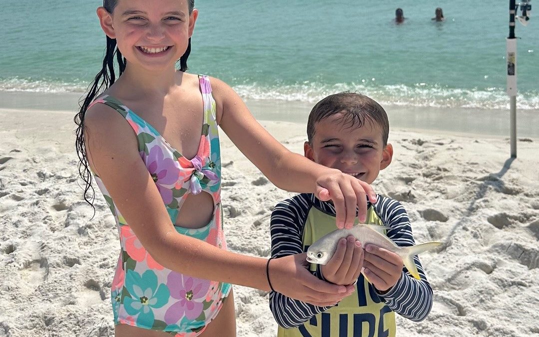
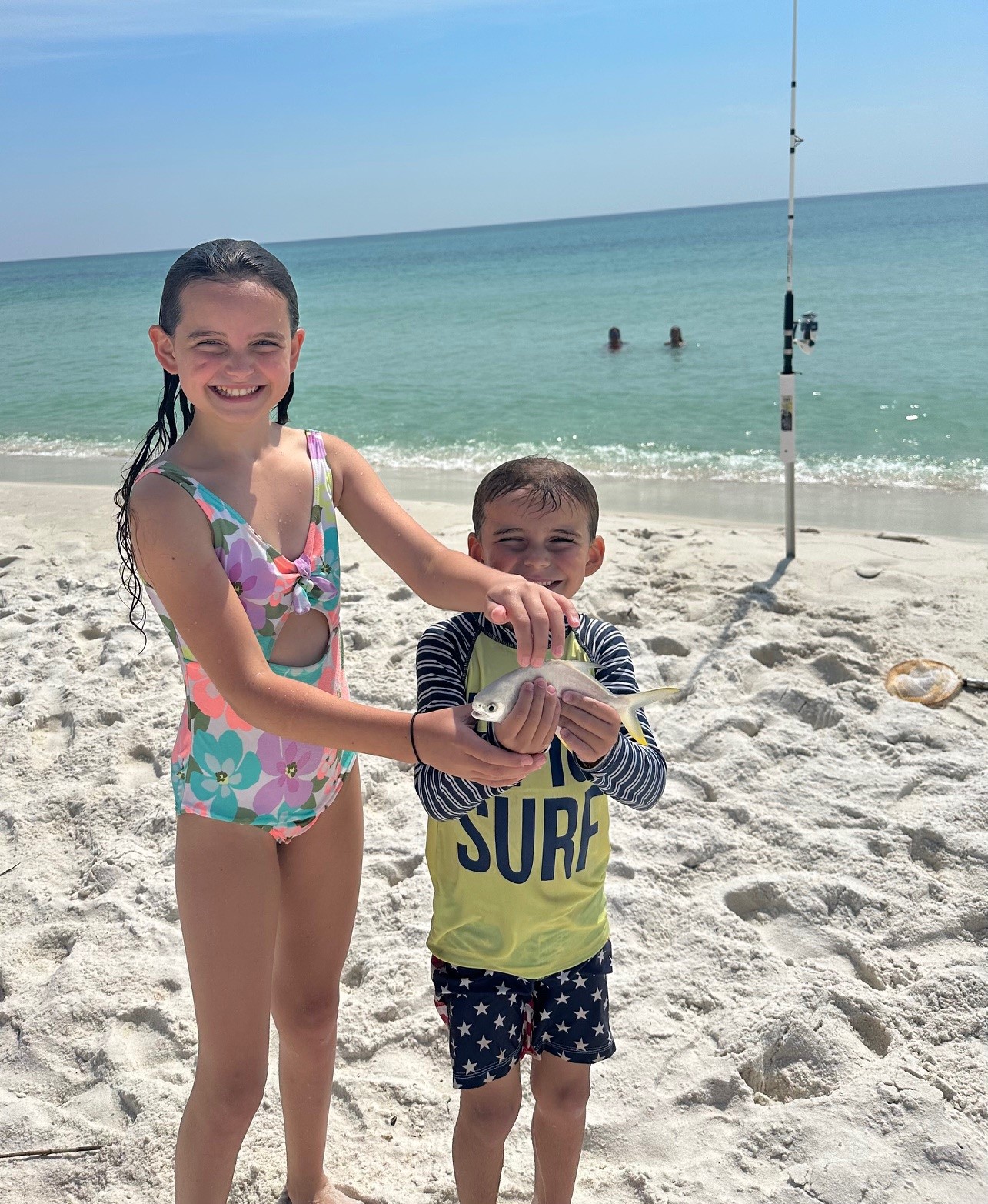
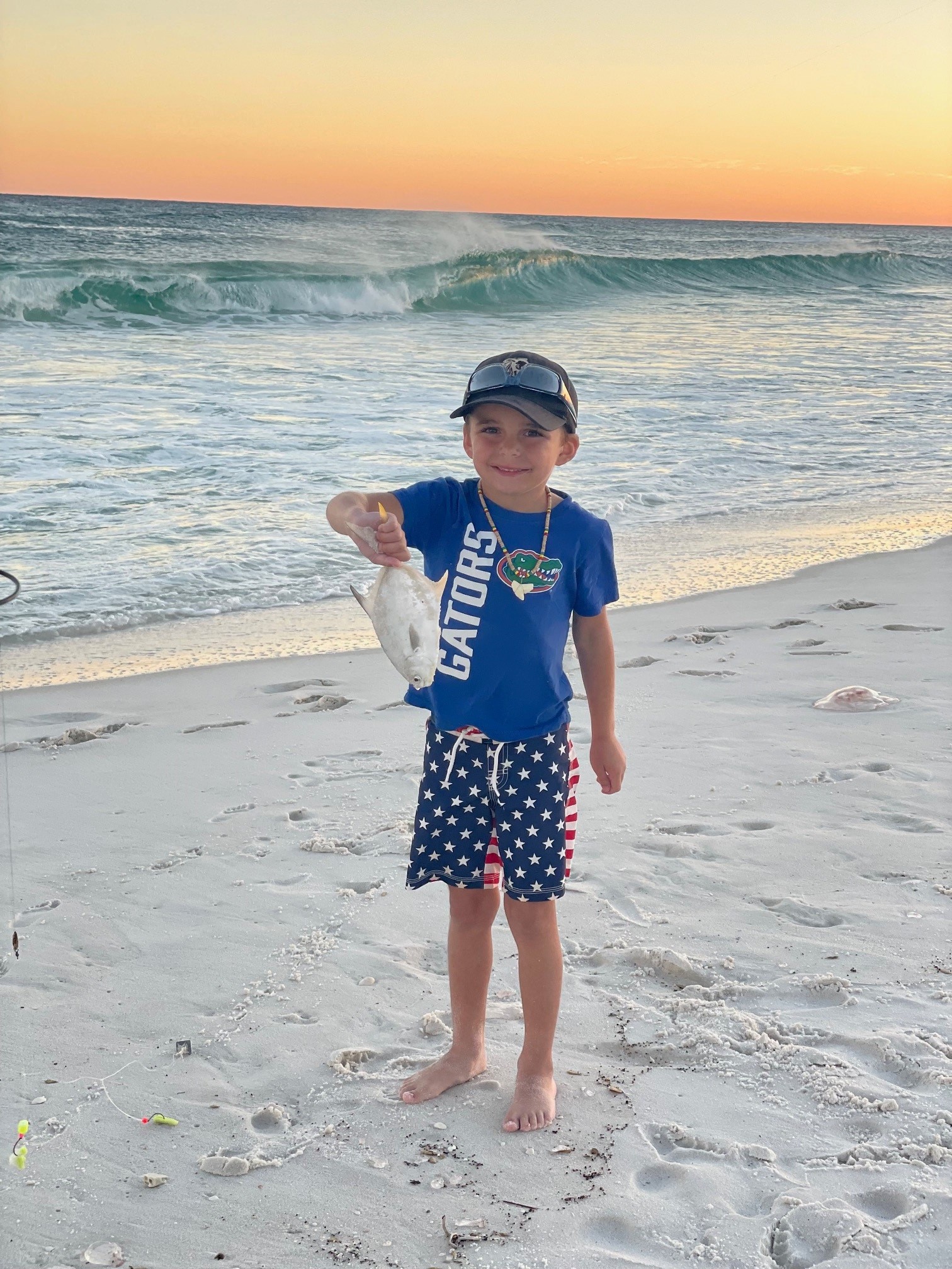
My nephew showing off his prized Florida Pompano – Zach Saway
I hope you have enjoyed this profile for the Florida Pompano. Now is the time to get your rods out of storage and ready to hit the beach!
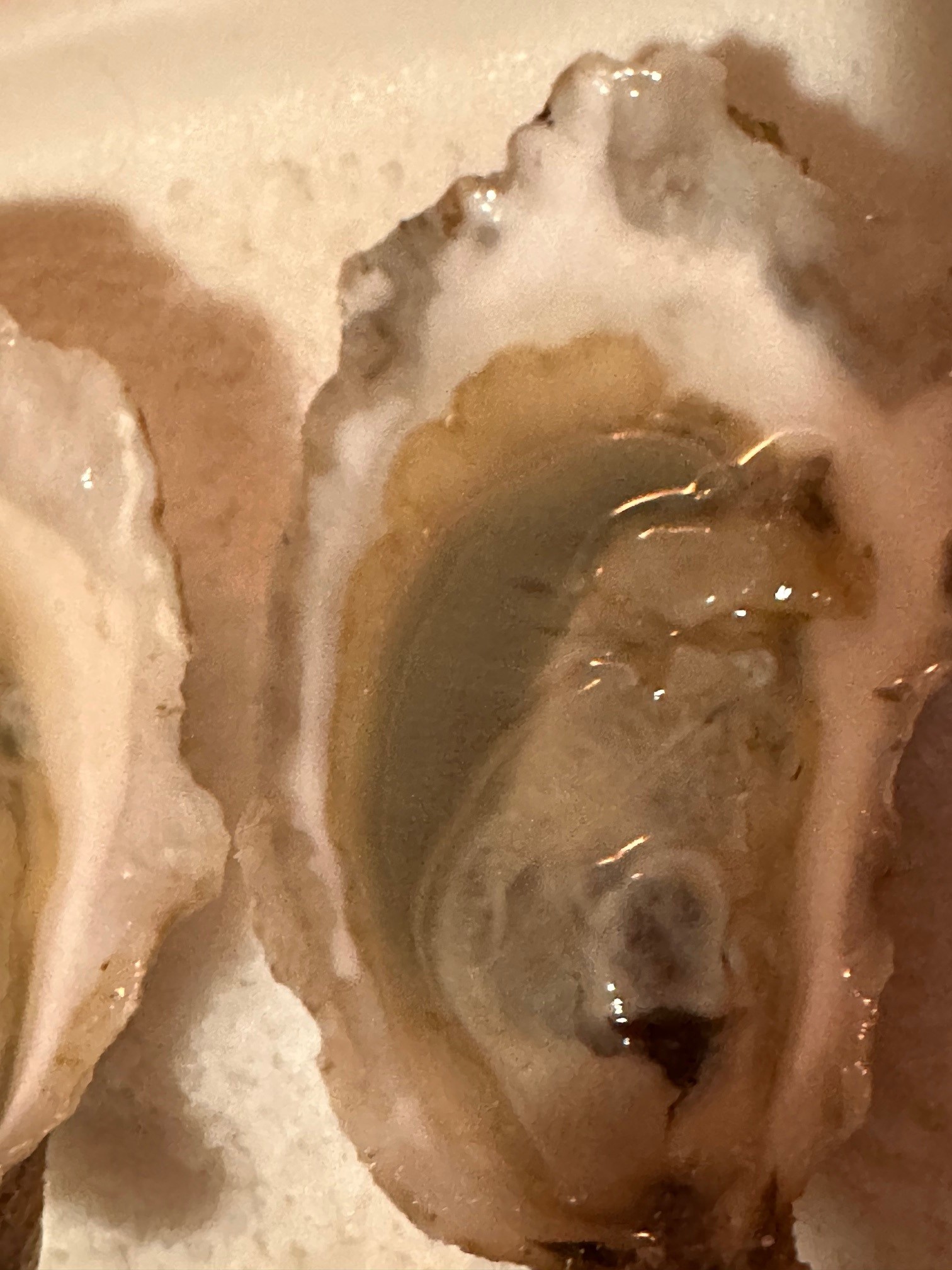
And it’s a good thing! Green gill oysters are prized in the oyster community. In the Carolinas and Northern France, green gill oysters are a seasonal, cherished crop and a product of the saying “You are what you eat!” The phytoplankton, Haslea ostrearia, is the typical culprit, and their distribution is measured by direct observation from plankton tows or the occurrence of green-gilled oysters. The exact distribution is unknown, but there are reports of H. ostrearia throughout the Atlantic, Pacific, and Indian oceans. Haslea ostrearia is a beautiful pennate diatom that contains a water-soluble blue pigment known as marennine (More Here). Marennine’s production is stimulated by long photoperiods, blue light, and high light/low cloud weather. It can also be released into the water and into the flesh of organisms (typically oysters) that consume them.
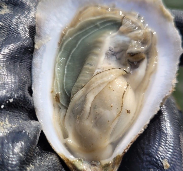
Fresh out of the water Grayson Bay Oyster with green gills! – Brandon Smith, Grayson Bay Oyster Company
Pensacola Bay, and surrounding areas, had a pretty mild fall in terms of rainfall, and the bays have turned a beautiful green-blue hue as the bays have risen in salinity and phytoplankton typically found in the Gulf of Mexico were able to survive. Brandon Smith, owner of Grayson Bay Oyster Company, was out working his farm January 7th, 2024, and sent a text to me saying “take note of the green gills,” and I was very shocked and happy to see actual, green-gilled oysters in our local waterways. He graciously harvested a few dozen to examine (and let me taste test), and I was able to confirm the presence of green gills in the oysters. After further research on H. ostrearia, it seems as though the pennate diatom made it into our bays and is the culprit of this wonderful surprise.
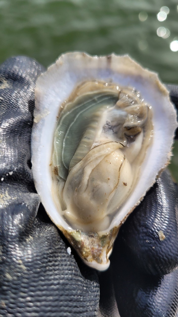
A local Grayson Bay Oyster displaying green-gills – Thomas Derbes II
When I shucked my graciously donated oysters from Grayson Bay, I was reminiscing on the first time I came across green-gilled oysters. The first batch of green gill oysters I ate came from an oyster farm in North Carolina called N. Sea Oyster Company. Their green-gilled beauties “Divine Pines” were requested by a wedding I was catering for, and I was able to slurp down one to get talking and tasting notes. The seasonal Divine Pines offered a sweet yet salty taste and became one of my favorite out-of-area oysters to serve at events and to personally consume. While beautiful, the green-gilled oysters are usually only found in the fall/winter months. These green-gilled Grayson Bays were very comparable and offered a salty yet very sweet and minerally finish. The H. ostrearia is responsible for not only the green gills, but the sweet tasting notes, and I highly recommend adding any green-gilled oyster to your fall/winter raw bar selection.
References:
Turpin, Vincent & Robert, J-M & Philippe, Goulletquer & Massé, Guillaume & Rosa, Philippe. (2008). Oyster greening by outdoor mass culture of the diatom Haslea ostrearia Simonsen in enriched seawater. Aquaculture Research. 32. 801 – 809.
When you sit down and enjoy some fresh, farmed oysters during the summer, you might notice that the oyster is not watery but yet plump and full of meat, unlike the usual wild oysters. These farmed oysters are very special and are called “triploid oysters.” What makes an oyster a triploid? Well, it all starts in the oyster hatchery and involves using tetraploid male oysters to breed with diploid female “wild” oysters.
Before we dive into triploids, let’s go over some definitions. A diploid organism contains two sets of chromosomes. As humans, we have two sets of chromosomes, and the pair is formed by a chromosome from the mother and a chromosome from the father. Triploid organisms contain three sets of chromosomes and while very rare, triploidy does happen in the wild. Tetraploid organisms have four sets of chromosomes and are usually only formed in a laboratory setting using pressure or other means to cause tetraploidy. When you breed a tetraploid oyster with a diploid oyster, the result is a triploid oyster.
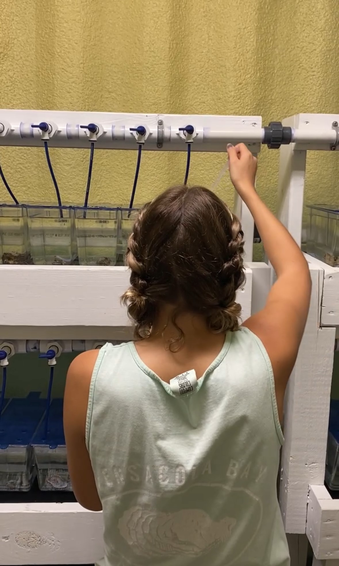
A hatchery worker keeping an eye on spawning chambers with diploid oysters – Thomas Derbes II
Inside of an oyster hatchery, you will see many small breeding chambers for the oysters. When a hatchery decides to spawn oysters, they place a single wild diploid oyster in each chamber. During spawning, the hatchery will introduce a cycle of cold then warm water and this cycle is repeated until a spawn is triggered. Hatchery workers will closely watch the oysters and will shut off the water supply to any oyster that has spawned so they can trap the gametes in the chamber. You can determine the sex of an oyster by watching it spawn; a female oyster “claps” out her eggs while a male opens slightly and releases sperm into the water. When spawning for triploid oysters, the hatchery workers will only obtain the eggs from female diploid oysters and discard any diploid sperm to avoid cross contamination. During the spawn, a worker will strip the sperm from male tetraploid oysters and once all female diploids are done spawning, they will introduce the tetraploid sperm to the diploid eggs. After 30 minutes, fertilization rates are calculated and stocking densities are formed.
3-month-old triploid seed – Thomas Derbes II
Why Would a Farmer Want to Grow a Triploid Oyster?
There are many benefits for a farmer to raise triploid oysters. First and foremost, triploid oysters are sterile. This is a major benefit for the farmers during the summer months. During the summer, wild diploid oysters spawn, and when they spawn, the meat turns very thin and watery. In the Panhandle of Florida, the harvest of wild oysters is prohibited in the summer and only farmed oysters can be harvested.
Another added benefit is the increased growth rate of a triploid oyster compared to a diploid oyster. As mentioned above, triploid oysters lack the ability to spawn. Since a triploid oyster does not have to spend energy producing gametes, it puts all of its energy into growing its shell and meat. A typical diploid oyster could take more than two years to reach harvest size, where a triploid oyster can reach harvest size within 8 months (commonly 12-24 months but there are usually some fast growers in a batch).
There are more benefits of triploid oysters including selective breeding for disease resistance and environmental sustainability. With the use of triploid oysters for oyster farming, wild stocks go relatively unaffected and help contribute to more sustainable aquaculture practices. I hope this brief explanation of triploid oysters will help you understand more about the somewhat unknown world of oyster aquaculture. With demand for oysters on the rise, triploid oysters hold great promise in meeting the needs of an ever-growing oyster aquaculture industry.
I began this project in 2022 wanting to know which of the 40 species of snakes known to inhabit the Pensacola Bay area were encountered by people. I also wanted to know where they were encountering them and what time of year. This information would be used in my Living with Snakes program and provide better information than field guides and publications that covered a broader area. The 40 local species were divided into six categories: small snakes (<12”), mid-sized snakes (12-24”), large snakes (> 24”), water snakes, venomous snakes, and non-native snakes.
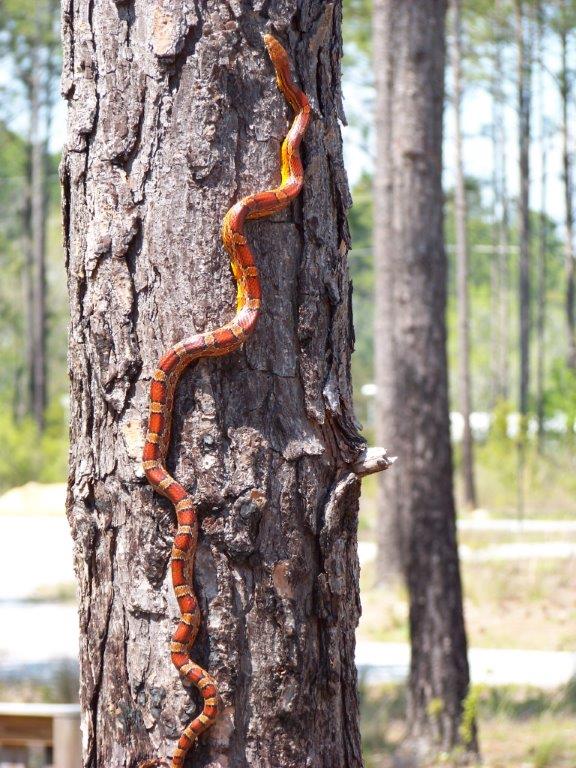
The red rat snake, or corn snake.
Photo: Molly O’Connor
Which snakes did people encounter?
In 2023 there were 215 snake encounters between Jan 1 and Dec 10. This is a 136% increase over 2022. This is probably not because of more snakes but rather more residents participating in the project.
Of the 40 species possible, 24 (60%) were encountered. This is a 13% increase over 2022. Again, I feel this is due more to increasing participation.
The most frequently encountered species were:
Cottonmouth – 49 records (23%)
Southern Black Racer – 35 records (16%)
Banded Water Snake – 26 records (12%)
Eastern Garter Snake – 17 records (8%)
Eastern Coachwhip – 11 records (5%)
The Southern Black Racer was the most frequently encountered snake in 2022 (23%), followed by the cottonmouth (16%). As you can see, the frequency of encounters remained the same this year, but the species flipped. The Eastern Ribbon Snake, which was third at (14%) in 2022 did not make the top five this year.
The rarest snakes – those encountered only once or not at all – included:
Encountered once:
Rough Green Snake
Eastern Kingsnake
Eastern Coral Snake
NOT Encountered at all:
Smooth Earth Snake
Marsh Brown Snake
Southern Hognose Snake
Mole Kingsnake
Scarlet Kingsnake
Eastern Indigo Snake
Black Swamp Snake
Glossy Crayfish Snake
Queen Snake
Midland Watersnake
Yellow Bellied Water Snake
Diamondback Water Snake
Western Green Water Snake
Western/Eastern Mud Snake
Rainbow Snake
Of the four species only encountered once, each is considered quite rare for encounters. The Eastern Kingsnake was once common but has declined over the years. The Eastern Coral Snake is quite common, but its behavior and activity make it rare to encounter. Some snake experts have never seen one in the wild.
Of the 16 species not encountered at all, three are small snakes whose size and habits make them difficult to detect. Two are mid-sized but their habits also make them hard to detect. Nine are water snakes who live in swampy environments along our rivers. You would have to be out there to encounter them, and few people are. Two species, the Southern Hognose and the Eastern Indigo Snake, are state and federal listed and are extremely rare.
The gray rat snake, also known as the oak snake.
Photo: Nick Baldwin
Where did people encounter these snakes?
I divided the bay area into four regions: North Escambia, South Escambia, North Santa Rosa, and South Santa Rosa.
North Escambia – 13 species (54% of the total 24 species found this year).
South Escambia – 16 species (67% of the total).
North Santa Rosa – 17 species (71% of the total).
South Santa Rosa – 11 species (46% of the total).
There is not much difference between these. In Escambia County more encounters occurred in the southern portion of the county. For Santa Rosa County it was the opposite. Whether this is because there are more snakes in these locations, or more participants in the project cannot be said. We will pay more attention to this next year.
Species that were found in ALL four regions included:
Eastern Garter Snake
Gray Rat Snake
Corn Snake
Southern Black Racer
Coachwhip
Cottonmouth
Species only found on one of the four regions included:
Eastern Kingsnake
Florida Pine Snake
Brahminy Blind Snake
Rough Earth Snake
Pinewoods Snake
Eastern Coral Snake
What time of year were these snakes encountered?
Winter – 57 encounters; 13 species
Spring – 80 encounters; 20 species
Summer – 52 encounters; 18 species
Fall – 17 encounters; 10 species
There was an obvious decline in encounters in the fall. Many species are beginning to settle in for the winter this time of year, but many others breed, and thus should be moving (at least the males). I know some volunteers ceased looking, but others I know who search weekly, or daily, did not encounter as many snakes.
Only one species was encountered every month of the year. This was the cottonmouth.
The Eastern Garter Snake was seen every month except June and October; it seems to be active year-round.
The Southern Black Racer was missing in January, November, and December – suggesting a dislike for the cold.
NOTE: many of these hibernating snakes will emerge on warmer sunny days during winter and can be encountered.
SPRING was the time of year with the highest encounter rate and species encountered. This would make sense in two parts; (1) they are emerging seeking food after non-feeding during winter, (2) they are emerging looking for mates because it is breeding season for many. Five species were only encountered in the early part of the year. Two species were only found in winter and one species was only found in the spring.
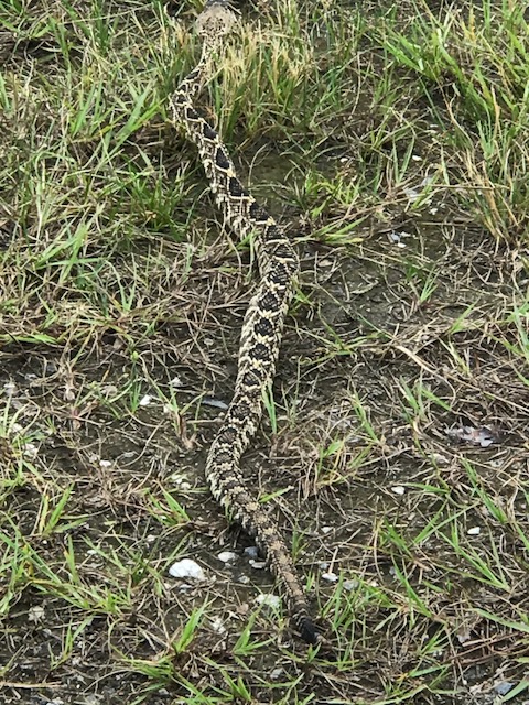
Eastern diamondback rattlesnake crawling near Ft. Pickens Campground.
Photo: Shelley Johnson
What about the venomous snakes?
As expected, most are concerned more about the encounters with venomous snakes. There are six venomous species listed in the state of Florida, four inhabit the Pensacola Bay area. All four were encountered in 2023.
Cottonmouth – was encountered in all regions, each month of the year, it was the most commonly encountered snake in our area this year.
Eastern Diamondback Rattlesnake – was encountered seven times, only during the spring and summer, and in three of the four regions in our area. This snake is pretty common but not commonly encountered where people most often reside and play. Though encounters do occur in residential neighborhoods, they are rare.
Dusky Pygmy Rattlesnake – was encountered six times, during spring, summer, and fall, and two of the four regions in the bay area.
Eastern Coral Snake – was encountered once, during the spring, and in only one of the four regions in the bay area. Again, this snake is actually quite common, but its behavior makes it difficult to encounter. So, encounters with this species are rare.
Summary
In 2023 60% of the known species of snakes that inhabit the Pensacola Bay area were encountered by residents at some time during the year. Most encounters occurred in the spring and summer and encounters occurred throughout the entire region. The cottonmouth was the most frequently encountered species this year but rare species, such as the Eastern hognose, Eastern kingsnake, and the Florida pine snake were seen – and that is pretty exciting. The snake diversity in the Pensacola Bay area seems good. There is concern that a non-native parasite decreasing the populations of some species in central and south Florida may make its way to the panhandle. We are participating in a project entitled Snake Lungworm Alliance Monitoring (SLAM) that collects deceased snakes for examination by researchers. If you find a deceased snake in good enough condition to be dissected, place it in a plastic Ziplock bag, label with the date, location (GPS preferred), and your contact information. You can then bring it to the Escambia County Extension office or freeze it and call me – (850-475-5230) or email roc1@ufl.edu and we will arrange pick up.
We plan to continue the Snake Watch Project in 2024 and encourage all who see snakes to contact me at the above email address. We will also be offering the Living with Snakes presentation. If your community group is interested in this talk, contact me.