by Rick O'Connor | Jan 10, 2025
After two articles on protozoans, we now know what these animal-like creatures are. We have discussed some that move by flagella, and others than move by pseudopodia. The last group by short flagella called cilia.
Ciliates are often covered with these small hair-like structures and can move them relatively fast. Thus, they swim MUCH faster than flagellates, and both are faster than the amoeboid sarcodinids.
They are easy, and not easy, to identify under a microscope. You will be examining the slide seeing diatoms and dinoflagellates scattered across the screen, an occasional flagellate slowly swim by, the very slow fried egg-looking amoeboid slime through, and then a dot/cell will zip by at high speed. That was a ciliate. Easy to identify because anything moving that fast is a ciliate. Hard to identify because you have NO idea which one. Under the heat of the light, they will eventually slow down, and you can better see them for identification.
Ciliated cell found in soil.
Photo: Florida Atlantic University
Most ciliates have an open mouth and what is called an oral groove. This groove acts like a throat leading the food to the food vacuole – where it is digested. Waste will live the protozoan either through the cell membrane, or back out the mouth. At the opening if the mouth are numerous cilia that generate a current sucking up food like a vacuum cleaner and moving it down the oral groove. Most have many nuclei which are easily seen under the scope. They move through the water column collecting food and moving it down the food chain. Most lack shells, so do not contribute to the sediments of the ocean floor or on our beaches.
Up to this point in the series we have been discussing the microscopic phytoplankton and zooplankton found in the Gulf of Mexico. These are creatures few know about, nor do they understand their importance in cycling food, energy, nutrients, and other chemical processes that keep the ecology of the northern Gulf of Mexico in balance. But is now time to turn our attention to the larger – macroscopic – creatures of this world. We begin with seaweed.
References
Yaeger, R.G. 1996. Protozoa: Structure, Classification, Growth, and Development. Chapter 77. Medical Microbiology, 4th edition. https://www.ncbi.nlm.nih.gov/books/NBK8325/#A4082.
by Rick O'Connor | Dec 20, 2024
In our last article we asked the question – “what are protozoans?” As we mentioned then the breakdown of the word includes “proto” which means “before”, and “zoan” which refers to animals. These are the “before animals” – meaning animal-like creatures BEFORE there were true animals.
They are single celled creatures that lack a cell wall and chlorophyll – animal-like – but they are only single celled – so, not true animals. Being animal-like means they cannot produce their own food as the diatoms, dinoflagellates, seaweeds, and true plants do. Rather, they must consume food as animals do. Some feed on diatoms and dinoflagellates. Some feed on decaying organic matter on the seafloor. Some are parasitic and feed off of a host organism. Some feed on other protozoans. And some do a combination. But they are all consumers.
The group is classified into six phyla mostly based on how they move. One subphylum is the Sarcodinids – which move using blobby extensions of their cytoplasm called pseudopods. Under a microscope they would resemble a fried egg oozing across the slide. They are NOT fast. They can use these pseudopods not only for moving but for gathering food. I remember watching them under a scope in college. They slowly oozed across the slide engulfing most other protozoans and phytoplankton they encountered. They were like the “sharks” of the micro-world. Many live on the seafloor, or within the sediments themselves. Some are parasites. And there are a few planktonic forms. Their primary role in the marine system is moving energy through the food chain and cleaning up the environment. As with the flagellates, there two common groups in marine waters – the foraminiferans and the radiolarians.
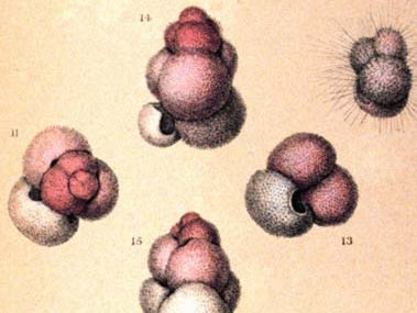
The first true oceanographic research cruise was the voyage of the HMS Challenger in 1872. The chief scientist on this first expedition was Charles Wyville Thomson, a marine geologist and one very interested in what was on the ocean floor. During the first leg of the voyage – from Europe to the America’s – they collected sediment samples several time each day. By far most of the ocean floor was made of what was called “globigerina ooze”. Globigerinids are a group of marine foraminiferans. They produce a calcium carbonate shell that is chambered. Under a microscope they look very much like seashells. They are part of the plankton layers in the ocean – what would be called “zooplankton”. Many possess spines on their shells to help reduce sinking. When they die their shells fall to the seafloor. Over time they formed the thick layers of sediment Thomson witnessed and called “ooze”. He also discovered that most of the ocean floor is covered with these microscopic shells. The Gulf of Mexico is no different. Most formaminiferans live on the seafloor and contribute to the sediment layers from there. One group forms mats on rocks that look pink in color and are responsible for the pink sands found in Bermuda.
Artist image of Globigerina.
Image: NOAA
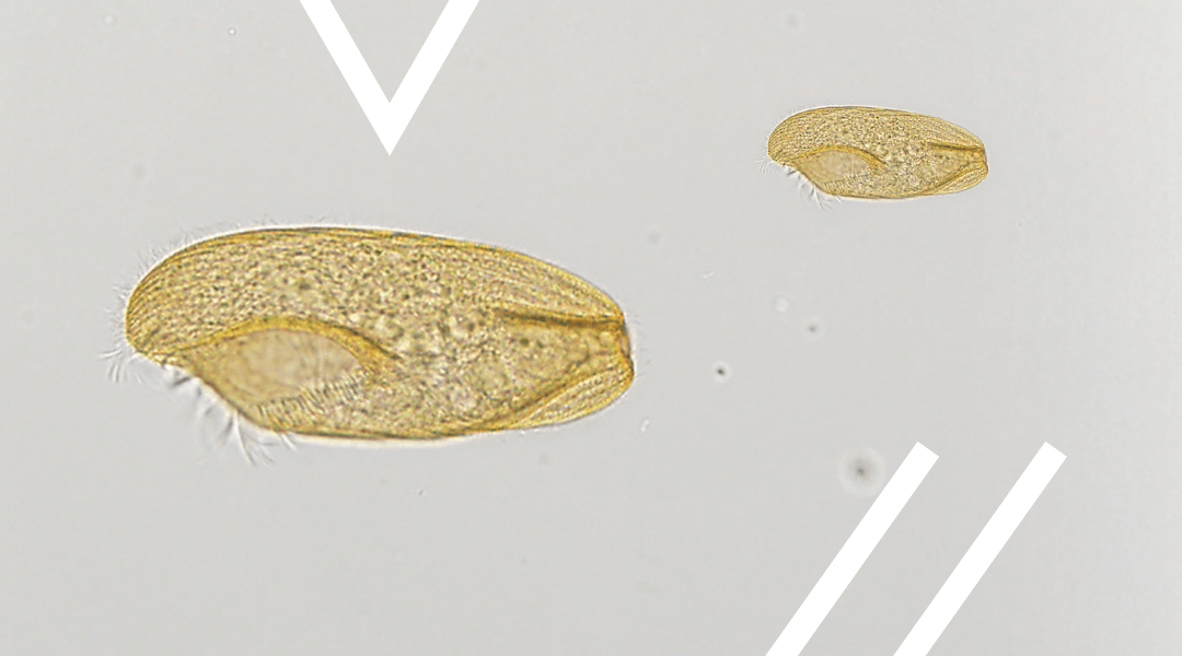
Another group of shelled amoeboid protozoans are the radiolarians. Under the microscope these are some of the most beautiful creatures you will find in the northern Gulf. Like diatoms, their shells are made of silica and look like glass. Most have spines and shapes that make them resemble snowflakes – truly beautiful. Like foraminiferans, when they die their shells settle on the seafloor and contribute to the ooze layers. Radiolarian ooze has been found as deep as 12,000 feet.

The snowflake-like shells of radiolarians.
Image: Wikipedia.
These small, microscopic amoeba like animals play an important role in moving food and energy through the Gulf. Their discovery on the seafloor helped marine geologists better understand how our oceans formed and how they have changed over time. On other beaches around the world, they have contributed to sands giving some beaches very unique colors – which are popular with tourists. They are an unknown, but important part of the marine community in the northern Gulf of Mexico.
References
Yaeger, R.G. 1996. Protozoa: Structure, Classification, Growth, and Development. Chapter 77. Medical Microbiology, 4th edition. https://www.ncbi.nlm.nih.gov/books/NBK8325/#A4082.
by Rick O'Connor | Nov 22, 2024
You may ask – “what are protozoans?” It’s a good question. The breakdown of the word includes “proto” which means “before”, and “zoan” which refers to animals. These are the “before animals” – meaning animal-like creatures BEFORE there were true animals.
They are single celled creatures that lack a cell wall and chlorophyll – animal-like – but they are only single celled – so, not true animals. Being animal-like means they cannot produce their own food as the diatoms, dinoflagellates, seaweeds, and true plants do. Rather, they must consume food as animals do. Some feed on diatoms and dinoflagellates. Some feed on decaying organic matter from the seafloor. Some are parasitic and feed off a host organism. Some feed on other protozoans. And some do a combination. But they are all consumers.
The group is classified into six phyla mostly based on how they move. One subphylum is the Mastiogophorans – which move using flagella. Flagella are long whip-like tails that extend from the cell and can “twirled” in a fashion that will help the cell move around in the environment. Flagellates can have one or many flagella. Most are not free-swimming in the water column but live on the bottom or are parasitic. Two groups common in marine waters are the choanoflagellates and the coccolithophores.
Choanoflagellates are cells that usually possess one flagella that is protected by a funnel shaped structure called a collar. They are often called “collar cells”. Though found in many benthic environments they are most famous for their role in sponges. Here they live within the walls of the sponge, twirling their flagella to generate a current that draws water into the sponge for feeding. The currents generated by the choanoflagellates also move waste and reproductive gametes out of the sponge into the environment.
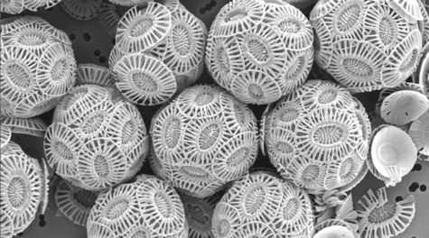
Coccolithophores are flagellated protozoans covered by calcium carbonate plates. These are more common in the plankton of the Gulf of Mexico and play an important role in the carbon cycle. They convert CO2 into calcium carbonate, and other forms of carbon, reducing the CO2 levels in both the atmosphere and ocean, that plays a role in ocean acidification.
Coccolithophores are flagellated creatures covered in calcium carbonate plates.
Image: National Oceanic and Atmospheric Administration.
An interesting note here… when I was in college, we studied the dinoflagellates in both marine botany AND marine invertebrate zoology. I was quite confused… are they “plant-like” or “animal-like”? They could not be both… When I asked my marine botany professor she was adamant, they were part of the “plant world”. But my marine invertebrate zoology professor felt the same – they were definitely in the animal world. They both mentioned this was why they were listed in their own phylum and agreed to disagree. Dinoflagellates (which we have already covered in this series) do photosynthesize, and they do consume other plankton. The same is true for coccolithophores. A quick look on the internet they were described as “phytoplankton” not “zooplankton”. I am including them here – and know they are called coccolithophores. I also know they are one of the creatures found in the northern Gulf of Mexico.
References
Yaeger, R.G. 1996. Protozoa: Structure, Classification, Growth, and Development. Chapter 77. Medical Microbiology, 4th edition. https://www.ncbi.nlm.nih.gov/books/NBK8325/#A4082.
by Rick O'Connor | Nov 15, 2024
Much of the phytoplankton found in the waters for the northern Gulf of Mexico are diatoms and dinoflagellates. We wrote about diatoms in our last article, here we will meet the dinoflagellates.
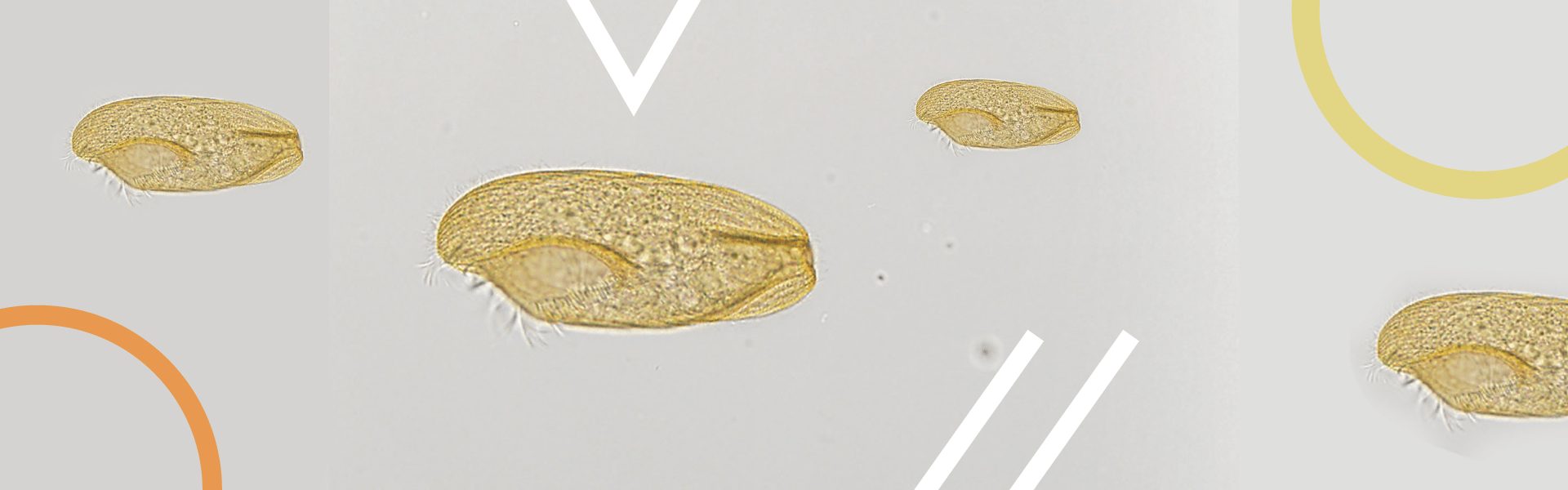
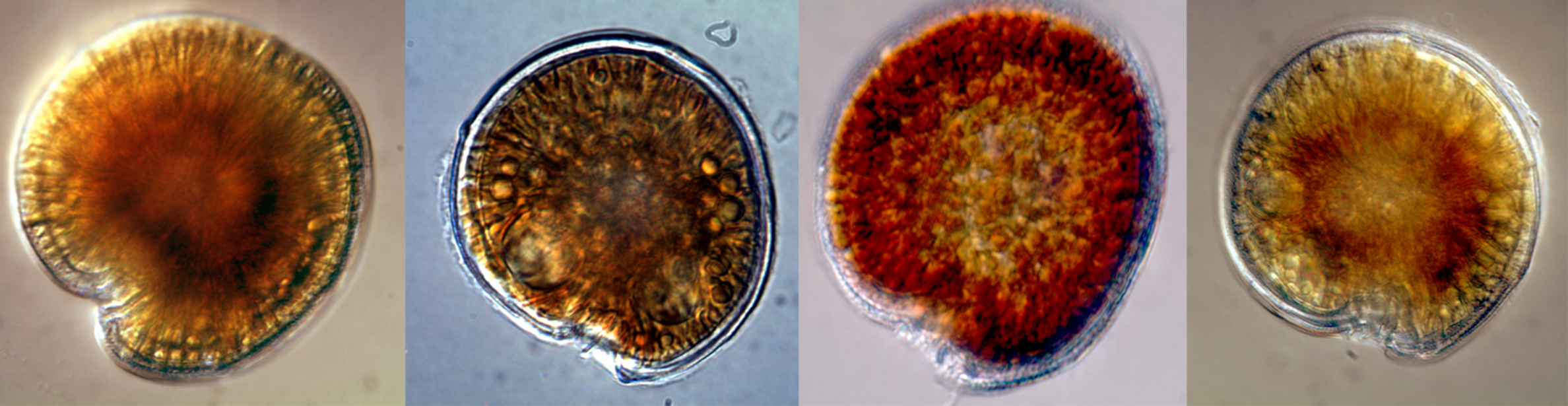
Like diatoms, dinoflagellates are microscopic phytoplankton drifting in the surface waters of the Gulf by the billions. We mentioned how abundant diatoms were, in the warmer seas, dinoflagellates are even more abundant. You collect them using a plankton net as you would diatoms. Observing them under the microscope they differ in a couple of ways. One, their shell is not made of clear silica but rather plates of cellulose with silica mixed in. Like diatoms, dinoflagellates possess several forms of chlorophyll but instead of fucoxanthins they possess carotenoids – giving them a brownish/red color. They also possess two hair-like tails called flagella – hence their name “dinoflagellate”. One flagella extends head to tail, the other encircles the dinoflagellate across their “girdle”. These flagella allow the cells to adjust and orient their position in the water column.
Dinoflagellates are microscopic plant-like plankton that possess two flagella.
Image: National Oceanic and Atmospheric Administration.
As with diatoms, dinoflagellates exist in the sunlit surface waters serving as “grasses of the sea”. They are an important part of the food chain and, along with their diatom cousins, produce about 50% of the world’s oxygen. But some members of this group are known for other roles they play.
Karenia brevis is the dinoflagellate primarily responsible for red tide in Florida. A plankton tow will find these organisms are always present – usually 1,000 cells/liter of water or less. Under certain conditions, these dinoflagellates begin to replicate in great numbers. Their numbers are large enough that the water will often change to a “reddish” color. In this case we are talking 1 million cells/liter or more. When disturbed, they will secrete a toxin – brevotoxin. This toxin can cause a variety of issues for marine life – and humans. Gastrointestinal, neurological, and respiratory problems in humans have all been associated with it. Red tides are famous for the large fish kills they generate and the mortality in marine mammals.
Being “plant-like” warm waters, sunlight, and nutrients will trigger a bloom. These blooms have been occurring for centuries and were logged by the Spanish explorers. Often, they generate offshore where the sunlit calm waters of the Florida shelf are bathed in nutrients from ocean currents coming from the seafloor. When wind conditions are right – these offshore blooms move inshore where they meet the nutrient rich discharge from rivers and estuaries – enhancing the blooms. Much of this discharge has higher levels of nutrients due to the actions of humans – such as fertilizers, animal and human waste.
Red tides are quite common off southwest Florida – happing frequently during the winter months. In the northern Gulf they are not as common. We do get blooms occurring here, though most are in the eastern panhandle, but sometimes the weather will drive blooms generated in southwest Florida up our way.

The dinoflagellate Karenia brevis.
Photo: Smithsonian Marine Station-Ft. Pierce FL
Noctiluca scitillans is another dinoflagellate that locals may know about – but did know they were dinoflagellates. What you may know it for is its ability to produce bioluminescence – “light in the sea” – what many locals called “phosphorus” when I was a kid. When disturbed a chemical reaction will create a blueish colored light. We see it during warm summer evenings when we walk through the water – or our footprints in the sand. From a boat you can see the blue light as fish swim by, or the wake from the moving boat. I remember once in high school we did a night dive near a pier where the bioluminescence from these dinoflagellates was so bright that you could see other divers, fish, and the pier without a dive light. Jim Lovell, commander of Apollo 13, tells the story of a night bombing mission he participated during the Korean War where his navigation lights went out on the return trip. The carrier was running without lights to avoid detection, but Lovell found the ship by the bioluminescent trail left by the propeller churning these dinoflagellates. This dinoflagellate is found all over the world.

Noctiluca are one of the dinoflagellates that produce bioluminescence.
Photo: University of New Hampshire.
Zooxanthalle is a dinoflagellate you may not have heard of, but you may have heard of the coral bleaching that is occurring on reefs across the world. Corals are actually jellyfish and their tissue, like many jellyfish, is clear. The bright colors we are familiar with are caused by a symbiotic dinoflagellate that lives within the tissue of the corals. This symbiotic dinoflagellate is a group of several species known as zooxanthalle. In this partnership the photosynthetic zooxanthalle use waste products from the coral, and the sun, to photosynthesize. The products of photosynthesis are used to produce sugars, proteins, and other material that both the corals and the zooxanthalle need. Because of the need for sunlight, reefs usually occur in very clear – nutrient poor – waters. The bleaching we may be familiar with is caused when the reef is exposed to stress – high temperatures, pollutants, etc. and the zooxanthalle are expelled along with their photosynthetic pigments (the colors) – leaving only the clear tissue of the coral and a “white” appearance in color – bleaching.
These symbiotic zooxanthalle cells are the ones that give corals their color.
Image: NOAA
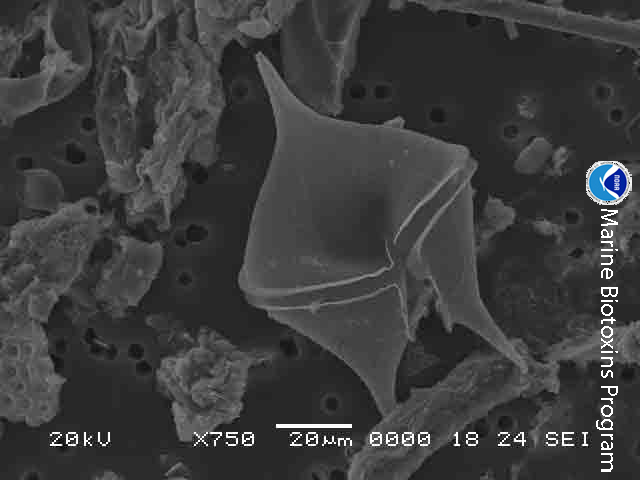
There are at least 18 species of dinoflagellates in the genus Gambierdiscus. These are not free-floating dinoflagellates, but ones they live on the bottom. You may not know them by name, but you may know them from the toxins they release when stressed – ciguatoxin. Ciguatoxins are a type of neurotoxin that can cause several illness – even death – in humans. The concentrations of ciguatoxin at the cellular level are minor and do not cause problems. However, as organisms graze on these dinoflagellates the toxins are not expelled from their bodies but are rather stored in the tissue. As you move up the food chain, no creature expels the toxins, and the concentrations increase in a process known as bioaccumulation. For humans the danger lies in eating the top predators in the food chain where the concentrations of ciguatoxin are high enough to cause problems – a condition known as ciguatera. Many who have visited the tropical parts of the world – where Gambierdiscus is most common – may have heard “you should not eat the barracuda” – or other large predators caught on a reef.
This situation has not historically been an issue for the northern Gulf of Mexico, but there are now records of this dinoflagellate north of the Florida Keys – as far north as North Carolina along the east coast. Scientists are watching the movement of this tropical group of dinoflagellates as the oceans warm.
The dinoflagellate known as Gambierdiscus. Known to cause ciguatera.
Image: National Oceanic and Atmospheric Administration.
There are thousands more species of dinoflagellates in the Gulf, and know they play many important roles in the ecology of our marine environment.
Resources
National Oceanic and Atmospheric Administration (NOAA).
National Institute of Health (NIH).
by Rick O'Connor | Nov 8, 2024
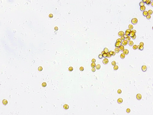
Remaining in the world of the microscopic, in this article we look at small plant-like creatures called diatoms. Diatoms are single celled algae that float in the surface waters of the Gulf of Mexico in the billions. Being plant-like, they possess chlorophyll for photosynthesis. In fact, they possess two forms of chlorophyll, and another photosynthetic pigment called fucoxanthin. Chlorophyll gives plants their characteristic green color, fucoxanthins are more yellow in color and give the diatoms the common name green-yellow algae.
Silica covered diatoms.
Photo: NOAA
To collect them scientists pull what is called a plankton net. This net is funnel shaped with the diameter of the large opening being from several inches to several feet. The mesh is of a cloth material with extremely small holes to allow water to pass but not the plankton. The plankton net is deployed off the stern of the ship/boat and towed slowly at a specific depth. Once back on board the sample can be observed in a microscope.

Plankton net.
Photo: NOAA
Diatoms are one of the more abundant microscopic plant-like algae called phytoplankton. They differ from other phytoplankters in that they do have the yellow-green color to them, but they also possess a clear glass-like shell called a frustule. This frustule is made of silica and comes in two parts. The top half is called the epitheca and the bottom half the hypotheca. The two halves fit together like the two plates of a petri dish. This frustule often has spines extending from it giving the diatom the appearance of a snowflake – and under the microscope they are beautiful. These spines actually serve a purpose. It is important they remain near the sunlit surface. To reduce sinking, these spines increase their surface area creating drag and reducing the chance they will sink. Most also produce gas pockets within the cytoplasm to make them more buoyant.
The spherical shape of the centric diatom.
Image: Florida International University
All diatoms are subdivided into two groups based on their frustule shape. Some have circular frustules and are called centric diatoms. Others are more elongated and are called pennate diatoms. Scientists currently estimate there are between 100,000 and 200,000 species of them. Though they are abundant in all the world’s oceans, they seem to be more abundant in cooler waters.
To say they play an important role in ocean ecology is an understatement. Between them and their other phytoplanktonic cousins – phytoplankton produce about 50% of the world’s oxygen. In an open ocean environment like the Gulf of Mexico where the seafloor is beyond the reach of the sun, diatoms, and other phytoplankton, are referred to as the “grasses of the sea”. They are the base of almost all marine creature’s food chain.

A phytoplankton bloom seen from space.
Photo: NOAA
When diatoms die (which is often in less than a week) their silica shells will eventually sink to the seafloor forming a layer of silica called “diatomaceous earth”. This sediment layer is commercially important as an abrasive. You will see diatomaceous earth labeled on toothpaste, household cleaners, soaps, anything with a little grit in it to help clean. It is also used in air and water filters to help purify such. You find these filters in aquariums, swimming pools, and hospitals.
If you collect a glass of water from the Gulf you are not going to see them without a microscope but know that the glass is full of these beautiful, amazing, and important marine creatures of the northern Gulf of Mexico.
by Thomas Derbes II | Nov 8, 2024
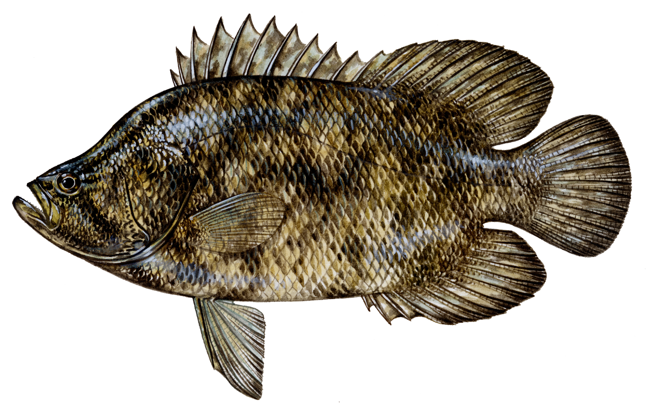
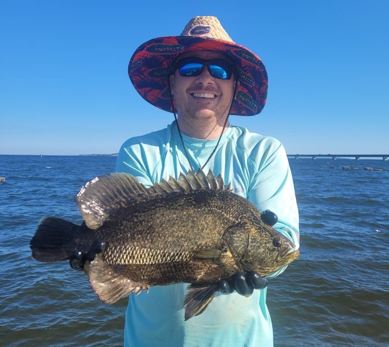
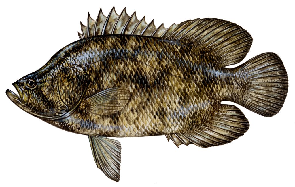
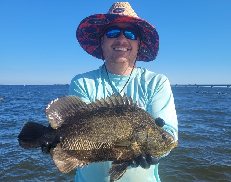
The Atlantic Tripletail (Lobotes surinamensis) is a very prized sportfish along the Florida Panhandle. Typically caught as a “bonus” fish found along floating debris, the tripletail is a hard fighting fish and excellent table fare. Just as the name implies, this fish is equipped with three “tails” that help aid it in propulsion; and also help contribute to their strong fighting spirit. In addition to the caudal fin, tripletail have very pronounced “lobed” dorsal and anal fin soft rays that sit very far back on the body, giving it the appearance of three tails (triple-tails).
Atlantic Tripletail (Lobotes surinamensis) – FWC, Diane Rome Peebles 1992
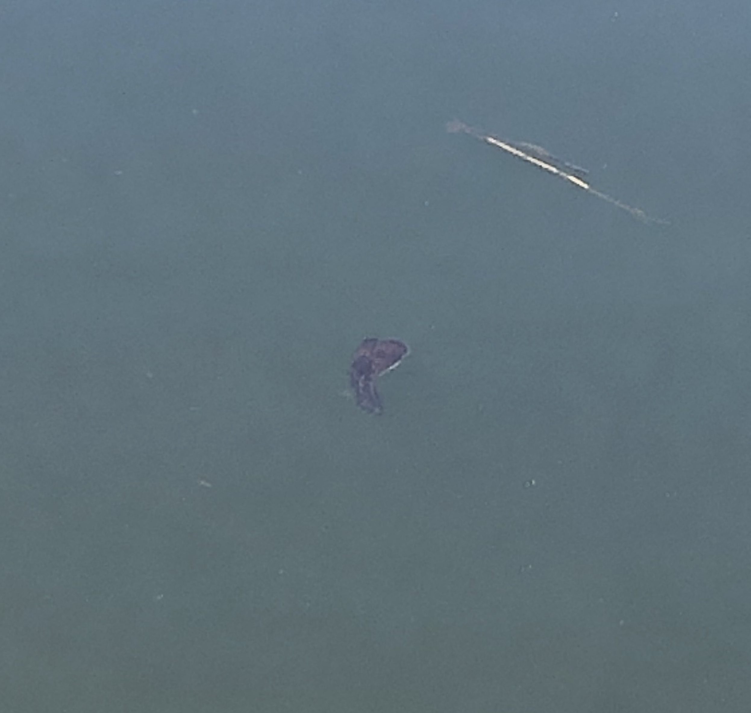
Tripletail are found in tropical and subtropical seas around the world (except the eastern Pacific Ocean) and are the only member of their family found in the Gulf of Mexico. Tripletail can be found in all saltwater environments, from the upper bays to the middle of the Gulf of Mexico. In the Florida Panhandle, tripletail begin to show up in the bays beginning in May and can be found up until October/November. They are masters of disguise, usually found floating along floating debris, crab trap buoys, navigation pilings, and floating algae like Sargassum. When tripletail are young, they are able to change their colors to match the debris, albeit it is usually a variation of yellow, brown, and black. Adult tripletail can change color as well, but the coloration is not as vibrant as the juveniles. Floating alongside debris and other floating materials protects them from predators and gives them food access. Small crustaceans, like shrimp and crabs, and small fish will gather along the floating debris, looking for protection, giving the camouflaged tripletail an easy meal.
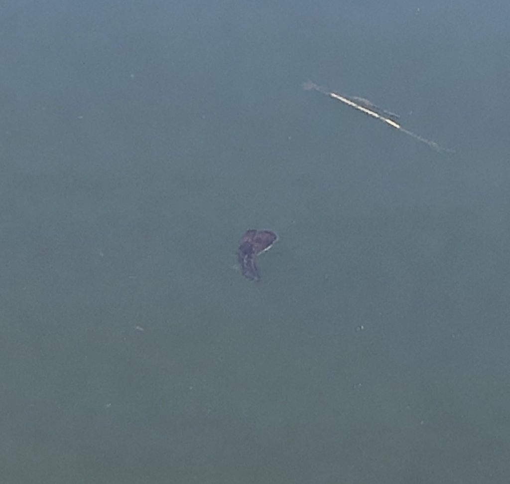
Baby Tripletail or Leaf? – Thomas Derbes II
Tripletail are opportunistic feeders that are what I classify as “lazy hunters.” Tripletail will hang out along any floating debris and wait for the food to come to them. They typically will not chase their prey items too far and will abandon the hunt if they expend too much energy. Since they are opportunistic feeders, their diet varies widely, but they cannot resist a baby blue crab, shrimp, or small baitfish like menhaden (Brevoortia patronus) that might visit their floating oasis. When further offshore, it is not uncommon to find many tripletail “laying out” on sargassum or floating debris. I personally have seen a dozen full-sized tripletail inside of a large traffic barrel 25 miles offshore that saved a skunk of a deep-dropping fishing trip.

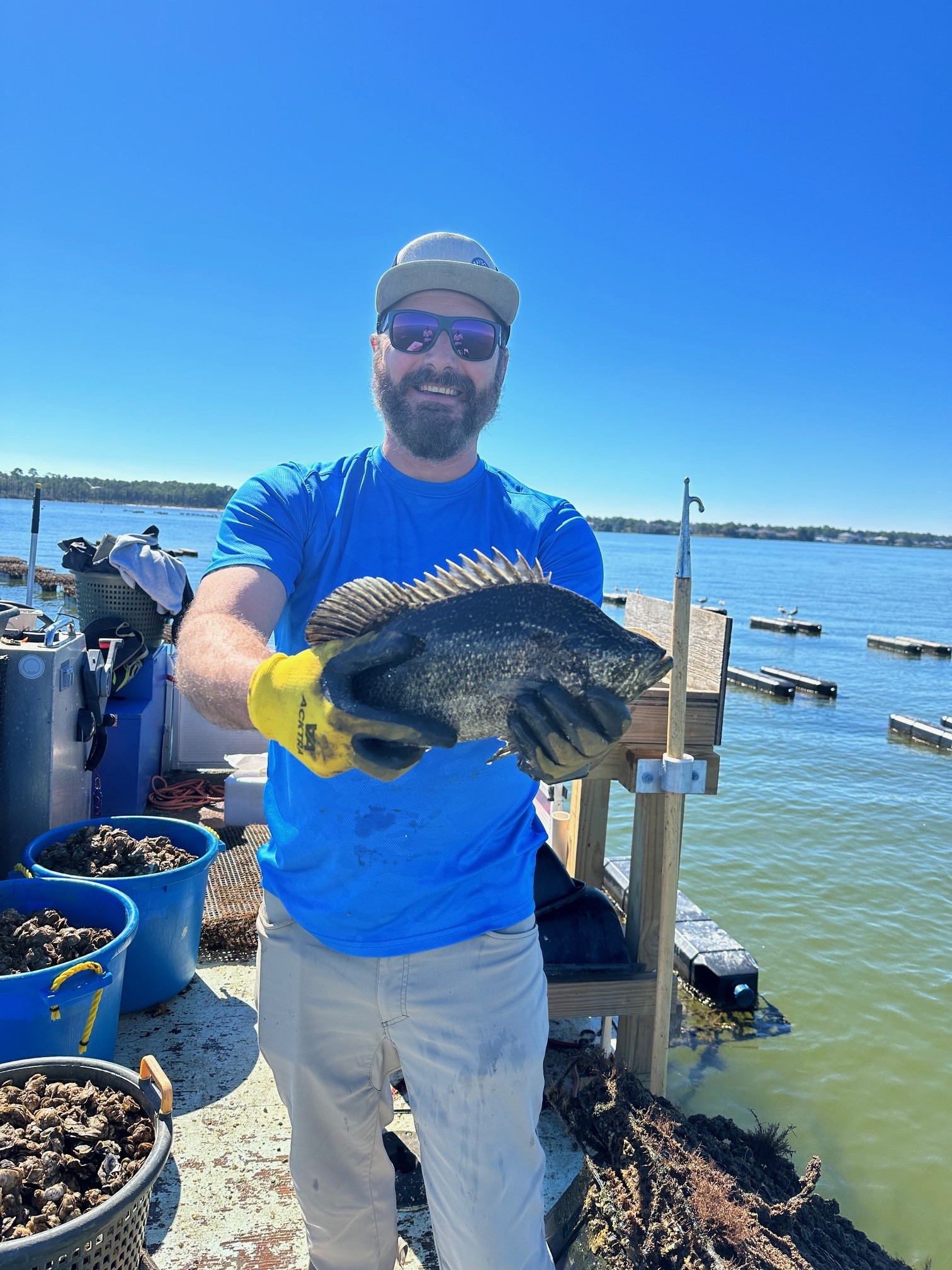
Tripletail Caught Off An Oyster Farm – Brandon Smith
When targeting tripletail, anglers will typically sit at the highest point of the boat (some anglers have towers for spotting tripletail) and cruise along floating crab trap buoys, pilings, and sometimes oyster farms looking for Tripletail. These fish are very easily spooked, and a slow, quiet approach is best. Once in casting distance, toss your preferred bait (I typically want to have baby crabs or live shrimp when targeting tripletail) close to the floating structure, but not too close to spook the fish. You can usually watch the fish eat your bait (another added bonus) and once you set the hook, the fight is on! In the state of Florida, tripletail must be a minimum of 18 inches and there is a daily bag limit of 2 fish per person. Be very careful handling tripletail as they have very sharp dorsal and anal fins and their operculum (gill cover) is also very sharp with hidden spines.
So next time you’re out fishing and see something floating, make sure you give it a good look over. There might be a camouflaged tripletail that you can add to your fish box!
Tripletail Caught While Working Oyster Gear – Thomas Derbes