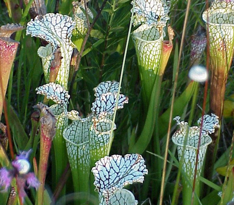
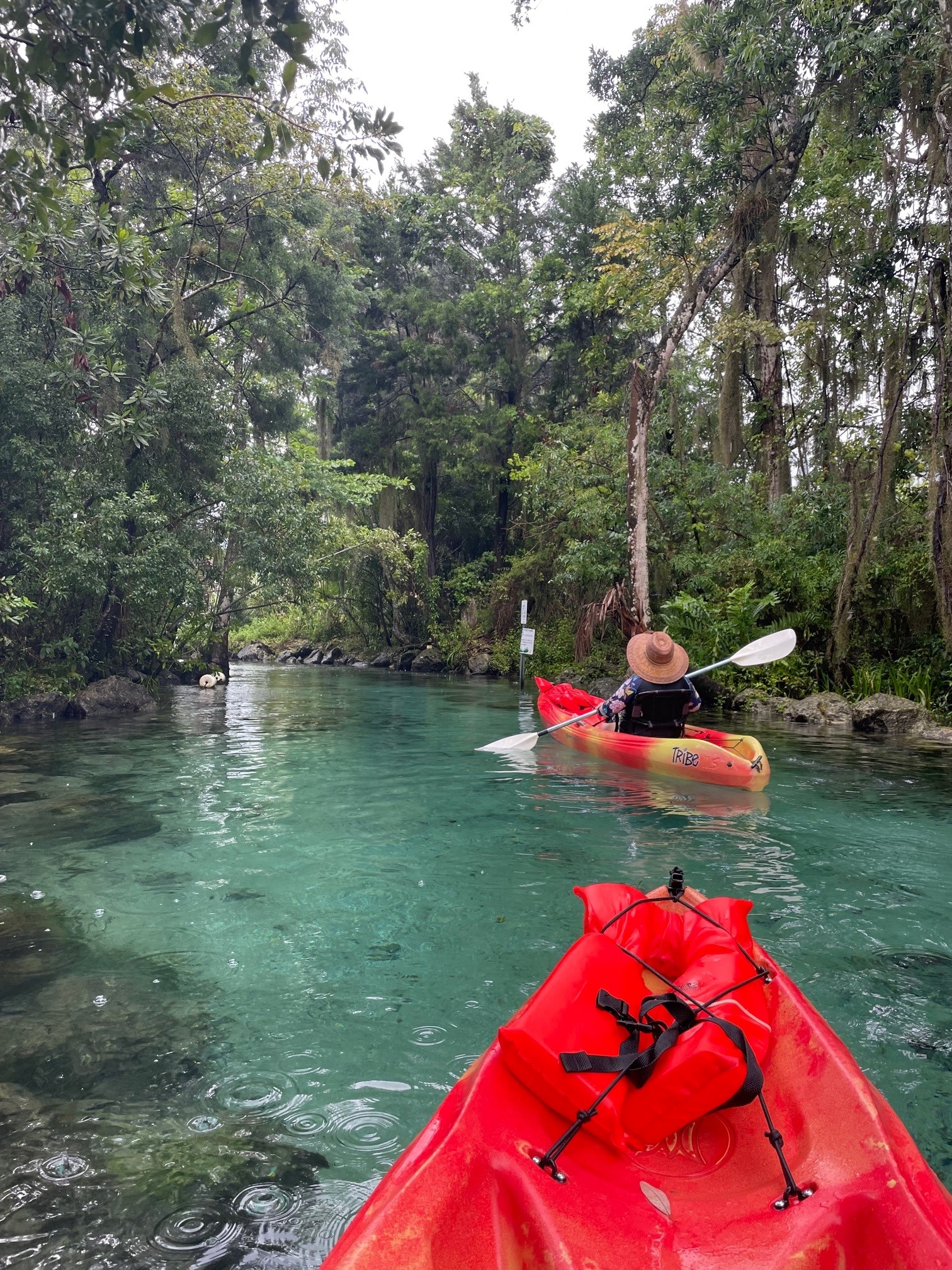
Kayaking over seagrass beds and stingrays, hiking among pitcher plants, boating past diving ospreys, and meeting hundreds of fascinating, like-minded people—these are just some of the great experiences I’ve had while teaching the Florida Master Naturalist Program. More than 20 years since its inception, the Florida Master Naturalist Program (FMNP) has inspired the creation of dozens of similar courses in other states and proven itself to be one of the most popular outreach programs to come out of UF IFAS Extension.
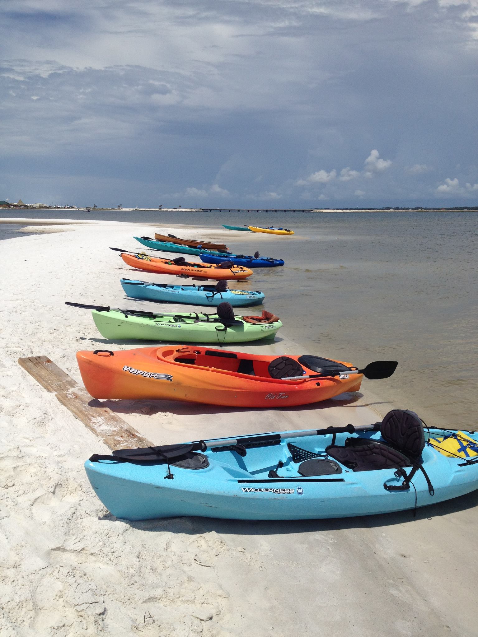
Kayaking Santa Rosa Sound in Navarre is one of the highlights of our Coastal Systems FMNP class. Photo credit: Carrie Stevenson, UF IFAS Extension
The mission of the FMNP is simple—to promote awareness, understanding, and respect of Florida’s natural world among Florida’s citizens and visitors. I have always felt strongly that if you want people to care about something, they need to understand it. And to really understand something, you need to experience it. I know my own passion for science and ecology was ignited early on by teachers who took us outside and helped us encounter the many wondrous surprises in the natural world. With the FMNP, we seek to do just that.
Master Naturalist students conduct field work in small groups. Photo credit: Carrie Stevenson, UF IFAS Extension
Over a span of 40 hours in 6-7 weeks, we spend about half our time with classroom presentations and the other half in the field, seeing the plants, animals, and ecosystems we discuss in class. In addition to classes and field trips, students produce a final project and present it to the class. These can range from labeled collections and slide presentations to building bird houses and new trails. The program is composed of three 40-hour core courses; Coastal, Upland, and Freshwater Systems. Seven “short courses” with 24 hours of class/field time include the Land Steward series (Conservation Science, Habitat Evaluation, Wildlife Monitoring, and Environmental Interpretation) and the Restoration courses (Coastal Restoration, Marine Habitat Restoration, and Invasive Plants). Locally, we try to rotate the core modules every couple of years and incorporate the short courses periodically. Registration includes a detailed course manual and, upon completion, FMNP patch, certificate, and pin denoting area of expertise. There are a handful of scholarships available for those interested in applying to offset costs.
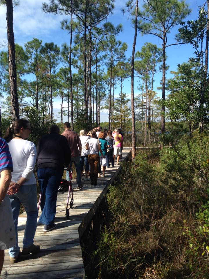
Master Naturalist students walk “The Way” boardwalk in Perdido Key. Photo credit: Carrie Stevenson
The classes do not count towards university credit but are an excellent certification and professional development opportunity that many will list on a resume. While we’ve had ecotour operators, park rangers, environmental consultants, teachers, and archaeologists participate, most of our FMNP students are not professionals in the field. They come from every background imaginable but share an interest in the outdoors. Because we meet weekly, class members often form long-lasting friendships during the courses.
Information on upcoming classes in northwest Florida and all around the state is available online. Classes range from fully in-person to hybrid and online options. FMNP classes are restricted to adults 18 and over, but a new “Florida Youth Naturalist” curriculum has been designed through our 4-H program for young people. For more information on that, check out their website.
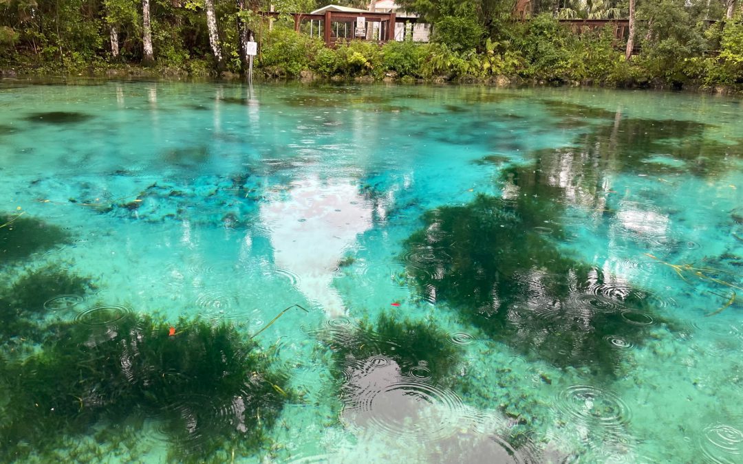
Morrison Springs in Walton County is a natural spring ideal for paddling, snorkeling, and diving. Photo credit: Carrie Stevenson, UF IFAS Extensio
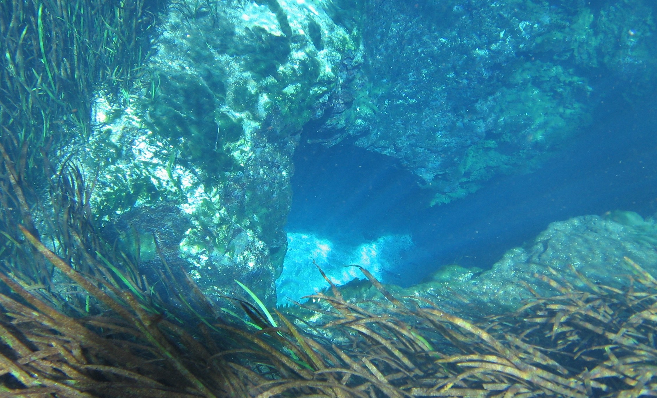
There is just SO much water in Florida. Besides the tremendous amount of rain and 1,350 miles of coastline and beachfront, there are endless bays, bayous, creeks, rivers, and streams. In this state, it is extraordinarily difficult to live more than a few miles from a body of water. Among the the coolest (literally) types of water bodies in Florida, though, are our springs. Like brilliant gemstones, the state’s 700+ springs dot the Florida landscape like a strand of sapphires.
While we have springs bubbling up all over northwest Florida in areas where the underground water table meets the surface, larger springs are more common as you move east and south. Some parts of north Florida and most of the peninsula are built on a limestone platform, known by the geological term “karst.” Limestone is composed of calcium carbonate, which has a porous and easily degradable chemical structure. When this barrier is breached, it allows the cold groundwater an opening directly to the surface water—hence a spring. (Fun fact—there are surface water streams that actually disappear into a spring—these are called swallets, operating as the reverse version of a spring!)
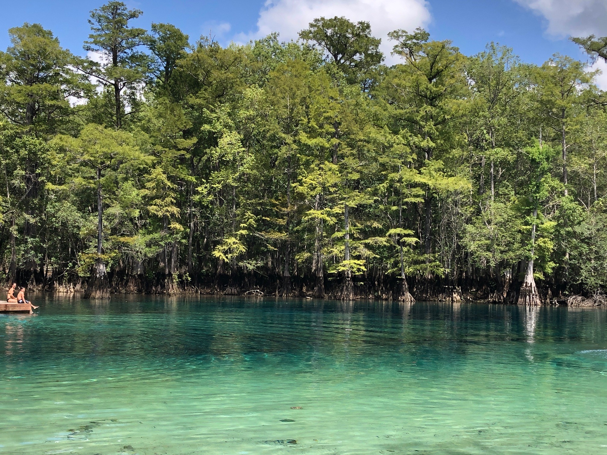
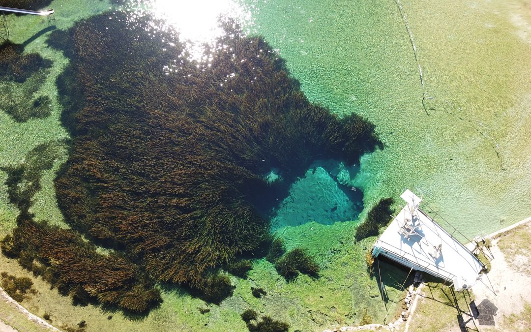
The striking blue-green water in Three Sisters Spring is only accessible by kayak or swimming. Photo credit: Carrie Stevenson, UF IFAS Extension
A few of the largest springs in northwest Florida are Vortex, Ponce de Leon, and Morrison Springs, found in Holmes and Walton County. Vortex is a privately operated water park and scuba diving/training facility. It is where the red and white “diver down” flag was invented and has a complex underwater cavern system. Ponce de Leon and Morrison Springs are state and county-run parks with a more natural feel, surrounded by woods and basic infrastructure for access. Morrison will especially wow visitors with its tremendous turquoise coloring.
Crystal clear water in Morrison Springs. Photo credit: Carrie Stevenson, UF IFAS Extension
Before a meeting in Crystal River last week, I paddled and snorkeled through the famous Three Sisters Spring. As part of Crystal River National Wildlife Refuge, it is a popular but highly protected area. Three Sisters is well-known as a manatee gathering place, especially in winter, but during my visit was mostly unoccupied. The color was striking, though. Why do so many of these springs have such brilliant blue and turquoise coloring? The phenomenon is essentially the same as the blue-green Gulf waters in the Panhandle. The reflection of the sky on a sunny day with the backdrop of that pure white sand causes the water to reflect a color that inspired the nickname “The Emerald Coast.” In springs, the white calcium carbonate in limestone breaks down into tiny crystals, mixing with the water and reflecting the vivid shades of blue.
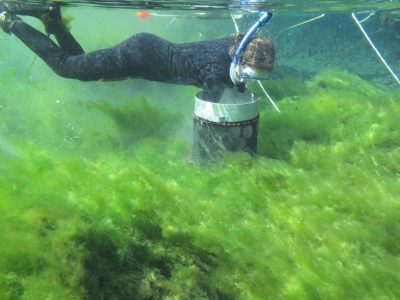
Alexander Springs Creek in Ocala National Forest is overrun with algae. Photo credit: Matt Cohen, UF IFAS
Besides their beauty, clarity, recreational, and wildlife value, springs pump 8 billion gallons of fresh water a day of into Florida ecosystems. Seagrass meadows in many of these springs are lush. Because they are literal windows into the underground aquifer, they are extremely vulnerable to pollution. While many springs have been protected for decades, others were seen as places to dump trash and make it “disappear.” Many have been affected by urban stormwater and agricultural pollution, losing their clarity, reducing dissolved oxygen levels, and prompting massive cleanup and buffer protection zones.
On one of these hot summer days in Florida, take the time to visit our incredible springs. While it may not be the literal “Fountain of Youth,” swimming in a spring is a unique and invigorating experience, and a beautiful way to get off the beaten path. A comprehensive guide to Florida springs, research, and statewide protection initiatives can be found at the Florida Department of Environmental Protection’s springs website.
Jackson Blue Springs discharging from the Floridan Aquifer. Jackson County, FL. Image: Doug Mayo, UF/IFAS Extension.
Florida has one of the largest concentrations of freshwater springs in the world. More than 1000 have been identified statewide, and here in the Florida Panhandle, more than 250 have been found. Not only are they an important source of potable water, springs have enormous recreational and cultural value in our state. There is nothing like taking a cool swim in the crystal-clear waters of these unique, beautiful systems.
How do springs form?
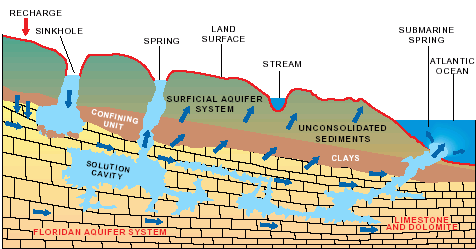
We have so many springs in Florida because of the state’s geology. Florida is underlain by thick layers of limestone (calcium carbonate) and dolomite (calcium magnesium carbonate) that are easily dissolved by rainwater that percolates into the ground. Rainwater is naturally slightly acidic (with a pH of about 5 to 5.6), and as it moves through the limestone and dolomite, it dissolves the rock and forms fissures, conduits, and caves that can store water. In areas where the limestone is close to the surface, sinkholes and springs are common. Springs form when groundwater that is under pressure flows out through natural openings in the ground. Most of our springs are found in North and North-Central Florida, where the limestone and dolomite are found closest to the surface.
Springs are windows to the Floridan Aquifer, which supplies most of Florida’s drinking water. Image: Ichetucknee Blue Hole, A. Albertin.
These thick layers of limestone and dolomite that are below us, with pores, fissures, conduits, and caves that store water, make up the Floridan Aquifer. The Floridan Aquifer includes all of Florida and parts of Georgia, South Carolina, and Alabama. The thickness of the aquifer varies widely, ranging from 250 ft. thick in parts of Georgia, to about 3,000 ft. thick in South Florida. The Floridan is one of the most productive aquifer systems in the world. It provides drinking water to about 11 million Floridians and is recharged by rainfall.
How are springs classified?
Springs are commonly classified by their discharge or flow rate, which is measured in cubic feet or cubic meters per second. First magnitude springs have a flow rate of 100 cubic feet or more per second, 2nd magnitude springs have a rate of 10-100 ft.3/sec., 3rd magnitude flows are 1-10 ft.3/sec. and so on. We have 33 first magnitude springs in the state, and the majority of these are found in state parks. These springs pump out massive amounts of water. A flow rate of 100 ft.3/sec. translates to 65 million gallons per day. Larger springs in Florida supply the base flow for many streams and rivers.
What affects spring flow?
Multiple factors can affect the amount of water that flows from springs. These include the amount of rainfall, size of caverns and conduits that the water is flowing through, water pressure in the aquifer, and the size of the spring’s recharge basin. A recharge basin is the land area that contributes water to the spring – surface water and rainwater that falls on this area can seep into the ground and end up as part of the spring’s discharge. Drought and activities such as groundwater withdrawals through pumping can reduce flow from springs systems.
If you haven’t experienced the beauty of a Florida Spring, there is really nothing quite like it. Here in the panhandle, springs such as Wakulla, Jackson Blue, Pitt, Williford, Morrison, Ponce de Leon, Vortex, and Cypress Springs are some of the areas that offer wonderful recreational opportunities. The Florida Department of Environmental Protection has a ‘springs finder’ web page with an interactive map that can help you locate these and many other springs throughout the state.
Florida’s park system has many unique and quality experiences to offer visitors, but few stand out as much as The Edward Ball Wakulla Springs State Park. It is home of the world’s largest and deepest freshwater springs.
The brisk water is home to manatees, alligators and a host of diverse wildlife which can be viewed from the shore or a boat. Each season delivers a different selection of birds passing through and offering birdwatchers a prime destination to see the avian residents and visitors in a natural setting.
The bracing, some say chilly, 70 degree waters are sure to refresh bathers even during the hottest summer days. For some human visitors ankle deep is enough to experience.
Wakulla Springs’ history extends back thousands of years with evidence of varied use by people and animals, some long gone. Early residents lived in shoreline villages and took advantage of the plentiful natural resources to support their idyllic existence.
One novel use of the area was by filmmakers who appreciated the primeval quality of the park’s swamps and wildlife as a backdrop for cinematic productions. Hollywood films such as Tarzan’s Secret Treasure (1941) and Creature from the Black Lagoon (1954) were shot at this location.
The historic lodge is an elegant remnant of old Florida, and set among the ancient cypress trees which surround the swamps. The Spanish style lodge with its period furniture, original elevators and colorful painted ceilings that depicts wildlife and Old Florida scenes still takes lodgers.
For the adventurous, there are several hiking trails requiring varying degrees of exertion. For more information about the park’s amenities visit their website: https://www.floridastateparks.org/parks-and-trails/edward-ball-wakulla-springs-state-park
The Wacissa River offers paddlers the opportunity to see north Florida unfiltered.
Being off the beaten path has many advantages. In the case of a spring-fed river, it translates to less pressure from human use and a great opportunity for those who do visit to experience the “real Florida”.
The Wacissa River, located in the southern half of Jefferson County, Florida, is near the crossroads identified as the town of Wacissa. There is a blinking light, a post office, and two small convenience stores where beer, ice and snacks can be purchased.
Access to the river is about two miles south of the blinking light on Florida 59, just after the state road veers to the southwest. The blacktop spur quickly become a dirt parking lot after passing several canoe and kayak rental businesses.
A county maintained boat landing with pick-nic tables, a manmade beach, and a tiny diving platform with a rope swing are the only signs of civilization. The cold, clear water extends to a tree line several hundred yards south of the landing with the river moving to the southeast.
The river emerges crystal clear from multiple limestone springs along the first mile and a half of the 12 mile waterway. The adjacent land is flat and subject to being swampy, especially in wet years like 2018.
The river terrain stands in contrast to the Cody Scarp just a few miles to the north. This geologic feature is the remnants of an ancient marine terrace and is hilly, rising 100 feet above the river in some spots.
Cypress, oak, pine, and other trees cover the bottomlands adjacent to the river. The river quickly enters the Aucilla Wildlife Management Area which results in a wide variety of animals, birds, amphibians and reptiles.
The wildlife viewing varies by season. Many migratory birds use the river’s shelter and resources on their annual trips.
Canoeing and kayaking are popular in the gentle current. Powerboats and fan boats can use the area also, but must be on constant alert for shallow spots and hidden snags.
For the adventurous paddler who wants to follow the river’s course, there is a debarkation point at Goose Pasture Campgrounds and another near St. Marks after the Wacissa merges with the Aucilla.
Be prepared when taking this journey. This is the real Florida, no fast food restaurants or convenience stores. Only clear water, big trees and the calls of birds will be found here.
Hydrologic cycle and geologic cross-section image courtesy of Florida Geological Survey Bulletin 31, updated 1984.
With more than 250 crystal clear springs in Northwest Florida it is just a short road trip to a pristine swimming hole! Springs and their associated flowing water bodies provide important habitat for wildlife and plants. Just as importantly, springs provide people with recreational activities and the opportunity to connect with the natural environment. While paddling your kayak, floating in your tube, or just wading in the cool water, think about the majesty of the springs. They are the visible part of the Florida Aquifer, the below ground source of most Florida’s drinking water.
A spring is a natural opening in the Earth where water emerges from the aquifer to the soil surface. The groundwater is under pressure and flows upward to an opening referred to as a spring vent. Once on the surface, the water contributes to the flow of rivers or other waterbodies. Springs range in size from small seeps to massive pools. Each can be measured by their daily gallon output which is classified as a magnitude. First magnitude springs discharge more than 64.6 million gallons of water each day. Florida has over 30 first magnitude springs. Four of them can be found in the Panhandle – Wakulla Springs and the Gainer Springs Group of 3.
Wakulla Springs is located within Edward Ball Wakulla Springs State Park. The spring vent is located beneath a limestone ledge nearly 180 feet below the land surface. Archaeological evidence suggests that humans have utilized the area for nearly 15,000 years. Native Americans referred to the area as “wakulla” meaning “river of the crying bird”. Wakulla was the home of the Limpkin, a rare wading bird with an odd call.
Over 1,000 years ago, Native Americans used another first magnitude spring, the Gainer Springs group that flow into the Econfina River. “Econfina”, or “natural bridge” in the local native language, got its name from a limestone arch that crossed the creek at the mouth of the spring. General Andrew Jackson and his Army reportedly used the natural bridge on their way west exploring North America. In 1821, one of Jackson’s surveyors, William Gainer, returned to the area and established a homestead. Hence, the naming of the waters as Gainer Springs.
Three major springs flow at 124.6 million gallons of water per day from Gainer Springs Group, some of which is bottled by Culligan Water today. Most of the springs along the Econfina maintain a temperature of 70-71°F year-round. If you are in search of something cooler, you may want to try Ponce de Leon Springs or Morrison Springs which flows between 6.46 and 64.6 million gallons a day. They both stay around 67.8°F. Springs are very cool, clear water with such an importance to all living thing; needing appreciation and protection.