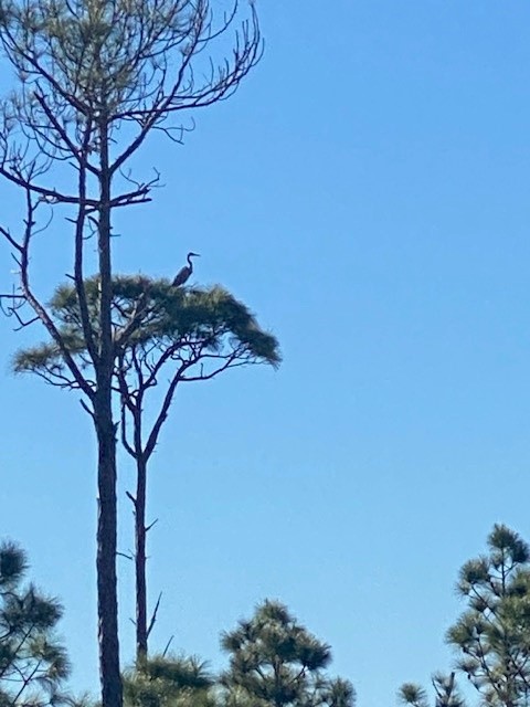
I was having dinner with my family on a cool March evening when one said “I have not seen any Swallow-tailed Kites yet. We usually see them this time of year”. To which I replied, “I saw one today!” – and I had. It was March 23, a very windy afternoon, and I saw it briefly zip over our backyard. The Swallow-tailed Kites were back.
Back in the sense they were back from their long migration from South America. The Swallow-tailed Kite resides there and ventures north to Central and North America during the summer for the breeding season.
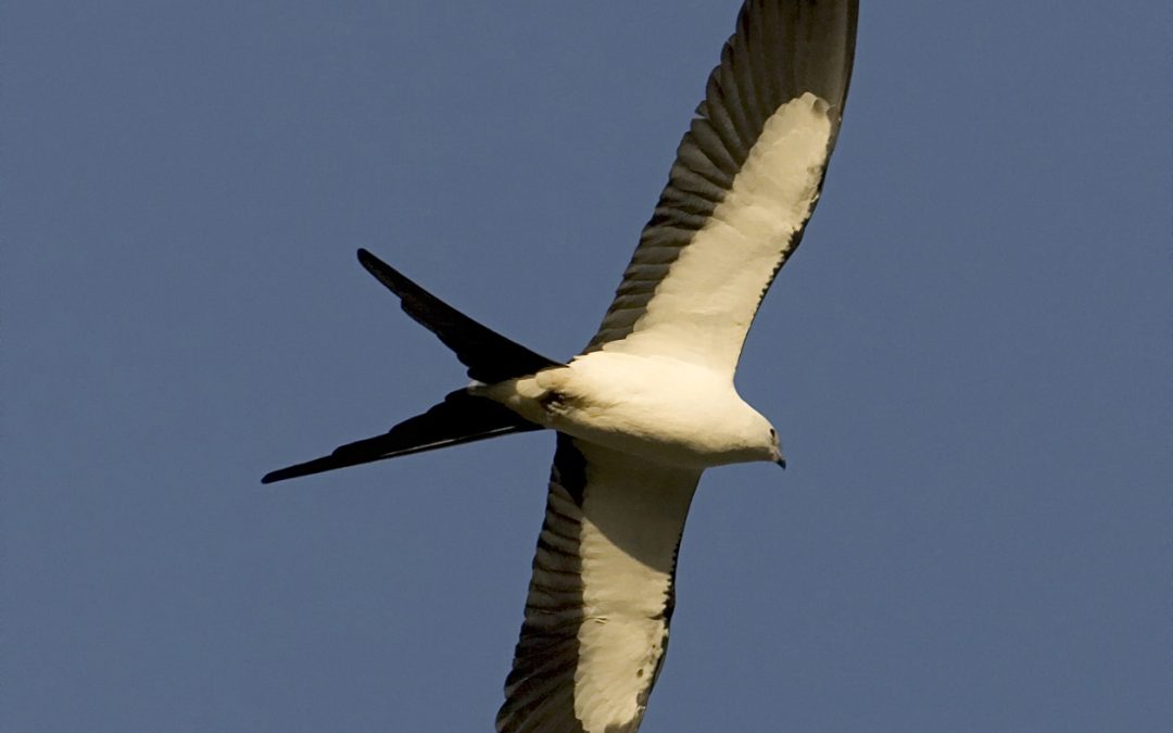
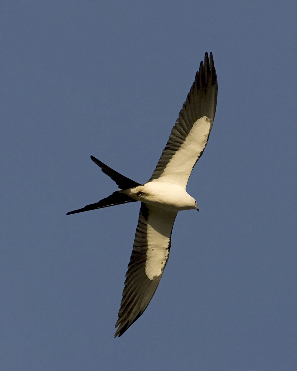
The Swallow-tailed Kite. Photo: Cornell University
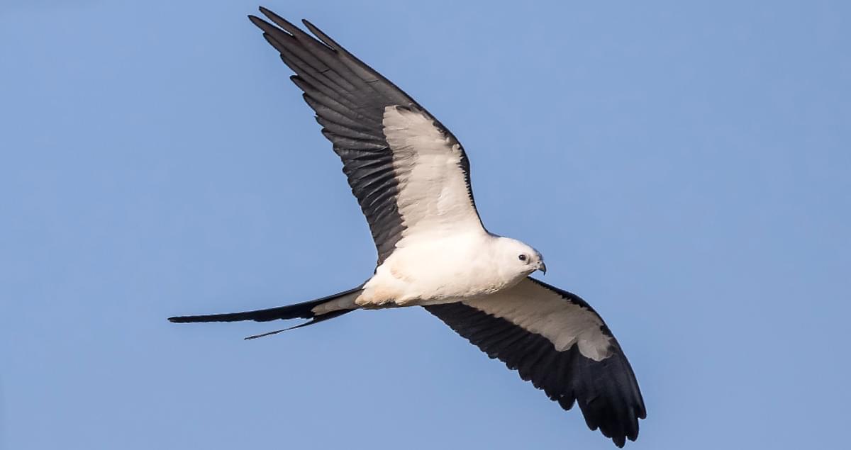
It is a magnificent bird, described as “one of the most awesome birds in the U.S.”. Their long slender bodies are sharp in contrast with a brilliant white head and a deep black body. They have long pointed wings which they use to soar with grace, rarely flapping their wings, and their key feature of the scissor-looking forked tail. They are a relatively large bird somewhere between the size of a crow and a large goose. Swallow-tailed kites are often seen soaring just above the treetops searching for food but can also be seen at higher elevations gliding along with the wind. It is a bird that many get excited about when they see it.
Arriving in the United States in late February and March, they seek out opportunities for nesting habitat. Their preference are tall trees, usually 60 feet or taller, and most often select pine trees, though have been known to nest in cypress and other large trees. They usually select trees close to water or open fields. These locations provide an abundance of their favorite prey – insects. They can be seen zooming close to the trees to grab unwary prey and will, at times, take larger creatures like treefrogs, lizards, and small snakes. Their beaks are small however, and so prey selection is limited.
Both the males and females participate in nest building. Swallow-tailed kites are monogamous and mate pairing often occurs during the migration. They usually build a new nest each season but often is the same location. Males are territorial of these nest locations and defend them with local vocalizations. Despite this, many swallow-tailed kite nests can be found near each other.
The Swallow-tailed Kite. Photo: Rodney Cammauf – National Park Photo.
Once the young hatch, the female remains with them while the male forages for food. He typically brings it back to the nest in his talons, perches and transfers the food to his beak, and the provides it to the female who in turn feeds the chicks. After fledging, around August or September, it is time to head back to South America and they leave our area until next spring.
Swallow-tailed kites were once common all along the Mississippi River drainage as far north as Minnesota. However, the numbers declined significantly, primarily due to humans shooting them, and today they are only found in the lower coastal regions of the southeastern U.S. Today they can be found, but are uncommon, in coastal Louisiana, Mississippi, Alabama, Georgia, and South Caroline. In Florida they are considered uncommon in the panhandle but common in the peninsula part of the state. Their numbers seem to be increasing but the loss of tall nesting trees is a major issue today. The clearing of these tall trees due to agriculture and urban development have kept them from reestablishing their original range. But for now – the swallow-tailed kites are back.
For more information on this amazing bird read the following.
Swallow-tailed Kite. All About Birds. Cornell Lab. Cornell University.
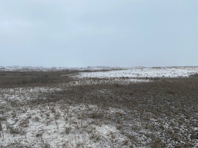
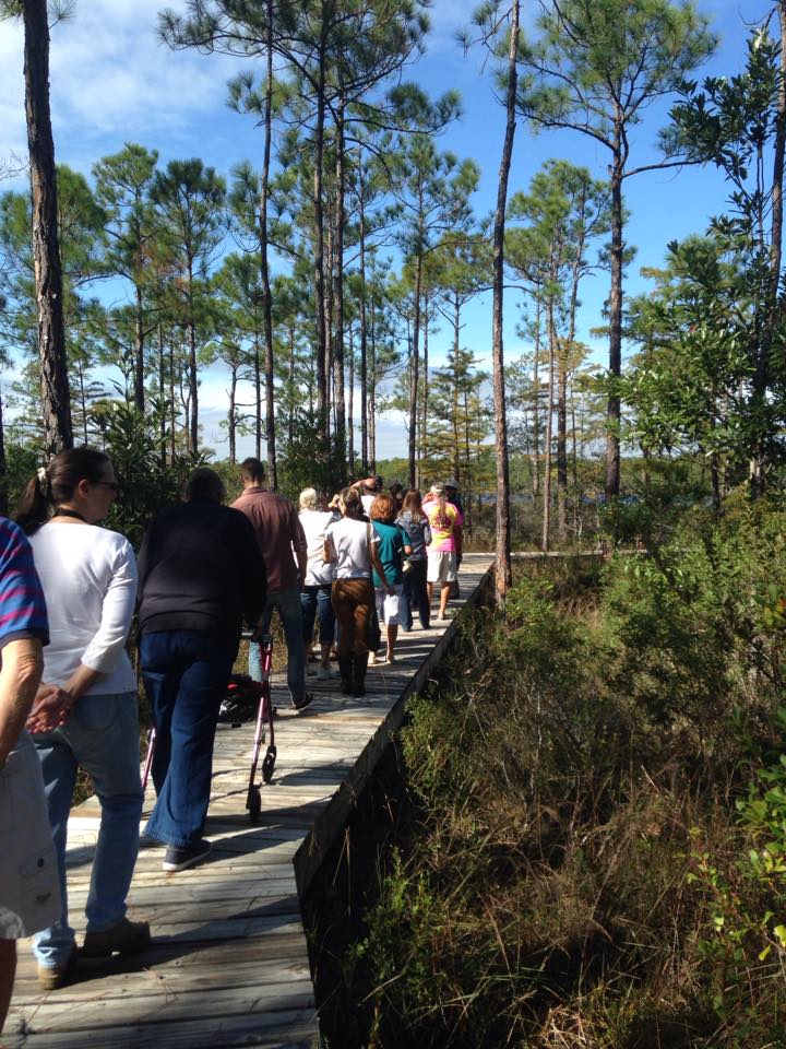
Though this is titled late winter, it did not feel like winter on this walk. The air temperature was 75°F. There was a blanket of fog over the beach, and it felt slightly humid and sticky, but with a cooler feel than we have in summer. It is true that Punxsutawney Phil did not see his shadow this year – signaling an early spring, and the weather today supported this, but spring does not officially begin until the equinox on March 21. So, this is a late winter walk.
This walk was near Big Sabine on Pensacola Beach. As I crossed the road at Park East and headed into the dunes there was a breeze from the south creating surf that could be heard across the island. The fog made things damp and chilled. And there was no sign of wildlife anywhere. The numerous songbirds I had encountered during early and mid-winter were gone. There were flowers in bloom but no insects pollinating them. Literally no wildlife was to be seen.
A foggy day on Pensacola Beach.
Photo: Rick O’Connor
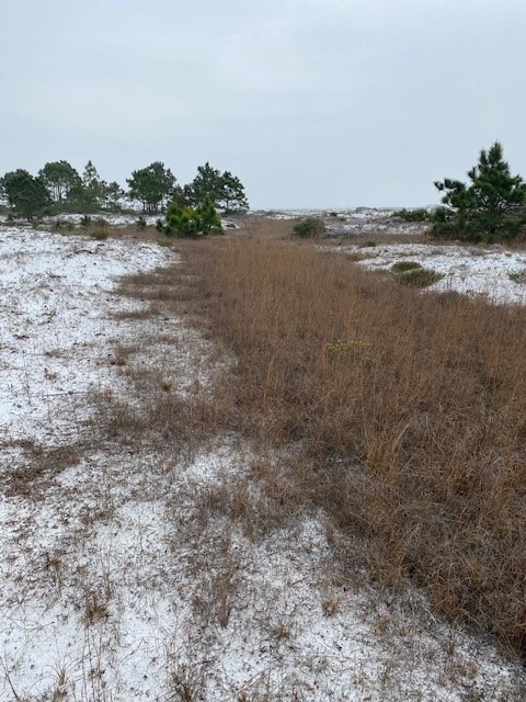
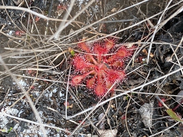
So, I turned my focus to the environment, noticing plants and the stages they were in. As you move from the primary dunes of the Gulf side into the more shrub covered secondary dunes, you cross through low areas in the dune field called swales. Here water collects during rain events forming ephemeral ponds and the plants associated with this habitat are more wetland than upland. In the boggy portions of the swale, I found sundews large and in a brilliant red color. These carnivorous plants produce tiny droplets of sugar water on threads at the tips of their leaves that attract the pollinators of the beach. Though sweet and delicious, they are also sticky and trap unaware insects which become a meal for them. Along with the sundew were numerous strands of ground pine, another carnivorous plant of the swale.
Swales are low areas of the dune field where water stands for periods of time and the more wetland plants can exist.
Photo: Rick O’ConnorThe carnivorous sundew inhabits more wetland locations.
Photo: Rick O’Connor
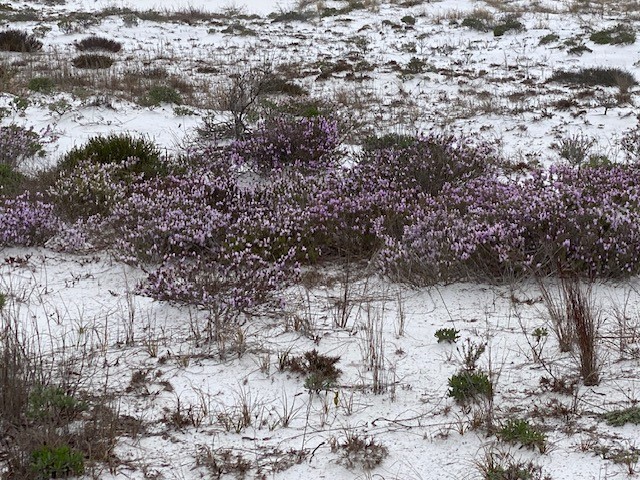
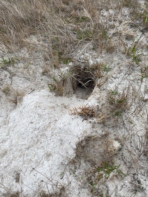
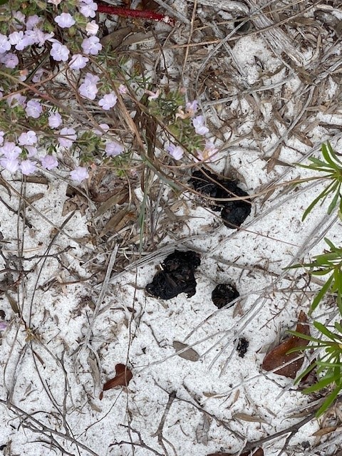
Beyond the swale, the secondary dunes were a blanket of lavender. The false rosemary, also called beach heather (Conradina), was in full bloom everywhere. As I walked through the dunes of flowers I came across the signs of wildlife. Armadillo dens were quite common. There were tracks of animals, including the raccoon, and scat was found. The scat contained seeds and, unlike the long-tapered shape of most carnivore scat, was blunt and rectangular shaped – suggesting a herbivore or omnivore. I did encounter a couple of ephemeral ponds with very little water, but there were no animals, or animal sign, to be found there.
The false rosemary was in bloom and the dunes were full of this lavender color.
Photo: Rick O’ConnorArmadillo burrows like this one can be found all over our barrier islands.
Photo: Rick O’ConnorThe blunt ended and rectangular shape of this scat suggests it was from a herbivore or omnivore. It was full of seeds.
Photo: Rick O’Connor
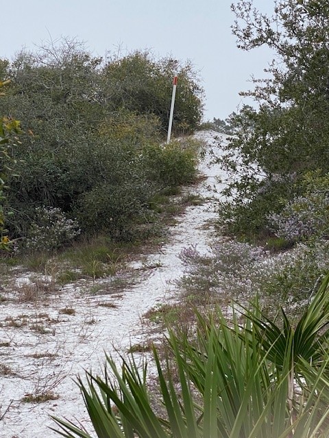
As you move from the secondary dunes into the maritime forest you pick up a section of the Florida Trail. This 1,500-mile trail begins at Ft. Pickens on the western end of Santa Rosa Island and ends near the Everglades. It was obvious that many of the animals who live in these dunes use this trail as well, there were numerous tracks covering it. Over the ridge into the maritime forest, you encounter marshes. The plants you find growing there help indicate whether the marsh is fresh or salt water. Pausing here to see if something stirred or moved, I saw and heard nothing and continued on.
The orange blaze indicates this is part of the Florida Trail.
Photo: Rick O’Connor
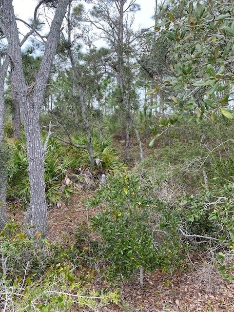
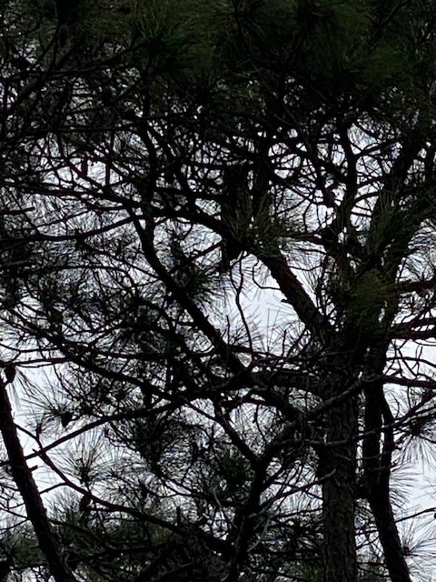
The maritime forest was full of healthy pine and oak trees, creating a completely different habitat for the wildlife out here. You get the feeling when you enter the forest that this is where the creatures prefer to be. Raccoons, skunks, coyote, snakes, birds, lizards, exist here and I was hoping to find something. And then it happened. Glancing up into one of the pine trees I saw a great horned owl – bingo! These are amazing birds and there have been a few reports of nesting great horned owls around the area. I did not see the nest but was happy to see the owl.
The maritime forests of our barrier islands is a completely different environment than the open dune fields.
Photo: Rick O’ConnorUsing the nests of other raptors, great horned owls raise their young this time of year. This one is in the “extended” position suggesting it is alarmed.
Photo: Rick O’Connor
I eventually reached the shore of Santa Rosa Sound and walked along for half a mile or so. I did see a great blue heron in the marsh, and some wharf crabs under a plank of wood – but there was nothing visible in the clear water of the Sound. There was evidence of armadillos digging. One section of the beach they had basically destroyed digging for grubs and other invertebrates to eat.
All in all, it was a quiet day. I am guessing that the foggy conditions moved the animals into their hiding places waiting for the sun to come out. Our next walk will be in early spring, and we are hoping to see more wildlife.
You should get out and take a hike on our beaches, there are plenty of cool things to see and it’s great for your mind.
Six months ago, they were predicting a colder than normal winter. In January that seemed to be the case. We had multiple fronts with high winds and temperatures dropping into the 20s. But February has been different. As I type this, it is 62°F and we have had some of the nicest days we have had in a while. Sunny, low humidity, really nice. AND THE GROUNDHOG SAW HIS SHADOW!!! So… maybe an early spring?
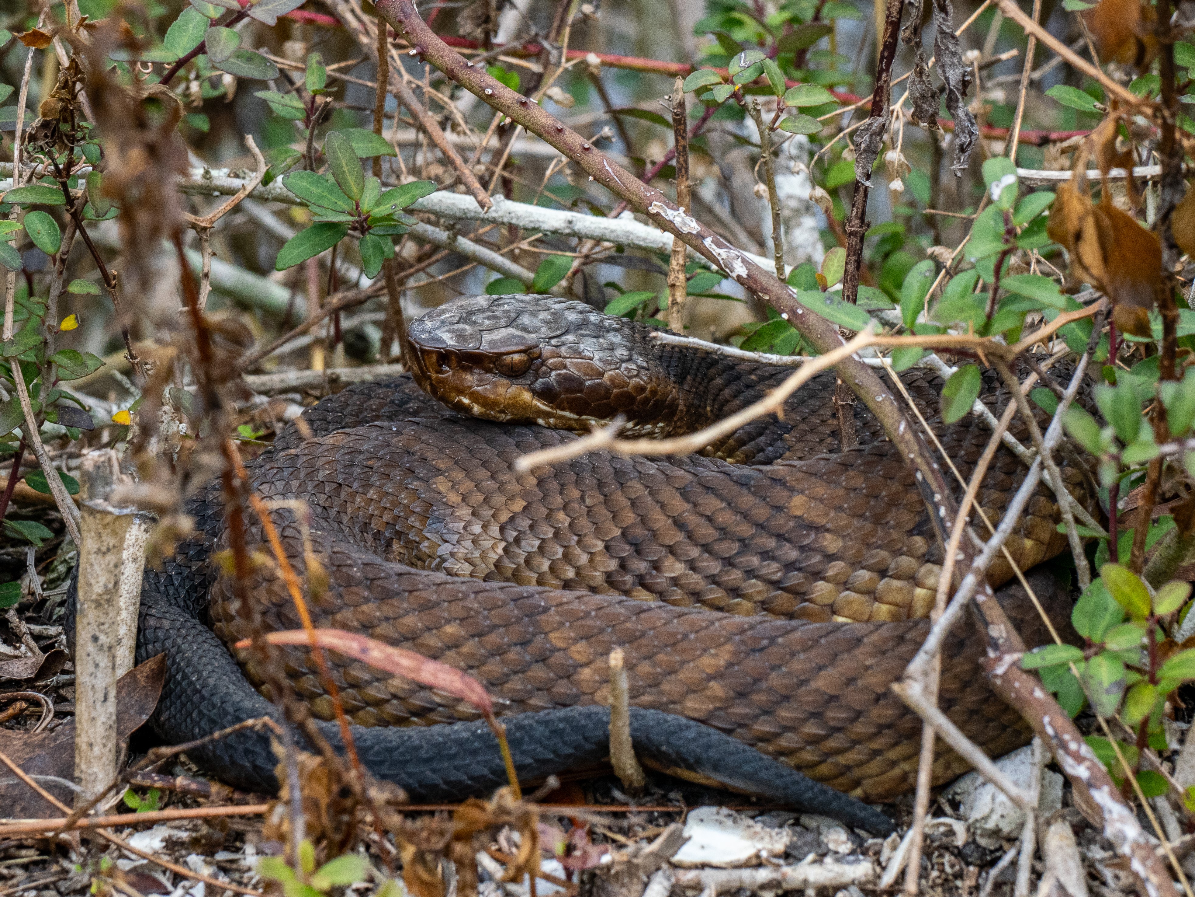
With the warmer temperatures I thought we might encounter some of our ectothermic friends (amphibians and reptiles). On days like we have seen, snakes and turtles will come out from their winter hiding spots to bask in the sun. Since our early winter article, two cottonmouths have been seen on Santa Rosa Island. They were both reported as being very sluggish – but that is to be expected – it is still winter, and the temperatures are still low in the mornings. With that thought in mind we did our February mid-winter hike at Ft. Pickens.
A cottonmouth found on the trail near Ft. Pickens. Photo: Ricky Stackhouse
The hike was on February 6. It was a beautiful sunny day, the temperature was 49°F, light wind from the north. I will say, in the wind it was a bit chilly, but behind the dunes it was very pleasant.
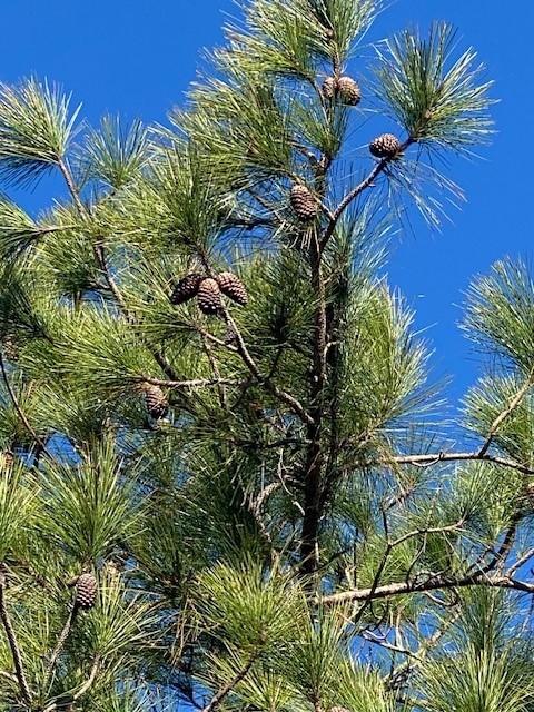
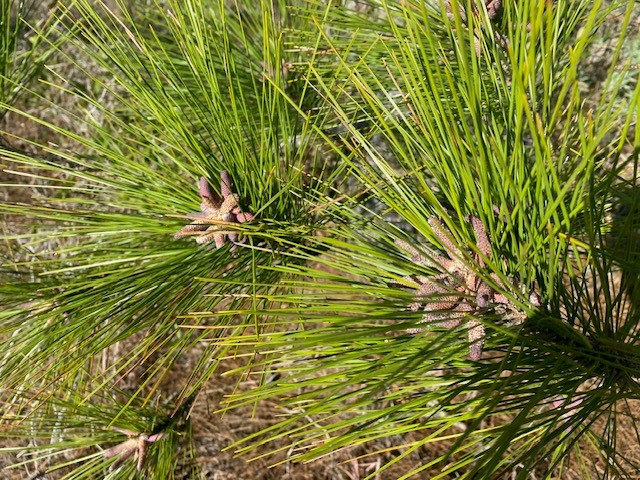
Along the trail I noticed a lot of green plants, but nothing was in bloom. Often the change in temperature can fool flowering plants into blooming early. However, the pine trees were full of male and female cones. They were definitely getting ready for pollen season.
The female cone of a pine tree.
Photo: Rick O’ConnorThe male cones of this pine tree are releasing the all too familiar yellow dust pollen.
Photo: Rick O’Connor
I began in the middle of the island in the hardwoods, moving slowly hoping to find a basking snake. I did not, but I did see numerous woodland songbirds. I am not a good birder, but I believe there were varieties of warblers, titmice, wrens, and the always present mockingbird. I did spot a great blue heron on a nest. Birds are endothermic – and this is their time – a great time to do some birding if you like that.
Blue herons often use the tops of pine trees for nesting.
Photo: Rick O’Connor
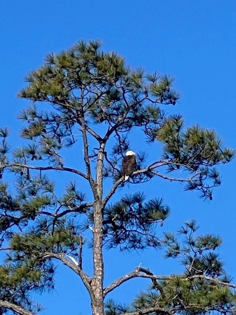
I took another trail heading towards the beach. This crossed through more woodlands before reaching the dunes and the shore. It was in the woodland area I came across a bald eagle nest. Many of us remember a time when we never saw bald eagles around here. Now they are becoming more common and nesting all around the bay area. These awesome birds are similar to dolphins, sea turtles, manatees, and the Blue Angels – you never get tired of seeing them. It is always an exciting moment when one flies over.
The American bald eagle.
Photo: Rick O’Connor
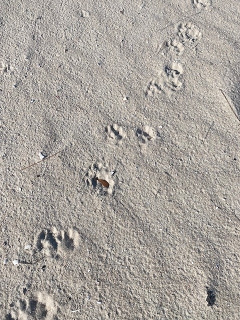
There was no wildlife on the beach that day but there were plenty of tracks. Mammals, even in the winter, still prefer to move around under the cover of darkness. I found the tracks of armadillo and raccoon, common mammals on our island, but there was another set that was harder to identify. The paw had the imprint of a cat (no claws visible) but the track was quite large for a feral cat. If it was, it was a big cat. I have seen bobcats in the Gulf Breeze area, and you cannot rule them out, but the pattern of the stride appeared more like an otter. Otter tracks would be webbed – these were not – so… I am not sure what it was.
Most encounter island mammals by finding their tracks.
Photo: Rick O’Connor
Leaving the beach, I returned to the inland trail heading back to the truck. On this portion of the trail, you cross over ponds just outside the walls of the fort. As I glanced across the water – hoping for a swimming snake – I saw something else. It surfaced briefly and then dove again. At first, I thought it was a diving bird, such as a cormorant or loon, but when it resurfaced, I saw that it was not. It was an otter. I had seen otters before in this area, and other pond areas on the island, but – like the bald eagle and dolphin – it is always exciting to see them again.
Based on this hike, it is still the time of the “warm-blooded”. Birds and mammals were the creatures most visible. We will see if this warming trend continues. Maybe during the late winter hike in March, we will see some of the “cold-bloods” come out. Maybe it WILL be an early spring.
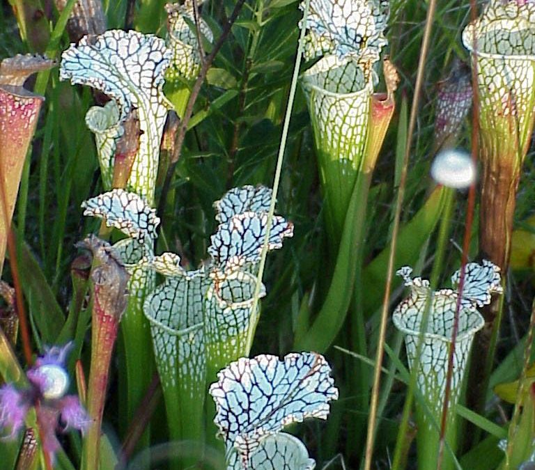
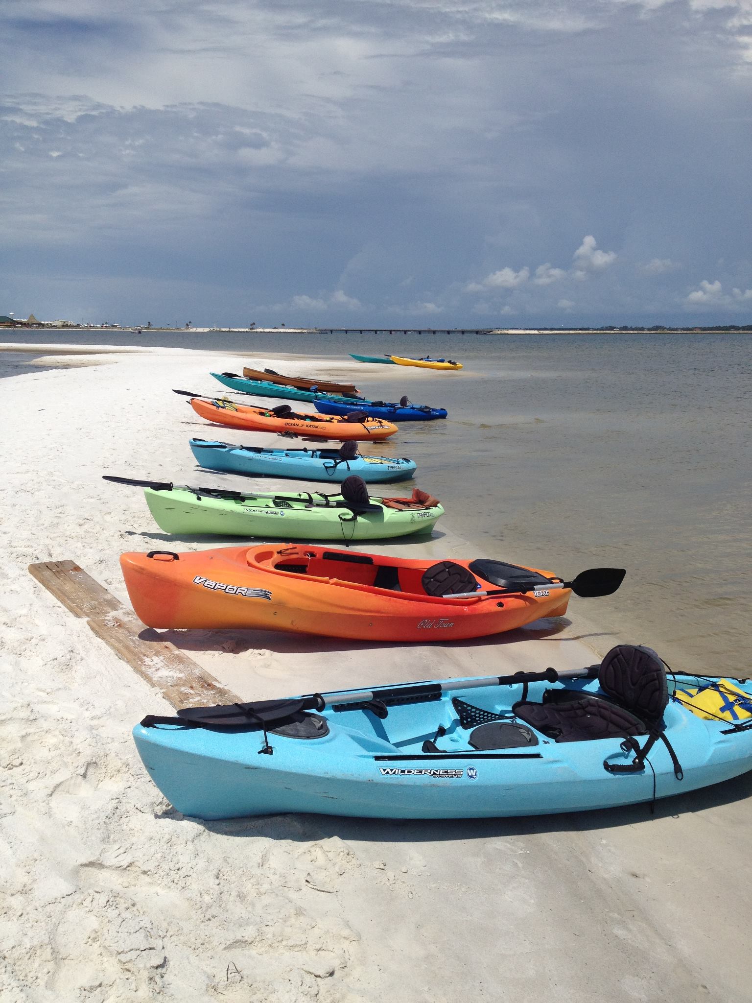
Kayaking over seagrass beds and stingrays, hiking among pitcher plants, boating past diving ospreys, and meeting hundreds of fascinating, like-minded people—these are just some of the great experiences I’ve had while teaching the Florida Master Naturalist Program. More than 20 years since its inception, the Florida Master Naturalist Program (FMNP) has inspired the creation of dozens of similar courses in other states and proven itself to be one of the most popular outreach programs to come out of UF IFAS Extension.
Kayaking Santa Rosa Sound in Navarre is one of the highlights of our Coastal Systems FMNP class. Photo credit: Carrie Stevenson, UF IFAS Extension
The mission of the FMNP is simple—to promote awareness, understanding, and respect of Florida’s natural world among Florida’s citizens and visitors. I have always felt strongly that if you want people to care about something, they need to understand it. And to really understand something, you need to experience it. I know my own passion for science and ecology was ignited early on by teachers who took us outside and helped us encounter the many wondrous surprises in the natural world. With the FMNP, we seek to do just that.
Master Naturalist students conduct field work in small groups. Photo credit: Carrie Stevenson, UF IFAS Extension
Over a span of 40 hours in 6-7 weeks, we spend about half our time with classroom presentations and the other half in the field, seeing the plants, animals, and ecosystems we discuss in class. In addition to classes and field trips, students produce a final project and present it to the class. These can range from labeled collections and slide presentations to building bird houses and new trails. The program is composed of three 40-hour core courses; Coastal, Upland, and Freshwater Systems. Seven “short courses” with 24 hours of class/field time include the Land Steward series (Conservation Science, Habitat Evaluation, Wildlife Monitoring, and Environmental Interpretation) and the Restoration courses (Coastal Restoration, Marine Habitat Restoration, and Invasive Plants). Locally, we try to rotate the core modules every couple of years and incorporate the short courses periodically. Registration includes a detailed course manual and, upon completion, FMNP patch, certificate, and pin denoting area of expertise. There are a handful of scholarships available for those interested in applying to offset costs.
Master Naturalist students walk “The Way” boardwalk in Perdido Key. Photo credit: Carrie Stevenson
The classes do not count towards university credit but are an excellent certification and professional development opportunity that many will list on a resume. While we’ve had ecotour operators, park rangers, environmental consultants, teachers, and archaeologists participate, most of our FMNP students are not professionals in the field. They come from every background imaginable but share an interest in the outdoors. Because we meet weekly, class members often form long-lasting friendships during the courses.
Information on upcoming classes in northwest Florida and all around the state is available online. Classes range from fully in-person to hybrid and online options. FMNP classes are restricted to adults 18 and over, but a new “Florida Youth Naturalist” curriculum has been designed through our 4-H program for young people. For more information on that, check out their website.
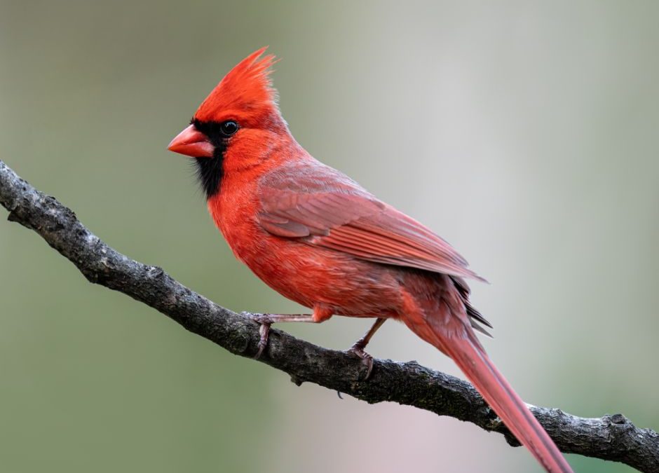
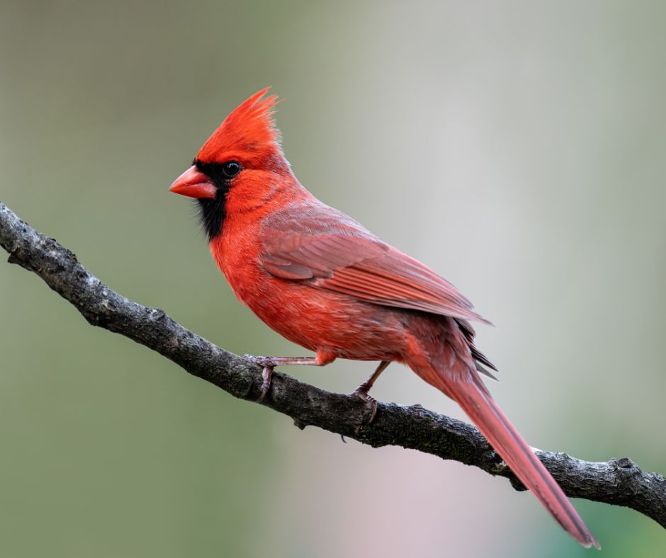
It seems overnight our yards and woods have come to life with the flitting of the Northern Cardinals, but the truth be told, they have been here all year! This eye-catching songbirds are abundant in the southeast. According to the North American Breeding Bird Survey their numbers continue to increase 0.32% per year since 1966, with an estimated 130 million global breeding population.
Adult Male Cardinal, Photo Sourced from Canva Pro.
History
The Northern Cardinal is not new to the bird scene. With the males sporting vibrant red plumage they caught the eye of founding colonists. In seeing they had similar red colors to the biretta and robes of the Catholic cardinals the early settlers gave them their name—The Cardinal.
Identification
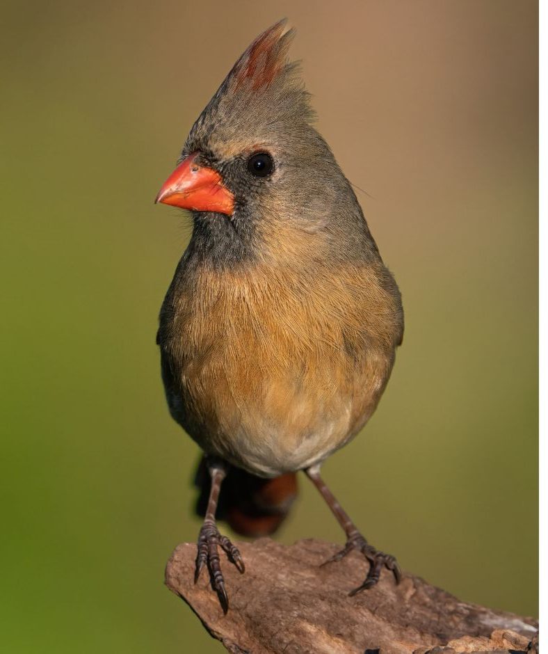
While the males are the noticeable bright red color, the females are a light brown bird with a reddish crest, wing, and tail. These non-migratory birds can be seen year-round in the Southwest, Midwest and Eastern parts of the U.S.
Female Adult Cardinal, Photo Sourced from Canva Pro.
Habitat
Living in dense shrubby areas, along wood lines and in regrowth the North Cardinal enjoys hopping through low branches and forage along the ground. They commonly sing and preen on higher branches. Interesting most female songbirds do not sing, but female Cardinal does. They are granivorous animals, meaning they mainly consume seeds, nuts, shells, and hulls, but they also enjoy some fruits and grasses.
Reproduction
Cardinals are monogamous birds, however nearly 20% of the pairs will split up by the next season and being searching for a new mate. Early spring marks the kick-off to mating season and it lasts into September, with each mating pair having one or two broods a year. After mating in the spring, the female can lay eggs continuously over the course of the season with the sperm being available in the female’s chambers for an extended period. Typically, the clutch size is between 2-5 eggs and are incubated 11-13 days before the 7-13 day nestling period after which the chicks are ready to leave the nest as fledglings. They will come and go from the nest for the next two weeks, before leaving for good. The adolescent birds will then stay with their parents (but not in the nest) for the next 40 days before they leave to find their own territories.
As we make our way into spring take time to enjoy the Northern Cardinals that have likely been your neighbors all year.
One of the programs I do with Florida Sea Grant is Restoring a Healthy Estuary. There are four focus areas within this program: improving water quality, restoring habitat, managing invasive species, and enhancing wildlife. For those who know me, they know that enhancing wildlife is near and dear to me. My major in college was vertebrate zoology and I have been monitoring and teaching about vertebrates for 40 years.
I have found that the articles I write on this topic are my most popular, particularly snakes. And I get that. Whether you love them or hate them, snakes are interesting to read about. As we roll into 2024, I thought I would do a series of articles on vertebrates I encounter as I conduct hikes/surveys on our barrier islands. From a biogeographic view, barrier islands are interesting in understanding first, how some of the animals reached the island, and second, how they survive in a sandy/dry environment that is in many ways similar to deserts.
The white quartz sand beaches of the barrier island in the northern Gulf of Mexico.
Photo: Molly O’Connor
My first hike was just after the new year on the western end of Santa Rosa Island. Wintertime is cold and the ectothermic vertebrates (amphibians and reptiles) are hard to find, most going dormant this time of year. But, on sunny days when the wind is low, they can find places where they bask and stay warm. If you encounter them, they will most likely not move quickly (they are still cold) and this provides a better opportunity to view them, though their coloration is very cryptic with the environment and, with little motion, you may miss them. For the endothermic vertebrates (birds and mammals) this is their time.
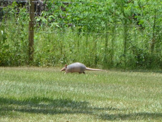
On this warmer sunny January day, we spent several hours out. There was not much movement other than a variety of songbirds. Then we heard rustling in the woods under some live oak trees – it was an armadillo.
The common nine banded armadillo scurrying across the lawn.
Photo: Les Harrison
Many of us have encountered this interesting mammal. You may not have recognized it as mammal, but it is. As a lifelong resident of Pensacola, I know that prior to Hurricane Ivan there were fewer armadillos on Pensacola Beach. They were there but in low numbers. What was common at that time were striped skunks. Since Ivan I have not seen a skunk. I have asked park rangers at the Gulf Island National Seashore, and they have not seen them either. But the number of armadillos immediately increased. It seems the skunk left a niche open, and this animal took it. Some say the armadillo may have increased in population whether the skunks were there or not – that is just armadillos. So, who is this “new kid on the block” that has become so common on our islands?
Armadillos are native to central and south America. They are a smaller mammal in the Order Cingulata and related to anteaters and sloths. Mammals are divided into orders based on their dental formula (what type, and how many teeth they have). In this sense armadillos are unique. They have around 30 peg like teeth which they use to feed on insects, their larva, arachnids, snails, small vertebrates, and eggs – though reports of them raiding shorebird nests are rare. They do eat cockroaches, which many people appreciate. They acquire their food by digging into loose soil with their large claws. This is one reason they do so well on our beaches and why many homeowners dislike them – they can destroy a yard to find prey. Though they have poor eye site and hearing, which is noticeable when you encounter one, they have an excellent sense of smell.
Armadillos move relatively slowly seeking prey but when disturbed they can run quickly and swim well. They dig round burrows, which I have found many on Santa Rosa Island. Because they often share habitats with gopher tortoises, the burrows are often confused. Armadillo burrows differ in that they are completely round. With gopher tortoises the entrance is usually flat across the bottom and dome shaped across the top. Armadillos usually spend the daytime in these burrows, foraging at night with more activity near dawn and dusk (crepuscular).
One secret to their success is their reproductive rate. They breed in summer but hold off development of the embryo to allow a late winter birth. They only have one litter each year but is almost always four identical young of the same sex. This is because they develop from the same fertilized egg.
Diseases and parasites in armadillos are few compared to native mammals, rabies has not been documented. Leprosy has been documented in armadillos in Texas, Louisiana and Mississippi, but there have been no reports of infected ones in Florida.
The dispersal of armadillos from central to north America most likely occurred crossing the isthmus in Panama. But there are reports of the animals being released in eastern Florida beginning in the 1920s. It was noted that they were able to cross the Mississippi River in the 1920s when people began to build bridges for this new thing called the automobile. Eventually the Florida and Texas populations merged. They are dispersing north towards the Ohio Valley but are not fans of cold weather and this has been a barrier for further dispersal north. We will see what climate change will do to their range. They most likely reached our barrier islands by crossing bridges, though there are locations where the Intracoastal Waterway is narrow enough, and dredge spoil island frequent enough, they could have swam/island hoped their way over. Either way they are here.
Many dislike this creature and would like to see them gone. Some consider it an invasive species and needs to be managed. Others find them cool and enjoy seeing them. It was the only non-bird creature moving that day, despite the warmer weather, we will see what the next hike/survey will bring.