by Andrea Albertin | Jan 20, 2022

Jackson Blue Springs discharging from the Floridan Aquifer. Jackson County, FL. Image: Doug Mayo, UF/IFAS Extension.
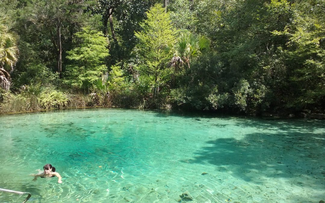
Florida has one of the largest concentrations of freshwater springs in the world. More than 1000 have been identified statewide, and here in the Florida Panhandle, more than 250 have been found. Not only are they an important source of potable water, springs have enormous recreational and cultural value in our state. There is nothing like taking a cool swim in the crystal-clear waters of these unique, beautiful systems.
How do springs form?
We have so many springs in Florida because of the state’s geology. Florida is underlain by thick layers of limestone (calcium carbonate) and dolomite (calcium magnesium carbonate) that are easily dissolved by rainwater that percolates into the ground. Rainwater is naturally slightly acidic (with a pH of about 5 to 5.6), and as it moves through the limestone and dolomite, it dissolves the rock and forms fissures, conduits, and caves that can store water. In areas where the limestone is close to the surface, sinkholes and springs are common. Springs form when groundwater that is under pressure flows out through natural openings in the ground. Most of our springs are found in North and North-Central Florida, where the limestone and dolomite are found closest to the surface.
Springs are windows to the Floridan Aquifer, which supplies most of Florida’s drinking water. Image: Ichetucknee Blue Hole, A. Albertin.
These thick layers of limestone and dolomite that are below us, with pores, fissures, conduits, and caves that store water, make up the Floridan Aquifer. The Floridan Aquifer includes all of Florida and parts of Georgia, South Carolina, and Alabama. The thickness of the aquifer varies widely, ranging from 250 ft. thick in parts of Georgia, to about 3,000 ft. thick in South Florida. The Floridan is one of the most productive aquifer systems in the world. It provides drinking water to about 11 million Floridians and is recharged by rainfall.
How are springs classified?
Springs are commonly classified by their discharge or flow rate, which is measured in cubic feet or cubic meters per second. First magnitude springs have a flow rate of 100 cubic feet or more per second, 2nd magnitude springs have a rate of 10-100 ft.3/sec., 3rd magnitude flows are 1-10 ft.3/sec. and so on. We have 33 first magnitude springs in the state, and the majority of these are found in state parks. These springs pump out massive amounts of water. A flow rate of 100 ft.3/sec. translates to 65 million gallons per day. Larger springs in Florida supply the base flow for many streams and rivers.
What affects spring flow?
Multiple factors can affect the amount of water that flows from springs. These include the amount of rainfall, size of caverns and conduits that the water is flowing through, water pressure in the aquifer, and the size of the spring’s recharge basin. A recharge basin is the land area that contributes water to the spring – surface water and rainwater that falls on this area can seep into the ground and end up as part of the spring’s discharge. Drought and activities such as groundwater withdrawals through pumping can reduce flow from springs systems.
If you haven’t experienced the beauty of a Florida Spring, there is really nothing quite like it. Here in the panhandle, springs such as Wakulla, Jackson Blue, Pitt, Williford, Morrison, Ponce de Leon, Vortex, and Cypress Springs are some of the areas that offer wonderful recreational opportunities. The Florida Department of Environmental Protection has a ‘springs finder’ web page with an interactive map that can help you locate these and many other springs throughout the state.
https://nwdistrict.ifas.ufl.edu/nat/2020/04/09/the-incredible-floridan-aquifer/
by Andrea Albertin | Apr 9, 2020
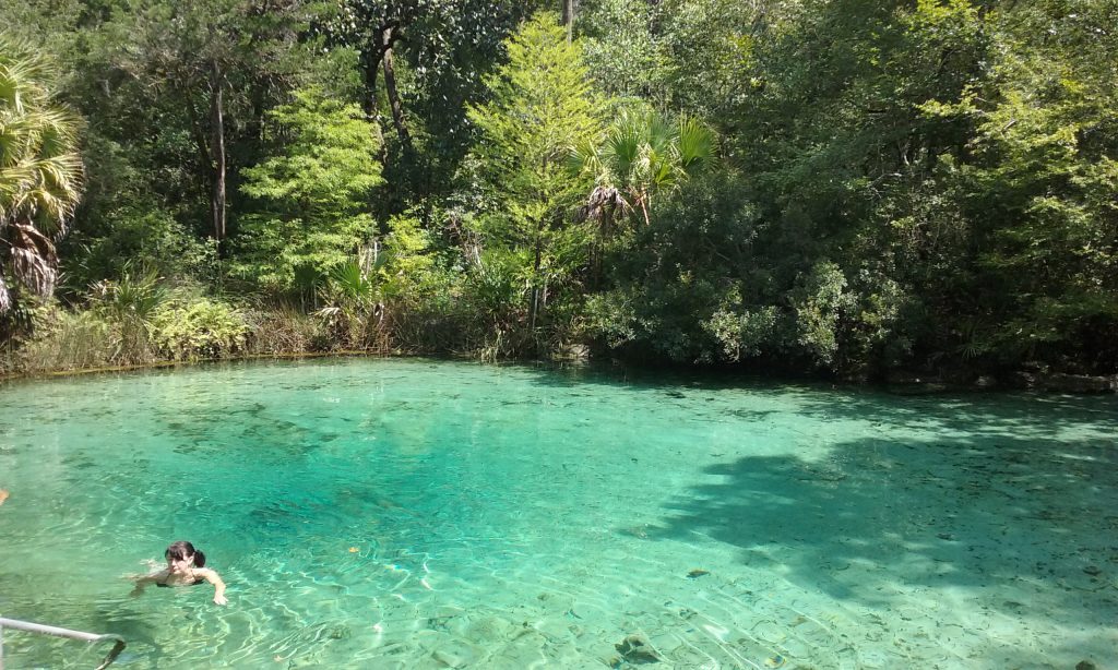
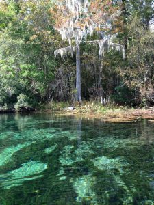
Pitt Spring in the Florida Panhandle is one of more than 1,000 freshwater springs in the state. Springs serve as ‘windows’ to groundwater quality, since the water that flows from them comes largely from the Upper Floridan Aquifer. Photo: A. Albertin
As Florida residents, we are so fortunate to have the Floridan Aquifer lying below us, one of the most productive aquifer systems in the world. The aquifer underlies an area of about 100,000 square miles that includes all of Florida and extends into parts of Alabama, Georgia and South Carolina, as well as parts of the Atlantic Ocean and the Gulf of Mexico (Figure 1). The Floridan Aquifer consists of the Upper and Lower Floridan Aquifer.
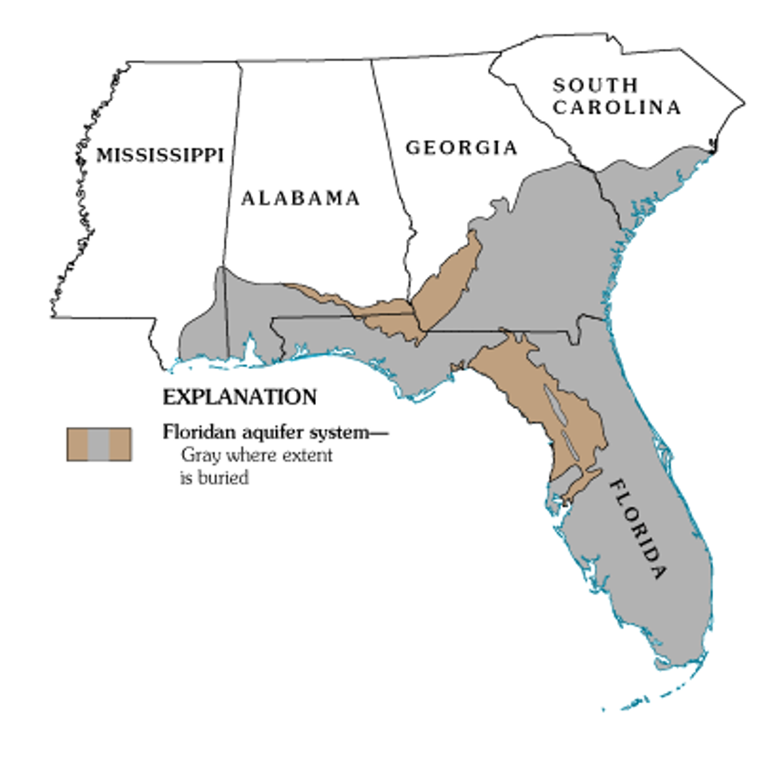
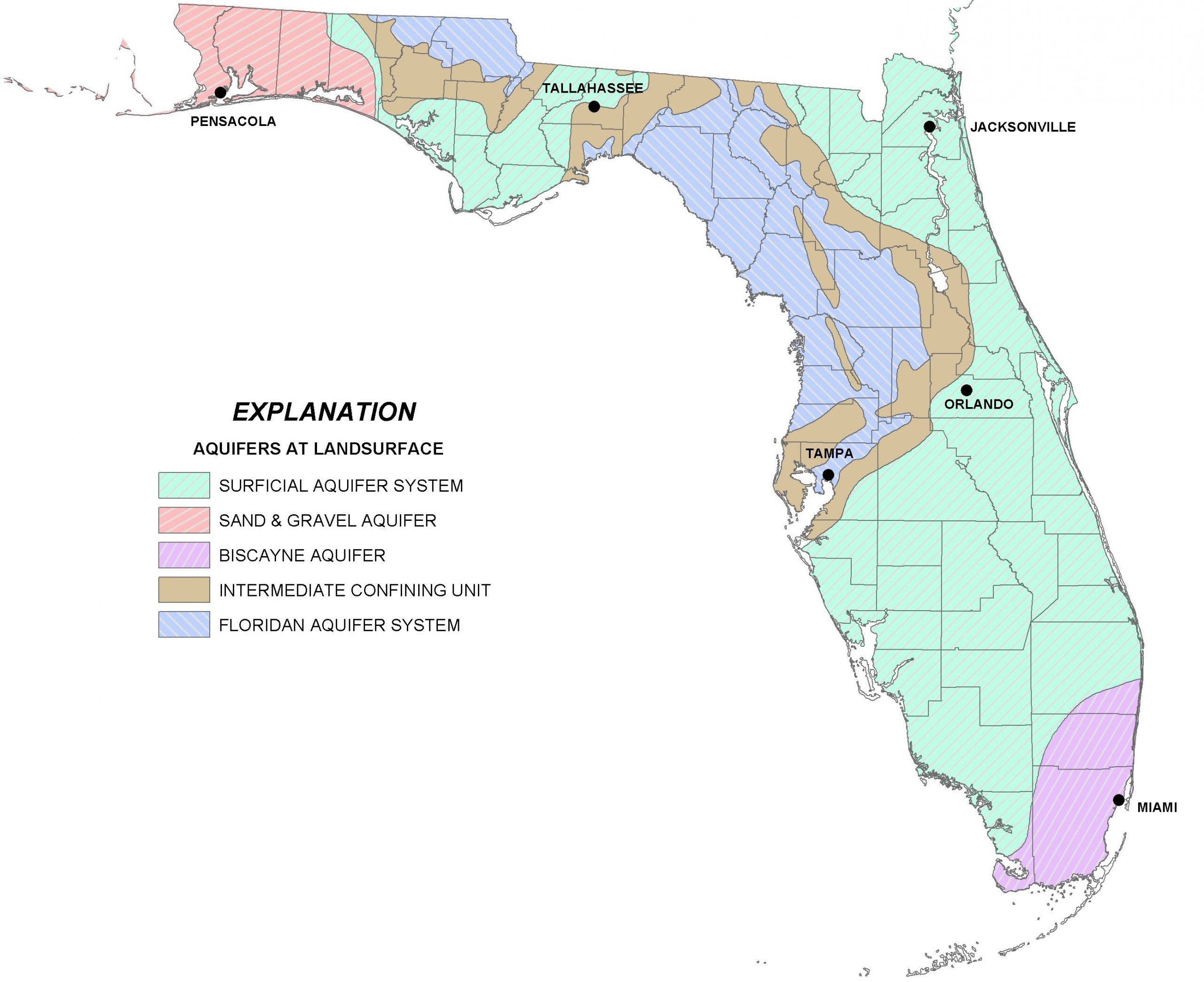
Figure 1. Map of the extent of the Floridan Aquifer. Areas in gray show where the aquifer is buried deep below the land surface, while areas in light brown indicate where the aquifer is at land surface. Many springs in Florida are found in these light brown areas. Source: USGS Publication HA 730-G.
Aquifers are immense underground zones of permeable rocks, rock fractures and unconsolidated (or loose) material, like sand, silt and clay that hold water and allow water to move through them. Both fresh and saltwater fill the pores, fissures and conduits of the Floridan Aquifer. Saltwater, which is more dense than freshwater, is found in all areas of the deeper aquifer below the freshwater.
The thickness of the Floridan Aquifer varies widely. It ranges from 250 ft. thick in parts of Georgia, to about 3,000 ft. thick in South Florida. Water from the Upper Floridan Aquifer is potable in most parts of the state and is a major source of groundwater for more than 11 million residents. However, in areas such as the far western panhandle and South Florida, where the Floridan Aquifer is very deep, the water is too salty to be potable. Instead, water from aquifers that lie above the Floridan is used for water supply.
There are actually several major aquifer systems in Florida that lie on top of the Floridan Aquifer and are important sources of groundwater to local areas (Figure 2):
- The Sand and Gravel Aquifer in the far western panhandle is the main source of water for Santa Rosa and Escambia Counties. It is made up of of sand and gravel interbedded with layers of silt and clay.
- The Biscayne Aquifer supplies water to Dade and Broward Counties and southern Palm Beach County. A pipeline also transports water from this aquifer to the Florida Keys. The aquifer is made of permeable limestone and less permeable sand and sandstone.
- The Surficial Aquifer System (marked in green in the map in Figure 2) is the major source of drinking water in St. Johns, Flagler and Indian River counties, as well as Titusville and Palm Bay. It is typically shallow (less than 50 ft. thick) and is often referred to as a ‘water table’ aquifer, but in Indian River and St. Lucie Counties, it can be up to 400 ft. thick.
- Not included in Figure 2 is a fourth aquifer, the Intermediate Aquifer System in southwest Florida. It lies at a depth between the Surficial Aquifer System and the Floridan Aquifer. It is found south and east of Tampa, in Hillsborough and Polk counties and extends south through Collier County. It is the main source of water supply for Sarasota, Charlotte and Lee counties, where the underlying Floridan Aquifer is too salty to be potable.

Figure 2. A map of four major aquifer systems in the state of Florida at land surface. The Floridan Aquifer (in blue) underlies the entire state, but in areas north and east of Tampa it is found at the surface. The Surficial (green), Sand and Gravel (red), and Biscayne Aquifer (purple/pink) lie on top of the Floridan Aquifer. A confining unit (area in brown) consists of impermeable materials like thick layers of fine clay that prevent water from easily moving through it. Source: FDEP.
All of the aquifer systems in Florida are recharged by rainfall. In general, freshwater from deeper portions of the aquifer tends to have better water quality than surficial systems, since it is less susceptible to pollution from land surfaces. But, in areas where groundwater is excessively pumped or wells are drilled too deeply, saltwater intrusion occurs. This is where the underlying, denser saltwater replaces the pumped freshwater. Florida’s highly populated coastal areas are particularly susceptible to saltwater intrusion, and this is one of the main reasons that water conservation is a major priority in Florida.
More information about the Floridan Aquifer System and overlying aquifers can be found at the Florida Department of Environmental Protection (https://fldep.dep.state.fl.us/swapp/Aquifer.asp#P4) and in the UF EDIS Publication ‘Florida’s Water Reosurces’ by T. Borisova and T. Wade (https://edis.ifas.ufl.edu/fe757).

by Erik Lovestrand | Jun 30, 2017
Imagine yourself as an early settler, migrating with your family into the area known as La Florida, with the hope of staking a claim and building a new life. You’ve heard stories of horrendous mosquitos, fierce native peoples, deadly snakes, and giant alligators. Regardless, the promise of abundant fish and wildlife, a year-round growing climate and a chance to start anew, override any doubts you might have and you pack your wagon, hitch up your mules and head south with great anticipation.
Florida’s springs are world famous. They attracted native Americans and settlers; as well as tourists and locals today.
Photo: Erik Lovestrand
Well, the mosquitos have been horrendous, one of your mules was bitten by a rattlesnake but survived, and one of your hounds was taken by an alligator at a river crossing. You are in your second month of travel and you’ve come into a strange area of forest that stretches for miles in all directions. Deep, white sands clutch at your wagon wheels and make tough going for the mules. The land is forested by tall majestic pines and the terrain is gently rolling with an open view across a landscape dominated by wiry grasses and other low growing herbaceous plants. The buzzing sound of insects in the trees makes it seem even hotter for some reason and everyone is tired and thirsty as you spy a dark line of hardwood trees just down-slope. You decide to take refuge in the shade to rest the lathered mules and hope for a water source to refill your dangerously low water cask.
As you walk back under the shady canopy you find an obvious trail that has been used by other humans for generations as evidenced by a deep rut worn into the ground between exposed limestone boulders. As luck would have it, you see the glint of water through the trees ahead. When you clear the trees near the water’s edge you stop abruptly in stunned amazement. The image of a deep blue pool of crystal clear water with a small stream exiting into the woods causes you to shake your head in disbelief. You must be dreaming, as you’ve never witnessed such a magical setting; water boiling out of a gaping hole in the earth, surrounded by white sand and long flat blades of grass waving in the current.
Just about everyone who has visited one of our sparkling North Florida springs probably has a similar, magical recollection of their first encounter. As surface water percolates downward through soil layers and the porous karst (limestone) bedrock, it is filtered and cleaned to incredible clarity. The clear water gushing forth in these artesian-spring flows remains 69-70 degrees year-round in our Panhandle springs. This is due to their open aquifer connection, from which many homes draw their drinking water directly.
However, there are some serious vulnerabilities that our springs are facing regarding the quality of the water that they provide for residents and visitors alike. One issue relates to the numerous sink holes throughout our landscape that also connect directly to this same Floridan aquifer. In the past, many of these holes have served as dumping grounds for items ranging from household garbage, to junk cars, old washing machines and refrigerators, and even the occasional murder victim. Imagine all of the pollutants that end up in our drinking water supply as a result of this. Another concern relates to pollution that goes onto the ground surface and ends up in the aquifer. This happens via runoff from paved surfaces, sediments and excess fertilizers or pesticides from the landscape, or even the intentional application of treated wastewater in spray fields located in a “spring-shed.” Water clarity and quality at many of our well-known springs has suffered from excess nutrients that cause algal growth and other unwanted, nuisance plant proliferation.
As we gain a better understanding of how water moves through our landscape and ends up flowing from these natural springs, we should become better stewards by minimizing our human impacts that degrade spring water quality. Let’s keep the magic alive for all of our future generations of nature explorers.

by Rick O'Connor | Jul 27, 2016
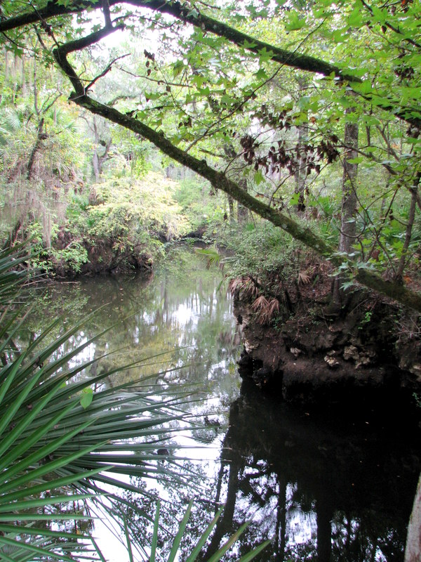
Many consider Northwest Florida as the “Canoe Capitol” of the state. We have numerous rivers, creeks, and springs that are great paddling spots. The scenery is great, wildlife is common, and most are easily accessed.
To introduce residents and visitors to the natural history of these waterways, UF/IFAS Extension Agents, and other experts, will lead a paddle trip down one of the many paddling creeks in our area – the Econfina Creek. This creek is one of the more unique ones. The term Econfina is a Muskogean (Creek) term meaning “land bridge” – which apparently existed near the present sight of Highway 20. However, the land bridge is no longer there. This creek runs 22 miles but the upper section is very difficult to paddle. Shallow, fast moving water winds its way through limestone gorges as the land drops at a rate of 7.9 feet / mile (one of the steepest in the state). The lower 6 miles (where our trip takes place) slows, meandering past several springs – including the first magnitude Ganier Springs – limestone outcrops, and lush vegetation – some plant species originate from the Appalachians. There is the chance of seeing some local wildlife including river otters. This lower section is slower and more relaxing and the scenery was graded an “A” by several canoeing guides.
The participants in the program will not only learn about the local natural history of this panhandle waterway but about some of the issues these unique habitats are currently facing. Field experts with the Northwest Florida Water Management District, Florida Fish and Wildlife Commission, and others will share insight to how we can protect these treasured ecosystems. To learn more about the trip contact Dr. Laura Tiu (lgtiu@ufl.edu) or to register visit http://ufifasecofina.eventbrite.com/ .
by Will Sheftall | Jan 19, 2016
The Florida Legislature has just convened for the 2016 session, and news from the capitol is already announcing a sweeping water bill on the fast-track to passage. Supporters are quoted as saying it would provide increased protection for certain key water resources in the State such as springs and the Everglades; opponents are quoted as saying that while it doesn’t undo current protections, neither does it go far enough to assure sustainable protection of water resources for Florida’s future.
Thus it seems our legislators and lobbyists are celebrating something that’s a little better than what we’ve got now, but isn’t good enough to get the job done. That doesn’t sound very reassuring. We need a realistic blueprint for how Florida’s ever-expanding population and robust agricultural industry that produces our food can continue to use Florida’s water resources without using them up. The only way that’s going to happen is for citizens concerned about their grandchildren’s future in Florida to become the voices that legislators ignore at the peril of their political future.
So how do you know what to think, and what to say, about the state of water resources where you live – in the Panhandle? Do you understand their current status and vulnerabilities? Threats to their near-term viability? Prospects for their long-term sustainability, complicated as they are by projections of amplified climate variability?
“Panhandle Outdoors LIVE!” is stepping it up a notch for 2016, to help you get a handle on these “need to know” issues that affect future sustainability. University of Florida Extension’s acclaimed “Panhandle Outdoors LIVE!” mode of exploring signature water resources with knowledgeable guides is not going away; it’s being expanded into “water school” events in 2016. We are adding expert presentations and discussion to the on-water, on-trail immersion learning adventures you’ve come to love.

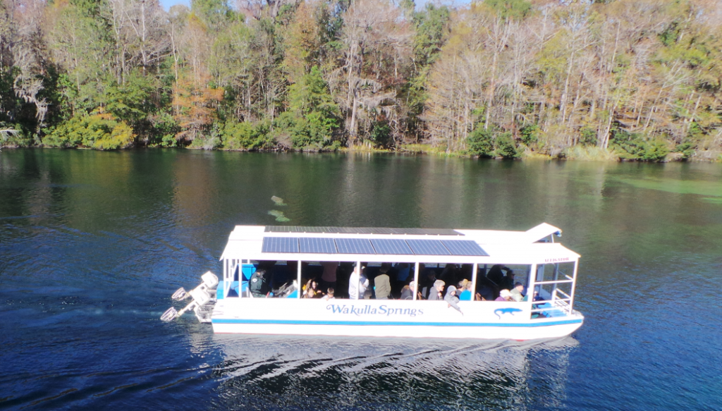
Daily river cruises on the Wakulla River are a great way to see manatees and other unique wildlife.
Photo: L. Scott Jackson
This year we’ll study four Panhandle water resources of regional significance – the Wakulla Springshed, St. Joe Bay, the Econfina Watershed, and Weeks Bay. Two are freshwater streams and their watersheds; two are bays. Two are in the eastern Panhandle; two are in the west (one even in Alabama). Two are being offered in the spring, the other two in the fall.
First up is the Panhandle Outdoors LIVE! – Wakulla Springshed School on March 1-2. It will base out of the magnificent “Old Florida” Wakulla Springs Lodge south of Tallahassee, and feature field trips to Leon Sinks Geological Area, Cherokee Sink and the Wakulla River – concluding with an optional paddle downriver from Wakulla Springs through a transition of ecosystems to historic Fort San Marcos de Apalachee, where the Wakulla joins the St. Marks River.
Next up, on April 4-5, is Panhandle Outdoors LIVE! – Weeks Bay Watershed School that will base out of the Episcopal Beckwith Camp and Retreat Center on Weeks Bay in Fairhope (Baldwin County) Alabama. This second watershed school will focus on the Weeks Bay National Estuarine Research Reserve, and feature a demonstration of oyster farming and a kayak paddle trip.
For more detailed information, and to register, for the Wakulla Springshed School visit – http://pol-2016-wakulla-springshed.eventbrite.com
For more information on the April overnight school to Weeks Bay National Estuarine Research Reserve contact Rick O’Connor at roc1@ufl.edu
For more information on the August day school on the Ecofina River contact Laura Tiu at lgtiu@ufl.edu
For more information on the September overnight school to St. Joe Bay contact Erik Lovestrand at elovestrand@ufl.edu