Recently I attended a conference that included a series of talks at the University of Florida’s Whitney Marine Lab. One of the talks was presented by the director of the lab, Dr. Mark Martindale, who discussed the history and mission of the lab. However, in that talk he made a comment that caught my attention.
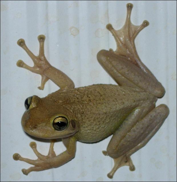
is this a Cuban Tree Frog? Do I have to rely on DNA barconding to know for sure – before I decide to euthanize it? Could I be making a mistake? Image by Dr. Steve A Johnson 2005.
He was discussing the work of the lab and mentioned the great diversity of microscopic life that existed in the Intracoastal Waterway right out their back door. But while discussing this he also mentioned that today’s biology students identify organisms by DNA markers. Going are the days of collecting the creatures and using taxonomic keys to identify using physical characteristics of the organism. What do I mean by this? Well, the “old timers” would wonder through the woods and shorelines, collecting specimens, and observing their physical characteristics… do they have legs? How many legs do they have? How many antennae do they possess? These “old timers” would observe the natural world, develop taxonomic keys (list of characters to help identify), have them peer reviewed, published, and occasionally updated. New microscopic techniques would alert them to mistakes they may have made and thus corrections and “re-do’s” could be done. There were specialists in this field called taxonomists. If you brought in a seashell, they would be able to identify relatively quickly. If they were confused on a few characters, they would contact their colleagues and an agreement would be reached on the proper identification. And so it went.
Today, this is not needed. The sequencing of genomes of many species have been done. The barcode method of identification by the “new school” is more accurate… as long as the sequence is correct, your identification is correct. There are fewer mistakes. Now problems like identifying what is partially digested in a fish gut can actually be done accurately. In some cases, we are learning that the classic “taxonomic tree” may have some flaws. Creatures whose physical characteristics suggest they are related, may in fact not be. We are looking at the progression of life all over again – it is an exciting time for biologists in many ways. But are we losing something by letting the “old natural history” methods go?
One example I can give is identification of a small marine creature called a lancelot. I was doing a survey of marine life at a local restoration project and collected several of these. I was trained by old school biologists and remembered there were four species of these found in our area. I looked through my old college notes to see if I could find how to tell them apart. I could not find those specific notes. So I thought I would contact local biologists for assistance… no one knew… they suggested I try this… try that… I finally decided that the only one who still knew was my old vertebrate zoology professor, Dr. Herbert Boshung. Unfortunately, Dr. Boshung – like so many other of the “old school” – had passed away.
And there I was… with a creature that I could not identify. The “new school” was not able to help. Could this be happening across the country, across the world. As the “old school” move on and the “new school” move in could we be losing a part of natural history that we won’t be able to get back? This concerned me some. To have people who should know, look at something and say “I do not know what that is” was a little disconcerting. Dr. Martindale thought we may have to “re-discover” all of this knowledge within the “new school” – start again.
I am a marine science educator who is in between the two schools. I was taught and trained by the “old school” – folks like Dr, Boshung and Dr. William Cliburn. I learned a LOT about our natural world through them and have used their “old school” methods to teach my students. The “new school” method of learning about the natural world has made wonderful discoveries and it is exciting to see what corrections will be made and what lionfish are actually eating. But I still feel the loss of the “old school” natural history is a true loss. We in Extension are often asked “can you identify this creature?” Those who have been trained “old school” can – or least to genus. “New school” not so much anymore. They can, but not by looking at it. This just seems to be a part of science education we should hold on to.
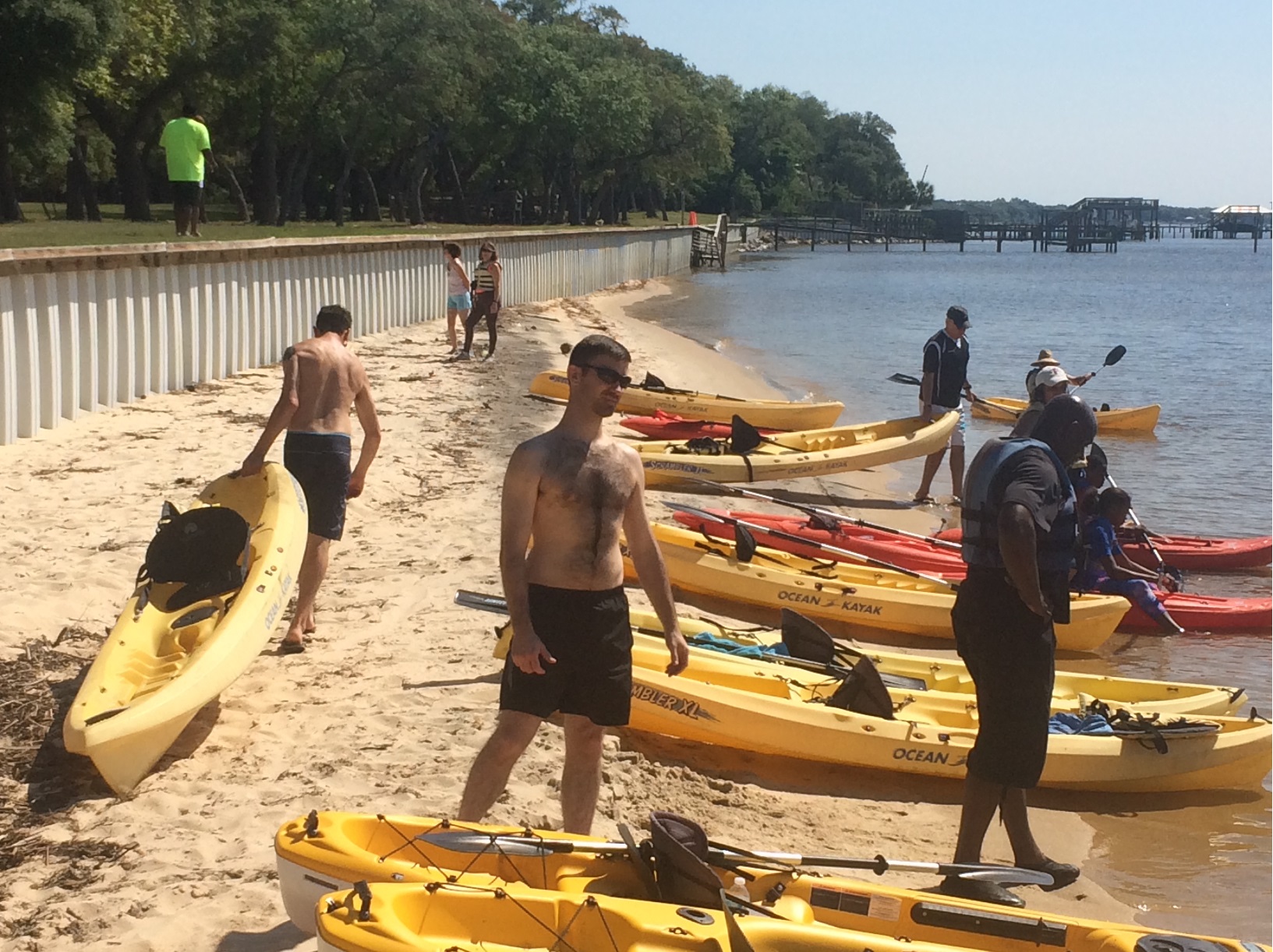
There is one place where the non-scientist interested in learning some of the “old school” methods still can… the Florida Master Naturalist Program. This program consists of three modules – uplands, wetlands/freshwater, and coastal. Participants will learn about the natural history and how to identify specific groups of creatures found in these systems – the old school way. For those interested in this I think it is a great program. It is offered through most county extension offices across the panhandle. To find out more about the program, and what modules are being offered in your area, visit http://www.masternaturalist.ifas.ufl.edu/
Humans have been settling on, and around, coastal estuaries since they first arrived in the panhandle over 10,000 years ago. These bodies of water have provided food and recreation as long as anyone can remember. They are a magnet for those looking to build homes or businesses – and we continue to be attracted to them today.
Black Needlerush is one of the species of marsh grasses that live in brackish conditions.
Estuaries are defined as semi-enclosed bodies of water where fresh and sea water mix. The point where the freshwater enters is called the head of the bay; the point where seawater enters is called the mouth. Seawater is denser than freshwater so during incoming tides the saline water tends to “wedge” it’s way into the upper estuary along the bottom. Under certain conditions, it is possible to catch freshwater fish near the surface and marine species on the bottom at the same location. The mixture of fresh and seawater makes for an interesting cocktail of salinities termed brackish water – which is required for the development of almost 90% of the commercially valuable seafood species we enjoy. This ecosystem supports stands of vegetation which are also important in the development of some species – some of these systems are the most biologically productive on the planet.
We are lucky to have several large estuaries along the Florida panhandle. All of our bays are what are called drowned river valleys. Most are very wide and pretty shallow, with the highest average depth being 17 feet in Choctawhatchee Bay. The rivers that feed these estuaries begin in states north of us and bring with them needed freshwater and nutrients. Each of the panhandle estuaries is unique and provides different resources for their neighboring communities. Below is a breakdown of some of these characteristics. This information was provided by GulfBase.org.
Bay
Surface Area (km2)
Drainage Area (km2)
Avg. Daily Inflow (m3/sec)
Avg. Depth (m)
Avg. Salinity (ppt)
Area of Wetlands (km2)
Area of Submerged Vegetation (km2)
Perdido
130
3,100
62
3.0
15
688
ND
Pensacola
370
18,100
328
4.0
23
991
32
Choctawhatchee
334
14,000
241
5.0
25
1,133
12
St. Andrews
243
2,800
127
4.0
31
1,016
53
St. Joseph ND
Apalachicola
554
53,100
824
3.0
22
2,396
36
Apalachee
412
11,900
150
3.0
30
2,813
130
You can see some of our estuaries have large areas and tremendous amounts of freshwater inflow. Others not so much, the bays with less freshwater inflow have higher salinities – and support a different ecology than the others. Is one better than the other?… no… certainly our ancestors understood this. Higher salinities meant more seagrass, scallops, and urchins – certain species of fish and maybe even marine turtles could be found here. Lower salinities meant a different group of fish, oysters, and crabs. It’s all good! Residents should benefit from what the bay provides – and not try to make “your bay” more like “another bay”.
They have suffered some over the years – discharge containing organic and inorganic chemicals have tainted some drinking water supplies as well as reduce valuable aquatic resources. Increased sediments from development have darkened the waters reducing light and reducing submerged plants. Heavily fishing and recreation have impacted both the habitats and the species that inhabit them. Through the efforts of universities, government agencies, non-profit organizations, and private citizens many of the problems have been addressed – and recovery is occurring… but there is still more to do.
National Estuaries Week is a chance for all who live in the panhandle to realize how important these bodies of water are to our locally economy and to our quality of life. We hope you will appreciate them and do your part to help protect them. HAPPY NATIONAL ESTUARIES WEEK!
Rocky Bayou Aquatic Preserve – Choctawhatchee Bay, Niceville, Florida – Photo by Laura Tiu
September 17-24, 2016 was the nation’s 28th time to celebrate America’s coasts and estuaries during National Estuaries Week. This week helps us to remember to appreciate the challenges these coastal ecosystems face, along with their beauty and utility.
Estuaries, semi-enclosed bodies of water with both fresh and saltwater, dot the Gulf Coast of the United States from Brownsville Texas to Key West, Florida. These estuaries are important as they serve as drainage basins for many of the large river systems, and play a significant role in the nation’s seafood industry.
Florida’s six major Panhandle estuaries, which includes Perdido Bay, Pensacola Bay (including Escambia Bay), Choctawhatchee Bay, St. Andrew Bay, St. Joseph Bay and Apalachicola Bay, are unique ecosystems teeming with life and diversity. Critical habitat includes important seagrass beds that support both the larval and adult stages of fish and invertebrates. In Choctawhatchee Bay, there is also critical foraging habitat for the federally protected Gulf sturgeon (Acipenser oxyrinchus desotoi) and stream habitat for the endangered Okaloosa darter.
Choctawhatchee Bay is in Okaloosa and Walton counties in the Florida Panhandle. It is approximately 30 miles long and from three and a half to six miles wide, with a total area of 129 square miles. It is relatively shallow varying from 10 to 40 feet deep. Large portions of the western half of Choctawhatchee Bay are militarily restricted (Eglin Airforce Base). The Bay is fed by the Choctawhatchee River and numerous small creeks that feed into several bayous. The only opening to the Gulf of Mexico is the East Pass, which ironically is at the Western end of the Bay in Destin, Florida. This is where the saltwater and freshwater mix.
Continued industrial and residential development in the watershed regions that drain into many of these estuaries has impacted them in a number of ways. Pollution comes from storm water runoff, lawns, industry and farms. The shorelines are impacted by development, which causes sedimentation and in turn loss of vegetation. This reduces water clarity and habitat for wildlife.
Many organizations work to protect this estuary and reach out to others through education, restoration, and recreation events. Choctawhatchee Basin Alliance (CBA) is one such organization committed to ensuring sustainable utilization of the Choctawhatchee River and Bay. They, working with their partners, provide leadership for the stewardship of the Bay. Alison McDowell, director of the CBA, notes that 75-85% of commercially and recreationally important species that are caught in the Gulf spend part of their lifecycle in the Bay. McDowell says a key factor in the Bay’s health is monitoring the water quality and reducing erosion, and the Oyster Reef Restoration program started in 2006 does just that.
There are often opportunities for the general public to join in some of the conservation efforts taking place in the Bay. For more information, like the Okaloosa or Walton County Extension Facebook page.
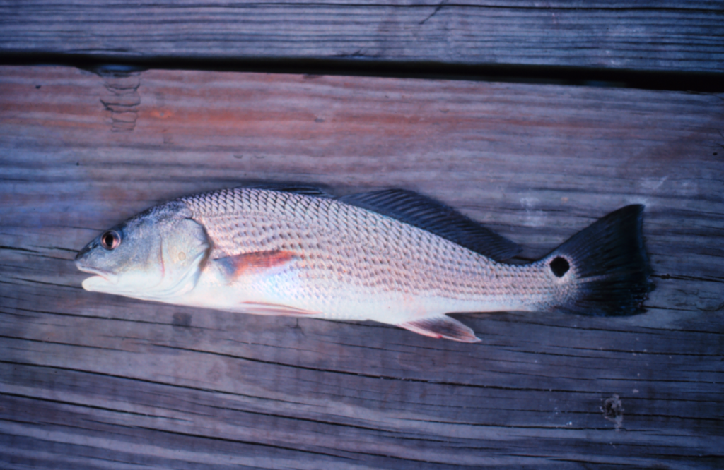
Red Drum are easily identified by their false eyespot located on the tail. Often, the tail and false eyespot break the water surface when red drum feed in shallow water. Shrimp and crabs are favorite food items of hungry red drum. Photo courtesy of NOAA. http://www.photolib.noaa.gov
Cool mornings this week reminded everyone fall is just around the corner. This subtle change in temperature inspires many of us to behave differently. It’s actually enjoyable to be outside again. Now, it’s easier to relax and drink a morning cup of pumpkin spice coffee on the porch or maybe take a brisk evening walk. These slightly cooler days not only announce the end of the dog days of summer but cue the natural world.
One of the most fascinating stories in nature unfolds this time of year. Red Drum or Redfish (Sciaenopsocellatus) are some of the most well-known and easily identified predators of the bay flats and marshes – But did you know these prized game fish can tell time? They don’t have calendars or watches but sense changes in water temperature and to the length of daylight : night time hours. Our calendar says September while their calendar says time to feed, migrate, and reproduce.
In the fish world, reproduction is known as spawning. It takes about three to four growing seasons for a red drum to mature and spawn. A mature four-year-old fish is about 28-inches in total length from head to tip of the tail. This size fish is critical to the continuation of the red drum population. This is one of the main reasons why fisheries managers regulate the number of 27 or 28-inch red drum caught. Limiting the number of this size redfish supports sustainable recruitment so there will be fish for years to come. Learn more about red drum fishing regulations by visiting Florida Fish and Wildlife at http://myfwc.com/fishing/saltwater/recreational/red-drum
When mature, red drum leave the nursery grounds of back bays and bayous and move to inlets and passes. This time of year, groups of spawning red drum may occur in entrances of the bay.
Notable members of Sciaenid or drum fish family include red drum, black drum, Atlantic croaker, and seatrout. Males have muscle fibers they vibrate against their swim bladder. The swim bladder is a hollow air filled sac fish use for buoyancy or depth control. When the muscle “strikes” the hollow sac a drum or drumming noise is created. The larger the fish the greater potential for noise. Male red drum often drum while spawning which generally occurs from sunset to sunrise.
In red drum hatcheries, light and temperature mimic the outside world and control spawning to support stock enhancement programs. In the hatchery, the drumming noise is loud and sounds like a bass drum being struck in rapid succession for about 10 seconds and then repeated. In the natural environment, Sciaenid drumming is so distinctive that researchers use hydrophones to locate and study fish species like seatrout and red drum.
While some fish species take care of their young and produce a few nurtured offspring, red drum overwhelm the odds of survival through shear numbers. During the two month spawning season, red drum spawning aggregations can produce millions of eggs each night. According to Louisiana Sea Grant, one female red drum can produce 1.5 million eggs in one night or 20-40 million per female each spawning season!
Spawning also occurs at the height of tropical storm season. Red drum eggs float on a tiny droplet of biologically produced oil that can be carried long distances by wind, waves, and water. In successful recruitment years, eggs and hatching red drum larvae make a journey into the most protected and productive portions of the bay or estuary in less than a week. Seagrass and submerged shoreline grass provide cover and protection. After rain and storms, adjacent land provides nutrients that naturally fertilize the bay waters. In response, algae and zooplankton bloom just in time to create the perfect first fish food for hatching red drum. The timing of red drum reproduction and survival is precise and elegant!
Juvenile red drum spend their next three to four-years growing to spawning adults, before migrating and starting the reproduction cycle over again.
Quick Facts: According to Texas Parks and Wildlife the oldest red drum ever recorded is 37 years old. The state record in Florida for red drum landed is just over 52 pounds and was caught near Cocoa in Brevard County, FL. A red drum caught in 1984 off the North Carolina coast holds the world record for largest red drum ever caught, 94 pounds!
An Equal Opportunity Institution. UF/IFAS Extension, University of Florida, Institute of Food and Agricultural Sciences, Nick T. Place, dean for UF/IFAS Extension. Single copies of UF/IFAS Extension publications (excluding 4-H and youth publications) are available free to Florida residents from county UF/IFAS Extension offices.
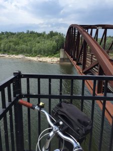
The bridge over the Winooski River was a scenic stop on our bicycle tour. Photo credit: Carrie Stevenson
If you told me earlier this summer that I would “accidentally” bike 18 miles one afternoon, I’d have laughed. I’ve always loved biking, but rarely have time for long distance rides. As part of the mobile workshops for an Extension professional development meeting in Burlington, Vermont, fifteen of us met up with the coordinator of Local Motion, a grassroots bike advocacy organization. Their mission is “to bring the joy of walking and biking within reach for all Vermonters by helping Vermont communities become great places to walk and bike.” The purpose of the tour was to get an on-the-ground lesson in community development and learn how the group has worked with residents to overcome challenges in implementing a successful project.
Burlington’s “Island Line Trail” is a classic rails-to-trails project–not unlike the Blackwater Heritage Trail in Santa Rosa County–that has resulted in significant economic development and increased use by area residents. The original rail service operated from 1899 to the early 1960’s. Since the 1990’s, 14 miles of railway has been converted to a biking/walking trail. Part of the Island Line’s charm is the diversity of scenery it encompasses.
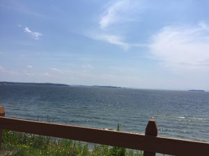
Sweeping views of Lake Champlain were part of what kept us riding far beyond our initial endpoint! Photo credit: Carrie Stevenson
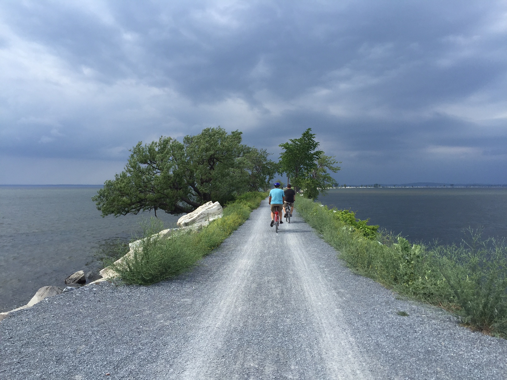
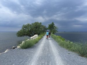
Starting in the heart of downtown Burlington, there are museums, shops, and restaurants within blocks of the trail, many of which cater directly to and exist because of the trail users. The entire stretch runs adjacent to Lake Champlain, providing scenic views along the path. Throughout the trail there are residential areas (which are highly desired because of their proximity to the trail), public parks, and a community center. After crossing a bridge over the Winooski River, we embarked upon a 3-mile open causeway with sweeping views of Malletts Bay on both sides. The trail also includes one of the country’s few bike ferries, which is located where a swing bridge used to operate for the railway. It was the constantly changing scenery and surroundings that kept a handful of us going far beyond the initially planned 6-mile trip.
The causeway over Malletts Bay includes a bike ferry, one of the few in the country. Photo credit, Carrie Stevenson
In addition to providing a recreational trail for local residents and visitors, Local Motion is dedicated to promoting bicycle safety and education. Workshops for hesitant adult bikers interested in biking more attracted over 450 adults last year, while 7,300+ kids participated in bicycle safety camps and training. As a result of all of the activity, youth bike rentals increased by 43% in 2015 over the prior year.
Much of the success in Burlington is transferable to Florida. In the Panhandle, we are looking at connecting existing trails to create a large-scale multi-county, multi-state bicycle trail. The successes in Vermont were inspirational and instructional as we embark upon our new project and a design workshop in late September.