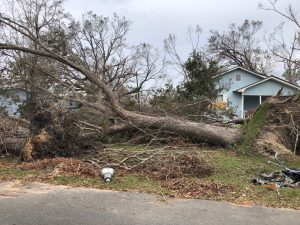
This tree was downed during Hurricane Michael, which made a late-season (October) landfall as a Category 5 hurricane. Photo credit: Carrie Stevenson, UF IFAS Extension
There are a lot of jokes out there about the four seasons in Florida—instead of spring, summer, fall, and winter; we have tourist, mosquito, hurricane, and football seasons. The weather and change in seasons are definitely different in a mostly-subtropical state, although we in north Florida do get our share of cold weather (particularly in January!).
All jokes aside, hurricane season is a real issue in our state. With the official season about to begin (June 1) and running through November 30, hurricanes in the Gulf-Atlantic region are a legitimate concern for fully half the calendar year. According to records kept since the 1850’s, our lovely state has been hit with more than 120 hurricanes, double that of the closest high-frequency target, Texas. Hurricanes can affect areas more than 50 miles inland, meaning there is essentially no place to hide in our long, skinny, peninsular state.
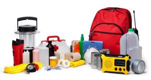
A disaster supply kit contains everything your family might need to survive without power and water for several days. Photo credit: Weather Underground
I point all these things out not to cause anxiety, but to remind readers (and especially new Florida residents) that is it imperative to be prepared for hurricane season. Just like picking up pens, notebooks, and new clothes at the start of the school year, it’s important to prepare for hurricane season by firing up (or purchasing) a generator, creating a disaster kit, and making an evacuation plan.
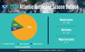
A summary infographic showing hurricane season probability and numbers of named storms predicted from NOAA’s 2024 Atlantic Hurricane Season Outlook. (Spanish version) (Image credit: NOAA)
Peak season for hurricanes is September. Particularly for those in the far western Panhandle, September 16 seems to be our target—Hurricane Ivan hit us on that date in 2004, and Sally made landfall exactly 16 years later, in 2020. But if the season starts in June, why is September so intense? By late August, the Gulf and Atlantic waters have been absorbing summer temperatures for 3 months. The water is as warm as it will be all year, as ambient air temperatures hit their peak. This warm water is hurricane fuel—it is a source of heat energy that generates power for the storm. Tropical storms will form early and late in the season, but the highest frequency (and often the strongest ones) are mid-August through late September. We are potentially in for a doozy of a season this year, too–NOAA forecasters are predicting a very active season, including up to 25 named storms. According to a recent article from Yale Climate Connections, Gulf waters are hotter this May than any year since oceanographers started measuring it in 1981.
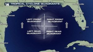
The front right quadrant of a hurricane is the strongest portion of a storm. Photo credit: Weather Nation
If you have lived in a hurricane-prone area, you know you don’t want to be on the front right side of the storm. For example, here in Pensacola, if a storm lands in western Mobile or Gulf Shores, Alabama, the impact will nail us. Meteorologists divide hurricanes up into quadrants around the center eye. Because hurricanes spin counterclockwise but move forward, the right front quadrant will take the biggest hit from the storm. A community 20 miles away but on the opposite side of a hurricane may experience little to no damage.
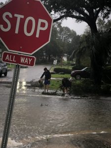
Flooding and storm surge are the most dangerous aspects of a hurricane. Photo credit: Carrie Stevenson, UF IFAS Extension
Hurricanes bring with them high winds, heavy rains, and storm surge. Of all those concerns, storm surge is the deadliest, accounting for about half the deaths associated with hurricanes in the past 50 years. Many waterfront residents are taken by surprise at the rapid increase in water level due to surge and wait until too late to evacuate. Storm surge is caused by the pressure of the incoming hurricane building up and pushing the surrounding water inland. Storm surge for Hurricane Katrina was 30 feet above normal sea level, causing devastating floods throughout coastal Louisiana and Mississippi. Due to the dangerous nature of storm surge, NOAA and the National Weather Service have begun announcing storm surge warnings along with hurricane and tornado warnings.
For helpful information on tropical storms and protecting your family and home, look online here for the updated Homeowner’s Handbook to Prepare for Natural Disasters, or reach out to your local Extension office for a hard copy.
- Hurricane Season 2025 - July 7, 2025
- The Striped Burrfish - April 11, 2025
- The Value of Biodiversity - March 28, 2025
