by Carrie Stevenson | Jul 7, 2025

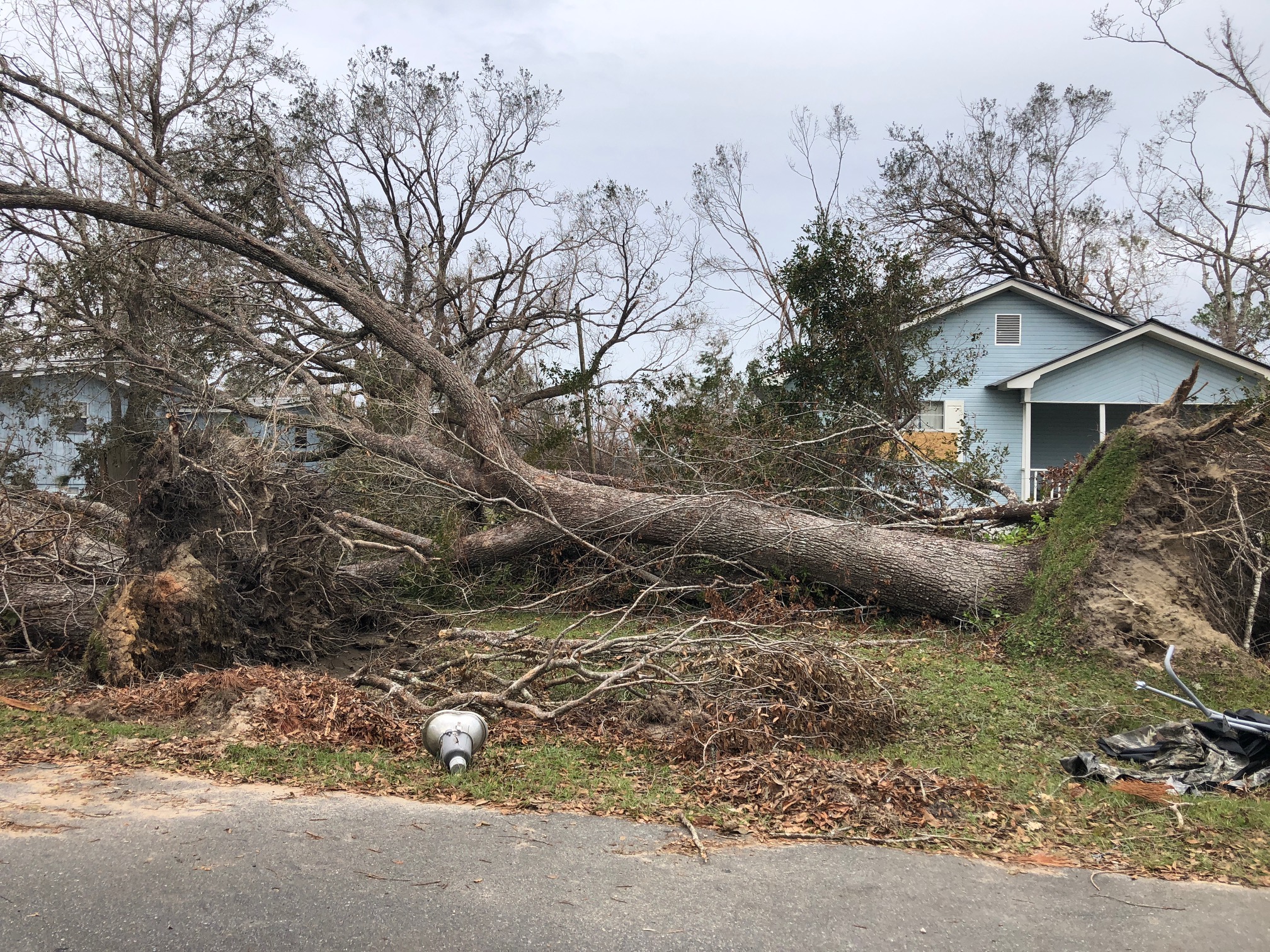
This tree was downed during Hurricane Michael, which made a late-season (October) landfall as a Category 5 hurricane. Photo credit: Carrie Stevenson, UF IFAS Extension
There are plenty of jokes about the four seasons in Florida—in place of spring, summer, fall, and winter; we have tourist, mosquito, hurricane, and football seasons. The weather and change in seasons are definitely different in a mostly-subtropical state, although we in north Florida do get our share of cold weather (remember that snow this year?!).

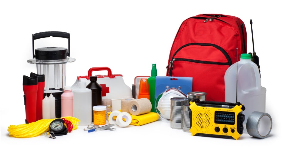
A disaster supply kit contains everything your family might need to survive without power and water for several days. Photo credit: Weather Underground
All jokes aside, hurricane season is a real issue in our state. With the official season having recently begun (June 1) and running through November 30, hurricanes in the Gulf-Atlantic region are a legitimate concern for fully half the calendar year. According to records kept since the 1850’s, Florida has been hit with more than 120 hurricanes, double that of the closest high-frequency target, Texas. Hurricanes can affect areas more than 50 miles inland, meaning there is essentially no place to hide in our long, skinny, peninsular state.
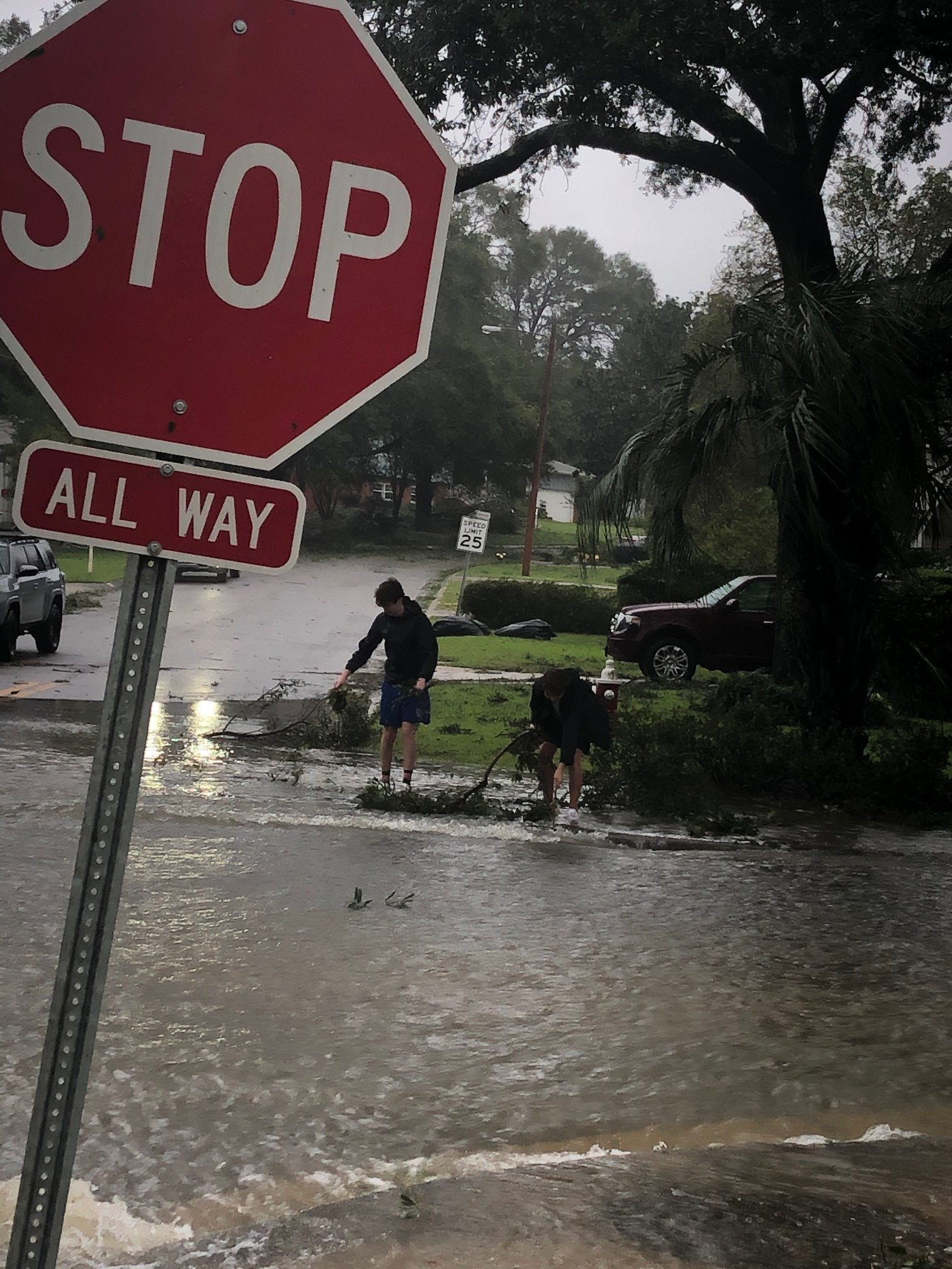
Flooding and storm surge are the most dangerous aspects of a hurricane. Photo credit: Carrie Stevenson, UF IFAS Extension
I point all these things out not to cause anxiety, but to remind readers (and especially new Florida residents) that is it imperative to be prepared for hurricane season. Just like picking up pens, notebooks, and new clothes at the start of the school year, it’s important to prepare for hurricane season by firing up (or purchasing) a generator, creating a disaster kit, and making an evacuation plan. We even have disaster preparedness sales tax exempt holidays in Florida; one in early June and another in the heart of the season, August 24-September 6.
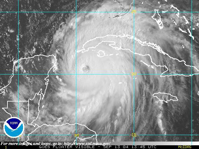
Peak season for hurricanes is September. Particularly for those in the far western Panhandle, September 16 seems to be our target—Hurricane Ivan hit us on that date in 2004, and Sally made landfall exactly 16 years later, in 2020. But if the season starts in June, why is September so intense? By late August, the Gulf and Atlantic waters have been absorbing summer temperatures for 3 months. The water is as warm as it will be all year–in 2023 even reaching over 100 degrees Fahrenheit–as ambient air temperatures hit their peak. This warm water is hurricane fuel—it is a source of heat energy that generates power for the storm. Tropical storms will form early and late in the season, but the highest frequency (and often the strongest ones) are mid-August through late September.
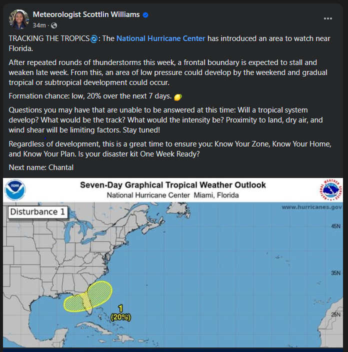
Pay attention to local meteorologists on social media, news, and radio. This alert was posted just yesterday online by the Escambia County Emergency Management Coordinator.
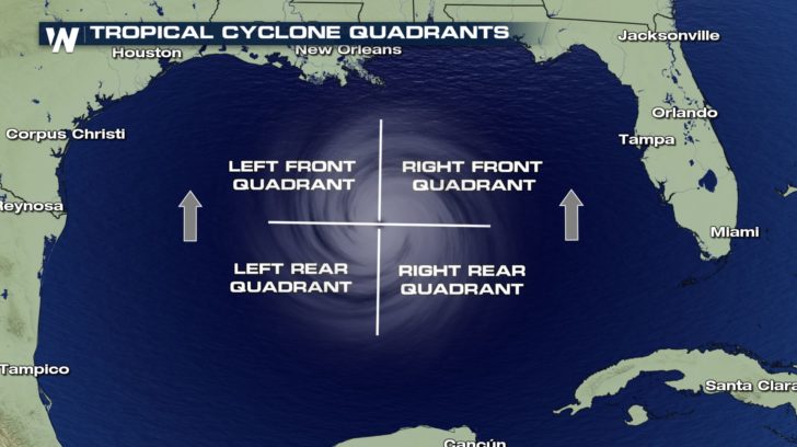
If you have lived in a hurricane-prone area, you know you don’t want to be on the front right side of the storm. For example, here in Pensacola, if a storm lands in western Mobile or Gulf Shores, Alabama, the impact will nail us. Meteorologists divide hurricanes up into quadrants around the center eye. Because hurricanes spin counterclockwise but move forward, the right front quadrant will take the biggest hit from the storm. A community 20 miles away but on the opposite side of a hurricane may experience little to no damage.

The front right quadrant of a hurricane is the strongest portion of a storm. Photo credit: Weather Nation
Hurricanes bring with them high winds, heavy rains, and storm surge. Of all those concerns, storm surge is the deadliest, accounting for about half the deaths associated with hurricanes in the past 50 years. Many waterfront residents are taken by surprise at the rapid increase in water level due to surge and wait until too late to evacuate. Storm surge is caused by the pressure of the incoming hurricane building up and pushing the surrounding water inland. Storm surge for Hurricane Katrina was 30 feet above normal sea level, causing devastating floods throughout coastal Louisiana and Mississippi. Due to the dangerous nature of storm surge, NOAA and the National Weather Service have begun announcing storm surge warnings along with hurricane and tornado warnings.
For helpful information on tropical storms and protecting your family and home, look online here for the updated Homeowner’s Handbook to Prepare for Natural Disasters, or reach out to your local Extension office for a hard copy.
by Rick O'Connor | Jun 20, 2025
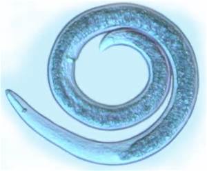
Snails and slugs belong to one of the largest phyla of animals on the planet – the mollusks. Mollusks are known for their calcium carbonate shells and seashell collecting along the shoreline has been a popular hobby for centuries. There are an estimated 50,000 to 200,000 species of mollusk worldwide. One group – the gastropods – have an estimated 40,000 to 100,000 species alone. This is the group that includes the snails and slugs.
Snails are soft-bodied creatures who produce a single, usually coiled, shell in which they live. The coiled shell has an opening called the aperture through which they can extend some, or most of their body. The elongated soft body “slugs” across the sea bottom searching for food which could be vegetation for some – like the small nerite snails found in our bays, or animals – like the venomous cone snails, or detritivores – like the periwinkle snails.
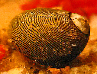
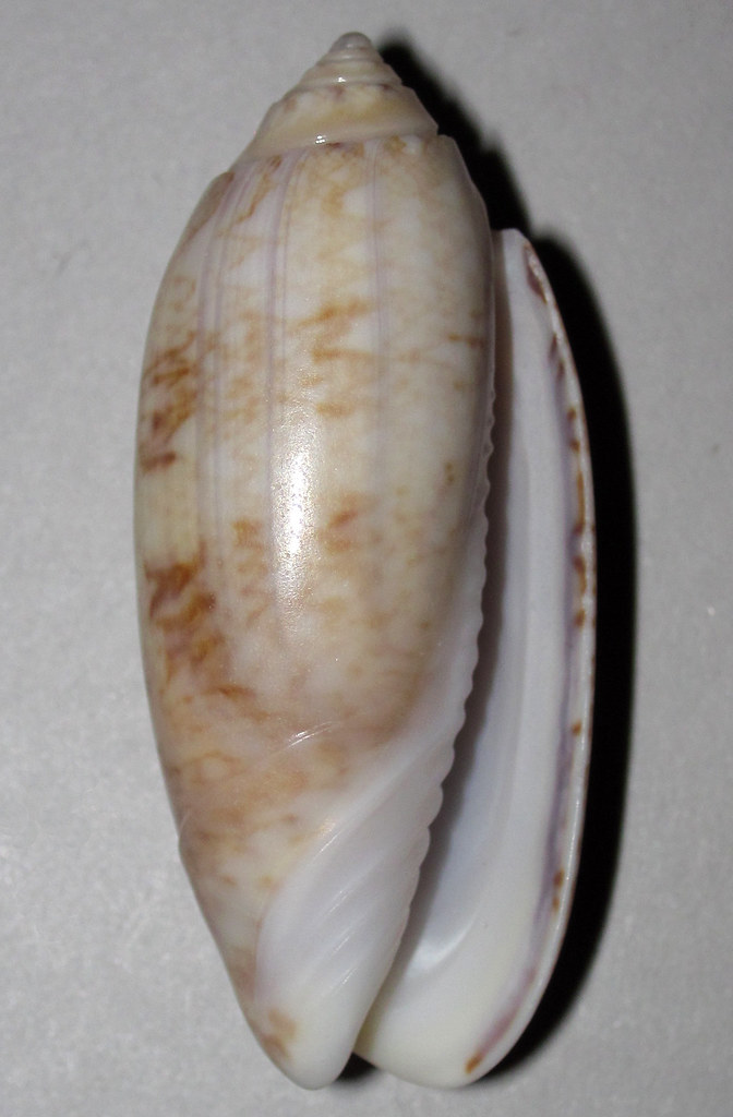
The Olive Nerite.
Photo: Wikipedia.
Many species of local snails produce egg cases in which they deposit their developing eggs. These are often found while people are beach combing. The most frequently encountered locally are the tube-shaped clusters of the oyster drill, the coin shaped chain of the lightning whelk, and the one that – to me – resembles the top of a vase or jar belonging to the moon snail.
The egg case of the Lightning Whelk.
Photo: Project Noah
The variety of snails found in the northern Gulf is immense – so, we will cover only a few of the more common.
Walking along the Gulf side, gazing down at the shells of snails washed ashore, one often finds the small ceriths. These tiny, elongated shells are small and look like a canine tooth. These are herbivores and detritivores.
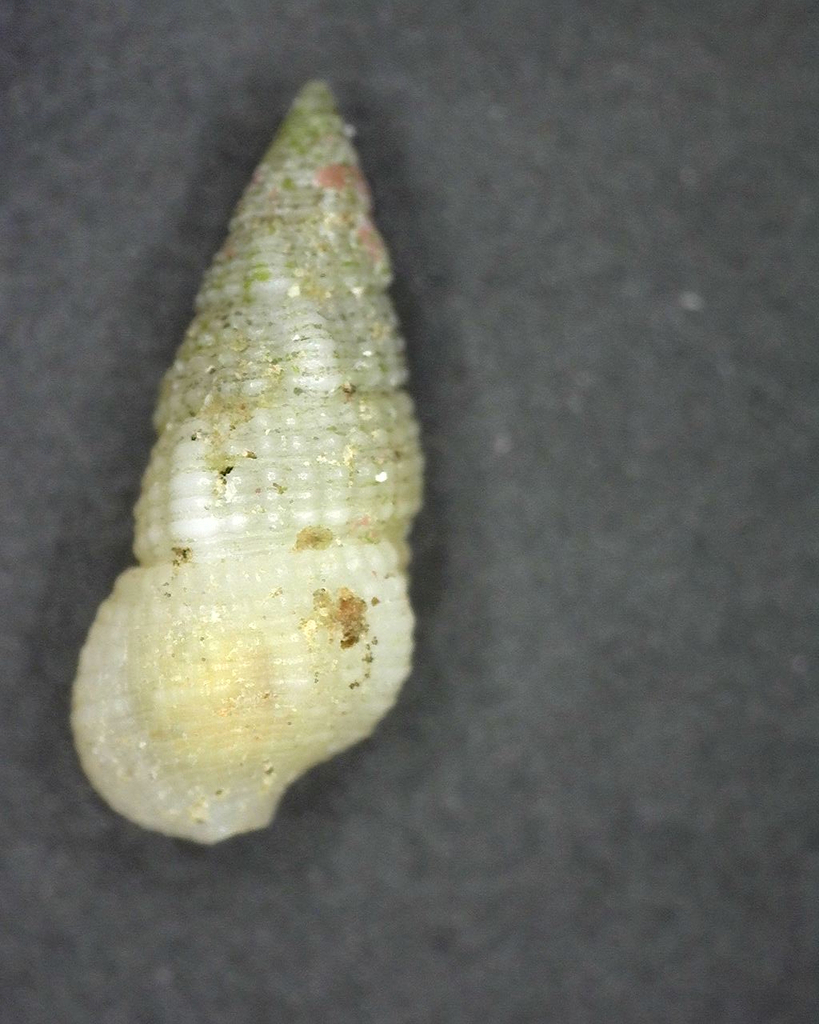
Cerith
Photo: iNaturalist
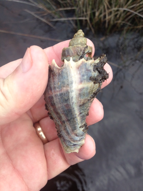
The Florida Fighting Conch is often found – but not always in whole condition. This is a true conch and herbivorous.
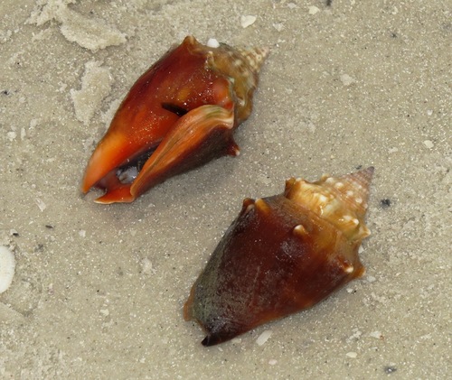
Florida Fighting Conch
Photo: iNaturalist
One not as common while beachcombing, but more common while snorkeling is the olive snail. These are fast burrowing snails that feed on bivalves and carrion they may find. I often find trails crisscrossing the sandy bottom made by these snails just off the beach.
Olive snail
Photo: Flickr
Over on the bay side of the barrier islands you have a better chance of finding live snails. One of the more common in the salt marshes is the marsh periwinkle. This small roundish snail is often seen on the extended leaves of the marsh grasses. It is here during high tide to avoid predators such as blue crabs and diamondback terrapins. At low tide they will descend to the muddy bottom and feed on detritus.
The marsh periwinkle is one of the more common mollusk found in our salt marsh. Photo: Rick O’Connor
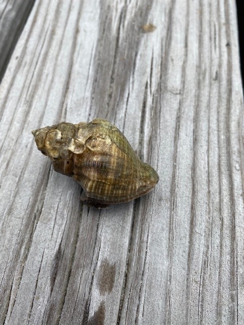
The crown conch is another frequently seen estuarine snail. With spines extending from the top whorl – it appears to have a crown, and where its common name comes from. These are predators of the bay feeding on other mollusks such as periwinkles and oysters.
The white spines along the whorl give this snail its common name – crown conch.
Photo: Rick O’Connor
The oyster drill shell is one of the more common shells you find hermit crabs in, but the snails are out there as well. As the name implies, they use a tooth like structure called a radula to bore into other mollusk shells to feed. They are particularly problematic for non-moving oysters – and where they got their common name from.
The shell of the oyster drill.
Photo: Rick O’Connor
The only slug I have encountered on our beaches is the sea hare. These slugs can be a greenish or brownish color and are about six inches in length. They lack an external shell but do not move much faster than their snail cousins. They feed on a variety of seaweeds and the color of their skin mimics the seaweeds they are feeding on. Lacking a shell, they produce a toxin in their skin to repel would be predators. They also release ink like the squid and octopus cousins.
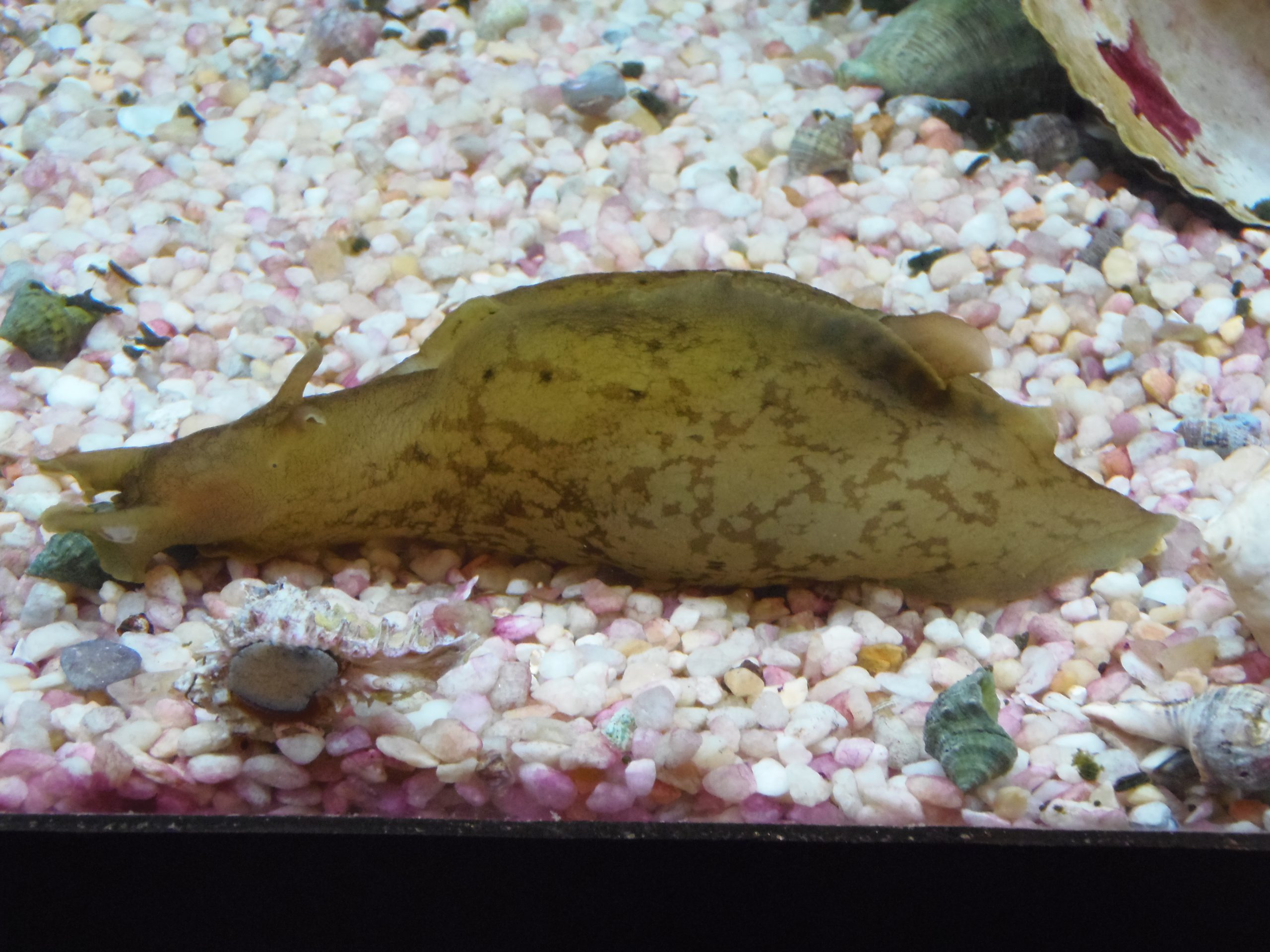
A common sea slug found along panhandle beaches – the sea hare.
This narrative only scratches the surface of the world of snails and slugs in this part of the world. Creating a check list of species and then seeing if you can find them all is great fun.
References
The Mollusca. Sea Slugs, Squids, Snails, and Scallops. University of California at Berkley. https://ucmp.berkeley.edu/taxa/inverts/mollusca/mollusca.php#:~:text=Mollusca%20is%20one%20of%20the,scallops%2C%20oysters%2C%20and%20chitons..
Gastropods. University of Texas San Antonio. https://www.utsa.edu/fieldscience/gastropod_info.htm#:~:text=Gastropods%20are%20another%20type%20of,of%20the%20entire%20Mollusca%20phylum..
by Rick O'Connor | May 16, 2025
As far as familiarity goes – everyone knows about worms. As far as seeing them – these are rarely, if ever seen by visitors to the northern Gulf. Most know worms as creatures that live beneath the sand – out of sight and doing what worms do. We imagine – scanning the landscape of the Gulf – millions of worms buried beneath the sediment. For some this may be quite unnerving. Worms are sometimes “gross” and associated with an unhealthy situation. You might say to your kids “don’t dig in the sand – you might get worms”. Or even “don’t drink the water – you might get worms”. But the reality of it all is that there are many kinds of worms in the northern Gulf, and many are very beneficial to the system. We will look at a few.
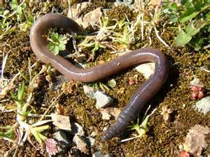
The common earthworm.
Photo: University of Wisconsin Madison
Flatworms are the most primitive of the group. As the name implies, they are flat. There is a head end, often with small eyespots that can detect light, but the mouth is in the middle of the body and, like the jellyfish, is the only opening for eating and going to the restroom. There are numerous species of flatworms that crawl over the ocean floor feeding on decayed detritus, many are brightly colored to advertise the fact they are poisonous – or pretending to be poisonous. And then there are species that actually swim – undulating through the water in a pattern similar to what we do with our hand when we stick it out the window driving at high speed.
But there are parasitic flatworms as well. Worms such as the tapeworm and the flukes are more well known than the free-swimming flatworms just described. These are the worms people become concerned about when they hear “there are worms out there”. And yes – they do exist in the northern Gulf. But what some people may not realize is that these internal parasites are adapted for the internal environment of their selected host and cannot survive in other creatures. There are human tapeworms and flukes, but they are not found in the sands of the Gulf.
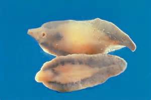
The human liver fluke. One of the trematode flatworms that are parasitic.
Photo: University of Pennsylvania
As the name implies, roundworms are round – but they differ from earthworms in that their bodies are smooth and not segmented as earthworms are. One group of roundworms is well known in the agriculture and horticulture world – nematodes. Some nematodes are also known for being human parasites – again, creating some concern. These include the hookworm and pinworm. Roundworms can be found in the sediments by the thousands – sometimes in the millions. The abundance of some species are used as an indicator of the health of the system – the more of these particular type of roundworms, the more unhealthy the system – again, a cause of concern for some when they see any worm in the sand.
The round body of a microscopic nematode.
Photo: University of Nebraska at Lincoln
We will end with the segmented worms – the annelids. This is the group in which the familiar earthworm belongs. Though earthworms do not exist in the northern Gulf, their cousins – the polychaetae worms – are very common. Polychaetas are much larger, easier to see, and differ from earthworms in that they have extended legs from each segment called parapodia. Some polychaetas produce tubes in which they live. They will extend their antenna out to collect food. Many of these tubeworms have their tubes beneath the sand and we only see them (rarely) when their tentacles are extended – or when they extend a gelatinous mass from their tubes to collect food. But there is a type of tubeworm – the sepurlid worms – that produce small skinny calcium carbonate tubes on the sides of rocks on rock jetties, pier pilings, and even marine debris left in the water. This is also the group that the leech belongs to. Though leeches are more associated with freshwater, there are marine leeches. These are rarely encountered and do not attach to humans as their freshwater cousins do.
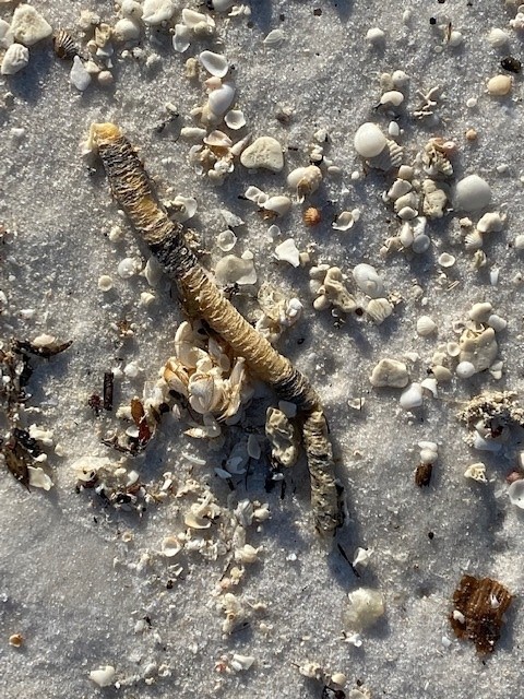
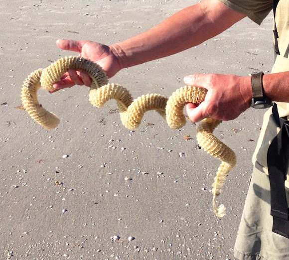
Diopatra are segmented worms similar to earthworms who build tubes to live in. These tubes are often found washed up on the beach.
Though we may be “creeped-out” about the presence of worms in the northern Gulf of Mexico, they are none threatening to us and are an important member of the marine community cleaning decaying creatures and waste material from the environment. We know they are there, and glad they are there.
by Dana Stephens | May 12, 2025
Spring is a time of change. Spring brings changes in our waters as well. Some of these changes are visible on top of the water and cause concern among water users and viewers. Let’s dispel some of these concerns associated with the spring season.
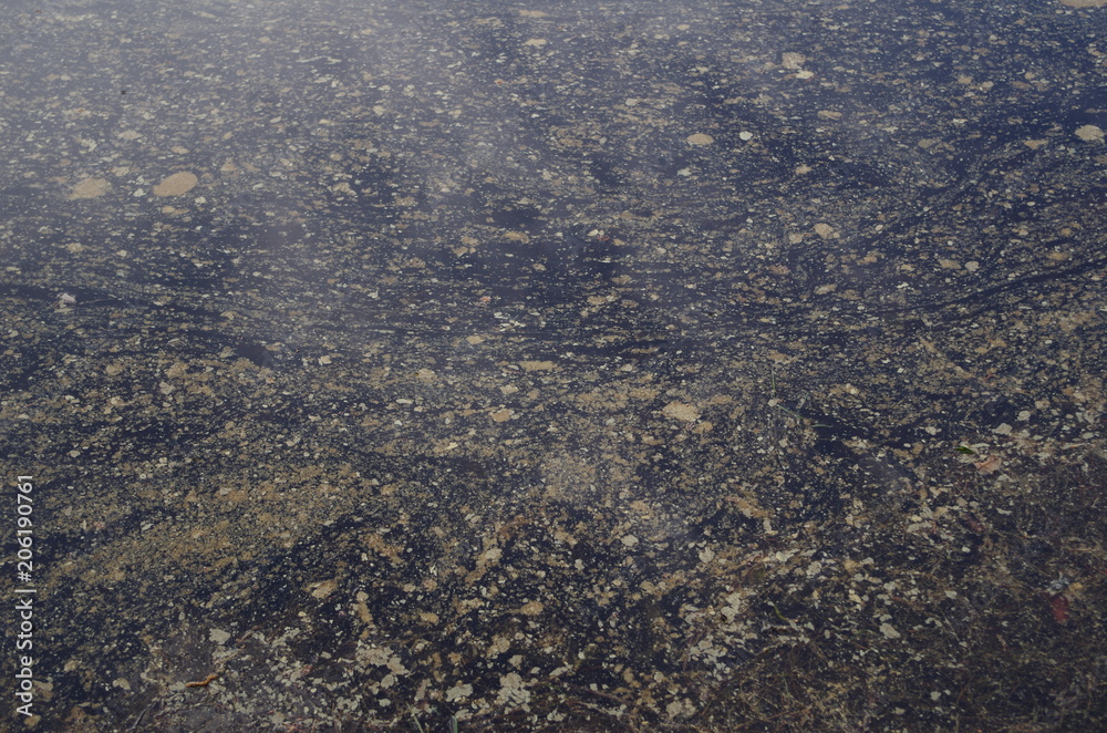
Sometimes, water users and viewers notice what appears to be oil floating on top of the water. Could this be oil? Potentially. Could this not be oil? Most likely. Plants perish, and decomposition occurs, typically during the spring and fall seasons of the year. Much of the decomposition that happens in spring is associated with the initial growth and development of plants. Bacteria living in the soils within and around the water break down the perished plants. These bacteria are decomposing the old plant material. The waste product produced from the bacteria’s decomposition of the old plant material is an oily substance. The oily sheen on the water is a waste product of bacteria. Frequently, the oil accumulates in portions of water where there is little to no water movement. As the decomposition process completes, the oily sheen should lessen over the next few days to weeks. This bacteria-produced oil from decomposition is a natural process.
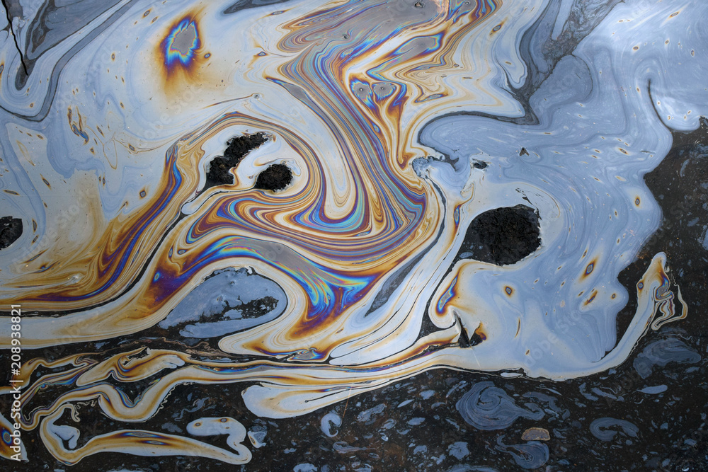
Petroleum-based oil seen on water is not a natural process. Petroleum-based oil could enter water from various sources, such as but not limited to transportation spills, stormwater runoff, and improper disposal of products containing oil. Like the oily substances produced by bacteria during decomposition, petroleum-based oils will float on top of the water and accumulate where there is little to no water movement.
Here are some tips to identify the difference between oils in water:
|
Bacteria-produced Oil |
Petroleum-based Oil |
| Appearance |
Oily sheen on top of water with little to no difference in color throughout |
Oily sheen on top of water with differences in color throughout (may even appear like a rainbow) |
| Touch
(use a stick) |
When disturbed, the sheen breaks away easily with irregular patterns and does not reform. The oil will not adhere to the stick. |
When disturbed, the sheen swirls, elongates, and does reform. The oil may adhere to the stick. |
| Odor
(not always present) |
Strong organic, musty, or earthy smell. |
Volatile organic compounds (VOCs) smelling like gasoline or diesel fuel. |
Another sheen on our waters that is frequent during Florida’s springtime is pollen. Pine, tree, and weed pollen accumulate on top of water, especially in areas with little or no water movement. If the sheen on the water is yellow, orange, or sometimes white, this is most likely due to pollen. Think about how pollen shows on a car in Florida during spring…our waters can show the same to some extent.
Let’s give it a try! See if you can identify the sheens in water in each photo—answers at the bottom of the page.
Photo 1

Photo 2

Photo 3
Photo 4
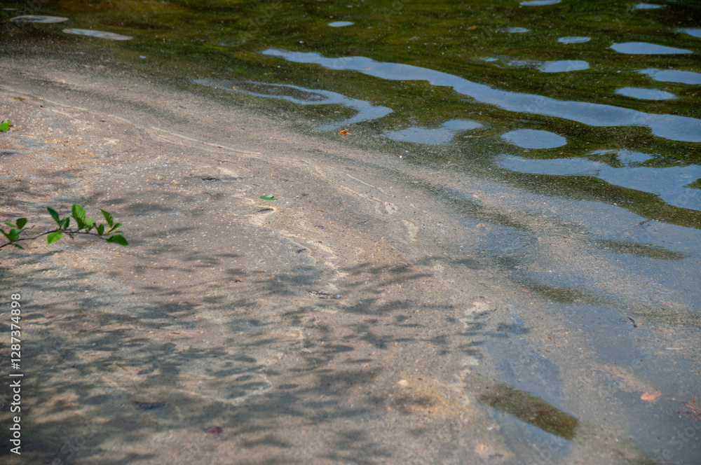
Photo 5

Photo 6
Keep Scrolling For Answers!
.
.
.
.
.
.
PHOTO ANSWERS: Photo 1: Bacteria-produced oil sheen. Photo 2: Pollen sheen. Photo 3: Petroleum-based oil sheen. Photo 4: Pollen sheen. Photo 5: Petroleum-based oil sheen. Photo 6: Mixture of bacteria-produced oil and pollen sheen. Note all photos were obtained from Adobe Stock Photos.
by Rick O'Connor | May 2, 2025
Many of the creatures we have written about in this series to this point are ones that very few people have ever heard of. But that is not the case with jellyfish. Everyone knows about jellyfish – and for the most part, we do not like them. These are the gelatinous blobs with trailing tentacles filled with stinging cells that cause pain and trigger the posting of the purple warning flags at the beach. They are creatures that many place in the same class as mosquitos and venomous snakes – why do such creatures even exist. But exist they do and there are plenty in the northern Gulf – more than you might be aware of.
Jellyfish are common on both sides of the island. This one has washed ashore on Santa Rosa Sound.
The ones we are familiar with are those that are gelatinous blobs with trailing tentacles – called medusa jellyfish. These include the common sea nettle (Chrysaora). Sea nettles have bells about 4-8 inches in diameter (though they are larger offshore). The bell has extended triangle markings that appear red and tentacles that can extend several feet beneath/behind the bell. The tentacles are armed with nematocyst – cells that contain a coiled “harpoon” which has a drop of venom at the tip. They use these nematocyst to kill their prey – which include small fish, zooplankton, and comb jellies. But they are also triggered when humans bump into them producing a painful sting. Their prey is digested in a sack-like stomach called the gastrovascular cavity and waste is expelled through their mouth, because they lack an anus. Though these animals can undulate their bells and swim, they are not strong enough to swim against currents and tides – and thus are more planktonic in nature.
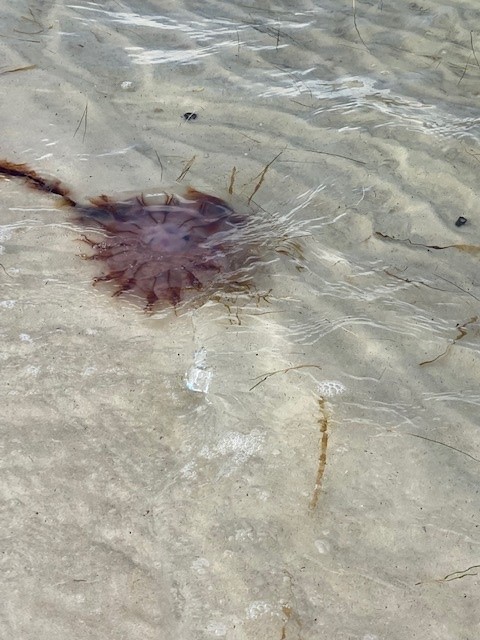
Another familiar jellyfish is the moon jelly (Aurelia). These are the larger, saucer shaped jellyfish that resemble a pizza with a clover leaf looking structure in the middle. They can reach 24 inches in diameter across the bell which is often seen undulating trying to swim against the current and tide. Their tentacles are very short – extending from the rim of the bell – but there are four large oral arms that are quite noticeable. The oral arms also possess nematocyst for killing prey. Their prey includes mostly zooplankton and other jellyfish. Like their cousins the sea nettles, moon jellies are planktonic in nature and are often found washed ashore during high energy days. Some say the pain from this jellyfish is minimal, others feel a lot of pain.
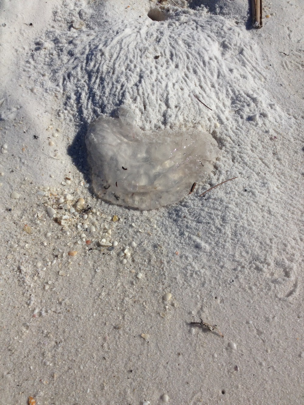
The remnants of moon jellyfish near a ghost crab hole.
Photo: Rick O’Connor
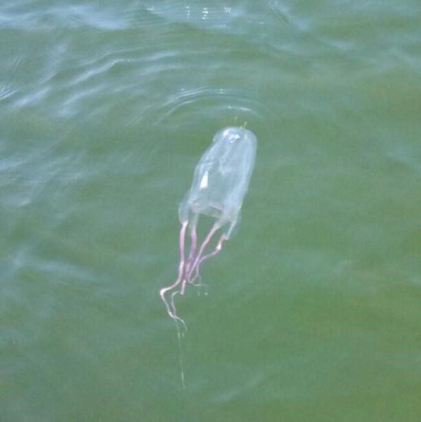
Though there are many others, our final familiar jellyfish would be the Portuguese man-of-war (Physalia). If you have never seen one, you most likely have heard of them. These are easy to identify. They produce a bluish colored gas filled balloon like sack that floats on the surface and extends above water to act as a “sail”. This gas filled sack is called a pneumatophore and helps move the animal across the Gulf. Extending down from this pneumatophore are numerous purple to blue to clear colored tentacles. You would think the pneumatophore would be the bell of the jellyfish and the tentacles of similar design as to the ones we mentioned above – but that would be incorrect. The tentacles are actually a colony of small polyp jellyfish connected together – it is not a true jellyfish (as we think of them). The stomachs of these individual polyps are connected and as one kills and feeds, the food passes throughout the colony to nourish all. In order to feed the whole colony, you need larger prey. To kill larger prey, you need a more toxic venom, and PMOW do have a very strong toxin. The sting from this animal is quite painful – though rare, it has even killed people. This jellyfish should be avoided. As with other jellyfish, they often wash ashore, and their stinging cells can still be triggered. Do not pick them up.
There is another form of jellyfish found here that is not as well known. They may be known by name, but not as jellyfish. They are called polyp jellyfish and instead of having an undulating bell with tentacles drifting behind, they are attached to the seafloor (or some other structure) and extend their tentacles upward. They look more like flowers and do not move much. Examples of such jellyfish include the tiny hydra, sea anemones, and corals. As with their medusa cousins, they do have nematocysts in their tentacles and can provide a painful sting, though some produce a mild toxin, and the sting is not as painful as other jellyfish. Many of these polyp jellyfish are associated with coral reefs. Though coral reefs are common in tropical waters, they do occur to a lesser extent in the northern Gulf.
The polyp known as Hydra.
Photo: Harvard University.
We will complete this article with a group of jellyfish that do not have nematocysts and, thus, do not sting – the comb jellies. Though many species of comb jellies have trailing tentacles, the local species do not. When I was young, we called them “football jellyfish” because of their shape – and the fact that you could pick them up and throw them to your friends. I have also heard them called “sea walnuts” because of their shape. A close look at this jellyfish you will see eight grooves running down its body. These grooves are filled with a row of cilia, small hairlike structures that can be moved to generate swimming. The cilia move in a way that they resemble the bristles of a comb we use for combing our hair. You have probably taken your thumb and run it down your comb to see the bristles bend down and back into position – sort of like watching the New York Rockettes high kick from one end of their line to the other – this is what the cilia look like when they are moving within these grooves – and give the animal its common name “comb jelly”. Since they do not have nematocysts, they are in a different phylum than the common jellyfish. They feed on plankton and each other and can produce light – bioluminescence – at night.
Though not loved by swimmers in the northern Gulf, jellyfish are interesting creatures and beautiful to watch in public aquaria. They have their bright side.
Comb jellies do not sting and they produce a beautiful light show at night.
References
Atlantic Sea Nettle. Aquarium of the Pacific. https://www.aquariumofpacific.org/onlinelearningcenter/species/atlantic_sea_nettle1.
Moon Jellyfish. Animal Diversity Web. University of Michigan Museum of Zoology. https://www.aquariumofpacific.org/onlinelearningcenter/species/atlantic_sea_nettle1.
by Rick O'Connor | Apr 25, 2025
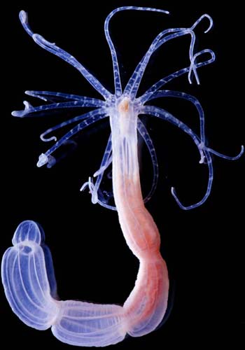
Everyone has heard of sponges, and many know they grow in the ocean. But fewer are aware that sponges are actually animals. When we think of animals, we think of something that crawls around seeking food and laying eggs periodically. Sponges are not like that. They are “blob” looking creatures sitting on the ocean floor. At first glance you might call them fungi, or maybe some weird form of algae – but they are animals, the simplest form of animal life on the planet.
A vase sponge.
Florida Sea Grant
What makes them animals is the lack of cell walls and chlorophyll. Fungi also lack chlorophyll, but they do possess cell walls – so, are classified differently. Because animals lack chlorophyll they cannot produce their own food – and must consume creatures in order to obtain their needed sugars. So, what do sponges “hunt”? They feed on plankton in the water column – many of the microscopic creatures we have already written about in this series.
The sponge body is basically a colony of individual ameboid and flagellated cells. These small cells attach to the substrate and begin to reproduce sexually and asexually to form the colony. As they grow, they form a series of pores found on the exterior of the mass. The flagellated cells – called collar cells – move their flagella to generate a current. This current draws in seawater – along with its plankton – where the colony, both the flagellated and ameboid cells, feed. As the colony grows the exterior pores lead to channels and canals where the cells live and eventually empty into a larger cavity known as the atrium. Here the water moves upward and exits the sponge through an opening called the osculum. Waste from feeding exits the sponge through the osculum as well.
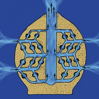
The anatomy of a sponge.
Flickr
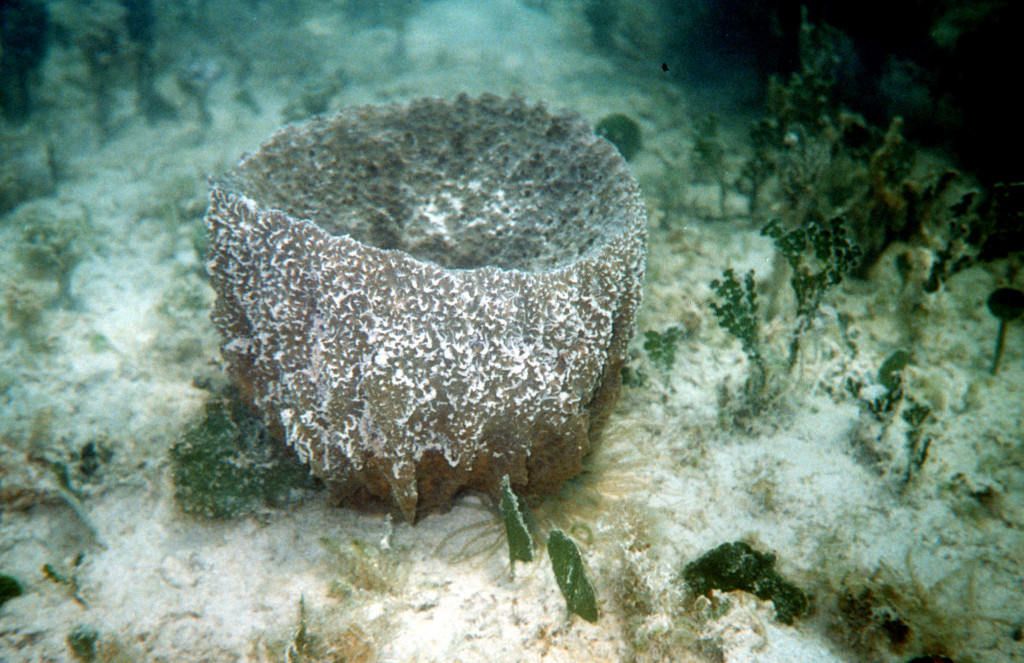
As the colony grows it is supported by a series of tiny spike-like structures called spicules. Spicules are made of different materials and are one method of separating and classifying the different sponges. One group of sponges are known as the calcareous sponges – their spicules are made of calcium carbonate and are rough to the touch. Another group are known as the “glass” sponges – their spicules are made of silica and are sharp-prickly to the touch. A third group are known as the bath sponges – their spicules are made of a softer material called spongin. It is this third group that was used for centuries for both bathing and washing.
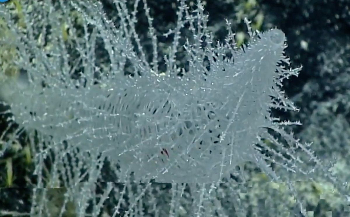
Glass sponges are beautiful.
Photo: NOAA
These simple creatures play an important role in the ecology of marine systems. As filter feeders, they remove material from the water column improving water clarity and quality. They remove excess nitrogen and play a role in the carbon cycle. They provide habitat for numerous small marine creatures where they can hide from predators and find food.
Sponges need a hard substrate to grow on and thus are more abundant in the coral reefs of south Florida. Locally I have only found them in the seagrass beds. But there they do play the same ecological role you would find them doing on coral reefs. They are one of the less encountered creatures of the northern Gulf.