Kayaking over seagrass beds and stingrays, hiking among pitcher plants, boating past diving ospreys, and meeting hundreds of fascinating, like-minded people—these are just some of the great experiences I’ve had while teaching the Florida Master Naturalist Program. More than 20 years since its inception, the Florida Master Naturalist Program (FMNP) has inspired the creation of dozens of similar courses in other states and proven itself to be one of the most popular outreach programs to come out of UF IFAS Extension.
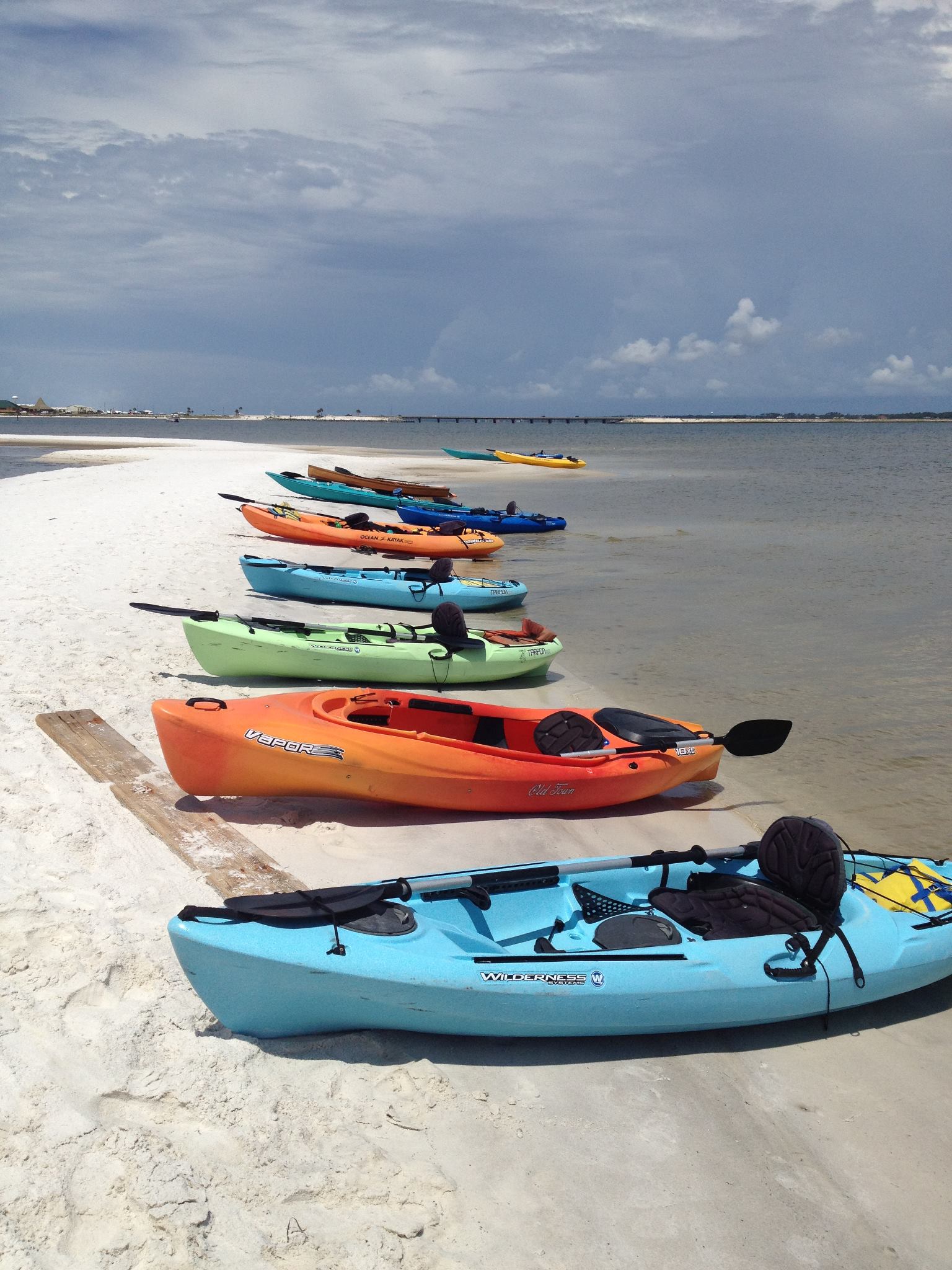
Kayaking Santa Rosa Sound in Navarre is one of the highlights of our Coastal Systems FMNP class. Photo credit: Carrie Stevenson, UF IFAS Extension
The mission of the FMNP is simple—to promote awareness, understanding, and respect of Florida’s natural world among Florida’s citizens and visitors. I have always felt strongly that if you want people to care about something, they need to understand it. And to really understand something, you need to experience it. I know my own passion for science and ecology was ignited early on by teachers who took us outside and helped us encounter the many wondrous surprises in the natural world. With the FMNP, we seek to do just that.
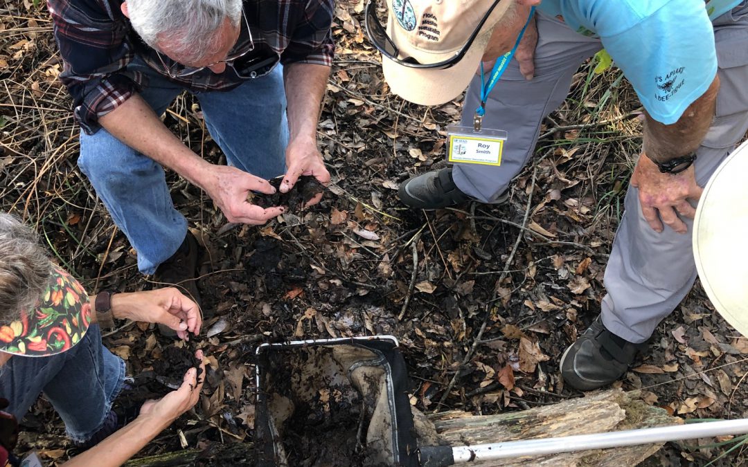
Master Naturalist students conduct field work in small groups. Photo credit: Carrie Stevenson, UF IFAS Extension
Over a span of 40 hours in 6-7 weeks, we spend about half our time with classroom presentations and the other half in the field, seeing the plants, animals, and ecosystems we discuss in class. In addition to classes and field trips, students produce a final project and present it to the class. These can range from labeled collections and slide presentations to building bird houses and new trails. The program is composed of three 40-hour core courses; Coastal, Upland, and Freshwater Systems. Seven “short courses” with 24 hours of class/field time include the Land Steward series (Conservation Science, Habitat Evaluation, Wildlife Monitoring, and Environmental Interpretation) and the Restoration courses (Coastal Restoration, Marine Habitat Restoration, and Invasive Plants). Locally, we try to rotate the core modules every couple of years and incorporate the short courses periodically. Registration includes a detailed course manual and, upon completion, FMNP patch, certificate, and pin denoting area of expertise. There are a handful of scholarships available for those interested in applying to offset costs.
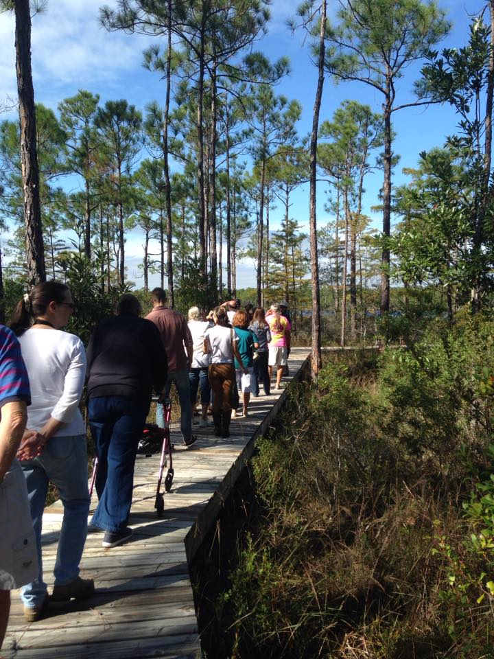
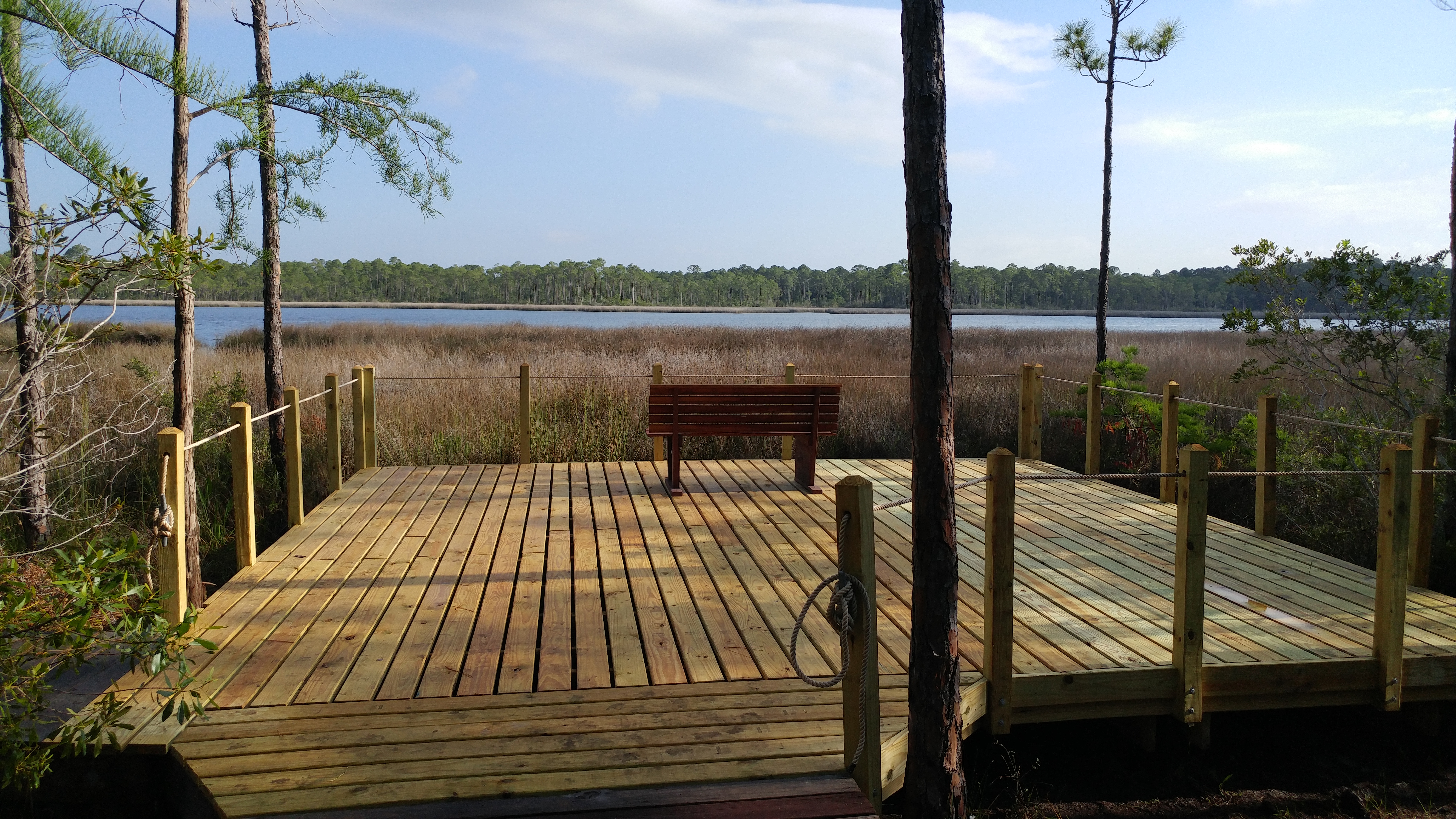
Master Naturalist students walk “The Way” boardwalk in Perdido Key. Photo credit: Carrie Stevenson
The classes do not count towards university credit but are an excellent certification and professional development opportunity that many will list on a resume. While we’ve had ecotour operators, park rangers, environmental consultants, teachers, and archaeologists participate, most of our FMNP students are not professionals in the field. They come from every background imaginable but share an interest in the outdoors. Because we meet weekly, class members often form long-lasting friendships during the courses.
Information on upcoming classes in northwest Florida and all around the state is available online. Classes range from fully in-person to hybrid and online options. FMNP classes are restricted to adults 18 and over, but a new “Florida Youth Naturalist” curriculum has been designed through our 4-H program for young people. For more information on that, check out their website.
Bats get a bad rap. They give people the creeps and can show up in unwanted places (like attics and sheds). But collectively, the bats in our communities eat millions of mosquitoes and agricultural pests every night. Without them, we’d be overrun with insects, disease, and damaged crops.
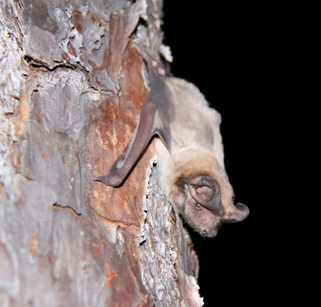
Bats sometimes move into buildings when they can’t find the natural structures they prefer (caves and large trees with cavities).
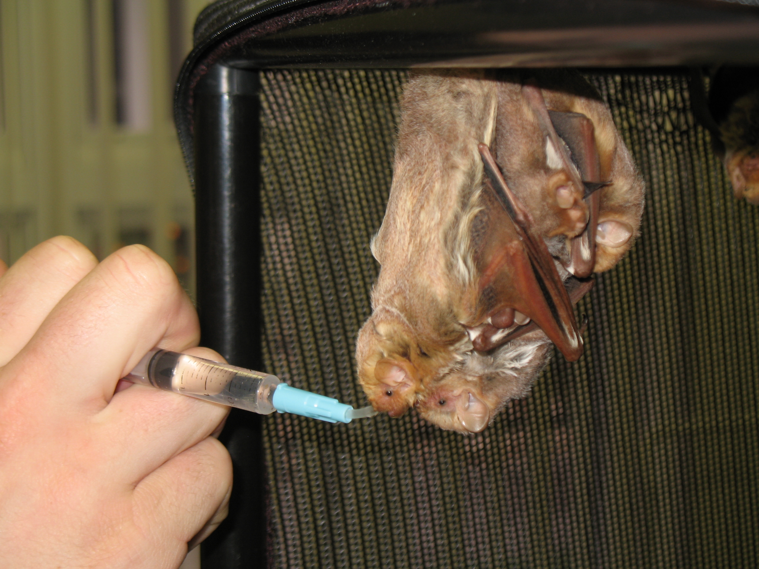
As a mom, I also have the utmost respect for bat mothers. When a member of this acrobatic species gives birth, it’s done while hanging upside down by her feet. When the baby is born, mom catches it in her wings and the newborn crawls up to her abdomen. Bat babies are not tiny, either—at birth, they are typically up to a third of an adult bat’s weight. Can you imagine giving birth to a 50+ pound baby, while hanging from your feet? Thankfully, most births are single pups, but occasionally multiples are born. Through our local wildlife sanctuary, I once met an exhausted bat mother of triplets. She and her new brood were found together on the ground—mom was unable to carry all three with her as she flew.
A wildlife biologist feeds an overwhelmed mother bat and her young after they were found on the ground. Photo credit: Carrie Stevenson, UF IFAS Extension
Summer is maternity season for female bats, typically giving birth in May or June. Being fellow mammals, bats must stay near their newborns to nurse. It takes about three weeks for juvenile bats to learn to fly. During that time, they either cling to their mother, nursing on the road, or stay behind in a maternity colony as she feeds at night. For that reason, during the period from April 16-August 14, it is illegal to “exclude” or prevent bats from returning to their roost—even if it’s your attic. Blocking a bat’s re-entry during this time frame could result in helpless newborn bats getting trapped in a building.
So, if you have seen evidence of bats flying in and out of your attic—or another building that should not house them—you will need to wait until August 15 or later. Excluding bats from a building entails waiting for the bats to fly out at night and putting up some sort of barrier to prevent their return. This can be done using several different methods explained in this video or by using a reputable wildlife professional. The Florida Fish & Wildlife Conservation Commission has regulatory oversight for bat-related issues, and they will work with homeowners to arrange a positive outcome for both the homeowner and the animals involved.
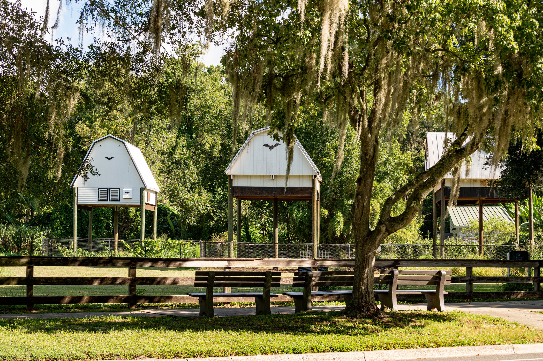
The University of Florida bat houses on the Gainesville campus are home to hundreds of thousands of bats that emerge every evening. Florida Museum photo by Kristen Grace
On just about any spring or summer night at dusk, you can look up and see bats darting around, chasing and catching insects. If you are a total bat nerd like me, there are also several places around the southeast with large bat houses for public viewing. In Gainesville, the University of Florida bat houses are home to over 450,000 bats that leave the houses every night. An even larger colony in Austin, Texas (750,000-1.5 million bats) flies out at sunset every night to forage from their dwelling under a downtown bridge. Both are fascinating experiences, and worth a visit!
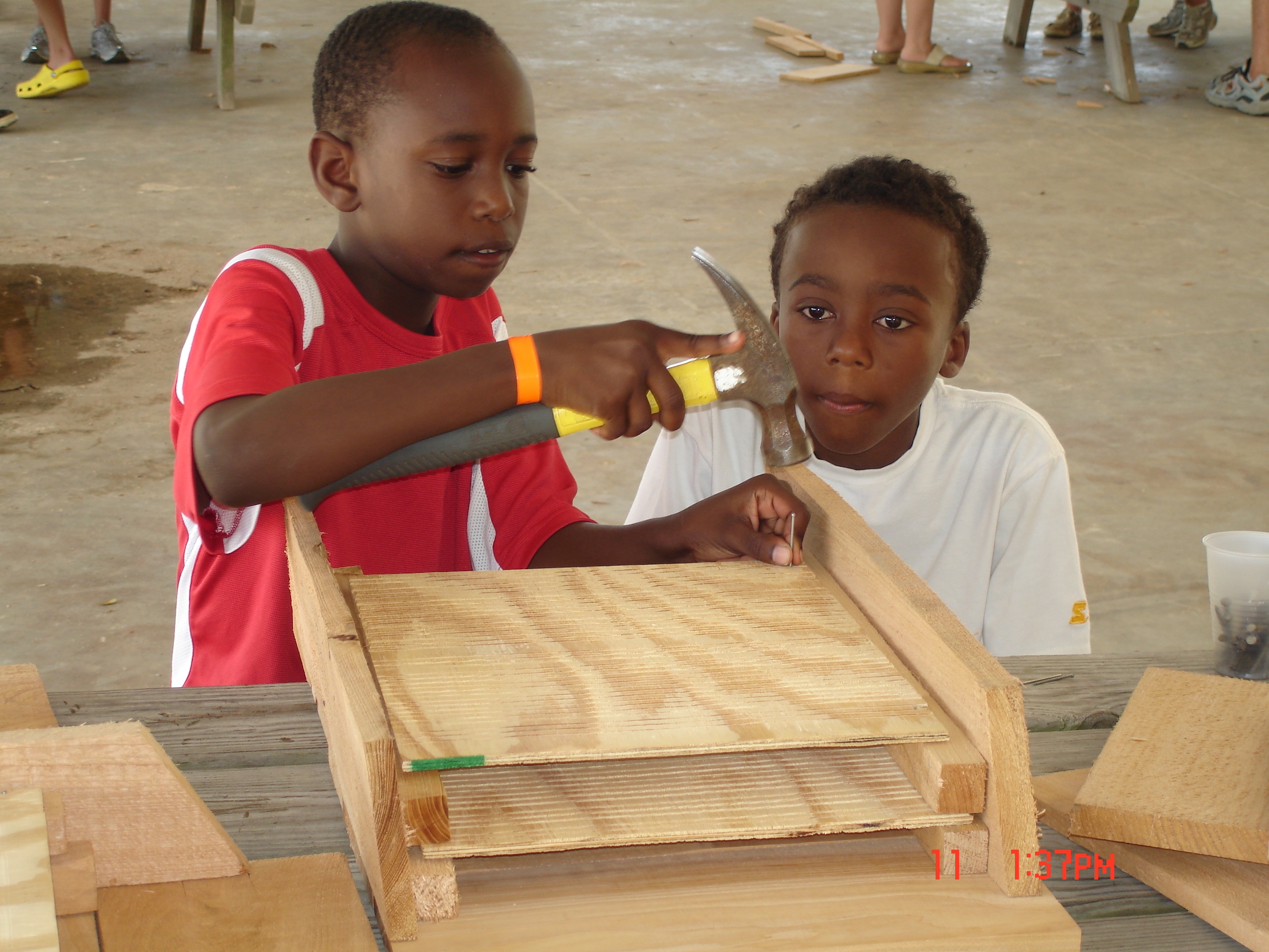
Building bat houses is a great family activity and helps provide much-needed habitat for bats. Photo credit: Carrie Stevenson, UF IFAS Extension
If you’re interested in building a bat house for your own backyard, reach out (ctsteven@ufl.edu); I have examples at the office and several sets of plans for building bat houses and installing them correctly. The publication, “Effective Bat Houses for Florida” goes through the best way to figure out where to place a house and includes a set of plans.
For better or worse, tropical storms are exciting. Besides the energy and tension around the mystery of where a storm will make landfall, the combination of powerful waves coming ashore, intense wind gusts, and driving rain really heighten all the senses. Most long-time Floridians don’t flinch too much at a Category 1 or 2 hurricane. But once we cross the threshold of a Category 3+, things change. If you have lived through a storm like Frederic, Ivan, or Michael, you know the damage and heartache these stronger storms can bring. Even Category 2 storms like Hurricane Sally just three years ago had serious lasting impacts, particularly affecting the under-construction Pensacola Bay Bridge.
An example of damage to local marinas and fishing vessels after Hurricane Michael in 2020. (Photo by Allen Golden).
Post-covid, with the economy (sort of) back in full swing, we are averaging just over 1,200 people a day moving to Florida. From July 2021-July 2022, nearly half a million people arrived, compared to 185,000 in the same timeframe the previous year. While some of these new residents may come from storm-prone locales, many have zero experience with hurricane season on the Gulf. If you are among those new to hurricanes, or know neighbors who could benefit from information, please share these tips with them.
Tip 1: Have the right insurance. The vast majority of insurance companies will not issue new policies when there’s a storm in the Gulf. Officially, hurricane season begins June 1. So, if you don’t have enough coverage for your investments, you should go RIGHT NOW and look into it, before the storm season really heats up in late summer. In addition, different types of policies cover different types of damage. Homeowners’ insurance (fire, theft, etc.) in Florida requires a separate windstorm policy, which includes damage from hurricanes and high winds (always confirm by reading your policy). And these are both separate from flood insurance. Performing certain types of windstorm mitigation, such as wind-rated garages, strong roof to wall connections, and obtaining shutters, can significantly reduce your overall costs for windstorm insurance.
Flood insurance is available through the National Flood Insurance Program (NFIP) and can be reasonably priced for people living outside of a flood zone. Those within designated flood zones will be required to purchase it, and rates vary widely depending on location and any prior flood impacts.
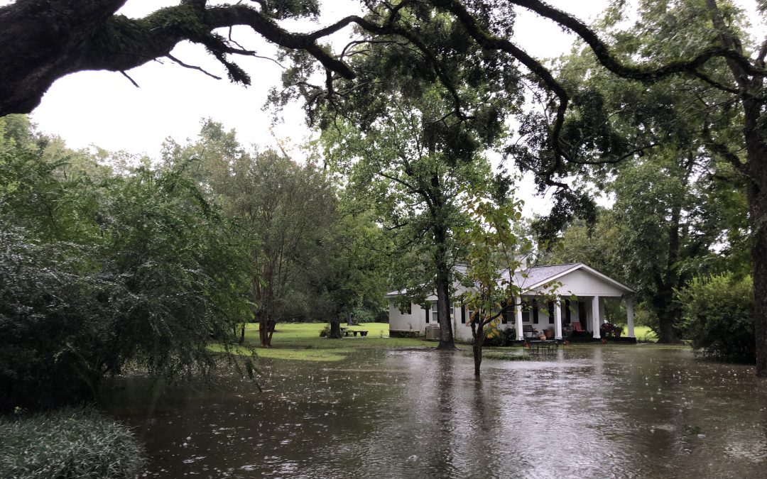
This property experienced significant flooding during a tropical storm a few years ago. Photo credit: Carrie Stevenson, UF IFAS Extension
As for which policy pays for storm impacts, it will become a game of “whodunit” afterwards, with adjustors making determinations of your damage based on the specific characteristics of each storm. These may include the direction of the incoming storm, the windspeed, amount of rain, and where any water damage actually originates from.
Tip 2. Create a disaster kit. Whether you are hunkering down and riding out the storm or getting out of the fray, it’s important to have a disaster kit with certain necessities. I always recommend a waterproof tote bin, to protect important documents from rain or floodwater. Items for a kit include medication, flashlights and batteries, shelf-stable food that can be eaten without heating or refrigeration, gallons of water, pet food, cash (since ATMs won’t work), portable phone chargers, a list of emergency contacts, and insurance paperwork. Comprehensive disaster kit lists can be found at floridadisaster.org. Another benefit of keeping these materials in a portable container is that if you do have to leave your home in a hurry, everything is in one place.
Tip 3. Come up with an evacuation plan. Talk with your immediate and distant family about your plans for a storm. If you plan to evacuate, look at the direction of an incoming storm and find a place to stay that is out of the immediate cone of impact. Sometimes this means moving east or west along the coast; other times it’s best to head inland. It’s important to let others know you’re leaving, in case there are serious impacts to your home from flooding or wind and rescuers are in the neighborhood.
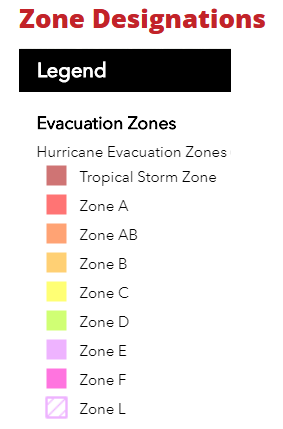
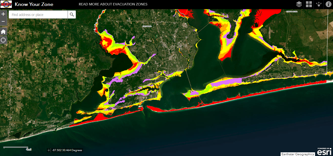
Tip 4. Pay attention to news about predicted storm surge—flooding is the deadliest factor of a hurricane. By using the Florida Division of Emergency Management website to “Know your zone,” you can look up your address to determine whether you are in a potential evacuation zone when a storm comes through.
Evacuation Zones in Florida are color-coded based on risk. Image from floridadisaster.orgA view of the evacuation zones for portions of southern Escambia and Santa Rosa Counties. Image from floridadisaster.org
Despite its name, giant salvinia (Salvinia molesta) is actually pretty small. The floating plant starts out with a cluster of leaves no bigger than a dime. They don’t stay that way, though, and perhaps their outsized influence and spread gives the “giant” a little more credence.
Giant salvinia is an invasive aquatic plant that was introduced to the United States as an ornamental plant (for aquariums and backyard ponds) from South America. Once it managed to escape to the wild, however, salvinia really took off. More than 20 states report salvinia popping up in their waters, although Texas and Louisiana seem to have the biggest battles with it. The plant has choked up entire freshwater lakes and sections of rivers, requiring a major eradication effort just to regain access to the water. Even small craft like kayaks and canoes cannot make it through a water body clogged with this plant. It is often spread by small pieces lodging in boat motors and trailers, so if you boat frequently in an area of known salvinia, be sure to remove any fragments of the plant once you are back on land. Preventing the spread from one water body to another is crucial.
Our native birds, fish, and aquatic mammals don’t eat giant salvinia—it appears not to have much nutritional value—and therefore its growth goes unchecked. The thick mats of plant growth block sunlight into the water column, preventing other aquatic plants from growing. Die-offs of large numbers of salvinia can eat up oxygen levels in the water, causing fish kills.
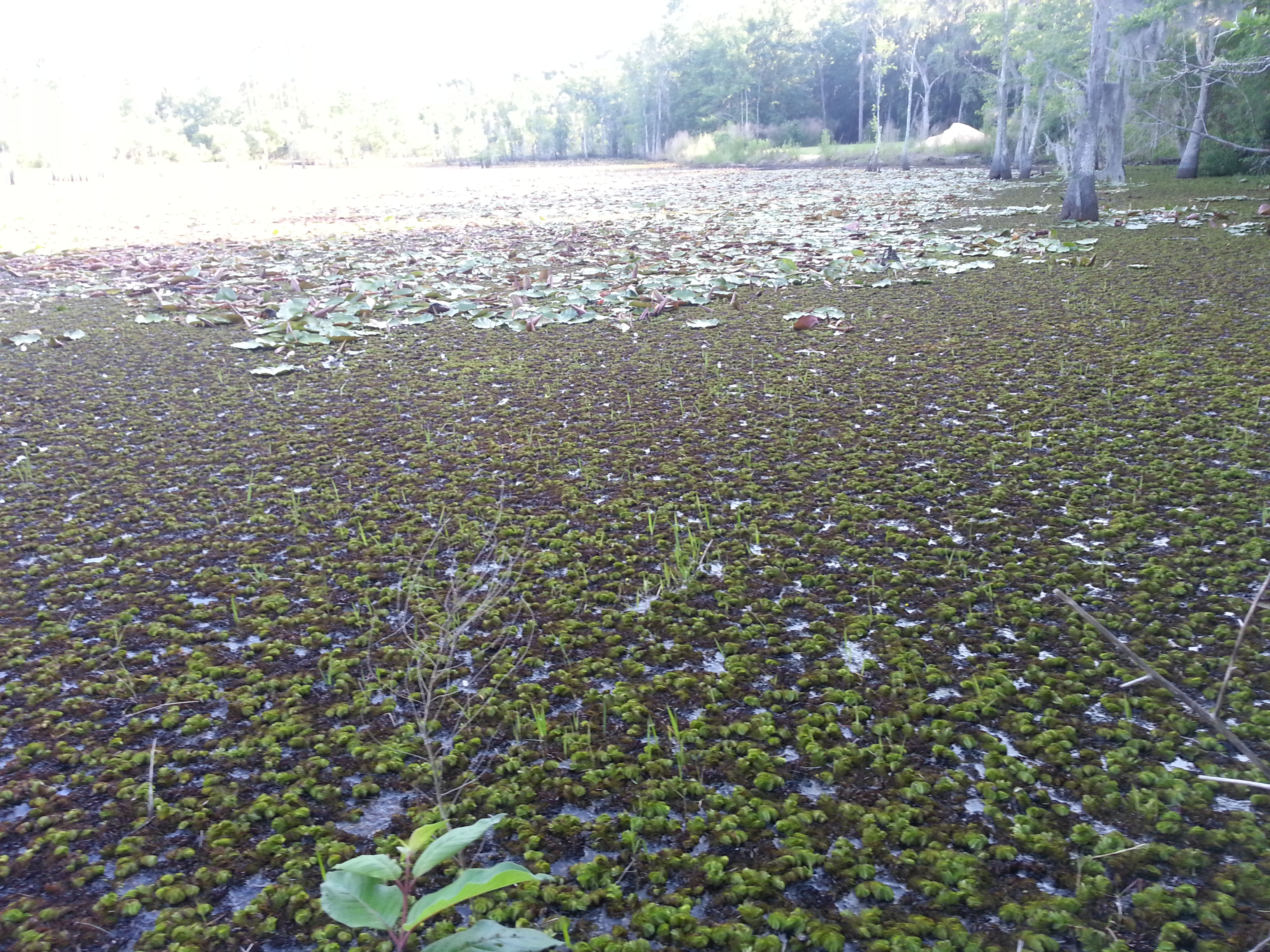
Giant salvinia overgrowth in a backwater section of Bayou Chico in Escambia County. Photo credit: Escambia County Natural Resource Management
There are several approaches to managing the plant. Mechanical or hand removal can take out significant amounts of salvinia, but is ineffective in the long run. Any small piece of chopped up plant left behind in the process will regrow into new spreading plants, so leaving any fragments in the water ends up increasing the population. More effective methods include applying herbicides or using a biocontrol insect called the salvinia weevil. This South American beetle (Cyrtobagous salviniae) is very small (only 2 mm as an adult) but feeds exclusively on salvinia plants, stunting their growth and causing them to sink underwater. A well-established salvinia weevil population can effectively manage large infestations of the plant, dropping coverage by 90%.
One natural check to unfettered growth in our area is that salvinia tends to thrive only in freshwater or very low salinity water bodies. We have identified populations of salvinia in the upper reaches of local bayous in Escambia County, but as salinity levels increase closer to the bay, the plant seems unable to establish itself.
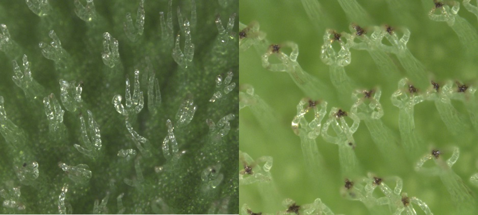
Identification of giant salvinia is rather fascinating, as you need a hand lens to definitively distinguish it from a very similar nonnative species called water spangles or water fern (Salvinia minima). Both species have small clear-white, upright hairs covering the leaves. When examined closely, the observer will note that in giant salvinia that double pairs of hairs form a structure very similar to an egg beater, whereas in water spangles the leaf hairs do not connect.
Giant salvinia can be distinguished from its cousin, common salvinia (Salvinia minima) by the shape of its trichomes, or leaf-hairs. Giant salvinia’s leaf hairs (right) are closed at the tip, forming an “egg-beater” shape, whereas common salvinia’s leaf hairs (left) are branched at the tip. Giant salvinia is a larger plant that forms thicker, denser mats. Common salvinia can cover large areas but typically forms thinner mats and does not pose as much risk to boating traffic. Photos and caption courtesy LSU AgCenter
If you think you see giant salvinia in a local water body, we would love to know. It is an aggressive invasive plant that is relatively new to the area, and we have a chance to keep this from spreading with your help. What can you do?
Contact the Escambia County Division of Water Quality and Land Management – (850) 595-3496
Contact the Escambia County Extension Office – (850) 475-5230 ext. 1111
Report in the EDDMapS national database – https://www.eddmaps.org – select “report sightings”
If you find just a small amount, remove it and allow to dry out on your property. Once dried you can double bag and dispose of it.
Kayaking through a crystal blue spring, hiking among longleaf pines and discovering gopher tortoise burrows, gliding past alligators by boat in Mobile Bay, private tours of the EPA lab on Pensacola Beach, and meeting hundreds of fascinating, like-minded people—these are just a handful of fond memories from my experiences teaching the Florida Master Naturalist Program. Having recently celebrated its 20th anniversary, the Florida Master Naturalist Program (FMNP) has inspired the creation of dozens of similar courses in other states and proven itself to be one of the most popular outreach programs to come out of UF IFAS Extension.
Kayaking Santa Rosa Sound in Navarre is one of the highlights of our Coastal Systems FMNP class. Photo credit: Carrie Stevenson, UF IFAS Extension
The mission of the FMNP is simple—to promote awareness, understanding, and respect of Florida’s natural world among Florida’s citizens and visitors. I have always felt strongly that if you want people to care about something, they need to understand it. And to really understand something, you need to experience it. I know my own passion for science and ecology was ignited early on by teachers who took us outside and helped us encounter the many wondrous surprises in the natural world. With FMNP, we seek to do just that.
Over a span of 40 hours in 7-8 weeks, we spend about half our time with classroom presentations and the other half in the field, seeing the plants, animals, and ecosystems we discuss in class. In addition to classes and field trips, students produce a final project and present it to the class. These can range from labeled collections and slide presentations to building bird houses and new trails. The program is composed of three 40-hour core courses; Coastal, Upland, and Freshwater Systems. Seven “short courses” with 24 hours of class/field time include the Land Steward series (Conservation Science, Habitat Evaluation, Wildlife Monitoring, and Environmental Interpretation) and the Restoration courses (Coastal Restoration, Marine Habitat Restoration, and Invasive Plants). Locally, we try to rotate the core modules every couple of years and incorporate the short courses periodically. The registration fee per core module is $250 – $300 and includes a detailed course manual and, upon completion, FMNP patch, certificate, and pin denoting area of expertise. There are a handful of scholarships available for those interested in applying to offset costs.
This trail and boardwalk in Perdido Key were part of a multi-stage FMNP final project highlighting multiple ecosystem types. Photo credit: Jerry Patee, Master Naturalist
The classes do not count towards university credit, but are an excellent certification and professional development opportunity that look great on a resume. While we’ve had ecotour operators, park rangers, environmental consultants, teachers, and archaeologists (and many seeking employment in the environmental field), most of our FMNP students are not professionals in the field. They come from every background imaginable, but share an interest in the outdoors. Because we meet weekly, class members often bond and create long-lasting friendships during the courses.
Extension Agents in northwest Florida are offering two Master Naturalist courses, starting in the next few weeks. In Escambia and Santa Rosa County, we will have an in-person daytime Coastal Systems class starting March 28 and running through May 16. Walton County is teaming up with Miami-Dade to offer an evening hybrid (online class sessions, in-person field trips) Freshwater Systems course from February 18 to April 13. FMNP classes are restricted to adults 18 and over, but a new “Florida Youth Naturalist” curriculum has been designed through our 4-H program for young people. For more information on that, check out their website.
Master Naturalist students conduct field work in small groups. Photo credit: Carrie Stevenson, UF IFAS Extension