by Rick O'Connor | May 21, 2021
Six Rivers “Dirty Dozen” Invasive Species
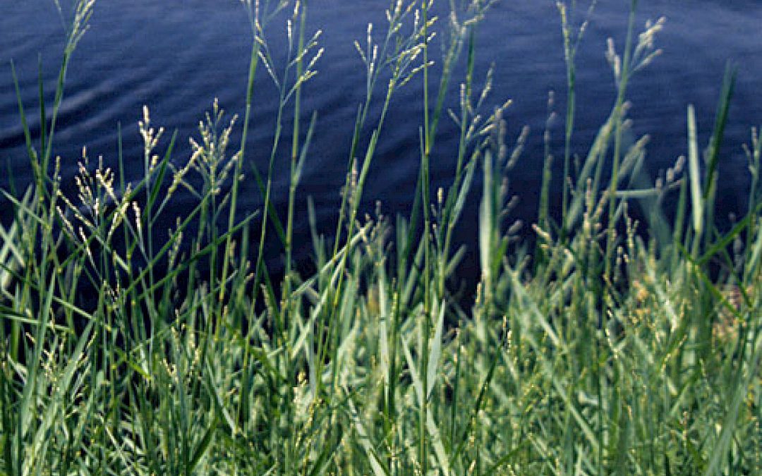
Torpedograss (Panicum repens)
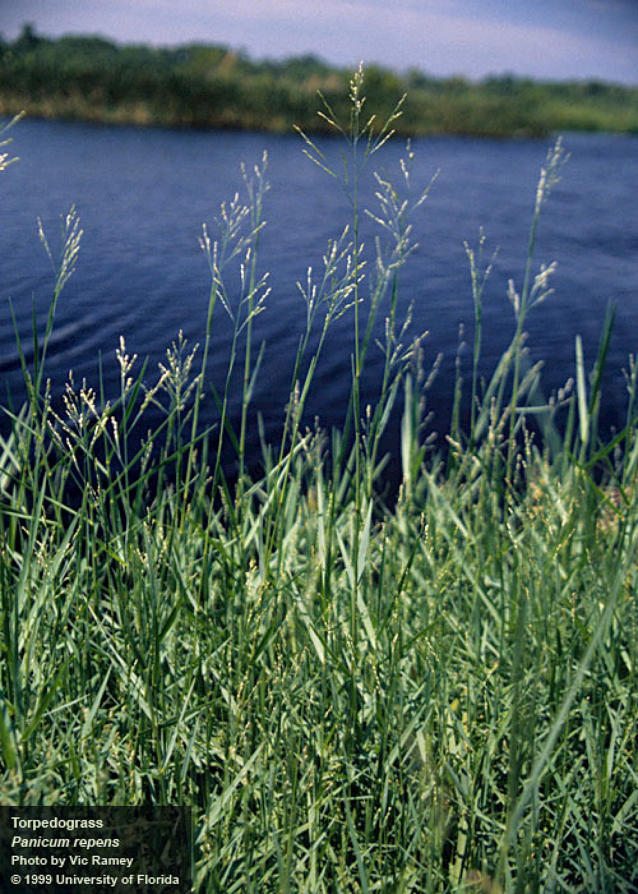
Torpedograss
Photo: University of Florida
Define Invasive Species: must have all of the following –
- Is non-native to the area, in our case northwest Florida
- Introduced by humans, whether intentional or accidental
- Causing either an environmental or economic problem, possibly both
Define “Dirty Dozen” Species:
These are species that are well established within the CISMA and are considered, by members of the CISMA, to be one of the top 12 worst problems in our area.
Native Range:
Africa and Asia.
Introduction:
Torpedograss was initially introduced prior to 1876 in seed for forage. In the early 1900s the USDA introduced the plant as a forage crop for pastures.
EDDMapS currently list 13,900 records of this plant. They range throughout the coastal states of the southeastern U.S. but most (96%) are in Florida and those records spread across the entire state from Pensacola to the Florida Keys.
Within our CISMA there are 2262 records, most are in Okaloosa County. The extent is probably underreported.
Description:
It is a tall grass reaching a height of 3-4 feet and grows along the shorelines, though it has on occasion been found more inland. The leaves are thin, stiff, flat, and “hairy” on the top and around the sheath. It has a waxy coating that appears “whiteish” and the leaves may fold. It has an extensive rhizome system that can grow deep into the ground and ends in a sharp point, where it gets its common name “torpedograss”. The flowers are a panicle-type inflorescence extending from the top of the plant.
Issues and Impacts:
This is an aggressively growing plant dispersing primarily from fragmentation and expansion of the sharp-pointed rhizome system. It quickly forms dense mats and out competes native grasses, many times forming monocultures along the shoreline where native plants have been removed. By 1992 it was reported in 70% of Florida’s public waterways, restricting waterflow, recreational use, and has become particularly problematic on golf courses.
Management:
Torpedograss spreads primarily by extended their rhizomes, or fragments of these rhizomes. When removing from the shoreline it is important to remove ALL of the rhizomes or the plant will return. It is also important not to spread fragments of these rhizomes while mowing or weed-eating the plant.
It is most aggressive in open disturbed areas. After mowing or burning land is when dense patches emerge. Maintaining a diversity of native shoreline grasses will help impede dispersal and growth.
Mowing and disking have not been very effective. In fact, disking may cut and spread the rhizomes.
When choosing chemical treatment, glyphosate has been every effective. However, this chemical is non-selective and overspray can kill native plants you wish to keep. Also, the plant is often in the water and an aquatic version of glyphosate should be used. When using near water read all instructions carefully to avoid killing other aquatic plants. Since the rhizomes can grow deep, and are at times submerged, re-treatment may be needed.
There are no biological agents currently approved for torpedograss management but cattle and goats both will eat the plant. Though it does not always remove the rhizomes, grazing can be a method of control.
For more information on this Dirty Dozen species, contact your local extension office.
References
Torpedograss, University of Florida IFAS Center for Aquatic and Invasive Plants
https://plants.ifas.ufl.edu/plant-directory/panicum-repens/.
Early Detection and Distribution Mapping System (EDDMapS)
https://www.eddmaps.org/
Six Rivers CISMA
https://www.floridainvasives.org/sixrivers/
by Rick O'Connor | May 20, 2021
I was recently gathering information together for a presentation on Florida snakes, highlighting those in the Florida panhandle. This particular reference listed 44 species found in the state. Of those, 29 were found throughout the state – north, central, and south Florida. Granted, there were subspecies for many which made for some distinction, but most of our snakes (66%) have few barriers and seem to have adapted to the different habitats and climates. And let’s face it, north and south Florida are two different worlds. That says a lot for the adaptability of these animals, they are pretty amazing.
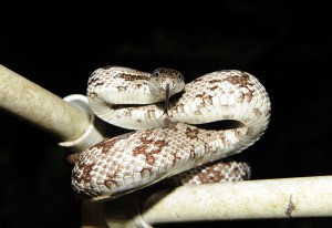
Snakes do make many nervous but most of our 44 species are nonvenomous.
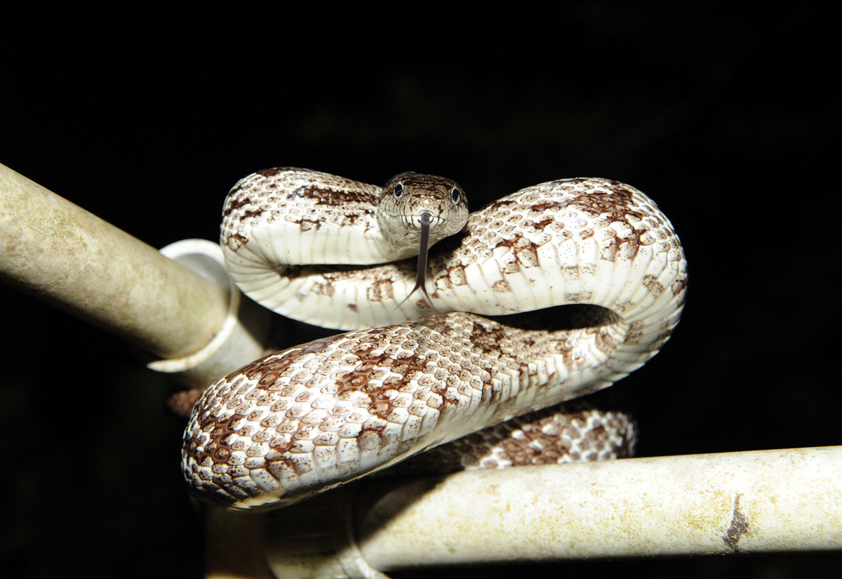
Photo: Nick Baldwin
Another trend was obvious. As you looked at those species which were only found in north Florida (here defined as the panhandle across to Jacksonville and south to Gainesville) and compared that to species only found south of Gainesville, we have a rich diversity of snakes in our part of the state. There were 12 species found in Florida that were only found in north Florida. South and central Florida only had 3 species that were unique to their part of the state. I saw this same trend with turtles. Of the 25 species of turtles found in Florida, 9 are unique to north Florida, 2 to central and south.
It has been known that the biodiversity of the panhandle is pretty amazing, and that the Apalachicola River basin in particular is a biodiversity hot spot. In the panhandle, several “worlds” collide and species, many using these river systems we find here, can easily reach this area. Some produce hybrid versions of two species. Some produce new species only found here. There may be more reptiles / acre in central and south Florida (I did not look at that) but the variety of these creatures in the north Florida is pretty amazing.
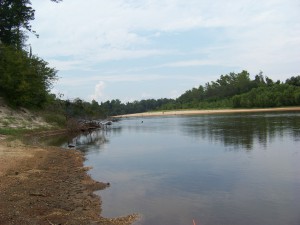
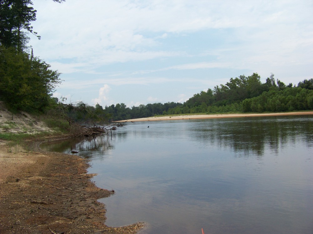
The Escambia River. One of the alluvial rivers of the Florida panhandle. Is a natural highway for many reptiles to disperse into our state.
Photo: Molly O’Connor
But what about those 12 species unique to our part of the state?
Four of them are small terrestrial snakes, rarely getting over a foot in length. These are easy prey and nonvenomous so are most often found beneath the leaf litter of the forest, or beneath the ground, coming out at night to feed on small creatures. We generally find them living in our flower beds and gardens. Most are ovoviviparous (producing an egg but instead of laying it in a nest, the female keeps it internally giving live birth), with only the Southeastern Crowned Snake laying eggs (oviparous).
- Smooth Earth Snake (Virginia valeria) This snake has records from Pensacola Bay area and areas south of the Georgia line.
- Rough Earth Snake (Virginia striatula) This snake has most records west of the Apalachicola River, but there are records from the Suwannee basin in north Florida.
- Red-bellied Snake (Storeia occipitomaculata) Common across north Florida.
- Southeastern Crowned Snake (Tantilla coronate) Found only in the panhandle.
Six of the unique panhandle 12 are nonvenomous water snakes. This would make sense in that we are host to several long alluvial rivers that reach deep into the southeast. The Escambia, Choctawhatchee, and Apalachicola Rivers are highways for all sorts of riverine species, and those closely associated with rivers, to cover hundreds of miles of territory with few barriers (except for the occasional dam). Though these water snakes are nonvenomous, they are known for the “bad attitudes” and high tendency to bite. They feed on a variety of prey and are often seen basking along the riverbank or in a tree branch hanging over the water where they can escape quickly if trouble comes, and they do escape quickly. Some are quite large (over 4 feet) and most are ovoviviparous. The northern watersnake is known to have a placenta-like structure to nourish its young (viviparous) and the rainbow snake lays eggs (oviparous).
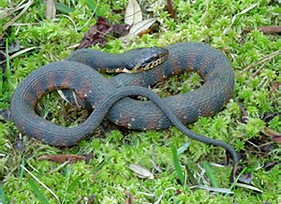
The banded watersnake is one found throughout the state and resembles the cottonmouth.
Photo: UF IFAS
- Queen Snake (Regina septemvittata) is only found in the western panhandle (west of the Apalachicola River). This snake likes cold, clear streams with rocky or sandy bottoms and plenty of crayfish.
- Northern Watersnake (Nerodia sipedon) also is only found in the western panhandle. It can be found in almost any body of water and has been reported on barrier islands.
- Plain-bellied Snake (Nerodia erythrogaster) This snake also can be found in just about any water system.
- Diamondback Watersnake (Neroida rhombifer) has only been found in the Pensacola Bay area (Escambia and Santa Rosa counties). They can be found at times in large numbers around almost any body of water.
- Western Green Watersnake (Neroida cyclopion) only as records in one Florida county – Escambia. There they have been found in a variety of water habitats including man-made ones.
- Rainbow Snake (Farancia erytogramma) This snake likes to feed on American eels and is usually found in aquatic systems where this prey inhabits.
Another interesting trend with these unique panhandle watersnakes is the number only found in the western panhandle. Four of the six are only found there and two are only found in the Pensacola area. Some say, “Pensacola is not really Florida”, the snakes might agree.
The last two of the unique 12 are venomous snakes. Florida has six species of venomous snakes, but two are only found in the north Florida.
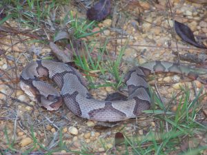
This copperhead was found JUST across the state line in Alabama. The more copper color and “hour-glass” pattern of their bands lets you know it is not it’s cousin the cottonmouth.
Photo: Molly O’Connor
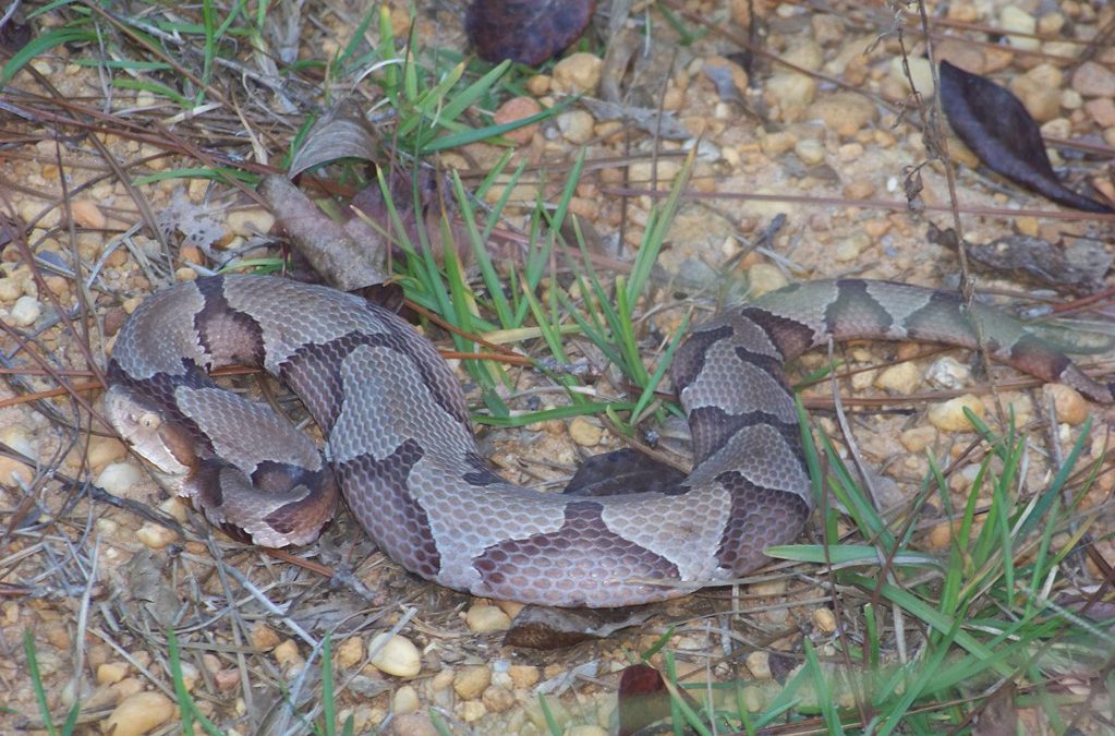
- Copperhead (Agkistrodon contortrix). Though quite common in Alabama and Georgia, most records in our state are from the Apalachicola River basin area. Many local panhandlers will tell you they see this snake everywhere, but they use this name for the cottonmouth also (a close cousin). The true copperhead is not common here. It seems to like rocky areas further north and is usually found with limestone rock areas that have been formed over time from river erosion.
- Timber Rattlesnake (Crotalus horridus). As with the copperhead, this is a common snake in Alabama and Georgia associated with rocky terrain and is not common in our state. Many ole timers will speak of the “canebrake”, which was found in the common cane of north Florida. There was discussion at one point of this being a separate species from the timber rattler, but the specialist now believe they are one in the same. So, the name canebrake is no longer used by herpetologists. Records of this snake in Florida are mostly east of the Apalachicola River and not common.
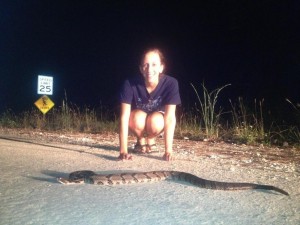
This timber rattlesnake has chevrons (stripes) instead of the diamond pattern on its back.
Photo provided by Mickey Quigley
I think the diversity of wildlife in our part of the state is pretty special. Even if you do not like snakes, it is pretty neat that we have so many kinds not found south of the Suwannee River. Snake watching is not as popular as bird watching, for obvious reasons, but it is still neat that we have these guys here.
by Rick O'Connor | May 5, 2021
EDRR Invasive Species
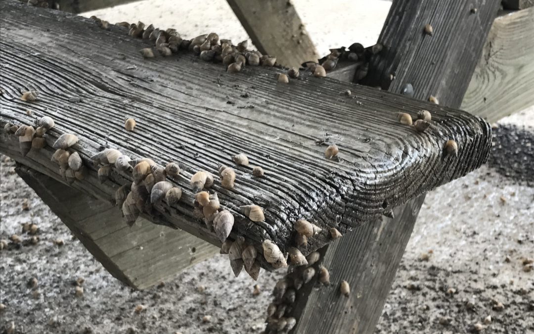
Land Snail (Bulimulus sporadicus)
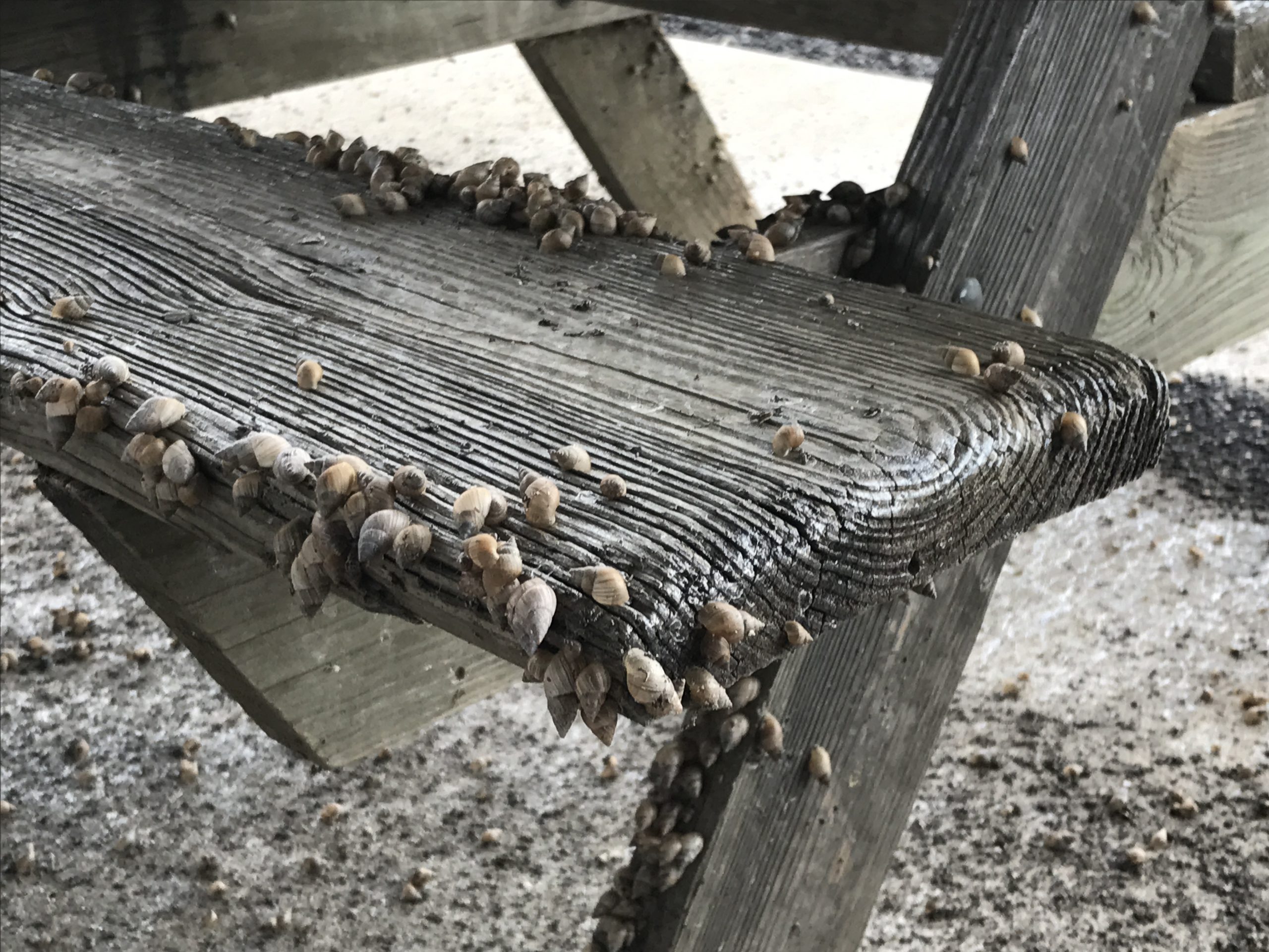
Bulimulus sporadicus
Photo: University of Florida
Define Invasive Species: must have ALL of the following –
- Is non-native to the area, in our case northwest Florida
- Introduced by humans, whether intentional or accidental
- Causing either an environmental or economic problem, possibly both
Define EDRR Species: Early Detection Rapid Response. These are species that are either –
- Not currently in the area, in our case the Six Rivers CISMA, but a potential threat
- In the area but in small numbers and could be eradicated
Native Range:
Bulimulus sporadicus is native to the West Indies.
Introduction:
There appears to have been multiple points of entry into Florida. It was first identified in Florida by Dr. Harry G. Lee, who discovered the snail in Duval County in 2009. Additional surveys found four different populations all associated with the CSX railways. It is believed the snail was introduced via the railway cars coming from Mexico. Populations began to appear both north and south of the original location, all near the CSX railways. The animal has been reported from central and south Florida, as well Georgia, Alabama, Mississippi, and Northwest Florida.
EDDMapS currently list only 2 records of Bulimulus sporadicus. One in central and another in south Florida. There are no EDDMapS records of the snail in the Florida panhandle, but it has been reported in Pensacola and Panama City. There are no records within the Six Rivers CISMA but it is believed to be here. Records of this animal is certainly under reported.
Description:
This is a small (3/4 – 1”) land snail. It has a conical shell that is light brown to tan in color. They are often found near gardening areas and seem to like the high humidity and moist conditions here.
Issues and Impacts:
A 2018 publication from the Center for Invasive Species and Ecosystem Health noted that it was not designated as invasive in any state, nor the federal level. However, with the relatively new introduction and wide spread of this species it warrants observation.
Management:
There are no management plans for this snail at this time. Chemical treatment of plants to reply the snail are not recommended. It appears the snail prefers the leaf litter within the mulch rather than the live plants. Snail baits, and other pesticides, can be harmful to pets and native wildlife and are not recommended. They do like mulched areas within gardens and if the home owner is having a serious problem, management of this type of habitat may be needed.
For more information on this EDRR species, contact your local extension office.
References
Stauderman, K. 2020. A Snail That Rode the Rails. UF/IFAS Extensions Volusia County Blog. http://blogs.ifas.ufl.edu/volusiaco/2020/04/07/a-snail-that-rode-the-rails/.
Snail (Bulimulus sporadicus, O’Brigny 1835). 2018. Center for Invasive Species and Ecosystem Health. https://www.invasive.org/browse/subinfo.cfm?sub=78908.
Early Detection and Distribution Mapping System (EDDMapS)
https://www.eddmaps.org/
Six Rivers CISMA
https://www.floridainvasives.org/sixrivers/
by Rick O'Connor | Apr 30, 2021
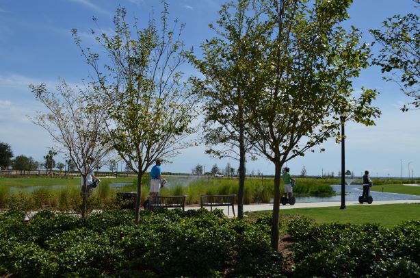
Please join us for a two-part webinar series ‘Managing Stormwater in a Changing Florida Panhandle’ on May 12th from 8-10 am CST (9-11 am EST), and May 19th from 8-10 am CST (9-11 am EST). The webinar series will cover stormwater management, green infrastructure and low impact development.
Please register through the following Eventbrite link: https://www.eventbrite.com/e/managing-stormwater-in-a-changing-florida-panhandle-tickets-150535308159
A detailed agenda can be found on the Eventbrite page.
- 4 Professional Development Hours (PDH) will be offered for Professional Engineers through the Florida Board of Professional Engineers. Two PDHs will be offered for Day 1 and two will be offered for Day 2.
- 4 Continuing Education Units (CEU) will be offered for Pesticide Applicators through FDACS in the following categories: Ornamental & Turf, Private Applicator Ag, Right-of-Way, Aquatic, Natural Areas, Commercial Lawn & Ornamental, Limited Commercial Landscape Maintenance, Limited Lawn & Ornamental and Limited Urban Fertilizer.
The webinar is free for those not seeking PDHs or CEUs. For those seeking PDHs or CEUs, the cost is $50 for Day 1, and $50 for Day 2.
We look forward to your attendance! Feel free to contact Dr. Andrea Albertin if you have any questions.
Dr. Andrea Albertin – (850) 875-7111 – albertin@ufl.edu
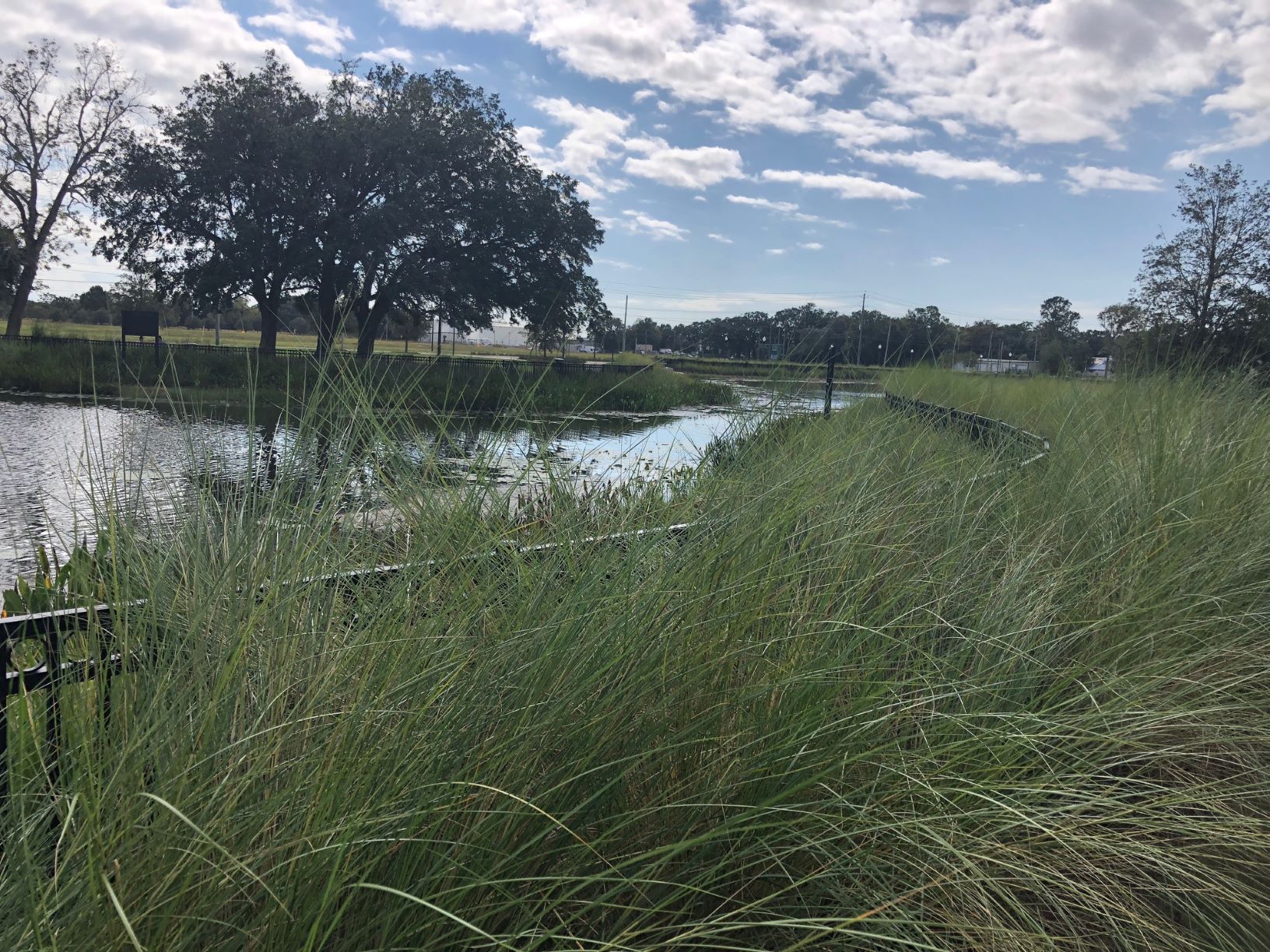
Well-maintained stormwater ponds can become attractive amenities that also improve water quality. Photo credit: Carrie Stevenson, UF IFAS Extension

by Rick O'Connor | Apr 22, 2021
Six Rivers “Dirty Dozen” Invasive Species
Chinese Privet (Ligustrum sinense)
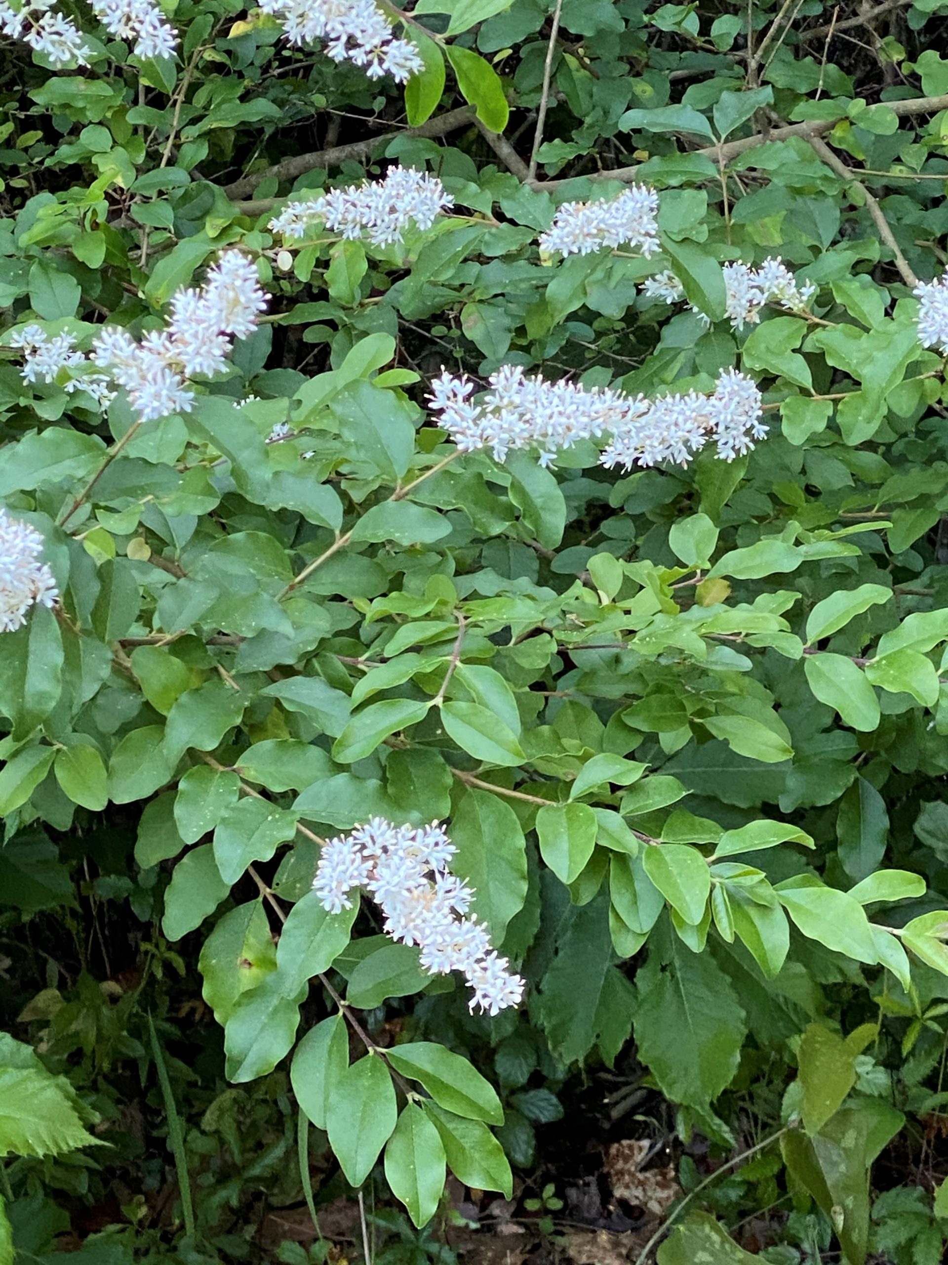
Chinese privet in bloom.
Photo: Molly O’Connor
Define Invasive Species: must have all of the following –
- Is non-native to the area, in our case northwest Florida
- Introduced by humans, whether intentional or accidental
- Causing either an environmental or economic problem, possibly both
Define “Dirty Dozen” Species:
These are species that are well established within the CISMA and are considered, by members of the CISMA, to be one of the top 12 worst problems in our area.
Native Range:
Chinese privet is from China.
Introduction:
Was introduced to the U.S. in 1852 as an ornamental plant often used as a hedge. It escaped cultivation and has spread across the Florida panhandle and into the peninsula as far as Hillsborough County.
EDDMapS currently list 12,702 records of this plant. They are scattered across the southeastern United States, west as far as Texas and Oklahoma, and north into the mid-west and as far as Connecticut. There are 1,883 records in Florida. 1,740 in the panhandle and 143 in the peninsula. There are 1,461 records within the CISMA. This is CERTAINLY underreported.
Description:
Chinese privet is a perennial shrub that can grow up to 16 feet in height. It has smooth bark and dark green elliptical leaves which are arranged opposite from each other – this is noticeable from a distance. Each leave is 1-3” in length. The small flowers grow from short branches at the ends of each twig. The slate blue fruits contain 1-4 seeds and can persist throughout winter. Seed dispersal is often aided by consuming wildlife.
Issues and Impacts:
This is a fast growing plant that can form dense populations in uplands and wetland areas. It quickly outcompetes native plants for space and is often the dominant plant within the system. It is listed as a Florida Invasive Species Council Category I invasive plant and a Florida noxious weed.
Management:
Management techniques depend on abundance of plants in area.
If there are few plants, they can be hand pulled or dug up. It is recommended not do this while in seed as seed dispersal can be a problem while removing.
If mowing is possible it can be effective if (a) you mow close to the ground, and (b) you do so frequently.
For larger areas where mowing and digging are not an option herbicides can be used. Foliar applications of glyphosate (at 25%) have been affective but be careful of overspray. Cut stump applications will work with glyphosate (25%) or triclopyr (1-2 quarts / acre). It is recommended to do herbicide applications in early spring or late fall.
There is no known biological control at this time.
For more information on this Dirty Dozen species, contact your local extension office.
References
Chinese Privet, University of Florida IFAS Center for Aquatic and Invasive Plants
https://plants.ifas.ufl.edu/plant-directory/ligustrum-sinense/.
Early Detection and Distribution Mapping System (EDDMapS)
https://www.eddmaps.org/
Six Rivers CISMA
https://www.floridainvasives.org/sixrivers/