by Andrea Albertin | Oct 9, 2020
Special care needs to be taken with your septic system after flooding. Image: B. White NASA. Public Domain
During and after floods or heavy rains, the soil in your septic system drainfield can become waterlogged. For your septic system to treat wastewater, water needs to drain freely in the drainfield. Special care needs to be taken with your septic system under flood conditions.
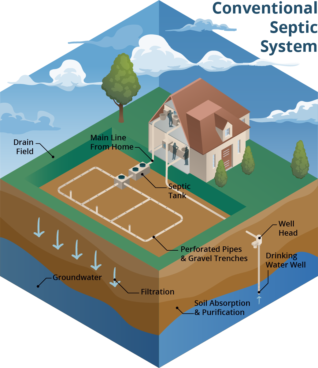
A conventional septic system is made up of a septic tank (a watertight container buried in the gound) and a drainfield. Image: Soil and Water Science Lab UF/IFAS GREC.
A conventional septic system is made up of a septic tank and a drainfield or leach field. Wastewater flows from the septic tank into the drainfield, which is typically made up of a distribution box (to ensure the wastewater is distributed evenly) and a series of trenches or a single bed with perforated PVC pipes. Wastewater seeps from these pipes into the surrounding soil. Most wastewater treatment occurs in the drainfield soil. When working properly, many contaminants, like harmful bacteria, are removed through die-off, filtering and interaction with soil surfaces.
What should you do if flooding occurs?
The U.S. Environmental Protection Agency (EPA) offers these guidelines:
- Relieve pressure on the septic system by using it less or not at all until floodwaters recede and the soil has drained. Under flooded conditions, wastewater can’t drain in the drainfield and can back up in your septic system and household drains. Clean up floodwater in the house without dumping it into the sinks or toilet. This adds additional water that an already saturated drainfield won’t be able to process. Remember that in most homes all water sent down the pipes goes into the septic system.
- Avoid digging around the septic tank and drainfield while the soil is waterlogged. Don’t drive vehicles or equipment over the drainfield. Saturated soil is very susceptible to compaction. By working on your septic system while the soil is still wet, you can compact the soil in your drainfield, and water won’t be able to drain properly. This reduces the drainfield’s ability to treat wastewater and leads to system failure.
- Don’t open or pump the septic tank if the soil is waterlogged. Silt and mud can get into the tank if it is opened and can end up in the drainfield, reducing its drainage capability. Pumping under these conditions can cause a tank to float or ‘pop out’ of the ground, and can damage inlet and outlet pipes.
- If you suspect your system has been damaged, have the tank inspected and serviced by a professional. How can you tell if your system is damaged? Signs include: settling, wastewater backs up into household drains, the soil in the drainfield remains soggy and never fully drains, a foul odor persists around the tank and drainfield.
- Keep rainwater drainage systems away from the septic drainfield. As a preventive measure, make sure that water from roof gutters doesn’t drain towards or into your septic drainfield. This adds an additional source of water that the drainfield has to process.
- Have your private well water tested if your septic system or well were flooded or damaged in any way. Your well water may not be safe to drink or use for household purposes (making ice, cooking, brushing teeth or bathing). You need to have it tested by the Health Department or other certified laboratory for total coliform bacteria and coli to ensure it is safe to use.
For more information on septic system maintenance after flooding, go to:
More information on having your well water tested can be found at:
More Information on conventional and advanced treatment septic systems can be found on the UF/IFAS Septic System website
by Carrie Stevenson | Aug 27, 2020
 Carrie Stevenson is the Coastal Sustainability Agent for the UF/IFAS Escambia County Extension Office, and has been with the organization almost 17 years. Her educational outreach programs focus on living sustainably within a vulnerable coastal ecosystem. She helps clientele better understand how to protect and preserve local ecosystems and water resources, wisely use our abundant rainfall and sunlight, and prepare and mitigate for flooding, coastal storms and climate impacts.
Growing up an avid reader and science junkie, a young Carrie aspired to find a career that allowed her to “be outdoors and wear jeans,” and in college sought to become a science writer. When National Geographic didn’t come calling, she found a position as a field-based environmental specialist with the Florida Department of Environmental Protection. There, she handled compliance and enforcement cases related to stormwater and wetlands, spending days tromping through the swamps, wet prairies, and newly built subdivisions of northwest Florida. After joining UF IFAS Extension, she spent 6 years as a Florida Yards & Neighborhoods Agent before switching to Coastal Sustainability. Her expertise and articles focus on climate issues, stormwater, hurricanes, native plants, and wetlands.
A lifelong outdoors enthusiast, she enjoys biking, standup paddleboarding, and traveling to national parks with her family. She also has many favorite international outdoor experiences, ranging from hiking glaciers in Canada to snorkeling coral reefs in Belize and watching elephants drink from a South African river. A native of Mississippi, Carrie has lived with her husband in Pensacola since 1999. Carrie earned her master’s degree in Biology/Coastal Zone Studies from the University of West Florida in Pensacola and an undergraduate degree in Marine Science from Samford University (Birmingham, Alabama). She is the proud mom of an Eagle Scout and leads her daughter’s Girl Scout troop. She is a Fellow in the Natural Resources Leadership Institute (NRLI), past president of the Florida Association of Natural Resource Extension Professionals (FANREP), and member of IMPACT 100 Pensacola Bay.
by Carrie Stevenson | Jul 31, 2020
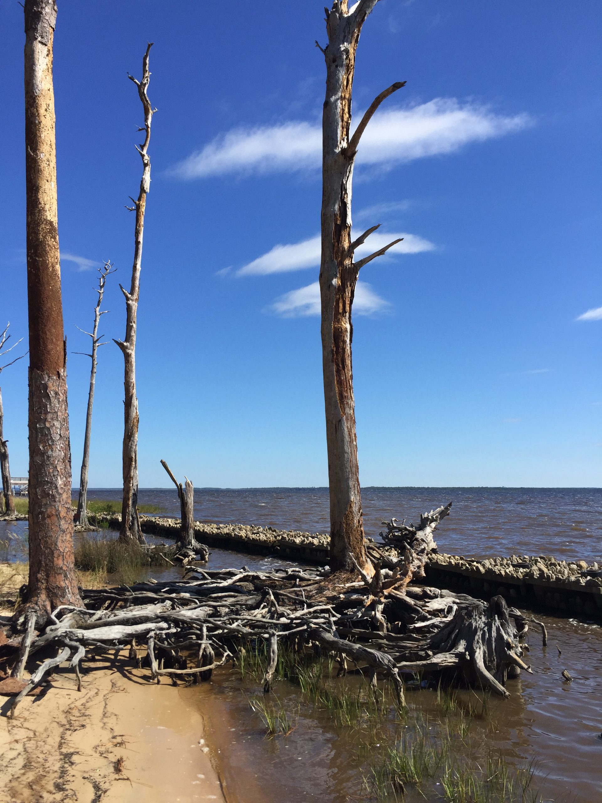
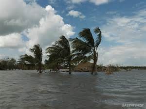
A living shoreline project was implemented on this bay in Santa Rosa County to try and prevent further erosion. Photo credit: Carrie Stevenson, UF IFAS Extension
We have reached that time of year when the Atlantic starts cranking out storms, and they will continue to roll out as the dog days of summer progress. Over the last decade, many experts have speculated on how climate change and sea level rise might impact hurricanes in the Gulf of Mexico. Two big issues are coastal erosion and flooding from storm surge and rainfall.
Those who live on the water or frequently visit area shorelines have probably noticed coastal erosion. While a natural part of a coastal ecosystem–and often exacerbated by heavy boat traffic–rising seas can also cause erosion. Sea level rise moves water slowly inland and washes away the roots of grasses and trees that once held the shoreline in place. Buildings and roads close to the water are impacted as well, with “sunny day flooding” on the roads and under pilings in many south Florida cities where water has moved in to stay. Large scale beach renourishment projects, living shorelines, and even road relocations (like the one at Ft. Pickens on Pensacola Beach) are all ways that local officials and property owners can respond to rising seas. However, these efforts always come with a big price tag. When that “line in the sand” is drawn beyond government and household budgets, there will come a point when we can no longer support protection of highly vulnerable coastal infrastructure. The closer a building is physically located to the water (whether built there intentionally or reached by rising seas), the greater the likelihood a hurricane will cause flooding damage from dangerous storm surge. Storm surge and heavy flooding cause 75% of the deaths in any given hurricane.
During a recent webinar, the appropriately named Dr. Chris Landsea of the National Hurricane Center answered several frequently asked questions on the impacts of global warming on hurricanes. Some of the predictions are surprising based on assumptions that have been put out in the media. He made a disclaimer that these are his predictions based on years of expertise and data analysis, and not an official proclamation by the National Hurricane Center. Following are a few of the points he made during his talk.
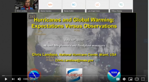
Dr. Chris Landsea of the National Hurricane Center recently met with floodplain managers around the Gulf Coast to discuss hurricanes.
Question: Will hurricanes get stronger based on increased temperatures?
Answer: The world average temperature has gone up 1.5 degrees Fahrenheit in the past 100 years. Based on data and computer modeling from the NOAA Geophysics Lab, typical hurricane wind intensity will increase slightly, by 3%. In this example, a storm with 100 mph average winds would be 103 mph by the end of the 21st century.
Question: Will we experience more tropical storms as the climate changes?
Answer: Dr. Landsea does not expect more tropical storms as the temperature increases. In fact, frequency may drop very slightly. While there may be more heat energy for hurricanes to feed on, the surrounding conditions will make it tougher for a storm to form. Those conditions may be atmospheric or include a vertical wind shear that tears up the storm.
Question: How will global warming affect rainfall during hurricanes?
Answer: Models and recent experience show that rainfall will increase by 10-20% during tropical storms. Global warming increases the amount of moisture in the atmosphere, and a hurricane can recycle this water into a constant loop of rainfall. Hurricane Harvey in Texas was one example of this situation, during which nearly 8 feet of rainfall fell, flooding neighborhoods. One of the aphorisms of climate change is “wet places get wetter, and dry places get drier.”
Dr. Landsea’s full presentation can be found online here, if you are interested in learning more. Keep in mind that these predictions can change based on land use, atmospheric carbon levels, and human practice change. For more on the work UF IFAS is doing on climate, visit this Florida Sea Grant Climate page.

by Sheila Dunning | Jul 3, 2020

Dog Star nights Astro Bob
The “Dog Days” are the hottest, muggiest days of summer. In the northern hemisphere, they usually fall between early July and early September. The actual dates vary greatly from region to region, depending on latitude and climate. In Northwest Florida, the first weeks of August are usually the worst. So, get out before it gets hotter.
In ancient times, when the night sky was not obscured by artificial lights, the Romans used the stars to keep track of the seasons. The brightest constellation, Canis Major (Large Dog), includes the “dog star”, Sirius. In the summer, Sirius used to rise and set with the sun, leading the ancient Romans to believe that it added heat to the sun. Although the period between July 3 and August 11 is typically the warmest period of the summer, the heat is not due to the added radiation from a far-away star, regardless of its brightness. The heat of summer is a direct result of the earth’s tilt.
Life is so uncertain right now, so, most people are spending less time doing group recreation outside. But, many people are looking to get outside Spending time outdoors this time of year is uncomfortable, potentially dangerous, due to the intense heat. So, limit the time you spend in nature and always take water with you. But, if you are looking for some outdoor options that will still allow you to social distance,
try local trails and parks. Some of them even allow your dog. Here are a few websites to review the options: https://floridahikes.com/northwest-florida and https://www.waltonoutdoors.com/all-the-parks-in-walton-county-florida/northwest-florida-area-parks/ Be sure to check if they are allowing visits, especially those that are connected to enclosed spaces.
Other options may include zoos and aquariums: www.tripadvisor.com/Attractions-g1438845-Activities-c48-Florida_Panhandle_Florida.html
Or maybe just wander around some local plant nurseries:

by Carrie Stevenson | Aug 16, 2019
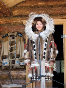
The indigenous people of Alaska have long adapted to freezing winters by relying on local wildlife for warm clothing. Photo credit: Carrie Stevenson, UF IFAS Extension
Human beings are an incredibly adaptable species. For countless generations, our ancestors have migrated to the far reaches of the planet to find food and territory. The Inuit people of Alaska adapted to months of freezing weather and darkness by developing techniques for harvesting fish through the ice and making furs from local wildlife. Meanwhile in the remote Andaman Islands, tribal people still subsist on fruit from the prolific rain forest and spearfishing in the Bay of Bengal.
Wildlife have behaved similarly throughout history. Before much of the United States was developed and crisscrossed with roads, large herds of bison grazed the entire mid and mountain west. Until the mid 1960’s, the upper Midwest and east coast experienced a tree-based squirrel migration of millions. Overhunting also impacted both of these species. According to the National Wildlife Foundation, monarch butterflies migrating for the winter from the United States to Mexico were down 15% last year due to hurricanes, warmer fall temperatures, and a lack of food sources along their routes. Overall, monarch numbers are down 90% from a peak population 20 years ago.
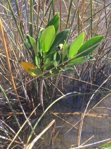
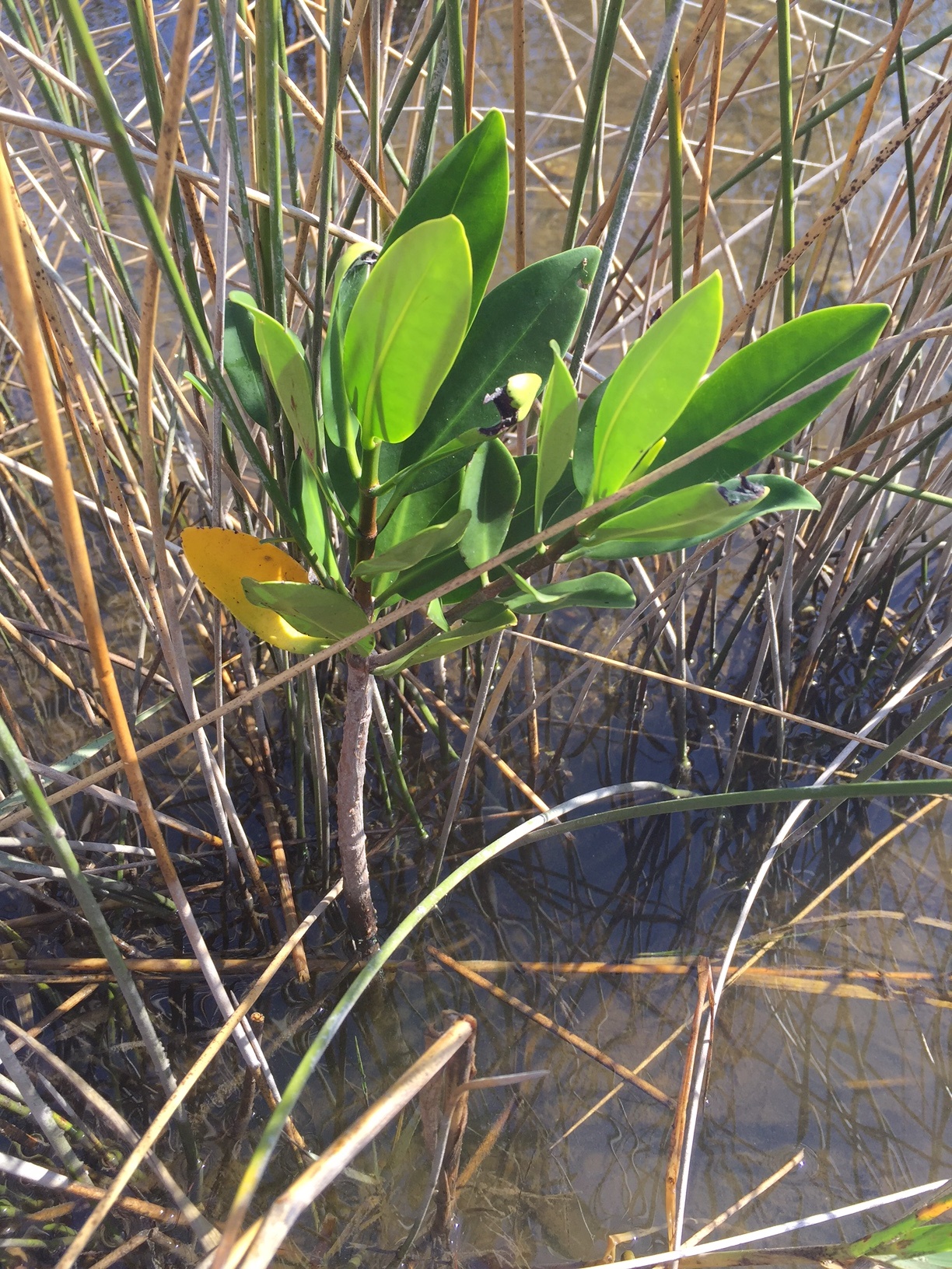
Worldwide, mangrove trees are moving from warmer climates into temperate habitats as climate changes. Photo credit: Carrie Stevenson, UF IFAS Extension
Recent changes in climate are also becoming a factor for human and wildlife behavior. I find myself “migrating” into the air conditioning more often in these dog days of August as 110°+ heat indices bear down. The European heat wave this summer resulted in record-breaking temperatures and at least 8 deaths. Many European countries have never needed air conditioning, so homes, public transportation, and vehicles provide no relief from the sweltering heat. Wildlife, by contrast, cannot move indoors. As the planet warms, some wildlife living in temperate regions may move because their homelands slowly turn subtropical. When this happens, history shows us that humans either “persecute, protect, or ignore” new species, which may result in great success or the downfall of species seeking new habitat. In addition, biologists have been observing and expecting many tropical species of plants and animals to expand into new, warmer territories, as formerly cold climates heat up and become more suitable for particular species to thrive. Mangroves, for example, are migrating beyond the equator worldwide, while the National Oceanic and Atmospheric Administration (NOAA) Arctic report card has shown that the melting of polar ice caps has literally broken up polar bear habitat, along with reducing populations of grazing herds of caribou and reindeer.
Keep in mind that neither one hot summer nor one cold winter define the pace of climate change. The issue at hand is the long-term change. We find ourselves, in August 2019, having just experienced the hottest July (globally) on record since worldwide recordkeeping began in 1880. Some may see this as a fluke, until we consider that NOAA and NASA data show that 17 of the 18 warmest years have occurred since 2001. The patterns are changing—and as always, we humans must adapt. It is important that our adaptation includes mitigation measures, which can range from reducing energy use to planting more trees. To learn more about changes in worldwide climate and what you can do to make a difference, visit the NOAA site https://www.climate.gov/
by Carrie Stevenson | Jul 6, 2018
Climate change. Those two simple words have the power to bring about a strong reaction in people. For many, the term is fraught with emotion—with worry, anger, and fear of the unknown. For others, these two words might elicit doubt or frustration. According to a multi-year, nationwide study conducted by George Mason and Yale Universities, as a country we react to the science of climate change along a spectrum of responses. On one end of the spectrum, people are “alarmed” (see a change in climate as a reality and taking action about it) and “concerned” (believe it is a serious issue but have not taken action). In the middle are those in different stages of understanding or awareness of climate issues, and characterized as “cautious”, “disengaged”, or “doubtful.” At the opposite end of the spectrum are the “dismissive”, which are that group of people who are actively opposed to action on climate change and may feel it is a conspiracy. These six categories were based on the responses of a large, in-depth survey conducted in 2008. Ten years later, researchers conducted the study again to see if attitudes had changed. Interestingly, they had—with the most noticeable shift out of the “disengaged” category, as people seemed to cast their lot with one side or the other.
| 2008/2009 |
Yale/George Mason Study Results |
2018 |
| 18% |
Alarmed (+3) |
21% |
| 33% |
Concerned (-3) |
30% |
| 19% |
Cautious (+2) |
21% |
| 12% |
Disengaged (-5) |
7% |
| 11% |
Doubtful (+1) |
12% |
| 7% |
Dismissive (+2) |
9% |
Table 1. 10-year comparison of “Global Warming’s Six Americas” Study. Source: http://climatecommunication.yale.edu/about/projects/global-warmings-six-americas/
Looking at the data, respondents left the “disengaged” group and moved either towards doubtful and dismissive or towards the cautious category. It is likely that the 3% change out of “concerned” moved directly into “alarmed”, as extreme weather events and record temperatures over the last 10 years brought the impacts of a changing climate closer to home.
Data from a national study shows the level of agreement/disagreement on climate-based issues. Source: Yale/George Mason University
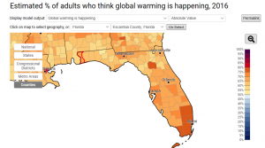
When the study is broken down by region, a minority of northwest Floridians believed human activities such as carbon emissions caused climate change. However ~65% of the same group believed climate change was happening (regardless of cause), and 80% responded that our country should fund research looking into renewable energy. The good news here is that while many of us do not agree on the cause of climate change, the majority of us agree on positive steps forward that may relieve some of its results.
For me, the take-home message of this study is that scientific understanding—on many issues, not just climate—is often along a spectrum based on exposure to research, personal interest/relevance, and cultural influences. When explaining any science-based concepts, it is important to know where your listener is coming from and start from there. It is unfortunate that we are in a time when many principles of science are taken as political positions and not products of unbiased scientific method. That being said, great thinkers from Galileo to Hawking have had their run-ins with popular opinion.
As the summer heat cooks on and hurricane season warms up, there will be more articles in the news about climate and its effects. When reading these, look at the source and their intent. Is this an opinion piece/blog with deeply emotional photos and stories meant to sway readers one way or the other? Or is it an agency page, reporting factual data? Time-tested agencies like the National Weather Service (NWS), National Oceanic and Atmospheric Administration (NOAA) and National Aeronautic and Space Administration (NASA) have been keeping historic records of climate data and satellite imagery of ice cover for decades. Use their information to inform yourself, no matter where you might fall upon the “six Americas” spectrum. Worldwide data for climate has been kept since 1880, and both NASA and NOAA climate data found:
- 2016 was the hottest year globally on record
- 2nd and 3rd hottest years on record were 2015 and 2014.
- 16 of the 17 warmest years documented since 1880 have been since 2001
For more information on climate science, check out these resources: Intergovernmental Panel on Climate Change, NOAA Climate, and NASA Climate.