by Rick O'Connor | Aug 17, 2025
In Part 15 of this series, we mentioned the need to begin seeking new sources of energy. Currently fossils fuels are our go-to source, but this source is limited, and the demand is rising. There are also issues with the waste produced from the drilling, processing, and burning of fossil fuels. Just as we moved from wood to coal, and from coal to oil – we need now to begin looking for what will follow oil. What options do we have?
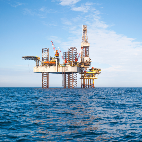
Drilling platform.
Photo: Florida Museum of Natural History
Is oil still an option?
As most know, crude oil and natural gas are found in pockets beneath the earth’s surface. We extract it by drilling deep wells, using gravity to drive the product towards the well head, and pump it to the surface. At some point in time, usually about a decade, the pressure is lower and the well has reached peak production. At that point we need to drive another well, sometimes in another location. With the demand for this energy source rising, peak production wells are becoming common and new sources of oil are becoming harder to find. The United States is particularly in a situation due the fact we use more oil than any other nation (24% of the world’s oil in 2011). Much of the oil reserves are outside of the U.S. and managed by the Organization of Petroleum Exporting Countries (OPEC) – which includes 12 nations. OPEC stated that since 1984 oil production from existing reserves has exceeded the discoveries or new sources – this resource is diminishing. It was predicted in 2011 that by 2025 70% of our oil needs would come from imports. However, there was a decline in imports beginning around 2005 and today 60% of our oil use comes from domestic sources. Here are some advantages and disadvantages of continuing with oil posted in 2011.
| Advantages |
Disadvantages |
| Ample supply for 40-100 years |
Need to find substitutes within 50 years |
| Low cost |
Large government subsides |
| Easily transported within and between countries |
Pollutes air when produced and burned |
| Technologies are well developed |
Can cause water pollution as well |
Is natural gas an option?
Much of the natural gas reserves (27%) are found in Russia. Other leading producers include Iran and Qatar – the U.S. only produces 3%. This fossil fuel can be used to power factories, cook and heat homes, and power transportation. Though extracting and burning natural gas produces greenhouse gases, it is less than coal and oil. It can be transported across oceans if liquified.
| Advantages |
Disadvantages |
| Ample supplies |
Releases CO2 when burned |
| High net energy yield |
Government subsides |
| Low cost |
Methane can leak from pipelines |
| Less air pollution than other fossil fuels |
Difficult to transfer from one country to another |
Is coal still an option?
In 2011 about 40% of the world’s electricity was generated by coal fired power plants. There has been a decline over the last decade, with a particular drop during the pandemic, but it has seemed to have rebounded some since with an current estimated of about 33% of the world’s electricity being produced by coal. Due to the pollution issues many nations have already begun to turn away from coal. According to the International Energy Agency, China is currently burning three times more coal than all other countries combined. However, this is expected to plateau by 2027. It is the world’s most abundant fossil fuel source. The US Geological Survey estimated in 2011 that coal could last between 214 and 1,125 years. Today the current reserves in the US could last another 422 years. The pollution issue is not only carbon dioxide but sulfur dioxide and trace amounts of mercury, and radioactive materials – it is the “dirtiest” fuel.
| Advantages |
Disadvantages |
| Ample supplies |
Severe land disturbance, air pollution, and water pollution |
| High net energy yield |
Soot is a human health risk |
| Low cost |
Large government subsides |
| Well-developed technology |
High CO2 emissions when produced and burned |
Is nuclear energy an option?
For the purpose of boiling water to produce steam that spins a turbine and generates electricity, nuclear power plants are quite complex and expensive. The fuel is mined uranium which is enriched from 0.7% fissionable uranium-235 to about 3%. It is made into pellets. These pellets are about the size of a pencil eraser and each pellet contains the energy equivalent to a ton of coal. These pellets are placed into pipes called fuel rods. The rods are moved in and out of the reactor to control the reaction and avoid a meltdown which could release large amounts of radioactive material. The system is cooled by water. This system is encased in a thick concrete structure called a containment shell to avoid the accidental release of radioactive material. About once a year the spent fuel rods are removed, placed in holding tanks, and transported to an underground holding facility for long term storage – between 10,000 and 240,000 years. However, after 60 years of using this form of energy – no country has developed such a storage facility, and the spent rods are currently stored on site.
In the 1950s researchers predicted that by the year 2000 at least 1,800 nuclear plants would supply 21% of the world’s energy. In 2011, after large investments and government subsidies, there were 439 commercial power plants in 30 countries producing only 6% of the world’s energy. That number has not changed. Reasons for the decline include construction costs, operating costs, low net energy yield, public safety concerns, and increased safety regulations.
| Advantages |
Disadvantages |
| Ample supply of fuel |
Cannot compete economically without government subsides |
| Low environmental impact (without accidents) |
Low net energy yield |
| Moderate land use |
Risk of catastrophic accidents |
| Low risk of accidents due to large number of safety systems |
Long term storage problem |
|
Subject to terrorist attacks |
|
Spread knowledge and technology for building nuclear weapons |
Listed above are the advantages and disadvantages of fossil fuel and nuclear energy – systems we have been using for a while. With the concern of climate change, and other environmental risks, humans have begun looking at other energy sources. In the next article we will look at those. Either way – we still need the energy.
References
Coal. The International Energy Agency. https://www.iea.org/energy-system/fossil-fuels/coal.
Coal Explained. How Much Coal Is Left? U.S. Energy Information Agency. https://www.eia.gov/energyexplained/coal/how-much-coal-is-left.php.
Miller, G.T., Spoolman, S.E. 2011. Living in the Environment. Brooks/Cole Cengage Learning. Belmont CA. pp. 674.
by Rick O'Connor | Aug 11, 2025
This is an interesting resource to discuss in this series. Everyone would agree that we need food, water, and space – but do we need energy? Other creatures on this planet do fine without electricity, machines, and alternative transportation – do we really need it? You could debate this for hours, but the bottom line is we now have it and yes… we need it.
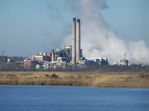
Power plant on one of the panhandle estuaries.
Photo: Flickr
Miller1 begins this topic with a brief history of energy use by humans. Early humans survived on muscle power alone and would require about 2000 kilocalories per human/per day – most of this energy was obtained from their food. A modern human from the United States would require 2000 kilocalories/day to maintain their muscle power and an additional 600,000 kilocalories/day to maintain the machines and systems of our modern lives. This is 600,000 kilocalories/human/day.
The first alternative energy source was fire and was used to keep people warm and cook their food. When humans began farming, they used domesticated animals to do much of the heavy work of plowing and transportation. Later they began to use the wind to pump water from the ground and move sailing vessels across waterways. They learned to use flowing water as a mode of transportation and for grinding grain. They eventually used flowing water to produce electricity.
As we moved into the industrial age, machines would do a lot of our work but needed an energy source to do so. Wood was the initial fuel. Burning wood could produce steam that would operate the motors that would lead to some of our greatest innovations. Trains could haul people and goods over long distances in a much shorter time than domesticated animals could. The steam engine allowed vessels to travel in locations where wind was not reliable. Wood burning stoves would heat our homes and cook our food. However, the growing demand for wood led to its demise. We harvested it faster than new trees could grow back. We faced our first energy crisis.
We solved this crisis by switching from wood to coal. There were several problems with coal. One was the amount one needed to power our machines. You could transport tons of coal to local factories, coal cars on trains to power the locomotives, and in the hulls of ships to get them across the ocean – but the amount you need to move larger trains and ships provided a storage problem. Two, coal burns dirty. The air all around cities and factories became black with smoke, and tailings from the mining of coal polluted local waterways. Despite the pollution problem, humans needed energy and were fine with burning coal.
In 1859 humans discovered how to pump oil from the ground. Oil could be refined into diesel and gasoline and could power engines but did not require the storage space that coal did. So, transportation could now move more people and goods than coal would allow. Though coal was still used to produce our electricity – which we used for cooking and heating our homes, oil became the go-to energy source for transportation. Eventually many would switch from coal to natural gas (refined from oil or found in the ground near the oil) to produce electricity.
In the 1950s we discovered how to produce enormous amounts of energy by splitting uranium atoms. This new source of energy was used to produce electricity until the safety concerns became too high and nuclear power production decreased.
Today about 82% of our energy still comes from the burning of fossil fuels. There are pollution issues associated with this – including changing our climate – but the need for energy is greater now, with over 8 billion people on the planet. We have entered a new energy crisis. As with wood, fossil fuel sources are limited, demand is rising, pollution and habitat degradation from burning and drilling for fossil fuels is becoming a serious problem.
In our next article we look at evaluating the energy choices we currently have as to which may be the best choice for our future.
Reference
1 Miller, G.T., Spoolman, S.E. 2011. Living in the Environment. Brooks/Cole Cengage Learning. Belmont CA. pp. 674.
by Rick O'Connor | Aug 4, 2025
As our human population grows, so grow urban and suburban areas – and our natural areas and farms are decreasing. Much of this will cause problems for us and other species on the planet as well. How do we manage this need for space?
Some cities such as Hong Kong and Tokyo have responded by building vertically. Large apartment complexes provide not only homes, by grocery stores and gyms. Most are located within walking distance from work – and if they are not close to work, they use mass transit. We see this in some cities in the American northeast as well. This is known as compact development and has been pushed by many city planners and demographers.
Heavy urban development “sprawls” away from the city in many U.S. communities. The “corridor” to work has become congested.
Photo: Rick O’Connor
However, the United States, Canada, and Australia are car dependent communities. Our car dependency began in the early 20th century when we had land to expand, gasoline was cheap, and cars actually became “part of us”. We did not just own cars we had specific cars with specific colors. They became part of our personality – and to get rid of them will be very difficult.
Some scientists and economists suggest one way to reduce car use, and the energy they require and pollution they generate, is what would be termed – user pays approach. Ideas such as taxes on gasoline have been suggested. The funds generated by such taxes could go to build bike paths and more mass transit systems. This has been tough to do in the U.S. because (a) most communities do not have an efficient mass transit system or bike paths, and (b) we do not want taxes. Other methods suggested to reduce car use include parking fees, toll roads, bridge tolls, etc.
There are some disadvantages to alternative methods of transportation. Bicycles do not protect you in bad weather, are impractical for long trips, and offer little protection in an accident. Mass transit rail systems are expensive to build and maintain, commit riders to set schedules, and are cost effective only in densely populated areas. Buses require low fares, and the bus companies lose money, can get caught in heavy traffic, and also require set schedules.
Other suggestions include better land use planning. Methods tried here include limit building permits, including green belts in community design, encouraging mixed use of homes and small businesses, and concentrating development along mass transit rail lines.
The bottom line is to concentrate humans in areas where they live close to where they work and the resources they need. Walkable cities will reduce the need for expansion into nearby land space and farms which will allow for more green spaces the ecological services they provide for our existence.
Reference
Miller, G.T., Spoolman, S.E. 2011. Living in the Environment. Brooks/Cole Cengage Learning. Belmont CA. pp. 674.
by Rick O'Connor | Jul 25, 2025
We all have our personal space, our personal bubble, where we do not like others to enter. Some have a small bubble, but others have a much larger one. This will play a part in the discussion below but the statement “we need space” initially means – we must have some place to lie our head. All creatures do. Battles between birds, bears, and berries all take place for their piece of land where they will obtain their resources and call home. And with the population growth we see in humans, we are all seeing and feeling our personal space being invaded.
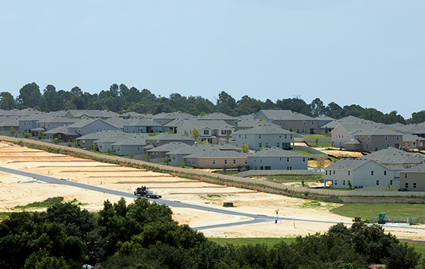
Much of the land in Florida is being developed.
Photo: University of Florida
Almost everyone reading this has experienced it. Some have homes on properties that are over 100 acres. Others have a house on only one city block. Others live on a city block where there are four houses. And others live on a city block that has a high rise with 200 apartments. Everywhere crowds are increasing. There is more traffic, more homes, more malls and strip malls. We are growing very fast. I have recently seen housing developments where people moved in BEFORE the house was done. We are feeling the growth of the human population and trying to maintain our space. And… as the human population grows there is need for more space.
Between 1800 and 2008 the percentage of the U.S. population living in cities increased from 5% to 79%. It began first with people moving from farms to the major cities. Then, due to crowding and congestion, people began to move from the central cities to what were called suburbs. Since 1980 people began to move from the crowded northeastern U.S. to the south and the west. Between 2008 and 2043 demographers (scientist who study populations) project that the fastest growing U.S. states will be Nevada, Arizona, and Florida. Currently (2025) the fastest growing state is the District of Columbia, followed by Florida and Texas. The largest state at over 39 million is California – followed by Texas (over 31 million) and Florida (over 23 million). States that are currently experiencing a decline in population include New York, Illinois, Hawaii, Louisiana, Mississippi, and West Virgina. Since the 1990s people have begun to move from the suburbs back to the farm areas – but not to farm – they are developing these rural areas into housing developments. We need space.
This urban sprawl has been supported by having automobiles and low-cost gasoline – most of these people still work in the cities. It is also supported by the fact people do not want to live in high rise buildings with 200+ apartments on one city block. We want more space – our bubble is bigger. In many locations these suburb communities are beginning to merge creating megalopolis – metro areas where you cannot really tell where one town ends and the next begins. Humans are spreading across the landscape like cancer. I have flown from Pensacola to Denver many times. As you look out the window of the airplane you can witness how our species has just engulfed the landscape – everywhere.
Heavy traffic is common place in the U.S. with our dependence on cars.
Photo: Rick O’Connor
These large urban areas have created some problems for us. They require high levels of energy to operate – and they do not produce their own energy. They generate tons of solid waste – and there is nowhere to dispose of it. They require large amounts of food – and they do not grow it. They require large amounts of water – and in some cases have their own source, but in many they do not. There is a lot of air and water pollution – it was because of regions like this the Clean Air Act and the Clean Water Act were created. There are few green spaces, trees are removed for development. Flooding, spreading diseases, and noise pollution are all issues.
The suburbs have their own problems. Traffic is heavy, and streets are crowded. There is the need for new schools, new stores, and new office space – often in areas that do not have the infrastructure to support them.
With a growing population there is a need for more space – but it is pretty obvious that how we are doing it is not sustainable and continues to create more problems for us and the rest of the planet. In our next article we will look at how to solve some of these problems.
References
Fastest Growing States in 2025. World Population Review. https://worldpopulationreview.com/state-rankings/fastest-growing-states.
Miller, G.T., Spoolman, S.E. 2011. Living in the Environment. Brooks/Cole Cengage Learning. Belmont CA. pp. 674.
by Rick O'Connor | Jun 20, 2025
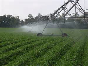
Despite the issues with modern agriculture, we still need food, and we need it for a lot of humans. So, what can be done to help improve things? Let’s look at some ideas that were suggested when I was teaching the class.
This is a common method used to irrigate crops across the U.S.
Photo: UF IFAS
Pesticides. There have been several methods employed to deal with the disadvantages of pesticides. One is legislation. In 1947 the Federal Insecticide, Fungicide, and Rodenticide Act (FIFRA) was passed. It was amended in 1972. This law allows the EPA, USDA, and FDA to regulate the sale and use of pesticides. In 1996 congress passed the Food Quality Protection Act. This law requires the EPA to reduce the allowed levels of pesticide residues in food by a factor of 10 when there is inadequate information on the potentially harmful effects on children. However, some studies from the National Academy of Science suggest these laws are not enforced as they should be for all pesticides. There are other methods suggested by scientists to battle crop pests.
- Fool the pests. This can be done by rotating different crops on the land each year. This helps control the population of insects that feed on specific crops and reduce their impact. Another idea is to plant crops during a time of year when the pest life cycle keeps it from being a problem, or when their predators are more abundant.
- Provide a home for pest enemies. Farmers can move from monocultured fields to polyculture fields which can decrease pest populations as well as enhance their predator’s population. This is also a method that could be used to reduce pesticides needed on homeowner lawns.
- Genetically modified plants. Though controversial, this method can produce both pest whose development is sped up, and crops that are resistant to the pest.
- Biological control. Introducing natural predators will reduce the need for pesticides all together. However, it is slow acting, not always available when needed, and can become pests themselves.
- Pheromones (sex attractants). These can be used to lure pests into traps or attract their natural predators. Pheromones are species specific so will not harm beneficial insects.
- Spraying hot water. This method has had success on cotton, alfalfa, potatoes, and citrus crops in Florida.
Many experts and farmers feel the best method to control pests is what is called the integrated pest management (IPM) plan. In this method the farmers assess their situation and then develop a plan that uses a combination of the above methods including chemicals. A study by the National Academy of Science found that using IPM methods can reduce pesticide use between 50-65% without reducing crop yield or food quality. However, there are some drawbacks. 1) it does require expert knowledge about the pest situation – here Extension can help. 2) it takes more time to be effective than pesticides. 3) no one IPM plan works for all, there could be slight differences between neighboring fields. There is also the issue of government subsides to encourage pesticide use, which has slowed this method down.
Soil. There are methods that have been used by farmers around the world to reduce soil erosion.
- Is used on land that is sloped. It helps retain water and soil from washing downhill.
- Contour farming. Is another method used on sloped land. Here the plowing goes across the landscape instead of up or down.
- Strip cropping. Is a method where one row is the row crop of interest (corn or cotton) with alternant rows of cover crops (alfalfa or clover). These cover crops help hold the soil in place and reduce water runoff.
- Alley cropping. Is a method where the crops are planted between rows of trees or shrubs – which provide some shade and reduces evaporation and helps slowly release soil moisture. The selected trees can provide fruit, and leaf litter than is used as mulch.
- Windbreaks or Shelterbelts. I see this a lot. This is a method where the larger field of crops is encircled by trees to reduce wind speed and erosion. The trees help retain moisture, provide habitat for insect predators, and can be sold as a product itself.
- No till or minimum tillage. Tilling the soil is needed but can enhance wind blown erosion. There are special tillers and planting machines that can plant seeds directly into through the crop residue into the undisturbed soil.
Years of abuse have made some soils less fertile and non-productive. There are methods being used to help restore this fertility. Some of these methods include organic fertilizers – such as animal manure and green manure. Green manure consists of using plant waste plowed into the soil. Composting is an option, as are commercial inorganic fertilizers.
Sustainable Aquaculture. Many feel with the size of the human population now wild harvest seafood cannot sustain us. Mass production of seafood – aquaculture – is the direction we should move. However, in the last article we mentioned some of the problems with aquaculture. Ways to improve this would include.
- Do not place aquaculture farms in/near environmentally sensitive systems – such as mangrove forest or salt marshes. Some aquaculture projects (oysters) can actually help enhance water quality.
- Improve management of aquaculture waste. Waste treatment facilities.
- Develop methods to reduce escape of aquaculture species into the wild.
- Caged methods in existing water systems can help reduce predation and disperse waste.
Meat Production. One issue with meat production is the amount of meat we consume. Since 2011 between 30-40% of the grain grown is used to feed livestock – not humans. Miller suggests that if the world had the average U.S. meat diet, our current grain harvest would only feed about 2.5 billion people. Reducing meat in our diet would provide more grain-based foods for human consumption. They also suggest shifting from less efficient grain fed meats – beef and pork – to more grain efficient forms of meat – chicken and fish – would also improve food production in general. There are also concerns about how livestock are raised for mass production. Large, overcrowded feedlots and pens are of concern. Several major fast-food chains and grocery stores have invested in research to try and improve conditions for our livestock. I watched a cooking show hosted by an Italian women. She mentioned that they had livestock on the farm growing up. During the spring, summer, and fall they ate primarily vegetables, fruit, and non-meat pasta dishes. In the fall they would slaughter their livestock and switched to a meat diet during the winter – because that was when the meat was available. It also makes sense from a biological point of view. Your body requires higher protein-fat diets to keep warm in winter – this is not needed in the summer. Consuming more fish in summer would make sense. Many have converted to such diets and – to keep up with the growing human population – many more will need to.
References
Sloat, L., Ray, D., Gracia, A., Cassidy, E., Hanson, C. 2022. The World is Growing More Crops – But Not for Food. World Resources Institute. https://www.wri.org/insights/crop-expansion-food-security-trends.
Miller, G.T., Spoolman, S.E. 2011. Living in the Environment. Brooks/Cole Cengage Learning. Belmont CA. pp. 674.
by Rick O'Connor | Jun 6, 2025
Let’s begin with crops. In 2011 it was reported that 77% of the world’s food was coming from grains being grown on 11% of the worlds land. Rice, wheat, and corn were/are the big players. We mentioned in Part 8 of this series that industrial farming of these crops was putting a heavy toll on the nutrients in the soil needed to sustain the next crop. Response… commercially produced inorganic chemical fertilizers – we will make these nutrients in a factory and spread them over the fields. Massive irrigation systems were developed to water these large fields and allow us to use land that would otherwise not be able to support these crops. Commercially produced pesticides to reduce the enormous numbers of insect pests – whose populations were also increasing with the increase in food sources. Reducing pests equals higher yield. High-yield grain varieties – science had been able to develop new strains of grains that could produce quicker and even produce their own defenses against insects. But with this success there has been a cost.
This is a common method used to irrigate crops across the U.S.
Photo: UF IFAS
There was a statement in the textbook I used when I taught this class saying – “according to many analysts, agriculture has a greater harmful environmental impact than any other human activity and these environmental effects may limit future food production”. Let’s look at some of these negative impacts.
Soil. Topsoil erosion is a serious problem in many parts of the world. Naturally the overlying vegetation holds the soil, retains water, and exchanges nutrients. When the native vegetation is removed for agriculture, the soil blows/washes away, it becomes drier, and the nutrients are not replenished. In 2011 it was estimated that 33% of the world’s cropland was losing soil faster than it was being replaced. In some locations this has been so extreme that the land has actually been converted into a desert – a process called desertification. Water used in irrigation has small traces of salt. When sprayed over a field in more arid areas – it evaporates quickly leaving behind the salt, which can kill the crops – a process called salinization. In some areas the water from irrigation causes the natural water table to rise, soaking the crops and killing them – a process called waterlogging.
Genetically Modified Food. The advances in genetically modified food have had both positives and negative results. One the positive side – many of these crops do not require fertilizers – need less water – more resistant to insects, disease, frost, and drought – they grow faster and at higher yields. The negatives include – irreversible and unpredictable genetic and ecological effects to the neighboring environment – possible harmful toxins produced by mutations of these GM plants – new allergens – lower nutrition – an increase in pesticide resistant insects and weeds – and can harm beneficial insects.
Industrialized Meat Production. Advantages include – increased meat production – less land use – reduced overgrazing – and reduced soil erosion. Negatives include – large inputs of grain, water, and energy – higher greenhouse gas emissions (methane) – high concentrations of animal waste that pollutes – and antibiotics increases genetic resistance to microbes in humans.
Pesticides. Advantages include – increased food supply. Disadvantages include – promoting genetic resistance – kills beneficial insects – can harm wildlife and humans – expensive. Studies have shown that when pesticides are used about 95% of the targeted pests are killed. However, the 5% of insects who were naturally immune to the pesticide reproduce rapidly to fill the decrease in the population. Within five or so years, most of the pests are now immune to the pesticide. So, they need to “beef up the formula”. This again kills 95% of those pests. But, again, 5% are immune – and the cycle begins again, during each round the pesticides become stronger and stronger – this process is called the pesticide treadmill. And we all have heard of the DDT story. This was a “one time spray to kill all your insect pests” – and it did. The bad insects, but the good insects, birds, and many other forms of wildlife suffered from this.
Aquaculture. Many feel the future of seafood production is in “fish farming”. They do not believe that wild harvest is sustainable with the growing population. The advantages to aquaculture include – high efficiency and high yield to small volume of water used. The disadvantages would include – requires large inputs of land, feed, and water – large waste outputs – reduces natural ecosystems – uses grain to feed some species – dense populations are vulnerable to diseases.
In Part 10 we will learn about attempts to correct some of the disadvantages – we still need food.
Reference
Miller, G.T., Spoolman, S.E. 2011. Living in the Environment. Brooks/Cole Cengage Learning. Belmont CA. pp. 674.
