by Will Sheftall | Jan 19, 2016
The Florida Legislature has just convened for the 2016 session, and news from the capitol is already announcing a sweeping water bill on the fast-track to passage. Supporters are quoted as saying it would provide increased protection for certain key water resources in the State such as springs and the Everglades; opponents are quoted as saying that while it doesn’t undo current protections, neither does it go far enough to assure sustainable protection of water resources for Florida’s future.
Thus it seems our legislators and lobbyists are celebrating something that’s a little better than what we’ve got now, but isn’t good enough to get the job done. That doesn’t sound very reassuring. We need a realistic blueprint for how Florida’s ever-expanding population and robust agricultural industry that produces our food can continue to use Florida’s water resources without using them up. The only way that’s going to happen is for citizens concerned about their grandchildren’s future in Florida to become the voices that legislators ignore at the peril of their political future.
So how do you know what to think, and what to say, about the state of water resources where you live – in the Panhandle? Do you understand their current status and vulnerabilities? Threats to their near-term viability? Prospects for their long-term sustainability, complicated as they are by projections of amplified climate variability?
“Panhandle Outdoors LIVE!” is stepping it up a notch for 2016, to help you get a handle on these “need to know” issues that affect future sustainability. University of Florida Extension’s acclaimed “Panhandle Outdoors LIVE!” mode of exploring signature water resources with knowledgeable guides is not going away; it’s being expanded into “water school” events in 2016. We are adding expert presentations and discussion to the on-water, on-trail immersion learning adventures you’ve come to love.

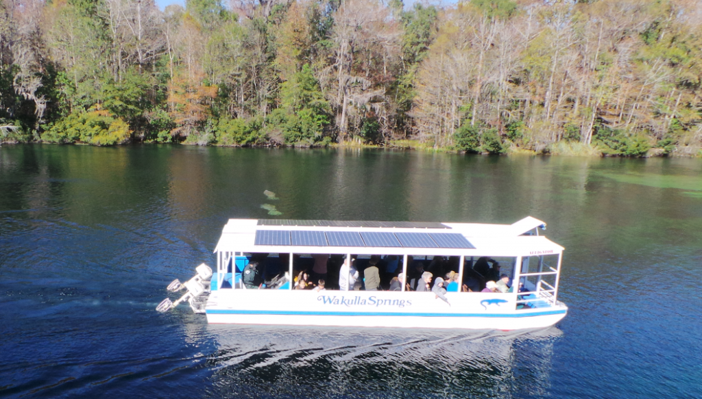
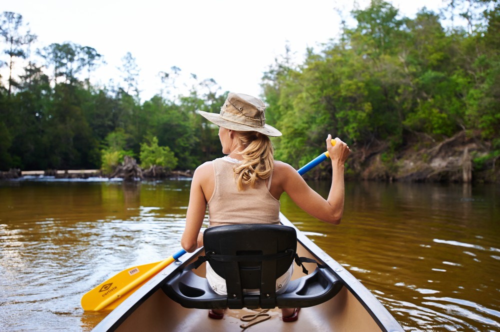
Daily river cruises on the Wakulla River are a great way to see manatees and other unique wildlife.
Photo: L. Scott Jackson
This year we’ll study four Panhandle water resources of regional significance – the Wakulla Springshed, St. Joe Bay, the Econfina Watershed, and Weeks Bay. Two are freshwater streams and their watersheds; two are bays. Two are in the eastern Panhandle; two are in the west (one even in Alabama). Two are being offered in the spring, the other two in the fall.
First up is the Panhandle Outdoors LIVE! – Wakulla Springshed School on March 1-2. It will base out of the magnificent “Old Florida” Wakulla Springs Lodge south of Tallahassee, and feature field trips to Leon Sinks Geological Area, Cherokee Sink and the Wakulla River – concluding with an optional paddle downriver from Wakulla Springs through a transition of ecosystems to historic Fort San Marcos de Apalachee, where the Wakulla joins the St. Marks River.
Next up, on April 4-5, is Panhandle Outdoors LIVE! – Weeks Bay Watershed School that will base out of the Episcopal Beckwith Camp and Retreat Center on Weeks Bay in Fairhope (Baldwin County) Alabama. This second watershed school will focus on the Weeks Bay National Estuarine Research Reserve, and feature a demonstration of oyster farming and a kayak paddle trip.
For more detailed information, and to register, for the Wakulla Springshed School visit – http://pol-2016-wakulla-springshed.eventbrite.com
For more information on the April overnight school to Weeks Bay National Estuarine Research Reserve contact Rick O’Connor at roc1@ufl.edu
For more information on the August day school on the Ecofina River contact Laura Tiu at lgtiu@ufl.edu
For more information on the September overnight school to St. Joe Bay contact Erik Lovestrand at elovestrand@ufl.edu
by Carrie Stevenson | Jan 19, 2016
In 2014, five Extension agents involved with www.naturallyescarosa.com launched the first Gulf Coast Agritourism & Ecotourism Business Development Conference. Over sixty business owners and members of the hospitality industry met to discuss marketing, sustainable tourism, and how to handle insurance and liability in an industry that involves outdoor exploration.
 Back by popular demand, we have organized a second one to be held February 18-19 at the Gulf Power Building in Pensacola.
We have a dynamic group of speakers from all over the southeast to discuss the economic opportunities available in this line of work.
Due to partial grant funding, registration (includes meals and materials) is only $25!!! Anyone involved in the agriculture (U-pick operations, fresh produce markets, corn mazes, pumpkin patches, etc.), nature (paddling, camping, fishing, etc.) tourism or hospitality industry is encouraged to come.
Click Here and Buy Tickets today!
For more information on the 2016 Gulf Coast Agritourism & Ecotourism Business Development Conference, contact Chris Verlinde (850) 623-3868 or Carrie Stevenson (850) 475-5230
by Laura Tiu | Nov 20, 2015
The Panhandle Outdoors LIVE team, with Extension Agents from eight counties, hosted an outdoor field day on August 26, 2015. Twenty-three participants from over eight counties in Florida attended the event and traveled to three local springs: Vortex, Ponce de Leon, and Morrison Springs. The goal of the day was to learn about spring characteristics, history, biodiversity and management issues. These popular springs in the western Panhandle are managed by three different entities – the private sector, local government and a state agency.
The day began at Vortex Springs. Three generations of the same family have owned and managed this popular dive resort in the Panhandle. The current owners shared the history of the spring along with a family photo album highlighting the growth and development over the years.
Vortex Springs Dive Resort
Vortex Spring produces 28 million gallons of crystal clear water daily at a year-round temperature of 68 degrees. Depths in the spring basin range from about 50 feet for a cavern dive and up to 115 feet for a cave dive. The bottom of the spring bowl is sandy, with limestone near the vent. Vortex waters flow out of the 225-foot-diameter spring pool to form Blue Creek, which flows over a half-mile before entering the Choctawhatchee River. Fish at the spring are tame, coming right up to visitors, and include bluegills, channel catfish, American freshwater eels, gar, redhorse suckers, shadow bass, and exotic species such as koi and goldfish (floridasprings.org). One of the biggest environmental challenges the owners face is controlling an invasive aquatic plant, hydrilla, which rings the basin.
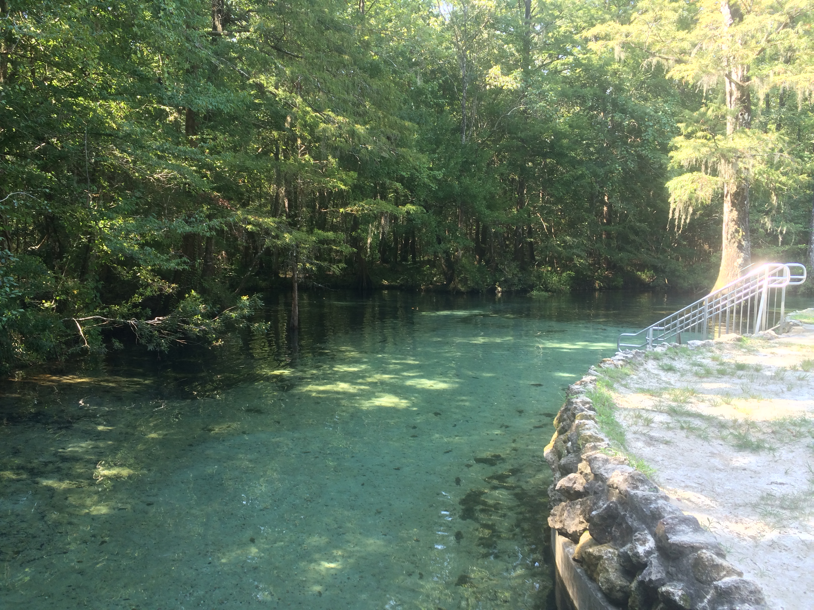
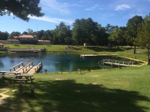
The next stop was Ponce de Leon Springs State Park where participants learned about the springs and had lectures on water quality, Florida Friendly landscapes and storm water management. Managed by a state agency, this beautiful spring is named for Juan Ponce de León, who led the first Spanish expedition to Florida in 1513 – as legend has it – in search of the “Fountain of Youth”. Visitors might well regain their youth by taking a dip in the clear waters where the temperature is a shocking 68 degrees F. year-round.
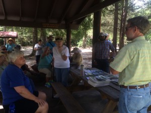
Leon County Extension Agent, William Sheftall, shares information on watershed management
The main spring produces 14 million gallons of water daily into a crescent-shaped basin with depths averaging five feet but increasing to 16 feet over the vents. The bottom is sand and limestone and gives the popular swimming area a light greenish blue appearance. The spring-run is approximately 350 feet in length and flows into Sandy Creek, a blackwater stream, which subsequently flows out of the park and into the Choctawhatchee River (floridasprings.org).

The spring run at Ponce de Leon Springs flowing into Sandy Creek
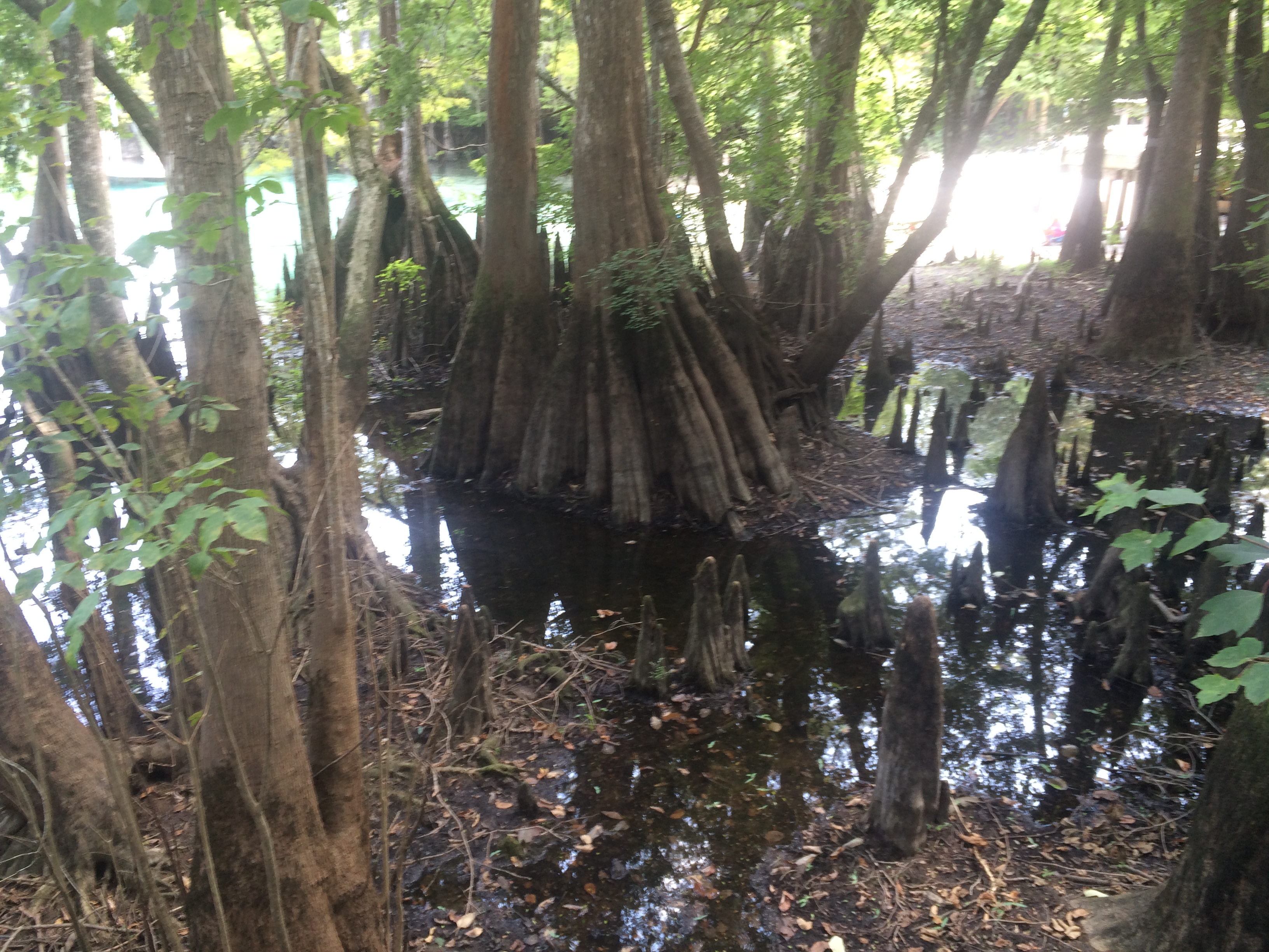
Our final destination was Morrison Springs. Morrison Springs is managed by Walton County, whose Commissioner and Habitat Conservation Plan Coordinator shared the history of the springs and the development work that has been completed. The large, sandy-bottomed spring is surrounded by a 161-acre park and is a popular spot for swimming, snorkeling, diving, birding, photography and nature walks . Morrison Spring discharges an average of 48 million gallons of crystal-clear water each day to create a 250-foot-diameter spring pool and a spring run that flows into the Choctawhatchee River (floridasprings.org). The springs are home to a healthy fish population with largemouth bass, bluegill, carp, white mullet, and pickerel all being seen that day.
Beautiful cypress trees and knees ring Morrison Springs
Field day participants (86%) reported an increase in knowledge of the springs after the event with 59% indicating that they would change their behavior based on the information presented. Behavior changes mentioned were cleaning up trash, controlling personal fertilizer applications, making sure their lawn care company was certified, controlling erosion, conserving water and planting native plants. All of the participants (100%) reported being interested in attending future Panhandle Outdoor Live events. That is just the kind of encouragement the team needed, so be sure to watch our website for future event announcements.
by Rick O'Connor | Nov 6, 2015
Hernando de Soto and his party crossed the Aucilla River sometime in October of 1539 and celebrated Christmas in what is now Tallahassee. Many things in Florida have changed since de Soto passed this way, but when the 2015 Panhandle Outdoors LIVE! tour hiked the Aucilla Sinks portion of the Florida Trail this September, many things had not.
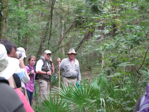
Panhandle residents explore the area of Aucilla Sinks with local guide David Ward.
Photo: Jed Dillard
Yes, the trail is maintained and marked by the Apalachee chapter of the Florida Trail Associations and there are bridges in spots, but the blood sucking bugs that bedeviled deSoto haven’t dissipated. More importantly, the spectacular and distinctive area provides a relatively easy hike that reveals the connections between geology and hydrology in an area with little disturbance by the settlers who followed the first Europeans into North Florida.
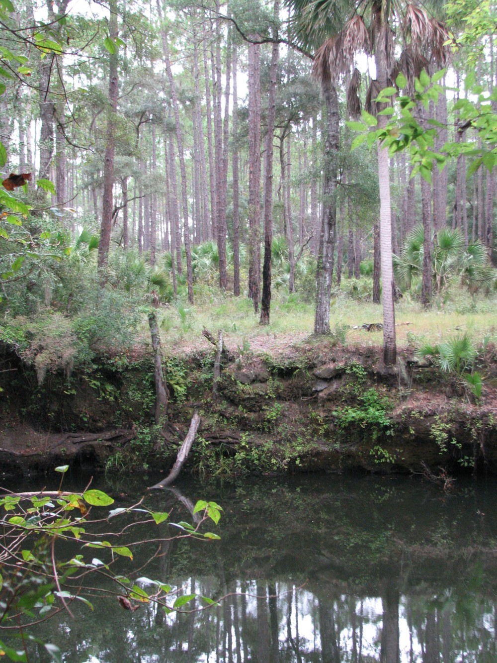
Hikers got up close and personal views of the Karst topography found in North Florida. This topography occurs as the tannic rivers and runoff dissolve the underlying limestone on their way to the aquifer. These connections and voids in the bedrock allow the Aucilla River to “come and go” above and below ground as it moves to the Gulf of Mexico as do all rivers in the Suwannee River Water Management District other than the Suwannee.
Native Jefferson county guide, David Ward pointed out the contrast between tannic water in the river channel and the clear water in caves near the river. “In those caves the water is crystal clear. You are looking at the water of the aquifer itself.”
Leon County agent Will Sheftall seized the opportunity to drive home how vulnerable Floridians are to ground water pollution and its effects on our water supply. “Here there’s little distance between the surface and the ground water. In these sandy soils, water moves quickly from the surface to the aquifer. Whatever is in that water can easily get into our ground water. Our personal activities and our public policies need to reflect that to ensure the future of Florida’s water quality.”
As we reached a slightly elevated area, Ward pointed out a longleaf pine/wiregrass community restored by reinstituting controlled burning. The open vegetation contrasts with the non-fire resistant species such as parsley hawthorn in wetter areas usually untouched by fire. “These pine savannahs were widespread when the Europeans arrived,” Ward noted. “Over my lifetime in these woods, I’ve seen appropriate management bring back these conditions closer to what we know it was like when the Europeans arrived.”

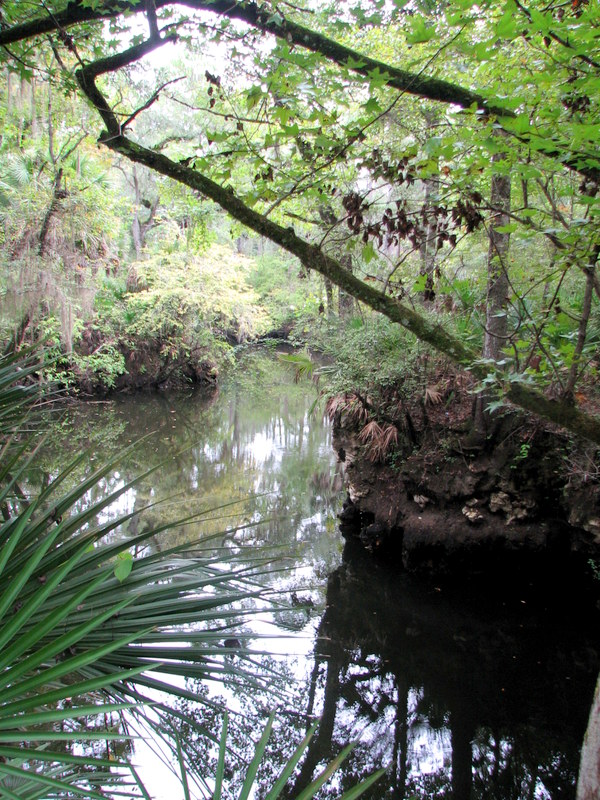
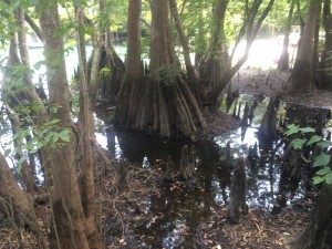
One of the many locations where the Aucilla River “rises from the limestone caverns beneath the earth.
Photo: Jed Dillard
Information on this section of the Florida Trail is available from the Apalachee Chapter of the Florida Trail Association, the Suwannee River Water Management District and Florida Fish and Wildlife Conservation Commission. Humidity never went below 80 percent during our late morning, early afternoon trip. November will likely provide less buggy and surely less muggy conditions. If you’d like to learn about this area from the comfort of your recliner or need some extra encouragement to strike out on the walk, check out this program previously broadcast by WFSU TV. http://wfsu.org/dimensions/viewvideo.php?num=184 Either way, you’ll know more about Florida’s spectacular natural world.
AUTHOR: Jed Dillard; Livestock and Forges Extension Agent; Jefferson County