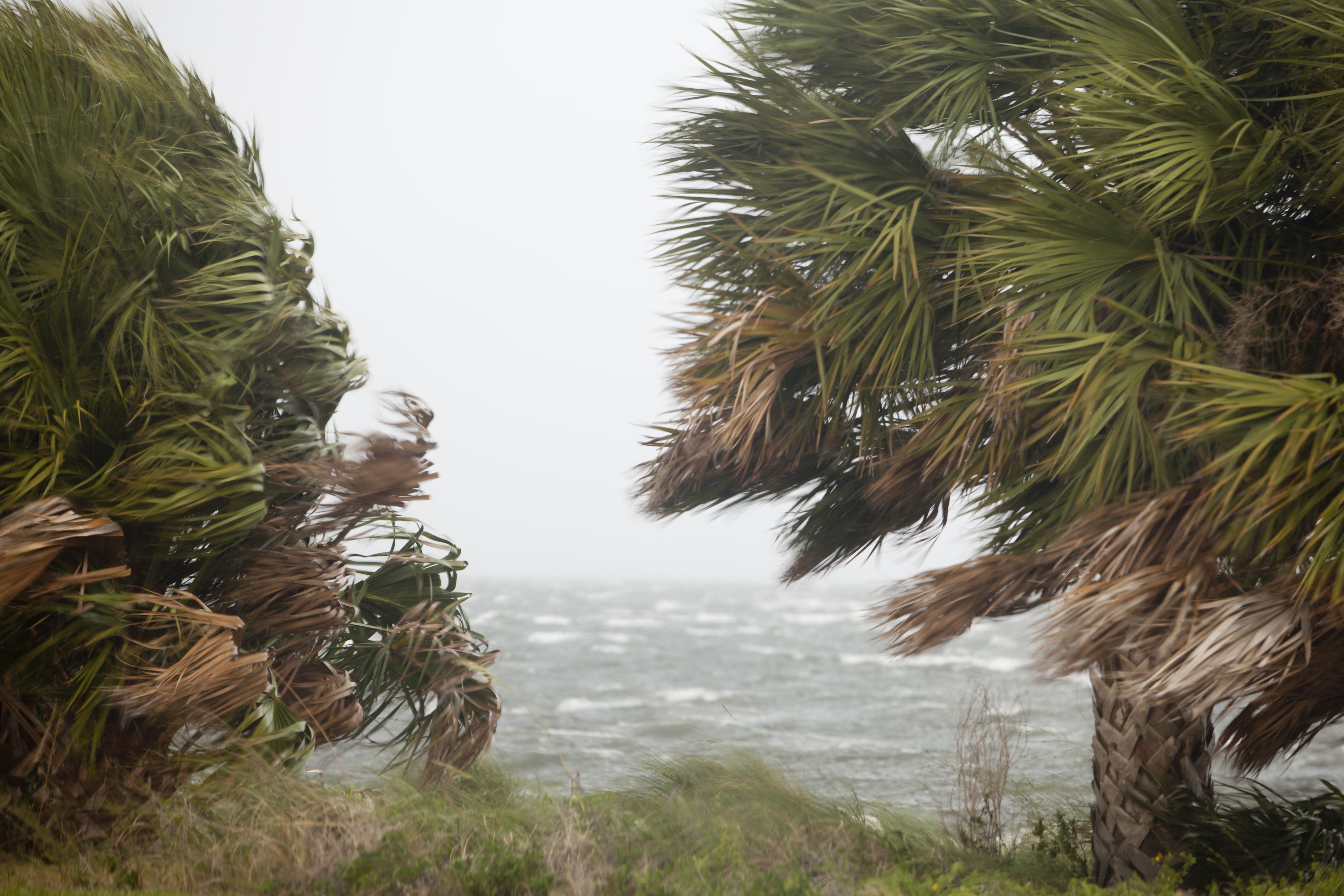
For better or worse, tropical storms are exciting. Besides the energy and tension around the mystery of where a storm will make landfall, the combination of powerful waves coming ashore, intense wind gusts, and driving rain really heighten all the senses. Most long-time Floridians don’t flinch too much at a Category 1 or 2 hurricane. But once we cross the threshold of a Category 3+, things change. If you have lived through a storm like Frederic, Ivan, or Michael, you know the damage and heartache these stronger storms can bring. Even Category 2 storms like Hurricane Sally just three years ago had serious lasting impacts, particularly affecting the under-construction Pensacola Bay Bridge.
An example of damage to local marinas and fishing vessels after Hurricane Michael in 2020. (Photo by Allen Golden).
Post-covid, with the economy (sort of) back in full swing, we are averaging just over 1,200 people a day moving to Florida. From July 2021-July 2022, nearly half a million people arrived, compared to 185,000 in the same timeframe the previous year. While some of these new residents may come from storm-prone locales, many have zero experience with hurricane season on the Gulf. If you are among those new to hurricanes, or know neighbors who could benefit from information, please share these tips with them.
Tip 1: Have the right insurance. The vast majority of insurance companies will not issue new policies when there’s a storm in the Gulf. Officially, hurricane season begins June 1. So, if you don’t have enough coverage for your investments, you should go RIGHT NOW and look into it, before the storm season really heats up in late summer. In addition, different types of policies cover different types of damage. Homeowners’ insurance (fire, theft, etc.) in Florida requires a separate windstorm policy, which includes damage from hurricanes and high winds (always confirm by reading your policy). And these are both separate from flood insurance. Performing certain types of windstorm mitigation, such as wind-rated garages, strong roof to wall connections, and obtaining shutters, can significantly reduce your overall costs for windstorm insurance.
Flood insurance is available through the National Flood Insurance Program (NFIP) and can be reasonably priced for people living outside of a flood zone. Those within designated flood zones will be required to purchase it, and rates vary widely depending on location and any prior flood impacts.
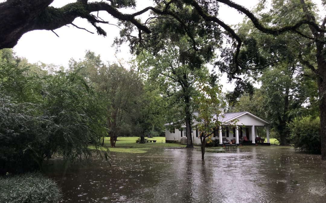
This property experienced significant flooding during a tropical storm a few years ago. Photo credit: Carrie Stevenson, UF IFAS Extension
As for which policy pays for storm impacts, it will become a game of “whodunit” afterwards, with adjustors making determinations of your damage based on the specific characteristics of each storm. These may include the direction of the incoming storm, the windspeed, amount of rain, and where any water damage actually originates from.
Tip 2. Create a disaster kit. Whether you are hunkering down and riding out the storm or getting out of the fray, it’s important to have a disaster kit with certain necessities. I always recommend a waterproof tote bin, to protect important documents from rain or floodwater. Items for a kit include medication, flashlights and batteries, shelf-stable food that can be eaten without heating or refrigeration, gallons of water, pet food, cash (since ATMs won’t work), portable phone chargers, a list of emergency contacts, and insurance paperwork. Comprehensive disaster kit lists can be found at floridadisaster.org. Another benefit of keeping these materials in a portable container is that if you do have to leave your home in a hurry, everything is in one place.
Tip 3. Come up with an evacuation plan. Talk with your immediate and distant family about your plans for a storm. If you plan to evacuate, look at the direction of an incoming storm and find a place to stay that is out of the immediate cone of impact. Sometimes this means moving east or west along the coast; other times it’s best to head inland. It’s important to let others know you’re leaving, in case there are serious impacts to your home from flooding or wind and rescuers are in the neighborhood.
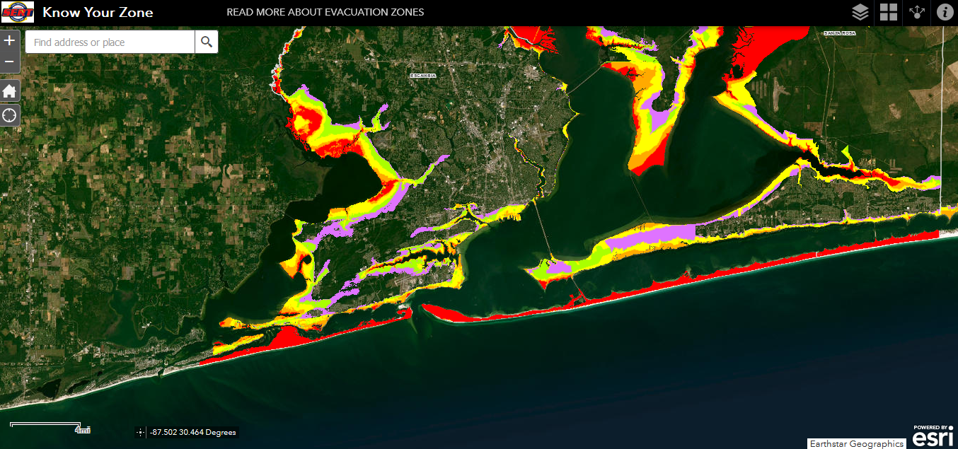
Tip 4. Pay attention to news about predicted storm surge—flooding is the deadliest factor of a hurricane. By using the Florida Division of Emergency Management website to “Know your zone,” you can look up your address to determine whether you are in a potential evacuation zone when a storm comes through.
Evacuation Zones in Florida are color-coded based on risk. Image from floridadisaster.orgA view of the evacuation zones for portions of southern Escambia and Santa Rosa Counties. Image from floridadisaster.org
Prepare an emergency drinking water supply for your household before a storm hits. Image: Tyler Jones, UF/IFAS.
Storm season is upon us. During a natural disaster, normal drinking water supplies can quickly become contaminated. To be prepared, collect and store a safe drinking water supply for your household before a storm arrives.
How much water should be stored?
Store enough clean water for everyone in the household to use 1 to 1.5 gallons per day for drinking and personal hygiene (small amounts for things like brushing teeth). Increase this amount if there are children, sick people, and/or nursing mothers in the home. If you have pets, store a quart to a gallon per pet per day, depending on its size.
Store a minimum 3-day supply of drinking water. If you have the space for it, consider storing up to a two-week supply.
For example, a four-person household requiring 1.5 gallons per person per day for 3 days would need to store 18 gallons: 4 people × 1.5 gallons per person × 3 days = 18 gallons. Don’t forget to include additional water for pets!
What containers can be used to store drinking water?
Store drinking water in thoroughly washed food-grade safe containers, which include food-grade plastic, glass containers, and enamel-lined metal containers, all with tight-fitting lids. These materials will not transfer harmful chemicals into the water or food they contain.
More specific examples include containers previously used to store beverages, like 2-liter soft drink bottles, juice bottles or containers made specifically to hold drinking water. Avoid plastic milk jugs if possible because they are difficult to clean. If you are going to purchase a container to store water, make sure it is labeled food-grade or food-safe.
As an extra safety measure, sanitize containers with a solution of 1 teaspoon of non-scented household bleach per quart of water (4 teaspoons per gallon of water). Use bleach that contains 5%–9% sodium hypochlorite. Add the solution to the container, close tightly and shake well, making sure that the bleach solution touches all the internal surfaces. Let the container sit for 30 seconds and pour the solution out. You can let the container air dry before use or rinse it thoroughly with clean water.
Best practices when storing drinking water
Store water away from direct sunlight, in a cool dark place if possible. Heat and light can slowly damage plastic containers and can eventually lead to leaks.
Make sure caps or lids are tightly secured.
Store smaller containers in a freezer. You can use them to help keep food cool in the refrigerator if the power goes out during a storm.
Keep water containers away from toxic substances (such as gasoline, kerosene, or pesticides). Vapors from these substances can penetrate plastic.
When possible, use water from opened containers in one or two days if they can’t be refrigerated.
Although properly stored public-supply water should have an indefinite shelf life, replace every 6-12 months for best taste.
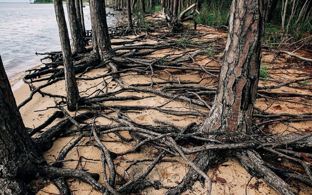
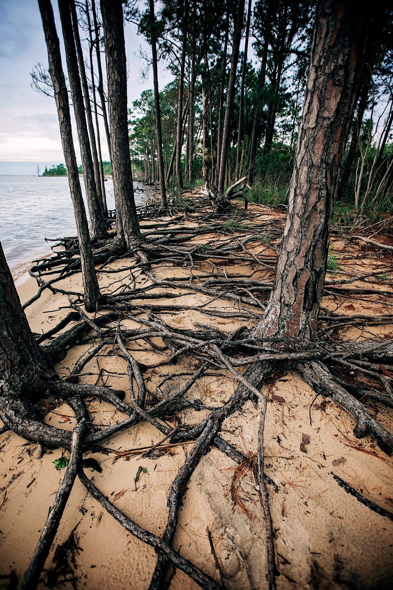
A ghost forest forming along the shoreline of Blackwater Bay in Santa Rosa County. Photo credit: Carrie Stevenson, UF IFAS Extension
As the name implies, they are haunting—wide stretches of standing, dead trees with exposed roots. These “ghost forests” are an unsettling scene in unsettling times for the environment. While coastal erosion is a fact of life—incoming waves, hurricanes, longshore drift of beach sand—the rate of its occurrence is startling lately.
Global rises in sea level due to increased atmospheric carbon levels mean more saltwater is moving into flat, coastal habitats that once served as a buffer from the open water. Salt is an exceedingly difficult compound for plants to handle, and only a few species have evolved mechanisms for tolerating it. Low-growing salt marshes and thick mangrove stands have always served as “first line of defense” buffers to take in wave action and absorb saltwater. If shorelines have too much wave action for marshes to form, wide stretches of sandy beach and dunes serve the same function, protecting the inland species of shrubs and trees. Many coastal areas are flat and stay at or just above sea level for thousands of yards, or even miles. This means that even a small increase in sea level can send saltwater deep into previously freshwater systems, drowning the marsh and flooding stands of oak and pine. The salt and sulfate in seawater will kill a tree quickly, although it may remain standing, dead, for months or years. Hurricanes and tropical storms exacerbate that damage, scouring out chunks of shoreline and knocking down already-unstable trees.
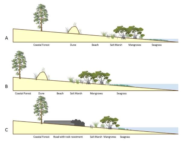
This diagram outlines the changes in coastal vegetation and shorelines as sea level rises. With “ghost forests,” the sea level moves into that coastal forest section. Figure credit: W. Gray, IAN Image Library
A slow increase in sea level could be tolerated and adapted to as salt marshes move inland and replace non-salt tolerant species. But this process of ecological succession can be interrupted if erosion and increased water levels occur too quickly. And if there is hard infrastructure inland of the marshes (like roads or buildings), the system experiences “coastal squeeze,” winnowing the marsh to a thin, eventually nonexistent ribbon, with no natural protection for that expensive infrastructure.
Ghost forests are popping up everywhere. Earlier this month, Popular Mechanics magazine reported on a recently published study that used satellite imagery to document how 11% of a previously healthy forest was converted to standing dead trees along the coast of North Carolina. The trees died within a span of just 35 years (1984-2019). During that time frame, this stretch of coastline also experienced an extended drought and Category 3 Hurricane Irene. These impacts sped up the habitat loss, with over 19,000 hectares converted from forest to marsh and 1100 hectares of marsh vegetation gone, becoming open water.
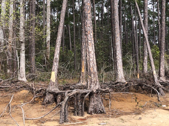
Exposed roots of a ghost forest forming along the Escambia Bay. Photo credit: Deanie Sexton
Due to increased coastal flooding and saltwater standing in forested areas, U.S. Fish and Wildlife Service employees are concerned that the historic Harriett Tubman Byway in Maryland—part of the famed underground railroad of the Civil War era—will soon be gone. Over 5,000 acres of tidal marsh have converted to open water in the area and large stands of trees have died. Even locally, trees along Escambia and Blackwater Bay are dying due to salt damage and heavy erosion. Hurricane Sally delivered a knockout punch to many remaining trees along the scenic bluffs of the bay.
Sea level has risen over 10” in the past 100 years in the Pensacola Bay area, and even mid-range Army Corps of Engineers estimates expect 0.6 to 1.4 feet of rise in the area by 2045. There are some actions we can take to mitigate future damage. Building a “living shoreline” of vegetation along a piece of waterfront property instead of using a seawall can help, especially if the vegetation growth outpaces sea level rise. You can also visit the City of Pensacola’s Climate Task Force report to learn more about climate action recommended (and being taken) locally, such as increasing the use of renewable energy and dedicating staff to sustainability measures.
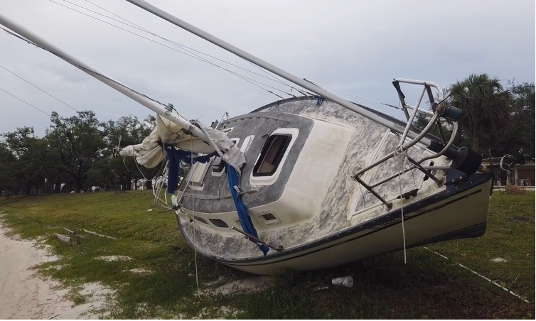
A storm impacted sailboat rests along the shoreline of Carl Gray Park near Gulf Coast State College. This vessel was removed after Panama City Law Enforcement Officers submitted the case for judicial processing. Vessels like this one, once legally processed, can be removed with the Hurricane Michael Marine Debris Removal Funds or by utilizing private funding sources. Photo by L. Scott Jackson
By L. Scott Jackson and Brittany Stark | UF/IFAS Extension Bay County and Florida Sea Grant
I received a phone call requesting an interview from a California based news outlet the day before Hurricane Michael made landfall October 10, 2018. The phone call came as I put the final hurricane shutter on my own home. I had spent the day preparing, bagging sand for old friends and new ones, I met at the sand pile in Lynn Haven. The day’s experience began to sink in – everyone is preparing for a major hurricane! The interviewer asked, “What concerns you the most about this storm?” I thought for second, “What concerns me the most, the Gulf of Mexico hasn’t seen a cold front this year. This is as hot as the Gulf can get, which can fuel large hurricanes.” I couldn’t have imagined what would happen in the next 24 hours after I spoke those words, despite how ominous they were.
In many ways, Michael was our version of the “Perfect Storm”. In the subsequent months and now years, Michael’s extensive devastation continues to confound residents and those responding to provide help.
Emergency responders with the Coast Guard and Florida Fish and Wildlife with Emergency Support Function 10 (ESF-10) worked effectively to address high priority vessels and marine debris problems immediately after Hurricane Michael. According to a media release January 11, 2019, “ESF-10 response teams have completed the following in their efforts to reduce the potential impact to Florida’s marine environment: Assessed 1,370 displaced, wrecked, sunken or beached vessels – 175 vessels mitigated and/or removed from the environment.”
I have been working with a team of professionals from the University of Florida, Florida Fish and Wildlife Commission, and local county Boards of County Commissioners in Bay, Gulf, and Franklin Counties to acquire funds and setup to clean-up what remains of the Hurricane related debris. The targeted area includes the shorelines of St Andrew, St Joe, and Apalachicola Bays. The team received notification of a 3 million dollar grant award from National Oceanic and Atmospheric Administration (NOAA) and the National Fish and Wildlife Foundation (NFWF) in April of 2020. This grant is designed specifically to help communities like ours recover and restore their bays and waterways after hurricanes.
Our project team made extensive use of Aerial Imagery. We estimate about 700 – 800 remaining marine debris targets including 90 vessels in the three-county project area, with the vast majority in Bay County and St Andrew Bay. Our goal is to clean-up and remove over 1,000 tons of marine debris during the project while protecting resources like seagrasses and shoreline vegetation.
The first phase of the vessel removal project was scheduled to begin in 2020. As a result of the pandemic and executive orders from Florida’s Governor, there was a pause to allow vessel owners the opportunity to address violations in this unprecedented situation. This put legal proceedings and investigations on hold from March through September 2020.
As 2021 began we had completed the remaining steps needed to initiate the clean-up and removal activities identified in our grant proposal. FWC completed legal investigations. NOAA finalized the required environmental assessment in consultation with appropriate federal and state agencies. Marine contractors and professionals were qualified and selected. We also employed two dedicated staff to work with impacted property owners that need assistance with shoreline debris and storm impacted vessels in Bay, Gulf, and Franklin Counties.
Our project Manager is Frank Mancinelli, a long-time Callaway resident and Air Force veteran, with professional experience and training in project management. Frank has a communications degree from Florida State University and a Master of Aeronautical Science / Safety degree from Embry-Riddle Aeronautical University. Our program Assistant is Bree Stark, a Florida native and long-time panhandle resident, who graduated from the University of Florida with a degree in Agricultural Education and Communication.
The number of remaining vessels and marine debris targets are astounding for everyone involved. Especially if it’s your property that is impacted. Each vessel has its own set of challenges that need to be addressed legally and logistically prior to removal. There are many obstacles that our project team can help property owners address.
The Hurricane Michael Debris Removal Team Wants to Hear from You!
Need a Hurricane Michael-impacted vessel removed? The Hurricane Michael Marine Debris Removal Project team wants to help!
If you would like to report a Hurricane Michael vessel in need of removal, contact Bree Stark by calling 850-378-2330 or by emailing bay@ifas.ufl.edu. Even if the vessel isn’t yours or on your property, the team needs your help to verify and expand their database of known sites for clean-up. You can also report Hurricane Michael impacted vessels via our online survey at http://bit.ly/HMVessel
(Portions of this Article Originally Published in the Panama City News Herald)
An Equal Opportunity Institution. UF/IFAS Extension, University of Florida, Institute of Food and Agricultural Sciences, Thomas Obreza, Interim-Dean for UF/IFAS Extension. Single copies of UF/IFAS Extension publications (excluding 4-H and youth publications) are available free to Florida residents from county UF/IFAS Extension offices.
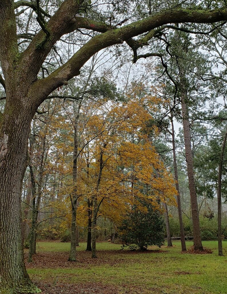
A healthy and diverse native forest provides many benefits for environmental and human health. Photo credit, Cathy Hardin
Trees often are low on priority lists – unless you had tree damage as a result of Hurricane Sally. However, you might be surprised to learn that trees played a beneficial, if somewhat behind the scenes, role for good this year and every year. And celebrating the good, while not ignoring potential problems, is important when making decisions involving trees.
Often trees are disparaged, especially after a severe storm. Many trees fell during Sally, causing costly clean up and often significant damage. Some trees were damaged: causing hazardous conditions, opportunities for the tree disease and insect infestation, or simply aesthetically unpleasant disfigurement. Even without storms, trees require care, can interfere with utilities and foundations, and require extra clean up certain times of year. Yet, healthy well-maintained trees might reduce wind speeds and damage for property underneath or on the leeward (downwind) side of trees. Trees also significantly reduce erosion and absorb stormwater.
Bald cypress. Photo credit, Cathy Hardin
Trees often give more than they take. Many studies have been done on the effects of green space on a person’s well-being, including lowering blood pressure, speeding up recovery times, and lessening depression and anxiety. Other social benefits include lowering crime rates, increasing property values, creating beauty and space for recreation and relaxation, and lowering cooling bills. They provide habitat for birds and other wildlife. We haven’t even begun to mention the material benefits such as fruit, nuts, wood, and the 5,000 plus commercial products made from trees (wood, roots, leaves, and saps).
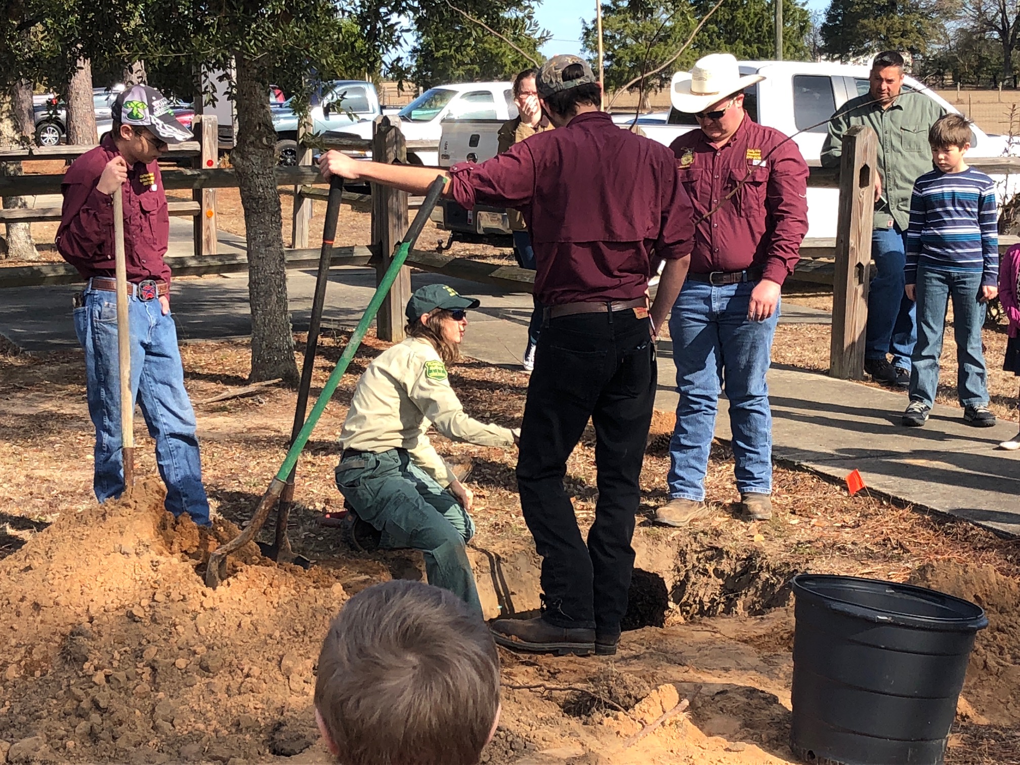
Author and county forester Cathy Hardin demonstrates proper tree planting at a past Arbor Day program. Photo credit: Carrie Stevenson, UF IFAS Extension
So, celebrate trees this year! Winter is a great time to improve existing trees and to plant new ones. Florida Arbor Day is celebrated the on the third Friday in January – January 15, 2021. National Arbor Day is the last Friday in April. In Escambia County, the UF IFAS Extension office is holding several Arbor Day related events, including a drive-through tree giveaway on January 23. Even if you are not able to attend a public event in your area, you still can get out and celebrate trees. Below are some ideas.
Existing Trees
• Care for storm damaged trees.
o Contact an arborist for evaluation of potential hazards
o Properly prune out broken limbs to create a smooth surface
o Some trees may not be able to be successfully treated and need removal
o Most trees will recover, but might need time and/or multiple treatments
• Learn about proper pruning techniques to take care of smaller trees yourself
• When hiring a professional is required, hire a reputable company with a certified arborist on staff. Ensure the company has both Personal and Property Damage Liability Insurance and Worker’s Compensation Insurance. Arborists certified by the International Society of Arboriculture can be found at http://www.isa-arbor.com/findanarborist/arboristsearch.aspx.
• Take care of tree roots. Don’t compact the soil by parking or piling things in the root zone. Use caution
when applying any chemicals (fertilizer, herbicide, pesticides) to the soil or lawn. Read the label to
ensure it will not harm your tree.
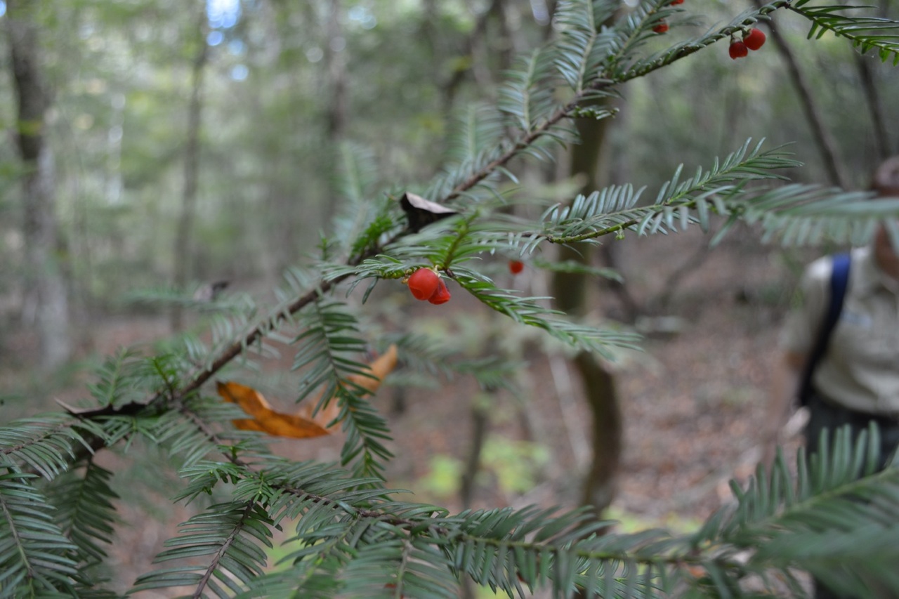
Florida yew. Photo credit, Cathy Hardin
New Plantings
• Decide what species of tree is right for you, considering the soil type, size of opening, climate, and eventual size of tree.
• Plant the tree at the right depth, not too deep or too shallow.
• Keep it simple. Soil amendments, fertilizers, and staking are usually unnecessary, especially for small native trees.
• Mulch lightly over the root zone, but not against the trunk.
• Water regularly until the tree is established. (Three gallons per inch of tree diameter weekly – applied slowly at the root ball)
• Celebrate!
• Take a photo of your favorite tree to post on social media. Tag the Florida Forest Service!
Longleaf pine. Photo credit, Cathy Hardin
• Take a hike in the woods or a nearby park.
• Have a picnic with friends or family by a tree.
• Be grateful for your tree and its benefits.
• Teach a child about trees. There are many activities that can be used. Check out Project Learning Tree Activities for Families – Project Learning Tree (plt.org) or the Arbor Day Foundation www.ArborDay.org for a few ideas.
• Plant a new tree.
For more information on the benefits of trees, visit healthytreeshealthylives.org or www.vibrantcitieslab.com. The Florida Forest Service, a division of the Florida Department of Agriculture and Consumer Services, manages more than 1 million acres of state forests and provides forest management assistance on more than 17 million acres of private and community forests. The Florida Forest Service is also responsible for protecting homes, forestland and natural resources from the devastating effects wildfire on more than 26 million acres. Learn more at FDACS.gov/FLForestService.
Cathy Hardin is the Escambia County Forester for the Florida Forest Service and can be reached at Cathy.Hardin@fdacs.gov.
I think we can all agree it has been one crazy hurricane season. We have gone through the entire alphabet, and much of the Greek alphabet, naming storms – a record 30. Here in Pensacola we had Sally, but we had to prepare for many others that were wobbling around out there. It seemed this year the computer models were struggling predicting landfall locations. The “spaghetti” paths of the recent Eta were all over the Gulf. So, what is going on? It probably has to do with a warmer Gulf but there has to be more to it than that. Some have mentioned that it has been a La Nina year, and that the Gulf is more active during such years. Fair enough… what is the La Nina?
It is the opposite of the El Nino – a term more people have heard of. Okay… what is the El Nino?
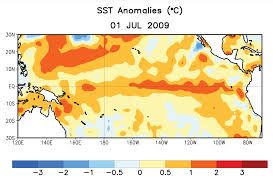
The red indicates warm water temperatures. Notice the warm temps in the eastern Pacific – not normal. Graphic: NOAA
The El Nino is a warming trend observed in the eastern Pacific Ocean every 2-7 years around Christmas time. El Nino… “the child”. There are records of this event going back over a century. It was first noticed by Peruvian fishermen, who fish some of the most productive waters on the planet. These productive waters are fueled by the cold HumboldtCurrent and an upwelling bringing nutrient rich cold waters from the seafloor. When the El Nino occurs the Humboldt Current warms and “caps” the upwelling from reaching the surface where the food chain can benefit. The fish move away, and the fishermen notice it. When people began to colonize southern California, and began fishing for tuna and sardines, they noticed the same thing. The El Nino moved north of the equator just as it moves south of it.
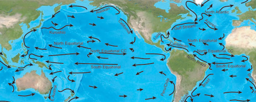
To better understand this, we will need to know a little about the ocean currents.
The world rotates on its axis every 24 hours – there, we are off to a good start.
The sun’s rays hit the earth more directly in the equatorial part of the planet, making it warmer there.
The cold polar water is more dense and sinks. The warmer equatorial waters move across the surface of the ocean to fill the void left by the sinking polar water. But it does not move in a straight line to that point. The world is turning remember, and this cause the moving water to bend in a curved pattern. The equatorial water moves west by northwest, warming more as it moves. This is the equatorial current. When it reaches Indonesia it is a balmy 80F+ (or so). This is the land of palm trees and coral reefs – “Bali-Hai”.
The equatorial currents of the Pacific. Image: NOAA
The water now moves north towards Japan and Korea before heading towards Alaska. Here it is called the KuroshioCurrent and here it slowly begins to lose its warmth. As it slides beneath Alaska heading for Canada it is called the NorthPacificCurrent, and then becomes the CaliforniaCurrent as it passes the western United States heading back towards the equator. Here the water is much cooler (60-70F). There are no coral reefs, but you do find palm trees in southern California. This coast is also bathed with an upwelling and supports a rich fishery.
The southern Pacific is the same – but the current names are different. The equatorial current heads west reaching Indonesia and heads south to Australia where they call it the EastAustralianCurrent (the EAC of Finding Nemo fame). This is the home of the Great Barrier Reef. The currents circle near Antarctica, become colder, and head north along South America as the Humboldt Current (also known as the Peru Current).
Now imagine this…
Imagine the warm equatorial water near Indonesia begins to slide back towards California and Central America. Imagine this warm water layer then heads north and south to the coasts of California and Peru. This warm water caps the upwelling and the fish leave – near Christmas time – the El Nino. Bad times for the fishing fleet.
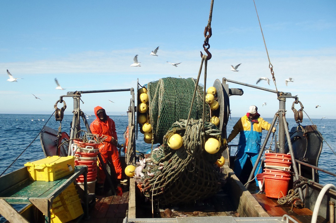
Commercial fishing in the California Current. Photo: NOAA
The atmosphere responds to these ocean temperature shifts. Normally, the cooler waters reaching the equator from California and Peru move westward forming the equatorial current. This cool water helps form east winds that move across westward as well. Known as the TradeWinds, sailors have used them for centuries to reach “good trading locations”. They are steady and dependable… unless it is an El Nino year. During El Nino the warmer ocean slows the strength of these winds. They actually move eastward across Central America and impact the Gulf of Mexico. During El Nino years these eastward moving Pacific winds push hurricanes out of the Gulf into the Atlantic. These are the hurricane seasons when Bermuda is hit frequently.
La Nina is the opposite. The Pacific waters moving into the equatorial area from California and Peru are colder than normal. These colder waters move faster and farther across the equatorial waters of the Pacific increasing the Trade Winds moving west… not east. With these Trade Winds moving in the direction they should, even stronger than normal, hurricanes are “sucked” into the Gulf of Mexico. La Nina seasons are very busy hurricane seasons for us. And you guessed it, it is a La Nina year. La Nina usually follows the El Nino and we can sometimes experience them for two seasons, but 12 months is typical.
The thing is La Nina’s have been occurring for centuries. We have certainly had hurricane seasons that were busier than normal but not to the extent we saw this year. You have to look at climate change in general, and other atmospheric conditions that could influence this. I am sure the meteorologists and climatologists are as interested in what happened (is happening) this year as we are.
Hopefully we will not see another season like this for some time.