by Andrea Albertin | Oct 2, 2020
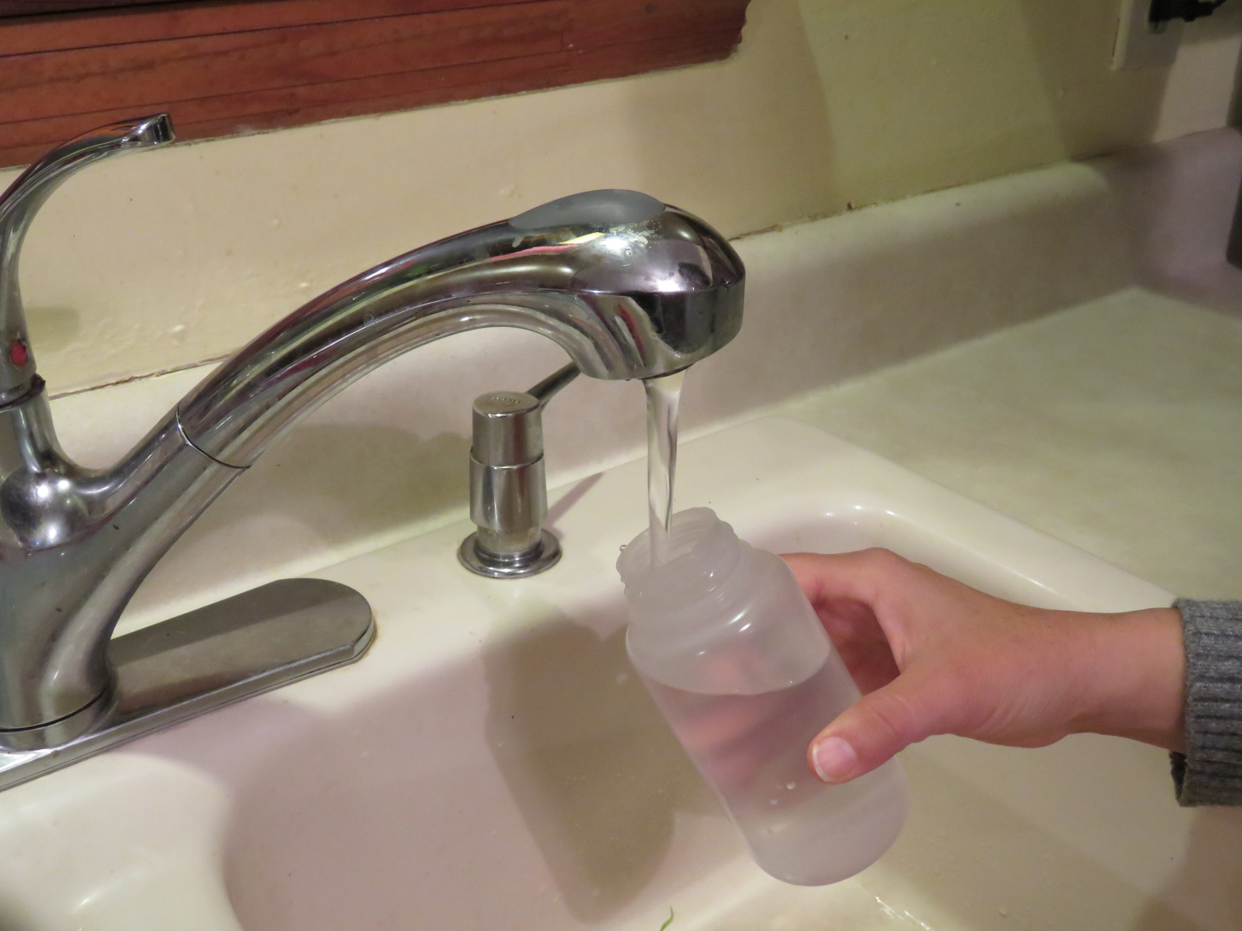
If your private well was damaged or flooded due to hurricane or other heavy storm activity, your well water may not be safe to drink. Well water should not be used for drinking, cooking purposes, making ice, brushing teeth or bathing until it is tested by a certified laboratory for total coliform bacteria and E. coli.
Residents should use bottled, boiled or treated water until their well water has been tested and deemed safe.
- Boiling: To make water safe for drinking, cooking or washing, bring it to a rolling boil for at least one minute to kill organisms and then allow it to cool.
- Disinfecting with bleach: If boiling isn’t possible, add 1/8 of a teaspoon or about 8 drops of fresh unscented household bleach (4 to 6% active ingredient) per gallon of water. Stir well and let stand for 30 minutes. If the water is cloudy after 30 minutes, repeat the procedure once.
- Keep treated or boiled water in a closed container to prevent contamination
Use bottled water for mixing infant formula.
Where can you have your well water tested?

Contact your county health department for information on how to have your well water tested. Image: F. Alvarado Arce
Most county health departments accept water samples for testing. Contact your local department for information about what to have your water tested for (they may recommend more than just bacteria), and how to collect and submit the sample.
Contact information for Florida Health Departments can be found here: County Health Departments – Location Finder
You can also submit samples to a certified commercial lab near you. Contact information for commercial laboratories that are certified by the Florida Department of Health are found here: Laboratories certified by FDOH
This site includes county health department labs, commercial labs as well as university labs. You can search by county.
What should you do if your well water sample tests positive for bacteria?
The Florida Department of Health recommends well disinfection if water samples test positive for total coliform bacteria or for both total coliform and E. coli, a type of fecal coliform bacteria.
You can hire a local licensed well operator to disinfect your well, or if you feel comfortable, you can shock chlorinate the well yourself.
You can find information on how to shock chlorinate your well at:
After well disinfection, you need to have your well water re-tested to make sure it is safe to use. If it tests positive again for total coliform bacteria or both total coliform and E. coli call a licensed well operator to have the well inspected to get to the root of the problem.
Well pump and electrical system care
If the pump and/or electrical system have been underwater and are not designed to be used underwater, do not turn on the pump. There is a potential for electrical shock or damage to the well or pump. Stay away from the well pump while flooded to avoid electric shock.
Once the floodwaters have receded and the pump and electrical system have dried, a qualified electrician, well operator/driller or pump installer should check the wiring system and other well components.
Remember: You should have your well water tested at any time when:
- A flood occurred and your well was affected
- The color, taste or odor of your well water changes or if you suspect that someone became sick after drinking your well water.
- A new well is drilled or if you have had maintenance done on your existing well
- There has been any type of chemical spill (pesticides, fuel, etc.) into or near your well
The Florida Department of Health maintains an excellent website with many resources for private well users: FDOH Private Well Testing and other Reosurces which includes information on potential contaminants and how to maintain your well to ensure the quality of your well water.
by Rick O'Connor | Sep 25, 2020
It began easy enough – a tropical storm making landfall between Louisiana and Mississippi. Northwest Florida could expect some rain and rising water. Okay…

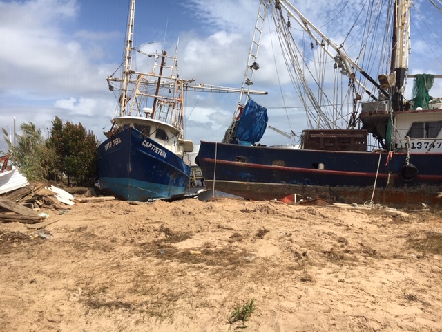
Shrimp boats from Allen Williams Seafood in Pensacola on shore. Most of the shrimp boats were.
Photo: Rick O’Connor
A few hours later the new landfall was predicted to be the Mississippi-Alabama coastline. This changes things a bit. We are expecting slightly higher winds, higher water, this will probably be a rain event. Some school districts closed; others were waiting to see. We already had our boat ready for Laura, which went further west than predicted, so we were ready. Tropical storm winds were doable as long as we did not get a direct hit. It was heading west of us. We were along the outside edge of the “cone of uncertainty”. I think we are good. Many others felt the same way.
Later, it was a sunny day and I was in a zoom meeting when my wife, a teacher, poked her head in and said they were closing schools through Wednesday. What? What is going on? Closing school for two days for a tropical storms that is going in west of Mobile AL? We should check out the weather channel. We did… it was now heading for the Alabama-Florida line. It was a strong tropical storm possible Category 1 hurricane. Maximum winds would be near 90 mph.
Pause…
We made a few more preparations. We actually got some boards up when the rain began but could not get them all up (we have 23 windows in our house). The sun set, the rain came harder, the wind picked up, and the weather service changed their forecast again – winds to increase to 110 mph – probably make landfall as a Category II storm. They issued a hurricane warning for counties further east including Walton County. The high winds and rain whipped Pensacola all through the night and much of the next day. We were in the eye wall of a Category II storm. No one was prepared for this.
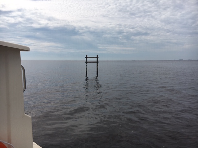
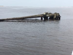
Several channel and day markers for navigation are damaged or missing. Mariners should be cautious.
Photo: Rick O’Connor
In the aftermath there was the typical hurricane damage. Downed trees, some on houses, boats on the beach, flooded homes, and – like other storms – some properties that were barely touched, or untouched all together. Power and water were out, and many roads were impassible. Oh, what a night…
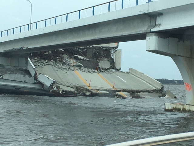
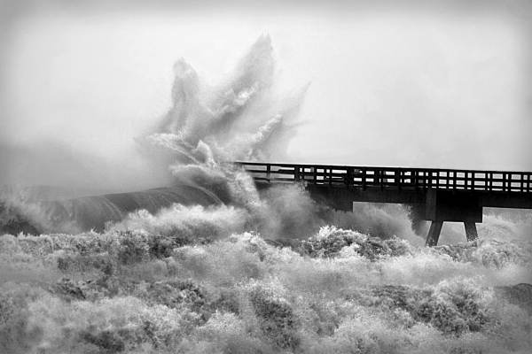
There was something different this time. A company out of Virginia was building a new bridge over Pensacola Bay. They had completed the south bound section, tore down the old bridge, and were working on the north bound section while the south bound was being used. They had numerous barges anchored all over the bay full of work equipment, cranes, etc. For what ever reason, they did not move these into one of the bayous. The lines broke and many barges drifted. Some landed along the shorelines, some hit the bridge – the southbound section of the bridge – and it is now closed. This is part of Highway 98 from Pensacola to Gulf Breeze and used by hundreds of thousands of people each day. It is closed and traffic access for many in the community has changed. This is going to be tough.
But this newsletter is about natural resources… what about that?
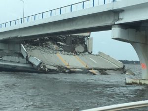
A section of the new 3 Mile Bridge over Pensacola Bay hangs down after being hit by one of the many barges adrift that night.
Photo: Rick O’Connor
As you might guess the water within the bay is a mess. There were hundreds of vessels that sank. You can see the fuel and oil slicks leaking from them on the surface of the water. You can also see pelicans and gulls swimming on and in it. There have been no reports of fish kills yet, but – to my knowledge – there has been no water sampling other than for bacteria. We know there were several sanitary sewer overflows due to the high rainfall amounts – I recorded 20.4” over the two-day period at my house. The water is a deep brown color and you can smell it in some locations. Health advisories are currently issued for all bodies of water that the Department of Health sample. No one should be in the water.
Along those same notes, no one should be boating at this time either. During our boat assessments of the area waters we saw numerous objects – such as docks, day markers, road work markers, and more – drifting all over the bay. Some floating, some slightly submerged. We managed to bump a submerged tree in one of the bayous and also managed to get a large sheet of plastic wrapped around our props. Boating is discouraged at this time. We know some of the fishing charters (smaller vessels) are going to try and fish this weekend. We understand this – they need the revenue – but we caution them to be on the look out for this debris.
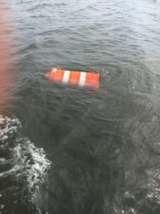
This highway work can was piece of thousands of pieces of debris floating in the bay. Mariners be cautious.
Photo: Rick O’Connor
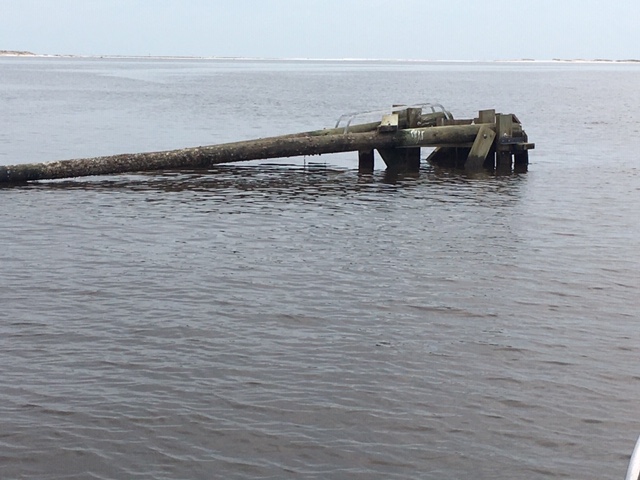
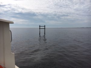
This drifting day marker ran aground on a shoal in the ICWW near Ft. Pickens. At the time of this photo, it was unmarked and had no light on it. Mariners be cautious.
Photo: Rick O’Connor
I have not been on the barrier islands, but photos show severe erosion on portions and there are three new inlets on the east end of Perdido Key, one of those we could see from our boat. We have no idea what impacts this storm had on the wildlife but it fair to say that things have changed. We alerted residents to be aware of snakes while doing clean up – we will alert them again. I remember after Ivan the increase in the hawk activity due to downed and thinned trees – squirrels were now easier targets. This has happened again. There is one really large red-tailed hawk hanging around our house and doing quite well.
At the time of this writing, I have not contacted the local wildlife sanctuary, but I am guessing injured and orphaned animals will increase. The wildlife sanctuary itself took on water, but almost all of the animals survived, and they are back at work.
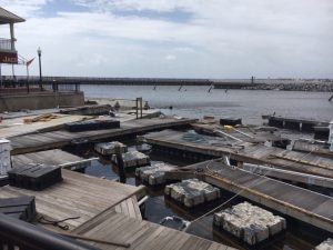
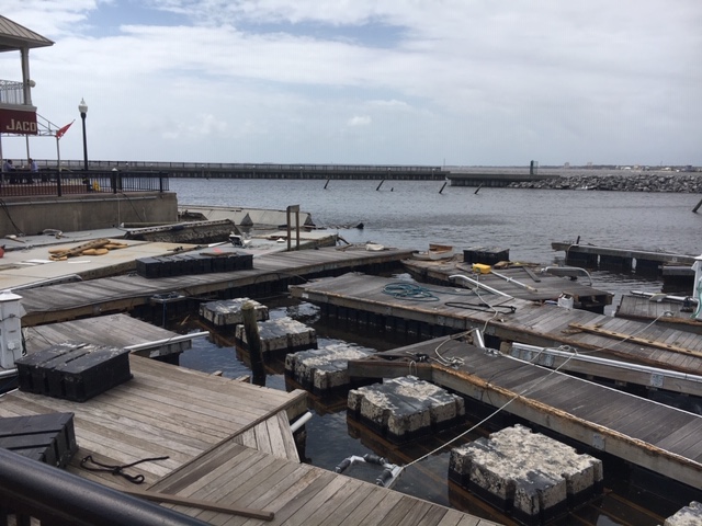
This marina, and many others, will be out of service for quite some time.
Photo: Rick O’Connor
So, from a natural resource stance – water is poor, do not swim – fish are not dying, but would hold off fishing inland – keep an eye out for wandering wildlife, such as snakes, that have been displaced. We are expecting sick and injured birds due to oil slick and other debris issues.
There is one last lesson from Sally… be prepared. We have become very comfortable with the forecast. Northwest Florida was outside the “cone” for a tropical storm making landfall near Mississippi – and then. As we all know these storms can change direction and intensify (remember Michael’s turn east) at a moments notice. Any storm with name in the Gulf should be taken seriously, whether tropical storm or not.
Stay safe.
by Carrie Stevenson | Jul 31, 2020
A living shoreline project was implemented on this bay in Santa Rosa County to try and prevent further erosion. Photo credit: Carrie Stevenson, UF IFAS Extension
We have reached that time of year when the Atlantic starts cranking out storms, and they will continue to roll out as the dog days of summer progress. Over the last decade, many experts have speculated on how climate change and sea level rise might impact hurricanes in the Gulf of Mexico. Two big issues are coastal erosion and flooding from storm surge and rainfall.
Those who live on the water or frequently visit area shorelines have probably noticed coastal erosion. While a natural part of a coastal ecosystem–and often exacerbated by heavy boat traffic–rising seas can also cause erosion. Sea level rise moves water slowly inland and washes away the roots of grasses and trees that once held the shoreline in place. Buildings and roads close to the water are impacted as well, with “sunny day flooding” on the roads and under pilings in many south Florida cities where water has moved in to stay. Large scale beach renourishment projects, living shorelines, and even road relocations (like the one at Ft. Pickens on Pensacola Beach) are all ways that local officials and property owners can respond to rising seas. However, these efforts always come with a big price tag. When that “line in the sand” is drawn beyond government and household budgets, there will come a point when we can no longer support protection of highly vulnerable coastal infrastructure. The closer a building is physically located to the water (whether built there intentionally or reached by rising seas), the greater the likelihood a hurricane will cause flooding damage from dangerous storm surge. Storm surge and heavy flooding cause 75% of the deaths in any given hurricane.
During a recent webinar, the appropriately named Dr. Chris Landsea of the National Hurricane Center answered several frequently asked questions on the impacts of global warming on hurricanes. Some of the predictions are surprising based on assumptions that have been put out in the media. He made a disclaimer that these are his predictions based on years of expertise and data analysis, and not an official proclamation by the National Hurricane Center. Following are a few of the points he made during his talk.
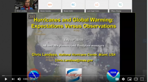
Dr. Chris Landsea of the National Hurricane Center recently met with floodplain managers around the Gulf Coast to discuss hurricanes.
Question: Will hurricanes get stronger based on increased temperatures?
Answer: The world average temperature has gone up 1.5 degrees Fahrenheit in the past 100 years. Based on data and computer modeling from the NOAA Geophysics Lab, typical hurricane wind intensity will increase slightly, by 3%. In this example, a storm with 100 mph average winds would be 103 mph by the end of the 21st century.
Question: Will we experience more tropical storms as the climate changes?
Answer: Dr. Landsea does not expect more tropical storms as the temperature increases. In fact, frequency may drop very slightly. While there may be more heat energy for hurricanes to feed on, the surrounding conditions will make it tougher for a storm to form. Those conditions may be atmospheric or include a vertical wind shear that tears up the storm.
Question: How will global warming affect rainfall during hurricanes?
Answer: Models and recent experience show that rainfall will increase by 10-20% during tropical storms. Global warming increases the amount of moisture in the atmosphere, and a hurricane can recycle this water into a constant loop of rainfall. Hurricane Harvey in Texas was one example of this situation, during which nearly 8 feet of rainfall fell, flooding neighborhoods. One of the aphorisms of climate change is “wet places get wetter, and dry places get drier.”
Dr. Landsea’s full presentation can be found online here, if you are interested in learning more. Keep in mind that these predictions can change based on land use, atmospheric carbon levels, and human practice change. For more on the work UF IFAS is doing on climate, visit this Florida Sea Grant Climate page.
by Carrie Stevenson | Jun 4, 2020
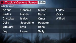
The lineup of 2020 tropical storm names. Tropical storm “Cristobal” is currently headed towards the northern Gulf of Mexico. Photo credit: The Weather Channel
This past March, many people spoke about sensing a sort of free-floating anxiety, waiting for potential disaster to land at their doorstep. The unknowns we faced as COVID-19 cases increased in the United States were not quite like anything we’d previously experienced, although it felt comparable to knowing a hurricane was about to make landfall. After this virus, perhaps, a hurricane seems like a relief—at least we know what to expect and approximately where the most damage will occur. However, big tropical storms carry with them their own set of unpredictable factors like direction and strength at landfall. But the storm-hardiness of our homes, our tree choices, smart evacuation plans—these we can control. Well-thought out precautions can make the difference between getting right back on your feet after a storm and losing almost everything.
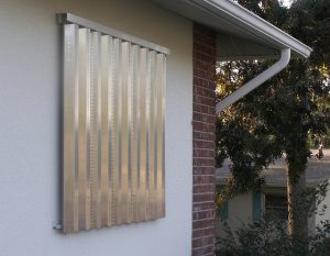
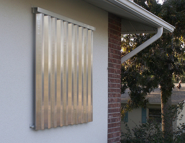
Aluminum shutters are one of the many preventative measures Florida homeowners can include in their hurricane preparedness.
Photo: Carrie Stevenson, UF IFAS Extension
No matter how well you have planned for a hurricane, unexpected issues always come up. However, being ready can cut down on the fear and worry.
A few of those preparedness factors include:
* An evacuation plan
* A hurricane kit
* Home wind mitigation techniques
* Tree evaluation
* Wind/flood insurance
I will discuss each of these topics in depth over the next few weeks. Particularly if you are new to the area or never experienced a hurricane, be sure to review good readiness websites, check out these apps, and see which tips might be the most useful to you and your family as we enter the already-active 2020 hurricane season.
by Carrie Stevenson | Sep 27, 2019
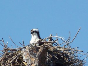
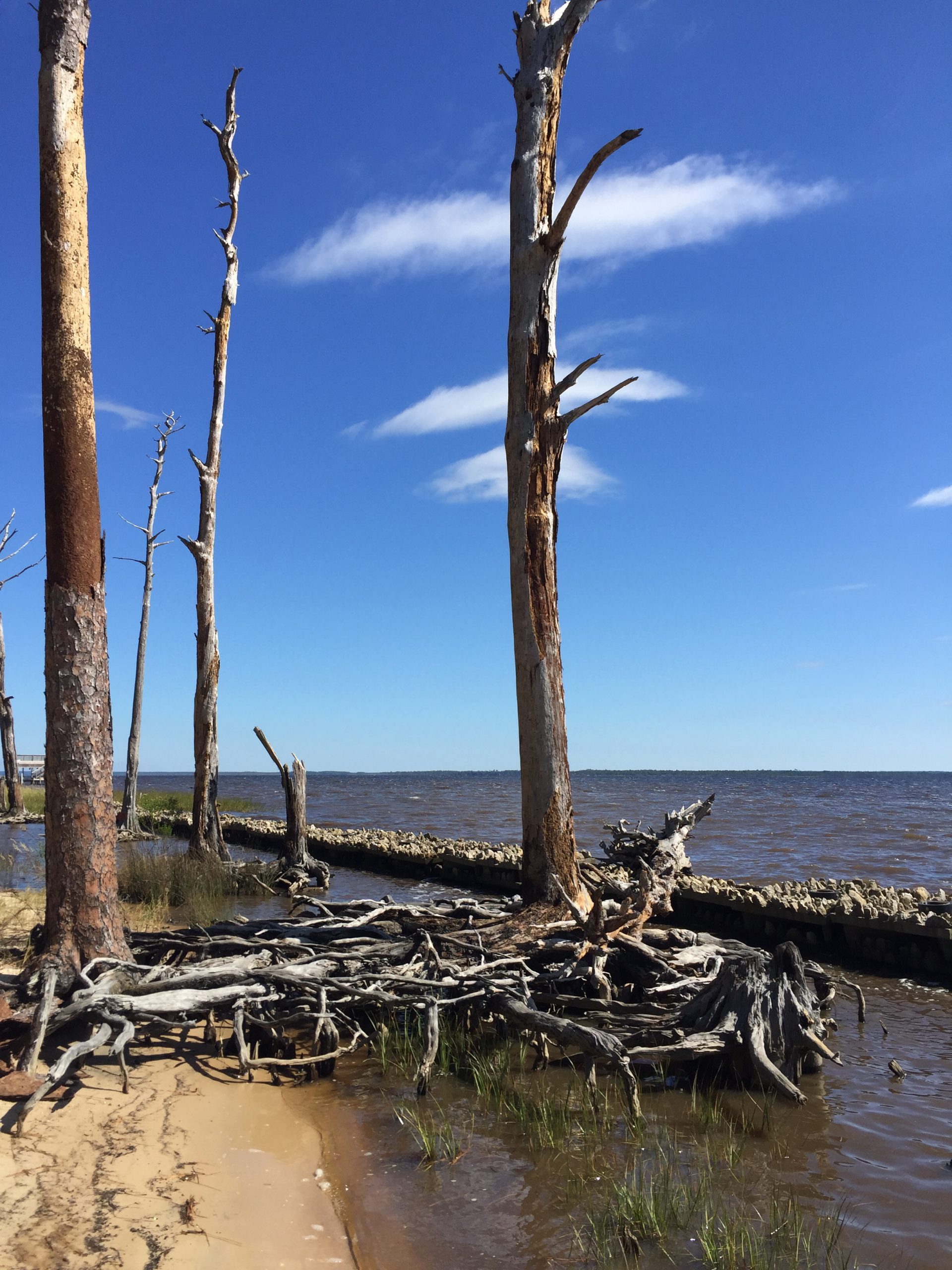
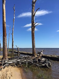
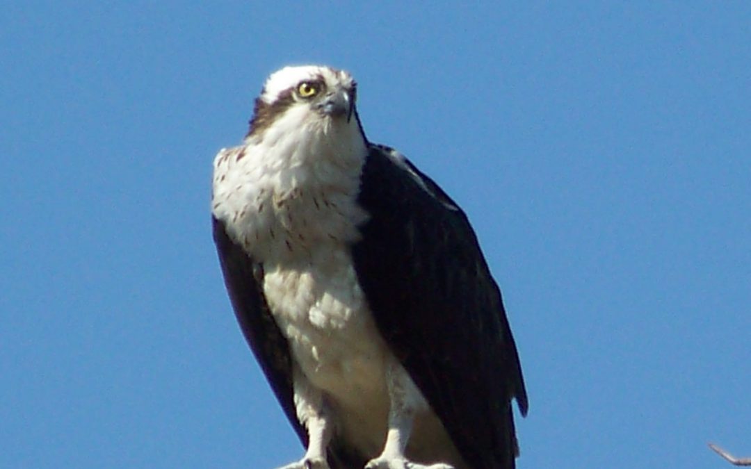
Ospreys, or fish hawks, build their nests from sticks atop dead trees. Photo credit: UF IFAS Extension
Big hurricanes like Dorian (Bahamas) and 2018’s Michael (central Florida Panhandle) were devastating to the communities they landed in. Flooding, wind, rain, loss of power and communications eventually made way for ad hoc clearing and cleanup, temporary shelters, and a slow walk to recovery. Among the most striking visual impacts of a hurricane are the tree losses, as there are unnatural openings in the canopy and light suddenly shines on areas that had been shaded for years. In northwest Florida, pines are particularly vulnerable. After any hurricane in the Panhandle, you can drive down Interstate 10 for miles and see endless pines blown to the ground or broken off at the top. During Hurricane Ivan 15 years ago, the coastal areas in Escambia and Santa Rosa lost thousands of trees not only due to wind, but also to tree roots inundated by saltwater for long periods.
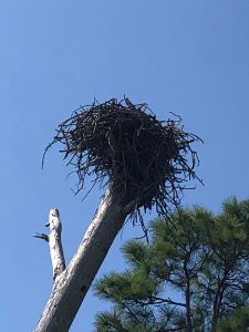
Dead trees left by hurricanes serve as ideal nesting ground for large birds like ospreys. Photo credit: Carrie Stevenson, UF IFAS Extension
Nature always finds a way, though. Because of all those dead (but still-standing) pines, our osprey (Pandion haliaetus) population is in great shape in the Pensacola area. How are these two things related? Well, ospreys build large stick nests in the tall branches/crooks of dead trees, known as snags. They particularly prefer those near the water bodies where they fish. When I first moved here 20 years ago, I rarely saw ospreys. Now, it’s uncommon not to see them near the bayous and bays, or to hear their high-pitched calls as they swoop and dive for fish.
If you are not familiar with ospreys, they can be distinguished by their call and their size (up to six foot wingspan). It is common to see them in their large nests atop those snags, flying, or diving for fish. I usually see them with mullet in their talons, although they also prey on catfish, spotted trout, and other smaller species. They have white underbellies, brown backs, and are smaller than eagles but larger than your average hawk. One of their more interesting physical adaptations (and identifying characteristics) is their ability to grip fish parallel to their bodies, making it more aerodynamic than the perpendicular method most birds use.
Ospreys mate for life, and cooperate to build nests and care for young. The species has overcome many complex threats—including DDT damage to eggs and habitat loss—but the sight of them flying is always inspiring to me. They are a living embodiment of resilience amidst adversity.
by Scott Jackson | Jun 21, 2019
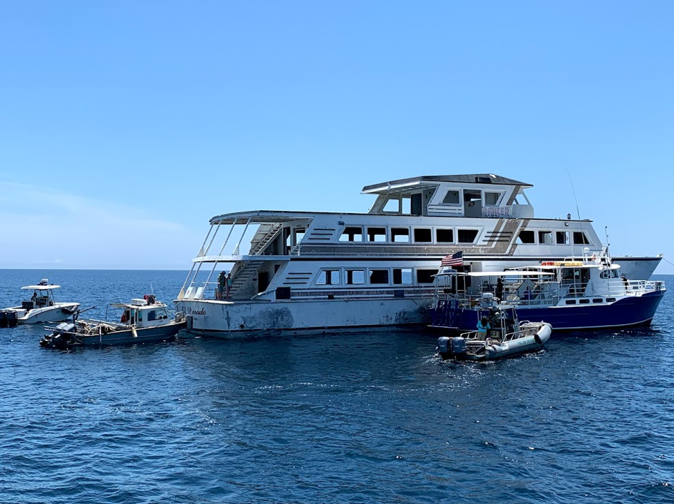
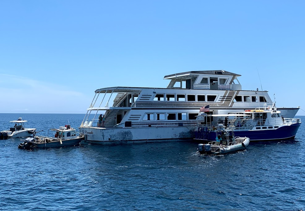
Panama City Dive Center’s Island Diver pulls alongside of the El Dorado supporting the vessel deployment by Hondo Enterprises. Florida Fish and Wildlife crews also are pictured and assisted with the project from recovery through deployment. The 144 foot El Dorado reef is located 12 nautical miles south of St Andrew Pass at 29° 58.568 N, 85° 50.487 W. Photo by L. Scott Jackson.
In the past month, Bay County worked with fishing and diving groups as well as numerous volunteers to deploy two artificial reef projects; the El Dorado and the first of the Natural Resources Damage Assessment (NRDA) reefs.
These sites are in Florida waters but additional opportunities for red snapper fishing are available this year to anglers that book for hire charters with captains holding federal licenses. Federal licensed Gulf of Mexico charters started Red Snapper season June 1st and continue through August 1st. Recreational Red Snapper fishing for other vessels in State and Federal waters is June 11th – July 12th. So booking a federally licensed charter can add a few extra fish to your catch this year.
The conversion of the El Dorado from a storm impacted vessel to prized artificial reef is compelling. Hurricane Michael left the vessel aground in shallow waters. This was in a highly visible location close to Carl Grey Park and the Hathaway Bridge. The Bay County Board of County Commissioners (BOCC) acquired the El Dorado, January 14, 2019 through negotiations with vessel owner and agencies responsible for recovery of storm impacted vessels post Hurricane Michael.
The El Dorado was righted and stabilized, then transported to Panama City’s St Andrews Marina by Global Diving with support from the Coast Guard and Florida Fish and Wildlife. Hondo Enterprises, was awarded a contract to complete the preparation and deployment of the vessel for use as an artificial reef.
Reefing the El Dorado provides new recreational opportunities for our residents and tourists. The new reef delivers support for Bay County’s fishing and diving charters continuing to recover after Hurricane Michael. Several local dive charter captains assisted in the towing and sinking of the El Dorado.
The El Dorado was deployed approximately 12 nm south of St. Andrew Bay near the DuPont Bridge Spans May 2, 2019. Ocean depth in this area is 102 feet, meaning the deployed vessel is accessible to divers at 60 feet below the surface.
The Bay County Board of County Commissioners continues to invest in the county’s artificial reef program just as before Hurricane Michael. Additional reef projects are planned for 2019 – 2020 utilizing Natural Resources Damage Assessment (NRDA) and Resources and Ecosystems Sustainability, Tourist Opportunities, and Revived Economies of the Gulf Coast States Act (RESTORE Act) funds. These additional projects total over 1.3 million dollars utilizing fines as a result of the Deepwater Horizon Oil Spill. Deployments will occur in state waters in sites located to both the east and west of St. Andrew Bay Pass.
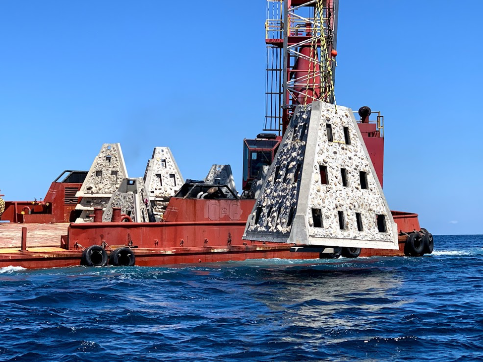
Walter Marine deploys one of nine super reefs deployed in Bay County’s NRDA Phase I project located approximately 12 nautical miles southeast of the St. Andrew Pass. Each massive super reef weighs over 36,000 lbs and is 15 ft tall. Multiple modules deployed in tandem provides equivalent tonnage and structure similar to a medium to large sized scuttled vessel. Photo by Bob Cox, Mexico Beach Artificial Reef Association.
The first of these NRDA deployments for Bay County BOCC was completed May 21, 2019 in partnership with Mexico Beach Artificial Reef Association, Florida Fish and Wildlife Conservation Commission, and Florida Department of Environmental Protection using a $120,000 portion of the total funding. The deployment site in the Sherman Artificial Reef Permit Area is approximately 12 nm south east of St Andrew Bay Pass at a depth of 78 – 80ft.
| Patch Reef # |
Latitude |
Longitude |
| BC2018 Set 1
(6 Super Reefs and 4 Florida Specials) |
29° 55.384 N |
85° 40.202 W |
| BC2018 Set 2
(1 Super Reef and 4 Florida Specials) |
29° 55.384 N |
85° 39.739 W |
| BC2018 Set 3
(1 Super Reef and 4 Florida Specials) |
29° 55.384 N |
85° 39.273 W |
| BC2018 Set 4
(1 Super Reef and 4 Florida Specials) |
29° 55.384 N |
85° 38,787 W |
In 2014, Dr. Bill Huth from the University of West Florida, estimated in Bay County the total artificial reef related fishing and diving economic impact was 1,936 jobs, $131.98 million in economic output and provided $49.02 million in income. Bay County ranked #8 statewide in artificial reef jobs from fishing and diving. Bay County ranked #3 in scuba diving economy and scuba diving was 48.4 % of the total jobs related to artificial reefs. Dr. Huth also determine that large vessels were the preferred type of artificial reef for fishing and diving, with bridge spans and material the next most popular. Scuba diving and fishing on artificial reefs contributes significantly to the county’s economic health.
For more information and assistance, contact UF/IFAS Extension Bay County at 850-784-6105 or Bay@ifas.ufl.edu. Follow us on Facebook at http://faceboook.com/bayifas .
An Equal Opportunity Institution. UF/IFAS Extension, University of Florida, Institute of Food and Agricultural Sciences, Nick T. Place, Dean for UF/IFAS Extension. Single copies of UF/IFAS Extension publications (excluding 4-H and youth publications) are available free to Florida residents from county UF/IFAS Extension offices.
This article is also available through the the Panama City New Herald