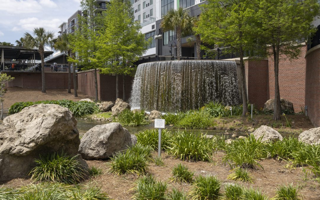
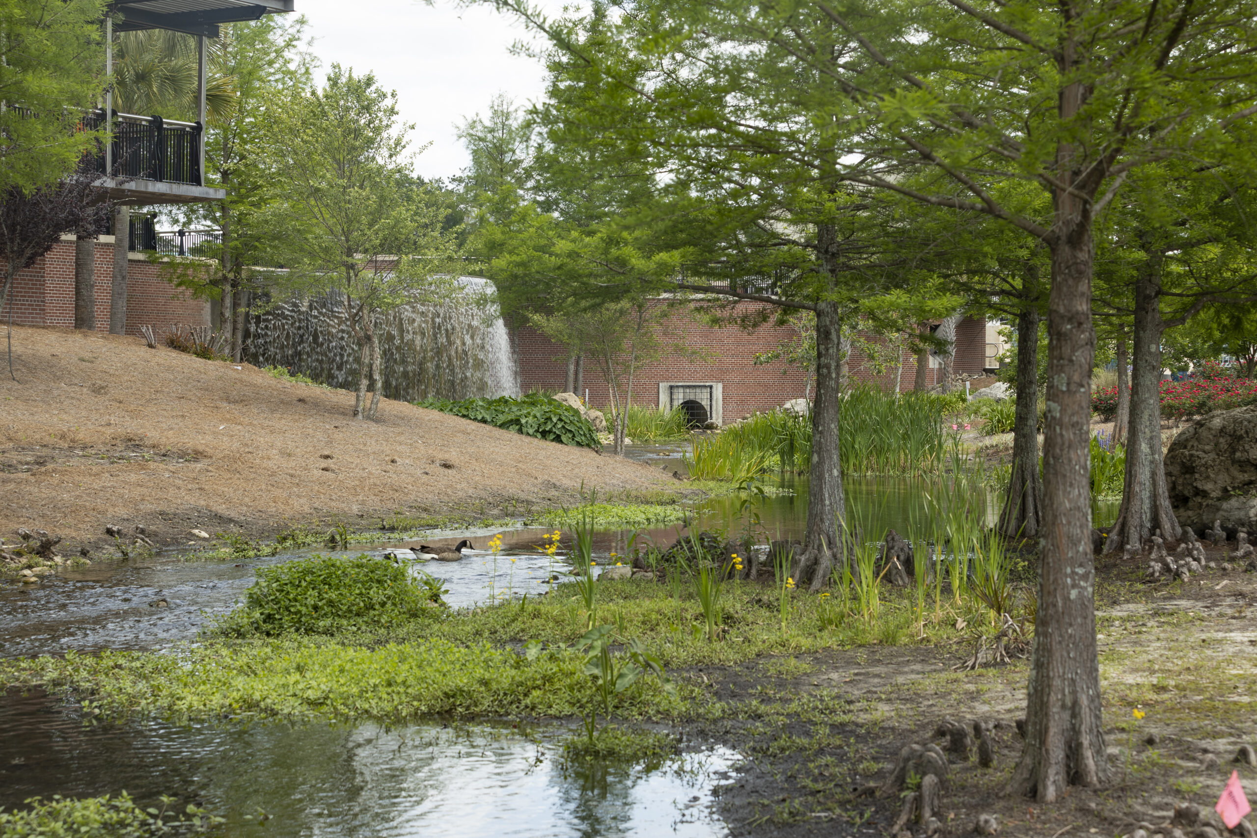
Green stormwater infrastructure at Cascades Park in Tallahassee, Florida. Image: T. Jones, UF/IFAS.
Join us for a two-part webinar series on Managing Stormwater in a Changing FL Panhandle on May 1, 2024 from 8:30-11:30 am CST (9:30-12:30 pm EST), and May 15, 2024 from 8:30-11:30 am CST (9:30-12:30 pm EST).
We are also offering two optional no-cost field tours of stormwater management sites in northwest Florida. The first will be held on May 3 in Pensacola to the Escambia County Central Office Complex, and the second on May 22 in Tallahassee to the Upper Lake Lafayette Nutrient Reduction Facility (aka Weems Pond). Detailed information as well as how to register for both the webinars and the field tours is found below.
Webinar series: Information and registration
Please register for the webinar series here: Eventbrite link Once in the registration site, you will have to register for both dates separately.
May 1: Day 1 will focus on Green Stormwater Infrastructure (GSI) and its maintenance, as well as presentations and discussion on the ecological function of GSI+LID.
May 15: Day 2 will focus on implementing GSI and LID at the community level, with presentations about ongoing research on extreme sea levels and effects on flooding events, a resiliency case study on Cedar Key and funding opportunities for GSI and LID through FDEP.
PDHs and CEUs offered:
4 Professional Development Hours (PDH) will be offered through the Florida Board of Professional Engineers. Two PDHs will be offered for Day 1 and two for Day 2.
4 Continuing Education Units (CEU) will be offered for Pesticide Applicators through FDACS in these categories: Ornamental & Turf, Private Applicator Ag, Right-of-Way, Aquatic, Natural Areas, Commercial Lawn & Ornamental, Limited Commercial Landscape Maintenance, Limited Lawn & Ornamental and Limited Urban Fertilizer.
The webinar is free for those not seeking PDHs or CEUs. For those seeking PDHs or CEUs, the cost is $50 for Day 1, and $50 for Day 2.
Field Tours: Information and registration
Please register for each tour separately through the Eventbrite links provided.
May 3 Pensacola Tour: Join us for a tour of the Escambia County Central Office Complex, a LEED Gold certified building with pervious pavement, energy efficient design, and the largest green roof in Florida. Registration: Pensacola Field Tour
May 22 Tallahassee Tour: Join us for a tour of the Upper Lake Lafayette Nutrient Reduction Facility (aka Weems Pond) which captures sediment and trash from a large upstream drainage basin and uses modern treatment methods to filter the stormwater before it enters a natural system. The tour will be led by the City of Tallahassee Stormwater Planning team. Registration: Tallahassee Field Tour
We look forward to your attendance! Please contact Andrea Albertin if you have any questions at (850) 875-7111 or via email: albertin@ufl.edu
The Gulf of Mexico Sea Grant Science Outreach Team is proud to announce four new outreach items that are applicable throughout the US and showcases marine microplastics and homeowners’ insurance:
Marine Microplastics Primer for Extension Professionals – This publication is intended to serve as a guide for extension professionals to aid in answering questions about microplastics that they have encountered or may encounter in the future. The publication can be accessed at https://gulfseagrant.org/wp-content/uploads/2023/08/MASGP-23-051.pdf.
Property Insurance Basics – Confused about homeowners’ insurance and what it covers or know people who are? The outreach team has created a publication to share basic information about insurance to help property owners make informed decisions about the amounts and types of protection for their homes. Access to the publication can be found https://gulfseagrant.org/wp-content/uploads/2023/08/MASGP-23-015.pdf.
What is Risk Rating 2.0 and how will it affect my flood insurance?–FEMA has updated their risk rating approach through a new pricing method. This change is the biggest change to the way flood insurance premiums are calculated since 1968. Want to learn more about this new system and how it will affect your flood insurance? Click https://gulfseagrant.org/wp-content/uploads/2023/08/What-is-Risk-Rating-2.0.pdf to access our publication.
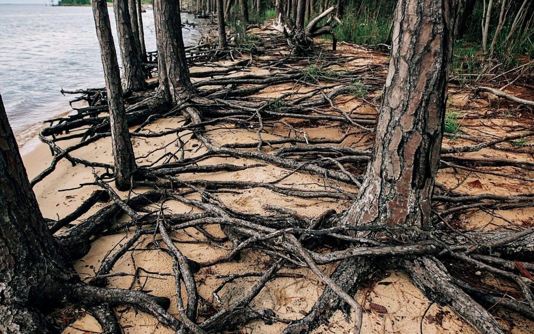
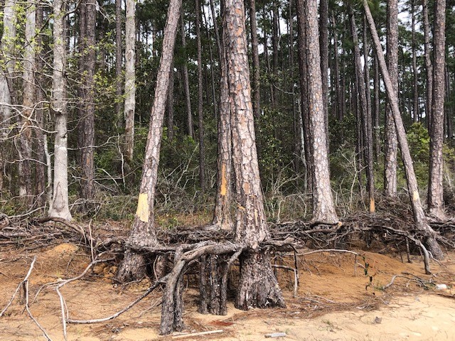
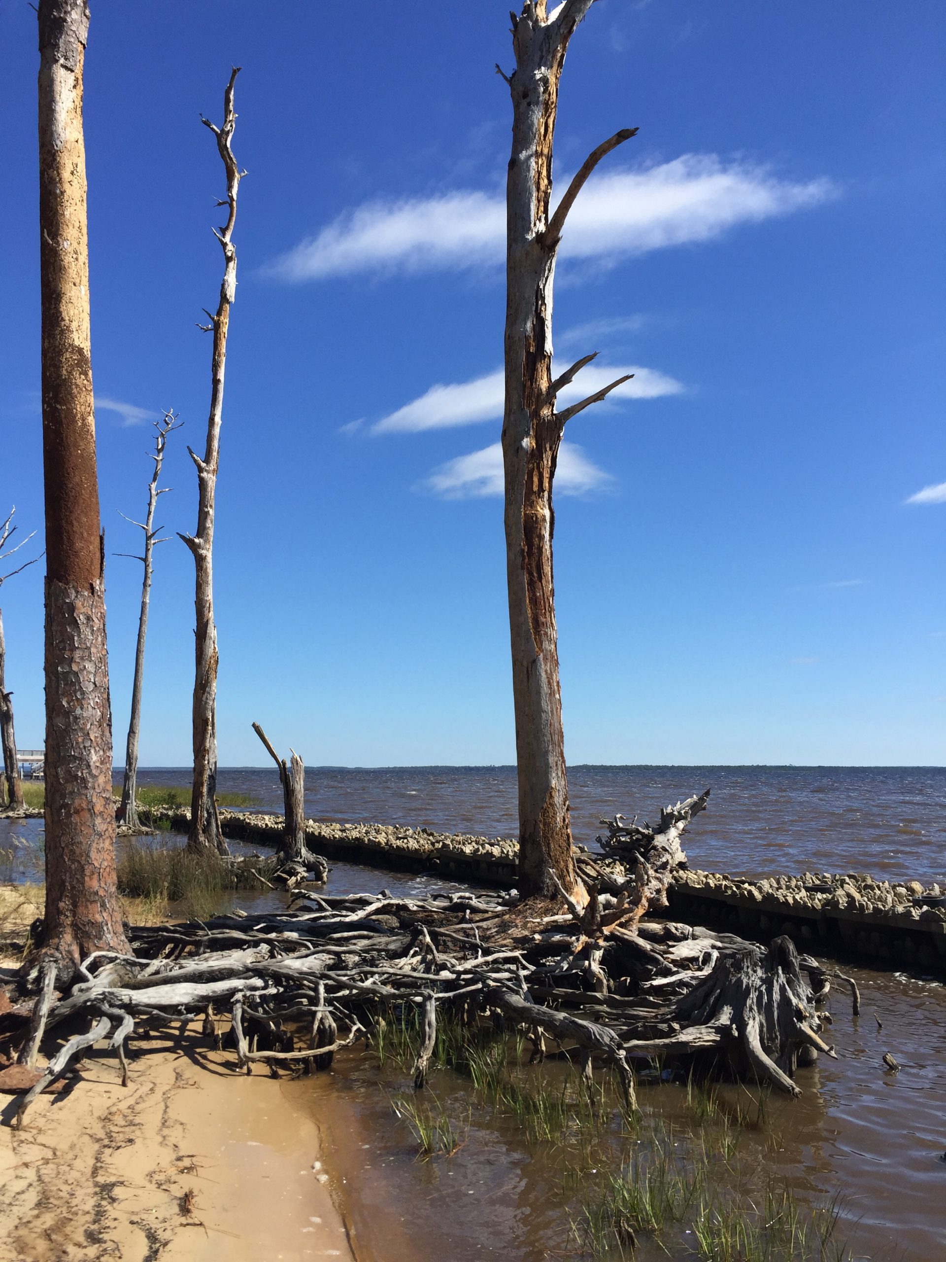
As the name implies, they are haunting—long stretches of standing, dead trees with exposed roots. These “ghost forests” are an unsettling scene in unsettling times for the environment. While coastal erosion is a fact of life—incoming waves, hurricanes, longshore drift of beach sand—the rate of its occurrence is startling lately.
Exposed roots of a ghost forest forming along the Escambia Bay. Photo credit: Deanie Sexton
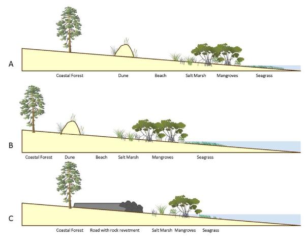
Global rises in sea level due to increased atmospheric carbon levels mean more saltwater is moving into flat, coastal habitats that once served as a buffer from the open water. Salt is an exceedingly difficult compound for plants to handle, and only a few species have evolved mechanisms for tolerating it. Low-growing salt marshes and thick mangrove stands have always served as “first line of defense” buffers to take in wave action and absorb saltwater. If shorelines have too much wave action for marshes to form, wide stretches of sandy beach and dunes serve the same function, protecting the inland species of shrubs and trees. Many coastal areas are flat and stay at or just above sea level for thousands of yards, or even miles. This means that even a small increase in sea level can send saltwater deep into previously freshwater systems, drowning the marsh and flooding stands of oak and pine. The salt and sulfate in seawater will kill a tree quickly, although it may remain standing, dead, for months or years. Hurricanes and tropical storms exacerbate that damage, scouring out chunks of shoreline and knocking down already-unstable trees.
A slow increase in sea level could be tolerated and adapted to as salt marshes move inland and replace non-salt tolerant species. But this process of ecological succession can be interrupted if erosion and increased water levels occur too quickly. And if there is hard infrastructure inland of the marshes (like roads or buildings), the system experiences “coastal squeeze,” winnowing the marsh to a thin, eventually nonexistent ribbon, with no natural protection for that expensive infrastructure.
This diagram outlines the changes in coastal vegetation and shorelines as sea level rises. With “ghost forests,” the sea level moves into that coastal forest section. Figure credit: W. Gray, IAN Image Library
Ghost forests are popping up everywhere. Last year, Popular Mechanics magazine reported on a recently published study that used satellite imagery to document how 11% of a previously healthy forest was converted to standing dead trees along the coast of North Carolina. The trees died within a span of just 35 years (1984-2019). During that time frame, this stretch of coastline also experienced an extended drought and Category 3 Hurricane Irene. These impacts sped up the habitat loss, with over 19,000 hectares converted from forest to marsh and 1100 hectares of marsh vegetation gone, becoming open water.
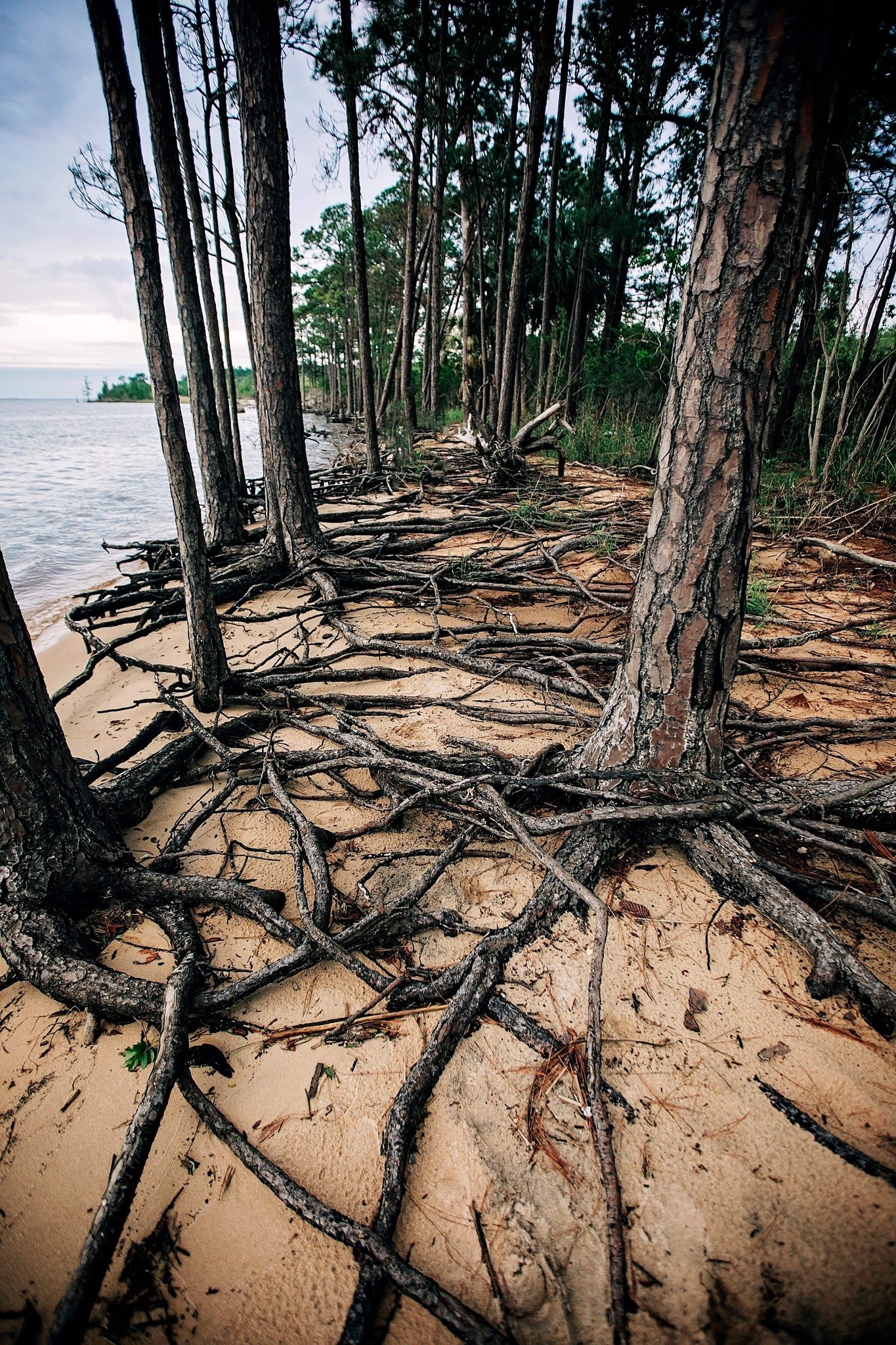
A ghost forest forming along the shoreline of Blackwater Bay in Santa Rosa County. Photo credit: Carrie Stevenson, UF IFAS Extension
Due to increased coastal flooding and saltwater standing in forested areas, U.S. Fish and Wildlife Service employees are concerned that the historic Harriett Tubman Byway in Maryland—part of the famed underground railroad of the Civil War era—will soon be gone. Over 5,000 acres of tidal marsh have converted to open water in the area and large stands of trees have died. Even locally, trees along Escambia and Blackwater Bay are dying due to salt damage and heavy erosion. Hurricane Sally delivered a knockout punch to many remaining trees along the scenic bluffs of the bay.
Sea level has risen over 10” in the past 100 years in the Pensacola Bay area, and even mid-range Army Corps of Engineers estimates expect 0.6 to 1.4 feet of rise in the area by 2045. There are some actions we can take to mitigate future damage. Building a “living shoreline” of vegetation along a piece of waterfront property instead of using a seawall can help, especially if the vegetation growth outpaces sea level rise. You can also visit the City of Pensacola’s Climate Task Force report to learn more about climate action recommended (and being taken) locally, such as increasing the use of renewable energy and dedicating staff to sustainability measures.
A ghost forest forming along the shoreline of Blackwater Bay in Santa Rosa County. Photo credit: Carrie Stevenson, UF IFAS Extension
As the name implies, they are haunting—wide stretches of standing, dead trees with exposed roots. These “ghost forests” are an unsettling scene in unsettling times for the environment. While coastal erosion is a fact of life—incoming waves, hurricanes, longshore drift of beach sand—the rate of its occurrence is startling lately.
Global rises in sea level due to increased atmospheric carbon levels mean more saltwater is moving into flat, coastal habitats that once served as a buffer from the open water. Salt is an exceedingly difficult compound for plants to handle, and only a few species have evolved mechanisms for tolerating it. Low-growing salt marshes and thick mangrove stands have always served as “first line of defense” buffers to take in wave action and absorb saltwater. If shorelines have too much wave action for marshes to form, wide stretches of sandy beach and dunes serve the same function, protecting the inland species of shrubs and trees. Many coastal areas are flat and stay at or just above sea level for thousands of yards, or even miles. This means that even a small increase in sea level can send saltwater deep into previously freshwater systems, drowning the marsh and flooding stands of oak and pine. The salt and sulfate in seawater will kill a tree quickly, although it may remain standing, dead, for months or years. Hurricanes and tropical storms exacerbate that damage, scouring out chunks of shoreline and knocking down already-unstable trees.
This diagram outlines the changes in coastal vegetation and shorelines as sea level rises. With “ghost forests,” the sea level moves into that coastal forest section. Figure credit: W. Gray, IAN Image Library
A slow increase in sea level could be tolerated and adapted to as salt marshes move inland and replace non-salt tolerant species. But this process of ecological succession can be interrupted if erosion and increased water levels occur too quickly. And if there is hard infrastructure inland of the marshes (like roads or buildings), the system experiences “coastal squeeze,” winnowing the marsh to a thin, eventually nonexistent ribbon, with no natural protection for that expensive infrastructure.
Ghost forests are popping up everywhere. Earlier this month, Popular Mechanics magazine reported on a recently published study that used satellite imagery to document how 11% of a previously healthy forest was converted to standing dead trees along the coast of North Carolina. The trees died within a span of just 35 years (1984-2019). During that time frame, this stretch of coastline also experienced an extended drought and Category 3 Hurricane Irene. These impacts sped up the habitat loss, with over 19,000 hectares converted from forest to marsh and 1100 hectares of marsh vegetation gone, becoming open water.
Exposed roots of a ghost forest forming along the Escambia Bay. Photo credit: Deanie Sexton
Due to increased coastal flooding and saltwater standing in forested areas, U.S. Fish and Wildlife Service employees are concerned that the historic Harriett Tubman Byway in Maryland—part of the famed underground railroad of the Civil War era—will soon be gone. Over 5,000 acres of tidal marsh have converted to open water in the area and large stands of trees have died. Even locally, trees along Escambia and Blackwater Bay are dying due to salt damage and heavy erosion. Hurricane Sally delivered a knockout punch to many remaining trees along the scenic bluffs of the bay.
Sea level has risen over 10” in the past 100 years in the Pensacola Bay area, and even mid-range Army Corps of Engineers estimates expect 0.6 to 1.4 feet of rise in the area by 2045. There are some actions we can take to mitigate future damage. Building a “living shoreline” of vegetation along a piece of waterfront property instead of using a seawall can help, especially if the vegetation growth outpaces sea level rise. You can also visit the City of Pensacola’s Climate Task Force report to learn more about climate action recommended (and being taken) locally, such as increasing the use of renewable energy and dedicating staff to sustainability measures.
A living shoreline project was implemented on this bay in Santa Rosa County to try and prevent further erosion. Photo credit: Carrie Stevenson, UF IFAS Extension
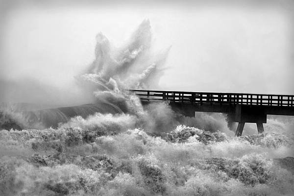
We have reached that time of year when the Atlantic starts cranking out storms, and they will continue to roll out as the dog days of summer progress. Over the last decade, many experts have speculated on how climate change and sea level rise might impact hurricanes in the Gulf of Mexico. Two big issues are coastal erosion and flooding from storm surge and rainfall.
Those who live on the water or frequently visit area shorelines have probably noticed coastal erosion. While a natural part of a coastal ecosystem–and often exacerbated by heavy boat traffic–rising seas can also cause erosion. Sea level rise moves water slowly inland and washes away the roots of grasses and trees that once held the shoreline in place. Buildings and roads close to the water are impacted as well, with “sunny day flooding” on the roads and under pilings in many south Florida cities where water has moved in to stay. Large scale beach renourishment projects, living shorelines, and even road relocations (like the one at Ft. Pickens on Pensacola Beach) are all ways that local officials and property owners can respond to rising seas. However, these efforts always come with a big price tag. When that “line in the sand” is drawn beyond government and household budgets, there will come a point when we can no longer support protection of highly vulnerable coastal infrastructure. The closer a building is physically located to the water (whether built there intentionally or reached by rising seas), the greater the likelihood a hurricane will cause flooding damage from dangerous storm surge. Storm surge and heavy flooding cause 75% of the deaths in any given hurricane.
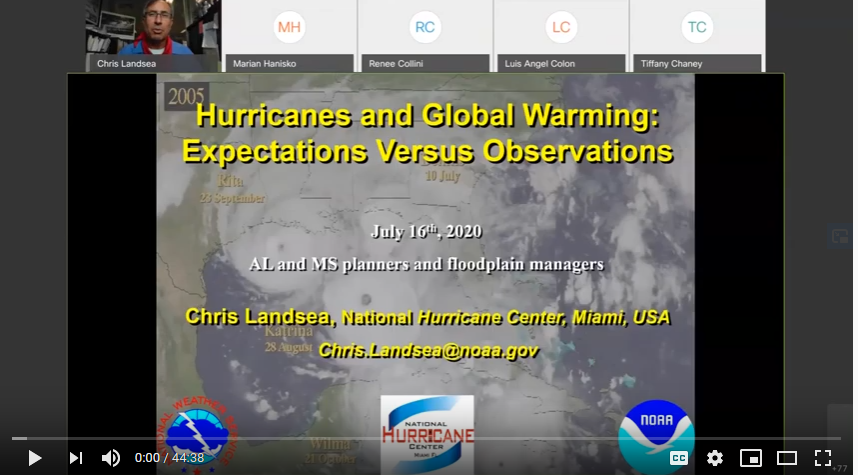
During a recent webinar, the appropriately named Dr. Chris Landsea of the National Hurricane Center answered several frequently asked questions on the impacts of global warming on hurricanes. Some of the predictions are surprising based on assumptions that have been put out in the media. He made a disclaimer that these are his predictions based on years of expertise and data analysis, and not an official proclamation by the National Hurricane Center. Following are a few of the points he made during his talk.
Dr. Chris Landsea of the National Hurricane Center recently met with floodplain managers around the Gulf Coast to discuss hurricanes.
Question: Will hurricanes get stronger based on increased temperatures?
Answer: The world average temperature has gone up 1.5 degrees Fahrenheit in the past 100 years. Based on data and computer modeling from the NOAA Geophysics Lab, typical hurricane wind intensity will increase slightly, by 3%. In this example, a storm with 100 mph average winds would be 103 mph by the end of the 21st century.
Question: Will we experience more tropical storms as the climate changes?
Answer: Dr. Landsea does not expect more tropical storms as the temperature increases. In fact, frequency may drop very slightly. While there may be more heat energy for hurricanes to feed on, the surrounding conditions will make it tougher for a storm to form. Those conditions may be atmospheric or include a vertical wind shear that tears up the storm.
Question: How will global warming affect rainfall during hurricanes?
Answer: Models and recent experience show that rainfall will increase by 10-20% during tropical storms. Global warming increases the amount of moisture in the atmosphere, and a hurricane can recycle this water into a constant loop of rainfall. Hurricane Harvey in Texas was one example of this situation, during which nearly 8 feet of rainfall fell, flooding neighborhoods. One of the aphorisms of climate change is “wet places get wetter, and dry places get drier.”
Dr. Landsea’s full presentation can be found online here, if you are interested in learning more. Keep in mind that these predictions can change based on land use, atmospheric carbon levels, and human practice change. For more on the work UF IFAS is doing on climate, visit this Florida Sea Grant Climate page.
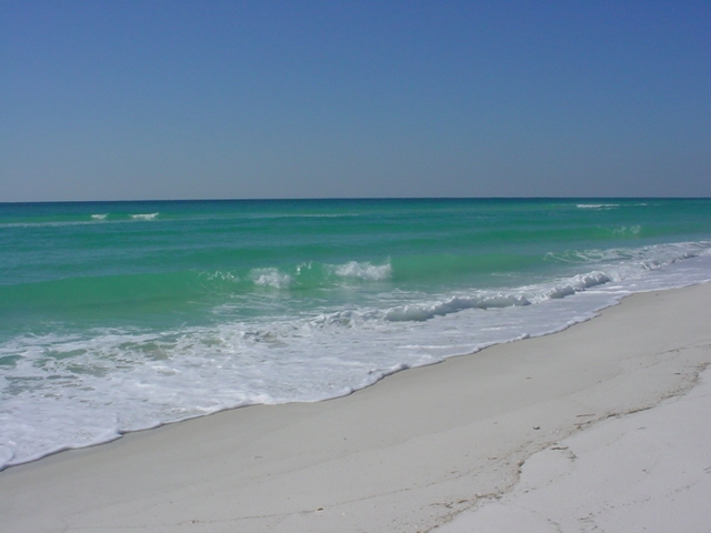
Life on the Gulf Coast can be beautiful, but has its share of complications. Photo credit: Carrie Stevenson, UF IFAS Extension
Life on the coast has tremendous benefits; steady sea breezes, gorgeous beaches, plentiful fishing and paddling opportunities. Nevertheless, there are definite downsides to living along it, too. Besides storms like Hurricane Harvey making semi-regular appearances, our proximity to the water can make us more vulnerable to flooding and waterborne hazards ranging from bacteria to jellyfish. One year-round problem for those living directly on a shoreline is erosion. Causes for shoreline erosion are wide-ranging; heavy boat traffic, foot traffic, storms, lack of vegetation with anchoring roots, and sea level rise.
Many homeowners experiencing loss of property due to erosion unwittingly contribute to it by installing seawalls. When incoming waves hit the hard surface of the wall, energy reflects back and moves down the coast. Often, an adjacent homeowner will experience increased erosion and bank scouring after a neighboring property installs a seawall. This will often lead that neighbor to install a seawall themselves, transferring the problem further.
Erosion can damage root systems of shoreline trees and grasses. Photo credit: Carrie Stevenson, UF IFAS Extension
Currently, south Louisiana is experiencing significant coastal erosion and wetlands losses. The problem is compounded by several factors, including canals dredged by oil companies, which damage and break up large patches of the marsh. Subsidence, in which the land is literally sinking under the sea, is happening due to a reduced load of sediment coming down the Mississippi River. Sea level rise has contributed to erosion, and most recently, an invasive insect has caused large-scale death of over 100,000 acres of Roseau cane (Phragmites australis). Add the residual impacts from the oil spill, and you can understand the complexity of the situation.
Luckily, there are ways to address coastal erosion, on both the small and large scale. On Gulf and Atlantic beaches, numerous coastal communities have invested millions in beach renourishment, in which offshore sand is barged to the coast to lengthen and deepen beaches. This practice, while common, can be controversial because of the cost and risk of beaches washing out during storms and regular tides. However, as long as tourism is the #1 economic driver in the state, the return on investment seems to be worth it.
On quieter waters like bays and bayous, living shorelines have “taken root” as a popular method of restoring property and stabilizing shorelines. This involves planting marsh grasses along a sandy shore, often with oyster or rock breakwaters placed waterward to slow down wave energy, and allow newly planted grasses to take root.
Locally in Bayou Grande, a group of neighbors were experiencing shoreline erosion. Over a span of 50 years, the property owners used a patchwork of legally installed seawalls, bulkheads, rip rap piles, private boat ramps, piers, mooring poles and just about anything else one can imagine, to reduce the problem. Over time, the seawalls and bulkheads failed, lowering the property value of the very property they were meant to protect and increasing noticeable physical damage to the adjacent properties.”
Project Greenshores is a large-scale living shoreline project in Pensacola. Photo credit: Carrie Stevenson, UF IFAS Extension
In 2011, a group of neighboring property owners along the bayou decided to take action. After considering many repair options, the neighbors decided to pursue a living shoreline based on aesthetics, long-term viability, installation cost, maintenance cost, storm damage mitigation and feasibility of installation. By 2017, the living shoreline was constructed. Oyster shell piles were placed to slow down wave energy as it approached the transition zone from the long fetch across the bayou, while uplands damage was repaired and native marsh grasses and uplands plants were restored to slow down freshwater as it flowed towards the bayou. Sand is now accruing as opposed to eroding along the shoreline. Wading shorebirds are now a constant companion and live oysters are appearing along the entire 1,200-foot length. Additionally the living shoreline solution provided access to resources, volunteer help, and property owner sweat equity opportunities that otherwise would have been unavailable. An attribute that has surprisingly appeared – waterfront property owners are now able to keep their nicely manicured lawns down to within 30 feet of the water’s edge. At that point, the landscape immediately switches back to native marsh plants, which creates a quite robust and attractive intersection. (Text and information courtesy Charles Lurton).
Successes like these all over the state have led the Florida Master Naturalist Program to offer a new special topics course on “Coastal Shoreline Restoration” which provides training in the restoration of living shorelines, oyster reefs, mangroves, and salt marsh, with focus on ecology, benefits, methods, and monitoring techniques. Keep an eye out for this course being offered near you. If you are curious about living shorelines and want to know more, reach out to the Florida Department of Environmental Protection Ecosystem Restoration section for help and read through this online document.