Almost everyone has heard of red tides and know they periodically occur off the coast of Florida. The more frequent events occur off southwest Florida between Tampa and the Keys, but they have occurred in other parts of the state.
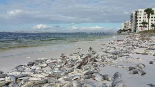
Dead fish line the beaches of Panama City during a red tide event in the past. Photo: Randy Robinson
When they do occur in the panhandle, they seem to be more common on the east side – Bay, Gulf, and Franklin counties. This year there has been a rather large red tide event that has lingered several weeks now in this area. There have been multiple samples that have been reported as HIGH (1,000,000 cells or more / liter). Cells in this case is referring to the organism that causes red tide – Karenia brevis.
The dinoflagellate Karenia brevis. Photo: Smithsonian Marine Station-Ft. Pierce FL
K. brevis is a microscopic plant that belongs to the dinoflagellate group. They occur naturally in Florida waters and when conditions are good – will begin to multiple and create a bloom. These blooms can be large enough to discolor the water – often making it a rusty/reddish color… hence the red tide. Good conditions would be those you would think plants like – plenty of sunlight, warm temperatures, plenty of nutrients. When the wind is lower the water moves less allowing them to concentrate into large patches producing “the tide”. These small plants can release a toxin, known as brevotoxin. Brevotoxins are neurotoxins that affect the transmission of nerve signals, which can lead to several internal complications and possibly death for marine life.
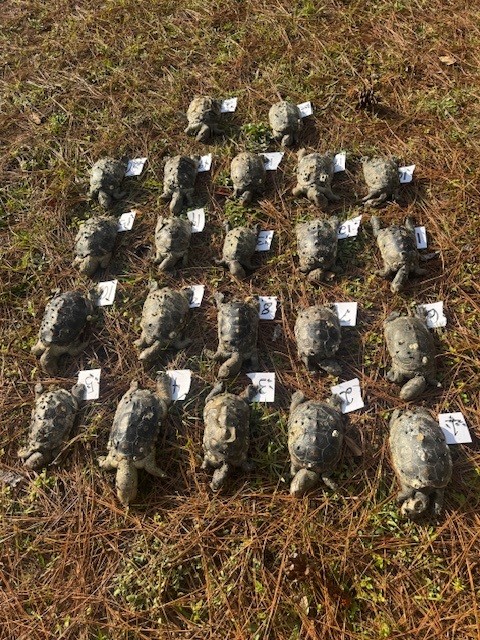
Humans and animals typically ingest or inhale brevotoxins during a large red tide event. Fish kills are a common phenomenon during large events, but marine mammals and sea turtles have also been killed. During the recent red tide event in the St. Joe area fish kills have been reported, as well as respiratory problems with humans. We now also can include diamondback terrapins as a victim.
Terrapins are smaller brackish water turtles found along the coast of Florida. At the time of this article, scientists with the US Geological Survey had logged 66 dead terrapins from the St. Joe area, all were females, and most were large females.
Diamondback terrapins lost during the recent red tide in St. Joe Bay. Photo: Dan Catizone
At the time of this writing the tide in this area continues. High concentrations have been reported from Gulf, Bay, and Franklin counties. The most recent FWC report at the time of this article (December 5) red tide had been detected in 20 samples from the panhandle. Cell concentrations of >100,000/liter (medium-high) were reported from five of those. Background to medium concentrations were reported from Bay County. Background to low in Gulf and Franklin counties. Fish kills suspected to be related to the red tide occurred in Bay County but there were no reports of respiratory problems anywhere at that time.
Red tides seem to be more common in late summer and fall. NOAA believes the same climate pattern that has caused the drought, and no named tropical storms to hit Florida, may be the cause of the current patterns holding the red tide near the St. Joe area. Concentrations SEEM to be declining. Hopefully this one will not last much longer.
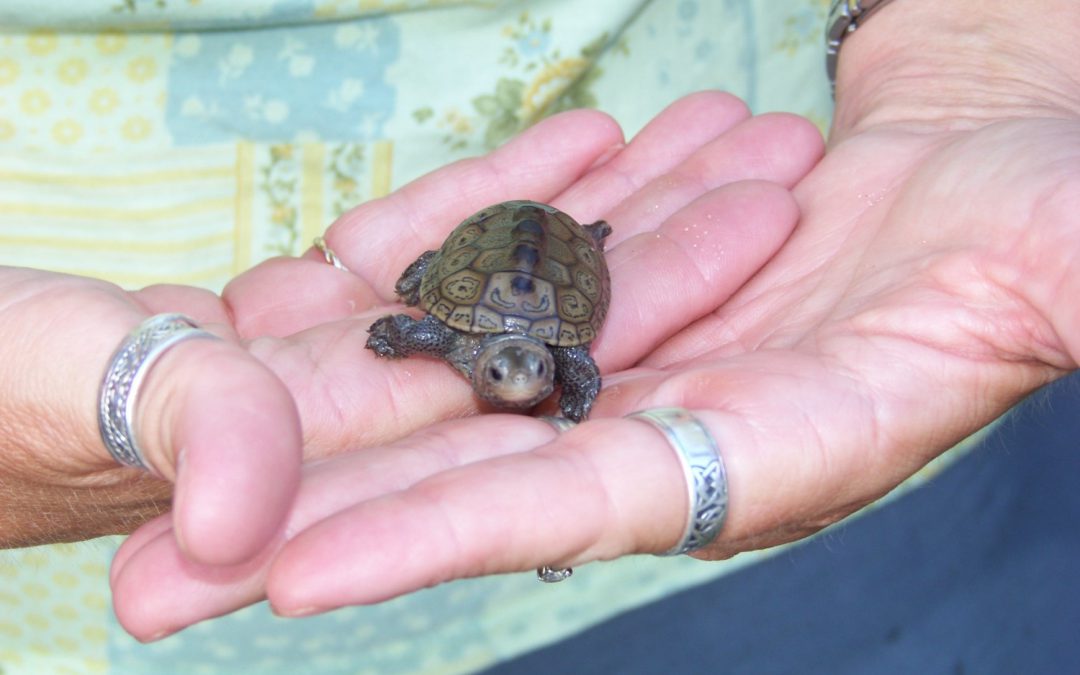
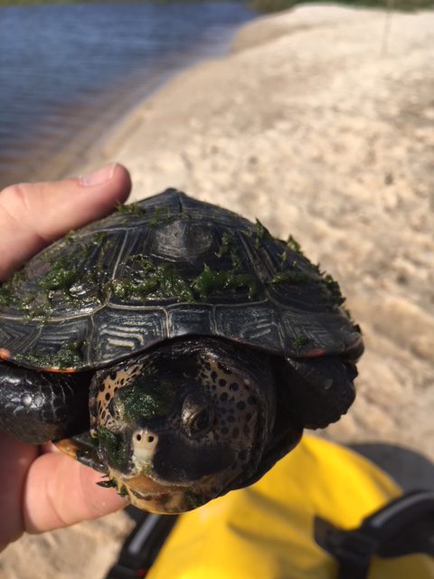
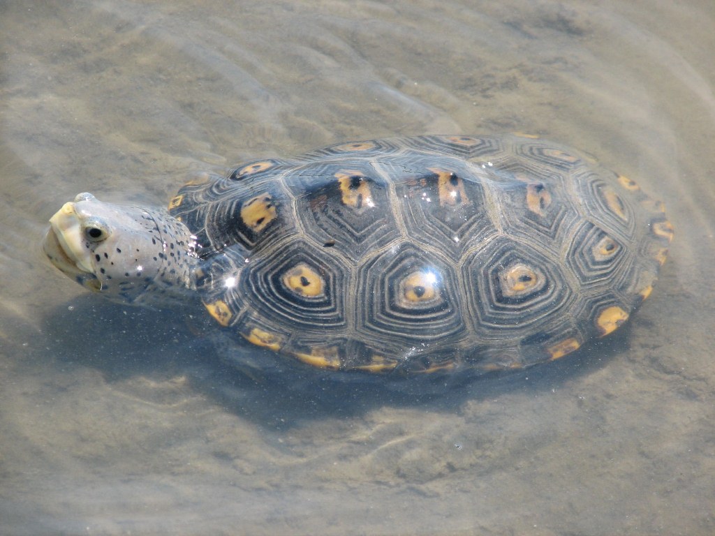
The diamondback terrapin (Malaclemys terrapin) is the only resident turtle within brackish water and estuarine systems in the United States (Fig. 1). They prefer coastal estuarine wetlands – living in salt marshes, mangroves, and seagrass communities. The literature suggests they have strong site fidelity – meaning they do not move far from where they live. Within their habitat they feed on shellfish, mollusk and crustaceans mostly. In early spring they will breed. Gravid females will venture along the shores of the bay seeking a high-dry sandy beach where they will lay a clutch of about 10 eggs. She will typically return to lay more than one clutch each season. Nesting will continue through the summer. Hatching begins mid-summer and will extend into the fall. Hatchings that occur in late fall may overwinter within the nest and emerge the following spring. They live 20-25 years.
Fig. 1. The diamondback terrapin. Photo: Molly O’Connor
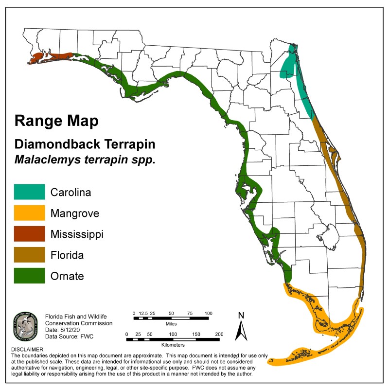
Terrapins range from Massachusetts to Texas and within this range there are currently seven subspecies recognized – five of these live in Florida, and three are only found in Florida (Fig. 2). However, prior to 2005 their existence in the Florida panhandle was undocumented. The Panhandle Terrapin Project (PTP) was initially created to determine if terrapins did exist here.
Fig. 2. Terrapins of Florida. Image provided by FWC
The Scope of the Project
Phase 1
The project began in 2005 using trained volunteers to survey suitable habitat for presence/absence. Presence is determined by locating potential nesting beaches and searching for evidence of nesting. Nesting begins in April and ends in September – with peak nesting occurring in this area during May and June. The volunteers are trained in March and survey potential beaches from April through July. They search for tracks of nesting females, eggshells of nests that were depredated by predators, and live terrapins – either on the beach or the heads in the water. Often volunteers will conduct 30-minute head counts to determine relative abundance. Between 2005 and 2010 the team was able to verify at least one record in each of the panhandle counties.
Phase 2
The next phase is to determine their status – how many nesting beaches does each county have, and how many terrapins are using them? A suitability map was developed by Dr. Barry Bitters as a Florida Master Naturalist project to locate suitable nesting beaches. Volunteers would visit these during the spring to determine whether nesting was occurring, and the relative abundance was determined using what we called the “Mann Method” – developed by Tom Mann of the Mississippi Department of Wildlife, along with the 30-minute head counts. The Mann Method involved counting the number of tracks and depredated nests within a 16-day window. The assumption to this method was that nesting females would lay multiple clutches each season – but they did not lay more than one every 16 days. Going on another assumption, that the sex ratio within the population was 1:1, each track and depredated nest within a 16-day window was a different female and doubling this number would give the relative abundance of adults in this population. Between 2007 and 2023 we were able to determine the number of nesting beaches in each county and relative abundance in three of those counties (see results below).
Phase 3
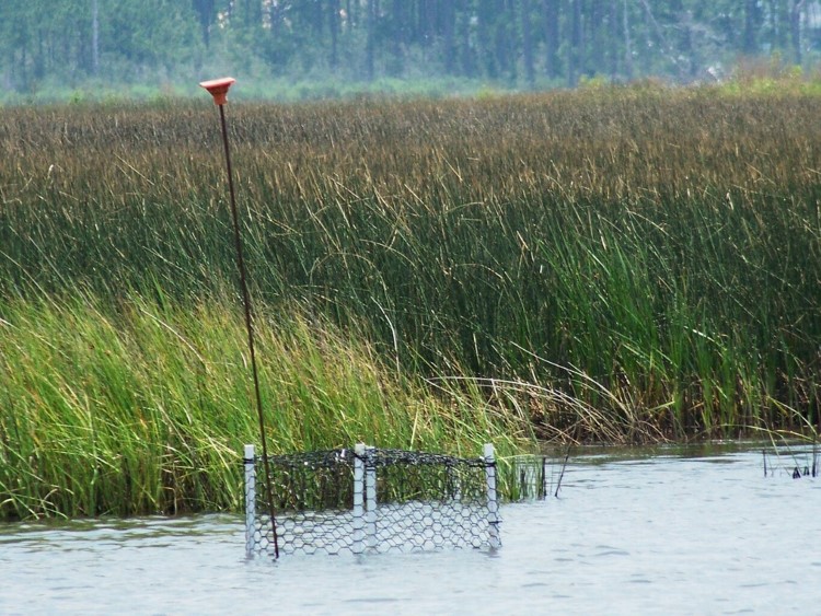
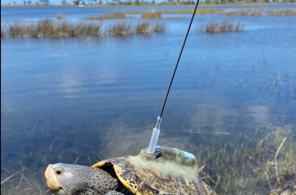
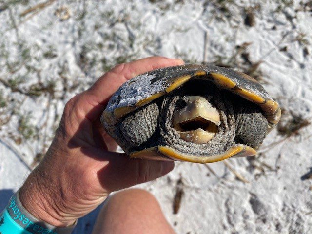
Partnering with the U.S. Geological Survey, we were able to move to Phase 3 – which involves trapping and tagging terrapins. Doing this gives the team a better idea of where the terrapins are going and how they are using the habitat. To trap the terrapins, we use modified crab traps (modified so that the terrapins had access to air to breath), seine nets, fyke nets, dip nets, and by hand – the most effective has been modified crab traps (Fig. 3). These traps are placed in terrapin habitat over a 3-day period, being checked daily. Any captured terrapins are measured, weighed, sexed, marked using the notch method, and given a Passive Intergraded Transponder (PIT) tag. Some of the terrapins are given a satellite tag where movement could be tracked by GPS (Fig. 4). We are now bringing on acoustic tagging for some counties. This involves placing acoustic receivers on the bottom of the bay which will detect any terrapin (with an acoustic tag) that swims nearby. Results are below.
Fig. 3. Modified crab traps is one method used to capture adults. Photo: Molly O’Connor
Fig. 4. This tag with an antenna can be detected by a satellite and tracked real time. Photo: USGS
Phase 4
This phase involves collecting tissue samples for genetic analysis. Currently it is believed that the Ornate terrapin (Malaclemys terrapin macrospilota) ranges from Key West to Choctawhatchee Bay, and the Mississippi terrapin (M.t. pileata) ranges from Choctawhatchee Bay to the Louisiana/Texas border. The two subspecies look morphologically different (Fig. 5) and the team believes terrapins resembling the ornate terrapin have been found in Pensacola Bay. Researchers in Alabama have also reported terrapins they believe to be ornate terrapins in their waters as well. The project is now working with a graduate student from the University of West Florida who is genetically analyzing tissue samples from trapped terrapins to determine which subspecies they are and what the correct range of these subspecies. This phase began in 2025, and we do not have any results at this time.
Fig. 5. The Mississippi terrapin found in Pensacola Bay is darker in color than the Ornate terrapin found in other bays of the panhandle. Photo: Rick O’Connor
Ornate Diamondback Terrapins Depend on Coastal Marshes and Sea Grass Habitats Photo: Erik Lovestrand.
2025 UPDATE AND RESULTS
In 2025 we trained 188 volunteers across each county – including state park rangers and members of the Florida Oyster Corps. 47 (25%) participated in at least one survey.
We logged 345 nesting surveys and 17 trap days.
No seining or fyke nets were conducted in 2025.
Phase 1 – Presence/Absence Update
County
Presence
Notes
Baldwin
Yes
A single deceased terrapin was found in western Baldwin County
Escambia
Yes
Team encountered nesting again this year
Santa Rosa
Yes
Two new locations were identified this year
Okaloosa
Yes
Encounters were lower this year
Walton
Yes
FIRST EVIDENCE OF NESTING IN WALTON COUNTY VERIFIED THIS YEAR
Bay
Yes
FIRST EVIDENCE OF NESTING IN BAY COUNTY VERIFIED THIS YEAR
Gulf
Yes
Team encountered nesting again this year
Franklin
ND
ND
Phase 2 Nesting Survey – Update
County
# of primary beaches1
# of secondary beaches2
# of surveys
# of encounters
FOE3
Baldwin
0
TBD
14
04
.00
Escambia
2
35
99
7
.07
Santa Rosa
3
45
137
25
.18
Okaloosa
4
3
20
1
.05
Walton
1
4
28
2
.07
Bay
3
3
47
14
.30
TOTAL
13
17
345
49
.14
1 primary beaches are defined as those where nesting is known to occur.
2 secondary beaches are defined as those where potential nesting is high but has not been confirmed.
3 FOE (Frequency of Encounters) is the number of terrapin encounters / the number of surveys conducted.
4 There was one deceased terrapin found by a tour guide in Baldwin County but was not part of the project.
5 There are potential nesting sites on Pensacola Beach that are technically in Escambia County but covered by the Santa Rosa team. The Escambia team focused on the Perdido Key area.
Phase 3 Trapping/Tagging Update
We currently have 8 years of data.
Terrapins have been tagged in 7 of the 8 panhandle counties.
1483 captures, 1061 individuals.
2025 Capture Effort
Method
County
Number
Description
Condition
Hand capture
Escambia
1
1 adult male
Deceased
Hand capture
Santa Rosa
5
4 adult females
1 unknown
Released, deceased
Hand capture
Okaloosa
1
1 adult female
Released
Dip Net
Santa Rosa
1
1 adult male
Released
Crab Traps
Santa Rosa
34
4 juvenile females
5 adult females
25 adult males
Released
Okaloosa
4
1 juvenile female
3 adult males
Released
TOTAL
46
5 juvenile females
10 adult females
30 adult males
1 unknown
Preliminary information subject to revision. Not for citation or distribution.
Satellite Tagging Information
Due to the size of the tags – only large females are satellite tagged at this time.
Big Momma – tracked for 188 days – averaged 0.16 miles.
Big Bertha – tracked for 137 days – averaged 35.83 miles.
2025 Tracking Effort
County
Tagging Effort
Santa Rosa
2 satellite tagged
6 acoustically tagged
Okaloosa
1 satellite tagged
TOTAL
8 tagged for tracking
Phase 4 Update
This phase began in 2025 and there are no results at this time.
Summary
2025
17 trainings were given in 7 of the 8 counties of the Florida panhandle (including Baldwin County AL).
188 were trained; 47 (25%) conducted at least one survey.
345 surveys were logged; terrapins (or terrapin sign) were encountered 49 (14%) of those surveys.
Every county had at least one encounter during a nesting survey.
17 trapping days were conducted; 46 terrapins were captured; 37 (83%) were captured in modified crab traps; 7 were captured by hand; 1 was captured in a dip net.
8 terrapins were tagged for tracking; 6 acoustically; 2 with satellite tags.
Since 2007
511 have been trained.
1449 surveys have been logged; 347 encounters have occurred; Frequency of Encounters is 24% of the surveys.
Discussion
Phase 1
We have shown that diamondback terrapins do exist in the Florida panhandle and in Baldwin County AL.
Phase 2
We currently have 13 primary nesting beaches we are surveying weekly during nesting season across the panhandle. There were 17 secondary nesting beaches surveyed and most likely there are many more to visit. Nesting seems to be more common in late spring, but the Frequency of Encounters has been declining since 2023. This could be due to less terrapin activity but could also be due to evidence being difficult to find. We will continue to monitor to see how this trend continues.
Phase 3
The team has captured 1483 terrapins, the majority of which were from the eastern panhandle. Satellite tagged females suggest more than one has traveled over 30 miles from where they were tagged. This goes against the idea that terrapins have strong site fidelity. However, all the terrapins tagged were large females (due to size of the tags) so we are looking at the movements of only the larger females – not the population as a whole. The movements of these females also suggest they may use seagrass beds as much as the salt marshes.
Training for volunteers occurs in March of each year. If you are interested in participating, contact Rick O’Connor – roc1@ufl.edu.
When I began working with terrapins 20 years ago, very few people in the Florida panhandle knew what they were – unless they had moved here from the Mid-Atlantic states. Since we initiated the Panhandle Terrapin Project in 2005 many more now have heard of this brackish water turtle.
Ornate Diamondback Terrapin (photo: Dr. John Himes)
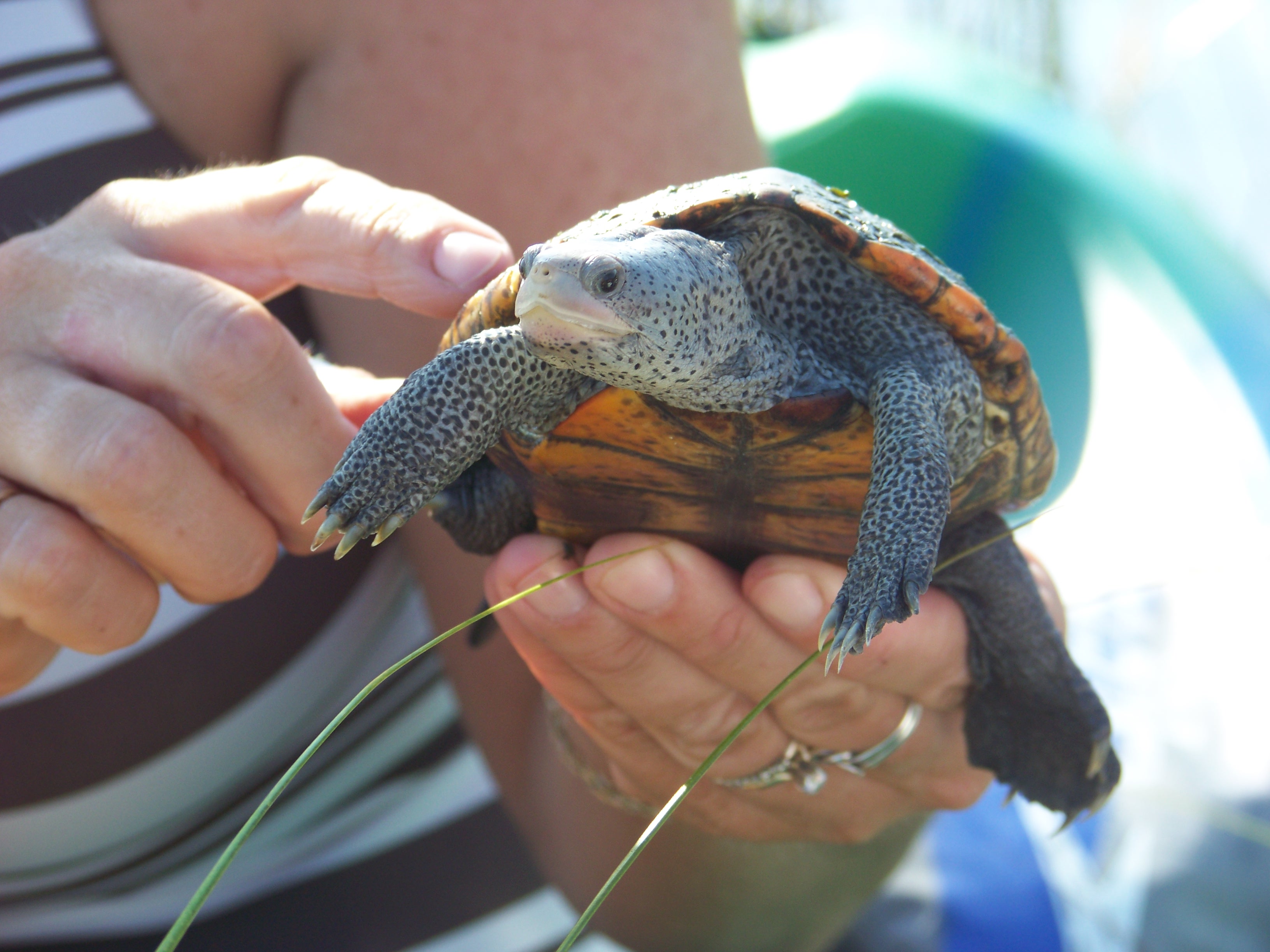
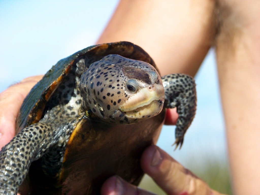
Diamondback terrapins are relatively small (10 inch) turtles that inhabit brackish environments such as salt marshes along our bays, bayous, and lagoons. They have light colored skin, often white, and raised concentric rings on the scales of their shells which give them a “diamond-backed” appearance. Some of them have dark shells, others will have orange spots on their shells.
The first objective for the project was to determine whether terrapins existed here, there was no scientific literature that suggested they did. We found our first terrapin in 2007, and this was in Santa Rosa County. We have since had at least one verified record in every panhandle county – diamondback terrapins do exist here.
The second objective was to locate their nesting beaches. Terrapins live in coastal wetlands but need high-dry sandy beaches to lay their eggs. Volunteers began searching for such and have been able to locate nesting beaches in Escambia, Santa Rosa, Okaloosa, Bay, and Gulf counties. We continue to search in the other counties, and for additional ones in the counties mentioned above. Once a nesting beach has been identified, volunteers conduct weekly nesting surveys, providing data which can help calculate the relative abundance of terrapins in the area.
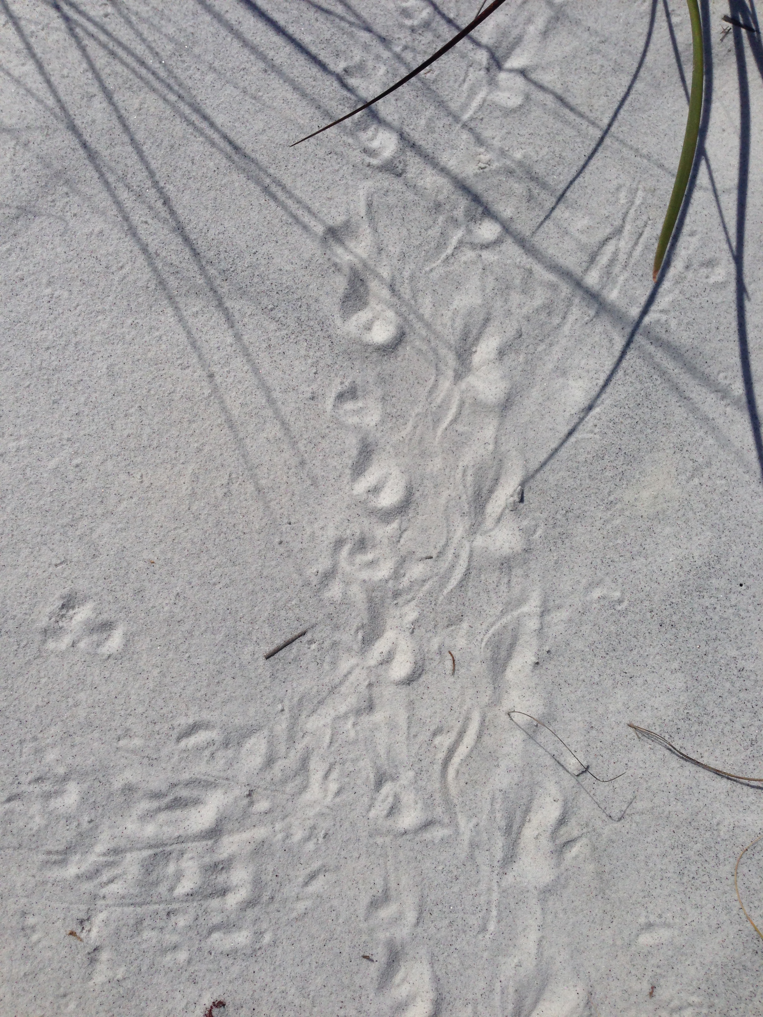
Tracks of a diamondback terrapin. Photo: Terry Taylor
The third objective is to tag captured terrapins to determine their population, where they move and how they use habitat. We initially captured terrapins using modified traps and marking them using a file notching system. We then partnered with a research team from the U.S. Geological Survey and now include passive integrated transponder tags (PIT tags) that help identify individuals, satellite tags that can be detected from satellites and track their movements, and recently acoustic tags which can also track movement.
The fourth objective is to collect tissue samples for genetic studies. This information will be used to help determine which subspecies of terrapins are living in the Florida panhandle.
As we move into the summer season, more people will be recreating in our bays and coastal waterways. If you happen to see a terrapin, or maybe small turtle tracks on the beach, we would like you to contact us and let us know. You can contact me at roc1@ufl.edu. Terrapins are protected in Florida and Alabama, so you are not allowed to keep them. If you are interested in joining our volunteer team, contact me at the email address provided.
The University of Florida/IFAS Extension & Florida Sea Grant faculty are reintroducing their acclaimed “Panhandle Outdoors LIVE!” series on St. Joseph Bay. This ecosystem is home to some of the richest concentrations of flora and fauna on the Northern Gulf Coast. This area supports an amazing diversity of fish, aquatic invertebrates, turtles and other species of the marsh and pine flatwoods. Come learn about the important roles of ecosystem!
Registration fee is $40. You must pre-register to attend.
Diamondback terrapins are the only resident turtle within brackish water and estuarine systems. Their range extends from Massachusetts to Texas but, prior to 2005, their existence in the Florida panhandle was undocumented. The Panhandle Terrapin Project was developed to first determine whether terrapins exist in the panhandle (Phase I) and, if so, what is their status (Phase II and III).
The project began at the Marine Science Academy at Washington High School (in Pensacola) in 2005. Between 2005 and 2010 the team was able to verify at least one record in each of the panhandle counties. For Phase II we used what we called the “Mann Method” to determine the relative abundance of terrapins in each area. To do this we needed to conduct assessments of nesting activity in each county. In 2012 the project moved from Washington High School to Florida Sea Grant. At that time, we developed a citizen science program to conduct Phase II of this project. Effort first focused on Escambia and Santa Rosa counties, but in recent years has included Okaloosa County. Florida Sea Grant now partners with the U.S. Geological Survey (based out of Gulf County) to assist with Phase II and lead Phase III, which is estimating populations using mark-recapture methods, as well as satellite tagging to better understand movements and habitat use. The focus of Phase III has been Gulf County, but tagging has occurred in Okaloosa and Escambia counties.
Over the years we have trained 271 volunteers who have conducted thousands of hours of nesting surveys and helped obtain a better picture of the status of diamondback terrapins in the Florida panhandle. Here are the 2023 project results.
Results from 2023
We trained 67 volunteers; 35 (52%) of which participated in at least one nesting survey.
The volunteers conducted 196 surveys logging 212 hours.
During those surveys terrapins (or terrapin sign) were encountered 43 times; a Frequency of Encounter (FOE) of 22%.
Three terrapins were tagged. Two from Okaloosa and one from Escambia. All but two of the nine primary survey beaches saw nesting activity (78%). One new nesting beach was discovered.
Escambia County
Two nesting beaches. 47 surveys. 7 encounters (FOE = 15%).
The Mann Method assumes the sex ratio is 1:1 (male: female) but recent studies suggest the ratio may be as high as 5:1 (male: female). Based on these two rations the number of terrapins estimated to be using these beaches ranged from 4-36.
One terrapin (“Dollie”) was tagged. Fire ants and torpedo grass were reported on some beaches.
Santa RosaCounty
Three nesting beaches. 68 Surveys. 14 encounters (FOE = 21%).
The number of terrapins estimated to be using these beaches ranged from 6-30.
No terrapins were captured, though one was seen nesting. No invasive species were reported from the nesting beaches.
OkaloosaCounty
Four nesting beaches. 67 surveys. 21 encounters (FOE = 31%).
The number of terrapins estimated to be using these beaches ranged from 2-66.
Two terrapins were tagged (“Kennedy” and “Molly”). Phragmites were reported from all beaches.
Walton County
Walton county currently does not have a volunteer coordinator and surveys are not occurring at this time. We are working with an individual who may take the lead on this.
BayCounty
This team is just beginning and currently there are no primary beaches. The team focused on five beaches encountering terrapin nesting activity on one of them. They conducted a total of 14 surveys encountering terrapin tracks on 1 of those (FOE = 7%). The estimated number of terrapins using this beach ranged from 4-12.
Baldwin County Alabama
Due to the proximity of terrapin habitat and nesting beaches at the Alabama/Florida line, and the possibility of terrapins using habitat in both states, a team was developed in Baldwin County Alabama this year. The team began conducting Phase I surveys and encountered one deceased terrapin. No nesting beaches have been identified at this time.
Summary
The results of this year’s surveys suggest that, based on the number of nesting beaches we know of, there are anywhere from 2-66 terrapins utilizing them. Again, two of the primary beaches did not have nesting activity this year. USGS tagging studies will provide better population estimates and a better understanding of how these animals are utilizing these habitats. The current population estimate for Gulf County is a little over 1000 individuals and most are showing relatively small range of habitat utilization, although two individuals in the western panhandle moved from one county to the neighboring one.
Training for volunteers occurs in March of each year. If you are interested in participating, contact Rick O’Connor – roc1@ufl.edu.
I recently wrote an article introducing some to a panhandle turtle that is not as well-known as most – the map turtles. This week I am going to write about another lesser-known species – the chicken turtle.
Some may say “is there a turtle REALLY called the chicken turtle?” and “if so, why is it called that?”.
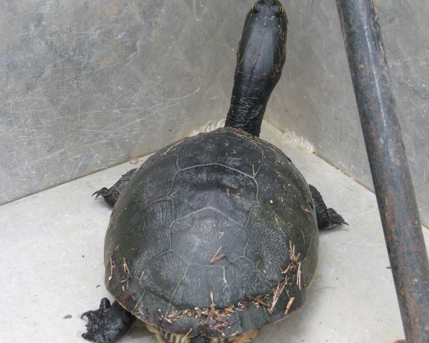
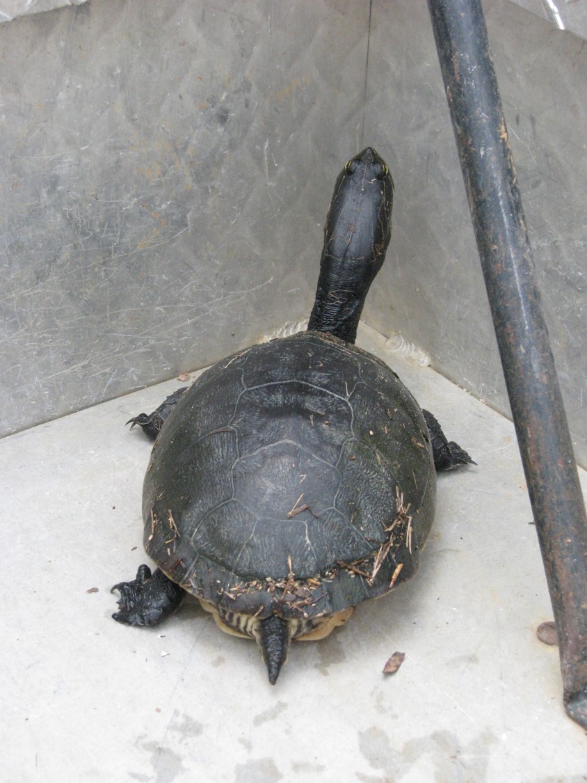
The long neck and oval shell of the Florida Chicken Turtle.
This one is missing a rear leg, probably attacked by a raccoon.
Photo: Molly O’Connor
The answer is yes… there is a turtle called a chicken turtle (Deirochelys reticularia). It is a member of the family Emydidae, which is the family where you find the different pond, river, and lake turtles, as well as the terrapins and box turtles. The name chicken may refer to the unusually long neck this turtle has, but more than likely it comes from an early description of the species in the 1800s that stated it “taste better than the cooters – more like chicken.”
The reason some are not aware of this animal is because of their habitat selection, behavior, and low population densities. Though they are aquatic turtles, they are very selective of which waterbodies they inhabit and may spend months out of the water in upland forested areas.
Chicken turtles seem to prefer quiet shallow waterways where the water is clear, or at least tannic, they dislike turbid/muddy systems. They avoid rivers, creeks, streams, and many lakes. Most of the waterways they inhabit are ephemeral, meaning they dry up during part of the year. During these dry times they, again, seek upland habitats and have been found as far as a 150 meters (510 feet) from any water source. The females appear to avoid their landward movements during the peak of summer. However, males are opposite – moving upland during summer and not as common during the winter months. These overland treks by the females seem to be associated with nesting activity. Where the upland movement of males seem to focus on finding new waterways after the ones they were in have become dry.
Their distribution extends across the southern coastal plains. From Virigina, throughout the deep south, west to Texas, and north to Arkansas. They are found throughout the state of Florida. There are three recognized subspecies –
The Eastern Chicken Turtle (Deirochelys reticularia reticularia)– is found from southern Virginia, coastal Carolinas, southern Georgia, Alabama, Mississippi, and the Florida panhandle. In addition to the long neck, the carapace is sort of “domed” shaped. Terms like “helmet” and “pear” shaped have been used as well. The coloration is dark gray to olive green with a distinct yellow line pattern that resembles a cast net covering the carapace. The plastron is solid yellow to a yellow-orange color. The underside of the bridge (portion of the shell connecting the carapace to the plastron) usually has two dark blotches. This subspecies often has dark spots along with the dark bars on the underside of the bridge.
The Florida Chicken Turtle (D. r. chrysea) – is found in the Florida peninsula. The dark markings on the underside of the bridge are absent in this subspecies.
The Western Chick Turtle (D. r. miaria) – is found west of the Mississippi River in Louisiana, Texas, and Arkansas. Its plastron is not solid yellow, but rather has dark markings within the seams of the plastron scutes.
Chicken turtles are of average size, with carapace lengths near nine inches, and (as with many turtles) females are larger than males. The young and males feed on the larva of such things as dragonflies and damselflies, as well as other aquatic bugs. Crayfish seem to be a particular favorite, especially with the larger females.
Mating occurs underwater. Nesting begins in summer and continues through fall and winter. Two to 19 eggs are deposited but the average is around 10/clutch, and she will lay more than one clutch each year.
Threats to their populations include being hit by cars while crossing highways. Their overland treks enhance this problem. Other threats include predation by raccoons and alligator snapping turtles, the pet trade, and it was once a food item – “taste like chicken”. With low densities of chicken turtles, this may be the result of overharvesting years ago. Potential threats include habitat loss and invasive species are very likely.
Statewide turtle surveys suggest that chicken turtles are found but their abundance/density is low compared to other species. It is exciting for folks exploring both our ephemeral wetlands and upland areas to find it. Hopefully, one day, you will encounter one as well.